SlideShare una empresa de Scribd logo
1 de 20
ICCM 2012 - Tech Training
        OpenStreetMap
               Severin Menard
Humanitarian OpenStreetMap Team (AKA H.O.T.)
1


    Wikipedia for
       Maps
1


                           History and
                              Stats

                 2004 Start of OSM
                 2012 OSM status
                 Users      825,278
                 Uploaded GPS points 112,101,094
                 Nodes      1,594,576,286
                 Ways       151,330,005
                 Relations 1575387


    http://wiki.openstreetmap.org/wiki/History_of_OpenStreetMap
1


      OSM Wiki


    http://wiki.openstreetmap.org
1


    OSM mailing lists


       http://lists.openstreetmap.org/listinfo/talk
1


    Mapping
    Parties
1


                   “Legal”
                   Details

    Was Licensed CC-BY-SA 2.0

          Moved towards ODbl

    http://www.maploser.com/2012/03/03/odbl-what-
              the-heck-can-you-do-with-it/
1


     OSM
    Features
1


               OSM Data
               Structure
        Based on the idea of key/value pairs

     highway=primary             building=yes
        name=I66          address=123 Main Street
                              city=Somewhere

     amenity=hospital
    name=Sacred Heart
1


    Imagery
1


       Walking
       Papers
               Printable Map
               Collect Data by
               Writing
               Scan and Upload
               Edit for
               OpenStreetMap


    http://www.walking-
        papers.org/
Most Any GPS Will
      Work

H.O.T. purchases
Garmin eTrex with
 MicroSD Cards
What is the Humanitarian OpenStreetMap Team?


An organization working to promote the
use of open data and volunteered
geographic information within the
humanitarian and development contexts

Incorporated as a NGO in the US Aug 2010
Responders

             Aims at providing
             good open baseline
             data
1


         HOT
        Package

    Training Materials
        Softwares
      Survey Forms
    Presets for Editing
1


          JOSM Editor
    Java Based OpenStreetMap Editor,
    works well with sporadic connectivity


      http://josm.openstreetmap.de/
1


    JOSM
    Presets


              Simplifies Editing
               Creates Editing
                   Forms
                XML Based
1


    Tasking
    Manager


        http://tasks.hotosm.org
1


                      Potlatch
    The Editor when you go to http://www.osm.org and hit
                          “Edit”
Questions?
              Kate Chapman
severin.menard@hotosm.org
  Humanitarian OpenStreetMap Team (AKA
                 H.O.T.)

Más contenido relacionado

Destacado

Establish a company in Iceland
Establish a company in IcelandEstablish a company in Iceland
Establish a company in IcelandBridgeWest.eu
 
Tour operators information phillip island nature parks
Tour operators information   phillip island nature parksTour operators information   phillip island nature parks
Tour operators information phillip island nature parksPhillipIslandNP
 
Ask datatech profile
Ask datatech profileAsk datatech profile
Ask datatech profileAsk Datatech
 
5x5x5 Pie Lesson and Lab
5x5x5 Pie Lesson and Lab5x5x5 Pie Lesson and Lab
5x5x5 Pie Lesson and LabRachael Mann
 
Sept 5 Appetizer Unit Jalepeno Poppers Day 1
Sept 5 Appetizer Unit Jalepeno Poppers Day 1Sept 5 Appetizer Unit Jalepeno Poppers Day 1
Sept 5 Appetizer Unit Jalepeno Poppers Day 1Rachael Mann
 

Destacado (8)

Establish a company in Iceland
Establish a company in IcelandEstablish a company in Iceland
Establish a company in Iceland
 
Tour operators information phillip island nature parks
Tour operators information   phillip island nature parksTour operators information   phillip island nature parks
Tour operators information phillip island nature parks
 
END EXTREME WEALTH
END EXTREME WEALTHEND EXTREME WEALTH
END EXTREME WEALTH
 
Ask datatech profile
Ask datatech profileAsk datatech profile
Ask datatech profile
 
5x5x5 Pie Lesson and Lab
5x5x5 Pie Lesson and Lab5x5x5 Pie Lesson and Lab
5x5x5 Pie Lesson and Lab
 
Sept 5 Appetizer Unit Jalepeno Poppers Day 1
Sept 5 Appetizer Unit Jalepeno Poppers Day 1Sept 5 Appetizer Unit Jalepeno Poppers Day 1
Sept 5 Appetizer Unit Jalepeno Poppers Day 1
 
Keralam
KeralamKeralam
Keralam
 
Stoll
StollStoll
Stoll
 

Más de Severin Menard

OpenStreetMap - La carte libre du monde
OpenStreetMap - La carte libre du mondeOpenStreetMap - La carte libre du monde
OpenStreetMap - La carte libre du mondeSeverin Menard
 
Open data e OpenStreetMap
Open data e OpenStreetMapOpen data e OpenStreetMap
Open data e OpenStreetMapSeverin Menard
 
OpenStreetMap : la carte libre du monde
OpenStreetMap : la carte libre du mondeOpenStreetMap : la carte libre du monde
OpenStreetMap : la carte libre du mondeSeverin Menard
 
OpenStreetMap : um mapa wiki mundial livre
OpenStreetMap : um mapa wiki mundial livreOpenStreetMap : um mapa wiki mundial livre
OpenStreetMap : um mapa wiki mundial livreSeverin Menard
 
Cartographie systématique dans OSM avec un référentiel routier
Cartographie systématique dans OSM  avec un référentiel routierCartographie systématique dans OSM  avec un référentiel routier
Cartographie systématique dans OSM avec un référentiel routierSeverin Menard
 
GIS based flood risk assessment exercise in Phalombe and Zomba districts: 19t...
GIS based flood risk assessment exercise in Phalombe and Zomba districts: 19t...GIS based flood risk assessment exercise in Phalombe and Zomba districts: 19t...
GIS based flood risk assessment exercise in Phalombe and Zomba districts: 19t...Severin Menard
 
ProjetEOF presentation at SOTM2014
ProjetEOF presentation at SOTM2014 ProjetEOF presentation at SOTM2014
ProjetEOF presentation at SOTM2014 Severin Menard
 
OSM La Carte Libre du Monde
OSM La Carte Libre du MondeOSM La Carte Libre du Monde
OSM La Carte Libre du MondeSeverin Menard
 
OSM Présentation Summerlab Casablance 2014
OSM Présentation Summerlab Casablance 2014OSM Présentation Summerlab Casablance 2014
OSM Présentation Summerlab Casablance 2014Severin Menard
 
HOT OSM Community mapping in Lower Shire, Malawi
HOT OSM Community mapping in Lower Shire, MalawiHOT OSM Community mapping in Lower Shire, Malawi
HOT OSM Community mapping in Lower Shire, MalawiSeverin Menard
 
OSM et trois échelles de référence pour la cartographie
OSM et trois échelles de référence pour la cartographieOSM et trois échelles de référence pour la cartographie
OSM et trois échelles de référence pour la cartographieSeverin Menard
 
Presentation OSM dans le contexte de l'Afrique de l'Ouest
Presentation OSM dans le contexte de l'Afrique de l'OuestPresentation OSM dans le contexte de l'Afrique de l'Ouest
Presentation OSM dans le contexte de l'Afrique de l'OuestSeverin Menard
 
Activation de crise humanitaire avec OSM : la République centrafricaine, une...
Activation de crise humanitaire avec OSM : la République centrafricaine,  une...Activation de crise humanitaire avec OSM : la République centrafricaine,  une...
Activation de crise humanitaire avec OSM : la République centrafricaine, une...Severin Menard
 
OSM Ulaanbaatar City - Улаанбаатар хотод OpenStreetMap-aар зураглал хийх
OSM Ulaanbaatar City - Улаанбаатар хотод OpenStreetMap-aар зураглал хийхOSM Ulaanbaatar City - Улаанбаатар хотод OpenStreetMap-aар зураглал хийх
OSM Ulaanbaatar City - Улаанбаатар хотод OpenStreetMap-aар зураглал хийхSeverin Menard
 
OpenStreetMap (OSM): Mapping from the crowd and on the field open data prepa...
OpenStreetMap (OSM):  Mapping from the crowd and on the field open data prepa...OpenStreetMap (OSM):  Mapping from the crowd and on the field open data prepa...
OpenStreetMap (OSM): Mapping from the crowd and on the field open data prepa...Severin Menard
 
Participatory mapping with OSM in Ulan Bator, Mongolia: general presentation ...
Participatory mapping with OSM in Ulan Bator, Mongolia: general presentation ...Participatory mapping with OSM in Ulan Bator, Mongolia: general presentation ...
Participatory mapping with OSM in Ulan Bator, Mongolia: general presentation ...Severin Menard
 
OpenStreetMap : um mapa wiki mondial livre. Seu uso nas situações de crise ...
 OpenStreetMap : um mapa wiki mondial livre.  Seu uso nas situações de crise ... OpenStreetMap : um mapa wiki mondial livre.  Seu uso nas situações de crise ...
OpenStreetMap : um mapa wiki mondial livre. Seu uso nas situações de crise ...Severin Menard
 
Humanitarian OpenStreetMap Team : Respuesta masiva y organizada ante y post ...
Humanitarian OpenStreetMap Team : Respuesta masiva y organizada  ante y post ...Humanitarian OpenStreetMap Team : Respuesta masiva y organizada  ante y post ...
Humanitarian OpenStreetMap Team : Respuesta masiva y organizada ante y post ...Severin Menard
 
JRC OpenStreetMap, editing and tasking mechanisms, 20130326
JRC OpenStreetMap, editing and tasking mechanisms, 20130326JRC OpenStreetMap, editing and tasking mechanisms, 20130326
JRC OpenStreetMap, editing and tasking mechanisms, 20130326Severin Menard
 

Más de Severin Menard (20)

OpenStreetMap - La carte libre du monde
OpenStreetMap - La carte libre du mondeOpenStreetMap - La carte libre du monde
OpenStreetMap - La carte libre du monde
 
Open data e OpenStreetMap
Open data e OpenStreetMapOpen data e OpenStreetMap
Open data e OpenStreetMap
 
OpenStreetMap : la carte libre du monde
OpenStreetMap : la carte libre du mondeOpenStreetMap : la carte libre du monde
OpenStreetMap : la carte libre du monde
 
OpenStreetMap : um mapa wiki mundial livre
OpenStreetMap : um mapa wiki mundial livreOpenStreetMap : um mapa wiki mundial livre
OpenStreetMap : um mapa wiki mundial livre
 
Cartographie systématique dans OSM avec un référentiel routier
Cartographie systématique dans OSM  avec un référentiel routierCartographie systématique dans OSM  avec un référentiel routier
Cartographie systématique dans OSM avec un référentiel routier
 
GIS based flood risk assessment exercise in Phalombe and Zomba districts: 19t...
GIS based flood risk assessment exercise in Phalombe and Zomba districts: 19t...GIS based flood risk assessment exercise in Phalombe and Zomba districts: 19t...
GIS based flood risk assessment exercise in Phalombe and Zomba districts: 19t...
 
ProjetEOF presentation at SOTM2014
ProjetEOF presentation at SOTM2014 ProjetEOF presentation at SOTM2014
ProjetEOF presentation at SOTM2014
 
OSM La Carte Libre du Monde
OSM La Carte Libre du MondeOSM La Carte Libre du Monde
OSM La Carte Libre du Monde
 
OSM Présentation Summerlab Casablance 2014
OSM Présentation Summerlab Casablance 2014OSM Présentation Summerlab Casablance 2014
OSM Présentation Summerlab Casablance 2014
 
HOT OSM Community mapping in Lower Shire, Malawi
HOT OSM Community mapping in Lower Shire, MalawiHOT OSM Community mapping in Lower Shire, Malawi
HOT OSM Community mapping in Lower Shire, Malawi
 
OSM et trois échelles de référence pour la cartographie
OSM et trois échelles de référence pour la cartographieOSM et trois échelles de référence pour la cartographie
OSM et trois échelles de référence pour la cartographie
 
Presentation OSM dans le contexte de l'Afrique de l'Ouest
Presentation OSM dans le contexte de l'Afrique de l'OuestPresentation OSM dans le contexte de l'Afrique de l'Ouest
Presentation OSM dans le contexte de l'Afrique de l'Ouest
 
Activation de crise humanitaire avec OSM : la République centrafricaine, une...
Activation de crise humanitaire avec OSM : la République centrafricaine,  une...Activation de crise humanitaire avec OSM : la République centrafricaine,  une...
Activation de crise humanitaire avec OSM : la République centrafricaine, une...
 
OSM Ulaanbaatar City - Улаанбаатар хотод OpenStreetMap-aар зураглал хийх
OSM Ulaanbaatar City - Улаанбаатар хотод OpenStreetMap-aар зураглал хийхOSM Ulaanbaatar City - Улаанбаатар хотод OpenStreetMap-aар зураглал хийх
OSM Ulaanbaatar City - Улаанбаатар хотод OpenStreetMap-aар зураглал хийх
 
OpenStreetMap (OSM): Mapping from the crowd and on the field open data prepa...
OpenStreetMap (OSM):  Mapping from the crowd and on the field open data prepa...OpenStreetMap (OSM):  Mapping from the crowd and on the field open data prepa...
OpenStreetMap (OSM): Mapping from the crowd and on the field open data prepa...
 
Participatory mapping with OSM in Ulan Bator, Mongolia: general presentation ...
Participatory mapping with OSM in Ulan Bator, Mongolia: general presentation ...Participatory mapping with OSM in Ulan Bator, Mongolia: general presentation ...
Participatory mapping with OSM in Ulan Bator, Mongolia: general presentation ...
 
OpenStreetMap : um mapa wiki mondial livre. Seu uso nas situações de crise ...
 OpenStreetMap : um mapa wiki mondial livre.  Seu uso nas situações de crise ... OpenStreetMap : um mapa wiki mondial livre.  Seu uso nas situações de crise ...
OpenStreetMap : um mapa wiki mondial livre. Seu uso nas situações de crise ...
 
Projet CAP103
Projet CAP103Projet CAP103
Projet CAP103
 
Humanitarian OpenStreetMap Team : Respuesta masiva y organizada ante y post ...
Humanitarian OpenStreetMap Team : Respuesta masiva y organizada  ante y post ...Humanitarian OpenStreetMap Team : Respuesta masiva y organizada  ante y post ...
Humanitarian OpenStreetMap Team : Respuesta masiva y organizada ante y post ...
 
JRC OpenStreetMap, editing and tasking mechanisms, 20130326
JRC OpenStreetMap, editing and tasking mechanisms, 20130326JRC OpenStreetMap, editing and tasking mechanisms, 20130326
JRC OpenStreetMap, editing and tasking mechanisms, 20130326
 

ICCM 2012 Tech Training OpenStreetMap 10/11/2012 (EN)

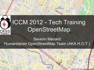
  • 1. ICCM 2012 - Tech Training OpenStreetMap Severin Menard Humanitarian OpenStreetMap Team (AKA H.O.T.)
  • 2. 1 Wikipedia for Maps
  • 3. 1 History and Stats 2004 Start of OSM 2012 OSM status Users 825,278 Uploaded GPS points 112,101,094 Nodes 1,594,576,286 Ways 151,330,005 Relations 1575387 http://wiki.openstreetmap.org/wiki/History_of_OpenStreetMap
  • 4. 1 OSM Wiki http://wiki.openstreetmap.org
  • 5. 1 OSM mailing lists http://lists.openstreetmap.org/listinfo/talk
  • 6. 1 Mapping Parties
  • 7. 1 “Legal” Details Was Licensed CC-BY-SA 2.0 Moved towards ODbl http://www.maploser.com/2012/03/03/odbl-what- the-heck-can-you-do-with-it/
  • 8. 1 OSM Features
  • 9. 1 OSM Data Structure Based on the idea of key/value pairs highway=primary building=yes name=I66 address=123 Main Street city=Somewhere amenity=hospital name=Sacred Heart
  • 10. 1 Imagery
  • 11. 1 Walking Papers Printable Map Collect Data by Writing Scan and Upload Edit for OpenStreetMap http://www.walking- papers.org/
  • 12. Most Any GPS Will Work H.O.T. purchases Garmin eTrex with MicroSD Cards
  • 13. What is the Humanitarian OpenStreetMap Team? An organization working to promote the use of open data and volunteered geographic information within the humanitarian and development contexts Incorporated as a NGO in the US Aug 2010
  • 14. Responders Aims at providing good open baseline data
  • 15. 1 HOT Package Training Materials Softwares Survey Forms Presets for Editing
  • 16. 1 JOSM Editor Java Based OpenStreetMap Editor, works well with sporadic connectivity http://josm.openstreetmap.de/
  • 17. 1 JOSM Presets Simplifies Editing Creates Editing Forms XML Based
  • 18. 1 Tasking Manager http://tasks.hotosm.org
  • 19. 1 Potlatch The Editor when you go to http://www.osm.org and hit “Edit”
  • 20. Questions? Kate Chapman severin.menard@hotosm.org Humanitarian OpenStreetMap Team (AKA H.O.T.)