20080717 session 1 early warning_claude heimo
•
0 recomendaciones•256 vistas

The document discusses the Food Security and Famine Early Warning System (FEWS) and its objectives. FEWS seeks to monitor food security situations, detect changes that could affect food availability, and facilitate identification of response strategies. It provides early warning information to answer questions about populations facing food insecurity, the impacts of events on food security, and best response approaches. FEWS indicators are used to assess food availability and access.

Recomendados
Recomendados
Más contenido relacionado
La actualidad más candente
La actualidad más candente (20)
Similar a 20080717 session 1 early warning_claude heimo
Similar a 20080717 session 1 early warning_claude heimo (20)
Más de Lichia Saner-Yiu
Más de Lichia Saner-Yiu (20)
Último
Último (20)
20080717 session 1 early warning_claude heimo
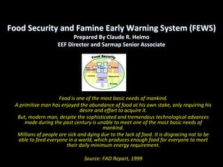
- 1. Food Security and Famine Early Warning System (FEWS) Prepared By Claude R. Heimo EEF Director and Sarmap Senior Associate Food is one of the most basic needs of mankind. A primitive man has enjoyed the abundance of food at his own stake, only requiring his desire and effort to acquire it. But, modern man, despite the sophisticated and tremendous technological advances made during the past century is unable to meet one of the most basic needs of mankind. Millions of people are sick and dying due to the lack of food. It is disgracing not to be able to feed everyone in a world, which produces enough food for everyone to meet their daily minimum energy requirement. Source: FAO Report, 1999
- 2. Under‐nourished 2001‐2003 2003 (in million) Food security condition in May 2008
- 4. Change in the proportion of under‐nourished in subregions from 1990 to 2003
- 5. Number of countries facing food emergencies 1985‐2007 Source: Sarris FAO 2008
- 6. Main Factors affecting Food Security in Developing Countries • Poverty • Population pressure • Low agricultural productivity • Environmental degradation • Natural disaster, conflicts, violence • Innapropriate macroeconomic and trade policies • Lack of off‐farm employment • Limited access to education • Poor health and sanitation conditions (HIV‐ AIDS) • Gender discrimination • Low capacities to resist external shocks (disasters, economic crisis, market and price fluctuations)
- 7. Recent Trends further affecting Food Security • In addition to the underperformance of developing countries in terms of food/crop production: – A boosting demand for food products in China and India (as a result of two decades of growth and diet changes) – A switch of agricultural production from food supply to biofuels – Poor harvests due to bad weather in some major grain producing countries (Australia, USA) – Increasing transport and agricultural inputs costs due to booming fuel prices – Speculation ( … assuming that food prices will continue to rise)
- 8. Famine Early Warning Systems seeks answers three key questions: • Which population groups are facing food insecurity or famine, and for how long? • What are the extend and impacts of extreme impeding events on the population’s food security? • What are the best ways to respond to food insecurity and famine and mitigate adverse trends or shocks to livelihood systems?
- 9. Overall Objectives of FSIEWS • Monitor food security situation, notably in vulnerable countries through the continuous assessment of the availability and access to food and its nutritional value – Provide adequate information on agricultural production during and between crip seasons – Detect in advance changes, or (natural and/or man‐made) crises that could affect food security situations and provoke famines (ex‐ante risk management) – Improve the knowledge of causes and circonstances of famines – Assess vulnerabilities (conjunctural and structural) that could affect the populations’ resistence to shocks (or coping capacities) – risk mangement) • Facilitate the identification of strategies and means to be promote to limit the socioeconomic and health impacts of famines • Improve the efficiency and effectiveness of food aid interventions in the event of food crisis through the advanced identification of risk or vulnerable areas • Improve the making of food security and poverty alleviation policies and their implementation at national level
- 10. FSI&FEWS Basic Segments • Forecast and Prediction • Warning • Reaction
- 12. Basic indicators for assessing food security
- 13. The Basic Concept Food Security Information and Famine Early Warning Systems Earth Observation Meteo Data Data Quantitative Socio-Economic & Qualitative Information Data Structural & Conjunctural Ground Data Vulnerability Early Warning Information Information Dissemintation
- 14. Continental Regional GMFS providing information on crops National Local
- 15. Famine Early Warning Systems currently operating in SSA Transnational FEWS • FEWSnet ‐ USAID Famine Early Warning System • GIEWS ‐ FAO Global Information and Early Warning System • VAM ‐ WFP ‐ Vulnerability Analysis and Mapping • MARS FOOD ‐ Monitoring Agriculture with Remote Sensing (EC/JRC) • FIVIMS ‐ Food Insecurity and Vulnerability Information and Mapping Systems Regional/National FEWS • AP3A ‐ Alerte Précoce et Prévision des Productions Agricoles (CILSS/Aghrimet ‐ Sahel) • SADC ‐ Regional Early Warning System for Food Security • DMC ‐ Drought Monitoring Centers (SADC/IGAD) • AEDES ‐ Systèmes d’information sur la sécurité alimentaire (SISA)
- 16. Problems affecting the efficiency of existing FSI&FEWS • Lack of common language, common indicators and lack of coordination between existing systems • Difficulties and lack of transparency in accessing basic data on food security, notably socioeconomic data • Spaceborne information are generally only available at global or regional level in spite of the fact that requirements are at national, sub‐national and/or local level • The use of NDVI to assess vegetation vigor and/or forecast yields remains questionable, notably under arid or semi‐arid conditions • Estimating or forecasting yield at national or sub‐national level on the basis of low‐ resolution data remains risky • Estimating crop acreage through low‐resolution data remains questionable, if not impossible • Spaceborne technologies currently in use in many existing FEWS do not reflect new technological advances in the field of earth observation as well as the capacities of existing sensors on board recent satellites
- 17. Transnational, Regional and National FEWS Frequently used Indicators for Food Security
- 18. GMFS Basic Objectives • Strenghten existing famine early warning systems …… • …..for improved information on food (in)security for decision making, as part of a global network
- 19. From users to partners ‐ More than 30 user organizations & networks, notably existing FEWS currently operating in SSA ‐ Annually renewed agreements with legally mandated organizations (SLA’s) – FAO‐GIEWS, – World Food Programme ‐ VAM, – EC – JRC/MARS – AGRHYMET (Niger), – RCMRD (Kenya), – SADC (Botswana) – SUDAN: Federal Ministry of Agriculture & Forestry, Remote Sensing Authority, FAO, WFP,.. – ETHIOPIA: Central Statistics Authority, FAO, WFP, Ministry of Agriculture, Mapping Agency, … – SENEGAL: Ministry of Agriculture, CSE, Meteo,.. – ZIMBABWE: Ministry of Agriculture, FAO, WFP, Central Statistics Office, … – MOZAMBIQUE: Ministry of Agriculture, Meteo – MALAWI: Ministry of Agriculture & FS, Meteo, FAO, WFP
- 21. Satellite data ‐ Optical ‐ high resolution data (3‐15 m) ‐ SPOT, Landsat, Formosat, LISS, AWIFS, … ‐ SAR data – medium and high resolution (3‐200 m) ‐ ENVISAT ASAR, ALOS PALSAR, COSMO‐SKYMED ‐ Low resolution optical data (+ 1km) ‐ SPOT‐VGT, MERIS, MODIS
- 22. GMFS Services provided to end‐users • GMFS provides four information services: • ‐ Early Warning service (continental) • ‐ Agricultural mapping service (national) • ‐ Yield assessment service (national) • ‐ EO based support to FAO/WFP CFSAM missions • + Support to Users: training, capacity building …
- 23. Services to Famine Early Warning ‐ Data distribution through email service ‐ 7 Regions of interest, 10‐daily updates ‐ Monitoring of the progress of the growing season ‐ Various indicators (VPI, fAPAR, …), JRC‐MARS indicators ‐ Use & building applications!
- 24. Monitoring Agricultural Production ‐ Estimating total cropped area ‐ Based on Fieldwork, integrated with Remote sensing data ‐ Sudan, Malawi, Senegal, Zimbabwe, Ethiopia ‐ Multi‐annual, yearly ‐ Crop yield estimates ‐ Yield models: remote sensing & meteo data ‐ Malawi, Senegal
- 25. Example: Estimating crop yield for Malawi in 2007 The color composite on the left illustrates a multi- temporal data set based on ENVISAT ASAR AP (120 images) and ALOS PALSAR FBS (70 scenes) data covering the whole Malawi (100,000 sqkm, 15m resolution). The image on the right shows an interferometric color composite based on ALOS PALSAR FBS data (70 image pairs). The enlargements highlight the extensive information included in this type of multi-temporal multi- source data set, which allows the generation of products such as crop map, main land cover/change classes, and digital elevation model. All processing has been performed starting from raw data.
- 26. Support to FAO/WFP Crop and Food Supply Assessment Missions (CFSAM) • Providing information further to Government requests for WFP/FAO production assessment mission • Participating to CFSAM field visit organized jointly by Government and FAO, WFP staff and observers • Example: Zimbabwe ‐ GoZ declared 2006/7 ‘drought’ year ‐ GoZ Requested for FAO/WFP CFSAM mission ‐ Estimating Food Production in Zimbabwe ‐ April 2007: Joint evaluation meeting: FAO, WFP, EC, USAID, FEWSNet, GMFS ‐ Hot spot analysis
- 28. Data integration & information management • Objective: integrate services into established systems ‐ FAO GEONETWORK catalogue ‐ WFP Food Insecurity Risk Mapping (FIRM) ‐ (FAO GIEWS) ‐ESA Data Dissemination Services (DDS) ‐CSE, AGRHYMET, RCMRD, (SADC) ‐ EUMETCAST system for Africa ‐ Making use of the infrastructure of Centre for Image processing
- 29. Conclusions • GMFS can provide today, on a operational way, reliable information on agriculture at national scale. Improvements are continuously on-going. • The service has been developed based on a low cost approach. Note that data availability and cost is no more a major issue as in the past. • Local expertise is essential for i) a correct understanding of the land management, ii) data calibration, and iii) products validation. • Capacity building at all levels (technical, institutional, political) is conditio sine qua non in order to include the local expertise and obtain service’s awareness.
- 30. The Way Ahead • Integration of Earth Observation based products with other methodologies, in particular statistical approaches. • Expand the on-going activities to new countries. • Expand the spectrum of the products, in particular by considering natural resources (water and forestry) and infrastructures (roads and settlements).
- 31. Note: This publication has been made available by CSEND with the agrement of the author. The Centre for Socio-Eco-Nomic Development (CSEND) aims at promoting equitable, sustainable and integrated development through dialogue and institutional learning. http://www.csend.org/programmes-a-services http://www.csend.org/about-csend http://www.csend.org/project-samples http://www.csend.org/csend-group http://www.csend.org/knowledge-area http://www.csend.org/csend-portraits http://www.csend.org/community-of-artists Diplomacy Dialogue is a branch of the Centre for Socio-Eco-Nomic Development (CSEND), a non-profit R&D organization based in Geneva, Switzerland since 1993. http://www.diplomacydialogue.org/mission http://www.diplomacydialogue.org/about-us http://www.diplomacydialogue.org/projects http://www.diplomacydialogue.org/publications http://www.diplomacydialogue.org/conferences http://www.diplomacydialogue.org/dialogue-forum http://www.diplomacydialogue.org/partners http://www.diplomacydialogue.org/links http://www.diplomacydialogue.org/contact http://www.diplomacydialogue.org/sitemap