SlideShare una empresa de Scribd logo
1 de 23
Descargar para leer sin conexión
Opportunities for
Open Spatial Data
                                   Bheshem Ramlal, Ph.D.
              Department of Geomatics Engineering and Land
                                              Management
                           The University of the West Indies
                                              St. Augustine
Presentation Overview
• Introduction
• Spatial Data Development in Trinidad and
  Tobago
• Open Spatial Data Access – Issues and
  Prospects
• UWI’s role
• Conclusions
Introduction
• From its initial development in Canada in the
  1960s, GIS has grown significantly to become
  pervasive in almost all societies
• Globally, spatial data development is a multi-
  billion dollar industry
GIS Worth -Global Estimates
Introduction
• With changes in ICT, spatial data have
  become much more accessible to
  users
• Initially most spatial data were not
  accessible to the public.
• There has been a gradual move by
  many countries from cost-recovery
  policies to open access policies
• Move to develop the public
  commons for Geospatial Data
ArcGIS Online
GEOSUR
IMAP Jamaica
Open Source Software
GIS Development in
           Trinidad and Tobago
•   WASA        •   NEMA Tobago   •   MoWT
•   TTEC        •   Forestry      •   LSA
•   TTPOST      •   MFPLMR        •   HDC
•   EMA         •   Police        •   MPESDGA
•   IMA         •   SUATT         •   MNS
•   TCPD        •   SSA           •   MSYA
•   LSD         •   MoH           •   PoSCC
•   LMD         •   CSO           •   TSTT
•   PETROTRIN   •   MPA           •   TATT
•   NGC         •   FSD
•   MoLG        •   MoEEI
•   ODPM        •   MoE
Data Sets Available
Roads and other transportation Landslides                      Underground Storage Tanks
networks                       Buildings                       Oceanography
Wetlands, Lagoons, Ponds,      Communications                  Topography
Lakes
                               Network                         Coastline and Coastal Activities
Administrative Boundaries
                               Utilities                       Aerial Photos & satellite Imagery
Soils
                               Oil and Gas Facilities          Survey Plans
Geology
                               Gas Stations                    Seismic Activities
Food Supply Networks
                               Watercourses                    Quarries
Public Safety Organizations
                               Flood Plains                    Recreation facilities and open
Health Care Providers                                          spaces
                               Demographic Data
Public Health Facilities
                               National Parks/ Protected Areas
Water Quality
                               Existing Land Use
Watersheds
                               Cemeteries and cremation sites
Electoral Boundaries
                               Industrial Plants
Dumps
                               Emergency Op/ Disaster shelters
Meteorological
                               Educational Facilities
Vegetation
                               Sensitive Sites
WASA Installations and wells
Status of GIS Development

                 Status of Agencies              No of Agencies
Interest in GIS development                           31
GIS needs assessment completed                        10
GIS implementation plan completed (document)           9
GIS training acquired                                 21
GIS database development initiated                    19
GIS database completed                                 5
Enterprise GIS                                         8
Metadata Developed                                     2
Data Sharing Policy                                    5
Data and Spatial products available on website         4
Open Spatial Data: Issues

•   Lack of Metadata
•   No Metadata Standards
•   Lack of Data Sharing Policies
•   Lack of Accuracy Specifications
Open Spatial Data: Prospects
• Significant effort being made to develop
  Enterprise GIS by government agencies
• Government moving towards the
  development of national policy on Spatial
  Data Infrastructure
• Technology becoming more available for the
  sharing of spatial data in Trinidad and
  Tobago
A Role for the DGELM
The UWI has had significant input in GIS
Development in Trinidad and Tobago
 – The UWI has designed and delivered over
   60 training courses in GIS to industry in the
   last 15 years
 – Certificate in GIS and a MSc Geo-
   informatics programs delivered by UWI
 – Provided consulting services for the design
   and development of several enterprise
   GIS for Government and Private
   Sector organizations
 – Set up the GIS Society of Trinidad
   and Tobago
A Role for the DGELM
• Provide support and advice to stakeholder
  with respect to policies, standards, and
  technical requirements
• Conduct relevant research and develop
  appropriate solutions
• Develop and make available spatial data
  sets where possible
• Advocate for policy changes
• Support training needs of
   stakeholders
Conclusions
• While extensive work has been done in the
  development of spatial data sets most are not
  available for open access to the public
• There is some movement by government
  towards setting up a NSDI but this is still at a
  very early stage of development
• There is much work to be done to convince
  government to adopt open access policies
• The UWI has played a significant role in
  making spatial data openly available

Más contenido relacionado

La actualidad más candente

Towards a Spatial Data Infrastructure for Archaeology: Peter McKeague
Towards a Spatial Data Infrastructure for Archaeology: Peter McKeagueTowards a Spatial Data Infrastructure for Archaeology: Peter McKeague
Towards a Spatial Data Infrastructure for Archaeology: Peter McKeagueSHED Strategy
 
Mildorf ppt gi2011_plan4all_final
Mildorf ppt gi2011_plan4all_finalMildorf ppt gi2011_plan4all_final
Mildorf ppt gi2011_plan4all_finalIGN Vorstand
 
Scope and extent of the training
Scope and extent of the trainingScope and extent of the training
Scope and extent of the trainingFAO
 
The 4th NENA workshop - Sudan
The 4th NENA workshop - SudanThe 4th NENA workshop - Sudan
The 4th NENA workshop - SudanExternalEvents
 
Volunteered Geographic Information (VGI) for Disaster Management
Volunteered Geographic Information (VGI) for Disaster ManagementVolunteered Geographic Information (VGI) for Disaster Management
Volunteered Geographic Information (VGI) for Disaster ManagementEmir Hartato
 
Locate17 and ISDE10 Keynote_S Ramage GEO April 2017
Locate17 and ISDE10 Keynote_S Ramage GEO April 2017Locate17 and ISDE10 Keynote_S Ramage GEO April 2017
Locate17 and ISDE10 Keynote_S Ramage GEO April 2017Steven Ramage
 
ITEM 3 - Alpine Soil Partnership
ITEM 3 - Alpine Soil PartnershipITEM 3 - Alpine Soil Partnership
ITEM 3 - Alpine Soil PartnershipSoils FAO-GSP
 
Progress of land ecosystem studies with geo information and space technology ...
Progress of land ecosystem studies with geo information and space technology ...Progress of land ecosystem studies with geo information and space technology ...
Progress of land ecosystem studies with geo information and space technology ...Institute of Space Knowledge Development
 
0.Introduction to the SOC map
0.Introduction to the SOC map0.Introduction to the SOC map
0.Introduction to the SOC mapFAO
 
Kenya Land Use Planning and the Need for GIS in County Spatial Planning - Mat...
Kenya Land Use Planning and the Need for GIS in County Spatial Planning - Mat...Kenya Land Use Planning and the Need for GIS in County Spatial Planning - Mat...
Kenya Land Use Planning and the Need for GIS in County Spatial Planning - Mat...Mathenge Mwehe
 
3. Scope and extent of the training
3. Scope and extent of the training3. Scope and extent of the training
3. Scope and extent of the trainingExternalEvents
 
Introduction to InaSAFE and case studies - Malawi
Introduction to InaSAFE and case studies - MalawiIntroduction to InaSAFE and case studies - Malawi
Introduction to InaSAFE and case studies - MalawiEmir Hartato
 
2. Soil organic carbon - GSOCmap
2. Soil organic carbon - GSOCmap2. Soil organic carbon - GSOCmap
2. Soil organic carbon - GSOCmapExternalEvents
 
ITEM 3 - Global Soil Partnership updates
ITEM 3 - Global Soil Partnership updatesITEM 3 - Global Soil Partnership updates
ITEM 3 - Global Soil Partnership updatesSoils FAO-GSP
 

La actualidad más candente (20)

Towards a Spatial Data Infrastructure for Archaeology: Peter McKeague
Towards a Spatial Data Infrastructure for Archaeology: Peter McKeagueTowards a Spatial Data Infrastructure for Archaeology: Peter McKeague
Towards a Spatial Data Infrastructure for Archaeology: Peter McKeague
 
Mildorf ppt gi2011_plan4all_final
Mildorf ppt gi2011_plan4all_finalMildorf ppt gi2011_plan4all_final
Mildorf ppt gi2011_plan4all_final
 
2014 geobusiness im&la_msp challenge
2014 geobusiness im&la_msp challenge2014 geobusiness im&la_msp challenge
2014 geobusiness im&la_msp challenge
 
Scope and extent of the training
Scope and extent of the trainingScope and extent of the training
Scope and extent of the training
 
Geoss
GeossGeoss
Geoss
 
ReGIS 1994
ReGIS 1994ReGIS 1994
ReGIS 1994
 
The 4th NENA workshop - Sudan
The 4th NENA workshop - SudanThe 4th NENA workshop - Sudan
The 4th NENA workshop - Sudan
 
Volunteered Geographic Information (VGI) for Disaster Management
Volunteered Geographic Information (VGI) for Disaster ManagementVolunteered Geographic Information (VGI) for Disaster Management
Volunteered Geographic Information (VGI) for Disaster Management
 
Locate17 and ISDE10 Keynote_S Ramage GEO April 2017
Locate17 and ISDE10 Keynote_S Ramage GEO April 2017Locate17 and ISDE10 Keynote_S Ramage GEO April 2017
Locate17 and ISDE10 Keynote_S Ramage GEO April 2017
 
ITEM 3 - Alpine Soil Partnership
ITEM 3 - Alpine Soil PartnershipITEM 3 - Alpine Soil Partnership
ITEM 3 - Alpine Soil Partnership
 
Progress of land ecosystem studies with geo information and space technology ...
Progress of land ecosystem studies with geo information and space technology ...Progress of land ecosystem studies with geo information and space technology ...
Progress of land ecosystem studies with geo information and space technology ...
 
0.Introduction to the SOC map
0.Introduction to the SOC map0.Introduction to the SOC map
0.Introduction to the SOC map
 
Kenya Land Use Planning and the Need for GIS in County Spatial Planning - Mat...
Kenya Land Use Planning and the Need for GIS in County Spatial Planning - Mat...Kenya Land Use Planning and the Need for GIS in County Spatial Planning - Mat...
Kenya Land Use Planning and the Need for GIS in County Spatial Planning - Mat...
 
3. Scope and extent of the training
3. Scope and extent of the training3. Scope and extent of the training
3. Scope and extent of the training
 
Introduction to InaSAFE and case studies - Malawi
Introduction to InaSAFE and case studies - MalawiIntroduction to InaSAFE and case studies - Malawi
Introduction to InaSAFE and case studies - Malawi
 
The whole is other than the sum of its parts: where is the spatial data infra...
The whole is other than the sum of its parts: where is the spatial data infra...The whole is other than the sum of its parts: where is the spatial data infra...
The whole is other than the sum of its parts: where is the spatial data infra...
 
2. Soil organic carbon - GSOCmap
2. Soil organic carbon - GSOCmap2. Soil organic carbon - GSOCmap
2. Soil organic carbon - GSOCmap
 
ITEM 3 - Global Soil Partnership updates
ITEM 3 - Global Soil Partnership updatesITEM 3 - Global Soil Partnership updates
ITEM 3 - Global Soil Partnership updates
 
ITEM 7 - Pillar 4
ITEM 7 - Pillar 4ITEM 7 - Pillar 4
ITEM 7 - Pillar 4
 
B08 A55s 134 Diapo Kouzmine En
B08 A55s 134 Diapo Kouzmine EnB08 A55s 134 Diapo Kouzmine En
B08 A55s 134 Diapo Kouzmine En
 

Destacado (8)

"How To Lie With Statistics" Chapter 10
"How To Lie With Statistics" Chapter 10"How To Lie With Statistics" Chapter 10
"How To Lie With Statistics" Chapter 10
 
Statistics and open data2
Statistics and open data2Statistics and open data2
Statistics and open data2
 
Trinidad opensourcedeck(final)
Trinidad opensourcedeck(final)Trinidad opensourcedeck(final)
Trinidad opensourcedeck(final)
 
Dclement uwiopendata
Dclement uwiopendataDclement uwiopendata
Dclement uwiopendata
 
Pendahuluan
PendahuluanPendahuluan
Pendahuluan
 
Mgmt 2010 15%
Mgmt 2010 15%Mgmt 2010 15%
Mgmt 2010 15%
 
Statistics and open data
Statistics and open dataStatistics and open data
Statistics and open data
 
Finding balance in the age of open data
Finding balance in the age of open dataFinding balance in the age of open data
Finding balance in the age of open data
 

Similar a Opportunities for open spatial data

GI2010 symposium-mildorf (+janecka, plan4 all)
GI2010 symposium-mildorf (+janecka, plan4 all)GI2010 symposium-mildorf (+janecka, plan4 all)
GI2010 symposium-mildorf (+janecka, plan4 all)IGN Vorstand
 
GIS tools for transmission line routing
GIS tools for transmission line routingGIS tools for transmission line routing
GIS tools for transmission line routingdlbelin
 
Geographical Information System
Geographical Information SystemGeographical Information System
Geographical Information SystemDevegowda S R
 
2017 Global Trends in Standards
2017 Global Trends in Standards2017 Global Trends in Standards
2017 Global Trends in StandardsPLACE
 
TNGIC 2011 Keynote Managing Mountains of Data
TNGIC 2011 Keynote Managing Mountains of DataTNGIC 2011 Keynote Managing Mountains of Data
TNGIC 2011 Keynote Managing Mountains of DataZsoltNC
 
Esri UK Road Ahead Welsh Conference
Esri UK Road Ahead Welsh ConferenceEsri UK Road Ahead Welsh Conference
Esri UK Road Ahead Welsh ConferenceEsri UK
 
Data Facilties Workshop - Panel on Global Data Sharing Exemplars
Data Facilties Workshop - Panel on Global Data Sharing ExemplarsData Facilties Workshop - Panel on Global Data Sharing Exemplars
Data Facilties Workshop - Panel on Global Data Sharing ExemplarsEarthCube
 
GIS and its value in the oil and gas
GIS and its value in the oil and gasGIS and its value in the oil and gas
GIS and its value in the oil and gasAndrew Cutts
 
Data specifications and information structures for soils data - Stephen Halle...
Data specifications and information structures for soils data - Stephen Halle...Data specifications and information structures for soils data - Stephen Halle...
Data specifications and information structures for soils data - Stephen Halle...FAO
 
FGP Open Group Paris 2016 Presentation FINAL - EN
FGP Open Group Paris 2016 Presentation FINAL - ENFGP Open Group Paris 2016 Presentation FINAL - EN
FGP Open Group Paris 2016 Presentation FINAL - ENBilyana Anicic
 
A Digitally Integrated Africa Soil Information Service (AfSIS)
A Digitally Integrated Africa Soil Information Service (AfSIS)A Digitally Integrated Africa Soil Information Service (AfSIS)
A Digitally Integrated Africa Soil Information Service (AfSIS)CIAT
 
PIAS 2013-GIS.pptxfskjczjsbchdbfscnnND dHSA
PIAS 2013-GIS.pptxfskjczjsbchdbfscnnND  dHSAPIAS 2013-GIS.pptxfskjczjsbchdbfscnnND  dHSA
PIAS 2013-GIS.pptxfskjczjsbchdbfscnnND dHSAFloridaTLaoaten
 
Geospatial Data Insfrastructures, Cybercartography and Open Data: The Need f...
Geospatial Data Insfrastructures, Cybercartography and Open Data:  The Need f...Geospatial Data Insfrastructures, Cybercartography and Open Data:  The Need f...
Geospatial Data Insfrastructures, Cybercartography and Open Data: The Need f...ProgCity
 

Similar a Opportunities for open spatial data (20)

GI2010 symposium-mildorf (+janecka, plan4 all)
GI2010 symposium-mildorf (+janecka, plan4 all)GI2010 symposium-mildorf (+janecka, plan4 all)
GI2010 symposium-mildorf (+janecka, plan4 all)
 
GIS tools for transmission line routing
GIS tools for transmission line routingGIS tools for transmission line routing
GIS tools for transmission line routing
 
Geographical Information System
Geographical Information SystemGeographical Information System
Geographical Information System
 
2017 Global Trends in Standards
2017 Global Trends in Standards2017 Global Trends in Standards
2017 Global Trends in Standards
 
Why The Historic Environment Needs A Spatial Data Infrastructure
Why The Historic Environment Needs A Spatial Data InfrastructureWhy The Historic Environment Needs A Spatial Data Infrastructure
Why The Historic Environment Needs A Spatial Data Infrastructure
 
TNGIC 2011 Keynote Managing Mountains of Data
TNGIC 2011 Keynote Managing Mountains of DataTNGIC 2011 Keynote Managing Mountains of Data
TNGIC 2011 Keynote Managing Mountains of Data
 
Esri UK Road Ahead Welsh Conference
Esri UK Road Ahead Welsh ConferenceEsri UK Road Ahead Welsh Conference
Esri UK Road Ahead Welsh Conference
 
Data Facilties Workshop - Panel on Global Data Sharing Exemplars
Data Facilties Workshop - Panel on Global Data Sharing ExemplarsData Facilties Workshop - Panel on Global Data Sharing Exemplars
Data Facilties Workshop - Panel on Global Data Sharing Exemplars
 
Gis in urban
Gis in urbanGis in urban
Gis in urban
 
GIS and its value in the oil and gas
GIS and its value in the oil and gasGIS and its value in the oil and gas
GIS and its value in the oil and gas
 
Data specifications and information structures for soils data - Stephen Halle...
Data specifications and information structures for soils data - Stephen Halle...Data specifications and information structures for soils data - Stephen Halle...
Data specifications and information structures for soils data - Stephen Halle...
 
FGP Open Group Paris 2016 Presentation FINAL - EN
FGP Open Group Paris 2016 Presentation FINAL - ENFGP Open Group Paris 2016 Presentation FINAL - EN
FGP Open Group Paris 2016 Presentation FINAL - EN
 
gis.pdf
gis.pdfgis.pdf
gis.pdf
 
gis.pdf
gis.pdfgis.pdf
gis.pdf
 
A Digitally Integrated Africa Soil Information Service (AfSIS)
A Digitally Integrated Africa Soil Information Service (AfSIS)A Digitally Integrated Africa Soil Information Service (AfSIS)
A Digitally Integrated Africa Soil Information Service (AfSIS)
 
Open Data Technological Citizenship & Imagined Futures
Open DataTechnological Citizenship& Imagined FuturesOpen DataTechnological Citizenship& Imagined Futures
Open Data Technological Citizenship & Imagined Futures
 
PIAS 2013-GIS.pptxfskjczjsbchdbfscnnND dHSA
PIAS 2013-GIS.pptxfskjczjsbchdbfscnnND  dHSAPIAS 2013-GIS.pptxfskjczjsbchdbfscnnND  dHSA
PIAS 2013-GIS.pptxfskjczjsbchdbfscnnND dHSA
 
land health surveillance highlights
land health surveillance highlightsland health surveillance highlights
land health surveillance highlights
 
Geospatial Data Insfrastructures, Cybercartography and Open Data: The Need f...
Geospatial Data Insfrastructures, Cybercartography and Open Data:  The Need f...Geospatial Data Insfrastructures, Cybercartography and Open Data:  The Need f...
Geospatial Data Insfrastructures, Cybercartography and Open Data: The Need f...
 
Geospatial Data Insfrastructures, Cybercartography and Open Data: The Need f...
Geospatial Data Insfrastructures, Cybercartography and Open Data:  The Need f...Geospatial Data Insfrastructures, Cybercartography and Open Data:  The Need f...
Geospatial Data Insfrastructures, Cybercartography and Open Data: The Need f...
 

Último

Apidays New York 2024 - The value of a flexible API Management solution for O...
Apidays New York 2024 - The value of a flexible API Management solution for O...Apidays New York 2024 - The value of a flexible API Management solution for O...
Apidays New York 2024 - The value of a flexible API Management solution for O...apidays
 
GenAI Risks & Security Meetup 01052024.pdf
GenAI Risks & Security Meetup 01052024.pdfGenAI Risks & Security Meetup 01052024.pdf
GenAI Risks & Security Meetup 01052024.pdflior mazor
 
ICT role in 21st century education and its challenges
ICT role in 21st century education and its challengesICT role in 21st century education and its challenges
ICT role in 21st century education and its challengesrafiqahmad00786416
 
Automating Google Workspace (GWS) & more with Apps Script
Automating Google Workspace (GWS) & more with Apps ScriptAutomating Google Workspace (GWS) & more with Apps Script
Automating Google Workspace (GWS) & more with Apps Scriptwesley chun
 
Powerful Google developer tools for immediate impact! (2023-24 C)
Powerful Google developer tools for immediate impact! (2023-24 C)Powerful Google developer tools for immediate impact! (2023-24 C)
Powerful Google developer tools for immediate impact! (2023-24 C)wesley chun
 
Repurposing LNG terminals for Hydrogen Ammonia: Feasibility and Cost Saving
Repurposing LNG terminals for Hydrogen Ammonia: Feasibility and Cost SavingRepurposing LNG terminals for Hydrogen Ammonia: Feasibility and Cost Saving
Repurposing LNG terminals for Hydrogen Ammonia: Feasibility and Cost SavingEdi Saputra
 
Ransomware_Q4_2023. The report. [EN].pdf
Ransomware_Q4_2023. The report. [EN].pdfRansomware_Q4_2023. The report. [EN].pdf
Ransomware_Q4_2023. The report. [EN].pdfOverkill Security
 
AXA XL - Insurer Innovation Award Americas 2024
AXA XL - Insurer Innovation Award Americas 2024AXA XL - Insurer Innovation Award Americas 2024
AXA XL - Insurer Innovation Award Americas 2024The Digital Insurer
 
Corporate and higher education May webinar.pptx
Corporate and higher education May webinar.pptxCorporate and higher education May webinar.pptx
Corporate and higher education May webinar.pptxRustici Software
 
How to Troubleshoot Apps for the Modern Connected Worker
How to Troubleshoot Apps for the Modern Connected WorkerHow to Troubleshoot Apps for the Modern Connected Worker
How to Troubleshoot Apps for the Modern Connected WorkerThousandEyes
 
Polkadot JAM Slides - Token2049 - By Dr. Gavin Wood
Polkadot JAM Slides - Token2049 - By Dr. Gavin WoodPolkadot JAM Slides - Token2049 - By Dr. Gavin Wood
Polkadot JAM Slides - Token2049 - By Dr. Gavin WoodJuan lago vázquez
 
Apidays New York 2024 - Accelerating FinTech Innovation by Vasa Krishnan, Fin...
Apidays New York 2024 - Accelerating FinTech Innovation by Vasa Krishnan, Fin...Apidays New York 2024 - Accelerating FinTech Innovation by Vasa Krishnan, Fin...
Apidays New York 2024 - Accelerating FinTech Innovation by Vasa Krishnan, Fin...apidays
 
Data Cloud, More than a CDP by Matt Robison
Data Cloud, More than a CDP by Matt RobisonData Cloud, More than a CDP by Matt Robison
Data Cloud, More than a CDP by Matt RobisonAnna Loughnan Colquhoun
 
A Beginners Guide to Building a RAG App Using Open Source Milvus
A Beginners Guide to Building a RAG App Using Open Source MilvusA Beginners Guide to Building a RAG App Using Open Source Milvus
A Beginners Guide to Building a RAG App Using Open Source MilvusZilliz
 
FWD Group - Insurer Innovation Award 2024
FWD Group - Insurer Innovation Award 2024FWD Group - Insurer Innovation Award 2024
FWD Group - Insurer Innovation Award 2024The Digital Insurer
 
Apidays New York 2024 - The Good, the Bad and the Governed by David O'Neill, ...
Apidays New York 2024 - The Good, the Bad and the Governed by David O'Neill, ...Apidays New York 2024 - The Good, the Bad and the Governed by David O'Neill, ...
Apidays New York 2024 - The Good, the Bad and the Governed by David O'Neill, ...apidays
 
Axa Assurance Maroc - Insurer Innovation Award 2024
Axa Assurance Maroc - Insurer Innovation Award 2024Axa Assurance Maroc - Insurer Innovation Award 2024
Axa Assurance Maroc - Insurer Innovation Award 2024The Digital Insurer
 
Navi Mumbai Call Girls 🥰 8617370543 Service Offer VIP Hot Model
Navi Mumbai Call Girls 🥰 8617370543 Service Offer VIP Hot ModelNavi Mumbai Call Girls 🥰 8617370543 Service Offer VIP Hot Model
Navi Mumbai Call Girls 🥰 8617370543 Service Offer VIP Hot ModelDeepika Singh
 
Emergent Methods: Multi-lingual narrative tracking in the news - real-time ex...
Emergent Methods: Multi-lingual narrative tracking in the news - real-time ex...Emergent Methods: Multi-lingual narrative tracking in the news - real-time ex...
Emergent Methods: Multi-lingual narrative tracking in the news - real-time ex...Zilliz
 
AWS Community Day CPH - Three problems of Terraform
AWS Community Day CPH - Three problems of TerraformAWS Community Day CPH - Three problems of Terraform
AWS Community Day CPH - Three problems of TerraformAndrey Devyatkin
 

Último (20)

Apidays New York 2024 - The value of a flexible API Management solution for O...
Apidays New York 2024 - The value of a flexible API Management solution for O...Apidays New York 2024 - The value of a flexible API Management solution for O...
Apidays New York 2024 - The value of a flexible API Management solution for O...
 
GenAI Risks & Security Meetup 01052024.pdf
GenAI Risks & Security Meetup 01052024.pdfGenAI Risks & Security Meetup 01052024.pdf
GenAI Risks & Security Meetup 01052024.pdf
 
ICT role in 21st century education and its challenges
ICT role in 21st century education and its challengesICT role in 21st century education and its challenges
ICT role in 21st century education and its challenges
 
Automating Google Workspace (GWS) & more with Apps Script
Automating Google Workspace (GWS) & more with Apps ScriptAutomating Google Workspace (GWS) & more with Apps Script
Automating Google Workspace (GWS) & more with Apps Script
 
Powerful Google developer tools for immediate impact! (2023-24 C)
Powerful Google developer tools for immediate impact! (2023-24 C)Powerful Google developer tools for immediate impact! (2023-24 C)
Powerful Google developer tools for immediate impact! (2023-24 C)
 
Repurposing LNG terminals for Hydrogen Ammonia: Feasibility and Cost Saving
Repurposing LNG terminals for Hydrogen Ammonia: Feasibility and Cost SavingRepurposing LNG terminals for Hydrogen Ammonia: Feasibility and Cost Saving
Repurposing LNG terminals for Hydrogen Ammonia: Feasibility and Cost Saving
 
Ransomware_Q4_2023. The report. [EN].pdf
Ransomware_Q4_2023. The report. [EN].pdfRansomware_Q4_2023. The report. [EN].pdf
Ransomware_Q4_2023. The report. [EN].pdf
 
AXA XL - Insurer Innovation Award Americas 2024
AXA XL - Insurer Innovation Award Americas 2024AXA XL - Insurer Innovation Award Americas 2024
AXA XL - Insurer Innovation Award Americas 2024
 
Corporate and higher education May webinar.pptx
Corporate and higher education May webinar.pptxCorporate and higher education May webinar.pptx
Corporate and higher education May webinar.pptx
 
How to Troubleshoot Apps for the Modern Connected Worker
How to Troubleshoot Apps for the Modern Connected WorkerHow to Troubleshoot Apps for the Modern Connected Worker
How to Troubleshoot Apps for the Modern Connected Worker
 
Polkadot JAM Slides - Token2049 - By Dr. Gavin Wood
Polkadot JAM Slides - Token2049 - By Dr. Gavin WoodPolkadot JAM Slides - Token2049 - By Dr. Gavin Wood
Polkadot JAM Slides - Token2049 - By Dr. Gavin Wood
 
Apidays New York 2024 - Accelerating FinTech Innovation by Vasa Krishnan, Fin...
Apidays New York 2024 - Accelerating FinTech Innovation by Vasa Krishnan, Fin...Apidays New York 2024 - Accelerating FinTech Innovation by Vasa Krishnan, Fin...
Apidays New York 2024 - Accelerating FinTech Innovation by Vasa Krishnan, Fin...
 
Data Cloud, More than a CDP by Matt Robison
Data Cloud, More than a CDP by Matt RobisonData Cloud, More than a CDP by Matt Robison
Data Cloud, More than a CDP by Matt Robison
 
A Beginners Guide to Building a RAG App Using Open Source Milvus
A Beginners Guide to Building a RAG App Using Open Source MilvusA Beginners Guide to Building a RAG App Using Open Source Milvus
A Beginners Guide to Building a RAG App Using Open Source Milvus
 
FWD Group - Insurer Innovation Award 2024
FWD Group - Insurer Innovation Award 2024FWD Group - Insurer Innovation Award 2024
FWD Group - Insurer Innovation Award 2024
 
Apidays New York 2024 - The Good, the Bad and the Governed by David O'Neill, ...
Apidays New York 2024 - The Good, the Bad and the Governed by David O'Neill, ...Apidays New York 2024 - The Good, the Bad and the Governed by David O'Neill, ...
Apidays New York 2024 - The Good, the Bad and the Governed by David O'Neill, ...
 
Axa Assurance Maroc - Insurer Innovation Award 2024
Axa Assurance Maroc - Insurer Innovation Award 2024Axa Assurance Maroc - Insurer Innovation Award 2024
Axa Assurance Maroc - Insurer Innovation Award 2024
 
Navi Mumbai Call Girls 🥰 8617370543 Service Offer VIP Hot Model
Navi Mumbai Call Girls 🥰 8617370543 Service Offer VIP Hot ModelNavi Mumbai Call Girls 🥰 8617370543 Service Offer VIP Hot Model
Navi Mumbai Call Girls 🥰 8617370543 Service Offer VIP Hot Model
 
Emergent Methods: Multi-lingual narrative tracking in the news - real-time ex...
Emergent Methods: Multi-lingual narrative tracking in the news - real-time ex...Emergent Methods: Multi-lingual narrative tracking in the news - real-time ex...
Emergent Methods: Multi-lingual narrative tracking in the news - real-time ex...
 
AWS Community Day CPH - Three problems of Terraform
AWS Community Day CPH - Three problems of TerraformAWS Community Day CPH - Three problems of Terraform
AWS Community Day CPH - Three problems of Terraform
 

Opportunities for open spatial data

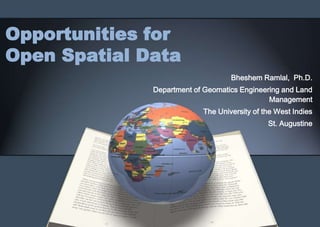
  • 1. Opportunities for Open Spatial Data Bheshem Ramlal, Ph.D. Department of Geomatics Engineering and Land Management The University of the West Indies St. Augustine
  • 2. Presentation Overview • Introduction • Spatial Data Development in Trinidad and Tobago • Open Spatial Data Access – Issues and Prospects • UWI’s role • Conclusions
  • 3. Introduction • From its initial development in Canada in the 1960s, GIS has grown significantly to become pervasive in almost all societies • Globally, spatial data development is a multi- billion dollar industry
  • 4. GIS Worth -Global Estimates
  • 5. Introduction • With changes in ICT, spatial data have become much more accessible to users • Initially most spatial data were not accessible to the public. • There has been a gradual move by many countries from cost-recovery policies to open access policies • Move to develop the public commons for Geospatial Data
  • 11. GIS Development in Trinidad and Tobago • WASA • NEMA Tobago • MoWT • TTEC • Forestry • LSA • TTPOST • MFPLMR • HDC • EMA • Police • MPESDGA • IMA • SUATT • MNS • TCPD • SSA • MSYA • LSD • MoH • PoSCC • LMD • CSO • TSTT • PETROTRIN • MPA • TATT • NGC • FSD • MoLG • MoEEI • ODPM • MoE
  • 12. Data Sets Available Roads and other transportation Landslides Underground Storage Tanks networks Buildings Oceanography Wetlands, Lagoons, Ponds, Communications Topography Lakes Network Coastline and Coastal Activities Administrative Boundaries Utilities Aerial Photos & satellite Imagery Soils Oil and Gas Facilities Survey Plans Geology Gas Stations Seismic Activities Food Supply Networks Watercourses Quarries Public Safety Organizations Flood Plains Recreation facilities and open Health Care Providers spaces Demographic Data Public Health Facilities National Parks/ Protected Areas Water Quality Existing Land Use Watersheds Cemeteries and cremation sites Electoral Boundaries Industrial Plants Dumps Emergency Op/ Disaster shelters Meteorological Educational Facilities Vegetation Sensitive Sites WASA Installations and wells
  • 13. Status of GIS Development Status of Agencies No of Agencies Interest in GIS development 31 GIS needs assessment completed 10 GIS implementation plan completed (document) 9 GIS training acquired 21 GIS database development initiated 19 GIS database completed 5 Enterprise GIS 8 Metadata Developed 2 Data Sharing Policy 5 Data and Spatial products available on website 4
  • 14.
  • 15.
  • 16.
  • 17.
  • 18.
  • 19. Open Spatial Data: Issues • Lack of Metadata • No Metadata Standards • Lack of Data Sharing Policies • Lack of Accuracy Specifications
  • 20. Open Spatial Data: Prospects • Significant effort being made to develop Enterprise GIS by government agencies • Government moving towards the development of national policy on Spatial Data Infrastructure • Technology becoming more available for the sharing of spatial data in Trinidad and Tobago
  • 21. A Role for the DGELM The UWI has had significant input in GIS Development in Trinidad and Tobago – The UWI has designed and delivered over 60 training courses in GIS to industry in the last 15 years – Certificate in GIS and a MSc Geo- informatics programs delivered by UWI – Provided consulting services for the design and development of several enterprise GIS for Government and Private Sector organizations – Set up the GIS Society of Trinidad and Tobago
  • 22. A Role for the DGELM • Provide support and advice to stakeholder with respect to policies, standards, and technical requirements • Conduct relevant research and develop appropriate solutions • Develop and make available spatial data sets where possible • Advocate for policy changes • Support training needs of stakeholders
  • 23. Conclusions • While extensive work has been done in the development of spatial data sets most are not available for open access to the public • There is some movement by government towards setting up a NSDI but this is still at a very early stage of development • There is much work to be done to convince government to adopt open access policies • The UWI has played a significant role in making spatial data openly available