Gsnsw geotourism
•
3 recomendaciones•1,895 vistas

Enhancing Earth Sciences in New South Wales, Australia, through Geotourism

Recomendados
Recomendados
Más contenido relacionado
La actualidad más candente
La actualidad más candente (20)
Destacado
Destacado (20)
Similar a Gsnsw geotourism
Similar a Gsnsw geotourism (19)
Más de Leisure Solutions®
Más de Leisure Solutions® (11)
Último
Último (20)
Gsnsw geotourism
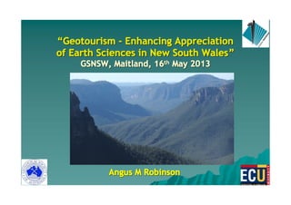
- 1. ““““““““Geotourism - Enhancing AppreciationGeotourism - Enhancing AppreciationGeotourism - Enhancing AppreciationGeotourism - Enhancing AppreciationGeotourism - Enhancing AppreciationGeotourism - Enhancing AppreciationGeotourism - Enhancing AppreciationGeotourism - Enhancing Appreciation of Earth Sciences in New South Walesof Earth Sciences in New South Walesof Earth Sciences in New South Walesof Earth Sciences in New South Walesof Earth Sciences in New South Walesof Earth Sciences in New South Walesof Earth Sciences in New South Walesof Earth Sciences in New South Wales”””””””” GSNSW, Maitland, 16GSNSW, Maitland, 16GSNSW, Maitland, 16GSNSW, Maitland, 16GSNSW, Maitland, 16GSNSW, Maitland, 16GSNSW, Maitland, 16GSNSW, Maitland, 16thththththththth May 2013May 2013May 2013May 2013May 2013May 2013May 2013May 2013 Angus M RobinsonAngus M RobinsonAngus M RobinsonAngus M RobinsonAngus M RobinsonAngus M RobinsonAngus M RobinsonAngus M Robinson
- 2. ‘‘Modern Day ExplorersModern Day Explorers’’ –– 19781978 An Early Geotourism Awakening!An Early Geotourism Awakening! Whilst employed in theWhilst employed in the tourismtourism industry,industry, I wrote a feature article in a tourism publication (See Australia) entitled ‘modern daymodern day explorersexplorers’’ and described the ‘‘natural heritagenatural heritage’’ of theof the mining areamining area of Chillagoe, Nth Qld based on my observations as an exploration geologistexploration geologist inin the early 1970s.the early 1970s.
- 3. TodayToday’’s Agendas Agenda � Landscapes and natural heritage � What do we mean by geotourism/experiential tourism � Scope of Geotourism and Geotourists � National Landscapes and Geoparks �� Geotourism Initiatives in NSWGeotourism Initiatives in NSW �� A suggestedA suggested rrole for the GSNSWole for the GSNSW � Take Aways
- 4. Scenery and Geology - a 1938 MusingScenery and Geology - a 1938 Musing �� SceneryScenery depends on landland structurestructure - in other words, its geologygeology.. � Everyone interested in the countrysidecountryside, how it has taken shape, why it presents us with the varied beauties of mountain and woodland, river valleys and fertile meadows, is, if often unconsciously, appreciating its geology.geology. A.E. Trueman Professor of Geology, Glascow University
- 5. Understanding Natural HeritageUnderstanding Natural Heritage Natural heritage is the legacy of natural objects and intangible attributes encompassing the countryside and natural environment, including flora and fauna, scientifically known as BIODIVERSITYBIODIVERSITY, and geology, landforms and soil landscapes, i.e., i.e. GEODIVERSITYGEODIVERSITY..
- 6. Understanding Geological Heritage (Geoheritage)Understanding Geological Heritage (Geoheritage) GeologicalGeological heritageheritage sites (sites (geositesgeosites)) are placesare places which enablewhich enable us to understand theus to understand the composition ofcomposition of the earth, the internal andthe earth, the internal and external processesexternal processes that have shaped it andthat have shaped it and the evolvingthe evolving flora and fauna that occupied itflora and fauna that occupied it.. Source: Adapted from Dr Susan White, AESC 2010Source: Adapted from Dr Susan White, AESC 2010
- 7. 7 Therefore they will have similar: � Geology � Topography � Vegetation � Soils �� Geoheritage featuresGeoheritage features A SOIL LANDSCAPESOIL LANDSCAPESOIL LANDSCAPESOIL LANDSCAPE is: a repeating pattern of soil and landforms resulting from aa repeating pattern of soil and landforms resulting from aa repeating pattern of soil and landforms resulting from aa repeating pattern of soil and landforms resulting from a common geological/geomorphic history.common geological/geomorphic history.common geological/geomorphic history.common geological/geomorphic history.
- 8. GeotourismGeotourism –– Professor Tom Hose, UK (1995)Professor Tom Hose, UK (1995) The provision of interpretive and service facilities to enable tourists to acquire knowledge and understanding of the geologygeology and geomorphologyand geomorphology of a site (including its contribution to the development of the Earth Sciences) beyond the level of mere aestheticbeyond the level of mere aesthetic appreciationappreciation.
- 9. GeotourismGeotourism –– National Geographic Society & theNational Geographic Society & the Travel Industry Association of America (1997)Travel Industry Association of America (1997) � Geotourism is "best practice" tourism that sustains, or even enhances, the geographical character of a placegeographical character of a place, such as its culture, environment, heritage, and the well-being of its residents. � Like ecotourism, geotourism promotes a virtuous circlegeotourism promotes a virtuous circle whereby tourism revenues provide a local incentive to protect what tourists are coming to see, but extends the principle beyond nature and ecology to incorporate allincorporate all characteristics that contribute to sense of placecharacteristics that contribute to sense of place. � Geotourism incorporates sustainability principles,sustainability principles, but in addition to the do-no-harm ethic, geotourism focuses on thegeotourism focuses on the place as a whole.place as a whole.
- 10. Key ConceptsKey Concepts –– EcotourismEcotourism � According to Ecotourism Australia, ecotourism is ecologically sustainable tourismecologically sustainable tourism with a primary focus on experiencing natural areasexperiencing natural areas that fosters environmental and cultural understanding, appreciation and conservation. � Ecotourism Australia believes that the ultimate definition of ecotourism is compliance with thecompliance with the core criteria stated within the Eco CertificationEco Certification Program.Program.
- 11. ‘‘ExperientialExperiential’’ TourismTourism –– A New Product PropositionA New Product Proposition � The global market is looking for unique productunique product experiencesexperiences and a broader mix of experiences. � The ‘geotourismgeotourism’’ experience (as defined by the NGS(as defined by the NGS) creates a more holistic experiencemore holistic experience, and is a move towards the ‘experiential’ tourism model. � In short, ‘‘experientialexperiential’’ tourists seek memorablememorable experiencesexperiences.
- 12. Geotourism incorporatingGeotourism incorporating all types ofall types of ‘‘place-basedplace-based’’ tourismtourism National Geographic PerspectiveNational Geographic Perspective Boley, B.B. after Thompson, S. 2009 SightseeingSightseeingSightseeingSightseeing CuisineCuisineCuisineCuisine AgritourismAgritourismAgritourismAgritourism IndigenousIndigenousIndigenousIndigenous TourismTourismTourismTourism HeritageHeritageHeritageHeritage TourismTourismTourismTourism CulturalCulturalCulturalCultural TourismTourismTourismTourism ECOTOURISMECOTOURISMECOTOURISMECOTOURISM GeotourismGeotourism i.e.i.e. ‘‘experientialexperiential tourismtourism’’
- 13. Geotourism CharacteristicsGeotourism Characteristics A GeologistA Geologist’’s Perspectives Perspective 1. Is geologically basedgeologically based and can occur in either natural, rural or urban environments. 2. Fosters geoheritage conservationgeoheritage conservation through appropriate sustainability measures. 3. Advances sound geological understandinggeological understanding through interpretation and education. 4. Generates touristtourist or visitor satisfaction. Dowling, 2010
- 14. Geotourism - asGeotourism - as oneone of the components of theof the components of the many types ofmany types of ‘‘place-basedplace-based’’ tourismtourism ‘‘GeologicalGeological’’ PerspectivePerspective Sightseeing CuisineCuisineCuisineCuisine AgritourismAgritourismAgritourismAgritourism IndigenousIndigenousIndigenousIndigenous TourismTourismTourismTourism HeritageHeritageHeritageHeritage TourismTourismTourismTourism CulturalCulturalCulturalCultural TourismTourismTourismTourism EcotourismEcotourismEcotourismEcotourism GeotourismGeotourism
- 15. GeotourismGeotourism –– Potential Markets??Potential Markets?? National Geographic/Tourism Industry ViewNational Geographic/Tourism Industry View ‘‘‘‘‘‘‘‘ExperientialExperientialExperientialExperientialExperientialExperientialExperientialExperiential’’’’’’’’ Domestic TravellersDomestic TravellersDomestic TravellersDomestic TravellersDomestic TravellersDomestic TravellersDomestic TravellersDomestic Travellers Geologists/Geomorphologists/SpeliologistsGeologists/Geomorphologists/SpeliologistsGeologists/Geomorphologists/SpeliologistsGeologists/Geomorphologists/SpeliologistsGeologists/Geomorphologists/SpeliologistsGeologists/Geomorphologists/SpeliologistsGeologists/Geomorphologists/SpeliologistsGeologists/Geomorphologists/Speliologists /Paleontologists/Paleontologists/Paleontologists/Paleontologists/Paleontologists/Paleontologists/Paleontologists/Paleontologists School GroupsSchool GroupsSchool GroupsSchool GroupsSchool GroupsSchool GroupsSchool GroupsSchool Groups ‘‘‘‘‘‘‘‘ExperientialExperientialExperientialExperientialExperientialExperientialExperientialExperiential’’’’’’’’ Overseas TravellersOverseas TravellersOverseas TravellersOverseas TravellersOverseas TravellersOverseas TravellersOverseas TravellersOverseas Travellers Geopark/PaleoPark InterestsGeopark/PaleoPark InterestsGeopark/PaleoPark InterestsGeopark/PaleoPark InterestsGeopark/PaleoPark InterestsGeopark/PaleoPark InterestsGeopark/PaleoPark InterestsGeopark/PaleoPark Interests
- 16. GSA GEOtouristsGSA GEOtouristsGSA GEOtouristsGSA GEOtouristsGSA GEOtouristsGSA GEOtouristsGSA GEOtouristsGSA GEOtourists FiveFiveFiveFiveFiveFiveFiveFive MostMostMostMostMostMostMostMost Important Travel PurposesImportant Travel PurposesImportant Travel PurposesImportant Travel PurposesImportant Travel PurposesImportant Travel PurposesImportant Travel PurposesImportant Travel Purposes 1.1. Increasing knowledgeIncreasing knowledge of geological sites and landforms. 2. To satisfy my curiosity.curiosity. 3. To have a memorable experiencememorable experience. 4. To obtain intellectual stimulationintellectual stimulation. 5. Visiting destinations offering a uniqueunique bundlebundle of features and attractions (i.e. ecology, geology, culture and history).
- 17. BrandingBranding ‘‘IconicIconic’’ GeotourismGeotourism –– Ensuring a Memorable Experience!Ensuring a Memorable Experience!
- 18. GeotourismGeotourism (Geological Tourism) -The Players(Geological Tourism) -The Players GeotourismGeotourismGeotourismGeotourismGeotourismGeotourismGeotourismGeotourism GeomorphologistsGeomorphologistsGeomorphologistsGeomorphologistsGeomorphologistsGeomorphologistsGeomorphologistsGeomorphologists Local GovtLocal GovtLocal GovtLocal GovtLocal GovtLocal GovtLocal GovtLocal Govt Flora/FaunaFlora/FaunaFlora/FaunaFlora/FaunaFlora/FaunaFlora/FaunaFlora/FaunaFlora/Fauna InterestsInterestsInterestsInterestsInterestsInterestsInterestsInterests GeographersGeographersGeographersGeographersGeographersGeographersGeographersGeographers ‘‘‘‘‘‘‘‘GeologistsGeologistsGeologistsGeologistsGeologistsGeologistsGeologistsGeologists’’’’’’’’ (Various types)(Various types)(Various types)(Various types)(Various types)(Various types)(Various types)(Various types) LandownersLandownersLandownersLandownersLandownersLandownersLandownersLandowners Geol Surveys/Geol Surveys/Geol Surveys/Geol Surveys/Geol Surveys/Geol Surveys/Geol Surveys/Geol Surveys/ Planning Agencies/Planning Agencies/Planning Agencies/Planning Agencies/Planning Agencies/Planning Agencies/Planning Agencies/Planning Agencies/ Park ManagersPark ManagersPark ManagersPark ManagersPark ManagersPark ManagersPark ManagersPark Managers Tour OperatorsTour OperatorsTour OperatorsTour OperatorsTour OperatorsTour OperatorsTour OperatorsTour Operators Govt TourismGovt TourismGovt TourismGovt TourismGovt TourismGovt TourismGovt TourismGovt Tourism AgenciesAgenciesAgenciesAgenciesAgenciesAgenciesAgenciesAgencies
- 19. GeotourismGeotourism –– Diversity of SitesDiversity of Sites GeotourismGeotourismGeotourismGeotourismGeotourismGeotourismGeotourismGeotourism IconsIconsIconsIconsIconsIconsIconsIcons ((((((((Inc National Landscapes)Inc National Landscapes)Inc National Landscapes)Inc National Landscapes)Inc National Landscapes)Inc National Landscapes)Inc National Landscapes)Inc National Landscapes) Mine SitesMine SitesMine SitesMine SitesMine SitesMine SitesMine SitesMine Sites National Parks/Reserves/National Parks/Reserves/National Parks/Reserves/National Parks/Reserves/National Parks/Reserves/National Parks/Reserves/National Parks/Reserves/National Parks/Reserves/ Urban ParksUrban ParksUrban ParksUrban ParksUrban ParksUrban ParksUrban ParksUrban Parks Geo-trailsGeo-trailsGeo-trailsGeo-trailsGeo-trailsGeo-trailsGeo-trailsGeo-trails Geo-sitesGeo-sitesGeo-sitesGeo-sitesGeo-sitesGeo-sitesGeo-sitesGeo-sites Geoparks/Geoparks/Geoparks/Geoparks/Geoparks/Geoparks/Geoparks/Geoparks/ PaleoParksPaleoParksPaleoParksPaleoParksPaleoParksPaleoParksPaleoParksPaleoParks Caves/Karst AreasCaves/Karst AreasCaves/Karst AreasCaves/Karst AreasCaves/Karst AreasCaves/Karst AreasCaves/Karst AreasCaves/Karst Areas LandformsLandformsLandformsLandforms WHAsWHAsWHAsWHAsWHAsWHAsWHAsWHAs
- 20. Definition of Karst Karst is a distinctive landform formed on rocks that have a greater degree of solubility (e.g. limestone) than is commonly found. This process typically occurs over thousands or millions of years resulting in a variety of unusual surface and below ground features such as arches, gorges, sinkholes and CAVES. Cave tourism is one of the best exemplars of Geotourism!CAVES. Cave tourism is one of the best exemplars of Geotourism! Cooleman Plains karst environments (Kosciuszko NP) Photos copyright A. C. Baker/DECCWCooleman Plains karst environments (Kosciuszko NP) Photos copyright A. C. Baker/DECCW
- 21. Definition of Karst EnvironmentsDefinition of Karst Environments Integrated, yet dynamic, systems of landforms, life, energy, water, gases, soils and bedrock. Karst environments may contain significant geodiversity, biodiversity, aboriginal cultural heritage, historic cultural heritage, aesthetic, scientific and social values. Photos copyright A. C. Baker/DECCW and S.Reilly/DECCW (middle imagePhotos copyright A. C. Baker/DECCW and S.Reilly/DECCW (middle image))
- 22. Geotourism and Mining AreasGeotourism and Mining Areas � Existing and abandoned mining sites � Old mining towns e.g. Broken Hill � Historic mining regions e.g. West Coast Tasmania � Economic Geology geosites e.g. gossans, alterationgossans, alteration zones e.g. Turtle Island, Taiwan � Old mine site complexes combining mining, museums, ecological interpretation, history and culture e.g. Gold Ecological Park, TaiwanGold Ecological Park, Taiwan
- 23. Broken HillBroken Hill DEWHA has been assessing both the mining and minerals (i.e. economic geologyeconomic geology) heritage of Broken Hill. �� Broken Hill’s prominent role in AustraliaAustralia’’s mining history.s mining history. � For the development of innovative mining and metallurgicalinnovative mining and metallurgical practices.practices. � As the place where safe working practices and workerssafe working practices and workers’’ legislationlegislation was first developed for miners. � For its well-known mineralogical diversitymineralogical diversity.. � For its importance for the associations with many individualsassociations with many individuals who have played a prominent role in the Australian mining industry. Source: DEWHA
- 24. Mining GeotourismMining Geotourism Gossans and Alteration ZonesGossans and Alteration Zones
- 25. Jinguashi Gold Ecological Park, Taiwan
- 26. Jinguashi Gold Ecological Park, Taiwan
- 27. Jinguashi Gold Ecological Park, Taiwan
- 28. Jinguashi Gold Ecological Park, Taiwan
- 29. Jinguashi Gold Ecological Park, Taiwan
- 30. Jinguashi Gold Ecological Park, Taiwan
- 31. Jinguashi Gold Ecological Park, Taiwan
- 32. Jinguashi Gold Ecological Park, Taiwan
- 33. Tianzhushan Global GeoparkTianzhushan Global Geopark Anhui Province, PRCAnhui Province, PRC
- 34. What is a Geopark?What is a Geopark? � A Global Geopark is a unified area with geologicalgeological heritageheritage of international significance and where that heritage is being used to promote the sustainableheritage is being used to promote the sustainable development of the local communitiesdevelopment of the local communities who live there. � The Global Geopark brand is a voluntary, quality label and while it is not a legislative designation, the keykey heritage sites within a geopark should be protectedheritage sites within a geopark should be protected under local, regional or national legislation asunder local, regional or national legislation as appropriate.appropriate. � These Earth heritage sites are part of an integrated concept of protection, education, and sustainableprotection, education, and sustainable developmentdevelopment.
- 35. Core Elements of a GeoparkCore Elements of a Geopark A GEOPARKGEOPARK achieves its goals of fostering local developmentfostering local development through a three-pronged approach: � GEOCONSERVATIONGEOCONSERVATION: A GEOPARK seeks to conserve significant geological features, and explore and demonstrate methods for excellence in conservation. � EDUCATIONEDUCATION: A GEOPARK organises activities and provides logistic support to communicate geoscientific knowledge and environmental concepts to the public. � GEOTOURISMGEOTOURISM: A GEOPARK stimulates economic activity and sustainable development through geotourism.
- 36. Land Composition of a GeoparkLand Composition of a Geopark A GEOPARKGEOPARK may comprise either solely or a mixsolely or a mix ofof � protected public lands including WHAs, national parks and any other like areas designated byareas designated by national governmentsnational governments, � private lands, and located wholly within or across national/statewithin or across national/state boundariesboundaries’’
- 38. Some Geomorphic Highlights Kanawinka Geopark – Victoria and New South Wales
- 39. Volcanic Landscapes, Kanawinka Geopark, VictoriaVolcanic Landscapes, Kanawinka Geopark, Victoria
- 40. Kanawinka and the EPHCKanawinka and the EPHC In November 2009, Australian Government Ministers for the Environment and Heritage decided that whilst Australian governments support geological heritage, they have significant concerns with the application of the UNESCO Geoparks concept in Australia, especially without government endorsement. Furthermore they determined that existingexisting mechanisms are considered sufficient to protectmechanisms are considered sufficient to protect geoheritage.geoheritage.
- 41. Warrambungles, New South WalesWarrambungles, New South Wales –– A Future Geopark for NSW?A Future Geopark for NSW?
- 42. ScenarioScenario WarrambunglesWarrambungles National ParkNational Park Outstanding Miocene Shield Volcano remnant landforms close to a major coal development area 236 square km area
- 46. National Landscapes and GeoparksNational Landscapes and Geoparks � Have similar goalssimilar goals relating to local development, education and experiential tourism (‘geotourism’). � However, National Landscapes do not focusNational Landscapes do not focus on fostering geoconservationon fostering geoconservation, but have a broader ‘natural heritage’ remit. � Nonetheless, the GSA has recently developed with Parks Australia a protocol providing forprotocol providing for geoscience inputgeoscience input.
- 47. Scenic RimScenic Rim –– Green CauldronGreen Cauldron National LandscapeNational Landscape
- 48. ‘‘Green CauldronGreen Cauldron’’ National LandscapeNational Landscape TheThe ‘‘Scenic RimScenic Rim’’ RegionRegion
- 50. Two Geotour LeadersTwo Geotour Leaders –– Different Interpretation TechniquesDifferent Interpretation Techniques Dr John JacksonDr John Jackson ‘‘The Rock DoctorThe Rock Doctor’’ Bob BrownBob Brown Bob & Nancy Geological Tour SiteBob & Nancy Geological Tour Site
- 51. ‘‘Gondwana CoastGondwana Coast’’ –– Fossils WalksFossils Walks Ulladulla, NSWUlladulla, NSW
- 52. Kanawinka Geopark - Education
- 57. The easy next stepThe easy next stepThe easy next stepThe easy next step
- 58. Camel Rock TurbiditeCamel Rock TurbiditeCamel Rock TurbiditeCamel Rock Turbidite -36.378131 150.076987 These are the strongly folded beds of 470 million year old turbidite. Turbidites form in the deep ocean when unstable masses of sediment avalanche down continental slopes, gathering water as they go . From each dense sediment flow, sand settles out first followed by finer sediment, preserved in a single bed or layer. Undulations in the fine layers at the top of each bed record the ripples as the flow comes to rest. The mud settles and duly forms as layers seen in the turbidite rock. Link http://www.sapphirecoast.com.au/6_The_g eological_floor_-_the_Ordovician.pdf
- 59. RIFTING EAST GONDWANARIFTING EAST GONDWANARIFTING EAST GONDWANARIFTING EAST GONDWANA Cretaceous volcanicsCretaceous volcanicsCretaceous volcanicsCretaceous volcanics Formation Great Eastern EscarpmentFormation Great Eastern EscarpmentFormation Great Eastern EscarpmentFormation Great Eastern Escarpment Formation continental shelfFormation continental shelfFormation continental shelfFormation continental shelf Formation Tasman SeaFormation Tasman SeaFormation Tasman SeaFormation Tasman Sea DEVONIAN EDEN- COMERONG RIFTDEVONIAN EDEN- COMERONG RIFTDEVONIAN EDEN- COMERONG RIFTDEVONIAN EDEN- COMERONG RIFT Devonian volcanics & related graniteDevonian volcanics & related graniteDevonian volcanics & related graniteDevonian volcanics & related granite Oxygenation , red beds fossil fishOxygenation , red beds fossil fishOxygenation , red beds fossil fishOxygenation , red beds fossil fish TERTIARY LANDSCAPESTERTIARY LANDSCAPESTERTIARY LANDSCAPESTERTIARY LANDSCAPES Escarpment developmentEscarpment developmentEscarpment developmentEscarpment development Lava flowsLava flowsLava flowsLava flows SandstoneSandstoneSandstoneSandstone QUATERNARY LANDSCAPESQUATERNARY LANDSCAPESQUATERNARY LANDSCAPESQUATERNARY LANDSCAPES Sea level fluctuations & current shoreSea level fluctuations & current shoreSea level fluctuations & current shoreSea level fluctuations & current shore Sand dunesSand dunesSand dunesSand dunes Coastal lagoons and lakesCoastal lagoons and lakesCoastal lagoons and lakesCoastal lagoons and lakes MID DEVONIAN GRANITEMID DEVONIAN GRANITEMID DEVONIAN GRANITEMID DEVONIAN GRANITE Bega BatholithBega BatholithBega BatholithBega Batholith Granite landscape evolutionGranite landscape evolutionGranite landscape evolutionGranite landscape evolution DISTINCTIVE GEODISTINCTIVE GEODISTINCTIVE GEODISTINCTIVE GEO THEMESTHEMESTHEMESTHEMES ORDOVICIAN REGIONAL FLOORORDOVICIAN REGIONAL FLOORORDOVICIAN REGIONAL FLOORORDOVICIAN REGIONAL FLOOR Narooma accreted terraneNarooma accreted terraneNarooma accreted terraneNarooma accreted terrane TurbiditesTurbiditesTurbiditesTurbidites
- 60. 50 km50 km50 km50 km 19191919 18181818 17171717 1616161615151515 14141414 13131313 12121212 11111111 10101010 9999 8888777766665555 4444 3333 2222 1111 19191919 7777666655554444 333322221111 181818181717171716161616 15151515141414141313131312121212 111111111010101099998888
- 61. NEXT ?NEXT ?NEXT ?NEXT ? Green CauldronGreen CauldronGreen CauldronGreen Cauldron Flinders RangesFlinders RangesFlinders RangesFlinders Ranges
- 62. Montague Island Cretaceous VolcanicsMontague Island Cretaceous VolcanicsMontague Island Cretaceous VolcanicsMontague Island Cretaceous Volcanics To the 2km long IslandTo the 2km long IslandTo the 2km long IslandTo the 2km long Island’’’’s south easts south easts south easts south east was a huge 99 million year oldwas a huge 99 million year oldwas a huge 99 million year oldwas a huge 99 million year old stratovolcano. This was one of a chainstratovolcano. This was one of a chainstratovolcano. This was one of a chainstratovolcano. This was one of a chain down eastern Gondwanaland markingdown eastern Gondwanaland markingdown eastern Gondwanaland markingdown eastern Gondwanaland marking the rupture that formed the Tasmanthe rupture that formed the Tasmanthe rupture that formed the Tasmanthe rupture that formed the Tasman Sea. The volcano flanks included theSea. The volcano flanks included theSea. The volcano flanks included theSea. The volcano flanks included the dark coloured lava and tuffs on thedark coloured lava and tuffs on thedark coloured lava and tuffs on thedark coloured lava and tuffs on the IslandIslandIslandIsland’’’’s north side. The Islands north side. The Islands north side. The Islands north side. The Island’’’’ssss granite-like grey rocks are thegranite-like grey rocks are thegranite-like grey rocks are thegranite-like grey rocks are the remnants of globs of molten materialremnants of globs of molten materialremnants of globs of molten materialremnants of globs of molten material intruded into the volcanic debris. Theintruded into the volcanic debris. Theintruded into the volcanic debris. Theintruded into the volcanic debris. The north side of Gulaga on the nearnorth side of Gulaga on the nearnorth side of Gulaga on the nearnorth side of Gulaga on the near horizon has the same rock assemblage,horizon has the same rock assemblage,horizon has the same rock assemblage,horizon has the same rock assemblage, giving an idea of the volcanogiving an idea of the volcanogiving an idea of the volcanogiving an idea of the volcano’’’’s size.s size.s size.s size.
- 63. Monaro Paleogene Lava PlainsMonaro Paleogene Lava PlainsMonaro Paleogene Lava PlainsMonaro Paleogene Lava Plains The 4300 square km Monaro VolcanicThe 4300 square km Monaro VolcanicThe 4300 square km Monaro VolcanicThe 4300 square km Monaro Volcanic Province was active over the periodProvince was active over the periodProvince was active over the periodProvince was active over the period 58 to 34 million years ago. Over 63058 to 34 million years ago. Over 63058 to 34 million years ago. Over 63058 to 34 million years ago. Over 630 cubic km of basalt was erupted fromcubic km of basalt was erupted fromcubic km of basalt was erupted fromcubic km of basalt was erupted from 65 known sites. Lava cascaded off the65 known sites. Lava cascaded off the65 known sites. Lava cascaded off the65 known sites. Lava cascaded off the highlands down coastal valleys.highlands down coastal valleys.highlands down coastal valleys.highlands down coastal valleys. Before this volcanic activity began,Before this volcanic activity began,Before this volcanic activity began,Before this volcanic activity began, the region was a flat plain with manythe region was a flat plain with manythe region was a flat plain with manythe region was a flat plain with many lakes and streams. Lake sediments oflakes and streams. Lake sediments oflakes and streams. Lake sediments oflakes and streams. Lake sediments of white clay can be seen in placeswhite clay can be seen in placeswhite clay can be seen in placeswhite clay can be seen in places beneath the basalt. The pollen andbeneath the basalt. The pollen andbeneath the basalt. The pollen andbeneath the basalt. The pollen and fossil wood in these deposits indicatefossil wood in these deposits indicatefossil wood in these deposits indicatefossil wood in these deposits indicate the region was covered by coolthe region was covered by coolthe region was covered by coolthe region was covered by cool temperate rainforest.temperate rainforest.temperate rainforest.temperate rainforest.
- 64. PRODUCT: NSW GEOTRAILSPRODUCT: NSW GEOTRAILSPRODUCT: NSW GEOTRAILSPRODUCT: NSW GEOTRAILSPRODUCT: NSW GEOTRAILSPRODUCT: NSW GEOTRAILSPRODUCT: NSW GEOTRAILSPRODUCT: NSW GEOTRAILS ► Are predetermined routes, which link sites of geoheritage significance or interest (possibly geosites/parks). ► Visitors travel by car/coach/bike to nominated sites where they can participate in a range of active and passive pursuits including geoventuresgeoventuresgeoventuresgeoventures such as caving, abseiling, mountain biking etc. ► Could involve the downloading of information from the DECC Website to personal MP3 players and GPS units – for use in on-site interpretation and route navigation. ► Would be marketed through brochures, signage, the DECC Website and other forms of electronic media, which would identify/describe tourism infrastructure Source: Stephen Meehan, OEH GEOTOURISMGEOTOURISMGEOTOURISMGEOTOURISM A road best travelledA road best travelledA road best travelledA road best travelled…………
- 65. PRODUCT: NSW GEOTRAILSPRODUCT: NSW GEOTRAILSPRODUCT: NSW GEOTRAILSPRODUCT: NSW GEOTRAILSPRODUCT: NSW GEOTRAILSPRODUCT: NSW GEOTRAILSPRODUCT: NSW GEOTRAILSPRODUCT: NSW GEOTRAILS ► Be developed/marketed in conjunction with NSW Tourism, regional tourism organisations, local councils and the business community. ► Partnerships with Aboriginal communities would also be sought – in many cases geosites have cultural heritage significance. ► Individual geotrails could target niche markets (e.g. wanderers, compatriots, pampadours). ►► Would be the first of itWould be the first of it’’s kinds kind – while similar products have been developed on a regional level (e.g. Flinders Rangers and SA Fossil Trail), its proposed scale and product mix makes it special. GEOTOURISMGEOTOURISMGEOTOURISMGEOTOURISM A road best travelledA road best travelledA road best travelledA road best travelled…………
- 66. On tour with our greatest rock stars … … Dine with three beautiful sisters … Hang with the in crowd … Meet these and other rock stars on a NSW GeotrailNSW GeotrailNSW GeotrailNSW Geotrail (see Inset). For further information visit www.environment.nsw.gov.au or contact your nearest office of the Department of Environment and Climate Change. GEOTOURISMGEOTOURISMGEOTOURISMGEOTOURISM –––– a road best travelleda road best travelleda road best travelleda road best travelled Unwind with legends …
- 68. NSW OpportunitiesNSW Opportunities 1. GeoTreat smartphone application project. 2. Existing Central NSW Mining Trail application. 3. Cartoscope NSW Geotourism Map. 4. Proposed OEH NSW Geotrail. 5. AusIMM Heritage project with pilot in the Illawarra
- 69. How Can GSNSW Help?How Can GSNSW Help? 1. GeoTreat smartphone application project. 2. Existing Central NSW Mining Trail application. 3. Gold Trails NSW www.goldtrails.com.au 4. Cartoscope NSW Geotourism Map. 5. Proposed OEH NSW Geotrail. 6. AusIMM Heritage project with pilot in the Illawarra 7. AESC field trips, Newcastle, July 2014
- 70. GeotourismGeotourism –– EstablishingEstablishing ‘‘Common GroundCommon Ground’’ withwith the Parks Movementthe Parks Movement There is an opportunity for geotourism advocates to engagegeotourism advocates to engage with pwith parkark managersmanagers to determine commonality on issues relating to: �� Connecting LandscapesConnecting Landscapes � Forming PartnershipsPartnerships �� Attracting VisitorsAttracting Visitors � Development of Regional CommunitiesRegional Communities �� IndigenousIndigenous Engagement � Identification and Establishment of Geosites/GeotrailsGeosites/Geotrails �� Geoscience information & interpretation e.g. web sitesGeoscience information & interpretation e.g. web sites
- 71. Take-AwaysTake-Aways 1. The incorporation of the geotourism experience (with traditional nature tourismtraditional nature tourism and elements of otherand elements of other ‘‘place basedplace based’’ tourism)tourism) creates a more holistic experience, and is a move towards the experiential tourism modelexperiential tourism model. In short, ‘experiential tourists seek memorable experiences. 2.2. GeoheritageGeoheritage and Geotourism are inextricably linked.
- 72. Take-AwaysTake-Aways 3. Geotourism initiatives are now being rolled out in NSW to meet growing public interest. 4. The GSA and the other geological societies (e.g. The AusIMM and the AIG) would welcome the opportunity to partner with both the GSNSW and the OEH to enhance the scope and effectiveness of these projects.
- 73. Contact DetailsContact DetailsContact DetailsContact DetailsContact DetailsContact DetailsContact DetailsContact Details www.leisuresolutions.com.auwww.leisuresolutions.com.au angus@leisuresolutions.com.auangus@leisuresolutions.com.au O418 488 340O418 488 340 Join the LinkedInLinkedIn ‘‘Australian Geotourism DevelopmentAustralian Geotourism Development’’ Discussion Group!