
Recomendados
Más contenido relacionado
La actualidad más candente
La actualidad más candente (20)
Destacado
Destacado (10)
Similar a Slideshow: Chapter 4
Similar a Slideshow: Chapter 4 (20)
Último
Último (20)
Slideshow: Chapter 4
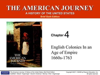
- 1. Copyright ©2011, ©2008 by Pearson Education, Inc. All rights reserved. The American Journey: A History of the United States, Brief Sixth Edition Goldfield • Abbott • Argersinger • DeJohn Anderson • Barney • Weir • Argersinger THE AMERICAN JOURNEYTHE AMERICAN JOURNEY A HISTORY OF THE UNITED STATESA HISTORY OF THE UNITED STATES Brief Sixth Edition Chapter English Colonies In an Age of Empire 1660s-1763 4
- 2. Copyright ©2011, ©2008 by Pearson Education, Inc. All rights reserved. The American Journey: A History of the United States, Brief Sixth Edition Goldfield • Abbott • Argersinger • DeJohn Anderson • Barney • Weir • Argersinger English Colonies In an Age of EmpireEnglish Colonies In an Age of Empire 1660s-17631660s-1763 • Economic Development and Imperial Trade in the Br • The Transformation of Culture • The Colonial Political World • Expanding Empires • A Century of Warfare • Conclusion
- 3. Copyright ©2011, ©2008 by Pearson Education, Inc. All rights reserved. The American Journey: A History of the United States, Brief Sixth Edition Goldfield • Abbott • Argersinger • DeJohn Anderson • Barney • Weir • Argersinger Susanna Truax, the subject of this 1730 portraitSusanna Truax, the subject of this 1730 portrait
- 4. Copyright ©2011, ©2008 by Pearson Education, Inc. All rights reserved. The American Journey: A History of the United States, Brief Sixth Edition Goldfield • Abbott • Argersinger • DeJohn Anderson • Barney • Weir • Argersinger Learning ObjectivesLearning Objectives • What were the goals of British trade policy? • How did new intellectual and religious trends reshape colonial culture? • How did the “Glorious Revolution” affect colonial politics? • What was the “backcountry”? Who settled there and why?
- 5. Copyright ©2011, ©2008 by Pearson Education, Inc. All rights reserved. The American Journey: A History of the United States, Brief Sixth Edition Goldfield • Abbott • Argersinger • DeJohn Anderson • Barney • Weir • Argersinger Learning Objectives (cont'd)Learning Objectives (cont'd) • What role did the colonists play in the French and Indian War?
- 6. Copyright ©2011, ©2008 by Pearson Education, Inc. All rights reserved. The American Journey: A History of the United States, Brief Sixth Edition Goldfield • Abbott • Argersinger • DeJohn Anderson • Barney • Weir • Argersinger Economic Development andEconomic Development and Imperial Trade in the BritishImperial Trade in the British ColoniesColonies
- 7. Copyright ©2011, ©2008 by Pearson Education, Inc. All rights reserved. The American Journey: A History of the United States, Brief Sixth Edition Goldfield • Abbott • Argersinger • DeJohn Anderson • Barney • Weir • Argersinger The Regulation of TradeThe Regulation of Trade • In the trade competition among European nations, England pursued a policy of national self-sufficiency based on mercantilism that used government intervention in the economy to increase national wealth.
- 8. Copyright ©2011, ©2008 by Pearson Education, Inc. All rights reserved. The American Journey: A History of the United States, Brief Sixth Edition Goldfield • Abbott • Argersinger • DeJohn Anderson • Barney • Weir • Argersinger The Regulation of Trade (cont'd)The Regulation of Trade (cont'd) • Government legislation required English ships carry all imperial trade, channeled colonial trade through England, and provided advantages for English manufacturers.
- 9. Copyright ©2011, ©2008 by Pearson Education, Inc. All rights reserved. The American Journey: A History of the United States, Brief Sixth Edition Goldfield • Abbott • Argersinger • DeJohn Anderson • Barney • Weir • Argersinger The Regulation of Trade (cont'd)The Regulation of Trade (cont'd) • English trade policies succeeded and the colonial economy expanded twice as fast as England’s did. Mercantilism - Economic system whereby the government intervenes in the economy for the purpose of increasing national wealth. Mercantilists advocated possession of colonies as places where the mother country could acquire raw materials not available at home.
- 10. Copyright ©2011, ©2008 by Pearson Education, Inc. All rights reserved. The American Journey: A History of the United States, Brief Sixth Edition Goldfield • Abbott • Argersinger • DeJohn Anderson • Barney • Weir • Argersinger The Regulation of Trade (cont'd)The Regulation of Trade (cont'd) Enumerated products - Items produced in the colonies and enumerated in acts of Parliament that could be legally shipped from the colony of origin only to specified locations, usually England and other destinations within the British Empire.
- 11. Copyright ©2011, ©2008 by Pearson Education, Inc. All rights reserved. The American Journey: A History of the United States, Brief Sixth Edition Goldfield • Abbott • Argersinger • DeJohn Anderson • Barney • Weir • Argersinger The Colonial Export Trade and theThe Colonial Export Trade and the Spirit of EnterpriseSpirit of Enterprise • The core of Anglo-American trade were staple crops such as sugar, tobacco, rice, and indigo produced by slave labor. After 1750, wheat became major colonial export.
- 12. Copyright ©2011, ©2008 by Pearson Education, Inc. All rights reserved. The American Journey: A History of the United States, Brief Sixth Edition Goldfield • Abbott • Argersinger • DeJohn Anderson • Barney • Weir • Argersinger The Colonial Export Trade and theThe Colonial Export Trade and the Spirit of EnterpriseSpirit of Enterprise • New England merchants prospered by developing a transatlantic trade with England and the West Indies. They built thousands of ships and eventually dominated shipping within the empire.
- 13. Copyright ©2011, ©2008 by Pearson Education, Inc. All rights reserved. The American Journey: A History of the United States, Brief Sixth Edition Goldfield • Abbott • Argersinger • DeJohn Anderson • Barney • Weir • Argersinger MAP 4–1 Anglo-American TransatlanticMAP 4–1 Anglo-American Transatlantic CommerceCommerce
- 14. Copyright ©2011, ©2008 by Pearson Education, Inc. All rights reserved. The American Journey: A History of the United States, Brief Sixth Edition Goldfield • Abbott • Argersinger • DeJohn Anderson • Barney • Weir • Argersinger FIGURE 4–1 Average Annual Value of ColonialFIGURE 4–1 Average Annual Value of Colonial Exports by Region, 1768–1772Exports by Region, 1768–1772
- 15. Copyright ©2011, ©2008 by Pearson Education, Inc. All rights reserved. The American Journey: A History of the United States, Brief Sixth Edition Goldfield • Abbott • Argersinger • DeJohn Anderson • Barney • Weir • Argersinger Scenes like this were common in the dockyards atScenes like this were common in the dockyards at Deptford and other parts of eighteenth-centuryDeptford and other parts of eighteenth-century London.London.
- 16. Copyright ©2011, ©2008 by Pearson Education, Inc. All rights reserved. The American Journey: A History of the United States, Brief Sixth Edition Goldfield • Abbott • Argersinger • DeJohn Anderson • Barney • Weir • Argersinger The Import Trade and Ties of CreditThe Import Trade and Ties of Credit • The colonies were a major market for English manufactured goods. By the late 1760s, over 4 million pounds worth of English manufactured goods were imported into the colonies. • A small but significant portion of the import trade was with Native Americans.
- 17. Copyright ©2011, ©2008 by Pearson Education, Inc. All rights reserved. The American Journey: A History of the United States, Brief Sixth Edition Goldfield • Abbott • Argersinger • DeJohn Anderson • Barney • Weir • Argersinger The Import Trade and Ties of CreditThe Import Trade and Ties of Credit (cont'd)(cont'd) • British merchants provided easy credit, especially to planters who charged the costs of purchases and transportation against future crop profits.
- 18. Copyright ©2011, ©2008 by Pearson Education, Inc. All rights reserved. The American Journey: A History of the United States, Brief Sixth Edition Goldfield • Abbott • Argersinger • DeJohn Anderson • Barney • Weir • Argersinger British Imperial Trade Regulations,British Imperial Trade Regulations, 1651–17331651–1733
- 19. Copyright ©2011, ©2008 by Pearson Education, Inc. All rights reserved. The American Journey: A History of the United States, Brief Sixth Edition Goldfield • Abbott • Argersinger • DeJohn Anderson • Barney • Weir • Argersinger Becoming More Like Britain: The GrowthBecoming More Like Britain: The Growth of Cities and Inequalityof Cities and Inequality • The growth of commerce stimulated the rise of seaport cities. Boston, Philadelphia, New York, and Charleston rivaled many British provincial towns in population and had similar cosmopolitan characters. • Two out of three artisans lived in colonial cities, many laboring in trades related to overseas commerce.
- 20. Copyright ©2011, ©2008 by Pearson Education, Inc. All rights reserved. The American Journey: A History of the United States, Brief Sixth Edition Goldfield • Abbott • Argersinger • DeJohn Anderson • Barney • Weir • Argersinger Becoming More Like Britain: The GrowthBecoming More Like Britain: The Growth of Cities and Inequality (cont'd)of Cities and Inequality (cont'd) • Colonial manufacturing occurred in workshops attached to the houses of artisans. The workforce included other family members, journeymen, and apprentices. • Over time, the gap between the rich and poor widened leading to poverty in the cities and relief efforts.
- 21. Copyright ©2011, ©2008 by Pearson Education, Inc. All rights reserved. The American Journey: A History of the United States, Brief Sixth Edition Goldfield • Abbott • Argersinger • DeJohn Anderson • Barney • Weir • Argersinger This view of the Philadelphia waterfront dates fromThis view of the Philadelphia waterfront dates from 1720. It shows how the city had developed into one1720. It shows how the city had developed into one of British America’s principal ports just forty yearsof British America’s principal ports just forty years after its founding.after its founding.
- 22. Copyright ©2011, ©2008 by Pearson Education, Inc. All rights reserved. The American Journey: A History of the United States, Brief Sixth Edition Goldfield • Abbott • Argersinger • DeJohn Anderson • Barney • Weir • Argersinger The Transformation of CultureThe Transformation of Culture
- 23. Copyright ©2011, ©2008 by Pearson Education, Inc. All rights reserved. The American Journey: A History of the United States, Brief Sixth Edition Goldfield • Abbott • Argersinger • DeJohn Anderson • Barney • Weir • Argersinger Goods and HousesGoods and Houses • As they felt more secure economically, 18th-century Americans purchased items to make their lives more comfortable. Among other things, chairs replaced benches, carpets covered wooden floors, and walls featured mirrors and portraits. • Prosperous colonists built grand houses that had rooms for specialized uses such as private bedrooms and parlors.
- 24. Copyright ©2011, ©2008 by Pearson Education, Inc. All rights reserved. The American Journey: A History of the United States, Brief Sixth Edition Goldfield • Abbott • Argersinger • DeJohn Anderson • Barney • Weir • Argersinger The Governor’s Palace in Williamsburg, VirginiaThe Governor’s Palace in Williamsburg, Virginia
- 25. Copyright ©2011, ©2008 by Pearson Education, Inc. All rights reserved. The American Journey: A History of the United States, Brief Sixth Edition Goldfield • Abbott • Argersinger • DeJohn Anderson • Barney • Weir • Argersinger Shaping Minds and MannersShaping Minds and Manners • Wealthy colonists cultivated genteel manners seeking to emulate the English gentry. • Balls, musical performances, and fancy dinners reinforced wealthy colonial beliefs that they were a better class of people than ordinary settlers.
- 26. Copyright ©2011, ©2008 by Pearson Education, Inc. All rights reserved. The American Journey: A History of the United States, Brief Sixth Edition Goldfield • Abbott • Argersinger • DeJohn Anderson • Barney • Weir • Argersinger Shaping Minds and Manners (cont'd)Shaping Minds and Manners (cont'd) • Literacy rates were high among white colonists stimulating the growth of newspapers, almanacs, and other books. • Educated colonists were especially interested in Enlightenment thought, such as Benjamin Franklin who was elected to the Royal Society of London.
- 27. Copyright ©2011, ©2008 by Pearson Education, Inc. All rights reserved. The American Journey: A History of the United States, Brief Sixth Edition Goldfield • Abbott • Argersinger • DeJohn Anderson • Barney • Weir • Argersinger Shaping Minds and Manners (cont'd)Shaping Minds and Manners (cont'd) Age of Enlightenment - Major intellectual movement occurring in Western Europe in the late seventeenth and early eighteenth centuries. Inspired by recent scientific advances, thinkers emphasized the role of human reason in understanding the world and directing its events. Their ideas placed less emphasis on God’s role in ordering worldly affairs.
- 28. Copyright ©2011, ©2008 by Pearson Education, Inc. All rights reserved. The American Journey: A History of the United States, Brief Sixth Edition Goldfield • Abbott • Argersinger • DeJohn Anderson • Barney • Weir • Argersinger By the time he was in his forties, BenjaminBy the time he was in his forties, Benjamin Franklin had already achieved considerableFranklin had already achieved considerable fame as an author, scientist, and inventor.fame as an author, scientist, and inventor.
- 29. Copyright ©2011, ©2008 by Pearson Education, Inc. All rights reserved. The American Journey: A History of the United States, Brief Sixth Edition Goldfield • Abbott • Argersinger • DeJohn Anderson • Barney • Weir • Argersinger Colonial Religion and the GreatColonial Religion and the Great AwakeningAwakening • In New England, religion remained at the core of society and had accommodated changing attitudes through the Halfway Covenant that eased baptism requirements. • In the South, the Congregational Church consolidated its authority in the early 1700s.
- 30. Copyright ©2011, ©2008 by Pearson Education, Inc. All rights reserved. The American Journey: A History of the United States, Brief Sixth Edition Goldfield • Abbott • Argersinger • DeJohn Anderson • Barney • Weir • Argersinger Colonial Religion and the GreatColonial Religion and the Great Awakening (cont'd)Awakening (cont'd) Halfway Covenant - Plan adopted in 1662 by New England clergy to deal with the problem of declining church membership. It allowed adults who had been baptized because their parents were church members but who had not yet experienced conversion to have their own children baptized. Without the Halfway Covenant, these third- generation children would remain unbaptized until their parents experienced conversion.
- 31. Copyright ©2011, ©2008 by Pearson Education, Inc. All rights reserved. The American Journey: A History of the United States, Brief Sixth Edition Goldfield • Abbott • Argersinger • DeJohn Anderson • Barney • Weir • Argersinger Colonial Religion and the GreatColonial Religion and the Great Awakening (cont'd)Awakening (cont'd) Great Awakening - Tremendous religious revival in colonial America. Sparked by the tour of the English evangelical minister George Whitefield, the Awakening struck first in the Middle Colonies and New England in the 1740s and eventually spread to the southern colonies by the 1760s. New Lights - People who experienced conversion during the revivals of the Great Awakening.
- 32. Copyright ©2011, ©2008 by Pearson Education, Inc. All rights reserved. The American Journey: A History of the United States, Brief Sixth Edition Goldfield • Abbott • Argersinger • DeJohn Anderson • Barney • Weir • Argersinger During George Whitefield’s tour of the AmericanDuring George Whitefield’s tour of the American colonies in 1739–1741, the famous revivalistcolonies in 1739–1741, the famous revivalist minister often preached to large crowds gatheredminister often preached to large crowds gathered outdoors to hear one of his powerful sermons.outdoors to hear one of his powerful sermons.
- 33. Copyright ©2011, ©2008 by Pearson Education, Inc. All rights reserved. The American Journey: A History of the United States, Brief Sixth Edition Goldfield • Abbott • Argersinger • DeJohn Anderson • Barney • Weir • Argersinger The Colonial Political WorldThe Colonial Political World
- 34. Copyright ©2011, ©2008 by Pearson Education, Inc. All rights reserved. The American Journey: A History of the United States, Brief Sixth Edition Goldfield • Abbott • Argersinger • DeJohn Anderson • Barney • Weir • Argersinger The Dominion of New England and theThe Dominion of New England and the Limits of British ControlLimits of British Control • Before 1650, England made little effort to exert centralized control over its North American colonies. • King James II attempted to tighten imperial control by combining the colonies into larger provinces, starting with the Dominion of New England.
- 35. Copyright ©2011, ©2008 by Pearson Education, Inc. All rights reserved. The American Journey: A History of the United States, Brief Sixth Edition Goldfield • Abbott • Argersinger • DeJohn Anderson • Barney • Weir • Argersinger The Dominion of New England and theThe Dominion of New England and the Limits of British Control (cont'd)Limits of British Control (cont'd) • The Glorious Revolution ended the Dominion practice but led to changes in the territory and governance of some colonies. For example, Massachusetts expanded to include Plymouth and Maine, and a new charter ended exclusive Puritan control.
- 36. Copyright ©2011, ©2008 by Pearson Education, Inc. All rights reserved. The American Journey: A History of the United States, Brief Sixth Edition Goldfield • Abbott • Argersinger • DeJohn Anderson • Barney • Weir • Argersinger The Dominion of New England and theThe Dominion of New England and the Limits of British Control (cont'd)Limits of British Control (cont'd) Dominion of New England - James II’s failed plan of 1686 to combine eight northern colonies into a single large province, to be governed by a royal appointee (Sir Edmund Andros) with an appointed council but no elective assembly. The plan ended with James’s ouster from the English throne and rebellion in Massachusetts against Andros’s rule.
- 37. Copyright ©2011, ©2008 by Pearson Education, Inc. All rights reserved. The American Journey: A History of the United States, Brief Sixth Edition Goldfield • Abbott • Argersinger • DeJohn Anderson • Barney • Weir • Argersinger The Dominion of New England and theThe Dominion of New England and the Limits of British Control (cont'd)Limits of British Control (cont'd) Glorious Revolution - Bloodless revolt that occurred in England in 1688 when parliamentary leaders invited William of Orange, a Protestant, to assume the English throne and James II fled to France. James’s ouster was prompted by fears that the birth of his son would establish a Catholic dynasty in England.
- 38. Copyright ©2011, ©2008 by Pearson Education, Inc. All rights reserved. The American Journey: A History of the United States, Brief Sixth Edition Goldfield • Abbott • Argersinger • DeJohn Anderson • Barney • Weir • Argersinger The construction of a Hindu temple in Malibu,The construction of a Hindu temple in Malibu, California, testifies to the persistence of religiousCalifornia, testifies to the persistence of religious diversity in modern America.diversity in modern America.
- 39. Copyright ©2011, ©2008 by Pearson Education, Inc. All rights reserved. The American Journey: A History of the United States, Brief Sixth Edition Goldfield • Abbott • Argersinger • DeJohn Anderson • Barney • Weir • Argersinger The predominance of church steeples in thisThe predominance of church steeples in this engraving of colonial New York’s skyline testifies toengraving of colonial New York’s skyline testifies to the religious vitality of the city.the religious vitality of the city.
- 40. Copyright ©2011, ©2008 by Pearson Education, Inc. All rights reserved. The American Journey: A History of the United States, Brief Sixth Edition Goldfield • Abbott • Argersinger • DeJohn Anderson • Barney • Weir • Argersinger Sir Edmund Andros was appointed by KingSir Edmund Andros was appointed by King James II to serve as governor of the ill-fatedJames II to serve as governor of the ill-fated Dominion of New England.Dominion of New England.
- 41. Copyright ©2011, ©2008 by Pearson Education, Inc. All rights reserved. The American Journey: A History of the United States, Brief Sixth Edition Goldfield • Abbott • Argersinger • DeJohn Anderson • Barney • Weir • Argersinger Salem WitchcraftSalem Witchcraft • In the absence of an established government in Massachusetts, an outbreak of accusations of witchcraft in Salem grew to unprecedented proportions. • Salem’s crisis occurred against a backdrop of local economic change, which created friction between agrarian and commercial interests.
- 42. Copyright ©2011, ©2008 by Pearson Education, Inc. All rights reserved. The American Journey: A History of the United States, Brief Sixth Edition Goldfield • Abbott • Argersinger • DeJohn Anderson • Barney • Weir • Argersinger Salem Witchcraft (cont’d)Salem Witchcraft (cont’d) • Various social tensions contributed to the frenzy of witchcraft accusations.
- 43. Copyright ©2011, ©2008 by Pearson Education, Inc. All rights reserved. The American Journey: A History of the United States, Brief Sixth Edition Goldfield • Abbott • Argersinger • DeJohn Anderson • Barney • Weir • Argersinger The Legacy of the Glorious RevolutionThe Legacy of the Glorious Revolution • The Glorious Revolution returned stability to England and led to the passage of the Bill of Rights. • Parliament assumed equal power with the crown and claimed full authority over the colonies.
- 44. Copyright ©2011, ©2008 by Pearson Education, Inc. All rights reserved. The American Journey: A History of the United States, Brief Sixth Edition Goldfield • Abbott • Argersinger • DeJohn Anderson • Barney • Weir • Argersinger Diverging Politics in theDiverging Politics in the Colonies and Great BritainColonies and Great Britain • English people on both sides of the Atlantic likened the state to a family. States worked best when all members fulfilled their responsibilities. • Another popular idea was that government should reflect the hierarchical organization of society and was reflected in England by the monarchy and Parliament.
- 45. Copyright ©2011, ©2008 by Pearson Education, Inc. All rights reserved. The American Journey: A History of the United States, Brief Sixth Edition Goldfield • Abbott • Argersinger • DeJohn Anderson • Barney • Weir • Argersinger Diverging Politics in theDiverging Politics in the Colonies and Great Britain (cont'd)Colonies and Great Britain (cont'd) • American colonial society grew closer to the British model but had some differences, including the absence of an aristocracy.
- 46. Copyright ©2011, ©2008 by Pearson Education, Inc. All rights reserved. The American Journey: A History of the United States, Brief Sixth Edition Goldfield • Abbott • Argersinger • DeJohn Anderson • Barney • Weir • Argersinger Diverging Politics in theDiverging Politics in the Colonies and Great Britain (cont'd)Colonies and Great Britain (cont'd) • A major issue was the distinction between virtual and actual representation. The colonies had experienced actual representation and were skeptical of virtual representation, leading to disputes between colonial governors and the colonists.
- 47. Copyright ©2011, ©2008 by Pearson Education, Inc. All rights reserved. The American Journey: A History of the United States, Brief Sixth Edition Goldfield • Abbott • Argersinger • DeJohn Anderson • Barney • Weir • Argersinger Diverging Politics in theDiverging Politics in the Colonies and Great Britain (cont'd)Colonies and Great Britain (cont'd) Virtual representation - The notion, current in eighteenth-century England, that parliamentary members represented the interests of the nation as a whole, not those of the particular district that elected them. Actual representation - The practice whereby elected representatives normally reside in their districts and are directly responsive to local interests.
- 48. Copyright ©2011, ©2008 by Pearson Education, Inc. All rights reserved. The American Journey: A History of the United States, Brief Sixth Edition Goldfield • Abbott • Argersinger • DeJohn Anderson • Barney • Weir • Argersinger Expanding EmpiresExpanding Empires
- 49. Copyright ©2011, ©2008 by Pearson Education, Inc. All rights reserved. The American Journey: A History of the United States, Brief Sixth Edition Goldfield • Abbott • Argersinger • DeJohn Anderson • Barney • Weir • Argersinger British Colonists in the BackcountryBritish Colonists in the Backcountry • Most of the Atlantic coast was settled by 1760, meaning new German, Scotch-Irish, and English immigrants had to settle in the backcountry. Most lived on subsistence farms. • Tensions grew between backcountry settlers and older seacoast communities regarding political representation in colonial legislatures.
- 50. Copyright ©2011, ©2008 by Pearson Education, Inc. All rights reserved. The American Journey: A History of the United States, Brief Sixth Edition Goldfield • Abbott • Argersinger • DeJohn Anderson • Barney • Weir • Argersinger British Colonists in the BackcountryBritish Colonists in the Backcountry (cont'd)(cont'd) • Tensions also emerged when settlers encroached on Indian lands. • The Spanish and French responded to English expansion by expanding their territories and strengthening relations with Indian peoples.
- 51. Copyright ©2011, ©2008 by Pearson Education, Inc. All rights reserved. The American Journey: A History of the United States, Brief Sixth Edition Goldfield • Abbott • Argersinger • DeJohn Anderson • Barney • Weir • Argersinger MAP 4–2 Expanding Settlement, c. 1750MAP 4–2 Expanding Settlement, c. 1750
- 52. Copyright ©2011, ©2008 by Pearson Education, Inc. All rights reserved. The American Journey: A History of the United States, Brief Sixth Edition Goldfield • Abbott • Argersinger • DeJohn Anderson • Barney • Weir • Argersinger FIGURE 4–2 Population Growth in BritishFIGURE 4–2 Population Growth in British Mainland Colonies, 1700–1760Mainland Colonies, 1700–1760
- 53. Copyright ©2011, ©2008 by Pearson Education, Inc. All rights reserved. The American Journey: A History of the United States, Brief Sixth Edition Goldfield • Abbott • Argersinger • DeJohn Anderson • Barney • Weir • Argersinger The Spanish in Texas and CaliforniaThe Spanish in Texas and California • Spanish fears of French expansion in the southwest led to the creation of buffer zones in Texas and California. • The Spanish constructed an extensive system of forts and missions in California.
- 54. Copyright ©2011, ©2008 by Pearson Education, Inc. All rights reserved. The American Journey: A History of the United States, Brief Sixth Edition Goldfield • Abbott • Argersinger • DeJohn Anderson • Barney • Weir • Argersinger The Spanish in Texas and CaliforniaThe Spanish in Texas and California (cont'd)(cont'd) • The scarcity of Spanish settlers and coercive control of the Indian population left Spain at a disadvantage compared to the strong commercial empires of France and England.
- 55. Copyright ©2011, ©2008 by Pearson Education, Inc. All rights reserved. The American Journey: A History of the United States, Brief Sixth Edition Goldfield • Abbott • Argersinger • DeJohn Anderson • Barney • Weir • Argersinger An idealized depiction of a California mission, thisAn idealized depiction of a California mission, this engraving shows pious Indian converts kneelingengraving shows pious Indian converts kneeling before a procession of Spanish clergy.before a procession of Spanish clergy.
- 56. Copyright ©2011, ©2008 by Pearson Education, Inc. All rights reserved. The American Journey: A History of the United States, Brief Sixth Edition Goldfield • Abbott • Argersinger • DeJohn Anderson • Barney • Weir • Argersinger The French along the MississippiThe French along the Mississippi and in Louisianaand in Louisiana • French expansion followed the major waterways of the St. Lawrence River, the Great Lakes, and the Mississippi River into the interior of North America. • In the 18th century, forts, trading posts, and villages were founded, forming a chain of way stations between Canada and the Gulf of Mexico.
- 57. Copyright ©2011, ©2008 by Pearson Education, Inc. All rights reserved. The American Journey: A History of the United States, Brief Sixth Edition Goldfield • Abbott • Argersinger • DeJohn Anderson • Barney • Weir • Argersinger The French along the MississippiThe French along the Mississippi and in Louisiana (cont'd)and in Louisiana (cont'd) • French Louisiana contained a diverse population and some plantations were established, but the French approach to empire was based on Indian alliances. • French expansion along the Mississippi Valley drove a wedge between Florida and Spain’s other mainland colonies and blocked English expansion westward.
- 58. Copyright ©2011, ©2008 by Pearson Education, Inc. All rights reserved. The American Journey: A History of the United States, Brief Sixth Edition Goldfield • Abbott • Argersinger • DeJohn Anderson • Barney • Weir • Argersinger A Century of WarfareA Century of Warfare
- 59. Copyright ©2011, ©2008 by Pearson Education, Inc. All rights reserved. The American Journey: A History of the United States, Brief Sixth Edition Goldfield • Abbott • Argersinger • DeJohn Anderson • Barney • Weir • Argersinger Imperial Conflict and the Establishment of anImperial Conflict and the Establishment of an American Balance of Power, 1689–1738American Balance of Power, 1689–1738 • European wars had colonial theaters. King William’s and Queen Anne’s wars ended indecisively.
- 60. Copyright ©2011, ©2008 by Pearson Education, Inc. All rights reserved. The American Journey: A History of the United States, Brief Sixth Edition Goldfield • Abbott • Argersinger • DeJohn Anderson • Barney • Weir • Argersinger Imperial Conflict and the Establishment of anImperial Conflict and the Establishment of an American Balance of Power, 1689–1738American Balance of Power, 1689–1738 • European nations financed wars on credit. England created a huge funded debt to harness its economy to military ends. The growing debt led to increased taxes stimulating the rise of Country or “Real Whig” ideology that feared the growth of state power threatened liberty.
- 61. Copyright ©2011, ©2008 by Pearson Education, Inc. All rights reserved. The American Journey: A History of the United States, Brief Sixth Edition Goldfield • Abbott • Argersinger • DeJohn Anderson • Barney • Weir • Argersinger Imperial Conflict and the Establishment of anImperial Conflict and the Establishment of an American Balance of Power, 1689–1738American Balance of Power, 1689–1738 • The Iroquois League adopted a policy of neutrality in 1701, using their strategic location to play the French and English against each other. King William’s War - The first Anglo-French conflict in North America (1689–1697), the American phase of Europe’s War of the League of Augsburg. Ended in negotiated peace that reestablished the balance of power.
- 62. Copyright ©2011, ©2008 by Pearson Education, Inc. All rights reserved. The American Journey: A History of the United States, Brief Sixth Edition Goldfield • Abbott • Argersinger • DeJohn Anderson • Barney • Weir • Argersinger Imperial Conflict and the Establishment of anImperial Conflict and the Establishment of an American Balance of Power, 1689–1738American Balance of Power, 1689–1738 Queen Anne’s War - American phase (1702–1713) of Europe’s War of the Spanish Succession. At its conclusion, England gained Nova Scotia. Country (Real Whig) ideology - Strain of thought first appearing in England in the late seventeenth century in response to the growth of governmental power and a national debt. Main ideas stressed the threat to personal liberty posed by a standing army and high taxes and emphasized the need for property holders to retain the right to consent to taxation.
- 63. Copyright ©2011, ©2008 by Pearson Education, Inc. All rights reserved. The American Journey: A History of the United States, Brief Sixth Edition Goldfield • Abbott • Argersinger • DeJohn Anderson • Barney • Weir • Argersinger Imperial Conflict and the Establishment of anImperial Conflict and the Establishment of an American Balance of Power, 1689–1738American Balance of Power, 1689–1738 Grand Settlement of 1701 - Separate peace treaties negotiated by Iroquois diplomats at Montreal and Albany that marked the beginning of Iroquois neutrality in conflicts between the French and the British in North America.
- 64. Copyright ©2011, ©2008 by Pearson Education, Inc. All rights reserved. The American Journey: A History of the United States, Brief Sixth Edition Goldfield • Abbott • Argersinger • DeJohn Anderson • Barney • Weir • Argersinger King George’s War Shifts the Balance,King George’s War Shifts the Balance, 1739–17541739–1754 • King George’s War was initially between England and Spain but France soon joined on the Spanish side. Conflict broke out in North America. • The war and the peace had strong repercussions. The colonists were shocked that Louisburg was returned to the French. The English were outraged by New York’s illegal trade with the French.
- 65. Copyright ©2011, ©2008 by Pearson Education, Inc. All rights reserved. The American Journey: A History of the United States, Brief Sixth Edition Goldfield • Abbott • Argersinger • DeJohn Anderson • Barney • Weir • Argersinger King George’s War Shifts the Balance,King George’s War Shifts the Balance, 1739–1754 (cont'd)1739–1754 (cont'd) • The French tried to halt colonial expansion of trade with their Indian allies by building a series of forts in the Ohio country. • The Iroquois suffered as the French were no longer committed to Iroquois neutrality and Ohio valley Indian groups challenged Iroquois claims of control.
- 66. Copyright ©2011, ©2008 by Pearson Education, Inc. All rights reserved. The American Journey: A History of the United States, Brief Sixth Edition Goldfield • Abbott • Argersinger • DeJohn Anderson • Barney • Weir • Argersinger King George’s War Shifts the Balance,King George’s War Shifts the Balance, 1739–1754 (cont'd)1739–1754 (cont'd) King George’s War - The third Anglo-French war in North America (1744–1748), part of the European conflict known as the War of the Austrian Succession. During the North American fighting, New Englanders captured the French fortress of Louisbourg, only to have it returned to France after the peace negotiations.
- 67. Copyright ©2011, ©2008 by Pearson Education, Inc. All rights reserved. The American Journey: A History of the United States, Brief Sixth Edition Goldfield • Abbott • Argersinger • DeJohn Anderson • Barney • Weir • Argersinger King George’s War Shifts the Balance,King George’s War Shifts the Balance, 1739–1754 (cont'd)1739–1754 (cont'd) Treaty of Lancaster - Negotiation in 1744 whereby Iroquois chiefs sold Virginia land speculators the right to trade at the Forks of the Ohio. Although the Iroquois had not intended this to include the right to settle in the Ohio Country, the Virginians assumed that it did. Ohio Valley Indians considered this treaty a great grievance against both the English and the Iroquois.
- 68. Copyright ©2011, ©2008 by Pearson Education, Inc. All rights reserved. The American Journey: A History of the United States, Brief Sixth Edition Goldfield • Abbott • Argersinger • DeJohn Anderson • Barney • Weir • Argersinger The Colonial Wars,The Colonial Wars, 1689–17631689–1763
- 69. Copyright ©2011, ©2008 by Pearson Education, Inc. All rights reserved. The American Journey: A History of the United States, Brief Sixth Edition Goldfield • Abbott • Argersinger • DeJohn Anderson • Barney • Weir • Argersinger This contemporary map shows the British seizure ofThis contemporary map shows the British seizure of the French fortress at Louisbourg in 1758 during thethe French fortress at Louisbourg in 1758 during the French and Indian War.French and Indian War.
- 70. Copyright ©2011, ©2008 by Pearson Education, Inc. All rights reserved. The American Journey: A History of the United States, Brief Sixth Edition Goldfield • Abbott • Argersinger • DeJohn Anderson • Barney • Weir • Argersinger The French and Indian War,The French and Indian War, 1754–1760: A Decisive Victory1754–1760: A Decisive Victory • The outbreak of war between Britain and France led to the idea of the Albany Plan of Union but it was rejected. • From 1754–1758, the war favored the French but the tide turned in 1758 to the British.
- 71. Copyright ©2011, ©2008 by Pearson Education, Inc. All rights reserved. The American Journey: A History of the United States, Brief Sixth Edition Goldfield • Abbott • Argersinger • DeJohn Anderson • Barney • Weir • Argersinger The French and Indian War, 1754–The French and Indian War, 1754– 1760: A Decisive Victory (cont'd)1760: A Decisive Victory (cont'd) • William Pitt soothed colonial dissatisfaction with the war by promising reimbursements to the colonies in proportion to their contributions.
- 72. Copyright ©2011, ©2008 by Pearson Education, Inc. All rights reserved. The American Journey: A History of the United States, Brief Sixth Edition Goldfield • Abbott • Argersinger • DeJohn Anderson • Barney • Weir • Argersinger The French and Indian War, 1754–The French and Indian War, 1754– 1760: A Decisive Victory (cont'd)1760: A Decisive Victory (cont'd) • The Iroquois decision to enter the war on the side of the Anglo-Americans sealed the defeat of the French. Albany Plan of Union - Plan put forward in 1754 by Massachusetts governor William Shirley, Benjamin Franklin, and other colonial leaders, calling for an intercolonial union to manage defense and Indian affairs. The plan was rejected by participants at the Albany Congress.
- 73. Copyright ©2011, ©2008 by Pearson Education, Inc. All rights reserved. The American Journey: A History of the United States, Brief Sixth Edition Goldfield • Abbott • Argersinger • DeJohn Anderson • Barney • Weir • Argersinger The French and Indian War, 1754–The French and Indian War, 1754– 1760: A Decisive Victory (cont'd)1760: A Decisive Victory (cont'd) French and Indian War - The last of the Anglo-French colonial wars (1754– 1763) and the first in which fighting began in North America. The war (which merged with the European conflict known as the Seven Years’ War) ended with France’s defeat and loss of its North American empire.
- 74. Copyright ©2011, ©2008 by Pearson Education, Inc. All rights reserved. The American Journey: A History of the United States, Brief Sixth Edition Goldfield • Abbott • Argersinger • DeJohn Anderson • Barney • Weir • Argersinger MAP 4–3 The French and Indian War, 1754–MAP 4–3 The French and Indian War, 1754– 17631763
- 75. Copyright ©2011, ©2008 by Pearson Education, Inc. All rights reserved. The American Journey: A History of the United States, Brief Sixth Edition Goldfield • Abbott • Argersinger • DeJohn Anderson • Barney • Weir • Argersinger By Charles Willson PealeBy Charles Willson Peale in 1772. It depicts him inin 1772. It depicts him in his military uniform fromhis military uniform from the French and Indianthe French and Indian War.War.
- 76. Copyright ©2011, ©2008 by Pearson Education, Inc. All rights reserved. The American Journey: A History of the United States, Brief Sixth Edition Goldfield • Abbott • Argersinger • DeJohn Anderson • Barney • Weir • Argersinger In his most famous painting, American artistIn his most famous painting, American artist Benjamin West depicted the death of the BritishBenjamin West depicted the death of the British general James Wolfe at the Battle of Quebec.general James Wolfe at the Battle of Quebec.
- 77. Copyright ©2011, ©2008 by Pearson Education, Inc. All rights reserved. The American Journey: A History of the United States, Brief Sixth Edition Goldfield • Abbott • Argersinger • DeJohn Anderson • Barney • Weir • Argersinger The Triumph of the British Empire,The Triumph of the British Empire, 17631763 • The British victory in the French-Indian War created the impression that British arms were invincible. • The Treaty of Paris, 1763, ended the French presence of the North American mainland, though France retained their West Indian sugar islands.
- 78. Copyright ©2011, ©2008 by Pearson Education, Inc. All rights reserved. The American Journey: A History of the United States, Brief Sixth Edition Goldfield • Abbott • Argersinger • DeJohn Anderson • Barney • Weir • Argersinger The Triumph of the British Empire,The Triumph of the British Empire, 1763 (cont'd)1763 (cont'd) • England received all French lands east of the Mississippi River except New Orleans, while Spain received the trans-Mississippi West and New Orleans. • Britain emerged as the dominant European power.
- 79. Copyright ©2011, ©2008 by Pearson Education, Inc. All rights reserved. The American Journey: A History of the United States, Brief Sixth Edition Goldfield • Abbott • Argersinger • DeJohn Anderson • Barney • Weir • Argersinger MAP 4–4 European Empires in North America,MAP 4–4 European Empires in North America, 1750–17631750–1763
- 80. Copyright ©2011, ©2008 by Pearson Education, Inc. All rights reserved. The American Journey: A History of the United States, Brief Sixth Edition Goldfield • Abbott • Argersinger • DeJohn Anderson • Barney • Weir • Argersinger ConclusionConclusion
- 81. Copyright ©2011, ©2008 by Pearson Education, Inc. All rights reserved. The American Journey: A History of the United States, Brief Sixth Edition Goldfield • Abbott • Argersinger • DeJohn Anderson • Barney • Weir • Argersinger ConclusionConclusion • In 1763, the colonists experienced a moment of great promise and patriotism to the British Empire.
Notas del editor
- Susanna Truax, the subject of this 1730 portrait, was evidently a member of a prosperous colonial family eager to display its imported English wares. Note the tea table at the left of the picture, topped with a teapot, cup and saucer, and sugar bowl—symbols of the Truax family’s genteel style of life.
- MAP 4–1 Anglo-American Transatlantic Commerce By the eighteenth century, Great Britain and its colonies were enmeshed in a complex web of trade. Britain exchanged manufactured goods for colonial raw materials, while Africa provided the enslaved laborers who produced the most valuable colonial crops.
- FIGURE 4–1 Average Annual Value of Colonial Exports by Region, 1768–1772 Staple crops—especially sugar—produced by slave labor were the most valuable items exported from Britain’s North American colonies. Data Source: John J. McCusker and Russell R. Menard, The Economy of British America, 1607–1789, rev. ed. (1991). Chapel Hill, N.C.: University of North Carolina Press.
- Scenes like this were common in the dockyards at Deptford and other parts of eighteenth-century London.Boxes and barrels of English goods were loaded aboard sailing ships that returned months later with sugar, tobacco, rice, and other products from every part of England’s worldwide empire.
- This view of the Philadelphia waterfront dates from 1720. It shows how the city had developed into one of British America’s principal ports just forty years after its founding. Peter Cooper, “The Southeast Prospect of the City of Philadelphia,” ca. 1720. The Library Company of Philadelphia.
- The Governor’s Palace in Williamsburg, Virginia, completed in 1722, was one of the grandest and most expensive dwellings in the colony.
- By the time he was in his forties, Benjamin Franklin had already achieved considerable fame as an author, scientist, and inventor. Mason Chamberlain (1727–1787), “Portrait of Benjamin Franklin.” 1762. Oil on canvas, 50 3⁄8 × 40 3⁄4 inches (128 103.5 cm). Gift of Mr. and Mrs. Wharton Sinkler, 1956. Location: Philadelphia Museum of Art, Philadelphia, Pennsylvania, U.S.A./Art Resource, NY.
- During George Whitefield’s tour of the American colonies in 1739–1741, the famous revivalist minister often preached to large crowds gathered outdoors to hear one of his powerful sermons.
- The construction of a Hindu temple in Malibu, California, testifies to the persistence of religious diversity in modern America.
- The predominance of church steeples in this engraving of colonial New York’s skyline testifies to the religious vitality of the city.
- Sir Edmund Andros was appointed by King James II to serve as governor of the ill-fated Dominion of New England. Sent back to England by rebellious New Englanders during the Glorious Revolution, Andros later returned to the colonies as governor of Virginia from 1692 to 1698.
- MAP 4–2 Expanding Settlement, c. 1750 Imperial rivalries drove Spain, France, and England to expand their North American empires in the mid-eighteenth century. Once again, this sparked conflict with native peoples as well as with European competitors.
- FIGURE 4–2 Population Growth in British Mainland Colonies, 1700–1760 Both natural increase and immigration contributed to a staggering rate of population growth in British North America. Some colonists predicted that Americans would soon outnumber Britain’s inhabitants—a possibility that greatly concerned British officials. Data Source: John J. McCusker and Russell R. Menard, The Economy of British America, 1607–1789 , rev. ed. (1991). Chapel Hill, N.C.: University of North Carolina Press.
- An idealized depiction of a California mission, this engraving shows pious Indian converts kneeling before a procession of Spanish clergy. Conditions for native peoples living in the missions were often much harsher than this image suggests. Copyright © North Wind/North Wind Picture Archives—All rights reserved.
- This contemporary map shows the British seizure of the French fortress at Louisbourg in 1758 during the French and Indian War. In 1745, during King George’s War, New Englanders had helped capture the fort, which was returned to France at the war’s end in 1748.
- MAP 4–3 The French and Indian War, 1754–1763 Most of the battles of the French and Indian War occurred in the frontier regions of northern and western New York and the Ohio Valley. The influx of settlers into these areas created tensions that eventually developed into war.
- This, the earliest known portrait of George Washington, was painted by Charles Willson Peale in 1772. It depicts him in his military uniform from the French and Indian War. Military service helped to strengthen Washington’s ties with the British Empire. Washington-Custis-Lee Collection, Washington and Lee University, Lexington, Virginia.
- In his most famous painting, American artist Benjamin West depicted the death of the British general James Wolfe at the Battle of Quebec. He portrays Wolfe as a glorious martyr to the cause of British victory. In the left foreground, West added the figure of a Indian, a “noble savage” who contemplates the meaning of Wolfe’s selfless sacrifice of his life. Benjamin West (1738-1820),“The Death of General Wolfe,” 1770. Oil on canvas, 152.6 x 214.5 cm. Transfer from the Canadian War Memorials, 1921 (Gift of the 2nd Duke of Westminster, England, 1918). Photo © National Gallery of Canada, Ottawa, Ontario.
- MAP 4–4 European Empires in North America, 1750–1763 Great Britain’s victory in the French and Indian War transformed the map of North America. France lost its mainland colonies, England claimed all lands east of the Mississippi, and Spain gained nominal control over the Trans-Mississippi West.