
Recomendados
Más contenido relacionado
La actualidad más candente
La actualidad más candente (20)
Similar a GIS in Natural and Built Environments - Lecture 1
Similar a GIS in Natural and Built Environments - Lecture 1 (20)
Último
Último (20)
GIS in Natural and Built Environments - Lecture 1
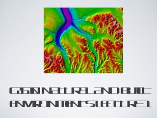
- 1. GSN N T R L N B I II A U A A D UL T E V ON E T: LC U E N I MN S E T R 1 R
- 2. OU L E TIN • C u e n a e mn or ad s s et s ss • W aa t f c n o htr h u t s f e e n io GS n GS e itn Iad Idf io in • Bieht y f I rfis ro GS o • H w os GS ok o d e a Iwr? T eg o r p icm t o h e ga h eh d • C ml et y is le o p n rd c ins im a ip • Sa ln aru dt pt ad tibt a ia t e a
- 3. W A A E H FN T S H T R T EU CION OF I GS? 1D tcp r . a at e a u 2D tcmilio . a o pa n a t 3D ts r e . a ta aog 4Mn u tn . aiplio a ( gC od a t nf mtn, e. o rint r s r a s e a o io Po c n ad de a h g rj t s n Eg mt in) e io c 5. A nalysis
- 4. W A IGS H TS I? Po l epe Dt aa GS I Sf a o wr t e Mt d e os h H rwr a a d e
- 5. W ais Icn ud ht GS ot e in • AGS a b se a a Icn e en s cmu r a d y e t o pt - s s t o eb e sm spot a aqisio, up rdt cuitn a mngmn mn u tn aae et aiplio, , a aas, m dl g n d p y nlis o ein ad isl y l a o sa l r e ne dtf fpt l e r cd a o ia - f e y a r adesg o p x l n g dr in cml p nin s e a ad aae et se. n mngmn is s u
- 6. W ais Icn ht GS ot. D fitn o GS a b e ios f Icn e in ct oisd cod got a gre acrin t h e e t e fmhs: y o e pa p is • GS s tob x Ia ao lo • GS s n f mtn c ne Ia a in r a s c o io ie • GS s n prah o Ia a apoc t s ne c c. ie
- 7. W ais Icn ht GS ot. •GS p a y dcio Iis r r a eis n im il spoto l up rto . •I a t ail t in g t t sh bit o t r e h e y ea in r a n n t a isin f mt ad o s t o io s dcio mk g n eis n ain ad udrad g ne t in. sn •A dfitn inl e h l e ios c d t l in u e esn l a r o sa l s t f t e fpt e ia e u s ia r e ne ad a e r cs n dt fe a aas. nlis y
- 8. AB I HSOR OF I RF I E T Y GS T he first G IS, C anada G eographic Information System ( C G IS) was created in the 1960s. T hree important trends contributed to the development of G IS: 1r inmn o cr g picehiqe . e e et fa or h t n us f t a c 2dvl mn o sa lnlisehiqe . ee p et fpt aas t n us o ia y c – oea cnetinad uail aas vry ocp l sit it nlis l s n by y 3dvl mn o d it cmu ry e s . ee p et figa o pt s t – o l e sm m rpoesr ic rcs . o o Recent developments include powerful computers, web-based developments and map servers, mobility
- 9. HOW D S GS OR ? OE A IW K •D tis pt t t GS a inu in h I a o e . •T ruh e tnla bs mngmn hog ra adt a aae et lio a e ad uraas to GS lw ml n qe / liso l Ia s ui yny s l o t c e aas o scl nirn et r r nlis foia evomn l it ia y , a ad cnm dtarssa ln n eoo ic a c spt ad a o ia t pr s l. e oa ce m l as
- 10. R L T DDS I IE EA E I P N S CL
- 11. SA IL N PT A D A A TI T D T TR U E A A B
- 12. SA IL N PT A D A A T I T D T cn ud T R U E A A ot e B in
- 13. SA IL N PT A D A A T I T D T cn T R U E A A ot B .
Notas del editor
- Figure: Geographic Process
- What distinguish GIS from other information systems are its spatial ANALYSIS functions.
- Major components of GIS.
- Figure: Gamma-ray remote sensing of soil properties in a forested area near Batlow, NSW.
- Try looking up different definitions of GIS, there are many! Note: always check online references are from a credible source Example of common spatial reference: Latitude/Longitude (degrees)
- Figure: Light Detection And Ranging (LIDAR) example of Mayan ruins, a recent development in remote sensing, a major source of GIS data, which allows very high accuracy (+/- mm’s)