Points of Knowledge - Crowdsourcing Solutions to Improve Data Accuracy and Re-use in Kenya
•Descargar como PPTX, PDF•
0 recomendaciones•822 vistas

This document discusses using crowdsourcing to improve the accuracy of open data in Kenya. It presents two location datasets from Kenya - health facilities and primary schools - and validates a sample of their locations using satellite imagery. The results show room for improving accuracy. The document proposes a web-based tool that would allow citizens to validate and correct location data by editing locations and uploading photos on a map. It envisions honoring top contributors and tracking global progress over time to turn data validation into a collaborative game. The goal is to leverage crowdsourcing to improve open data validity and re-use in an open source platform.

Recomendados
Recomendados
Más contenido relacionado
Similar a Points of Knowledge - Crowdsourcing Solutions to Improve Data Accuracy and Re-use in Kenya
Similar a Points of Knowledge - Crowdsourcing Solutions to Improve Data Accuracy and Re-use in Kenya (20)
Points of Knowledge - Crowdsourcing Solutions to Improve Data Accuracy and Re-use in Kenya
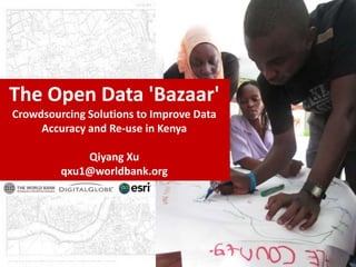
- 1. The Open Data 'Bazaar' Crowdsourcing Solutions to Improve Data Accuracy and Re-use in Kenya Qiyang Xu qxu1@worldbank.org
- 2. Kenya Open Data Initiative
- 3. Government Citizens Data collector Launches Companies Open Data Civil Society, etc Inaccuracy for the Accuracy? efficacy of open data initiatives? Leverage crowdsourcing to improve the validity? ‘Crowds’ Three Questions about Open Data
- 4. Location Datasets Kenya Primary School 2007 Health Facilities Kenya Both available on Kenya Open Data site (opendata.go.ke, 2012) Geospatial Information Datasets Global Administrative Unit Layers (GAUL) DigitalGlobe Global Basemap Google Earth Datasets
- 5. Health Facilities Total: 8232 For validation: 4867 Actual valid: 4644 4,203 in Digital Globe 441 in Google Earth Primary Schools Total: 31229 For validation: 110 (random sampling) Actual valid: 108 Results
- 6. Basemaps Track selection changes School Information School locations
- 7. Connect available data to ‘crowds’ for more powerful feedbacks Color of Locater Description Green Original location given in the dataset Purple New location added to the dataset Track changes Red Proposed correction to the original location Yellow Current location selected to be moved
- 9. Let’s play…… Honor Board with highlighted contributors: Last registered Most active Best contributor…… Measure global progress over time Clear goals, easy to achieve Editing locations and user interactions
- 10. Future…… Multi-language interface Community built on Points of Knowledge Users communication Allow picture-uploading and GPS position collection using mobile device ……
- 11. All datasets are fully open Open source solution preferred Collaborative development process
- 12. Unleashing the ‘wisdom of crowds’ Innovation in Governance, World Bank Institute