

Recomendados
Más contenido relacionado
La actualidad más candente
La actualidad más candente (20)
Destacado
Destacado (12)
Similar a Riverbank Restoration Guide Internet
Similar a Riverbank Restoration Guide Internet (20)
Riverbank Restoration Guide Internet
- 1. A Guide to Bank Restoration Options for Large River Systems: Part II Bioengineering Installation Manual MWMO Watershed Bulletin: 2010-3 Prepared for the MWMO by: Great River Greening
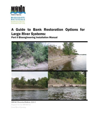
- 3. A Guide to Bank Restoration Options for Large River Systems: Part II Bioengineering Installation Manual Prepared for the Mississippi Watershed Management Organization by: Great River Greening Contributing Authors: Todd Rexine, Great River Greening Operations Manager Dan Kalmon, Mississippi Watershed Management Organization Planner & Program Manager Daniel Tix, (former) Great River Greening Conservation Director Assistance from: Sol Bijnagte, (former) Landscape Ecologist at Great River Greening Tony Randazzo, (former) Landscape Ecologist at Great River Greening Thank you to the staff from the following organizations: Minnesota DNR, USGS, Mn/DOT, US COE, NRCS, U of M St Anthony Falls, and MNRRA who reviewed various stages of this project as well as provided resources for: the modeling of the river; assembling the bio-engineering and stabilization practices and developing the written guidance. Published by: The Mississippi Watershed Management Organization Suggested Citation: Mississippi Watershed Management Organization. 2010. A Guide to Bank Restoration Options for Large River Systems: Part II Bioengineering Installation Manual MWMO Watershed Bulletin 2010-3. 95 pp. Front Cover: Riverbank photos near downtown Minneapolis. Clockwise discription starting in the upper left: eroded bank; 10 to 25% vegatated bank; Minneapolis Park and Recreation Board bank restoration sites using bioengineering. Photograph by: Daniel Kalmon, Mississippi Watershed Management Organization 1224 Marshall Street NE, Suite 201 Minneapolis, Minnesota 55413-0136 (612) 465-8780 (612) 465 8785 fax www.mwmo.org
- 5. A Guide to Bank Restoration Options for Large River Systems: Part I Riverbank Restoration Planning Software Prepared for the Mississippi Watershed Management Organization by: LimnoTech Contributing Authors: Todd Redder, LimnoTech Hans Holmberg, LimnoTech Dan Kalmon, Mississippi Watershed Management Organization Planner & Program Manager Daniel Rucinski, LimnoTech Assistance from: Thank you to the staff from the following organizations: Minnesota DNR, USGS, Mn/DOT, US COE, NRCS, U of M St Anthony Falls, and MNRRA who reviewed various stages of this project as well as provided resources for: the modeling of the river; assembling the bio-engineering and stabilization practices and developing the written guidance. Published by: The Mississippi Watershed Management Organization Suggested Citation: Mississippi Watershed Management Organization. 2010. A Guide to Bank Restoration Options for Large River Systems: Part I Riverbank Restoration Planning Software MWMO Watershed Bulletin 2010-3. 95 pp. Front Cover: Riverbank photos near downtown Minneapolis. Clockwise discription starting in the upper left: eroded bank; 10 to 25% vegatated bank; Minneapolis Park and Recreation Board bank restoration sites using bioengineering. Photograph by: Daniel Kalmon, Mississippi Watershed Management Organization 1224 Marshall Street NE, Suite 201 Minneapolis, Minnesota 55413-0136 (612) 465-8780 (612) 465 8785 fax www.mwmo.org
- 6. 1224 Marshall Street NE, Suite 201 Minneapolis, Minnesota 55413 (651) 287 0948 (651) 287 1308 fax www.mwmo.org
- 8. Abstract The Mississippi Watershed Management Organization (MWMO) has developed a guidance document and planning software for bank restoration on large river systems. Physical characteristics of the riverbank, along with predicted shear stresses across a full range of flows, are used to classify and recommend bio-engineering applications that restore and protect the riverbanks of the Mississippi River. This effort included: writing an installation manual, field surveys and data collection, modeling, and data synthesis. Field surveys were conducted to collect information on bank profiles and slope, vegetative cover, soil type, and existing structures or protection measures. Two-dimensional hydrodynamic modeling of the Mississippi River from the Hwy 694 bridge to Ford Dam has been conducted to assess shear stress and critical bank elevations. Planning software was also developed to allow property owners to select locations, review physical data and modeling results, and choose from applicable bio-engineering applications for their site. The MWMO anticipates further development and application of this tool, in cooperation with local and state authorities, as a planning resource other organizations can replicate and utilize for TMDLs and Implementation Plans. 1224 Marshall Street NE, Suite 201 Minneapolis, Minnesota 55413 (651) 287 0948 (651) 287 1308 fax www.mwmo.org
- 9. NOTICE: The Mississippi Watershed Management Organization, Great River Greening, and LimnoTech Inc are not liable for damages or losses that may result from the installation of any of the recommended practices in this guidance manual. It is the landowners’ responsibility to assure that the practices installed on their sites do not result in damages or losses to persons or property. This guidance manual provides a range of restoration options for various sites based on a generalized classification of the riverbanks within the MWMO. It is meant to provide landowners with a list of potential riverbank restoration practices. Landowners must conduct any analysis needed to determine which of these practices, if any, are suitable for installation on their sites given site specific characteristics. A Guide to Bank Restoration Options for Large River Systems: Part II bioengineering installation manual
- 10. Table of Contents Purpose of the Guide .................................................................................................................................................... 1 Introduction........................................................................................................................................................................ 1 Mississippi River Dynamics ........................................................................................................................................ 3 Assessing Riverbank Zones....................................................................................................................................... 5 How to Recognize Bank Stability Problems......................................................................................................... 7 What is Working Along the River.............................................................................................................................. 9 Steps to a Successful Project.................................................................................................................................. 10 Case Studies .................................................................................................................................................................. 17 Slope Restoration, St.Croix River, Lakeland, MN ...................................................................................... 17 Bank Restoration, Vermillion River, Hastings, MN..................................................................................... 18 Toe Restoration, St. Croix River, Lake St. Croix Beach, MN................................................................. 19 Technical Sheets: River Bank Restoration Solutions................................................................................ 21 Technical Sheet 1: Vegetated Erosion Control Blanket..................................................................... 23 Technical Sheet 2: Bio-logs .......................................................................................................................... 25 Technical Sheet 3: Live Stakes ................................................................................................................... 27 Technical Sheet 4: Live Fascines............................................................................................................... 29 Technical Sheet 5: Brush Mattress ............................................................................................................ 31 Technical Sheet 6: Tree Revetments........................................................................................................ 35 Technical Sheet 7: Vegetated Geogrids .................................................................................................. 39 Technical Sheet 8: Rootwads....................................................................................................................... 41 Technical Sheet 9: Crib walls ....................................................................................................................... 45 Technical Sheet 10: Riprap with Live Stakes......................................................................................... 47 Technical Sheet 11: Rock Barbs with Live Stakes .............................................................................. 49 Technical Sheet 12: Gabions with Live Stakes ..................................................................................... 53 Technical Sheet 13: Retaining Walls......................................................................................................... 55 Technical Sheet 14: Soft Armor Walls ...................................................................................................... 57 Appendix A: Plants for Live Cuttings .................................................................................................................... 59 Appendix B: Plants....................................................................................................................................................... 60 Appendix C: Practices Tables ................................................................................................................................. 61 Appendix D: Riverbank Assessment Sheet ....................................................................................................... 63 Appendix E: Soil Classification................................................................................................................................ 65 Appendix F: Vegetation Cover Percentage ...................................................................................................... 67 Appendix G: Understanding Our Streams & Rivers, MnDNR..................................................................... 69 Appendix H: Suppliers ................................................................................................................................................ 73 Appendix I: Minneapolis Regulations .................................................................................................................. 77 Bibliography .................................................................................................................................................................... 81 A Guide to Bank Restoration Options for Large River Systems: Part II bioengineering installation manual
- 11. A Guide to Bank Restoration Options for Large River Systems: Part II bioengineering installation manual
- 12. Glossary The following list of terms, defines the intended meaning of terminology and phrases that are used in this manual. Bank Zone The area of the riverbank above the toe, located between the normal water level and the bankfull elevation. Bankfull This is the top of the channel. It occurs at the top of the bank and bottom of the upland. For this stretch of the Mississippi it is demarked by a change in the slope at the top of the bank; the presence of a floodplain area or at the start of the 100 year flood elevation in reaches with vertical embankments that continue beyond the 100 year flood elevation Basal end The end of a live cutting where it was cut from the parent plant. Low Water The lowest annual elevation of a stream or river. Colluvial Slope A loose deposit of rock debris accumulated through the action of gravity or rain-wash making up a slope. Crib wall A soil bioengineering practice used to stabilize stream and river banks. The crib is a hollow, box-like structure of interlocking logs or timbers. The structure is filled with rock, soil and live cuttings or rooted plants. Dead Stout Stake Lumber stakes used to secure soil bioengineering practices. Erosion The wearing away of soil by water, wind, or ice. Erosion Control Blanket A temporary protective blanket laid on top of bare soil that is vulnerable to erosion; commonly made of mulch, wood fiber, straw, or synthetics. Flora Plant life Fauna Animal life Gabion A wire basket or cage filled with rocks used to stabilize riverbanks or slopes. Hydroseed Seed, mulch, and water are mixed into a slurry and then sprayed out of a hose onto the ground. Commonly used on steeper slopes. Invasive Exotic Species Species that are non-native (or alien) to the ecosystem and whose introduction causes or is likely to cause economic or environmental harm or harm to human health. (Executive Order 13112). Invasive species can be plants, animals, and other organisms (e.g., microbes). Human actions are the primary means of invasive species introductions. Live Fascine A bioengineering technique used to stabilize riverbanks. A long bundle of live cuttings bundled together with rope and placed in a shallow trench. A Guide to Bank Restoration Options for Large River Systems: Part II bioengineering installation manual
- 13. Ordinary High Water When describing a river this is the elevation at the top of the bank or channel. Level (OHWL) Reach A section of river that shares similar characteristics. Riprap The use of larger stone to provide immediate and permanent riverbank protection. Restoration Practices used to stop or prevent erosion which include the installation of vegetation at a density of 10% of minimum landcover or match existing vegetative density, whichever is greater. Vegetation used is native to the local ecosystem (see density photos in appendix G) Stabilization Practices used to stop or prevent erosion which do not necessarily include the installation of vegetation at a density of 10% or match existing vegetative density, whichever is greater (see density photos in appendix G) Rooting Hormone A hormone applied to the basal end of live cuttings to help stimulate root growth. Rootwad The use of locally available logs and root fans to add physical habitat to streams and rivers in the form of coarse woody debris and deep scour pockets. Scour Downward vertical erosion in a channel bed. Shear Stress The stress exerted on a stream or river bank that is the product of the energy slope, hydraulic radius, and unit weight of water. Sloughing On a river or stream this is when the bank collapses from either being undercut, oversaturated, or over-steepened. Sheet pile Flat panels of steel, concrete or other approved material. Typical applications include toe walls, flanking and undermining protection, grade stabilization structures, slope stabilization and earth retaining walls. Soil bioengineering The use of live and dead plant materials in combination with natural and synthetic support materials for slope restoration, erosion reduction, and vegetative establishment. Splash Zone The water surface is most commonly in this zone. It lies between low water and normal high water. This zone is generally poorly vegetated, but emergent vegetation may be present in slow-moving water. Stretch A section of a river or stream. A Guide to Bank Restoration Options for Large River Systems: Part II bioengineering installation manual
- 14. Toe Zone The area of the riverbank between the normal water level and the upper edge of the bottom of the channel. Thalweg The deepest portion of the channel. Upland Zone The portion of the bank located above the bankfull elevation. Water Jetting A process where high-pressure water is used to create a hole in the ground to plant cuttings. A Guide to Bank Restoration Options for Large River Systems: Part II bioengineering installation manual
- 15. A Guide to Bank Restoration Options for Large River Systems: Part II bioengineering installation manual
- 16. Purpose of the Guide This guide has two parts: the Bioengineering Installation Manual and the Riverbank Restoration Planning Software. The guide will assist riparian landowners with restoration activities along the Mississippi River and other similar large river systems. The information in the guide is tailored to specific river reaches within the Mississippi Watershed Management Organization’s (MWMO) boundaries (figure 1). However, there is a custom function within the planning software that allows landowners along other similar large river reaches to identify potential bioengineering practices for their individual site. Furthermore, this guide was developed for public use and replication. As such, the MWMO is willing to assist other large river managers in tailoring the installation manual and planning software to the systems they manage. Currently there is no guide for large river systems that assists landowners in ecological restoration of eroded riverbanks. The planning software suggests bioengineering practices best suited for restoring the toe/splash, bank and upland zones of the riverbank. These suggestions change as the riverbank’s reach characteristics of slope, soils, depth to bedrock, shear stress, and vegetation density change. The manual provides landowners with additional information on permitting requirements within the MWMO and step by step how to guidance in assessing their own property for erosion and riverbank restoration solutions. Landowner’s that apply the bioengineering practices recommended in this guide will restore the ecological and aesthetic benefits to the Mississippi’s riverbanks while eliminating near-bank erosion problems. Introduction Riverbank restoration is a means of restoring, protecting and stabilizing the banks of rivers against scouring, flooding and erosion. This installation manual, along with the restoration planning software, is a means for riparian landowners to gain an understanding of possible bioengineering restoration practices that could be implemented along their stretch of the river. There are many means to accomplish bank restoration in eroded areas. Traditional riverbank stabilization, methods used have focused on hard armoring practices such as riprap and block, void of any vegetation when installed. The bioengineered practices laid out in this guide will help restore the natural landscape of the Mississippi River Critical Area as it passes through an urbanized Minneapolis corridor. This is type of restoration will resolve near bank erosion issues and improve aquatic and terrestrial habitat within a corridor that has become so fragmented. A Guide to Bank Restoration Options for Large River Systems: Part II bioengineering installation manual 1
- 17. Figure 1: Mississippi Water Management Organization Boundary A Guide to Bank Restoration Options for Large River Systems: Part II bioengineering installation manual 2
- 18. Mississippi River Dynamics As the Mississippi River winds its course through Minneapolis, from Interstate 694 to the Ford Dam, there are a variety of changes along the banks as well as the elevation of the river itself. Not only does the river itself change through this stretch but so does the surrounding landscape and land use. The Mississippi River is also part of the larger Mississippi Flyway which is a migration corridor for North American birds to South America. The river is also a means for economic traffic West Bank Looking Downstream from barges and tug boats to fishing and tourism. There is a Dan Kalmon complex balance between human needs and the needs of the flora and fauna that have adapted over centuries to the conditions along the river. As the river makes its course from the Interstate 694 bridge south there are several distinct changes. The upper area still has a natural feel as the river is bordered on both sides by city or regional park systems. The banks of the river are still relatively intact at this point as vegetation is holding the slopes. The river channel itself is still relatively shallow and there are points where stone riffles are apparent. Minor signs of erosion are West Bank Looking Upstream apparent but this is primarily from wave action and flooding. Dan Kalmon By the 42nd Avenue bridge human presence on the river begins to become more prominent. In this area is the city of Minneapolis’ water treatment plant where water is treated for the more than 372,000 residents (2006 census) and surrounding communities. The riverbank at this point begins to become more fragmented and less natural. There are still adjacent land use areas of park but there is also the presence of industrial and residential areas. This is also the upper limits of the Army Corps shipping channel for barge traffic. In this area vegetation on the riverbanks begins to break up. This is especially true on the western riverbank where heavier West Bank Looking Upstream industrial uses are located, and there is a need for docking Todd Rexine barges. The industrial bank of the river is composed primarily of vertical sheet pilings. Erosion from concentrated areas of stormwater runoff, stormwater outfall discharge pipes, flooding, and wave action is more apparent. As well as erosion caused by human trampling of vegetation along the river in the form of paths. At Lowry Avenue bridge the riverbank opens up as the river gets closer to downtown Minneapolis. The natural landscape gets even more fragmented and fractured. Adjacent land use is a mix of parks, commercial, residential, and industrial areas. Looking Downstream into Downtown Some of the park land tends to be more open allowing views Todd Rexine and easy access to the river while the industrial area terminates just upriver from the Broadway Avenue bridge. A Guide to Bank Restoration Options for Large River Systems: Part II bioengineering installation manual 3
- 19. Several changes exemplify the river in downtown Minneapolis. Buildings, roads and sidewalks begin to encroach on the riverbanks. The riverbank is primarily composed of vertical walls or sheet pilings with the exception of Nicollet Island which has steep soil and vegetated banks. This area also includes St. Anthony Falls and the two upper Locks and Dams on the Mississippi River. This area is witness to the only falls on the river along with largest single drop in elevation. Between the upper and lower lock there is a 73 foot elevation change. Downstream from St. Anthony Falls there are a couple isolated Looking Upstream at Downtown (West Bank) floodplains as the Mississippi flows through a river gorge, Todd Rexine ending the MWMO reach with one more significant elevation drop by Ford Parkway at the Ford Dam (Lock and Dam 1). The gorge area is typified by bluffs and steeper banks carved out of the limestone. There tends to be more tree canopy on the banks than in downtown, and buildings are set back further from the bank. The land adjacent to the river in the gorge area is mostly park land either maintained by Minneapolis or St. Paul. With all of these changes on this short stretch of the river there is a dynamic relationship between the river and the landscape Downstream East Bank (Washington Ave) surrounding it. Tributary streams and rivers have been put into Dan Kalmon pipes and now flow directly into the Mississippi through culverts. There are stormwater outlets that flow directly or indirectly to the river from the surrounding city. This, combined with other influences on the river, can produce a delicate balance in preserving the resources of the Mississippi River. Upstream East Bank Dan Kalmon East Bank Floodplain Dan Kalmon A Guide to Bank Restoration Options for Large River Systems: Part II bioengineering installation manual 4
- 20. Assessing Riverbank Zones Bankfull Normal water Low water Upland Bank Toe/splash River Bank Cross Section, LimnoTech Inc. Four zones are usually used when describing riverbanks. According to the elevation relative to water level, from bottom to top, these zones are: toe, splash, bank, and terrace (Allen and Leech 1997). In this guidance, the terrace is more generally described as an upland zone and toe and splash zones are combined. A copy of the assessment worksheets used to assess the MWMO’s portion of the Mississippi River is included in appendix D. Toe Zone The toe zone is located between the upper edge of the bottom of the channel and normal normal water level. This zone is generally underwater, but is exposed during droughts. Portions may be exposed in the winter of each year. Except in slow moving portions of rivers, this zone is generally unvegetated. However, this zone may include large portions of backwaters and flooded, slow-moving inlets and bays. Emergent, floating, or submerged aquatic vegetation may be present in this zone. Importance of vegetation in the toe zone: The emergent vegetation in this zone contributes to bank stabilization primarily by diffusing wave energy before it reaches the banks. In small channels it may also serve to diffuse current to a small degree, but generally vegetation will not be present in the toe zone of large river channels. However, rooted plants should be established wherever possible for securing sediment and providing wildlife habitat. Splash Zone The water surface is most commonly in this zone. It lies between low water and the normal water level. This zone is generally poorly vegetated, but emergent vegetation may be present in slow-moving water. Areas of the bank that are exposed for extended periods may support small annual plants and suckers from plants higher on the bank. Importance of vegetation in the splash zone: Emergent vegetation in this zone can be critical for diffusing wave action against the bank and securing in- stream sediments and thus, should be established whenever possible. However, most reaches will not support vegetation in the splash zone. Small annual plants that begin growing from seed after river levels have A Guide to Bank Restoration Options for Large River Systems: Part II bioengineering installation manual 5
- 21. dropped below the normal water level form an interesting, ephemeral plant community; however they have little function for bank stability though they do provide valuable seed sources for various wildlife species. Therefore, areas where these are present should be protected from disturbance during installation of bank restoration practices. Deep-rooted plants located high in the splash zone or in the bank zone can significantly contribute to soil stabilization in this zone as well. Bank Zone The bank zone lies above the normal water level up to bankfull (a terrace or other change in slope). For purposes of this study in areas where there is not a floodplain or terrace due to a vertical embankment, the top of the bank zone is the same as the 100yr flood elevation. The bank zone may be subjected to heavy flows during high water stages. Rooted vegetation generally occurs in the upper portion of the bank zone under stable conditions. Importance of vegetation in the bank zone: Vegetation should be maintained in this portion of the riverbank, where it provides the greatest benefits for stabilization, water quality, and habitat. The roots of the plants in the bank zone also contribute to stabilization in the splash zone. The bank zone provides a buffer from upslope erosion and prevents the upper slopes from sloughing into the channel. Dense vegetation in this zone slows water flow and reduces wave energy during flood stages, further protecting upper slopes from erosion and wave action. Upland Zone The upland zone occurs above the level of bankfull. It may be a narrow crest of the natural levee between the floodplain and the main channel or it may be a level floodplain terrace. For sites without a broad floodplain, the upland zone is generally sloping upward away from the riverbank above bankfull. Portions of the upland zone may become flooded during high water. Importance of vegetation in the upland zone: Vegetation here is critical and should be established and protected. Plants here stabilize the slopes and minimize erosion from above. The vegetation here also serves important functions for the bank below by providing dense roots behind the bank and reducing the likelihood of bank fracturing. In addition, vegetation from the upland zone will spread into the bank zone when portions of the bank zone are disturbed. Other benefits of vegetation here include the sheltering of the lower banks by overhanging trees, wildlife benefits of riparian vegetation, and contributions of coarse woody debris to the river. A Guide to Bank Restoration Options for Large River Systems: Part II bioengineering installation manual 6
- 22. How to Recognize Bank Stability Problems There are various influences that affect the degradation and stability of river banks. Some of the more common problems that influence the degradation and stability of river banks are erosion, pollution, invasive species, and low biological diversity. Anyone of these can cause problems for a site but often times these problems influence each other, making early detection a key. Erosion Erosion is caused in areas where there has been some form of disturbance. Typically along the Mississippi, erosion occurs where external factors have removed vegetation, exposing bare soil and then either river-way flood waters or landside stormwater runoff can wash away the soil. Early signs of possible areas of erosion are: small channels cut into a slope, foot paths where vegetation is bare, areas where water is running directly over a slope. The earlier these erodible areas are recognized and remedied, the less work needed to restore the area. Eroding trail Dan Kalmon Pollution The watershed of the Mississippi River is large and covers a diverse landscape. Depending on its geography, location on the river, and pollutant sources, a site may, contribute a varied amount and a wide-range of pollutants. Sources include: existing pollutants in the river (as it enters the MWMO’s reach), multiple stream inlets, stormwater outfalls, activities on the river, and various adjacent land uses that drain into the river system. Pollutants, depending on their form, disrupt plant growth, cause fish kills, induce algae blooms, and contaminate the soil. Whether in an urban or rural setting, attention should be paid to how water drains across the landscape. Water running across surfaces tends to pick up pollutants like grass clippings, soil particles, nutrients, heavy metals, and hydrocarbons. The more water is loaded up with soil particles, the greater its ability to scour and erode riverbanks. Spilt paint washing into a storm drain. Anina Nielsen A Guide to Bank Restoration Options for Large River Systems: Part II bioengineering installation manual 7
- 23. Invasive Exotic Species Invasive exotic species are a concern on any site when trying to reestablish native vegetation. Typically invasive exotic species were introduced to North America from Europe or Asia for agricultural purposes, as ornamentals; in essence, because they had a specific growth characteristic that was found desirable. Often times, too, they were introduced inadvertently or accidentally. Eventually these plants found their way into the native landscape where they have thrived. Many times a single invasive species will move into a site and choke out multiple native species resulting in a singular invasive species stand. Typically, invasive tree and shrub species Buckthorn Great River Greening such as buckthorn block out the sun leaving bare earth that is easily eroded by runoff, wave action, or flooding. As a result, where native flora is displaced there is an increase in soil erosion. Before beginning any restoration practices in a specific area, invasive species should be identified, and controlled. There are several ways of treating a site that has invasive species present depending on how prevalent they are on the site. If the infestation is minimal (less than 15% cover), hand pulling or digging out may be an option. For areas that have large infestations (50% cover or greater), the site may need to be treated with an herbicide. Due to the proximity to water an aquatic herbicide should be used. The management of invasive species is an ongoing task as the seeds can stay viable in the soil for several years. The initial treatment of a site is the largest and most time Amur Maple consuming. After the first year, maintenance is reduced to Todd Rexine pulling or spot treating areas before they go to seed. Some invasive species that have been observed on the river include: Common and Glossy Buckthorn (Rhamnus cathartica and Rhamnus frangula), Exotic Honeysuckle (Lonicera tartarica, Lonicera morrowii, and Lonicera x bella), Amur Maple (Acer ginnala), Reed Canary Grass (Phalaris arundinacea), and Purple Loosestrife (Lythrum salicaria). This is just a partial list of invasive species that were observed. For more information and sources to identify invasive species contact a professional, the Minnesota Department of Natural Resource, www.dnr.state.mn.us/invasives/index.html or Minneapolis Parks and Recreation, www.minneapolisparks.org. Low Diversity Typically when areas have been affected by prolonged periods of erosion, pollution, or invasive species, diversity of flora will be low, which often leads to low diversity of fauna. As with invasive species, depending on the level of pollution or erosion present, native species can also form single species stands. This condition of low diversity should be avoided. By the time this condition is usually noticed a site restoration may be needed. A Guide to Bank Restoration Options for Large River Systems: Part II bioengineering installation manual 8
- 24. What is Working Along the River Rivers, as well as the land adjacent to them, are in a constant state of flux with rising and dropping water levels from rainfall, snow melt, and dams, and with varying levels of sediment load. The system that has evolved along the river is able to adapt to changing conditions. Plants have evolved to handle extended durations of flooding as well as dry periods. The river’s banks are constantly changing themselves by slumping or stabilizing with the growth of new plant material. Along the Mississippi River there are areas of natural stabilization; areas where traditional stabilization efforts have been undertaken; and areas where restoration efforts utilizing bioengineering have been undertaken. Natural Stabilization Riverbanks naturally stabilize themselves through various methods. A natural stabilized river bank is the result of many factors including proper vegetation, slope, soil type, river current, amount of erosion, and flooding frequency. These are just some factors that affect the appearance of a naturally stabilized river bank. There is a balancing act going on along the river banks and the absence or addition of any of these factors will effect how the bank responds. Those naturally stabilized banks along the Mississippi River have arrived at this delicate equilibrium. Along the Mississippi River within the MWMO boundaries, are examples of intact plant communities. These areas are largely intact because they have been incorporated into park lands. The plant communities would typically be classified as floodplain and riparian communities. Plants in these areas are adapted to occasional flooding and moist soils. The root systems that have been created are able to confine and stabilize the soil. These areas are threatened by populations of invasive species that occur along the river. In some areas, invasive species have begun to establish an influential presence within native community remnants. Traditional Stabilization Efforts Stabilization efforts that use hard armoring with no vegetation are sometimes necessary in limited locations along the river to protect transportation infrastructure and buildings, to maximize riverfront land use while maintaining channel width, and to provide boat tie-up locations. One example is, north of downtown, in the industrial area where there is a need to have a vertical bank for the mooring of barges. Restoration Efforts There are several examples along the Mississippi River of various restoration and stabilization efforts. At this time, the majority of restoration efforts along the Mississippi River are overseen by Minneapolis Park and Recreation Board. There are newer installations along Sheridan Memorial Park, West River Road and North Mississippi Park. A Guide to Bank Restoration Options for Large River Systems: Part II bioengineering installation manual 9
- 25. Steps to a Successful Project Assessing and classifying a site are just the first steps in a restoration or stabilization along the Mississippi River. Once an assessment is completed and potential practices are decided upon, implementation mechanisms can be employed. This includes a closer analysis of the site, project cost, design, permitting, purchasing supplies, hiring a contractor, and maintenance. These steps are necessary to fulfill the site objectives for a successful project. Analyzing the Site Appendix D: Riverbank Assessment Sheet. This is a copy of a riverbank assessment sheet used in the field while assessing the Mississippi Riverbank. The sheet is provided as a reference as well as a resource for landowners to complete their own assessment of their reach of the river. Three sheets need to be filled out per observation; one for each zone of the riverbank. Assess Site for Signs and Sources of Erosion What to look for: Steep slopes with highly erodible soils Bare eroded soil with no vegetation Sloughing soil Uprooted or fallen trees Rills or gullies caused by rainfall Undercut bank How bad is it: Is there considerable soil loss from erosion or sloughing? Sloughing Soil Have many trees been toppled and need to be Dan Kalmon removed? Have invasive species moved in and need to be treated? Do-it-Yourself or Bring in a Contractor Access the Riverbank Restoration Planning Software to determine the appropriate practice(s) for your site. Look over the technical sheets for the practice(s) in the manual or via the riverbank restoration planning software. Some practices may require heavy machinery, special equipment, or technical training to install. If this is the case, a Uprooted and Fallen Trees contractor may need to be consulted for the Dan Kalmon installation. Also a contractor may want to be considered if the riverbank is too steep to access from land and supplies need to be brought in from the river. A Guide to Bank Restoration Options for Large River Systems: Part II bioengineering installation manual 10
- 26. Using background and research materials This manual’s appendix as well as the Riverbank Restoration Planning Software’s detailed field / model data section both contain a breadth of supporting information to further aid riverbank restoration efforts. Reference to appendices, web sites, and web links are given in this manual’s text to allow the user to pursue a more thorough understanding of the particular topic and to provide more tools for the user to access. Identify zones The most important point on the bank to identify is the level of bankfull. Generally, everything below bankfull is frequently subjected to heavy flows of water. A bank crest may be present at bankfull. The crest is generally a sharp break in the slope at the level of incipient flooding. Possible indicators of this level may include (this list modified from USACE 1997): The elevation of incipient flooding, the height at which water will flow into the surrounding floodplain. The elevation associated with the top of the highest depositional features (e.g., point bars, central bars within the active channel). These depositional features are especially good stage indicators for channels in the presence of terraces or adjacent colluvial slopes. A break in slope of the banks and/or a change in the particle size distribution, (since finer material is associated with deposition by overflow, rather than deposition of coarser material within the active channel). Exposed root hairs below an intact soil layer indicating exposure to erosive flow. Lichens and, for some stream types and locales, certain riparian vegetation species. A change in species composition may also indicate the bankfull level. Review the section Assessing Riverbank Zones, pg . See Appendix G: Understanding our Streams & Rivers, MnDNR The USDA Forest Service also has online videos on identifying zones of the river. ww.stream.fs.fed.us/publications/videos.html Identify soils Appendix E: Soil Classification has images of cards for identifying both soils and gravels. Identify vegetation cover percentage Appendix F: Vegetation Cover Percentage has images of various cover percentages as viewed during the team’s assessment of the Mississippi Riverbank. A Guide to Bank Restoration Options for Large River Systems: Part II bioengineering installation manual 11
- 27. Determine if assessment is feasible It is generally best to assess and classify the riverbank during periods of low water levels. Late fall and winter are good times to assess and classify (provided snow does not cover the bank) because reduced leaf cover helps to expose more of the bank substrate. As a general rule, the river level should be at or below average flow rate (normal water level) or gauge height to perform this assessment. If the river flow is above average or no gauge data is available, the following must be true to get an accurate assessment of the whole river bank: The river level must not be at or above bankfull If there are any scarps, the entire scarp must be visible above water A reasonable portion of the splash zone must be visible (enough to determine the slope below the scarp and identify the surface material) River Level Gauge Information US Army Corps of Engineers river levels for the Upper Mississippi Minneapolis , MN to Guttenberg, IA: www.mvp-wc.usace.army.mil/imagemaps/Miss.shtml A more site specific analysis should be conducted to collect additional information. The soil and sun orientation (aspect of slope) should be checked and noted. This will help to understand the type of vegetation that is appropriate for the site. The slope of the bank and slope of the upland should also be quantified to help determine the appropriate practices to implement. It is also important to do a visual assessment to identify the location of the transition of the toe/slope, bank, and upland. Additionally, the approximate OHWL location determines if the site falls within the jurisdictions of the Minnesota Department of Natural Resources (MnDNR) (anything below the OHWL is property of the state). The site specific analysis is important, since it allows for a better understanding of the site. A Guide to Bank Restoration Options for Large River Systems: Part II bioengineering installation manual 12
- 28. Project Costs River bank restoration techniques can vary widely in price. The difference in price reflects the complexity of the project, site accessibility, permitting, and whether large machinery is needed to complete the project. Below are rough cost estimates for the various practices included in this manual with costs adjusted for 2008. Having a project installed by a professional will typically double or triple the cost of a project in the short term, but may actually save money in the long term. Do-it-yourself cost Installed Cost (Material and Labor) Restoration and Stabilization Practices Seed $20 per 1000 square feet $170 per 1000 square feet Planting $1.25 per plug $2.5 - $3 per plug Erosion blanket with planting .78¢ per square foot $1.80 per square foot Bio-logs $5-$10 per lineal foot $15-$20 per lineal foot Live Stakes $1 -$3 per stake $3-$8 per stake Live Fascine $2.5 per lineal foot $13 per lineal foot b Brush Mattress $1.3 -$3.9 per lineal foot a $12 - $20 per lineal foot a Tree Revetment N/Ad $35 per lineal foot Vegetated Geogrid N/Ad $20 per square foot b Rootwads N/Ad $450 - $1,500 per Rootwadc Crib walls N/Ad $260 per lineal foot Riprap N/Ad $65 -$118 per lineal foot a Gabions N/Ad $30 per square foot Retaining Walls N/Ad $50 per square foot Erosion Control Measures 1’-2’ Compost Berm N/Ad $2.75-$3.3 per lineal foote 12” Compost Filter Sock N/Ad $3.15 - $3.7 per lineal foote 3’ Silt Fence .75¢ per lineal foot $2.20 - $3 per lineal foote Site Improvement Site Grading N/Ad $15-$30 per cubic yard a Adapted from Henderson, Carol L., Carolyn J. Dindorf, Fred J. Rozumalski. 1998. Lakescaping for Wildlife and Water Quality. Minnesota Department of Natural Resources, St. Paul, MN. Costs were adjusted for inflation to 2008. b Adapted from The Kestrel Design Group. Minnesota Soil Bioengineering Handbook. Minnesota Department of Transportation, St. Paul, MN. Costs were adjusted for inflation to 2008. c Data provided by MnDNR. Cost provided is that the site is fairly open with only shrubs and small trees on site. d The installation requires the use of heavy machinery or special equipment consult with a contractor for installation. e Adapted from Schwab, Jean. 2006. Erosion Control Alternatives Cost Calculator. United States Environmental Protection Agency, Green Scapes. http://epa.gov/epawaste/partnerships/greenscapes/tools/erosion.pdf. Costs were adjusted for inflation to 2008. http://epa.gov/epawaste/partnerships/greenscapes/tools/erosion.pdf. f Cost were adjusted for inflation to 2008. Inflation Source CPI Inflation Calculator. http://data.bls.gov/cgi-bin/cpicalc.pl A Guide to Bank Restoration Options for Large River Systems: Part II bioengineering installation manual 13
- 29. Design Start with the riverbank restoration planning software to identify possible restoration solutions. Next consult with qualified professionals to design or review your project’s design. Improperly designed projects can lead to failure and additional expenses later. A final design should include an erosion control plan, grading plan as needed, planting plan, and maintenance plan. Erosion Control Plan: This is a plan that includes all measures that will be taken to control erosion and sediment loss during the construction period. See Appendix I: Minneapolis Regulations. Other resources: www.ci.minneapolis.mn.us/stormwater/classroom-resources/erosioncontrollinks.asp City of Minneapolis’ web site with links to other information and agencies. www.metrocouncil.org/environment/Watershed/bmp/manual.htm Metropolitan Councils Urban Small Sites Best Management Practice Manual which has a section on erosion control practices Grading Plan: Usually included as part of the erosion control plan, this may or may not be needed depending on the practice(s) being implemented. The grading plan will show the existing grade and what the proposed changes will be to the grade. Planting Plan: A planting plan gives specific instructions about how the soil is to be prepared, what species are to be planted, what size plants are to be used, and what the spacing of plants should be. The planting plan will also contain a plant schedule with a list of all the plants and total plant counts. Maintenance Plan: This can be included on the planting plan or separately. It typically lays out the maintenance requirements for installed practices and vegetation, as well as a schedule of specific maintenance tasks and when they need to be accomplished. There is a limited window of opportunity for implementing restoration practices along the Mississippi River, which can vary from year to year. It is best to consult with a professional at the end of the year or early in the project implementation year. This allows for the design to be drawn and measurements to be taken while the water level is low. There is usually a stretch of time in spring and early summer when river levels are too high to implement restoration projects. This is a good time to be finalizing the design and begin preparing for installation. While planning the scope of the project it is also a good time to layout what phases the project will be installed. This will help to understand which and how many erosion control measures need to be considered, as well as the timing of their implementation. All efforts should be made to properly stabilize slopes, so as to prevent further degradation to the site. Steps should be taken to make sure restoration is done properly to lessen the chance of having to redo the project. This includes proper selection of bioengineering materials and installation time. Other steps should be taken to manage the site during installation so that erosion and sedimentation to the river are kept at a minimum. Erosion and sedimentation control can be achieved through both perimeter and interior controls, which may include the use of silt fences, temporary bio-logs, temporary ground cover, temporary seeding, check damns, and sediment catch areas. A Guide to Bank Restoration Options for Large River Systems: Part II bioengineering installation manual 14
- 30. Permitting Before beginning or attempting to install any restoration of a riverbank, check with the necessary governing bodies. Many times restoration along water bodies is regulated by federal, state, and local authorities and programs. This overlapping of regulatory jurisdictions is a way of maintaining and protecting natural resources for generations to come (NRCS 2007). For any type of restoration work along the Mississippi River within Minneapolis it is best to start with Minneapolis Development Review. For site projects over one acre Compliance with Chapter 54 of the Minneapolis Code of Ordinances Stormwater Management must be met. This includes providing a stormwater management report that includes design details of all BMP’s, calculations, inspection, operations and maintenance plans, www.ci.minneapolis.mn.us/stormwater/fee/requirements_chapter54.asp. (see Appendix I). Minneapolis Development Mississippi Watershed Management Review Organization 250 S. 4th St., Room 300 2520 Larpenteur Ave W Minneapolis, MN 55415 Lauderdale, MN 55113 (612) 673-2352 (651) 287-0948 www.ci.minneapolis.mn.us/mdr/ www.mwmo.org Minnehaha Creek Watershed Shingle Creek Watershed Management District Commission 18202 Minnetonka Blvd 3235 Fernbrook Lane Deephaven, MN 55391 Plymouth, MN 55447 (952) 471-0590 (763) 553-1144 www.minnehahacreek.org www.shinglecreek.org For any part of a project affecting the area below the OHWL, a permit may be needed. Typically in Minnesota, this area of water bodies is overseen by the Minnesota Department of Natural Resources (MnDNR) for both state and federal permits. Usually bioengineering practices do not require permit, but approval is still needed as long as the project is installed by hand for the purpose of shoreline restoration work if: Project is approved by MnDNR staff and is designed or reviewed by the county environmental services, local soil and water conservation district or the local watershed management organization. Design does not interfere with navigation or other riparian uses of the waterbody. Project is done during times of the year when it will not interfere with fish spawning or the nesting of protected bird species. Local origin native plant species, adapted for the site, are used. Aquatic plant management permit is obtained when aquatic plants are used. Waterward encroachment is the minimum necessary for the project; and a maintenance plan is developed for the project and a copy submitted for Review to the Department's Area Fisheries office (MnDNR, 10/9/08). www.dnr.state.mn.us/permits/water/answers.html#shorelinerestoration MnDNR Waters 1200 Warner Road St. Paul, MN 55106 (651) 259-5845 http://files.dnr.state.mn.us/waters/area_hydros.pdf A Guide to Bank Restoration Options for Large River Systems: Part II bioengineering installation manual 15
- 31. If any part of a restoration affects the navigable waters of the Mississippi River a permit from the United States Army Corp of Engineers must be obtained. www.usace.army.mil/cw/cecwo/reg/reg_faq.htm Construction Even though bioengineering and riverbank restoration are becoming more accepted, not all contractors are experienced with the proper techniques for installation. Contractors need to be aware of how and when the river level typically fluctuates and when the best time of year is to install plants along the river. Typically rivers are high in the spring after snow melt and spring rains. This leaves late May and June as a good time for installation otherwise it is best to wait until the weather has cooled and plant in the fall. Some suppliers of native plants and supplies have been included in Appendix H. If a project needs to be hired out to a designer or contractor, make sure to ask to see examples of their work as well as customer references. Don’t hesitate to follow up and check some of the references to see what the outcome was of their project and how things went while establishing. Riverbank restoration is a rather narrow field of expertise, and may require looking for someone who also specializes in lakeshores and wetland restoration. Make sure to ask them questions to see if they are qualified to complete the work being asked of them, for example: Have they installed or designed a river restoration before? Three references of completed projects and can they be visited? What is their background in river bank restoration? What extent are native plants used in their river bank restorations? Where do they purchase their native plants and supplies from? Maintenance A follow up maintenance and monitoring plan is key to a successful installation. Maintenance is necessary to ensure the objectives of the project are attained. The maintenance plan for each project should be flexible to respond to conditions monitored on site as they arise. This flexibility is important, as rivers are ever-changing systems and conditions will fluctuate from year to year. With bioengineering practices, follow up maintenance and monitoring is especially important. These projects rely on vegetation to become well-established before a major disturbance event occurs, such as high water. If a major event does occur, it may be necessary to inspect the practice and reinstall vegetation in areas where flooding occurred. A Guide to Bank Restoration Options for Large River Systems: Part II bioengineering installation manual 16
- 32. Case Studies Slope Restoration, St.Croix River, Lakeland, MN This private residence, located along the St. Croix River, required a hillside restoration in order to heal the eroding slope. A previous owner had installed concrete block on the upper half of the slope with a concrete wall at the bottom. Both areas were in decline as the concrete was deteriorating. At the same time, roof runoff ran across the concrete slope causing eroded soils to drain directly into the St. Croix River. After consulting with an engineer, the project manager and owner agreed that the concrete needed to stay in place to protect the Bio-log installation building foundation. The solution as proposed by the engineer Todd Rexine was to bring in soil, bio-logs, and large outcroppings to bury the concrete and reestablish the slope. Once the soil was in place, technicians installed erosion control blankets. The site was then planted with a diversity of appropriate native plants and shrubs to create a root structure that holds the soil in place. Planting above the concrete blocks allows the native plants to send roots through the cracks in the concrete and anchor into the pre-existing soils. Upon completion the property owner purchased a pump that could be placed in the river to help irrigate all the new plantings while they were establishing. A water use (appropriation) permit Erosion control blanket & plantings from DNR Waters is required for all users withdrawing more than Todd Rexine 10,000 gallons of water per day or 1 million gallons per year (MnDNR, 12/12/08). www.dnr.state.mn.us/waters/watermgmt_section/appropriations/permits.ht ml The images at right are in progression from initial installation to one year later. 2 month follow up Jay Riggs, WCD 1 year follow up Sally Arneson-Scallon A Guide to Bank Restoration Options for Large River Systems: Part II bioengineering installation manual 17
- 33. Bank Restoration, Vermillion River, Hastings, MN This is a bank restoration for a private residence that abuts the Vermillion River in Hastings, MN. The property is located along an outside bend in the river with an eroded bank. The bank is approximately 30 feet in height with a steep slope and very sandy soils. Sloughing was occurring along 150 feet of the mid-section of the bank due to an absence of vegetation, this in turn, led to smothering the vegetation in the lower portions of the bank. To address the bank erosion issues multiple restoration techniques were implemented along the 150 feet of river bank. Pre-existing streambank The plan incorporated a double layer of cedar tree revetments at Great River Greening the toe of the bank. Above the revetments native shrub-willow fascines, live shrub-willow stakes, and erosion control blanket with native seed were installed in strips across the middle portions of the bank. The seed, live fascines and stakes will root into the bank soil providing a structure to hold the soil in place. The revetments are in place to help stabilize the toe and control cutting of the bank from the current. Playing a dual role, the cedar revetments will also help capture any additional soil that sloughs from the bank while vegetation is establishing. In this situation, using rip rap alone would most likely fail, since the bank soil is so steep and highly erodible. Pre-existing streambank Great River Greening Stabilized Bank Great River Greening A Guide to Bank Restoration Options for Large River Systems: Part II bioengineering installation manual 18
- 34. Toe Restoration, St. Croix River, Lake St. Croix Beach, MN The toe of the slope at this residence on the St. Croix was heavily eroded due to flooding of the St. Croix River in the late 1990’s. The flooding caused undercutting of trees which have since toppled. Buckthorn and exotic honeysuckle have easily invaded this disturbed area, shading out understory growth. The overall cumulative affect on the soil erosion of the site goes beyond just the flooding in the late 1990’s. The approach to stabilizing the slope had multiple phases. The first phase was to berm the top of the slope and vegetate it with Pre-existing Riverbank native plants. This was an effort to slow rain water down and Great River Greening allow it to infiltrate into the very sandy soils. Next step was to clear the upland potion of the bank and complete an oak savanna restoration, which required that six mature red cedars were removed to allow sunlight into the understory. In place of the cedars, four bur oaks were planted on the slope. The toe of the slope was the last phase to go in. This required a more engineered approach to stabilizing the slope. Starting at mid slope and working down every 5 feet some form of revetment was installed per an engineer’s specification. The revetments were a combination of cedar logs, brush wattles and bio-logs. The Pre-existing Riverbank Great River Greening revetments were anchored in using a cable anchoring system. The system required driving an anchor 3 feet into the ground. The toe also had erosion fabric installed which was seeded with native grasses. The toe area was also planted with various native bare root shrubs and trees. Toe Installation Todd Rexine Completed Toe Installation Todd Rexine A Guide to Bank Restoration Options for Large River Systems: Part II bioengineering installation manual 19
- 35. A Guide to Bank Restoration Options for Large River Systems: Part II bioengineering installation manual 20
- 36. Technical Sheets: River Bank Restoration Solutions Riverbank restoration can be achieved through a wide array of practices. The proper technique(s) dependant upon the specific conditions and circumstances associated with a given site. Frequently, practices are combined to form an effective package of treatments to address several issues playing out at a given site. In the following pages, several practices have been detailed, ranging from soil bioengineering solutions to more complex hard armoring systems. These practice reference sheets are intended to familiarize readers with some of the practices employed to address riverbank restoration. St. Croix River, Lake St. Croix Beach, MN. Fascines, coconut rolls (bio-log), seeded erosion blanket Todd Rexine Vermillion River, Hastings, MN. Tree revetments, erosion blanket, and live staking Great River Greening NOTICE: The Mississippi Watershed Management Organization, Great River Greening, and LimnoTech Inc are not liable for damages or losses that may result from the installation of any of the recommended practices in this guidance manual. It is the landowners’ responsibility to assure that the practices installed on their sites do not result in damages or losses to persons or property. This guidance manual provides a range of restoration options for various sites based on a generalized classification of the riverbanks within the MWMO. It is meant to provide landowners with a list of potential riverbank restoration practices. Landowners must conduct any analysis needed to determine which of these practices, if any, are suitable for installation on their sites given site specific characteristics. A Guide to Bank Restoration Options for Large River Systems: Part II bioengineering installation manual 21
- 37. A Guide to Bank Restoration Options for Large River Systems: Part II bioengineering installation manual 22
- 38. Technical Sheet 1: Vegetated Erosion Control Blanket Summary Vegetated erosion control blankets are used for temporary soil stabilization to aid in establishing plants in areas with exposed soils or slight erosion problems. Max Shear Stress Maximum Slope Substrate not Minimum Site recommended to be Disturbance installed beyond Width 4 lb/ft2 2:1 Gravel 6 ft 1915.2 dyne/cm2 Installation Zones Vegetation Density Minimum Vertical Slope Width Required Upland 76-100% 6 ft Advantages Relatively inexpensive and Erosion blanket Herbaceous quick to install. key into soil at top plugs or seed This is a soft installation and can be combined be used in conjunction with other 100 yr flood practices especially where river currents exhibit higher stresses. Disadvantages May be dislodged by high water levels prior to vegetation 6” U-staples or spikes establishment. Minimum 2-3 ft on center 12” spacing on top, bottom and sides Installation Gently grade the slope. If using seed, broadcast it over the prepared bed and lightly rake in, prior to placement of blanket. Dig a shallow 6 inch wide by 6 inch deep trench along the top of the slope. Place the top edge of the blanket in the trench; secure every 12 inches and backfill. This will prevent overland runoff from undermining the blanket. Unroll the blanket over the bed and anchor using staples or other stakes to anchor the blanket every 2 – 3 feet on center in a diamond pattern. St. Croix River, Lakeland, MN. Erosion blanket and native plugs Todd Rexine A Guide to Bank Restoration Options for Large River Systems: Part II bioengineering installation manual 23
- 39. Staple the top, bottom, and sides every 12 inches minimum. 12” spacing across top Erosion blanket should always be “shingled” by having blankets upstream or uphill overlapping 2-3 ft spacing in those downstream or downhill diamond pattern (overlap should be at least 12 inches). Plugs can easily be planted into the blanket by cutting a small hole in the blanket to expose the soil below. When selecting plants, whether nursery grown 12” spacing along sides or seed, it is important to understand the light conditions and soil of the site, since Stapling pattern for erosion fabric this will dictate what the moisture conditions and shade tolerances that plants will encounter. This will help in choosing proper plants and lead to a much better success rate, especially in the long term. For a list of possible plants and other reference materials for plants see Appendix B: Plants. Management New plantings will be stressed and require watering to aid in establishment. When plants are first installed, they will require watering at a minimum every 2 -3 days for the first 2 months. After the first 2 months watering should be cut back to 1 inch of water per week for the rest of the first year. Long soaking waterings are better than short ones as they encourage roots to grow downward into the soil. If possible, it is recommended that a sump pump be purchased and placed in the river to facilitate the watering of the new plantings. The area should be monitored, especially following any high water events. Repairs should be made as needed and additional vegetation planted. Bibliography Tuttle, Ronald W. and Richard D. Wenberg. 1996. “Streambank and Shoreline Protection.” Engineering Field Handbook, Chapter 16. USDA-NRCS. http://www.info.usda.gov/CED/ftp/CED/EFH-CH16.pdf A Guide to Bank Restoration Options for Large River Systems: Part II bioengineering installation manual 24
- 40. Technical Sheet 2: Bio-logs Summary Bio-logs are used for temporary soil stabilization to aid in establishing plants in areas with exposed soils or slight erosion problems. The logs are typically made out of coconut fiber, rice wattle or wheat wattle. Shear Stress Maximum Slope Substrate not Minimum Site recommended to be Disturbance Width installed beyond 5 lb/ft2 2:1 Cobble 10 ft 2394 dyne/cm2 Installation Zones Vegetation Density Minimum Vertical Slope Width Required Toe/Splash, Bank, 51-75% 1 ft Upland Advantages Relatively inexpensive and quick to install. This is a soft installation and can be combined be used in conjunction with other practices especially where river currents exhibit higher stresses. Biologs are fairly lightweight. Biologs can conform to the contours of the bank/toe. Biologs are bio-degradable, and decompose in 3 to 7 years for coconut fiber, and 1 to 3 years for wood fiber, depending on density of Bone Lake, Scandia, MN. packing. Coconut fiber roll (bio-log) with herbaceous plugs Todd Rexine Disadvantages May be dislodged by high water levels prior to vegetation establishment. High wave-action may cause loosen anchored Biologs are fairly bulky. Installation Dig a shallow, 2 inch trench at the base of the slope. Place the bio-log in the trench so the backside is tight against the slope. Stake in place using two, 4 foot long wood stakes at each end and alternating sides every 1 foot on center. Secure in place with rope or wire tied to stakes and drive stakes flush with top of log. Cut the slope to fill the backside of the bio-log with soil up to 2 inches from the top. One month or more after installation (or when biolog is saturated), plant plugs into the bio-log, spacing every 12 inches. This will enable sediment to collect, ensuring a high survival rate. If logs are placed in water, planting can occur immediately after installation A Guide to Bank Restoration Options for Large River Systems: Part II bioengineering installation manual 25
- 41. Existing vegetation or bioengineering practice Herbaceous plugs Bio-log Bankfull Normal Water Level 2”x2” x 3 - 4’ wood stake install 1’ on center alternating sides. Install 2 stakes on each end. Tie coir rope to stakes and finish driving stakes in. Management The area should be monitored, especially following any high water events. Repairs should be made as needed and additional vegetation planted. Bibliography Eubank, C. Ellen and Dexter Meadows. A Soil Bioengineering Manual for Streambank and Lakeshore Stabilization. USDA-Forest Service Tuttle, Ronald W. and Richard D. Wenberg. 1996. “Streambank and Shoreline Protection.” Engineering Field Handbook, Chapter 16. USDA-NRCS. http://www.info.usda.gov/CED/ftp/CED/EFH-CH16 A Guide to Bank Restoration Options for Large River Systems: Part II bioengineering installation manual 26
- 42. Technical Sheet 3: Live Stakes Summary Live staking is a technique to quickly and easily establish woody vegetation in areas with high moisture. Shear Stress Maximum Slope Substrate not Minimum Site recommended to be Disturbance installed beyond Width 3.1 lb/ft2 2:1 Gravel 6 ft 1484.28 dyne/cm2 Installation Zones Vegetation Density Minimum Vertical Slope Width Required Bank and Upland 76-100% 1 ft Advantages Relatively inexpensive and quick to install. Allows river bank to revegetate. This is a soft installation and can be combined be used in conjunction with other practices especially where river currents exhibit higher stresses. Disadvantages May be dislodged by high water levels prior to vegetation establishment. Difficulty finding enough plant material on site. Timing: stakes should be dormant, so work must be conducted either in spring of fall, which may be difficult. Installation Live stakes can be cut from willow, dogwood, or other woody species (see Triangular spacing appendix B) that readily resprout from 2-3 ft apart cuttings. Stakes should be cut from dormant plants either after dropping leaves or before budding. This is typically after Bankfull November 1st to the middle of March. Live stakes should not be installed after frost has set in the ground. Live stakes can also be refrigerated and installed during the Normal Water growing season; spring or fall. Stakes should be from ½ inch to 1 inch in diameter and 3 – 4 feet in length. Basal end Live stakes should be installed Live cuttings ½” to 1” in diameter. same day they are prepped. Cut end of stake at 30° - 45°. Before planting the basal end of the stake should be cut diagonally to 30°- 45° and dipped in a rooting hormone. Install stakes 2 - 3 feet apart. Gently pound into soft ground, using a dead blow hammer or rubber mallet, or place in a preformed hole so that 2/3 of the stake is buried. In more compacted soils holes can be dug using a small auger or water jetting. Be sure not to split the stake when planting and that the basal end is placed in soil. A Guide to Bank Restoration Options for Large River Systems: Part II bioengineering installation manual 27
- 43. Stakes should be planted in an offset pattern so when viewed from top or bottom they form a diamond pattern. Minimum soil depth is 2 feet for rooting into soils. Live stakes can be installed either vertical, horizontal or at an angle. Live stake trees typically are installed either vertical or at a slight angle. Management The area should be monitored, especially following any high water events. Repairs should be made as needed and additional vegetation planted. Bibliography Eubank, C. Ellen and Dexter Meadows. A Soil Bioengineering Manual for Streambank and Lakeshore Stabilization. USDA-Forest Service Henderson, Carol L., Carolyn J. Dindorf, Fred J. Rozumalski. 1998. Lakescaping for Wildlife and Water Quality. Minnesota Department of Natural Resources, St. Paul, MN. The Kestrel Design Group. Minnesota Soil Bioengineering Handbook. Minnesota Department of Transportation. Tuttle, Ronald W. and Richard D. Wenberg. 1996. “Streambank and Shoreline Protection.” Engineering Field Handbook, Chapter 16. USDA-NRCS. http://www.info.usda.gov/CED/ftp/CED/EFH-CH16.pdf A Guide to Bank Restoration Options for Large River Systems: Part II bioengineering installation manual 28
- 44. Technical Sheet 4: Live Fascines Summary A bundle of live cuttings tied together with rope and placed in a shallow trench. Shear Stress Maximum Slope Substrate not Minimum Site recommended to be Disturbance Width installed beyond 3.1 lb/ft2 2:1 Gravel 8 ft 1484.28 dyne/cm2 Zones of Impact Vegetation Density Minimum Vertical Slope Width Required Bank and Upland 76-100% 1.5 ft Advantages Relatively inexpensive and quick to install. Allows river bank to revegetate. This is a soft installation and can be combined be used in conjunction with other practices especially where river currents exhibit higher stresses. Disadvantages Erosion control May be dislodged by high blanket & native seed water levels prior to or planting vegetation establishment. Bankfull Installation Fascines are bundles of live cuttings (see appendix B). Normal Water Cuttings are harvested under the same conditions Top of live fascine as live stakes, however slightly exposed after cuttings should be 5 to10 installation feet in length. Stake spacing Tie the cuttings into 10 2-3 ft to12 inch diameter bundles staggering the cuttings throughout the bundle Live End Basal End with the live ends all facing one direction. Excavate a trench 2 inches wider than the finished bundle. Place fascine bundle in the Current trench and secure in place 18” overlap with a 3 foot dead stout stake. The live end of fascines should overlap the basal ends of the previous fascine by 18 inches. Once all the fascines are staked in place the trench may be backfilled. A Guide to Bank Restoration Options for Large River Systems: Part II bioengineering installation manual 29
- 45. Recommended Live Fascine Spacing Slope Steep Eroded soils Non-eroded soils Fill soils 3:1 or flatter 3-5ft 5-7ft 3-5ft * Steeper than 3:1 3ft* 3-5ft - *practice not recommended alone Adapted from: Tuttle, Ronald W. and Richard D. Wenberg. 1996. “Streambank and Shoreline Protection.” Engineering Field Handbook, Chapter 16. USDA-NRCS. http://www.info.usda.gov/CED/ftp/CED/EFH-CH16.pdf Management The area should be monitored, especially following any high water events. Repairs should be made as needed and additional vegetation planted. Bibliography Eubank, C. Ellen and Dexter Meadows. A Soil Bioengineering Manual for Streambank and Lakeshore Stabilization. USDA-Forest Service Hoag, Craig and Jon Fripp. 2002. Streambank Soil Bioengineering Field Manual for Low Precipitation Areas. USDA-NRCS. http://plant-materials.nrcs.usda.gov/pubs/idpmcpussfglpa.pdf Tuttle, Ronald W. and Richard D. Wenberg. 1996. “Streambank and Shoreline Protection.” Engineering Field Handbook, Chapter 16. USDA-NRCS. http://www.info.usda.gov/CED/ftp/CED/EFH-CH16.pdf A Guide to Bank Restoration Options for Large River Systems: Part II bioengineering installation manual 30
- 46. Technical Sheet 5: Brush Mattress Summary Use a combination of live cuttings and live stakes. Branches from species such as dogwood or willow are secured against bare soil to create a dense mat of live brush. Live brush can be mixed with other brush, such as buckthorn or honeysuckle from an invasive species removal. Soil is placed over the cuttings (or allowed to fill in over time with sedimentation). The cuttings will sprout to create a dense network of roots and stems to stabilize the soil Max Shear Stress Maximum Slope Substrate not Minimum Site recommended to be Disturbance Width installed beyond 4.1 lb/ft2 (initial) 2:1 Gravel 8 ft 8.2 lb/ft2 (grown) 1963.08 dyne/cm2 (initial) Zones of Impact Vegetation Density Minimum Vertical 3926.16 dyne/cm2 (grown) Slope Width Required Bank and Upland 76-100% 10 ft Advantages Low cost to install. Good utilization of on-site shrubs. Allows river bank to revegetate. Disadvantages Locating enough brush on site or a donor site close by. Installation Grade the site to a slope of 2:1 or less. Clear the site to bare soil to ensure that proper soil contact is achieved. Harvest live cuttings (see appendix B) after Sheridan Memorial Park, Minneapolis, MN. they have gone dormant or before budding in Brush Mattress Nick P Eoloff, MPRB the spring. Twenty percent of the cuttings can be dead to add bulk to the mattress. Cuttings should be ½ -1 inch in diameter and from 5-10 feet in length. Shorter cuttings will not be secured properly and should be avoided. Dig a shallow trench at the bottom of the slope, (do not extend into toe zone). Place the cuttings vertically against the slope with the basal ends placed in the trench. Place 2 layers of cuttings over the slope so that no gaps remain. Drive in live and/or dead stakes halfway every 2-3 feet throughout the mattress area. Tie rope between the stakes to create a “spider web” pattern. Drive the stakes in bit by bit so that they all go down relatively simultaneously, until the mattress is tightly secured against the bank. Place a live fascine in the trench along the bottom of the slope and secure in place using stakes. Cover the mattress with a thin layer of soil so that 1/3 of the branches are visible. This will allow some branches to sprout leaves and some to grow roots. A Guide to Bank Restoration Options for Large River Systems: Part II bioengineering installation manual 31
- 47. Management The area should be monitored, especially following any high water events. Repairs should be made as needed. Additional brush should be added and secured in place as needed to allow for bank stabilization. Add live fascine last over brush ends Bankfull Normal Water Dead stout stakes to be at least 2 ft into ground Top View Rope secured to stakes Dead stout stakes 2-3 ft on center Basal end of branches down Live fascine A Guide to Bank Restoration Options for Large River Systems: Part II bioengineering installation manual 32
- 48. Bibliography Eubank, C. Ellen and Dexter Meadows. A Soil Bioengineering Manual for Streambank and Lakeshore Stabilization. USDA-Forest Service Hoag, Craig and Jon Fripp. 2002. Streambank Soil Bioengineering Field Manual for Low Precipitation Areas. USDA-NRCS. http://plant-materials.nrcs.usda.gov/pubs/idpmcpussfglpa.pdf The Kestrel Design Group. Minnesota Soil Bioengineering Handbook. Minnesota Department of Transportation. Tuttle, Ronald W. and Richard D. Wenberg. 1996. “Streambank and Shoreline Protection.” Engineering Field Handbook, Chapter 16. USDA-NRCS. http://www.info.usda.gov/CED/ftp/CED/EFH-CH16.pdf A Guide to Bank Restoration Options for Large River Systems: Part II bioengineering installation manual 33
- 49. A Guide to Bank Restoration Options for Large River Systems: Part II bioengineering installation manual 34
- 50. Technical Sheet 6: Tree Revetments Summary Cedar or other brushy trees are anchored to the stream bed at the toe of the slope. They slow velocity along the stream edge and collect sediment to rebuild the bank. Shear Stress Maximum Slope Substrate not Minimum Site recommended to be Disturbance Width installed beyond *3.9 lb/ft2 N/A Boulder 15-20 ft *1867 dyne/cm2 Zones of Impact Vegetation Density Minimum Vertical Slope Width Required Toe/Splash and 10-25% 3 ft Bank * Estimated shear stress based on brush mattress. Actual max shear stress still to be determined. Advantages Easy and inexpensive to install. Reduces velocity along bank. Collects sediment and debris to rebuild bank. Good utilization of existing red cedar/trees Disadvantages Not appropriate for sites with loose disturbed soil. Can appear messy at high visibility sites. Availability of trees close to the installation site. Should not be installed close to structures, such as bridges, where dislodged revetments from high water could cause damage or blocking of river. Will not root into soil Installation Collecting and preparing trees: Trees used should contain many branches. 10-15 feet tall trees work well as they have enough bulk but are manageable to move by hand. Sparse trees will not hold sediment nor create enough friction to be effective. Branches from one side should be removed to allow the trunk to sit tight against the bank. Approximately ¼ of each tree will overlap the downstream tree so a 20 foot bank will need 25 feet of trees harvested. Installing: Installation should begin on the downstream end and move upstream with the top of the trees pointing downstream. The first tree is anchored by installing an earth anchor system such as a Duckbill™ or screw-type earth anchor two feet from the top of the tree. The anchor is driven into the bank at a 45 degree angle far enough so that the cable is tight and the tree will not move. A second tree should be placed upstream so that the top of the upstream tree overlaps the base of the downstream tree by 3 feet. A second earth anchor is cabled around the two trees and driven into the ground. Continue working upstream. A Guide to Bank Restoration Options for Large River Systems: Part II bioengineering installation manual 35