
Recomendados
Recomendados
Más contenido relacionado
La actualidad más candente
La actualidad más candente (20)
Similar a FreshMan Geography Lecture 2.pptx
Similar a FreshMan Geography Lecture 2.pptx (20)
Último
Último (20)
FreshMan Geography Lecture 2.pptx
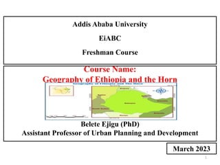
- 1. 1 Course Name: Geography of Ethiopia and the Horn by: Belete Ejigu (PhD) Assistant Professor of Urban Planning and Development Addis Ababa University EiABC Freshman Course March 2023
- 2. CHAPTER TWO: THE GEOLOGY OF ETHIOPIAAND THE HORN
- 3. Objectives • After completing this chapter, the learners will be able to: - Analyze the geologic processes and the resultant land forms of Ethiopia and the Horn. - Examine the formation of the Rift Valley. - Recognize the current status of Ethiopian mineral endowment associated with geologic processes.
- 4. Introduction • Geology is an Earth science that studies about: 1.the evolution of the earth, 2. the materials of which it is made of, and 3.the processes acting upon the earth’s materials. • Geology studies of how Earth's materials, structures, processes and organisms have changed overtime. • Much of Geology is concerned with events that took place in the remote past. • A great deal of geological understanding can be obtained by inference using clues from what can be seen and what can be measured. There are many clues which can be observed and measured from the rocks and landforms • There are many clues provided by indirect methods such as geophysics, geochemistry and geochronology.
- 5. Cont’d… • Indirect methods such as: - Geophysics - studying earthquake waves which can penetrate deep beneath the Earth’s surface, - Geochemistry - analysis of the detailed composition of rocks which can give clues as to their origin and - Geochronology - methods for finding the ages of rocks, usually from the radioactive elements they contain. - In short, a great deal of geological understanding can be obtained by inference using clues through: i. Direct Observation and Measurement of rocks and landforms ii. Indirect Methods such as geophysics, geochemistry and geochronology.
- 6. Continental Drift Theory • German Metrologiest Alfred Wegener proposed the hypothesis that the earth’s continents were once assembled or bunched up together in to a single huge continent or as a supercontinent called Pangaea. The Pangaea or large super continent was then split into Gondwanaland and Laurasia; and later into smaller fragments over the last million years; then drifted apart to form the present arrangement of continents. • Wegener’s principal observations were: 1. The Apparent Fit of the continents: - The opposing coastlines of continents appears to fit together. 2. Match of Mountain Belts, Rock types/Rocks and Mountain Correlation: - If the continents are reassembled as Pangaea, mountains in West Africa, North America, Greenland, and Western Europe match up.
- 7. Cont’d… • Distribution of Fossils/Fossil Correlation: - The distribution of plants and animal fossils on separate continents forms definite linked patterns if the continents are reassembled. • Paleoclimates /Past Climate Data: - Rocks formed 200 million years ago in India, Australia, South America, and southern Africa all exhibited evidence of continental glaciations.
- 8. The Geologic Processes: • The Geologic Processes are divided into two major groups: 1. The Internal Processes (Endogenic Forces): - It includes: - volcanic activity, - all the tectonic processes (folding, faulting, orogenesis, and epeirogenesis. Orogenesis - mountain building Process Epeirogenesis - slow rising and sinking of the landmass - These processes result in building of structural and volcanic features like Plateaus, Rift Valleys, Block Mountains, Volcanic Mountains, etc.
- 9. Cont’d… 2. The External Processes (Exogenic Forces): - are geomorphic processes. - they include weathering, mass transfer, erosion and deposition. - They act upon the volcanic and structural landforms by modifying, roughening and lowering them down. • The landmass of Ethiopia is the result of the combined effect of endogenic and exogenic processes.
- 10. The Geological Time Scale and Age Dating Techniques • Geological Time Scale (GTS) is a system of chronological dating (following the order in which the event occurred) that relates geological strata or layer to time. • GTS describes the timing and relationships of events that have occurred during earth’s history. • GTS is essential or needed for understanding those events which have been happened on earth before million years ago. • GTS gives the information of sequence of events which occurred in the history of the earth. • The first Geological Time scale was proposed by Giovanni Arduino in 1760, also known as the father of GTS.
- 11. Cont’d… • GTS have some division or units like Eon, Era, Period and Epoch. I. Eon: • Eon is the mega or biggest unit in GTS (the duration of Eon is around half a billion or more) • There are two Eon. These are: 1 Phanerozoic Eon (Visible life) 2. Cryptozoic Eon (No life) • NB: - The word ozoic means life while azoic means no life - Our GTS is composed of Phanerozoic Eon since we will talk about life which were visible or existed in those time period. Thus, the Eon used in GTS is Phanerozoic Eon.
- 12. II. Eras: - Eons are further divided in to smallest units called eras - There are four eras. These are: 1. Precambrian Era (Primitive Life) 2. Paleozoic Era (Ancient/Old Life) is the age of invertebrates 3. Mesozoic Era (Middle Life) is the age of reptiles 4. Cenozoic Era (Recent Life) is the age of mammals. • The Eras are given names that indicate the kind of life that existed in them. III. Periods: - Each era are further sub divided in to smaller time units called periods IV. Epoch: - Periods are further divided in to smaller units are called Epoch. - Rock units corresponding to epochs are called series.
- 13. Cont’d… Eon > Era > Periods > Epoch Biggest unit in GTS Smallest unit in GTS -The Earth is believed to have been formed approximately 4.5 billion years ago. -The earliest forms of life were thought to have originated approximately 3.5 billion years ago. -To describe the geology and history of life on Earth, scientists have developed the geological time scale -The geological time scale measures time on a scale involving or relating with four main units: 1. Epoch - smallest unit of time in a scale encompasses a period of millions years 2. Period 3. Era 4. Eon is the largest period of geological time. - The span of time before life appeared was termed the Precambrian Era. Therefore,
- 14. Cont’d… • The geological time divisions basically differ from each other based on the following characteristics: - the relative position of land and sea, - the kind of climate and - the kind of animal and plant life that developed and existed during that Era or period. • The division of time units in the geological time scale is usually based on the occurrence of significant geological events (e.g. mass extinctions - process of being or becoming extinct). As such, the geological time categories do not usually consist of a uniform length of time.
- 15. The Geological Time Scale
- 17. Age Dating Techniques • There are two techniques of knowing the age of rocks: 1. Relative age dating. 2. Absolute age dating 1. Relative dating: - It uses geological evidence to assign comparative ages of fossils. - we can use two ways to know the relative age of a rock: i. by looking at any fossils the rock may contain. ii. by looking layers of rocks - The two methods only give the relative age of rocks - which one is younger and which is older.
- 18. Cont’d… 2. Absolute Dating: - It is known as Radiometric techniques i. Carbon-14 Technique ii. Potassium-Argon Technique
- 19. Geological Processes and the Resulting Landforms of Ethiopia and the Horn 1. The Precambrian Era (4.5 billion - 600 million years ago) • It covers 5/6th of the Earth’s history • Our knowledge of the events is limited due to its remoteness in time and the absence of well-preserved fossils • Some general description of the main geologic processes includes: - Orogenesis: the land was subjected to intense folding which was associated with intrusive igneous activity. The result was the formation of huge mountain ranges/gigantic mountains - There were long periods of denudation which finally reduced these mountains to near-level (peneplained) rock surfaces. - The formation of the basement rocks or crystalline rocks
- 20. Cont’d… • In Ethiopia the Precambrian rock or the basement/crystalline rocks are found exposed in the following areas: - In the Western Part: Gambella, Benishangul-Gumuz (Metekel and Asossa), western Gojjam, western Wellega, Illuababora, and Abay gorge. - In the Southern Part: Guji, southern Omo, and parts of southern Bale and Borena. - In the Eastern part: Eastern Hararghe.
- 21. Cont’d… 2. The Paleozoic Era (600 million - 225 million years ago) • The major geological process was intense and prolonged denudation followed by peneplaination (peneplained surface). • The formation of undulating plains or inselbergs. • The sediments were transported southward and eastward to form continental (in Africa) and marine deposit. • Rocks belonging to plaeozoic Era are rare in Ethiopia the because of the limited deposition.
- 22. Cont’d… 3. The Mesozoic Era (225-70 million years ago): • It was an era of epeirogenesis or alternate slow sinking and rising of the landmass. • This process affected the whole present-day Horn of Africa and Arabian landmass. At the same time the land was tilted eastward and therefore lower in the southeast and higher in the northwest. • Due to gradual subsidence or sinking of land, the sea invaded the land starting from Somalia and Ogaden and slowly spreading northwestward, this was began during Triassic period and continued up to Jurassic Period. • As the shallow sea spread towards the land, sands were deposited over the peneplained Precambrian rock surface. As the depth of the sea increased, mud (shale), gypsum and later lime were deposited due to decomposition and precipitation of marine life; this makes the Mesozoic rocks to have a great potential of oil and gas deposit
- 23. Cont’d… • Through time, compression by the overlying rocks and by cementing minerals, the sands and lime were compacted to form sandstone and limestone layers respectively. These are known as the Adigrat sand stone and Hintalo limestone layers. • In the Horn of Africa and Ethiopia, the slow rise of the land and consequently the regression/drop of the sea began in the Upper Jurassic. It continued throughout the Cretaceous period, and hence, due to uplift of the landmass, the sea began to retreat and thus another process of deposition occurred. • By the end of the Mesozoic Era, when the land emerged out of the sea, three major sedimentary formations were laid and formed upon the Precambrian rock surface. These were: i. Adigrat or lower sandstone, ii. Hintalo limestone and iii. Upper Sandstone.
- 24. Cont’d… • Due to the tilting/sloping of the landmass during the transgression and regression of the sea, and due to the direction of the invading and retreating sea, the age and thickness of the Sandstone layers vary in a Southeast - Northwest direction. • The Adigrat sandstone is older and thicker in the southeast and progressively decreases in age and thickness northwestward. • The Upper sandstone, is thicker and younger in the Southeast, while in the Northwest it is older and thinner. • The transgressing sea and Mesozoic sediments nearly covered the whole of Ethiopia. • As surface rocks, these old marine sediments are extensively found in the Southeast lowlands. Other exposures include central Tigray, and along the gorges of Abay and Wabishebelle rivers.
- 25. Cont’d… 4. The Cenozoic Era (70million years ago - Present) • The tectonic and volcanic activities that took place in this era have an important effect in the making of the present-day landmass of Ethiopia and the Horn of Africa. • The major geologic events/activities were: a. Uplifting of the Arabo-Ethiopian landmass and outpouring of huge quantity of lava ( i.e Trappean lava or Trap Series lava formed volcanic mountains) b. Formation of the Rift Valley c. Quaternary volcanism and deposition A. Tertiary Period: • The Red Sea and the Gulf of Aden were connected as a result of the rifting and faulting, the Afar depression (including the Gulf of Zula) was down-faulted, thick saline materials accumulated; the area between the Danakil Depression and the Red Sea was uplifted to form the Afar Block Mountains.
- 26. Cont’d… • The spatial extent of the rift valley- - Great East African Rift system extends from Palestine- Jordan in the north to Malawi-Mozambique in the south, with a distance of about 7,200 kilometers. Of these, 5,600 kilometers is in Africa, and 1,700 kilometers in Eritrea and Ethiopia. - the widest part of the Rift Valley is the Afar Triangle (200-300 km). • The Red Sea, the Gulf of Aden, and the East African System meet and form the triangular depression of the Afar where the Kobar Sink lies about 125 meters below sea level (the lowest place). • The formation of the Gulf of Aden and the separation of the Arabian Peninsula from the Horn of Africa also took place during the Tertiary period.
- 27. Cont’d… • The Rift Valley region of Ethiopian is the most unstable part of the country; in this region, there are numerous hot springs, fumorales, active volcanoes, geysers, and frequent earthquakes • The formation of the Rift Valley has the following structural (physiographic) effects: - It divides the Ethiopian Plateau into two. - It separates the Arabian landmass from African landmass. - It causes the formation of the Dead Sea, Red Sea and the Gulf of Aden troughs/channels. - It creates basins and fault depressions on which the Rift Valley lakes are formed.
- 28. Cont’d… • Quaternary Volcanic Eruptions and Depositions - Quaternary Deposition: During the Quaternary period of the Cenozoic Era, the Earth experienced a marked climatic change, where warmer and dry periods were alternating with cooler and wet periods. This is the time of ‟Ice Age” in the middle and high latitude areas and the time of the “Pluvial Rains” in Africa. • The heavy Pluvial Rains eroded the Ethiopian plateau and the eroded materials were deposited in the Rift Valley lakes.
- 29. Cont’d… • According to the place and manner of deposition and depositing agents these deposits are divided as follow. a. Lacustrine deposits: Deposits on former lakebeds, and swampy depressions. b. Fluvial deposits: Deposits on the banks of rivers, flood plains both in plateau, foothills etc. c. Glacio-fluvial deposits and erosional features: These are occurred on high mountains, such as Bale and Kaka Mountains. d. Aeolian deposits: are windblown deposits. e. Coastal and marine deposits: Deposits on sea invaded and sea- covered places.
- 30. Cont’d… • The quaternary deposits are mainly found in the Rift Valley (Afar and Lakes Region), Baro lowlands, southern Borena, and parts of northwestern low lands.
- 31. Rock and Mineral Resources of Ethiopia • The occurrence of metallic minerals in Ethiopia is associated with the Precambrian rocks. • Gold production and utilization, the mining and working of iron for the manufacture of tools, utensils and weapons and the use of salt and salt-bar indicates the long mining tradition in Ethiopia.
- 32. Brief Facts and Current State of Main Minerals in Ethiopia • Geological surveys proved that Ethiopia has abundant mineral resources of metals and precious metals, coal, and industrial minerals.
- 33. Mineral Potential Sites of Ethiopia • According to the Ethiopian geological survey, the geologic formations that host most mineral potentials of Ethiopia includes three major greenstone belts and other formations
- 34. Discussion Question • Answer the following questions briefly. 1. What were the major geologic processes of the Precambrian and Paleozoic Eras in the Horn of Africa? 2. Explain the formation of the oldest sedimentary rocks in Ethiopia and the Horn. 3. Discuss the major geologic events of Ethiopia that took place during the Cenozoic Era. 4. Where are the major mineral potential sites of Ethiopia? Discuss each of them with the help of examples.
- 35. Thank You!