The Regional Image: Interpreting the Visual Products of Regional Planning
•Descargar como PPT, PDF•
1 recomendación•316 vistas

Presented at the Association of Collegiate Schools of Planning Conference, Salt Lake City, UT, 2011.

Recomendados
Recomendados
Más contenido relacionado
La actualidad más candente
La actualidad más candente (15)
Destacado
Destacado (13)
Similar a The Regional Image: Interpreting the Visual Products of Regional Planning
Similar a The Regional Image: Interpreting the Visual Products of Regional Planning (20)
Último
Último (20)
The Regional Image: Interpreting the Visual Products of Regional Planning
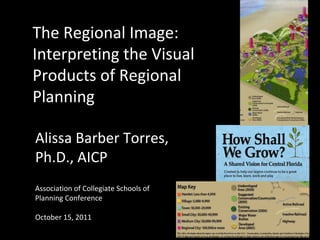
- 1. The Regional Image: Interpreting the Visual Products of Regional Planning Alissa Barber Torres, Ph.D., AICP Association of Collegiate Schools of Planning Conference October 15, 2011
- 2. Approach • Studied “How Shall We Grow?” 2050 regional land use scenario (“The 4C’s”) • Includes seven Central Florida counties (93 local governments) • Implementation through decades of local stakeholder decisions and interpretations Can that be done effectively?
- 3. “The 4C’s” Scenario Source: http://www.myregion.org/RegionalVision/VisionMaps/tabid/204/Default.aspx
- 4. Visual documentation Visual instructions Visual persuasion Visual intervention Scenarios as Textual “instructions” to create persuasion a future place (“storytelling”)
- 5. Approach • Dissertation considers scenarios as technical and persuasive communication • Five one-hour interviews and two focus groups with planners (N=14) • Qualitative “data slice” providing insights for further research • Other scenarios may not have same characteristics and outcomes
- 6. Approach • Included comparison to Harris Interactive Community Values Survey • Values: growth management, neighborhoods, nature, schools, transportation • Also used rhetorical analysis (Healey 2007) designed for regional scale • Assessment context of “imageability”-- elements that create “identity and structure in the mental image” (Lynch, 1950, p. 9)
- 7. Approach “What space is being referred to? How is it positioned in relation to other spaces and places? What are its connectivities and how are these produced? How is it bounded and what are its scales? What are its ‘front’ and ‘back’ regions? What are its key descriptive concepts, categories, and measures? How is the connection between past, present, and future established? Whose viewpoint and whose perceived and lived space is being privileged?” (Healey, 2007, p. 209-210).
- 8. Research Findings • “The 4C’s” scenario not functioning well as technical communication • Two community values not seen in scenario at all • Needs clarification the meaning of design/visual elements • Would benefit from more detailed textual support within scenario’s “real estate” • Can’t rely on shared mental context among planners about the regional place depicted
- 9. Research Findings Assessment of Scenario Legend White dotted lines are confusing and not on the legend. Doesn’t give accurate description of where people will live based on sprawl and quarter-acre lots. What is defined as undeveloped? No definition in the legend. Also need definition of conservation—would it include conservation subdivisions? Bothers me that vacant and conservation are different—not clear—where would we build after 2050? Legend doesn’t describe nonresidential that is in mix. Existing conservation looks forested, not wetland. Why are development areas both hatched and not hatched? Color palettes usually are specific to planning—dark to light for density/intensity, and this doesn’t do that. Source: Focus Groups and Interviews.
- 10. Research Findings Assessment of Scenario Place Icons Growth or population. Consider to be growth centers to focus densities and intensities. Shows current location of employment and residential centers in region and what growth projections are. How and where future growth will take place. Misleading where height of colored boxes suggests building height, but is actually population. Not clear the size of column equals people—may be with clusters—nominal, but ordinal and interval here—no way of determining. Thought it was transportation icons. Pink boxes say 100,000 population or more, but doesn’t tell why four are together.
- 11. Research Findings Assessment of Scenario Lines (Transportation) I don’t know, I have no idea [after referring to legend]—connection corridors. Swooshes are connections. Economic regions that have partnerships with each other. Transportation and connectivity between places. The map represents multimodal nature of the region and the connection of centers. Nominal levels shows where going, but not volume. Doesn’t suggest surface travel, as goes top of box to top of box [place icon]. Roads and railroads—look like we’re flying, as don’t connect on ground. Multimodal connections and the short pink block are confusing. Source: Focus Groups and Interviews.
- 12. Research Findings • Planners’ interpretations vary, often by their own specializations or value systems • No planner identified two of the five community values within the scenario • Many challenges to defining a region in this setting among planners, even individually • Regional sense of place or narrative not present or emerging
- 13. Research Findings • Need detailed content to support intrepretation, using text and clear visual/spatial logic • Kostelnick and Hassett warn visual conventions fleeting and often based in particular moment in time (2003, p. 190) • Planning community may not sustain conventions needed to interpret the scenario over intended life (2050) • Implications for realizing community values and the desired “future place “
- 14. Research and Practice • Need testing with larger samples • User-centered design approaches specific to tasks (“think aloud” protocol) • Observe planners in workplaces (ex. Healey, Carp) interpreting and comparing to local plans • Comparison of U.S. visioning scenarios’ visual conventions as a visual meta-analysis
- 15. Research and Practice • Testing with prior dialogue and consensus about regional context • Review of scenarios with better regional contexts (ex. Portland, the Buffalo Commons ) • “Storymapping” regional narratives online • Use of digital media, like Krieger’s “Urban Tomography,” for participatory image-making • Create region in gaming/virtual environment or Central Florida MST decision theater
- 16. References Healey, P. (2007). Urban Complexity and Spatial Strategies: Towards a Relational Planning for Our Times. London and New York: Routledge. Kostelnick, C. and Hassett, M. (2003). Shaping Information: the Rhetoric of Visual Conventions. Carbondale: Southern Illinois University Press. Lynch, K. (1950). The Image of the City. Cambridge and London: The MIT Press.