
Recomendados
Más contenido relacionado
La actualidad más candente
La actualidad más candente (20)
Similar a Map Projections ―concepts, classes and usage
Similar a Map Projections ―concepts, classes and usage (20)
Más de Prof Ashis Sarkar
Más de Prof Ashis Sarkar (20)
Último
Último (20)
Map Projections ―concepts, classes and usage
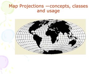
- 1. Map Projections ―concepts, classes and usage
- 2. Maps are flat, but the Earth is not! Producing a perfect map is like peeling an orange and flattening the peel without distorting a map drawn on its surface. A map projection is a mathematical model of a set of rules or for transforming locations from the 3D Earth onto a 2D display. This conversion necessarily distorts some aspect of the earth's surface, such as area, shape, distance, or direction.
- 3. Why use a projection? 1. A projection permits spatial data to be displayed in a Cartesian system. 2. Projections simplify the calculation of distances and areas, and other spatial analyses. P = Point on 3D Globe Geographical Co-ordinates = (λ, Ф) Spherical Co-ordinates = (θ, r) Ṕ´= Transformed point on 2D Plane Rectangular Co-ordinates = (x, y) Polar Co-ordinates = (ρ, z) Transformation Functions {X = f1 (λ, Ф), y = f2 (λ, Ф)} {ρ = f3 (θ, r), z = f4 (θ, r)} f1, f2, f3, f4 are real, single valued, continuous and differentiable functions
- 4. Hence, no flat representation of the earth can be completely accurate. Many different projections have been developed, each suited to a particular purpose. Map projections differ in the way they handle four properties: area, angles, distance and direction. Accordingly, they are called equal-area (authalic, homolographic or equivalent), orthomorphic (true-shape or conformal), equidistant, and azimuthal projections. Rules: 1. No projection can preserve all four simultaneously, although some combinations can be preserved, such as Area and Direction. 2. No projection can preserve both Area and Angles, however. The map-maker must decide which property is most important and choose a projection based on that.
- 5. Basics of Map Projection • Every projection has its own set of advantages and disadvantages. • There is no such thing as "best" projection. • Distortions in shape, scale, distance, direction, and area always occur. • Some projections minimize distortions in some of these properties at the expense of maximizing errors in others. • Some projection are attempts to only moderately distort all of these properties. The mapmaker must select the one best suited to the needs, reducing distortion of the most important features. They have devised almost limitless ways to project the image of the globe onto a flat surface (paper). “Every map user and maker should have a basic understanding of map projections” to — • Create spatial data (collecting GPS data) • Import into GIS and overlay with other layers • Acquire spatial data from other sources • Display the GPS data using maps
- 6. Classes of Map projections Physical models: • Cylindrical Projections (cylinder) - Tangent case (Normal, Equatorial, Oblique) - Secant case • Conic Projections (cone) - Tangent case (Normal, Equatorial, Oblique) - Secant case • Azimuthal or planar projections (plane) - Tangent case (Normal, Equatorial, Oblique) - Secant case Distortion properties: • Conformal (preserves local angles and shape) • Equal area or equivalent (preserves area) • Equidistant (preserves scale along a center line) • Azimuthal (preserves directions)
- 8. Coordinate Systems ― 3D Earth Sphere : (Longitude, Latitude, Altitude) Spheroid / Ellipsoid: (Longitude, Latiitude, Altitude) 2D Plane Cartesian: (u, v) Polar: (d, z) Rectangular: (x, y)
- 9. Cylindrical Projections • Meridians and Parallels intersect at 90o, • Often Conformal, • Least Distortion along Equator, • Example: Plate Carree, Mercator, Galls, etc.
- 10. Plate Carree Projection Lambert’s Cylindrical Equal Area Projection
- 13. Transverse Mercator Projection • Mercator is hopelessly distorted away from the equator towards high latitudes. • Fix: rotate 90° so that the line of contact is a central meridian (N-S). • Example: Universal Transverse Mercator (UTM) Works well for narrow strips (N-S) of the globe.
- 14. Planar Projections • Preserves Azimuth from the Center • Best for Polar Regions • Gnomonic Chart • Celestial Hemisphere • Conformality or Stereograms
- 15. Azimuthal Equidistant Equatorial Projection Azimuthal Equal Area Equatorial Projection Polar Zenithal Equal Area Projection
- 16. Conical Projections • Most accurate along “standard parallels”. • Meridians radiate out from vertex (often a pole). • Poor in polar regions – just omit those areas. • Examples: Albers Equal Area. Used in most USGS topographic maps.
- 17. Conical Equidistant Projection Lambert’s Conical Equal Area Projection Alber’s Conical Equal Area Projection
- 18. Euler Projection Lambert’s Conformal Conic Projection Braun’s Stereographic Conic Projection
- 19. American Polyconic Projection Rectangular Polyconic Projection
- 21. Compromise Projections 1. Robinson’s World Projection based on a set of co-ordinates rather than a mathematical formula. 2. Shape, area, and distance ok near origin and along equator. 3. Neither conformal nor equivalent (equal area). Useful only for world maps.
- 22. What if you’re interested in oceans?
- 23. “But wait: there’s more …”
- 26. Braun’s Stereographic Cylindrical Projection Sinusoidal Projection
- 29. Eckert – IV Projection Robinson Projection
- 34. Wagner IX Projection Eckert – Greifendroff Projection
- 35. Winkel Tripple Projection Lagrange Projection
- 39. Xarax’s World Projection Van der Grinten’s III Projection Van der Grinten’s IV Projection
- 40. Maurar Globular Projection Orthoapsidal Projection
- 41. Arden - Close Projection Oblique Hammer Projection Briesemeister’s Projection
- 45. Conoalactic Projection Maurer’s S231 Projection Maurer’s S233 Projection
- 47. Interrupted Molleide’s Projection Interrupted Goode’s Homolosine Projection Interrupted Bogg’s Eumorphic Projection
- 48. Kent – Halstead’s Projection Halstead’s Composite World Projection
- 53. Gnomonic Projection on a Cuboctahedron Gnomonic Projection on a Icosahedron
- 54. Snyder’s Polyhedral Projection Gnomonic Projection on a Dodecahedron
- 56. Tetrahedron Cube Octahedron Dodecahedron Icosahedron Cuboctahedron Rhombicuboctahedron Map Fold Out
- 57. Trapezoidal Projection Ortelius’s Projection Apian Projection
- 59. Mercator Projection Oblique Mercator Projection
- 60. Universal Transverse Mercator (UTM) Coordinate System • UTM system is transverse-secant cylindrical projection, dividing the surface of the Earth into 6 degree zones with a central meridian in the center of the zone. each one of zones is a different Transverse Mercator projection that is slightly rotated to use a different meridian. UTM zone numbers designate 6 degree longitudinal strips extending from 80 degrees South latitude to 84 degrees North latitude. UTM is a conformal projection, so small features appear with the correct shape and scale is the same in all directions. (all distances, directions, shapes, and areas are reasonably accurate ). Scale factor is 0.9996 at the central meridian and at most 1.0004 at the edges of the zones. • UTM coordinates are in meters, making it easy to make accurate calculations of short distances between points (error is less than 0.04%) • Used in USGS topographic map, and digital elevation models (DEMs) • Although the distortions of the UTM system are small, they are too great for some accurate surveying. zone boundaries are also a problem in many applications, because they follow arbitrary lines of longitude rather than boundaries between jurisdictions.
- 61. CM: central meridian AB: standard meridian DE: standard meridian -105 -108 -102 Transverse Mercator Projection
- 62. Zone 1 International Date Line - 180 Equator Zone 18o Universal Transverse Mercator- Grid
- 63. UTM Zone Numbers
- 64. Universal Polar Stereographic (UPS) Coordinate System • The UPS is defined above 84⁰N latitude and south of 80⁰ S latitude. • The eastings and northings are computed using a polar aspect stereographic projection. • Zones are computed using a different character set for south and north Polar regions.
- 66. THANK YOU prof ashis sarkar Presidency University, Kolkata profdrashis@gmail.com