Land Health Surveillance Information for decision making
•Descargar como PPTX, PDF•
0 recomendaciones•1,914 vistas

Remote sensing –Beyond images Mexico 14-15 December 2013 The workshop was organized by CIMMYT Global Conservation Agriculture Program (GCAP) and funded by the Bill & Melinda Gates Foundation (BMGF), the Mexican Secretariat of Agriculture, Livestock, Rural Development, Fisheries and Food (SAGARPA), the International Maize and Wheat Improvement Center (CIMMYT), CGIAR Research Program on Maize, the Cereal System Initiative for South Asia (CSISA) and the Sustainable Modernization of the Traditional Agriculture (MasAgro)

Recomendados
Recomendados
Más contenido relacionado
La actualidad más candente
La actualidad más candente (19)
Destacado
Destacado (20)
Similar a Land Health Surveillance Information for decision making
Similar a Land Health Surveillance Information for decision making (20)
Más de CIMMYT
Más de CIMMYT (20)
Último
Último (20)
Land Health Surveillance Information for decision making
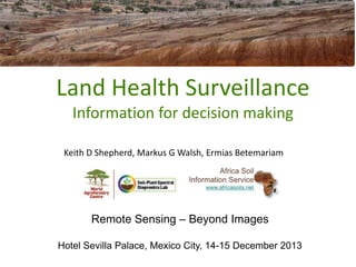
- 1. Land Health Surveillance Information for decision making Keith D Shepherd, Markus G Walsh, Ermias Betemariam Remote Sensing – Beyond Images Hotel Sevilla Palace, Mexico City, 14-15 December 2013
- 2. Surveillance Science Principles • Define target population/area • Measure frequency of problems and associated risk factors in populations • • • • • • • Sample units Probability sampling Standardized measurement protocols Case definitions Rapid screening tests Risk quantification Operational surveillance systems built into policy and practice UNEP. 2012. Land Health Surveillance: An Evidence-Based Approach to Land Ecosystem Management. Illustrated with a Case Study in the West Africa Sahel. United Nations Environment Programme, Nairobi. http://www.unep.org/dewa/Portals/67/pdf/LHS_Report_lowres.pdf Shepherd KD and Walsh MG (2007) Infrared spectroscopy—enabling an evidence-based diagnostic surveillance approach to agricultural and environmental management in developing countries. Journal of Near Infrared Spectroscopy 15: 1-19.
- 3. Land Health Surveillance Sentinel sites Randomized sampling schemes Consistent field protocol Coupling with Prevalence, Risk factors, Digital mapping remote sensing Soil spectroscopy
- 4. AfSIS ✓60 primary sentinel sites ➡ 9,600 sampling plots ➡ 19,200 “standard” soil samples ➡ ~ 38,000 soil spectra ➡ 3,000 infiltration tests ➡ ~ 1,000 Landsat scenes ➡ ~ 16 TB of remote sensing data to date
- 5. Soil infrared spectra • • • • Mineral composition Iron oxides Organic matter Water (hydration, hygroscopic, free) • Carbonates • Soluble salts • Particle size distribution Functional properties 1 = Fingerprint region e.g Si-O-Si stretching/bending 2 = Double-bond region (e.g. C=O, C=C, C=N) 3 = Triple bond (e.g. C≡C, C≡N) 4 = X–H stretching (e.g. O–H stretching) NIR = Overtones; key features clay lattice and water OH; SOM affects overall shape
- 6. Infrared spectroscopy Dispersive VNIR Handheld MIR ? FT-NIR FT-MIR Robotic Mobile phone cameras ? FT-MIR Portable Shepherd KD and Walsh MG. (2002) Development of reflectance spectral libraries for characterization of soil properties. Soil Science Society of America Journal 66:988-998. Brown D, Shepherd KD, Walsh MG (2006). Global soil characterization using a VNIR diffuse reflectance library and boosted regression trees. Geoderma 132:273–290. Terhoeven-Urselmans T, Vagen T-G, Spaargaren O, Shepherd KD. 2010. Prediction of soil fertility properties from a globally distributed soil midinfrared spectral library. Soil Sci. Soc. Am. J. 74:1792–1799
- 8. • Submit batch of spectra online • Uncertainties estimated for each sample • Samples with large error submitted for reference analysis • Calibration models improve as more samples submitted • All subscribers benefit
- 10. Soil-Plant Spectral Diagnostics Lab • • • 500 visitors/yr again 338 instruction 13 PhD, 4 MSc training
- 11. Markus Walsh
- 12. Soil property maps of Africa at 1 km Legacy soil profiles12,000 locations
- 15. Probability topsoil pH < 5.5 ... very acid soils prob(pH < 5.5) Africa Soil Information Service www.africasoils.net Markus Walsh
- 16. Markus Walsh
- 18. Global-Continental Monitoring Systems Applications CGIAR pan-tropical sites Vital signs AfSIS Vital Signs Regional Information Systems National surveillance systems Private sector soil testing Ethiopia, Nigeria Project baselines SLM Cameroon Parklands Malawi Rangelands E/W Africa Cocoa - CDI MICCA EAfrica
- 19. What is the decision? Decisions before Data • Review of the Evidence on Indicators, Metrics and Monitoring Systems. http://r4d.dfid.gov.uk/output/192446/default.aspx • A Survey and Analysis of the Data Requirements for Stakeholders in African Agriculture http://r4d.dfid.gov.uk/Output/193813/Default.aspx • Government-level programmatic decisions (fertilizer supply/blending; liming programmes) • Farmer or local provider decisions (what fertiliser to apply, where, when)
- 20. Explicit decision modelling dealers. • Uncertainties (risks) represented • Value of Information Analysis • Preferences of stakeholders Influence diagram “Make fertilizer recommendations” use case • • • • • • Workflows that use consistent data model Free and open source computer software Automated analyses of remote sensing and market time series Maps, monitoring and decision analysis products and services for Africa Deployable via web and cellular/mobile services Products to CKW’s, farmer groups, land management policy-makers, government agencies and agro-input dealers
- 21. Outputs Probabilistic impact projections Identification of high-value variables Aquifer size after 70 years of abstraction (% of original) Replenishment Irrigation growth Initial irrigated area Water use per hectare Aquifer size Natural water use Importance threshold
- 22. Smart data – Smart Decisions • Inclusion of uncertain variables allows truly holistic impact assessments • Efficient way of organizing existing knowledge • High information value variables are almost always not those typically measured • Identifies important metrics for monitoring • Provides accumulated evidence for impact attribution • Community of practice & capacity building in decision analysis under uncertainty
Notas del editor
- This is the overall AfSIS schema. At the top is a systematic grid system to which all observations can be spatially referenced. From the left we have georeferenced legacy data, such as soil profile data and newly collected field, spectral and lab reference data. Then we have our remote sensing layers, and planned is greater use of UAVs, or drones, for high resolution work.Spectral predictions can be combined with spatial prediction (e.g. using any residual spatial correlation) as well as modelling to remote sensing layers. The outputs of this are digital soil maps and prediction services. Our current emphasis is on feeding spectral predictions and digital soil maps directly into specific development decisions, and developing applications around this.
- AfSIS is in the process of producing Africa wide maps based on the newly collected data, updating the maps already generated from the legacy soil profile data, which are available on the AfSIS web site.We have also been helping governments establish national soil surveillance systems. Ethiopia is the most advanced. We proposed a national level baseline based on sampling at latitude and longitude intersection points (blue points). And this work has started. However the government wanted to fast track characterization of soil fertility in areas that were high priority for food production in specific woredas (green areas). The red crosses are points where observations of whether land is cultivated have been made by volunteers under the IIASA Geowiki scheme.
- This is an example of the type of product that is being generated. Here we see the areas with high probability of strong soil acidity, which map out very distinctly and where the government can now target liming programmes.
- Use case(s) described in this document can be implemented as workflows that use consistent data models (see: http://en.wikipedia.org/wiki/Data_model) and free and open source computer software (see e.g.: http://www.r-project.org & http://grass.osgeo.org) supported by largely automated analyses of remote sensing and market time series that will produce maps, monitoring and decision analysis products and services for the cropland areas of Africa. Once the envisaged system has been developed, it should be deployable via web and cellular/mobile services that will provide access to data and information products to CKW’s, farmer groups, land management policy-makers, government agencies and agro-input