E-Poster presented at the 2nd Annual Science Meeting of the Marine Alliance for Science and Technology, Scotland. Presented by CMBB PhD student Lauren McWhinnie
Apidays Singapore 2024 - Scalable LLM APIs for AI and Generative AI Applicati...
MASTS - Lauren McWhinnie
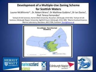
1. Development of a Multiple-Use Zoning Scheme
for Scottish Waters
Lauren McWhinnie1a , Dr. Robert Briers2, Dr Matthew Gubbins3, Dr Ian Davies3,
Prof. Teresa Fernandes1
1School of Life Sciences, Heriot-Watt University, Riccarton, Edinburgh, EH14 4AS. 2School of Life
Sciences, Edinburgh Napier University, Sighthill Court, Edinburgh, EH11 4BN. 3Marine Scotland Science,
Marine Laboratory, Aberdeen, AB11 9DB, Scotland. alhm3@hw.ac.uk
2. Types of Activities
Data accompanied with coordinates were used to configure a formal GIS database
representing the Scottish coastline and its biological and human components. From this
integrated baseline maps were compiled allowing accurate assessments of the spatial
distributions of human activities and their associated pressures to be carried out and for the
locations of marine habitats and biological communities present to be assessed.
3. Level of Human Impact
Due to the need to integrate and manage such a variety of factors, Geographical Information
Systems (GIS) were used to capture, organise, analyse and display the different types of
geographically referenced information. This study aims to develop, explore and test
approaches to Scottish Marine Spatial Planning through this use of GIS and propose a
framework to be used as a tool to aid future aquaculture placement and development.
4. Multiple-Use Zoning Scheme
Two different zoning schemes were applied and tested using this data inventory. The first
was a multiple use zoning scheme originally developed for the Irish Sea. This zoning scheme
has enabled the identification of any interactions and potential conflicts in certain areas
and the extent to which existing measures help avoid and minimise these conflicts.
5. Marine Planning Framework
The Marine Planning model was the second methodology to be applied. This is an
ecosystem-based zoning scheme originally devised for Australian waters. It has resulted in
maps depicting ecologically rated zones. Lessons learned from both zoning schemes are
now being used to design our own Prototype Zoning Scheme for Scottish waters.
6. The aim of this project is to develop a tool to facilitate the
implementation of marine spatial planning in Scotland.
The focus will be the sustainable development and management
of marine aquaculture by giving consideration to future
placement or expansion of facilities.
Notas del editor
Hi, my name is Lauren McWhinnie and I’m currently doing my PhD at Heriot-Watt University in Edinburgh. Today I would like to tell you all about the research I’m going to be carrying out over the next few years ALONG WITH MY SUPERVISORS TERESA FERNANDES AT HERIOT-WATT UNIVERSITY AND ROB BRIERS FROM EDINBURGH NAPIER and give you a general outline of the project and what I’m hoping to achieve. I WOULD ALSO LIKE TO MENTION CLARE NISBETT WHO IS AN MSC STUDENT THAT HAS HELPED ME BY CARRYING OUT SOME PRELIMINARY WORK IN THIS AREA OVER THE SUMMER. My research will focus on the sustainable development of mariculture in Scotland and the application of spatial planning frameworks in this context.
This study will evaluate and explore the application of different approaches, using Geographic Information Systems (GIS), to the development of a Scottish marine spatial planning framework, with a particular focus on decision-making for future aquaculture sites.