
Recomendados
Recomendados
Más contenido relacionado
Destacado
Destacado (14)
Similar a Geo-empower Africa (FEB)
Similar a Geo-empower Africa (FEB) (20)
Geo-empower Africa (FEB)
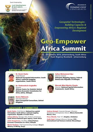
- 1. Organised by Geospatial Technologies - Building Capacity & Empowering Africa‘s Regional Development www.fleminggulf.com Geo-Empower Africa Summit 23 - 24 February 2016, Johannesburg, South Africa Hyatt Regency Rosebank - Johannesburg Event Endorsed by KEYNOTE ADDRESS Dr. Derek Clarke Chief Director National Geospatial Information: South Africa’s national mapping organisation, South Africa Dr. Chukwudozie Ezigbalike Director African Centre for Statistic United Nations Economic Commission for Africa (ECA), Ethiopia Denise McKenzie Executive Director Open Geospatial Consortium, United Kingdom Sultan Mohammed Alya Director General Ethiopian Mapping Agency, Federal Democratic Republic of Ethiopia Maroale Mimi Martha Chauke Director: National Spatial Information Framework, South Africa ADVISORY COMMITTEE Derek Clarke, Chief Director, National Geo-spatial Information: South Africa’s national mapping organization, Republic of South Africa Aubrey Kekana, Manager: Data, Products and Services, South African National Space Agency, South Africa Andre Nonguierma, GIS Officer, United Nations Economic Commission for Africa, Ethiopia Martin Nyakinye, Chief Superintending Geologist, Kenya’s Ministry of Mining, Kenya Andreas Rompel, Corporate Manager of Business Development and Exploration Mexico, Minera Hochschild Mexico, Peru Percy Sibanda, Head ICT, Zimplats, Zimbabwe Andy Lloyd, Strategy & Resource Manager, ICVL - International Coal Ventures Limited, Mozambique
- 2. Associate Sponsor Networking partner PRESTIGIOUS SPEAKERS Dr. Derek Clarke, Chief Director National Geo-spatial Information: South Africa’s national mapping organisation Dr Ganiy Agbaje, Chief Executive Officer, African Regional Centre for Space Science & Technology Education, NASRDA Marcelle Hattingh, Director: Corporate Geo-Informatics, City of Johannesburg Metropolitan Municipality, South Africa Engelbert Breg, Sales Director (EMEA) Microsoft Ultracam, Austria Dechlan Liech Pillay, Senior manager: Early Warnings and Capability Systems, National Disaster Management Centre (NDMC), South Africa Zipho Tyoda, Deputy Director: Earth Observation, Department of Science and Technology, South Africa Ali Al-Hadheri, Geoinformation Manager, TOTAL E&P, Yemen Adri de la Rey, GIS Manager, Group Technology, Eskom, South Africa Aart Broekhuizen, General Manager Sedibelo Platinum Mines Ltd, South Africa Percy Sibanda, Head ICT, Zimplats, Zimbabwe Martin Nyakinye, Head of Geodata Management Division & Chief Superintending Geologist, Ministry of Mining, Kenya Andy Lloyd, Senior Manager- Resource & Exploration, ICVL - International Coal Ventures Limited, Mozambique Sean Meadon, Vice President, Technical Services, Goliath Gold, South Africa Representative PMM, Professional Mobile Mapping KEY DIGNITARY Mr Lesetja Mathiba Chief Directorate Intelligence Information and Communication Systems, National Disaster Management Centre, South Africa Event Supported By Making location count. ® Supporting Association Media Partners Email: john.paul@fleminggulf.com | www.fleminggulf.com Booking line: + 91 98 4528 7972 | fax: + 91 80 4900 5100
- 3. EVENT OVERVIEW Post marking two successful years of Geo-Leadership in the Middle East, Fleming Gulf is proud to present its mark in Africa with the Geo-Empower Africa Summit. Africa‘s economic crisis and long term sustainability issues are serving as catalysts to adopt new technologies and tools boosting its regional and economic development. The Geospatial Industry is rapidly growing and empowering business and nations. It has the ability to increase efficiency, enhance decision-making process and drive development at all level in every business with its advanced technologies. The Geo-Empower Africa summit will be Africa‘s leading platform for the Geospatial society to serve and exchange thoughts, network and discuss their geospatial requirements, initiatives, technologies and applications. EVENT FOCUS Power packed Presentations Interactive Panel discussion Technical Presentations Special Workshop :- LiDAR • En Route a Regional SDI for Geo- empowered Africa • Enabling role of Government in Geospatial data provisioning and management • Next Gen Standards and InteroperabilityGeospatial Information for the Post-2015 Development Agenda: The African Perspective • Skilled resource and Manpower- a requirement for optimum utilization of data and technology • Addressing “Business Uncertainties and Challenges”: Role of Geo-technologies? • The Digital Transformation- Are we ready to embrace new technologies for overall Business enhancement? • Open Source • Cloud computing • Mobile mapping • Unmanned Aerial Vehicles (UAVs) Email: john.paul@fleminggulf.com | www.fleminggulf.com Booking line: + 91 98 4528 7972 | fax: + 91 80 4900 5100
- 4. GOVERNMENT Municipalities Ministries Public works authorities Cadastral and Land registration agencies National/ International Oil & Gas companies National Utilities Companies National Transport companies National Telecommunications companies Decision makers, policy makers from various agencies Town Planning Departments GIS Directorates Surveying and Mapping Agencies National Space Agency Land Adminstration PRIVATE Mining Companies Utilities Companies Power Companies Oil & Gas Companies Transportation Companies Telecommunications Companies TECHNOLOGY PROVIERS GIS Companies GPS Companies GNNS Companies Earth Observation companies Remote Sensing Companies Satellite Companies Cloud Computing Companies LiDAR Companies Mobile Mapping Companies Sensor Companies Image processing Companies Satellite Imaging Companies Aerial Photography Companies Surveying Companies Location based Service Companies E-Governance Companies Navigation Companies IT Companies POLICY Makers SDI Agencies/ National Mapping Organisations Ministries National Remote Sensing Agencies ACADEMIA Departments Designations Academic Institutes Universities GIS training Institutes Research Associations GIS Spatial Planning ICT Department Geo-science Geology Geo-physics Exploration Surveying Chief Executive Officer Directors Executive Vice president / Vice President Heads Managers Specialists Experts Advisors Geologists Surveyors Target Audience Email: john.paul@fleminggulf.com | www.fleminggulf.com Booking line: + 91 98 4528 7972 | fax: + 91 80 4900 5100
- 5. Conference 8:00 Registration and Coffee 8:50 Welcome Note – Fleming Gulf 8:55 Opening Remarks by Event Chair The Geo- Empower Agenda - Building Capacity Empowering Africa‘s Regional Development 9:00 Keynote: The importance of geospatial technologies in Spatial Planning and Land Use Management 9:20 Keynote: AFRICA – Leaping ahead with Geospatial Technologies • Current and future trends in Geospatail technologies. • Aspects administrating Geospatial penetration in the African continent. • Opportunities and objection in successful execution of Geospatial technologies • Role of the Government, Private sectors and academia in promoting Geospatial technologies 9:40 Keynote: Enabling role of Government in Geospatial data provisioning and management • Governments role in providing the Geographic data and its administration • Providing a credible, reliable, and controlled Geospatial information base • Establishing standards, approach and tools to assure quality of the data • Strengthening the existing legacy systems - Policies and Regulations favouring the adoption and Integration of Geospatial technologies • Bridging the gap – coordination and collaboration Dr. Derek Clarke, Chief Director, National Geo-spatial Information: South Africa’s national mapping organisation, Republic of South Africa 10:00 Keynote: Guide to the Role of Geospatial Standards 10:20 Tea/ Coffee and Networking Break 10:50 Creation of 3D city models by using Microsoft UltraCam technology For over a decade now oblique images are collected from airborne platforms on a regular basis. Several camera products have been presented from distinct camera vendors and their image products are well known. The UltraCam Osprey is the new oblique sensor by Microsoft / UltraCam Business Unit and was introduced into the market at the ASPRS 2013. This camera combines a metric nadir subsystem creates one panchromatic high resolution image, one true-color RGB image, one near-infrared image and six oblique true-color wing images taken at an off-nadir angle of 45°. This specific camera design supports exceptional productivity and quality during acquisition and processing. Camera specification parameters as well as results from aero-triangulation, DSM production, and oblique image processing are presented. Engelbert Breg, Sales Director (EMEA) Microsoft Ultracam, Austria The Geo- Empower Data- Geo-technologies trends and future Directions of Data Production, maintenance and administration 11:10 Failures in the take-up of SDI at the National Regional levels in Africa –Proffering Solution • National and Regional Efforts in SDI implementation • INSPIRE: Any Lesson for Africa? • AfriGEOSS – a possible window • Possible Implementation Strategies for the realisation of a Sustainable SDI. Dr Ganiy Agbaje, Executive Director African Regional Centre for Space Science Technology Education, NASRDA 11:20 Implications of the global ICT trends to Geo-Technical Information • Global ICT Trends • Geo-Technical information systems • Challenges in implementation and integration of the systems • Deriving maximum value from the technology Percy Sibanda, Head ICT, Zimplats, Zimbabwe 11:50 Next Gen Standards and Interoperability for “Intelligent Business” • Accessing the Benefits of achieving interoperability between data and system • Highlighting the best tools and technologies to assure successful interoperability between data and system across different functions and departments • Assessing the benefits and challenges in application of Next Gen standard for the increasing productivity safety and reducing cost Aart Broekhuizen, General Manager Sedibelo Platinum Mines Ltd, South Africa 12:20 PANEL DISCUSSION Role of Geo-technologies?- Addressing “Business Uncertainties and Challenges” • The Role of Geospatial technologies is minimizing the business uncertainties and challenges • Challenges in adoption of Geospatial technologies for business enhancement • Government‘s role in promoting Geospatial technologies and addressing business needs • Future of Geospatial Technologies favouring development in Africa considering Economic and Social Development, Environmental Sustainability, Security and Good Governance. Panelist: Aart Broekhuizen, General Manager Sedibelo Platinum Mines Ltd, South Africa Dr. Derek Clarke, Chief Director ,National Geo-spatial Information: South Africa’s national mapping organisation, Republic of South Africa Dr Ganiy Agbaje, Executive Director African Regional Centre for Space Science Technology Education, NASRDA Percy Sibanda, Head ICT, Zimplats, Zimbabwe 13:00 Luncheon and Networking Break DAY 1 23rd February 2016 Email: john.paul@fleminggulf.com | www.fleminggulf.com Booking line: + 91 98 4528 7972 | fax: + 91 80 4900 5100
- 6. Geo-Empowering the lifelines of the Nation 14:00 Organic development of an Automated Mapping / FACILITIES (ASSET) MANAGEMENT System (AM/FM) into a Geo Information System (GIS) • This history will be addressed around the following points • Satisfying a specific geospatial need • The challenge of geospatial data sets in a developing country: Base, Proprietary and Complementary • Standard applications versus in-house development of Applications • The value of Geo Information Science - Decision making, Improving the efficiency and effectiveness of operations, Visualisation and mapping • Embedding Geo Information in a large organisation multiplying its value • Challenges for the future- Technology versus Education Adri de la Rey, GIS Manager Group Technology, Eskom, South Africa 14:20 The production of Indicative risk and Vulnerability profiles for SA using GIS and Remote sensing • Disaster risk management in SA • Risk reduction • Drought, windstorms and snowfall Dechlan Liech Pillay, Senior Manager: Early Warnings and Capability Systems, National Disaster Management Centre (NDMC), South Africa 14:40 Case Study Spatial Information Management in the City of Johannesburg: Fact or Fiction? More than 80% of municipal information has a spatial component and can be geographically mapped. Municipalities have a vast range of service delivery responsibilities, covering multiple fields of expertise. Decisions have a direct impact on the ground (real life) and require reliable information from various sources to be integrated and analysed. A geographic Information system is the best tool to address these requirements. Why then is a GIS in itself not the complete answer? What is that evasive “golden wand” that really ensures GIS Success? The presentation looks at the practical implementation on spatial information management in a large municipality, achievements, lessons learnt and proposals for further dialogue. Marcelle Hattingh, Director: Corporate Geo-Informatics City of Johannesburg Metropolitan Municipality, South Africa 15:00 Exploration data – learning from our mistakes • Legacy projects • Re-visiting the same place more than twice • Database´s the good the bad and the ugly • The basics of sample collection – how many sample No.1 do we have 15:20 Overview of the Earth Observations (EO) initiatives that are funded by the Department of Science and technology (DST) • DST funded research • Earth Observation products and services produced by the CSIR • The South African Geological Hazard Observation System • The activities of the South African Group on Earth Observation (SA-GEO) Zipho Tyoda, Deputy Director: Earth Observation Department of Science and Technology, South Africa 15:40 Case Study Taking the East Rand Gold Target Area in South Africa up the Value Curve • Introducing the Target Area and its unique challenges • Focusing on quality assurance on different data types • Modelling the data in a way that non-geologists can make sense of it • Presenting Project financial models to assist strategic decision making Sean Meadon, Vice President:Technical Services Goliath Gold, South Africa 16:00 Evening Tea/ Coffee and Networking Break 16:30 PANEL DISCUSSION Skilled resource and Manpower- a requirement for optimum utilization of data and technology • Threats of unskilled resource and Manpower; and opportunities of up skilling them • Bridging the talent gap- Up-skill and expanding capabilities • Skilled labour a Challenge?- Do we have adequate manpower skilled in Geospatial understanding the sector‘s requirement • Organization’s role to improve its utilisation of governance and manpower to drive change and improvement Adri de la Rey, GIS Manager Group Technology, Eskom, South Africa Dechlan Liech Pillay, Senior Manager: Early Warnings and Capability Systems, National Disaster Management Centre (NDMC), South Africa Marcelle Hattingh, Director: Corporate Geo-Informatics, City of Johannesburg Metropolitan Municipality, South Africa Zipho Tyoda, Deputy Director: Earth Observation Department of Science and Technology, South Africa Sean Meadon, Vice President:Technical Services Goliath Gold, South Africa 17:00 Closing Remarks by Chair End of Day ConferenceDAY 1 23rd February 2016 Email: john.paul@fleminggulf.com | www.fleminggulf.com Booking line: + 91 98 4528 7972 | fax: + 91 80 4900 5100
- 7. Conference 8:00 Registration and coffee 8:50 Opening Remarks by Event Chair 9:00 Keynote: Geospatial Information For the Post-2015 Development Agenda: The African Perspective • Introducing the United Nations Post-2015 Sustainable Development Goals and their significance to Africa • The Role of Geospatial Information in Economic Development in Africa • The Role of Geospatial Information in Social Development • The Role of Geospatial Information in Environmental Sustainability • The Role of Geospatial Information in Governance and Security in Africa Sultan Mohammed Alya, Director General, Ethiopian Mapping Agency, Federal Democratic Republic of Ethiopia 9:30 Keynote: En Route a Regional SDI for Geo- empowered Africa • Promoting the need and importance of developing a robust regional SDI for Geospatial advancement/growth in the region • Analyzing the role of the Governments in promoting regional SDI • Discussing the opportunities and benefits of developing a regional SDI in Africa • Highlighting the challenges in the path of establishing a successful regional SDI Maroale Mimi Martha Chauke, Director National Spatial Information Framework, South Africa 10:00 Morning Tea/ Coffee and Networking Break 10:30 TECHNICAL PRESENTATION:- Open Source- Encouraging Geo-spatial Development and Operations • New Open Source platforms encouraging Geospatial development and operations with the continent • Challenges in cross platform interoperability • Inpsect different Geospatial tools for Geospatial data collection and management • What are the Legal, Technical and Business aspects of Open Source • Discussing User cases with the best available Open Source Software for Maximising Return on Investment For sponsorship enquiries, please contact John Paul at john.paul@fleminggulf.com, + 91 97311 83803 11:00 TECHNICAL PRESENTATION:- Cloud Computing- Accessing information anytime, anywhere • Cloud computing platforms, applications and experience • Examining the Risk, Challenges and Governance of Cloud computing/ Security and Privacy in clouds • Cloud Optimization and Automation • Discussing the recent advances and future of cloud computing • Delivering Big Data analytic through Cloud-based software to optimize business • Cloud Bridging and Cloud bursting For sponsorship enquiries, please contact John Paul at john.paul@fleminggulf.com, + 91 97311 83803 11:30 TECHNICAL PRESENTATION:- Mobile mapping initiating the new age of advanced surveying • Latest technology trends and developments in mobile mapping technology • Integrating Mobile mapping with other technologies like LiDAR, GIS, UAVs • Benefits and challenges and applications of Mobile mapping • Integration of 3D mobile mapping with GIS Representative PMM - Professional Mobile Mapping 12:00 TECHNICAL PRESENTATION:- Unmanned Aerial Vehicles (UAVs) • Applications, Benefits and Recent developments of UAVs • Using small Unmanned Aerial Vehicles (UAV) as data acquisition platforms and measurement instruments • Future directions of UAV in geomatics research, applications and services. • Understanding UAV navigation and positioning function, directing decisions in outdoor and indoor environments • Disaster mapping and Damage assessment using UAV based monitoring • UAV for Mapping and 3D modelling – Current and future perspectives For sponsorship enquiries, please contact John Paul at john.paul@fleminggulf.com, + 91 97311 83803 12:30 PANEL DISCUSSION The Digital Transformation- Are we ready to embrace new technologies for overall Business enhancement? • Are we responding to opportunities to innovate • How could we adopt the most tried-and-true and up-and- coming Geospatial technologies • Reinvesting in technology to improve operations • Bridging the gap between use of current methods and technologies with adoption of new technologies benefiting the overall business Sultan Mohammed Alya, Director General, Ethiopian Mapping Agency, Federal Democratic Republic of Ethiopia Maroale Mimi Martha Chauke, Director National Spatial Information Framework, South Africa 13:00 Luncheon and Networking Break Special Workshop 14:00 LIDAR WORKSHOP – Building sustainable development in Africa with LiDAR Applications • Why LiDAR? LiDAR, a remote sensing technology is used in all major sectors like Mapping and Cartography, Urban Planning, Transport Planning, Oil Gas exploration, Mineral exploration, Cellular Network planning. LiDAR provides accurate dataset that are cost affect and less time consuming, thus benefiting faster decision making. • The Workshop Focus • Introduction to LiDAR • ‚Viewing and Manipulating‘ laser scanned data and ‚LiDAR data and Geographical information Systems‘ • LiDAR data Capture and analysis standards • Making use of LiDAR Data from point clod to supporting decisions • Feature extraction from multi-sensor airborne data • Current and future LiDAR developments and applications:- - LiDAR for Surveying and Engineering - LiDAR for Geological Surveying and mapping - LiDAR for Transport Planning - LiDAR for Oil Gas and Mineral, Exploration - LiDAR for Cellular Network Planning - LiDAR for Urban Planning - LiDAR for Navigation - LiDAR for Environment monitoring and management • Who should attend? This workshop will be an enriching learning and knowledge building platform for Geospatial division Directors, Heads, Managers, Advisors, GIS Chief, GIS Experts, GIS officer from:- • National Mapping and Cadastral Agencies • Telecommunications Companies • Mining Companies • Oil Gas Companies • Utilities • Transport Authorities • Environment Authorities For sponsorship enquiries, please contact John Paul at john.paul@fleminggulf.com, + 91 97311 83803 17:00 End of Day 2 DAY 2 24th February 2016 Email: john.paul@fleminggulf.com | www.fleminggulf.com Booking line: + 91 98 4528 7972 | fax: + 91 80 4900 5100
- 8. Meet the Speakers Dr. Derek Clarke, Chief Director, National Geo-Spatial Information, South Africa‘s National Mapping Organization, Republic of South Africa Dr Derek Clarke, Chief Director: National Geospatial Information. Derek is head of the national mapping organization in South Africa. He has around 30 years of experience in the field of geospatial information management. Not only does he take a leading role at the national level but is also active at the regional and international levels, including chairing CODIST-Geo (now GGIM: Africa), serving as Rapporteur on the UN-GGIM Executive for two terms, Vice-President of the International Cartographic Association for two terms, and serving on other international bodies. He is registered as a Professional Land Surveyor and a Professional GISc Practitioner in South Africa, and is certified as an integral coach. Dr. Chukwudozie Ezigbalike, Director - African Centre for Statistic, United Nations Economic Commission for Africa (UNECA), Ethiopia Dr. Chukwudozie (Dozié) Ezigbalike is the Chief of the Data Technology Section at the Africa Centre for Statistics (ACS) of the United Nations Economic Commission for Africa (ECA) in Addis Ababa, Ethiopia. He also served as the Acting Director of ACS from September 2013 to April 2015; and earlier as Data Management Coordinator of the Centre. Before moving to ACS, he had served ECA in various capacities, namely, Chief of the Geo-Information Systems Section in ISTD, Knowledge Management Coordinator of the Institutional Strengthening Programme (ISP), and Development Management Office in DISD. Prior to joining ECA, he lectured in land surveying, GIS, land administration and spatial analysis at the universities of Zimbabwe, Botswana and Melbourne (Australia). He holds a PhD in Land Information Management from UNB; an MSc in Land Surveying from the Ahmadu Bello University in Zaria, Nigeria; and a BSc (Hons.) in Surveying from the Enugu Campus of the University of Nigeria. His current focus is on implementing an endogenous data revolution in Africa, based on the concept of “data communities.” Denise McKenzie, Executive Director Open Geospatial Consortium, United Kingdom Denise is the Executive Director, Communications and Outreach for the international open standards organisation the Open Geospatial Consortium (OGC). In this role she is responsible for the planning and execution of marketing, communications and education programs to raise awareness and increase application of open geospatial and location standards by technology providers and users worldwide. Denise also represents the OGC at the United Nations Global Geographic Information Management (UNGGIM) committee. Prior to her role with OGC, she worked for over 12 years with the Victorian Government (Australia) in areas of strategic policy, collaboration and innovation. She currently lives in the United Kingdom with her family, though at times her children have thought she lives on the space station. Dr Ganiy Agbaje, Chief Executive Officer, African Regional Centre for Space Science Technology Education – NASRDA Dr Ganiyu Ishola Agbaje is currently the Director/Chief Executive Officer of the African Regional Centre for Space Science Technology Education – English (ARCSSTEE). ARCSSTEE is an affiliated Centre to the United Nations Office for Outer Space Affairs (UN – OOSA). The Centre runs PGD MTech. programme in five prime areas of Space Science Technology: Remote Sensing/GIS; Satellite Meteorology Global Climate; Satellite Communication and Basic Space Atmospheric Science, and Global Navigation Satellite Systems. He was the Director, Mission Planning, ICT and Data Management Department of the National Space Research and Development Agency [NASRDA] – Space Agency, Nigeria [2007 – 2014] Dr Agbaje is a Geoinformation expert, with PhD [Geography -Geomatics] degree from Lancaster University, UK; MPhil [GIS Remote Sensing] from University of Cambridge; and MSc BSc (Hons) [Surveying] from University of Lagos. He is a Registered Surveyor and a Fellow of the Nigerian Institution of Surveyors. Dr Agbaje was the Group on Earth Observation (GEO)-Principal for Nigeria (2010 – 2014) and serves in the GEO Executive Committee, Institution Development Board, and Data-Sharing Working Group of GEO and serves in the GEO Executive Committee (EXCOM), Geneva during this period. Sultan Mohammed Alya, Director General, Ethiopian Mapping Agency, Federal Democratic Republic of Ethiopia Sultan Mohammed Alya born on 27th of November 1951 is presently working as the Director General of Ethiopian Mapping Agency. His main duty in the organisation is as a Chief Executive officer of the National Mapping Organization, a public agency responsible for Surveying, Mapping, Remote Sensing and related GIS activities in Ethiopia. Previously he was serving as a State Minister of the Ministry of National Defence, Federal Democratic Republic of Ethiopia. His educational qualification comply him as a Master of Defence Administration from Defence College of Management and Technology (DCMT), Cranfield University, Schrivenham, Swindon, England. He also holds a M.Sc. in Manufacturing Systems Engineering from School of Industrial and Manufacturing Science (SIMS), Cranfield University, Cranfield, Bedford, England. He is a Member of Association of MBAs (AMBA) since 2006. Marcelle Hattingh, Director: Corporate Geo-Informatics, City of Johannesburg- Metropolitan Municipality, South Africa Marcelle Hattingh is a registered Professional GeoScience Parctitioner (PrGISPrac(SA)). She studied at the Universities of Pretoria and Johannesburg where she obtained a BSC (Geography Mathematics), a BSc (Hons) in Geography and an Information Management (Hons) respectively. She has worked in the academic as well as national and local government environments. She has been involved in GIS for more than 25 years. She was appointed as the Director: Corporate Geo-Informatics at the City of Johannesburg in 2004. She is the business owner of the City’s Land Information System which is the single source of property information for all other City systems. Dechlan Liech Pillay, Senior manager: Early Warnings and Capability Systems, National Disaster Management Centre (NDMC), South Africa My name is Dechlan Pillay. I am 42 years old and live in Gauteng, South Africa. I am currently employed at the National Disaster Management Centre which is a national disaster management function for South Africa. I have a Masters in Environment and Development from the University of KZN and an MBA from the Gordon Institute of Business Science. In total I have 15 years of experience in the field of GIS and remote sensing in various organisations. These have been private, public and parastatal. I am also registered with the PLATO Council as a Professional GIS Practioner and the South African Institute of Directors. Currently my research and work concerns relate mainly to disaster management hazard quantifications using GIS, remote sensing and statistical analysis. I have previously done research and applied work in various other fields including: wetland mapping, harbour mapping, defence and environmental applications using spatial technology. Martin Nyakinye, Head of Geodata Management Division Chief Superintending Geologist, Ministry of Mining, Kenya Martin was born in the Nyanza Province of Kenya on the shores of Lake Victoria. He attended Moi Forces Academy and is a Geology graduate of the University of Nairobi in 1993. He has a Master degree in Geoinformation Science(Mineral Exploration) from the Institute Geo-information Science and Earth Observation (ITC/University of Twente), The Netherlands. He has interests in the application of geospatial technologies in mineral exploration and has been championing for greater uptake of GIS Ministry of Mining Kenya. Martin is a Chief Superintending Geologist in the Geodata Management Division in the same Ministry. Sean Meadon, Vice President, Technical Services Goliath Gold, South Africa Sean obtained his Msc. (Specializing in the economic geology related chromite in the Bushveld Igneous Complex). Together with subsequent Geostatistics and Management part-time qualifications he spent 6 years as a practising geologist on Chrome mines (Samancor)and various gold mines (Gencor and Harmony), working himself up to a Regional Mineral Resource Manager. During this period he specialised in Mineral Resource management and left the mine to form an independent consultancy specialising in geological modelling and Mineral Resource estimation in a variety of mine types. In a 15 year period, Sean has also formed several start-up companies that initiated various green fields exploration ventures with varying degrees of success. In 2009, Sean joined SRK Consulting as a Senior Resource consultant, being exposed to a variety of deposit types and in 2012 joined Gold One International as the Geology Manager and thereafter Vice President: Exploration. Currently Sean holds the position of Vice President: Technical Services at Goliath Gold. In his view on exploration, there is a responsibility to treat shareholder investment with the respect it deserves by obtaining good clean data, and transforming this into accurate results that enable management to make informed decisions about the future economic viability of a project. His philosophy on life is about having an untroubled spirit and seeing things for what they really are. Email: john.paul@fleminggulf.com | www.fleminggulf.com Booking line: + 91 98 4528 7972 | fax: + 91 80 4900 5100
- 9. Martha Maroale Mimi Chauke, Director, National Spatial Information Framework, Republic of South Africa Ms. Chauke has over 16 years’ experience and exposure in the field of GIS. She has worked in different sectors in Research (HSRC), Statistics (Statistics South Africa), Mining (Department of Mineral Resources) and Land Administration (Department of Rural Development and Land Reform). She is currently the Director: National Spatial Information Framework at the Department of Rural Development and Land Reform- responsible for the implementation of the South African Spatial Data Infrastructure as established by the SDI Act (No.54 of 2003). Ms. Chauke holds a Masters Degree in Business Leadership (MBL) with the University of South Africa (UNISA) and BSc Honours Degree in GIS from the University of Pretoria. Andreas Rompel, Corporative Manager Business Development and Exploration Manager Mexico, Hochschild Mining,Peru With more than 27 years in the industry Andy Rompel has gained a wealth of experience in Exploration, Mining and Financial Investments of Mining Projects. Furthermore he has a strong technical background in various Geosciences and other mining-related disciplines, particularly in new technologies for Exploration and Mining Percy Sibanda, Head ICT, Zimplants, Zimbabwe Percy Sibanda is the Head of ICT at Zimplats, Associate Member of the The Institute for the Management of Information Systems (IMIS), holds an ITIL V3, and an MBA. Percy has been in ICT in the Mining industry for over 20 years. He has worked extensively in the Technical departments in the mines. He has in depth knowledge of both the Geo-technical systems and of the general ICT systems. Andy Lloyd, Strategy Resource Manager, ICVL - International Coal Ventures Limited,Mozambique Andy Lloyd has worked in the Mining and exploration environment for 20 years with Rio Tinto. I have been involved with multiple commodities in almost 20 countries in Africa, during which time I have seen the abuse and misuse of exploration data and have therefore strived to develop systems that maximize the potential of both legacy and current data. Aart Broekhuizen, General Manager, Sedibelo Platinum Mines Ltd, South Africa Aart obtained his MSc (Specializing in Structural Geology) in 1998 Blasting Licence for Metalliferous Mines (Permanent Scheduled Mines: Underground Blasting) thereafter. He is also an accredited Master Black Belt in the Lean Six Sigma continuous improvement methodology and has impacted continuous improvement and sustainability at operations at Lonmin, BHP Billiton Canada’s EKATI Diamond Mine as well as Sedibelo Platinum Mines’ Pilanesberg Platinum Mines. Aart extensively, for the last 20 years, worked in underground mines (incline and vertical; shaft sinking and operational) as well as open pit operations at Lonmin, BHP Billiton and Sedibelo Platinum Mines. Functions included: Exploration, Planning, Tactical Manoeuvres, Operational Execution, Integration of new businesses into existing ones, Production Management, Safety and Cultural Management-Transformation, Continuous Improvement, General Management, Union Negotiations and Contracts Management. He was instrumental in leading and implementing the application of computerized technical systems in the Lonmin Technical Departments; and consecutive winner of the Global Six Sigma Awards in Manufacturing in 2006 2007. Aart was commended at the 2009 BHP Billiton HSEC Awards for his contribution to the EKATI SAFETY GUARANTEE. He plays a key role in the establishment, integration and ramp-up of Sedibelo Platinum Mines’ first platinum mine, Pilanesberg Platinum Mines. Aart is the author and co-author of papers published and presented covering a wide variety of topics from basic geology to culture transformation. Aart is passionate about ensuring people are safe while at work as well as continuously improving businesses to secure sustainable businesses in sustainable communities: ultimately mining it SAFE and EFFECTIVELY, leaving a legacy of progression and sustainable leadership. Adri de la Rey, GIS Manager- Group Technology, Eskom, South Africa Adri de la Rey is working at Eskom since 1975 and is a registered Professional Land Surveyor/Professional GISc Practitioner. He was selected programme manager for the Eskom Distribution Automa- ted Mapping and Facilities Management (AM/FM) program in 1995 and GIS is his passion since then. His work experience includes development of the applicable standards and management of the collecting and capturing of the entire Eskom electrical network and national base geospatial data sets. These objects were reached through negotiations with geospatial data owners, obtaining funding and the physical digitizing, surveying and converting of features with attributes from documents for loading into a sustainable GIS. Since then he was involved in the development of the national data set known as SPOT BUILDING COUNT (SBC) and embedding GIS in the larger Eskom as a tool and a function. This gives him the opportunity to act as mentor and coach for young geoscience interns during their forming years. His protégé and mentees are working across the country for Eskom, governmental departments, organs of state and in the private sector. To observe the success and growth of these youngsters are a great prerogative for him. Zipho Tyoda, South Africa Deputy Director: Earth Observation, Department of Science and Technology Mr Zipho Tyoda was born in 1986 in a small town of Idutywa; he later moved to Stellenbosch to study towards a degree in geology and also obtained an Honours degree in geology at the University of Stellenbosch in 2010. Early 2011 he joined the Council for geosciences as an intern GIS geologist. During his internship at the Council for geosciences he successfully obtained an MSc in GIS and Remote Sensing at Stellenbosch University. Mr Tyoda is currently employed as a Deputy Director at the Department of Science and Technology, Earth Observation division. Meet the Speakers Email: john.paul@fleminggulf.com | www.fleminggulf.com Booking line: + 91 98 4528 7972 | fax: + 91 80 4900 5100
- 10. Event Supported by Associate SponsorEvent Endorsed by Departnemt of Rural Development and Land Reforms:- The Department of Rural Development and Land Reform (DRDLR) was created in 2009, in line with the government resolutions. For the first time in its history, the country would have a ministry dedicated to the social and economic development of rural South Africa; committed to ensuring that South Africans residing in rural areas enjoyed the same benefits as their urban counterparts. Following its establishment, the new department developed a Comprehensive Rural Development Programme (CRDP) aimed specifically at curing the blight of poverty by the creation of vibrant, equitable and sustainable rural communities. To achieve its vision, the department defined its role and mission as being that of facilitating integrated development and social cohesion through partnerships with all sectors of society. The most important strategy the department pursues to deliver on the CRDP’s strategic objectives is, Agrarian Transformation. The aim is to increase agricultural production through the optimal and sustainable use of natural resources and appropriate technologies to ensure food security, dignity and improved rural livelihoods as well as ensuring land reform based on restitution, redistribution and land tenure reform. In 2013, the department was mandated by parliament to provide a framework for spatial planning and land use management aimed at providing an inclusive, developmental, equitable and efficient spatial planning at the different spheres of government. UNECA The United Nations Economic Commission for Africa (ECA) was established by the Economic and Social Council (ECOSOC) of the United Nations (UN) in 1958 as one of the UN‘s five regional commissions. ECA is the made up of 54 member States, and has the main development responsibilities of carrying out activities that encourage the growth of the economic and social sectors on the continent; fostering regional integration while promoting international cooperation. In the area of Geospatial information science and technology, ECA vision is to ensure that spatial information (data, information products and resources) permeates every aspect of society and that they are available to people who need them, when they need them, and in a form that they can use to make informed-decisions. In line with this vision the Commission has been carrying out – together with partners and other regional initiatives – a number of synergistic actions in: (i) Assisting member States to develop Geospatial information resources for priority initiatives at regional and national level (ii) Driving Africa to become more spatially-enabled, ensuring that the continent is leveraging the benefits of Geospatial science and technology for a people- centered, free market based and export-oriented socio-economic development (iii) Advancing the development of spatial data infrastructures through raising awareness among stakeholders, and promoting and supporting activities of key major Geo-related events in Africa. Making location count. ® Open Geospatial consortium The Open Geospatial Consortium (OGC) is an international industry consortium of 482 companies, government agencies and universities participating in a consensus process to develop publicly available interface standards. OGC® Standards support interoperable solutions that “geo-enable” the Web, wireless and location based services and mainstream IT. The standards empower technology developers to make complex spatial information and services accessible and useful with all kinds of applications. Bentley System Bentley Systems is the world’s leading software provider dedicated to sustaining infrastructure. Bentley offers comprehensive solutions for the management of information, collaborative design, construction and delivery of infrastructure projects of any scale or complexity. Through such an integrated environment, Bentley empowers engineers, and constructors to deliver better performing assets through its depth of information modelling and to manage better performing projects through its breadth of information mobility Microsoft Ultracam Established through Microsoft’s 2006 acquisition of Vexcel Imaging, Microsoft’s UltraCam business unit is a leading provider of digital aerial cameras and brings more than two decades of photogrammetry expertise to Microsoft’s Bing Maps business. Its family of award-winning UltraCam sensor systems includes the UltraCam Hawk, UltraCam Falcon, and UltraCam Eagle digital photogrammetric sensors, and the UltraCam Osprey nadir/oblique photogrammetric digital aerial sensor. Rounding out the UltraCam offerings is the fully integrated UltraMap workflow software system, with features that include high-density 3D point cloud creation, highly accurate and detailed digital surface model (DSM) generation, and ortho mosaicing capabilities based on an automatically generated DSM or traditional DSM. PMM - Professional Mobile Mapping As a level 2 BEE, PMM’s core focus is: Developing custom-made Oracle on Oracle GIS Mobile Mapping applications as the optimal solution for accurate on-site data collection. Our smart logic mobile applications, with strict built- in validations, records GPS coordinates linked to attribute data and embedded images. Recordings are Saved and Synchronized to a central server where data is immediately accessible on the web. Rendering related specialized services e.g. creating spatial maps, feature extraction, fieldwork, expert quality assurance (utilizing STATA) and dynamic reporting techniques that makes data come alive (custom-made web-based real time reports). Spatial analysis, in the form of maps, illustrates trends, distinguishes GIS from other types of information systems. PMM is an accredited Oracle Gold Partner with Oracle Exastack Ready Status. Our expertise reflects through our proven track record of accomplishments for the SABC, Departments of Public Works and Human Settlements. Networking partner Email: john.paul@fleminggulf.com | www.fleminggulf.com Booking line: + 91 98 4528 7972 | fax: + 91 80 4900 5100