
Recomendados
Recomendados
Más contenido relacionado
Destacado
Destacado (20)
Lowland_Derbyshire_Biodiversity_Action_Plan_2011-2020
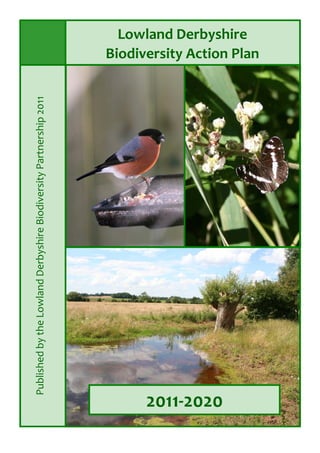
- 2. 2www.derbyshirebiodiversity.org.uk Quick Start Guide Cover photos, clockwise from top left: Bulfinch. Credit: Laura Whitehead White Admiral. Credit: Debbie Alston Green Lane, north‐east Derbyshire. Credit: Debbie Alston Click links to go the various sections of the LBAP Section Quick start Guide Introduction Generic Action Plan Area Action Plans and Targets Action Area 1: Magnesian Limestone Action Area 2: Rother and Doe Lea Valleys Action Area 3: Peak Fringe Action Area 4: Erewash Valley Action Area 5: Claylands Action Area 6: Derby Action Area 7: Trent and Dove Valleys Action Area 8: National Forest area Cumulative Targets UK Priority Habitats—Background Information Farmland Grassland Heathland Wetland Woodland List of Lowland Derbyshire LBAP Partners Appendix 1: Detailed Maps of All Eight Action Areas (with Priority Habitats) these are available as eight 4MB files on CD or from www.derbyshirebiodiversity.org.uk Contents
- 3. 3www.derbyshirebiodiversity.org.uk Quick Start Guide This Local Biodiversity Action Plan (LBAP) covers the Lowland Derbyshire region for the period 2011 to 2020. It identifies the basic actions we must collectively take if we are to protect and enhance the key biodiversity of this region. The UK Government recognises its international obligations and the economic urgency to protect biodiversity and ecosystems. This LBAP is part of that delivery and local reporting mechanism. Only those habitats and species meeting the UKBAP definitions of ‘Priority Habitat’ or ‘Priority Species’ are included in the targets for the Lowland Derbyshire Action Plans. The history and rationale behind the Local Biodiversity Action Plan is given in the Introduction. A Generic Action Plan then outlines a series of Actions applying across all eight subdivisions of this LBAP region, but numerical targets are not included. Lowland Derbyshire is then divided into eight separate Action Areas, each having its own characteristic type of landscape. Each therefore has its own description, plus a distinct list of Actions and measurable Targets for that area. These Action Areas are: Quick Start Guide Each Area Action Plan follows the format below (where ‘x’ is the Area number shown above) x.1 Area Description and map x.2 Vision x.3 Challenges and Opportunities x.4 Key Actions x.5 Key Targets x.6 Current Biodiversity Resources x.7 Achievements to Date A single page summary showing Cumulative Targets for all Action Areas is also provided. Further details on each Priority Habitat in Lowland Derbyshire are given in Background Information. These do not contain actions or targets, but do offer more habitat information and lists of species such as rare or local Red Data Book Species which are of more local significance. An Appendix includes eight Detailed Maps of each Action Area. They include all those Priority Habitats regarded as the most significant, primary features within those landscapes. (Available as a separate download from the Derbyshire Biodiversity website). Species Action Plans have not been included in this document. However, a selected number of action plans for Priority Species will be made available on the Derbyshire Biodiversity website from 2012. Updates to this LBAP will also be available from that site at www.derbyshirebiodiversity.org.uk For those parts of the county outside of Lowland Derbyshire, please refer to the Peak District LBAP, published by the Peak District Biodiversity Partnership. 1. Magnesian Limestone 2. Rother and Doe Lea Valleys 3. Peak Fringe 4. Erewash Valley 5. Claylands 6. Derby 7. Trent and Dove Valleys 8. National Forest area
- 5. 2 Introduction www.derbyshirebiodiversity.org.uk Contents Page 1. What is ‘biodiversity’? 3 1.1 Why is biodiversity important, and why should we conserve it? 3 1.2 Biodiversity Action Plans – history and context 5 1.3 Previous Lowland Derbyshire LBAPs 6 1.4 New thinking to BAP work beyond 2010 8 1.5 Our new approach to the LBAP: Landscape Character Areas 10 14 Table 1: UK Priority Habitats in the LBAP area. 17 Table 2: UK Priority Bryophyte, Fungus and Vascular Plant Species recorded in the LBAP area. 18 Figure 1: LBAP Boundaries 7 Appendix 1: UK Priority Habitats in the LBAP Area 17 2. Structure of the revised LBAP 2.3 How it works 15 2.2 Who is involved? 15 2.1 Monitoring 15 3. References 16 Figure 2: LBAP Action Areas 13 Appendix 2: UK Priority Species in the LBAP Area 18 Table 4: UK Priority Fish Species recorded in the LBAP area. 18 Table 3: UK Priority Amphibian and Reptile Species recorded in the LBAP area. 18 Table 5: UK Priority Bird Species recorded in the LBAP area. 19 Table 6: UK Priority Mammal Species recorded in the LBAP area. 20 Table 7: UK Priority Invertebrates (other than moths) Species recorded in the LBAP area. 20 Table 8: UK Priority Moths Species recorded in the LBAP area. 21 Introduction
- 8. 5 Introduction www.derbyshirebiodiversity.org.uk The final argument for the conservation of biodiversity is an ethical one. Many people would argue that we share the planet with a great many species of plants and animals, and that we have no right to stand idly by whilst they become extinct, largely as a result of our own actions. Others would argue we have a moral duty to ensure that we pass on a healthy, functioning natural environment to future generations, so that they might equally have the opportunity to experience it, and benefit from it themselves. Indeed, the idea that we should ensure we pass on an environment capable of meeting the needs of future generations is a key principle of sustainable development. It is quite apparent from all the above that conservation of biodiversity is not a luxury; it is essential. The air we breathe, the water we drink, the food we eat, and the products we use on a daily basis all depend on biodiversity, and biodiversity is therefore critical to our own continued survival as a species. Our quality of life and our physical and mental wellbeing also benefit hugely from biodiversity, and we have a duty to conserve wildlife for its own sake, for ours and for future generations. The conservation of biodiversity is not just the partnership’s concern, but everyone’s. We need to work together to ensure we have a healthy and biodiverse natural environment, with functioning ecosystems and natural processes, for now and forever. 1.2 Biodiversity Action Plans – history and context In June 1992, the United Nations Conference on Environment and Development (UNCED), was held in Rio de Janeiro. The conference became known as the Rio Summit or the Earth Summit. Its participants, including 172 governments, considered a wide variety of environmental issues such as energy, fossil fuels and climate change, waste and pollution, water scarcity and biodiversity. The conference resulted in 159 governments signing the Convention on Biological Diversity. Within a year this number had grown to 168 signatories. By 2011, of all the 192 UN member States, only the USA and Andorra had still not ratified that Convention. The Convention on Biological Diversity (also known as the CBD or the Biodiversity convention) is a legally binding treaty which provides a world‐wide framework for biodiversity conservation. The CBD came into force on 29th December 1993. It has three main goals: • the conservation of biological diversity • the sustainable use of its components • the fair and equitable sharing of the benefits from the use of genetic resources In order to achieve these goals, the CBD called for the creation and enforcement of national strategies and action plans to conserve, protect and enhance biological diversity. In response to the Convention of Biological Diversity, in 1993 the UK government consulted over 300 organisations throughout the UK and held a two‐day seminar to debate the key issues raised in Rio. The product of this was the launch of ‘Biodiversity: the UK Action Plan’ in 1994, which included action plans and targets for 45 habitats and 391 species. These habitats and species were chosen because they are considered to be either globally threatened, or evidence indicates they are rapidly declining in the UK, i.e. by more than 50% in the last 25 years. This list was revised in 2007 and now includes 65 Priority Habitats and 1,149 Priority Species. Rio de Janeiro Credit Marciofleury
- 10. 7 Introduction www.derbyshirebiodiversity.org.uk 1.3 Previous Lowland Derbyshire LBAPs In 1996 when consideration was first given to achieving LBAP coverage for Derbyshire, there were no clear precedents. It was agreed: • to prepare one LBAP for the Peak District (because of its large proportion of nationally and internationally important habitats); • to prepare an LBAP for the whole National Forest area (to ensure consideration of biodiversity in the Forest’s development); • to prepare an LBAP for the rest of Derbyshire, outside these two areas. In June 1997, Part 1 of the ‘Mid‐Derbyshire LBAP’ was launched, with Part 2 following in March 1998. Part 1 set the context for the Plan and provided Habitat and Species Action Plans for most of Derbyshire’s priority habitats and some species. Part 2 completed that process. The Plan provided Habitat Action Plans (HAPs) for every habitat in the area it covered. By 2001 however, it became accepted that the National Forest LBAP was primarily a sectoral LBAP, providing priorities for the work of the National Forest Company and its primary partner, the Forestry Commission. As a result it was agreed by all relevant parties that the county LBAP should be extended to include that part of the National Forest area within Derbyshire, and that the name should be changed to the ‘Lowland Derbyshire LBAP’, reflecting its coverage of the whole of the lowland part of the county (see Figure 1). The National Forest LBAP remains in place, however, guiding the work of the National Forest Company. The Peak District LBAP covers the area encompassed by the White Peak, Dark Peak and South West Peak areas, both inside and outside the Peak District National Park. In 2004 the Lowland Derbyshire Biodiversity Partnership employed its first co‐ordinator. Her role was to revise the various habitat and species action plans and monitor the work of the partnership against the local targets. By 2008 the Lowland Derbyshire BAP Project Officer had produced a Delivery Plan, assessing progress to date against the targets set in the original BAP and identifying the work required to achieve the remaining targets by 2010. The existing LBAP and the associated targets were all set to expire at the end of 2010. It was therefore necessary to review progress against the BAP again in 2010, and the decision was then made to develop a completely new LBAP for Lowland Derbyshire, taking us through from 2011 to 2020 (i.e. this document).
- 14. 11 Introduction www.derbyshirebiodiversity.org.uk In many ways, these concepts are not new. We have long sought to improve the quality of existing habitats, to create new habitats and extend existing ones, and to increase their connectivity. In recent years, the focus has begun to shift away from site‐based conservation and towards the landscape‐ scale approach. This is the step change we need. Landscape‐scale conservation is about building very large functioning networks of habitats, which incorporate existing high quality sites and extend, buffer and interconnect them with new habitats to produce robust ecosystems, capable of supporting natural processes as well as sustainable populations of dependent species. The approach should provide a resilient natural environment, capable of delivering ecosystem services and the other functions that we rely upon, whilst also supporting biodiversity. Landscape‐scale conservation should also provide habitats which are resilient to climate change, which allow species to adapt to the impacts of climate change, and which provide services that protect us from the effects of climate change. Because of these benefits, it is likely that landscape‐scale conservation will become an increasingly important approach to biodiversity conservation during the 2011‐2020 LBAP plan period. At a national level, effort and funding is already being targeted at landscape‐scale delivery. In 2010, Natural England began promoting the idea of landscape‐scale conservation, firstly through the identification of IBDAs – Integrated Biodiversity Delivery Areas ‐ large areas of land in which species conservation with habitat management can be delivered though partnership working, integrating other environmental, social and economic agendas. Landscape‐scale conservation is also being brought to the fore in the strategies of national and local bodies. Examples include the RSPB’s Futurescapes initiative, or the Wildlife Trust’s Living Landscapes Schemes, as well as in the preparation of funding bids for landscape‐scale conservation within Derbyshire. In June 2011, the Government launched The Natural Environment White Paper, ‘The Natural Choice: securing the value of nature’. The White Paper outlines the Government’s vision for our natural environment over the next 50 years, and it included proposals for a number of new initiatives, including: • Local Nature Partnerships (LNPs) ‐ strategic partnerships of organisations that work to create a shared vision for their area and deliver better, more integrated environmental outcomes • Nature Improvement Areas (NIAs) ‐ large, landscape scale areas (between 10‐50,000 hectares) that offer opportunities to secure and enhance the benefits of the natural environment In August 2011, Defra also launched the new England Biodiversity Strategy ‘Biodiversity 2020: A strategy for England’s wildlife and ecosystem services’. It is likely that both of these documents will be central to biodiversity delivery at both the national and local level throughout the period of this LBAP plan.
- 16. 13 Introduction www.derbyshirebiodiversity.org.uk In developing the new Lowland Derbyshire Biodiversity Action Plan, it was quickly recognised that our plan needed to reflect the emerging trends towards landscape‐scale conservation. In particular, it was noted that landscape characterisation, which includes an assessment of habitats and biodiversity assets, would provide a useful tool in the development of the LBAP. As work progressed, it became apparent that much of our habitat and species data correlated very strongly with Landscape Character Areas, and it was decided that landscape character assessment work would be integrated into the LBAP. In particular, it was decided that within the LBAP, the county could be subdivided into different character areas, recognising the occurrence of habitats and species in those areas, and the different approaches to conservation that might be required. The reasons for this are multiple: • Emerging approaches in biodiversity are increasingly recognising the need to work at the landscape scale. • Existing landscape characterisation work provides an established mechanism for dividing large areas such as counties into smaller units on the basis of their environmental character. • Landscape character assessment includes biodiversity interests in the underlying assessment methodology, and biodiversity assets strongly correlate with landscape character types. • Landscape character assessment methodologies are recognised and accepted nationally, and fit neatly into characterisation work completed at the national level • Landscape character areas include a suite of habitats, which are broadly defined by the same environmental and anthropogenic influences. In effect these are functional, recognisable ecosystems. • As the occurrence of habitats and species differs from area to area, habitat and species conservation action can be targeted at those areas in which those habitats and species are currently, or were formerly found. • Targets can be set for each area, ensuring that conservation actions are appropriate for the environmental conditions and character of that area • By defining geographical areas of similar environmental character, it is hoped that local conservation groups, parish councils and landowners will be better able to engage with the LBAP by joining their local area group. In turn, they will be able to liaise with, cooperate with and learn from each other, as each group will most likely be working with similar habitats and species, under similar conditions • Many other LBAPS are also developing their new action plans on the basis of landscape characterisation; this will allow biodiversity action to extend across administrative boundaries, following more natural landscape type boundaries • By recognising the unique environmental and biodiversity characteristics of each area, and working towards common aims for them, it will be possible to add value to each others work, producing functioning environments of interconnected habitats characteristic of that area – true landscape‐scale delivery • This approach should support funding bids, demonstrating that the actions of a group, landowner or project contribute to the specific targets for that area, and contribute to landscape‐scale delivery. It should be recognised that the use of landscape characterisation in the development of LBAPs is not new in Derbyshire. The existing boundary between the Lowland Derbyshire and Peak District LBAPs is defined according to National Character Areas, rather than administrative boundaries.
- 17. 14 Introduction www.derbyshirebiodiversity.org.uk For practical reasons, the eight Action Areas set out in this new Lowland Derbyshire Biodiversity Action Plan are drawn from the regional landscape characterisation work. For our purposes they function at a more suitable geographic scale. They are more detailed than national landscape types, yet less numerous than Derbyshire’s own Landscape Character Types. The LBAP Action Areas defined here follow the regional divisions, but with three notable exceptions: • Derby ‐ Built up areas, including cities such as Derby, are excluded from landscape character assessment work, although the urban area of Derby is surrounded by four different landscape character types. As Derby city has a unitary local authority and a city‐wide ‘WildDerby’ project that delivers effective biodiversity results across the area, it was logical to identify Derby as a separate Action Area that follows the city’s administrative boundary. • The Action Areas of Erewash Valley and The Rother& Doe Lea Valleys have been created as two separate entities from one larger Regional Landscape Unit (the Settled Coalfield Farmlands), despite having very similar landscape characteristics. They have simply been divided along the watershed between the southerly‐flowing Erewash and the northerly‐flowing Rother and Doe Lea rivers. • The National Forest area as defined here is an LBAP Action Area consisting of three small segments of three much larger and very different regional landscape units. These are the Wooded Village Farmlands, the Settled Coalfield Farmlands, and the Village Farmlands. For practical reasons they have been brought together into one Action Area here. Note, also, that the National Forest Development Agency does have its own operations‐wide biodiversity action plan, and that that their plan cuts across a much larger area, covering Staffordshire, Derbyshire and Leicestershire. The Action Areas defined in this LBAP are shown in Figure 2. True distribution of the Regional Landscape Units in Lowland Derby‐ shire which have since been simplified into eight Action Areas for use in this LBAP document. * Crown copyright database rights 2011. Ordnance Survey 100023251
- 20. 17 Introduction www.derbyshirebiodiversity.org.uk Section Contents Frequency of review Introduction LBAP overview Unlikely to be reviewed in plan period Generic Action Plan Actions applying to the entire LBAP area May have a mid–term review in 2015 Overview of LBAP Targets Summary of all targets May have a mid–term review in 2015 Area Action Plans (8 in total one per area) Area Action Plan, map, background Information, targets and achievements. Achievements updated annually. Priority Habitat Background Information Further information for reference Only if new information becomes available. Species Documents and associated actions Action plans for individual species. (Available online from 2012) Species plans to be added piecemeal. List of LBAP Partners Partners signed up to the LBAP and agreeing to take part in partnership activities Whenever main list of partners is updated 2.1 Monitoring It is hoped this new LBAP structure will enable partners to record their work more easily , report on their activities and to feed back to their area group on the work they have done. Just as before, it is envisaged that the Lowland Derbyshire Biodiversity Project Officer post will coordinate reporting, collecting and collating data, monitoring progress against targets and providing performance data to the UK Biodiversity Action Plan through ‘BARS’, the Biodiversity Action Reporting System. Biodiversity delivery will be recorded spatially on a digital mapping system by the Biodiversity Project Officer and the Local Record Centre Partnership. This allows achievements and opportunities to be viewed at a landscape scale. Each of the area action plans ends with an ‘Achievements to Date’ page which will be updated annually and will monitor the progress towards all area targets. To do this we need clear feedback from all partners in order to accurately monitor and report on our achievements and combined efforts. All updates to these documents will be done online. Please refer to the Derbyshire Biodiversity website to ensure you are using the most up‐to‐date documents. See Appendix 1 and 2 in this Introduction for tables of UK Priority Habitats and Species recorded in the LBAP area .
- 23. 20 Introduction www.derbyshirebiodiversity.org.uk 1 2 3 4 5 6 7 8 ML RD PF EV CL DE TD NF Arable Field margins √√√ √√ √ √√ √√ √ √√√ √√ Calaminarian grassland √ Coastal and Floodplain grazing marsh √ √√√ √√√ √√√ √√ √√√ √√√ √√ Hedgerows √√√ √√√ √√√ √√√ √√√ √√ √√ √√√ Inland Rock outcrop and scree habitats √ √ √ √ Lowland calcareous grassland √√√ √ √ √ √ √ Lowland mixed deciduous woodland √√√ √√√ √√√ √√√ √√ √√√ √√ √√√ Lowland dry acid grassland √ √ √√√ √ √√ √ √ √√ Lowland Fens √ √ √ Lowland heathlands √ √√ √ √ √ Lowland meadows √√ √√√ √√√ √√√ √√√ √√ √√√ √√√ Mesotrophic lakes √√ √√√ √√ √√√ √√ √ √√√ √√√ Open mosaic habitats on previously developed land √ √ √ √ √ √ √ √ Ponds √√ √√√ √√ √√√ √√√ √√√ √√√ √√√ Reedbeds √√ √ √√ √√√ √ Rivers √ √√√ √√√ √√√ √ √√√ √√√ √√ Traditional Orchards √ √ √ √ √ √ √ √ Wet woodland √ √√√ √ √√√ √√ √√ √√√ √√√ Wood pasture & Parkland (including Veteran Trees) √√ √ √√ √√ √√√ √√√ √ √√√ Priority habitat Appendix 1: UK Priority Habitats in the LBAP Area Table 1 shows which UK Priority Habitats which have been recorded in the Lowland Derbyshire Biodiversity Action Plan region and in which of the eight Action Areas they occur. 1) ML—Magnesian Limestone area 5) CL—Claylands area 2) RD—River Rother and Doe Lea Valleys area 6) DE—Derby area 3) PF—Peak Fringe area 7) TD—Trent and Dove Valleys area 4) EV—Erewash Valley area 8) NF—National Forest area Table 1: UK Priority Habitats in the LBAP area. √√√ ‐ Primary √√ ‐ Secondary √ ‐ Localised
- 24. 21 Introduction www.derbyshirebiodiversity.org.uk Type 1 2 3 4 5 6 7 8 ML RD PF EV CL DE TD NF Fish Atlantic Salmon √ √ Brown trout √ √ √ Eel √ √ √ √ English Name Type 1 2 3 4 5 6 7 8 ML RD PF EV CL DE TD NF Amphibians Great crested newt √ √ √ √ √ √ √ √ Common toad √ √ √ √ √ √ √ √ Reptiles Adder √ √ Common lizard √ √ √ √ √ √ √ √ Grass snake √ √ √ √ √ √ √ √ Slow worm √ √ √ √ √ √ √ √ English Name Type English Name 1 2 3 4 5 6 7 8 ML RD PF EV CL DE TD NF Mosses Sausage‐beard moss √ Flamingo moss √ Fungi Oak polypore √ √ Grass‐wrack Pondweed √ Tubular Water Dropwort √ √ Vascular Plants Appendix 2: UK Priority Species in the LBAP Area Tables 2‐8 show the UK priority species which have been recorded in the Lowland Derbyshire Biodiversity Action Plan area since 2000 and in which Action Areas they can be found. (This is based upon the best information available to date, and is liable to being updated) 1) ML—Magnesian Limestone area 5) CL—Claylands area 2) RD—River Rother and Doe Lea Valleys area 6) DE—Derby area 3) PF—Peak Fringe area 7) TD—Trent and Dove Valleys area 4) EV—Erewash Valley area 8) NF—National Forest area √ ‐ recorded in the area (√) ‐ unconfirmed Table 2: UK Priority Bryophyte, Fungus and Vascular Plant Species recorded in this LBAP area. Table 3: UK Priority Amphibian and Reptile Species recorded in this LBAP area. Table 4: UK Priority Fish Species recorded in this LBAP area.
- 25. 22 Introduction www.derbyshirebiodiversity.org.uk Type English Name 1 2 3 4 5 6 7 8 ML RD PF EV CL DE TD NF Birds Bullfinch √ √ √ √ √ √ √ √ Corn bunting 1 √ √ √ √ √ √ √ Cuckoo 2 √ √ √ √ √ √ √ Curlew √ √ √ √ √ √ √ Dunnock √ √ √ √ √ √ √ √ Grasshopper warbler √ √ √ √ √ √ √ Grey partridge √ √ √ √ √ √ √ √ Hawfinch √ √ √ √ √ √ Herring Gull 3 √ √ √ √ √ √ √ √ House sparrow √ √ √ √ √ √ √ √ Lapwing √ √ √ √ √ √ √ √ Lesser Redpoll √ √ √ √ √ √ Lesser spotted woodpecker √ √ √ √ √ √ √ √ Linnet √ √ √ √ √ √ √ √ Marsh tit √ √ √ √ √ √ √ √ Reed bunting √ √ √ √ √ √ √ √ Skylark √ √ √ √ √ √ √ √ Song thrush √ √ √ √ √ √ √ √ Spotted flycatcher √ √ √ √ √ √ √ √ Starling √ √ √ √ √ √ √ √ Tree pipit √ √ √ √ √ √ √ √ Tree sparrow √ √ √ √ √ √ √ √ Turtle dove √ √ √ √ √ √ √ Twite 4 √ √ √ √ Willow tit √ √ √ √ √ √ √ √ Wood Warbler √ √ √ √ √ √ √ Yellowhammer √ √ √ √ √ √ √ √ Yellow wagtail √ √ √ √ √ √ √ √ Table 5: UK Priority Bird Species recorded in this LBAP area (not necessarily breeding) 1 Corn bunting: now an infrequent breeder 2 Cuckoo: declining breeder 3 Herring Gull: not breeding 4 Twite: only breeds in Peak LBAP area.
- 26. 23 Introduction www.derbyshirebiodiversity.org.uk Type 1 2 3 4 5 6 7 8 ML RD PF EV CL DE TD NF Ants Shining guest ant √ Beetles Necklace ground beetle √ Butterflies Dingy skipper √ √ √ √ √ √ Grizzled skipper √ √ Small heath √ √ √ √ √ √ Wall √ √ √ √ √ √ √ White admiral √ White letter hairstreak √ √ √ √ √ √ √ √ Crustaceans White‐clawed crayfish √ √ √ √ √ √ English Name Type English Name 1 2 3 4 5 6 7 8 ML RD PF EV CL DE TD NF Mammals Brown hare √ √ √ √ √ √ √ √ Brown long‐eared bat √ √ √ √ √ √ √ √ Dormouse √ Harvest mouse √ √ √ √ √ √ √ √ Hedgehog √ √ √ √ √ √ √ √ Noctule √ √ √ √ √ √ √ √ Otter √ √ √ √ √ Pine martin (√) Polecat √ √ √ √ √ √ √ Soprano pipistrelle √ √ √ √ √ √ √ √ Water vole √ √ √ √ √ √ √ √ Table 6: UK Priority Mammal Species recorded in this LBAP area. Table 7: UK Priority Invertebrates (other than moths) Species recorded in the LBAP area.
- 27. 24 Introduction www.derbyshirebiodiversity.org.uk Type English Name 1 2 3 4 5 6 7 8 ML RD PF EV CL DE TD NF Moths Argent and sable √ √ August thorn √ √ Autumnal rustic √ √ √ √ Beaded chestnut √ √ √ √ √ √ √ √ Blood‐vein √ √ √ √ √ √ √ √ Brindled beauty √ √ √ √ √ √ √ √ Broom moth √ √ √ √ √ √ √ Brown‐spot pinion √ √ √ √ √ √ Buff ermine √ √ √ √ √ √ √ √ Centre‐barred sallow √ √ √ √ √ √ √ √ Dark spinach √ √ Dark‐barred twin‐spot carpet √ √ Deep‐brown dart √ √ √ √ √ √ Dot moth √ √ √ √ √ √ √ √ Double dart √ √ √ Dusky brocade √ √ √ √ √ √ √ √ Dusky thorn √ √ √ √ √ √ √ Dusky‐lemon sallow √ √ √ Ear moth √ Feathered gothic √ √ √ Figure of eight √ √ √ Flounced chestnut √ √ √ Forester √ Garden dart √ √ √ √ √ Garden tiger √ √ √ √ √ √ Ghost moth √ √ √ √ √ √ √ √ Grass rivulet √ √ Green‐brindled crescent √ √ √ √ √ √ √ √ Grey dagger √ √ √ √ √ √ Heath rustic √ Knot grass √ √ √ √ √ Large nutmeg √ Latticed heath √ √ √ √ √ √ √ √ Minor shoulder‐knot √ √ √ Mottled rustic √ √ √ √ √ √ Table 8: UK Priority Moths Species recorded in this LBAP area.
- 28. 25 Introduction www.derbyshirebiodiversity.org.uk Type English Name 1 2 3 4 5 6 7 8 ML RD PF EV CL DE TD NF Moths Mouse moth √ √ √ √ √ √ √ √ Oak hook‐tip √ √ √ √ √ √ √ Oblique carpet √ Pale eggar √ √ Powdered quaker √ √ √ √ √ √ √ Pretty chalk carpet √ Rosy minor √ √ √ √ √ √ √ Rosy rustic √ √ √ √ √ √ √ √ September thorn √ √ Shaded broad‐bar √ √ √ √ √ √ √ √ Shoulder‐striped wainscot √ √ √ √ √ √ √ √ Small emerald √ √ √ √ Small phoenix √ √ √ √ √ √ √ √ Small square‐spot √ √ √ √ √ √ √ √ The cinnabar √ √ √ √ √ √ √ √ The crescent √ √ The rustic √ √ √ √ √ √ √ The sallow √ √ √ √ √ √ √ The spinach √ √ √ √ √ √ The sprawler √ The streak √ √ White ermine √ √ √ √ √ √ √ √ White‐spotted pinion √ Table 8 (cont.): UK Priority Moths Species recorded in this LBAP area.
- 33. 5 Generic Action Plan www.derbyshirebiodiversity.org.uk Table 1: The table below provides information on the contributions made by each type of LBAP partner towards the Generic Actions and Area Targets. Key √ ‐ Partner usually carries out this function. (√) ‐ Partner and non‐partners may carry out this function if their skills and interests allow. Partner Surveying & recording Site management (including management, restoration and creation) Land manage‐ ment advice Planning advice/ responsibility/ commenting on applications Working with volunteers Grant aiding Education & awareness raising BTCV √ √ √ √ Businesses √ √ √ Derbyshire Constabulary √ √ Derbyshire Wildlife Trust √ √ √ √ √ √ Developers (√ ) (√ ) (√ ) Ecological Consultancies (√ ) (√ ) (√ ) Environment Agency √ √ √ √ Forestry Commission √ √ √ √ √ √ √ Farming and Wildlife Advice Group (FWAG) √ √ √ Groundwork Derby & Derbyshire; Groundwork Creswell, Ashfield and Mansfield √ √ √ √ √ Highways Agency √ √ √ Individuals (√ ) (√ ) (gardens) Landowners and Tenant Farmers (√ ) √ (√ ) (√ ) Local community groups and ‘Friends of Groups’ √ √ (√ ) (√) √ √ Local Authorities √ √ √ √ √ √ √
- 34. 6 Generic Action Plan www.derbyshirebiodiversity.org.uk Partner Surveying & recording Site management (including management, restoration and creation) Land manage‐ ment advice Planning advice/ responsibility/ commenting on applications Working with volunteers Grant aiding Education & awareness raising Parish and Town Councils (√ ) (√ ) (√ ) (√ ) (√ ) RSPB √ √ √ √ √ Schools, Colleges and Universities (√ ) (√ ) (√ ) (√ ) Special Interest Groups (including county recorders, recording groups and national/ local specialists √ (√ ) (√ ) (√ ) Severn Trent Water √ √ √ Small Woods Association √ √ Woodland Trust √ √ √ √ Natural England √ √ √ √ √ √ √ National Trust √ √ √ √ √ National Forest Company √ √ √ √ √ √ √ National Farmers Union √ √ Mineral Companies √ √ √ √ Lowland Derbyshire Biodiversity Partnership co‐ ordinator √ √
- 36. www.derbyshirebiodiversity.org.uk “For me, the real truth, the real truth about wildlife is as much as that wildlife depends upon us, we depend upon it. And therefore I think we’ve got to get it right, and we ought to do it now.” Chris Packham, ‘The Truth About Wildlife’ Series, BBC, 2011
- 38. Magnesian Limestone Area Action Plan www.derbyshirebiodiversity.org.uk Magnesian Limestone Area Contents Map of Magnesian Limestone Action Area 1.1 Area Description 1.2 Vision 1.3 The Challenges and Opportunities 1.3.1 Existing initiatives and projects 1.3.2 Main landowning bodies 1.3.3 Key Sites 1.4 Key Actions for Magnesian Limestone Area 1.5 Key Targets for Magnesian Limestone Area 1.5.1 Targets for UK BAP Priority Habitats (with Target Table 1.1) 1.5.2 Targets for UK BAP Priority Species (with Target Table 1.2) 1.6 Appendix 1: Current Biodiversity Resources 1.6.1 UK BAP Priority Habitat Resources 1.6.2 UK BAP Priority Species Resources (with Species List Table 1.3) 1.6.3 Organisational and Manpower Resources 1.7 Appendix 2: Achievements to Date
- 40. Action Area 1: Magnesian Limestone Page 2 of 14 Updated: Nov 2011 The area includes two Sites of Special Scientific Interest (SSSIs) and parts of two further SSSIs, one Local Nature Reserve, 12 RIGS, 47 Local Wildlife Sites and a number of potential Local Wildlife Sites. The Magnesian Limestone area comprises two Derbyshire Landscape Character Types: • Limestone Farmlands • Limestone Gorges Use the Derbyshire County Council online mapping system to view Landscape Character Types within this Lowland Derbyshire LBAP area. www.derbyshire.gov.uk/maps This Action Area includes the settlements of Whitwell, Clowne, Creswell, Bolsover, Shirebrook and Pleasley 1.2 Vision A managed and connected landscape where a network of hedgerows and associated field margins link fragments of calcareous grassland, woodland and other semi‐natural habitats. 1.3 The Challenges and Opportunities This Action Area is the only part of the Lowland Derbyshire LBAP area where magnesian limestone grassland can be found. It makes up 63% of the overall lowland calcareous grassland resource. What remains is fragmented and outside of the agri‐environmental schemes, whilst main partners’ ownership is largely unmanaged. Opportunities for expansion, restoration and management are limited to sites with suitable soils, but Greenway development and restoration work at Whitwell do provide significant opportunities. This area is predominately an agricultural landscape, dominated by arable fields which are mostly separated by over‐managed, gappy hedgerows. These are poorly connected because many have been lost as fields have been expanded, and there is considerable opportunity for reconnections to be made. Associated with this, the area has experienced a gradual decline in its farmland bird populations. There is a significant opportunity to help reduce this decline by encouraging landowners to include arable field margin options in Entry Level Scheme applications. Coverage of Entry Level Scheme in the area is reasonable, but there are some significant gaps where take‐up of the scheme is poor. Use of living bird tables outside Entry Level Schemes and Higher Level Schemes is an opportunity. Landownership within the area is dominated by a handful of owners, mainly Chatsworth, Welbeck and National Trust estates. Tenant farmers are supported when applying for agri‐environmental schemes. A number of biodiversity‐ related projects in this area will contribute towards the achievements of the Targets and with the engagement of local people in the landscape.
- 42. Action Area 1: Magnesian Limestone Page 4 of 14 Updated: Nov 2011 The Bolsover Greenprint is a mini‐biodiversity action plan for the District of Bolsover. It has actions and targets relating to the entire District, only part of which lies within this Action Area. 1.3.2 Main landowning bodies There are relatively few landowners within the area. The majority of the farmland is owned by Chatsworth and Welbeck estates, which they tenant out. They also own significant woodland sites. Major current mineral extraction sites are owned by Lafarge and Tarmac. The National Trust has an estate, which is larger than just Hardwick Park. Derbyshire County Council owns and manages a number of large former reclamation sites and the trails network. The Forestry Commission manages two very large woodlands, Pleasley Park and Whitwell Wood. 1.3.3 Key Sites The key sites in Magnesian Limestone Action Area are: • SSSIs: Creswell Crags SSSI, Hollinhill and Markland Grips SSSI • LNRs: Pleasley Pit Country Park LNR, Rowthorne Trail LNR • Others: Bolsover Moor Quarry, Hardwick Hall, Pleasley Park and Vale, Phoenix Trails network, Poulter Country Park, Scarcliffe Park, Steetley Quarry, Whitwell Quarry, Whitwell Wood and Wollen Meadow. Pleasley Pit Country Park LNR. Credit: Debbie Alston
- 43. Action Area 1: Magnesian Limestone Page 5 of 14 Updated: Nov 2011 1.4 KEY ACTIONS for the Magnesian Limestone area. 1. The primary habitat objective within the area is the maintenance, restoration and expansion of calcareous grassland, woodland and arable habitats to achieve targets in Table 1.1. 2. The secondary objective is to increase connectivity of semi‐natural habitats to create larger habitat complexes using priority habitats, such as hedgerows wherever possible. To achieve this will require the creation of completely new habitats to link and extend existing networks. 3. Target renewing Entry Level Stewardship agreement holders to include appropriate actions for farmland birds. 4. Research and implement the creation of a white‐clawed crayfish ark site. Full targets for all Priority Habitats and Species are listed in Tables 1.1 and 1.2 All actions listed in the separate Generic Action Plan also apply to this area.
- 44. Action Area 1: Magnesian Limestone Page 6 of 14 Updated: Nov 2011 1.5 KEY TARGETS for the Magnesian Limestone area. 1.5.1 Targets for UK BAP PRIORITY HABITATS Table 1.1 below lists the specific habitat targets for the Magnesian Limestone area. The requirements of UK BAP reporting mean that our own LBAP targets need to be presented as cumulative figures. The meaning of each column is explained below the table. See Maps section for the distribution of primary habitat features within this Action Area. Table 1.1 Targets for the Magnesian Limestone Action Area 2011‐2020. Targets for 2011‐2020 UK BAP Priority Habitat (1) Current Extent at 2011 (i.e. Maintenance* Target to 2020) (2) Manage* (3) Restore* (4) Expand* Primary feature: Lowland mixed deciduous woodland 900 ha 800 ha n/a 30 ha Lowland calcareous grassland 31 ha 25 ha 35 ha 20 ha Hedgerows unknown An additional 10km n/a 10 km Field margins unknown 60 ha# Secondary feature: Wood‐pastures and Parkland 2 sites 2 sites 1 site n/a Lowland meadow 4 ha 4 ha 50 ha 2 ha Localised feature: Traditional orchard 17 sites 5 sites n/a 2 sites Ponds >90 ponds 40 ponds 5 ponds 5 ponds Mire and Fen 3.1 ha 3.1 n/a n/a Open mosaic habitats Unknown ∞
- 45. Action Area 1: Magnesian Limestone Page 7 of 14 Updated: Nov 2011 * Table explanation: Terminology and measurements are the same as those used in the UK Biodiversity Action Plan (UK BAP). These are: (1) ‘Maintenance’–this is the current 2011 resource of each Priority Habitat, irrespective of condition and management that we must, at the very least, keep and carry forward into the next plan period after 2020. (i.e. no net loss.) (2) ‘Manage’ – The amount of Priority Habitat in (1) that we want to be under appropriate management to maintain in ‘favourable’ condition. This is a cumulative target, continuing on from the previous plan period. (3) ‘Restore’ – Habitat which is not in a ‘favourable’ condition, but which is under restorative management to bring it up to that condition. This is a cumulative target, continuing on from the previous plan period. (4) ‘Expand’ – New habitat created from scratch. This could be on a new site or an extension to an existing one. The target is for this Plan Period, though some habitats, such as woodland, take far longer to fully develop. Notes to accompany Table 1.1 Grassland habitat creation should also be targeted where the underlying ground conditions are suitable and it links existing habitats. Woodland creation should be appropriate and in accordance with the recommendations in the Landscape Character of Derbyshire, linking existing sites wherever possible. Hedgerow restoration and creation work should be targeted along existing networks such as main roads, historic boundaries and green lanes where they are fragmented. Due to the free‐draining nature of this area, wetland creation is not suitable everywhere, so pond creation is likely to be associated with suburban situations and areas such as schools. # For field margins it is not possible to set separate targets for management, restoration or expansion. A single overall target for simply increasing this resource is provided. Figures can only be based on Entry Level Stewardship monitoring. Further habitat may also be provided through Living Bird Table initiatives ∞ Open mosaic habitats the distribution of this habitat is not well understood at the start of this Plan Period (see Generic Action Plan). Its presence is, however, important in this area. It should be maintained in situ wherever possible, especially where it contributes to a wider network linking key habitats.
- 46. Action Area 1: Magnesian Limestone Page 8 of 14 Updated: Nov 2011 1.5.2 Targets for UK BAP PRIORITY SPECIES There are 76 UK BAP Priority Species recorded within the Magnesian Limestone Action Area since 2000. The distribution and status of many of these species is not currently well known, and consequently it is not possible to set meaningful targets for them. However, there are other species about which we do know enough to be able to set targets, monitor and assess their success. These are shown below in Table 1.2 The full list of UK BAP Species for the Magnesian Limestone area is given in Table 1.3 (see Section 1.6.2) Table 1.2 Targets for UK BAP Species within the Magnesian Limestone Action Area. Dingy skippers are relatively common in this area and have been recorded in ten grid squares (10 x 1 km2 ) since 2000. These records are almost exclusively confined to short and developing grassland on former reclamation sites. Work has been carried out by Butterfly Conservation to enhance these sites to create optimal conditions for these butterflies. Target: Increase range by one 1 km2 by appropriate habitat enhancement. Flamingo moss has been recorded in just one grid square (1 x 1 km2 ). This population, at Steetley Quarry, is potentially under threat from development. Target: Maintain range by appropriate habitat protection. Great‐crested newts have been recorded in three grid squares (3 x 1 km2 ) since 1990. One, at Steetley Quarry, is potentially under threat from development. Target: Maintain range by appropriate habitat protection. UK BAP Priority Species Range targets to 2020 (1km2 ) Range expansion targets 2011‐2020 (1km2 ) Method of expansion Dingy Skipper 10 1 Appropriate habitat enhancement Flamingo moss 1 n/a n/a Great crested newt 3 n/a n/a Grizzled Skipper 2 1 Appropriate habitat enhancement Water Vole 5 n/a n/a White‐clawed crayfish 0 1 Creation of 1 ark site White‐ letter Hairstreak 20 2 Appropriate habitat enhancement