DSD-INT 2017 Connecting ecology and water allocation - Chrzanowski
•
1 recomendación•1,660 vistas

Presentation by Clara Chrzanowski (Deltares) at the River Basin Planning and Modelling symposium, during Delft Software Days - Edition 2017. Wednesday, 25 October 2017, Delft.

Recomendados
Recomendados
Más contenido relacionado
La actualidad más candente
La actualidad más candente (20)
Similar a DSD-INT 2017 Connecting ecology and water allocation - Chrzanowski
Similar a DSD-INT 2017 Connecting ecology and water allocation - Chrzanowski (20)
Más de Deltares
Más de Deltares (20)
Último
Último (20)
DSD-INT 2017 Connecting ecology and water allocation - Chrzanowski
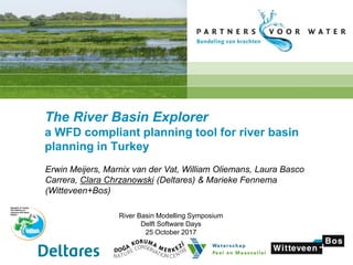
- 1. The River Basin Explorer a WFD compliant planning tool for river basin planning in Turkey Erwin Meijers, Marnix van der Vat, William Oliemans, Laura Basco Carrera, Clara Chrzanowski (Deltares) & Marieke Fennema (Witteveen+Bos) River Basin Modelling Symposium Delft Software Days 25 October 2017
- 2. Table of contents • Objectives • Modelling Framework • Hydrology • Water Quality • Ecology • Büyük Menderes and the water challenges • Modelling results • Stakeholder consultation • Lessons Learned
- 3. Main objectives of the project Development and tailoring of a EU-compliant tool to: • Assist in determining the good chemical and ecological status / potential of water bodies. • Play a key role in identifying, quantifying and prioritizing the most cost effective measures to meet the objectives of the Water Framework Directive • Stimulate the communication with stakeholders • Encourage uniformity in the data that is being used • Facilitate reporting to the EC
- 4. Workflow of modelling activities 0D-RIBASIM GIS maps Networks Meteo Flow Hydrology Ecology Species EQR EKF Ecological knowledge rules Product-unit Neural Networks WFD-Explorer Loads Substances Processes Water Quality WFD Explorer schematization
- 6. Water Quality Inputs River flows Diffuse Emissions Point Source Emissions Output Concentrations of substances
- 7. Ecology Inputs Modifications (Embankments; meandering) Concentrations of substances Artifical flow regime (Dams/ obstruction; dam operation, irrigation abstraction) Output
- 8. RB-Explorer: interactive tool An interactive tool for selecting measures How does it work ? This will help just enough, the Explorer shows Now this measure
- 9. Büyük Menderes river: 584 km Annual average flow: 63.28 m3 /s Number of dams: 15 Basin Area: 25 000 km2 Population: 2.4 million Key Features Büyük Menderes
- 10. Büyük Menderes challenges E. MeijersE. Meijers Water body classes Artificial Heavily modified Natural E. Meijers E. Meijers INDUSTRIESLargeherds.co.nzAGRICULTURE RESERVOIRSE. Meijers
- 11. Workflow of modelling activities 0D-RIBASIM GIS maps Networks Meteo Flow Hydrology Ecology Species EQR EKF Ecological knowledge rules Product-unit Neural Networks WFD-Explorer Loads Substances Processes Water Quality WFD Explorer schematization
- 12. Objective of use of RIBASIM in this project To prepare the hydrological input for the WFD-Explorer: • Flow through all the water bodies • In a dry, a wet and a normal year • On a quarterly basis Used in WFD - Explorer: • To calculate transport of pollutants • To assess difference between natural and artificial flow regime
- 13. Approach to derive flows from monitoring data Observed discharges in upstream monitoring stations not influenced by reservoirs and abstractions A time series of monthly runoff depths (mm/month) is derived Are assigned to sub-catchments and corrected for the difference in catchment area
- 14. RIBASIM model • Period from October 2003 until September 2011 • Time step one month • Calculation for actual situation and natural flow regime (without dams and water use) • Assumed each reservoir only supplies the nearest downstream irrigation area (no coordination) • Results presented as graphs of monthly and quarterly flows • Initial use of 4 stations • End result: 7 stations
- 15. Results RIBASIM – station E07A012
- 16. Results RIBASIM – station E07A012 • Flow in Buyuk Menderes downstream of Cindere Reservoir is dictated by irrigation water demand • Timing of the peak flow has been changed from winter in the natural situation to summer for the current situation due to high irrigation water demand • Comparison with the natural flow regime shows that peak flows are reduced significantly monthly quarterly
- 17. Results RIBASIM – station E07A006
- 18. Results RIBASIM – station E07A006 • Most downstream monitoring station with data for a number of years • Low flows 2004 and 2005 underestimated • Peak in 2006 overestimated • Most likely from limited information on reservoir operation rules and generation of hydropower • Natural flow much higher, especially during peak flow monthly quarterly
- 19. Conclusions • RIBASIM model results are adequate for use in WFD - Explorer • Monthly time steps available quarterly time steps • 5-10 recent years including a dry, wet and normal year • Results for upstream tributaries can differ significantly from reality due to use of data from other catchments • Coverage and quality of flow monitoring should be improved. • Quality of inflow records for reservoirs is good • Assumption that reservoirs are operated to supply only the nearest downstream irrigation area seems valid. There is potential to optimise reservoir operation & storage in the basin by coordinating reservoir releases
- 20. RIBASIM – WFD-Explorer coupling Surface water units Basin nodes
- 21. Water Quality Domestic IndustrialDiffuse Emissions Animal/ or manure Land use Fertilizer Septic tanks Treated sewer water (WWTP) Untreated sewer water Industrial plants Regulation tables • steady state • Σ Qin = Σ Qout • Σ Min = Σ Mout + Mretention • seasonal forcing (4 periods/y) • simplified first order decay processes Point sourcesDiffuse sources Focus on nitrogen and phosphorus, COD and suspended solids
- 22. Total load of all diffuse sources for TN Data source: River basin protection action plan (TUBITAK) The irrigation areas around Söke have the largest values for the diffuse source emissions due to the use of fertilizer. The loads seem low considering the large agricultural activities.
- 23. Domestic waste water locations village city No monitored data: Estimates for domestic waste for 2010 (TUBITAK) Sewer system/ direct discharge
- 24. Industrial loads locations No monitored data: Based on permits
- 25. COD: Modelled (2010) vs. Observed (2010) Factor = Modelled / Observed: • Green: good aggreement • Pink: Moderate aggreement (underestimate) • Red: Bad agreement(underestimate)
- 26. TN: Modelled (2010) vs Observed (2011 -2014)
- 27. Ecology Inputs Modifications (Embankments; meandering) Concentrations of substances Artifical flow regime (Dams/ obstruction; dam operation, irrigation abstraction) Output
- 28. Ecology Inputs Modifications (Embankments; meandering) Concentrations of substances Artifical flow regime (Dams/ obstruction; dam operation, irrigation abstraction) Output PUNN 3) Ecological knowledge rules for different water types 1) Cluster water types (7): lakes, rivers,… 2) Ecological key factors are derived for each water type • COD • Temperature; • tot-N; • tot-P; • Modifications • Conductivity; • Toxic elements; • Artifical flow regime • Suspended solids Requirementents: - Represent pressures on current ecol. conditions - Measureable - Influencable 4) EQR
- 29. Types of measures Point sources and diffuse sources • Improvement of waste water treatment plant • Reallocation of leather industry into industrial zone with WWTP • Buffer strips along water courses • Management of manure for intensive farming Ecological measures • Environmental flow and fish passage in dams • Restore meandering of river canals Capacity building • Training on waste water treatment plant operation
- 30. Stakeholder participation Effectiveness of measures
- 31. Measures
- 32. Conclusions & Lessons Learned • Hydrology: • Good for purpose • Can be improved in upstream parts and reservoir operation • The quality of discharge monitoring can be improved (more continuous data sets at the same location) • Water Quality: • Hardly any monitored emission data • Overall underestimation missing loads? / lack of data/ information about emission pathways • Lack of data for validation upgrade model to recent years • Ecology: • First application using this concept seems promising • Improve monitoring of macrophytes
- 33. Thank you for your attention clara.chrzanowski@deltares.nl erwin.meijers@deltares.nl