December 2010 Desert Report, CNCC Desert Committee
•
0 recomendaciones•330 vistas


Recomendados
Recomendados
Más contenido relacionado
La actualidad más candente
La actualidad más candente (9)
Destacado
Destacado (9)
Similar a December 2010 Desert Report, CNCC Desert Committee
Similar a December 2010 Desert Report, CNCC Desert Committee (9)
Más de CNCC Desert Committee
Más de CNCC Desert Committee (15)
Último
Último (20)
December 2010 Desert Report, CNCC Desert Committee
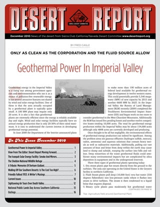
- 1. December 2010 News of the desert from Sierra Club California/Nevada Desert Committee www.desertreport.org BY FRED CAGLE ONLY AS CLEAN AS THE CORPORATION AND THE FLUID SOURCE ALLOW Geothermal Power In Imperial Valley G Geothermal energy in the Imperial Valley to make more than 190 million acres of is a rising star among government agen- federal land available for geothermal en- cies and environmentalists who see it as a ergy development in twelve western states. source of pollution-free renewable energy. This could potentially provide 5,540 mega- It has several attractive features not shared watts (MW) of new capacity by 2015 and by wind and solar energy facilities. One of another 6600 MW by 2025. In the Impe- these is that the area actually occupied FRED CAGLE rial Valley the Bureau of Land Manage- by a geothermal plant is typically quite ment (BLM) recently (2009) completed the small. A 100 MW plant may require only Truckhaven Environmental Impact State- 20 acres. It is also a fact that geothermal ment (EIS) and began work on two more to plants are extremely efficient since the energy is reliably available consider geothermal in the West Chocolate Mountains. Additionally day and night. Wind and solar energy facilities typically have an the BLM has issued five pending leases and another twelve competi- annual energy production that is only 20-30% of their rated maxi- tive leases totaling 16,000 acres. The total for geothermal energy mum. It is easy to understand the current interest in developing production within the Imperial Valley may be about 134,000 acres geothermal energy potential. although only 4808 acres are currently developed and producing. In June 2008 the Department of the Interior announced plans Once thought to be all but negligible, the environmental effects of geothermal energy production can indeed be significant. Among the problem areas are gaseous effluents (hydrogen sulfide, mercury, In This Issue December 2010 radon, ammonia) and aqueous solutions that contain heavy met- als as well as radioactive materials. Additionally, pulling out vast Geothermal Power In Imperial Valley . . . . . . . . . . . . . . . . . . . . . . . . . . . . 1 amounts of heat and brine from deep within the earth may cause land to slump and subside, warping the surface into hills and val- View From The Editor: Desert Report Moving Forward . . . . . . . . . . . . . . . 2 leys. Deep reinsertion of the waste geothermal fluids could ame- The Ivanpah Solar Energy Facility: Smoke And Mirrors . . . . . . . . . . . . . . . 3 liorate many environmental impacts but are complicated by silica deposition in equipment and in the underground reservoir. The Sheldon National Wildlife Refuge . . . . . . . . . . . . . . . . . . . . . . . . . . . 4 There three types of geothermal plants operating today: A Tribute: Memories Of Derham Giuliani . . . . . . . . . . . . . . . . . . . . . . . . . . 5 1. Dry steam plants pipe hot steam directly from the ground to the turbines. The only one operating in the United States is the Geysers Walling Off Our Southern Deserts: Is The Cost Too High? . . . . . . . . . . . . . 6 facility in northern California. Friendly Fallout 1953: A Writer’s Musings . . . . . . . . . . . . . . . . . . . . . . . . . 7 2. Flash Steam plants pull deep (10,000 feet) very hot water (550 degrees Fahrenheit) into low-pressure tanks where it flashes into Current Issues . . . . . . . . . . . . . . . . . . . . . . . . . . . . . . . . . . . . . . . . . . . . . . 10 steam to drive turbines. The steam is then condensed to a liquid Sightseeing Air Tours Over Death Valley . . . . . . . . . . . . . . . . . . . . . . . . . . 12 brine that requires disposal. 3. Binary cycle plants pass moderately hot geothermal water National Public Lands Day Across Southern California . . . . . . . . . . . . 13 Continued on page 14 Outings . . . . . . . . . . . . . . . . . . . . . . . . . . . . . . . . . . . . . . . . . . . . . . . . . . . 16 Top: Agriculture field around Geothermal Plant
- 2. View From The Editor BY CRAIG DEUTSCHE DESERT REPORT Moving Forward S Some things change and some do not. Responsibilities for produc- by the Sierra Club through the California/Nevada Conservation ing the Desert Report have been defined; the format and schedule Committee. This source was abruptly discontinued when the Club for the publication will remain essentially unchanged; and finances reorganized its finances. In the year immediately past some of the for the publication are being reorganized. I will report on these in printing expenses have been covered by grants from the San Gorgo- order. nio Chapter of the Sierra Club, from the Conservation Committee Beginning with the June 2011 issue, the new managing editor of the San Diego Chapter, and from the Desert Protective Council. of the Desert Report will be Stacy Goss. She is recently retired, has Other funds have come from a one-time bequest to the Desert Com- been a long-time member of Desert Survivors, and has been active mittee (Saylor Fund) and from individual contributors who have with the ORV committee of the Desert Committee. Stacy will be been acknowledged as sponsors in previous issues. This broader responsible for the content, direct editing, and timely distribution financial support has permitted an editorial policy which has been of the Desert Report. She will be the visible face of publication. less tightly tied to official positions of the National Sierra Club. Stacy will not be alone. The task of maintaining circulation Printing and mailing for the Desert Report costs $16,000 a year. lists and handling new mailing requests will be done by Kate Allen All other work is done by volunteers. In comparison with most oth- who is currently the Outings Editor. She will also be the person er newsletters, this represents a very real bargain - but it is not free. to whom routine matters of subscriptions and donations are ad- The organizations who have provided funds in the past have indi- dressed. The third major task before the Desert Report will be rais- cated sympathy for the publication, but with one exception there ing funds to continue printing and publication. This will largely have been few firm promises. There are other groups which can involve identifying organizations that might be willing to support be approached for support, but these sources are certainly far from the Desert Report and then presenting our case to them. D’Anne assured. The Desert Committee has a limited endowment which Albers, previously staff with Defenders of Wildlife, will assume might cover emergencies, but for the near future, the continued these duties. work of the Desert Report will depend heavily upon individual con- It is critical to realize that these three can not fulfill their tributions from subscribers. promise without help, and other persons will need to step forward. Stacy will need help in editing specific articles. Kate will need help in checking and updating the circulation list, and D’Anne will need persons who complete the sometimes detailed requests to specific Your support is both appreciated and needed. organizations for funding. Beyond this assistance the Desert Re- port has recruited an overseeing Board of Directors which includes among its responsibilities the policy decisions and backup support As in the past persons contributing $100 or more will be ac- that may be required. These persons are Terry Frewin, Tom Bud- knowledged as “Sponsors” in alternate issues of the publication. long, Cal French, and Craig Deutsche. Finally, and certainly in the Checks may be made out to “Sierra Club/CNRCC Desert Commit- category of good news, the present graphics editor, Jason Hashmi, tee” and may be mailed to “Editor, Desert Report/ 2231 Kelton Ave/ will continue to do the design of future issues. His efforts have Los Angeles, CA 90064.” For larger donations to qualify as a chari- been considerable, and the results are visible in front of you now table contribution (for income tax purposes), there is an alternate and on every page. procedure which can be provided by contacting the present editor Although leadership will change, the goals and format of the (craig.deutsche@gmail.com). Although this message indicates the Desert Report will remain as in the past. The color, layout, edito- importance of these larger contributions, any help that can be pro- rial policies, and organization of material will be unchanged. A vided is both useful and very much appreciated. principal goal of the Desert Report is to provide information to the general public and to educate public officials about matters that af- The bottom line is that the Desert Report is your publication, fect the desert. Indeed, nearly one-third of the mailed copies go to and it is no longer possible to assume that others will bear re- libraries throughout California and to legislators in both California sponsibility for its future. and Nevada, Up through 2008 the Desert Report was funded almost entirely 2 DESERT REPORT DECEMBER 2010
- 3. BY CHRIS CLARKE SMOKE AND MIRRORS The Ivanpah Solar Energy Facility In a previous issue of the Desert Report (June, tortoises than BrightSource or the Feds had an- 2010) an article by John Hiatt emphasized the im- ticipated. By the day previous, the number had portance of protecting natural habitat in the des- reached 27. The Biological Opinion, prepared by ert, and another article by Al Weinrub and Rob- the Fish and Wildlife Service for the BrightSource ert Freehling presented the advantages of locally project, had predicted that only 12 tortoises would generated energy over that produced at remote be found in the area of the project’s Phase 1. A to- industrial facilities. The story here was written tal of 32 was predicted for the entire site. If biolo- KEVIN EMMERICH by an observer at the dedication ceremonies for gists were to find 38 tortoises on site it would trig- a particular solar energy facility and expresses the ger a round of renegotiation with Fish and Wildlife concerns, held by many, about the fast-tracking over BrightSource’s incidental take permit. It was process that has become the norm in the permit- starting to look like they might find more than 38 ting of such facilities. –Editor tortoises just in the footprint of Phase 1. Some of O the biologists began to speculate that there could October 27 was a cool day in the Ivanpah Valley; the temperature be as many as 100, perhaps even 125, tortoises on the site. never broke 70 degrees. The people standing out on the bajada at A few tortoises were determined to have strayed into the proj- the Primm Golf Course looked comfortable and collected in their ect area from nearby burrows. They were simply moved out of the business casualwear, if a little windblown. Among them were re- way. The rest were in holding pens waiting to be moved off-site. A porters and photographers, representatives of San Bernardino week earlier, during a BrightSource press tour, reporters watched as County, representatives of building trade unions, as well as sup- a mortally wounded tortoise slowly died. The BLM blamed traffic porters bused in from Las Vegas and Los Angeles. Brightsource CEO on Colosseum Road. Onlookers speculated that it had been hit by John Woolard and VP Joshua Bar-Lev were there, fresh from nego- some heavy equipment. Not long after, another tortoise on the site tiating a $300 million equity investment in their project by a New fell victim of a coyote. Jersey firm. Interior Secretary Ken Salazar flew in by helicopter. The earthbound California Governor Arnold Schwarzenegger sped past a knot of protestors at the entry to the event, his limo moving at twice the legal limit. The cost: 3,400 acres of some of the best The occasion was the groundbreaking of BrightSource’s Ivan- tortoise habitat in California, with ancient pah Solar Electric Generating Station (SEGS). On completion, the project’s more than 170,000 mirrored heliostats would track the yucca clones, old-growth creosote, the sun, focusing its heat on three boilers atop 459-foot towers. Steam endangered Rusby’s desert mallow and much of would drive turbines, generating a maximum of 392 megawatts of electricity. The average over time would be less than a third that. California’s population of Mojave milkweed. The cost: 3,400 acres of some of the best tortoise habitat in California, with ancient yucca clones, old-growth creosote, the endangered Rusby’s desert mallow (Sphaeralcea rusbyi, var. eremi- None of this appeared to faze Governor Schwarzenegger. He cola), and much of California’s population of the Mojave milkweed dedicated an historic marker at the site noting the groundbreaking. (Asclepias nyctaginifolia). Though BrightSource claimed the site Standing in front of one of the project’s 10’ by14’ heliostats, he told configuration would allow rows of “trimmed” native vegetation be- the assembled crowd “Some people look out into the desert and see tween the heliostats, the land would be useless as habitat, and the miles and miles of emptiness. I see miles and miles of gold mine.” trimmed shrubs would almost certainly die within a couple of years. He then returned to his limousine and sped away. The desert landscape would be converted to an industrial area. Continued on page 18 By the time Arnold’s ride sped past them, the tortoises on the site had already caused BrightSource concern. Biologists canvass- Top: Members of the Ft. Mojave and Chemehuevi tribes at the ing the area in advance of the bulldozers had found many more Ivanpah Solar Site. DESERT REPORT DECEMBER 2010 3
- 4. BY SHAARON NETHERTON and BRIAN BEFFORT A TREASURE TO PRESERVE The Sheldon National Wildlife Refuge T Tucked away in remote northwestern Nevada, for this plan began in May of 2008 and has the Sheldon’s vast beauty can take your breath continued with a series of planning updates away. Birds of prey ride thermals along spec- issued by the Sheldon Refuge planning team. tacular cliffs and deep gorges; high volcanic The most recent update issued this summer tables of grass, sage, and wildflowers rise lays out a series of alternatives that will be ad- GRAHAM STAFFORD above the surrounding landscape like forts, dressed in the draft plan and Environmental dotted with small lakes and archaeological Impact Statement, scheduled for public review wonders; mother antelope nuzzle their young; in early 2011. These preliminary alternatives and vistas are so broad you can almost feel address the following categories: Fish and them. Created back in the 1930s to provide Wildlife Populations; Feral Horse and Burro habitat for pronghorn antelope, this refuge Populations; Management of Refuge Habitats; encompasses 572,876 acres of high-desert, Water Control Structures, Diversions, and oth- sagebrush-steppe ecosystem. Here many species find refuge from er Developments; Historic Structures’ Public Use; and Recreation development pressures. and Wilderness Recommendations. Today, the Sheldon and its sister refuge to the north, Oregon’s The most controversial issue will be a proposal to remove hors- Hart Mountain Refuge, are the last, best remaining tracts of this es and burros from the refuge entirely. The springs and riparian sagebrush-steppe ecosystem. In addition to the incredible opportu- areas are currently being damaged by horses, and removing them nities the Sheldon offers for solitude, remote beauty, and primitive from an area that was set aside to protect pronghorn and other na- and unconfined recreation, the Sheldon is rich in both natural and tive wildlife makes sense. Unfortunately since the horses reproduce human history. so quickly, the refuge spends the majority of its budget trying to keep down horse numbers. Alas, there are almost more horses than The Resource pronghorn on the Sheldon. Continued on page 11 The Sheldon Refuge’s primary mission is to protect the prong- horn antelope (Antilocapra americana) and other wildlife. Al- though pronghorn once numbered in the millions, the population declined precipitously in the early 1900s. Three hundred other spe- cies of vertebrates also make their home in the Sheldon, including California bighorn sheep, mule deer, pygmy rabbits, and 23 other species of upland mammals. There are 21 species of upland birds including sage grouse, many species of waterfowl, many raptors including the prairie and peregrine falcons, and smaller birds such as brewer, black-throated, and grasshopper sparrows. The refuge also has a long human history. Native Americans used the Sheldon area and left petroglyphs, stone tools, camp sites, and other evidence of their past. Historic homesteads and ranches like the Last Chance Ranch, Kinney Camp, and the Pruett Ranch BRIAN BEFFORT are all a testament to the hardy pioneers and ranchers that lived and worked here for many years. During the 1930s and 40s, over a thousand Civilian Conservation Corps employees lived at Camp Sheldon, and many of the structures they built are still standing. Planning for the Future Above: Young explorers discover some of the hidden beauty in the The US Fish & Wildlife Service is currently revising its Compre- Sheldon Refuge. Top: Volunteers make a huge difference removing dangerous hensive Conservation Plan (CCP) to determine how the Sheldon barbwire around springs where pronghorn and sage-grouse can National Wildlife Refuge will be managed in the future. Scoping become entangled. 4 DESERT REPORT DECEMBER 2010
- 5. BY BOB ELLIS AND LAURA CUNNINGHAM A TRIBUTE Memories Of Derham Giuliani Derham Giuliani died at his home in Big Pine on September 7, 2010. wielding a butterfly net high in the Inyos. He was an inspiration to all who knew him. The two tributes printed Downtown Dyer, Fish Lake Valley, Nevada. Ingrid and I stopped here tell of a unique man who saw beauty in the world that most of in town to get some eggs and cheese. As we were walking out, here us may never know. comes Derham. He’s pacing back and forth across the street. He tells O us he has been tracking the flights of painted lady butterflies. We On my first Desert Survivor trip, Derham led us up Morris Creek then noticed several flying along. He said it was one of the largest Canyon in the northern White Mountains wearing his usual tennis migrations he had seen and that he tracked them every year. shoes. We spent the first day taking eight hours with full packs to Durham loved the dunes. He had discovered several new spe- thrash just two miles through dense wildrose brush before camp- cies of sand insects. Because I have met him and spent time learn- ing. The next morning we climbed a rough, trail-less, brushy gully ing from him, I can’t go walking on sand dunes without thinking of a couple thousand feet to top out on the beautiful Trail Canyon Derham and looking for insects in the sand. In at least that way he saddle. I thought I was in pretty good shape, but this was some- will always be with me. thing else. Who were these people who could have a great time Thank you Derham, we’ll miss you. punishing themselves this way? I was hooked. After the first day’s backpack on a later trip in the North Inyos, Bob Ellis we finally got to a somewhat flat spot well after dark. It began to rain. Some of us had leaky tarps and jammed together into the re- I maining tents. The next morning we found Derham sleeping under clear plastic wrap, happy as a clam. I was really shocked and saddened by this; to me it is the end of an Desert Survivors led a couple of trips to survey the three rare era, the era of the Naturalist. Derham came to the August 7-8 Sierra and endangered plants that grow on the Eureka Dunes. I think it Club Desert Committee meeting in the White Mountains; I had not was on one of these that Derham and two other entomologists seen him in a few years, so I wanted to spend a lot of the weekend were trading ideas about the insect pollinators of the dune plants. talking to him, and I am so glad I did. I met him around 2000, when That night it rained hard. The next morning, on a hike across the we worked with him on a study of Panamint alligator lizards, a spe- playa toward the dunes at the base of the Saline Range, we started cies very difficult to find as it lives in talus rock piles and riparian to see tiny bright red spots on the ground as we walked. It turned thickets of steep arid canyons in the Whites, Inyos, and Panamints. out that the spots were crimson mites, who normally spend their Of course, Derham had seen more than anybody, and he amazed us lives underground but had been forced to the surface by the rain. by even happening upon a shed tail of one of the lizards in a canyon Neither Derham nor the other entomologists had ever seen these that qualified as a range extension (who else would just find a shed particular mites before; what excitement! tail of a rare lizard?). The lizards drop the tail if a predator grabs it, After a California Native Plant Society trip where Derham and they are able to flee to safety. showed us a new population of the rare plant Dedeckera eurekensis He looked a little tired, and told me he wanted to finally retire he had discovered, Derham, Ingrid, and I stayed over another night from exploring the dunes. I said, really? He seemed sad that the in Dedeckera Canyon. The next day Derham spotted a chuckwalla desert was still under so much ever-growing human impact. But he eating some plants, and we spent the next several hours just quiet- still had that sparkle in his eye about Nature, and we both asked ly watching the animal. Ingrid and I had never realized how much ourselves why more people didn’t spend time enjoying the discov- we could get from just being quiet and still. ery of the secrets that were so amazing. Derham asked me if I could help him locate a population of I spent hours conversing about everything. Maybe I sensed Dedeckera eurekensis 3,000 feet up the Beveridge Ridge Trail in something about the lack of time to ask him questions from his the Inyo Mountains. I had seen it the previous year, and Derham gigantic memory library of nature observations. I have never met wanted to bring an entomologist along who wanted to capture a anyone who has surveyed a single route for, what was it, 30-40 moth that fed only on this rare plant. They were going to compare years? Every week he drove up to count chipmunks along the West- the DNA of moths taken from separated Dedeckera populations to gard Pass Road. Most scientific studies are lucky to get two years. estimate how long the populations had been separated. We found He did decades. I asked him if he detected any climate change the plants, and I got to witness a very jolly entomologist in shorts Continued on page 9 DESERT REPORT DECEMBER 2010 5
- 6. BY SCOTT NICOL IS THE COST TOO HIGH? Walling Off Our Southern Deserts O Over 660 miles of border wall have been built along the U.S.- Homeland Security (DHS) and, ignoring the concerns of the EPA Mexico border, slicing through the deserts of California and Ari- and DOI, the DHS decided to “disrupt the land” of the Otay Moun- zona on its route from the Pacific Ocean to the Gulf of Mexico. The tain Wilderness Area with a border wall and a patrol road. The wall’s path takes it through some of our nation’s most fragile and rugged terrain necessitated the blasting of 530,000 cubic yards of biologically diverse protected lands. Border wall construction has rock and extensive grading and leveling. Border wall construction involved dynamiting mountains and damming rivers, the disrup- caused tremendous erosion and involved cutting down more than tion of migration corridors, and the destruction of endangered spe- 100 Tecate cypress trees. cies habitat. Because dynamiting mountains is clearly incompatible with a In 2004, the California Coastal Commission determined that wilderness designation, Secretary Chertoff used the Real ID Act to border walls south of San Diego would have a devastating impact waive the Otay Mountain Wilderness Act. He also swept aside the on the Tijuana Estuary, in violation of the Coastal Zone Manage- Clean Water Act and the Endangered Species Act. The Otay Moun- ment Act. Environmental groups, including the Sierra Club, sued tain Wilderness Area now suffers from a barren scar and erosion to stop the Border Patrol’s plan to plug several canyons in order to that will bleed sediment into the Tijuana River for years to come. create a level path for the border wall. The court found that the Continued on page 8 Border Patrol was in violation of federal environmental laws, and construction ground to a halt. Rather than insist that Border Patrol obey our nation’s envi- ronmental laws, Congress passed the Real ID Act. Section 102 of the act was intended to overrule the objections of the California Coastal Commission and the Sierra Club by allowing the Secretary of Homeland Security to waive any law that border wall construc- tion might otherwise violate. No one else, including the President, is granted this power. Former Homeland Secretary Chertoff used the Real ID Act five times to set aside 36 federal laws and “all fed- eral, state, or other laws, regulations, and legal requirements of, deriving from, or related to the subject of” those laws. The waivers encompass the broad subjects of water, air, wildlife, and the envi- ronment, leaving few, if any, environmental laws in place. A few miles east of the border wall’s start in the Pacific Ocean, the Otay Mountain Wilderness Area protects the last surviving stands of Tecate cypress, an ice age tree that survives by absorb- ing coastal moisture from the air. This tree in turn is the host plant for the rare Thorne’s hairstreak butterfly. When the Environmental Protection Agency (EPA) reviewed the plan to build border walls through the Otay Mountain Wilderness Area, they expressed con- cern that filling in canyons and waterways that feed the Tijuana River would violate the Clean Water Act. The Department of the Interior (DOI) warned that six endangered species would also be harmed by the wall. San Diego Sector Border Patrol spokesperson Richard Kite said SCOTT NICOL of the Wilderness Area, “At the mountain range, you simply don’t need a fence. It’s such harsh terrain it’s difficult to walk, let alone drive. There’s no reason to disrupt the land when the land itself is a physical barrier.” By 2008, this logic no longer held sway at the Department of Border Wall in the Otay mountain Wilderness Area 6 DESERT REPORT DECEMBER 2010
- 7. BY ANN RONALD A WRITER’S MUSINGS Friendly Fallout 1953 While the events of 1953 and the cold war may interviews and analytic books. I read everything I seem far removed from our concerns of the 21st could find, and then began corresponding via e- Century, the story here is very relevant. As the mail with a man in his 80s who had been a young author makes clear, both the politics of our time lieutenant in 1953. The more we wrote back and and our uses of the desert need to be informed by forth, the more details Robert remembered. Matt, history. –Editor the imagined soldier in my book, isn’t Robert, but D he shares many of Robert’s experiences along with During the spring of 1953, the Nevada desert immediate post-blast incidents described by other both literally and figuratively exploded. In just a military men that year. The dirt and dust, the sight little over two and a half months, eleven different of huge trucks and artillery turned upside down, detonations occurred. Eight fell from stationary the native birds that are maimed by the blast, and towers, two dropped from planes flying overhead, and one shot the naivety of the participants. At the time, it never occurred to out of a 280 mm cannon. Combining the testing of “gadgets” and Robert that the fallout might be dangerous. He was lucky; many of “devices” (the word “bomb” was never used) with the analysis of his companions were not. Civil Defense practices, the entire testing series was called “Up- That was true of the so-called downwinders who lived in east- shot-Knothole.” It changed forever the way Americans perceived ern Nevada and southwestern Utah. The children were especially the powers of atomic and nuclear experimentation. vulnerable. Watching the rainbow clouds drift overhead, walking to While scientists and engineers worked non-stop to build big- school, playing in their backyards, drinking contaminated milk af- ger, more effective, and more destructive weaponry, the fallout ter the local dairy cattle fed on grass contaminated by fallout, they from their tests grew larger and larger too. Two early 1953 tests were unwitting participants. The stories of these innocent victims yielded only 0.2 kilotons of energy apiece; later ones that year are heart-wrenching. Even today the government is loathe to ac- yielded the equivalent of more than 40 kilotons of TNT, and their knowledge the breadth and depth of the downwinders’ health prob- mushroom clouds soared well over 40,000 feet into the atmo- lems. Some reparation has occurred, but money can’t assuage the sphere. Like their predecessors at Los Alamos a decade earlier, the heartache that accompanied so many odd and debilitating cancers. physicists and experimentalists were ecstatic. However, the ensu- Obviously I couldn’t interview the deceased victims, so I had to ing fallout—and there was a lot—spread more widely and more rely on family recollections and oral histories. These are plentiful, malevolently than anyone predicted. each narrating the excitement of witnessing the tests in the sky and A number of nonfiction journalists and historians have ana- then the horror of peculiar physical problems, unexplained illness, lyzed the 1953 triumphs and debacles; only one novel exists to tell and often agonizing deaths. To remain true to my focus on 1953, the story of the downwinders. For my new book, I wanted to try I couldn’t let my “friendly fallout” characters predict the future or something different. Although I am a nonfiction writer by training foresee their fates. I created a Mormon family unwittingly caught and experience, I like to think I have an active imagination. So, I in the fallout that year, but the reader’s imagination needs to fill in decided to braid fact and fiction together. Almost everything in the blanks of what happened to them beyond the pages of the book. Friendly Fallout 1953’s pages actually occurred to someone some- Although I drop hints, especially about the milk consumption, I em- where that year. The quotations and the facts are real, taken from phasize their innocence that year. I express their patriotism, too, now declassified documents, federal websites, and government and their absolute trust that the government would do no harm. archives. Many of the incidents are real, too, gleaned from oral Other imagined characters play different roles. There is a news- histories and from talking with people who actually participated paperman who views the Doom Town blast when a faux community in the atomic testing program. of houses is destroyed. There is a radiation specialist who measures For example, many soldiers watched the detonations from the roentgen levels immediate after each detonation. In the Atomic trenches not far from ground zero. They volunteered for the honor Testing Museum in Las Vegas, I found numerous photographs of and relished the opportunity. But no one told them of any potential such rad men clad in protective white suits and laughing at how dangers or aftereffects. In a way, they were guinea pigs. There are awkward they looked. I combined the oral histories of two secretar- websites devoted to the stories of “atomic soldiers,” plus numerous ies into one composite woman who then types actual memos I took Continued on page 9 DESERT REPORT DECEMBER 2010 7
- 8. Walling Off Our Southern Deserts Continued FRoM page 6 Further east, Arizona’s San Pedro River is one of the last un- graves. When the Secretary of Homeland Security waived the Na- dammed, free-flowing rivers in the American Southwest. It anchors tive American Grave Protection and Repatriation Act, the regula- one of the most biologically diverse areas in the United States at tions that ensured respect for the Tohono O’odham’s ancestral re- the convergence of four major ecosystems: the Sierra Madre and mains and culture no longer applied to border wall construction. Rocky Mountains and the Sonoran and Chihuahan Deserts. The Speaking before a U.S. House of Representatives hearing on San Pedro Riparian National Conservation Area was designated the border wall, Tohono O’odham Chairman Ned Norris Jr. said, by the National Audubon Society as its first Globally Important “… fragments of human remains were observed in the tire tracks of Bird Area and by the United Nations World Heritage Program as a heavy construction equipment. Imagine a bulldozer parking in your World Heritage Natural Area. family graveyard, turning up bones. This is our reality.” When the DHS announced that it would put a wall across the DHS claims that border walls are actually good for the envi- San Pedro, the Sierra Club and Defenders of Wildlife sued. A feder- ronment because border crossers leave litter, make footpaths, and, al court agreed that the federal government’s failure to fully assess in the states that do not have a river for a border, drive off-road the environmental impacts of the border wall violated the National vehicles through sensitive habitat. This assertion is based on a pair Environmental Policy Act (NEPA) and ordered a temporary halt to of false premises. The first is that border walls stop crossers. They construction. Rather than comply with NEPA, former DHS Secre- do not. The Congressional Research Service found that border walls tary Chertoff used the Real ID Act to waive it. Border walls built in have “no discernible impact” on the number of undocumented im- the San Pedro watershed are now causing erosion and damming migrants who enter the United States each year. Instead, walls re- that will permanently alter the riparian habitat. direct many of those who seek to enter on foot, “funneling” them into more remote areas. This often means that their environmental impacts are concentrated in fragile desert ecosystems, rather than closer to walled off border towns. “Funneling” has contributed to The wall’s path takes it through some the deaths of more than 5,600 crossers in the harsh Arizona desert. of our nation’s most fragile and biologically The second false premise is that border walls and patrol roads are less damaging to ecosystems than border crossers. The border diverse protected lands. wall’s destructive impact is made obvious by the Department of Homeland Security’s need to “waive in their entirety” our nation’s most important environmental laws. The only reason for DHS to The border wall’s impact on the flow of water in desert eco- waive laws is that border walls violate them. Litter and migrant systems was made clear in 2008, when the Organ Pipe Cactus Na- trails can be a problem for wildlife, but the blasting, bulldozing, tional Monument received seasonal monsoon rains that resulted habitat fragmentation, and large-scale erosion caused by border in the flooding of a number of washes that were blocked by the walls and roads are worse by magnitudes of scale. border wall. Grates built into the base of the wall to allow for the Ignoring the useless and destructive nature of border walls, po- passage of water quickly choked with debris and sediment. The litical hopefuls from Alaska to Kansas, Utah to Rhode Island, have wall then acted as a dam with water up to seven feet deep piling up called for more walls in the run up to the mid-term elections. This behind it. Floodwaters then travelled laterally along the wall until is not just empty rhetoric that can be ignored. A number of amend- they found an outlet at the Sonoyta port of entry, causing millions ments requiring the erection of hundreds of miles of new wall were of dollars of damage to private businesses and government build- introduced in the last Congress, and one, authored by Jim DeMint ings there. of South Carolina, passed in the Senate before being stripped in a The border walls and patrol roads that slice through hundreds House/Senate conference committee. Following the mid-term elec- of miles of public and protected lands also fragment the habitats of tions DeMint and others will likely redouble their efforts, and their a number of endangered species including the Sonoran pronghorn, legislation will stand a better chance of making it onto the Presi- cactus ferruginous pygmy owl, and desert tortoise. Cut off from dent’s desk. their usual range, populations may not have access to mates in Instead of building more border walls, Congress should focus other groups, a necessity for a genetically diverse, healthy popu- on mitigating the damage that has already been inflicted. It is also lation. Border walls also separate animals from food and water critically important that Congress repeal the Real ID Act’s waiver sources, leaving them especially vulnerable in times of drought. provision. The Real ID Act is not only a threat to border ecosystems With the endangered species act waived, these threats to species’ should Congress require more walls; it also establishes the prec- survival have been largely ignored. edent that bedrock environmental laws, such as the Endangered The lands of the Tohono O’odham, whose name means “the Species Act and Clean Water Act, can be swept aside when obeying desert people,” were once vast, extending from what is now Central them would be inconvenient. For these reasons, the Sierra Club op- Arizona down into Sonora, Mexico, and from the Gulf of California poses further border wall construction and calls upon Congress to east to the San Pedro River. The international border splits their repeal section 102 of the Real ID Act. land, and the erection of the border wall has restricted their ability to visit family and sacred sites and to collect traditional foods and Scott Nicol co-chairs the Sierra Club’s Borderlands Team. For more other materials. information on the border wall and the Borderlands Team’s effort, visit Border wall construction has also unearthed Tohono O’odham www.sierraclub.org/borderlands. 8 DESERT REPORT DECEMBER 2010
- 9. Friendly Fallout 1953 Memories of Derham Giuliani Continued FRoM page 7 Continued FRoM page 5 verbatim from the record. My meteorologist judges the weather shifts. He did, a gradual moving upslope over the decades, which forecast before each experiment takes place. Like his real-life coun- he described in intricate detail. I asked him if he had this written terparts, he sometimes makes mistakes. down; just some of it, he replied. I even imagined silenced voices, those whose stories have nev- Several large-scale solar projects threaten the skirts of dunes er been told. Two Indian reservations—one Paiute and one Shosho- in Nevada, and I especially wanted to download some of his ency- ne—lay directly in the path of the worst fallout incidents. When I clopedic knowledge about the dune beetle faunas he knew so well. tried to schedule some interviews with tribal elders, I learned there He gave me a load of valuable information, from the most minute are none. Almost everyone of the generation who would have been details of how to locate each beetle species, to a broad evolution- children in the 1950s long since have succumbed to cancer. As a re- ary trend of flightlessness from northern Nevada dunes to southern sult, my Paiute family is wholly fictional, although their experience dunes. He told me of species he found still unknown to science and at a roadblock set up to wash off trucks and cars is typical, I think. fretted about how no new young entomologists/taxonomists were In the author’s notes, I am much more specific about what is real in coming up to describe them, following in the footsteps of those the book and what is not, acknowledging my sources and designat- who were all retiring. He gently corrected me on why I had missed ing those incidents that are complete fiction. This brief article is finding the beetles in my own searches: one species only comes meant only to tantalize potential readers, those who are intrigued out for an hour after sunset during the entire year in its mating by the desert southwest’s role in war and peace. flight, for example. He has been observing the dunes for so incred- Overall, then, the individual stories of Friendly Fallout 1953 are ibly long that he told me he thought one solar project at Big Dune combinations of what happened, what might have happened, what would probably eventually get smothered partly in sand, as he had probably happened, and what could have happened. The book has patiently watched signs of certain creosote bushes on the eastern a subtext, too. Surprisingly, the decade since 9/11/2001 replicates edge of the dune get covered by the leading edge of the dune, over much of the angst of the 1950s. We’re confronting an unknowable the decades, and have to grow taller. He thought this was partly enemy, and operatives argue that government obfuscation is nec- due to destabilization from the intense OHV use. essary in order to protect us all. Some citizens may be concerned He seemed so happy to find anyone who shared his joy in Na- about such arbitrary choices, especially when citizens’ rights are ture and liked to talk about it. threatened, but any real dissent is labeled un-American. All too He also revealed that he went through a brief period long ago frequently, heightened patriotism takes precedence over reasoned whern he got hooked on watching TV: in his younger years, he debate. Replace communists with terrorists, above ground atom- would sit and watch the television for hours, and he even liked ic testing with airport security, Joseph McCarthy with Rush and James Bond movies. But then it broke, and he never fixed it, never Glenn, and the parallels are suggestive. I didn’t start out to write watched it again for 50 years or so. a political polemic, and I’m very careful to retain neutrality in my We talked about many topics concerning the ecology of the characters’ thoughts and actions. Friendly Fallout 1953, however, desert, and I thought to myself, I need to visit Derham and try to raises questions about what we were doing in the Nevada desert in write more of this down. I have never met anyone like him, and he 1953, and why. will be missed. Finally, a last word about that particular place, then called the Nevada Proving Ground and now known as the Nevada Test Site. Laura Cunningham Except for the two flat playas where the detonations occurred, a maze of two-tracks nearby, and altogether too much construction and engineering debris, the remainder of the reserve is incredibly beautiful. The area hasn’t been grazed since World War II, so the PRONGHORNS by Claora Styron meadowlands and grasses resemble pre-pioneer landscape more Just over the Utah line, than anywhere else in the Silver State. Places like Tippipah Springs Five pronghorns and Rainier Mesa and the slickrock in between are both photogenic Springing from the roadside dusk and wild enough to belong in a National Park. That few ordinary Veer to cross the highway, citizens are able to visit there is one more aftereffect of atomic Black diamond eyes see all around, tests, like the massive ones that blew the desert apart in the spring Golden crescents as they go of 1953. Ringed white rumps in the air, Precise hooves Ann Ronald, retired Foundation Professor of English at the Univer- Incising the dusk sity of Nevada, Reno, has written many books and articles about the Arc American West. Her most recent book, Friendly Fallout 1953 is avail- To avoid a crash, able directly from the University of Nevada Press, at www.unpress. Then blending nevada.edu, and through most online and retail booksellers. Into a golden glow, Dark foothills embrace them As distant desert ranges Vanish in our dust. DESERT REPORT DECEMBER 2010 9
- 10. Current Issues Historic Owens Valley Ranch Up for Sale: Marred California Poppies in the Antelope Valley Viewshed? The plan to build a motorsports racetrack near the Califor- nia State Poppy Reserve has been halted. The proposed track was Many southern California backpackers who drive up to the to be built on land near Fairmont Butte that had previously been Owens Valley know of an obscure shortcut before reaching Lone farmed, but has since recovered. Operation was expected to be Pine that takes you to the trailheads at Horseshoe Meadows high year-round, but the developer, Tom Malloy, had indicated that races in the Sierra. Driving along Hwy 395 just past Owens Lake, they would be held only on weekends. Opposing this plan, local resi- look for a left turn onto Lubken Canyon Road. The lower portion dents had submitted letters, emails, and testimony at several LA of this country lane leads through one of the most pastoral scenic County Planning Commission hearings. In an email message to the areas in California – the Lubken Ranch. Roughly 600 acres of irri- Antelope Valley Press he is quoted as saying the idea “was met gated pasture is set among Alabama Hills boulders with the High with overwhelming opposition that eventually snuffed it out.” Sierra rising in the background. Here, where Lubken Creek exits The developer has decided to sell the land to a solar company, its Sierran canyon, the Lubken family began cattle ranching in the which will use it for mitigation lands when its project in the Ante- late 1800’s. lope Valley is approved. Originally the State identified this parcel Today the Kemp Ranch owns and runs things as part of a much as part of the best place to preserve poppies, but due to limited larger operation. Like many family businesses, however, they are funds it was not purchased when the Preserve was created. Under struggling in transition since the death of the family’s patriarch. the current scenario it may, indeed, receive this kind of protection. Siblings not involved in the ranching are seeking their share of the inheritance and have put the property up for sale. A recent subdivision amendment to Inyo County’s General Plan will offer twelve 2.5 acre lots located on dry upland parts A Desert Coalition Protests Solar Two of the ranch. The proposal states that the irrigated portions of On November 15th and 16th, a coalition of Native Americans, the property will be sold as a cattle operation, but is it possible wildlife biologists, geologists, solar energy activists, local resi- to succeed in the cattle business after purchasing a $6,000,000 dents, members of several conservation groups, and members of piece of land? The family’s Beverly Hills real estate agent reports the Imperial Valley Environmental Justice Enforcement Task Force inquiries from a Google think tank, Burning Man promoters, and gathered in the Western Imperial County desert. This was a camp- the Coachella Music Festival. out to protest the construction of the Tessera Imperial Solar Two With such a world class landscape along Lubken Canyon solar farm which, if built, will be one of the largest solar power util- Road, locals and visitors alike are wary of any large scale impacts ity developments in the United States. to such a beautiful place. There is little logic in having such devel- This project has been described in some detail in the March opment away from any local town or real infrastructure. The situ- 2009 issue of the Desert Report (“Another Questionable Give- ation is being watched and will continue to be shared through Away Of Public Lands”) which outlined its associated economic, updates. Mike Prather, Lone Pine resident environmental, and social consequences. In addition to expressing their opposition to the proposed developent, the protest was held in support of the recently filed lawsuit of the Quechan Tribe of the Fort Yuma Indian Reservation against the Department of Interior for approving this project. This area of desert is part of the Yuha Desert, an area rich in American geoglyphs and other cultural sites and is of spiritual significance to the Native American tribes of the Colorado River. The message which the group presented to attending media representatives was that distributed generation of power, PHOEBE PRATHER including urban rooftop solar, was superior from many different perspectives. Lubken Canyon Road 10 DESERT REPORT DECEMBER 2010
- 11. Sheldon National Wildlife Refuge Continued FRoM page 4 Tools for Environmental Justice Refuge planners have also reassessed their wilderness resourc- es. While about 341,500 acres were recommended for wilderness Off-road recreation, mining, air and water quality, and en- in the 1970s, past managers may have forgotten the wilderness ergy production are desert concerns that can impact people di- resources they were charged with protecting and have allowed uses rectly. Frequently the impacts are born most heavily by minority and roads that fragmented some of those recommended areas. The USFWS is working to address wilderness wherever appropriate in and lower income groups. Hence these activities are also matters the upcoming CCP. At this point, their new proposals make sense of environmental justice. Lessons learned in one local may serve and should be supported. widely in other places. One of the most positive Imperial County developments of 2010 has been the creation of the Imperial County Environmental Justice (EJ) Taskforce. This group was spawned by Comite Civi- Today, the Sheldon and its sister refuge co del Valle, whose mission it is to engage and empower citizens are the last, best remaining tracts of this throughout the Imperial Valley. The EJ Taskforce meets regularly sagebrush-steppe ecosystem. In addition to the in a public venue. Members of the public, business representatives, and agency representatives are invited to participate. The goal is incredible opportunities the Sheldon offers to provide a forum to address problems, to cultivate partnerships, for solitude, remote beauty, and primitive and and to transparently inform the EJ process in the Imperial Valley unconfined recreation, the Sheldon is rich in community. Integral to the discussion of each topic are proposals for active follow-up and assignment of responsibility for follow-up both natural and human history. actions. With funding from Imperial Visions, the EJ Taskforce in con- junction with Comite Civico del Valle has created the Imperial Val- Opportunities for the public: ley Action Network (IVAN) web site: http://www.IVANonline.org. Although cattle grazing was removed from the Sheldon in the early 1990s, at least 150 miles of fence remain on the Sheldon, This website provides a centralized location for documentation of ensnaring pronghorn and killing many sage grouse in collisions. reports of suspected environmental hazards. Citizens can quickly Volunteers working with Friends of Nevada Wilderness and other determine the proper authority or agency to report a particular organizations hope to remove at least 40 miles of fence each year concern, toxic waste site, acrid aroma, destruction of public land, over the next two years and to attach visible reflectors on the Shel- dumping etc. The web site is a gold mine of environmental and don’s external boundary fences to minimize sage grouse mortality health studies and reports relevant to Imperial County residents, from collisions with the fences. Information on these ongoing proj- ects as well as the third annual Sheldon Rendezvous (June 23-26, agency managers, and watchdog groups. The website may pro- 2011) is available at: http://www.nevadawilderness.org. vide a model for other desert and rural communities of southern Information on the Comprehensive Conservation Planning pro- California. cess is available at http://www.fws.gov/pacific/planning/. Click on “Sheldon” on the right panel and you will find copies of all the plan- ning updates along with the proposed wilderness boundaries and travel management recommendations. This site offers a convenient on-line form for citizens to submit comments on the plan. As an DESERT COMMITTEE MEETING alternative, written comments may be sent to: Sheldon National The winter meeting of the Desert Committee will be held jointly Wildlife Refuge, PO Box 111, Lakeview, OR 97630 or faxed to (541- with the Wilderness Committee in Shoshone, CA, on February 5 949-4414). These will be accepted until the actual CCP and EIS are and 6, 2011. Vicky Hoover and Terry Frewin will be joint chairper- issued in 2011. Your public Lands need public involvement. Please join the sons.. The spring meeting of the Desert Committee will be held at effort. the Mission Creek Preserve near Palm Springs on May 14 and 15. Jeff Morgan will chair the meeting. As always we encourage local Shaaron Netherton is Executive Director of Friends of Nevada Wil- citizens in the area to attend as many of the items on the agenda derness, and a 22-year veteran of the Bureau of Land Management. include local issues. E-mail Tom Budlong at tombudlong@road- Brian Beffort is Friends’ Associate Director and author of two outdoor runner.com or call (310-476-1731) to be put on the invitation list. guidebooks: Afoot & Afield Las Vegas and Southern Nevada, and The Joy of Backpacking. Friends of Nevada Wilderness has been defending and restoring Nevada’s wildlands since 1984. DESERT REPORT DECEMBER 2010 11
- 12. BY TOM BUDLONG SOUNDS AND SILENCE COMPETE Sightseeing Air Tours Over Death Valley D Death Valley National Park is one of the quietest places in the coun- the quickest way to get the “big picture” of the geology and immen- try. Quiet is consistent with its very name. Commercial air tours, so sity of the park is from above. The Park’s management plan doesn’t common at Grand Canyon and other parks, are largely non-existent exclude using aircraft to provide visitor opportunity to discover and at DVNP, mostly because of the distance from Las Vegas, the near- explore. The plan does talk of conserving scenery, geology, history, est practical launch point. For historic reasons, flights are capped at wildlife, ecosystems, and natural and cultural resources. Does a ‘natu- 67 per year. The current estimated level is far less at 10-15 flights ral resource’ include sounds? More specifically, the plan management per year. objectives include prevention of artificial noise so visitors can experi- The Federal Aviation Administration (FAA) and the National ence the stillness of the desert. Park Service (NPS) have been in discussions for some time concern- As with many Western parks, Death Valley is around 95% wil- ing National Park air tour overflights in general. In 2000 Congress derness. The park’s management plan echoes principals in the 1964 passed the National Parks Air Tour Management Act, directing the Wilderness Act – words that are familiar to us: “protection of natural NPS and FAA to cooperate in writing air tour management plans Continued on page 15 for the various parks. Creation of these Air Tour Management Plans (called ATMPs) has been frustratingly slow. The FAA feels it has juris- diction over all commercial flight operations. Almost exclusively for noise concerns, the Park Service feels an obligation to control its own air- space. Agreement is elusive. The FAA Reautho- rization Act of 2009 (HR 915) could sort this out by giving control to parks, but it’s stalled by legislative inertia, so common these days. The NPS and FAA recently started a unique process to work out an air tour management plan for DVNP. Unlike almost all other such efforts, the agencies have set up an Aviation Rulemak- ing Committee (ARC). Using an ARC is intended to expedite the process by getting stakeholders involved from the beginning. Besides the NPS and FAA, stakeholders included in the ARC are commercial air tour operators with operations at other places, environmental organizations, other agencies, the Timbisha Shoshone tribe, and local businesses. Final authority, though, is with the FAA and NPS. The timing is right. The current low frequency of flight presents a more academic atmosphere. Noise – the Driving Force The question of course is aircraft noise – unnatu- ral sounds intruding on the park’s natural quiet and low natural sound levels. How much noise is acceptable, balanced against visitors’ desire for, and the park’s obligation to provide oppor- tunities for discovery and exploration? Certainly The red lines are existing generalized flight tracks of air tour operators 12 DESERT REPORT DECEMBER 2010
- 13. A PUBLIC THAT CARES National Public Lands Day Across Southern California A All across the country volunteers work contribute Land Management who are the administrators of their efforts on public lands. This is especially no- the Monument. table on National Public Lands Day which occurs The Saucito Ranch has been occupied, on and every year at the end of September. Although there off, since 1870 and includes a very well preserved were over a dozen projects carried out in Califor- house, a barn, extensive corrals, and several out- nia, four in the southern deserts are described here. buildings. About twenty volunteers raked and These people care and contribute. We can all offer picked up scatter that had been blown by wind. LAUREEN LENZ our thanks. In the center of the Plain another thirty persons worked cleaning up what is called the Van Matre Clean-Up at a National Park site. This homestead was occupied in the 1920s but Open spaces seem to attract litter. The Na- in recent years has been empty and largely ignored. tional Public Lands Day project at Joshua Tree Recently the house has been stabilized and plans National Park was largely an effort to remove trash left previously have been made to place interpretive signs. Roofing had blown by unthinking visitors. Nearly 150 volunteers participated in the across the site, pieces of fallen corrals were scattered, and rusting work representing hospital employees from the Marine Corp Air barbed wire was everywhere. When the morning was over a huge Ground Combat Center (MCAGCC) in Twentynine Palms, Marine dumpster had been filled with the debris. Corp Students from MCAGCC C&E Schools, several boy scout The Friends of Carrizo Plain organization provided a lunchtime troops, and many, many individuals and families. The size of the barbecue and the the day ended with a celebration of the Plain, the group and their willingness to work was impressive. Monument, and the history. South of Yucca Valley one group removed illegally dumped household items that had been dumped over a period of time. Cucamonga Canyon Clean Up: Local Partners for National When the day was over volunteers had loaded a huge dump truck Public Lands Day to the brim with nearly 1000 pounds of dumped trash. In other On October 2nd, 2010, over 150 volunteers and staff arrived areas individuals, families, and boy scout troops picked up trash at Cucamonga Canyon near Rancho Cucamonga, California, to help along nature trails, campgrounds and cleaned off some of the park’s restore a much-used canyon to its natural beauty. The canyon is wayside exhibits. a popular place for hiking and swimming, but in recent years has At the Rattlesnake Picnic Area and the Desert Queen Mine been vandalized with graffiti and litter. Participants tackled litter Area Marines also removed discarded items. The rest of the Marines and graffiti, pulling out numerous trash bags and utilizing various worked to clean up the Oasis of Mara. They moved 12 loads of palm techniques to deal with the graffiti. fronds and fruit stems to the chipper area and another eight loads A sand blaster took care of easier to reach areas of graffiti, but were placed in the wash areas of the oasis. They raked, swept, and further back in the canyon, volunteers used grey-brown paint and loaded all morning. The Marines landed, took control and secured an innovative technique of plastering local mud over the graffiti for the area! Ooh- Rah! a very natural covering that when dry, can last for a few years. The day began with a visit from Mohave Max while volunteers The clean up was a result of several months of organizing work were checking in that morning. He thanked them for their concern by numerous individuals and partners. The California Wilderness about our public lands. The day ended with a sense of satisfaction Coalition and San Bernardino Supervisor Paul Biane’s office hatched from helping to restore a national Park. the idea in early August. Among the participants were the Rancho Laureen Lenz, Volunteer Coordinator, Joshua Tree National Park Cucamonga Fire Department, the San Bernardino County Sheriff, Rancho Cucamonga Fire Safe Council, City of Rancho Cucamonga, Historic Ranches in the Carrizo Plain Inland Empire Resource Conservation District, the Alta Loma Riding With an area greater than 250,000 acres and a rather small Club, and many individual volunteers. staff, the Carrizo Plains National Monument needs and depends Graffiti and litter has been on recurring problem at Cucamonga upon volunteer assistance. It was a diverse group of individuals and Continued on page 15 families that assembled on September 26 to restore or maintain two historic ranch sites. The days work was organized by the Bureau of Top: Mojave Max greets volunteers at Joshua Tree National Park DESERT REPORT DECEMBER 2010 13
- 14. Geothermal Power In Imperial Valley Continued FRoM page 1 through a heat exchanger, vaporizing another liquid such as isobutene, which then drives the turbines. Flash steam plants, the kind found in the Imperial valley, bring up hot water brines with levels of toxic and radioac- tive substances that are often sufficiently high to be considered hazardous. When the resulting steam is then condensed to a brine it may contain up to 30% of its FRED CAGLE weight as dissolved solids. This hot brine is then treated to separate out the solids, known as filter cake. At a temperature of about 200 degrees Fahrenheit the result- Signs on Geothermal wells ing brine is then sent to outdoor pools where still more solids precipitate out. Finally the remaining fluids and the siting of the operation which determine the greenness, in are re-injected into the underground reservoir. The solid residues addition to public health and safety, of the facility. All geothermal are tested on site by the company, and any hazardous filter cake sites are not the same, especially in the production of solid wastes, is sent to a hazardous waste facility. The company assumes that the enhanced radioactive materials, and how they handled. all the remaining filter cake is non-hazardous by standards of the Investigations of geothermal facilities in the Imperial Valley, Environmental Protection Agency. conducted by the Department of Toxic and Hazardous Substances A very large proportion of the national geothermal capacity is (DTSC) in 2005, have resulted in fines totaling $910,000 against in California, and it is the the southern sites that produce the most Cal Energy Operating Corp (Calipatria CA - a subsidiary of MidAm- waste. While dissolved solids represent less than 5% by weight of erican Energy Holdings in Omaha, NB). Violations included the production brines in most geothermal areas, this figure is closer to illegal storage, treatment, and disposal of hazardous waste; the 30% in the Imperial Valley. A typical Imperial Valley plant in 2000 failure to label and cover hazardous waste containers; and failure pulled up 410 tons of production brine per day which then pro- to properly train employees. Recent investigations (2010) by the duced 30 tons of filter cake and another 10 tons of solids from the Continued on page 17 brine pool. About 360 tons of remaining fluids are then re-injected into the underground reservoir (minus some cooling water). The estimated total annual production of this solid waste in the Im- Geothermal Materials perial Valley, which may not be injected back into the ground, is between 40,000 and 59,525 tons. Typical characteristics of geothermal materials in the The disposal site in Imperial County is a good example of the Imperial Valley: potential solid waste needs. This facility contains 400,000 cubic meters of geothermal solid waste (about 816,000 tons) which is Brine Filter Cake Pipe Scale approximately 20 years of filter cake from plants operating in the (mg/L) (mg/Kg) (mg/Kg) Imperial Valley. The site occupies 100,000 square meters, with a (liquid) (solid) (solid) waste depth of four meters. Closed sites have about 2.4 meters of Arsenic 15* 300 30,000** soil added to reduce radon emissions. The proposed geothermal development by BLM is going to require significant increases in Antimony 0.9 10 1,000** waste facilities. Much of this material is classified as hazardous, requiring transport to Class 1 waste facilities in Central California. Lead 100* 30 1,000** Extensive development of geothermal in California may require the development of extensive Class 1 and 2 facilities depending on the Copper 5 250 250 composition of the solid wastes. Cadmium 1.2** 0.2 500** In addition to the heavy metals which can be concentrated in the solid wastes remaining from geothermal energy produc- Zinc 370* 130 400 tion, the process can also enhance naturally occurring radioactive materials, such as radon, which are present in the original produc- * Exceeds STLC (soluble threshold limit concentration tion brine. ** Exceeds TTLC (total threshold limit concentration) There are, of course, numerous laws and regulations appli- cable to geothermal waste which are intended to preclude any For example, hazardous waste limits for arsenic are: environmental harm. As in many other instances where pollution TTLC 500mg/L and STLC 5 mg/L as set forth in EPA Title occurs, it is more a question of the integrity of the producer, the en- 22 Chapter 11 forcement of the laws and regulations by the relevant authorities, 14 DESERT REPORT DECEMBER 2010
- 15. Sightseeing Air Tours At Death Valley National Public Lands Day Continued FRoM page 12 Continued FRoM page 13 condition,” “preservation of wilderness character,” and “opportuni- Canyon and the effort to keep it clean and graffiti-free will be ongo- ties for solitude, primitive, unconfined recreation.” ing. The California Wilderness Coalition is working closely with the The Sierra Club weighed in with its Air Tours policy in 2001. County and other partners to conduct regular monitoring trips to It sides with the NPS in arguing that the NPS, not the FAA, knows the canyon. A follow up clean up may take place later this winter the territory better and could better manage air tour frequencies, or in early 2011. Readers are encouraged to contact Laurel Williams routes, and schedules. Implied is that the NPS has no commercial in- for more information or to get involved with the ongoing project: terest, where the FAA could well be a promoter. The Club policy rec- lwilliams@calwild.org. ognizes that natural sounds are part of the natural environment and mentions preserving natural quiet and eliminating impacts from air Rasor sharpens its image tours. It even recommends control of nearby air tours and landings. Rasor Road is where the rubber leaves the road -- literally. Just beyond the half-way point from Southern California to Las Vegas, Alternatives it’s where far too many travelers think they’ve found the ideal place The process to date has considered several alternatives. Eliminated to clean out their cars on the move. Smack in the middle of nowhere, was unrestricted air tours, which would allow operators to decide whole families join in the purge, rolling down their windows, scat- where and when to fly, with no park control. Also eliminated from tering the remains of bags, burgers and rings from Barstow fast-food consideration was prohibiting landings at the Furnace Creek airport palaces along with reams of no-longer needed scraps of paper. near the visitor center, independent of the plan ultimately selected, After miles of scorching hot pavement, the cars and semis since this would not be allowed under the National Parks Air Tour themselves join in. They shred and shed rubber -- stage a blow out Management Act of 2000. or two -- and scatter it all to the winds of the traffic of the I-15. No Alternatives remaining are: No Action – the limit would re- wonder many think this is the land nobody wants – the vast waste- main the historic 67 flights per year using the currently permitted land on the way to someplace else – the perfect place for a landfill scattered traffic pattern; No Air Tours – air tour activity over DVNP in motion. would cease; Consolidated Flight Track – flights would be restricted “Not so,” said 50 volunteers on National Public Lands Day. Staff to one north-south route; and the One Way Track – using the same from the BLM, the Mojave National Preserve, the Rasor Road gas consolidated track but in one direction only. A preference has not station, and from places far and wide – all gave up a September been indicated. Saturday to help restore the land. They put up a 250-foot fence to Competing forces exist. As mentioned, the Sierra Club prefers stop trash from migrating from the roadway to the desert and open to eliminate all commercial aircraft noise. Rocky Mountain National areas. They collected 40 yards of trash along Rasor and Basin roads Park has already done this. Others see value in letting visitors un- – access points to the Rasor Off-Highway Vehicle Area. derstand the geologic character and vast landscape from above. The The volunteers placed signs to mark the boundary of the open NPS would not like to exceed the current 67/year limit, preferring area. Other signs were placed near the boundary of the preserve fewer. The FAA, apparently as a promoter of the commercial aircraft warning that only street-legal vehicles are allowed. Still another industry, would like to see a growth plan included. There is some project replaced kiosk panels so that the public could easily see sentiment that the park is for the public, and the plan should not maps of riding areas and boundaries, as well as historical informa- restrict access from the air. tion and lists of rules. The first Rulemaking Committee meeting was held over a year Smack in the middle of nowhere on National Public Lands Day, ago. A postponed second meeting should be held shortly. Providing 50 folks did care. incentive to complete a management plan is the possibility of a more convenient airport than Las Vegas, perhaps at Pahrump, increasing demand for more flights. The time to act is now. Tom Budlong lives in Los Angeles but travels widely in the eastern California Deserts Tom is active in ORV and energy concerns, is a member of the Desert Committee, and is the committee’s representa- tive to the Aviation Rulemaking Committee. JAMIE DIERSING LAUREEN LENZ Mesquite Flat Sand Dunes, Death Valley National Park Truck loads of trash remove at Joshua Tree National Park DESERT REPORT DECEMBER 2010 15