Networks Urbanism in spatial planning scale: A case study in Banda Aceh City - Indonesia
•
1 recomendación•874 vistas

This document discusses spatial planning in Indonesia, focusing on Aceh province and Banda Aceh City. It provides background on Indonesia's national spatial planning system and patterns. It then describes Aceh province's spatial planning and identifies Banda Aceh City as the provincial capital. The document outlines Banda Aceh City's population, area, elevation, districts and role as the center of a "monocentric network" of spatial planning in Aceh province.

Recomendados
Recomendados
Más contenido relacionado
Similar a Networks Urbanism in spatial planning scale: A case study in Banda Aceh City - Indonesia
Similar a Networks Urbanism in spatial planning scale: A case study in Banda Aceh City - Indonesia (10)
Más de Desy Rosnita Sari
Más de Desy Rosnita Sari (9)
Último
Último (20)
Networks Urbanism in spatial planning scale: A case study in Banda Aceh City - Indonesia
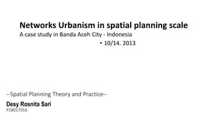
- 1. Networks Urbanism in spatial planning scale A case study in Banda Aceh City - Indonesia • 10/14. 2013 --Spatial Planning Theory and Practice-Desy Rosnita Sari P28017016
- 2. Contain 1. Spatial Planning system in Indonesia 2. Aceh province Spatial Planning 3. City networks for Province Spatial Planning
- 4. INDONESIA Kalimantan Sumatra / Borneo Sulawesi Papua Java 1,919,440 square kilometers 33 Provinces spreading over 5 main islands and 4 archipelago (Riau, Bangka Belitung, Nusa Tenggara, Maluku Archipelago)
- 6. NATIONAL SPATIAL PATTERN Major spatial cluster : Develop area Protection area Conservation area Preservation area Detail Contents: marine boundary protected forest conservation area economic integration area national strategic area regional cooperation the priority area
- 7. NATIONAL STRUCTURE PATTERN Content: transportation (airport, harbor, road system and class) network electricity and telecommunication network city function hierarchy (activity center: national, regional/province, strategic)
- 8. Agriculture and Energy production center Industry and service center Mining and Energy production center Tourism and agriculture production center Agriculture, plantation, fisheries and Energy production center Agriculture, Fisheries, Energy and Mining production center
- 10. BANDA ACEH CITY Aceh province capital since 1956 coordinates 5°33’0’N 95°19’0’E Population 174.433 people, density 3.457/km² (8.950/sq mi) Total area 64 square kilometers, elevation 2 m (7 ft) AMSL
- 11. Taiwan Island : 36.193 km2 Population : 23,340,136 22 Regencies Aceh Province : 58,376 km2 Population : 5,046,000 people 23 regencies
- 13. Province capitol city Banda Aceh City under Regency level
- 14. BANDA ACEH CITY Population 174.433 people Density 3.457/km² (8.950/sq mi) Total area 64 km² Elevation 0.8-5 m AMSL
- 15. BANDA ACEH CITY 9 Districts
- 18. ADMINISTRATIVE CULTURE and RELIGION TRANSPORTATION Kinetic network through Architectural solution Under “monocentric network” of spatial system
- 19. Thank You Xie Xie Ni Terima Kasih