Digital image processing
•Descargar como PPT, PDF•
5 recomendaciones•2,239 vistas

some important information about the digital image processing in world.

Recomendados
Más contenido relacionado
La actualidad más candente
La actualidad más candente (20)
Similar a Digital image processing
Similar a Digital image processing (20)
Más de Dhaval Jalalpara
Más de Dhaval Jalalpara (20)
Último
Último (20)
Digital image processing
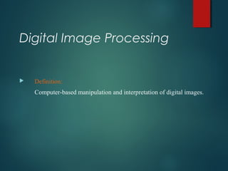
- 1. Digital Image Processing Definition: Computer-based manipulation and interpretation of digital images.
- 2. Digital Image Processing Five broad types of computer assisted operation: 1. Image rectification and restoration (preprocessing 2. Image enhancement 3. Image classification (spectral vs. spatial pattern recognition) 4. Data merging and GIS integration 5. Hyperspectral image analysis 6. Biophysical modeling 7. Image transmission and compression
- 3. Image Rectification & Restoration Preprocessing to correct distorted or degraded image data Geometric distortions Radiometric calibration Elimination of noise
- 4. Image Enhancement To more effectively display or record the data, increasing the visual distinctions between features in a scene Contrast manipulation: stretching
- 5. Image Classification To determine the land cover identity of each pixel in an image, replacing visual analysis with quantitative techniques Spectral pattern recognition: using only spectral radiances Spatial pattern recognition: using geometric shapes, sizes and patterns
- 6. Image Classification The overall objective of classification is to categorize all pixels in a digital image into one of several land cover classes Themes thematic maps: A map designed to demonstrate particular features or concepts.
- 8. Data Merging and GIS Integration To combine image data with other geographically referenced datasets for the same area Multitemporal data merging Change detection procedures Multisensor image merging
- 9. Image Rectification & Restoration To correct image data for distortions or degradations stemming from the image acquisition process Varies with: Type of device (camera, scanner) Platform (airborne versus satellite) Total field of view- A sensor with a wide field of view can image the same place from different angles more frequently than a sensor in the same orbit with a narrower field of view and smaller swath
- 11. Digital images Remote sensing images are recorded in digital forms A digital image is a two-dimensional array of pixels. Each pixel has an intensity value (represented by a digital number) and a location address (referenced by its row and column numbers). They are distributed in computer compatible tapes (CCTs) The basic unit is pixel that is represented as a digital number (DN) Different data sets may use different number of bits so that bit scaling is common.
- 12. Image processing systems Computer hardware (e.g. PC) Computer software Operating system (e.g. Windows/NT) Image processing software (e.g. ENVI) Operator (e.g. you)
- 13. Geometric Correction Raw digital images usually contain geometric distortions so significant that they cannot be used directly as a map base without subsequent processing. Distortion ()-changes in shape and position of objects with respect to their true shape and position. The source of distortions: Variations in altitude, attitude (position), and velocity of sensor platform Panoramic distortion Earth curvature Atmospheric refraction Relief displacement
- 14. Image registration (or resampling) Resampling -The calculation of new DN for pixels created during geometric correction of a digital scene, based on the values in the local area around the uncorrected pixels. In the Nearest Neighbor : technique, the transformed pixel takes the value of the closest pixel in the pre-shifted array. Bilinear Interpolation :uses the 4 closest pixel values surrounding the transformed output pixel is used. Cubic Convolution : uses the 16 closest pixel values
- 17. (Radiometric correction)(Radiometric correction) Atmospheric EffectsAtmospheric Effects LP TE LAPP + Π = ρ Lapp=apparent radiance measured by sensor ρ = reflectance of object T = atmospheric transmittance E = irradiance on object, incoming Lp = path radiance/haze, from the atmosphere and not from the object