California Geological Survey – “Probabilistic Tsunami Modeling and Public Policy” (Rick Wilson)
•Descargar como PPTX, PDF•
1 recomendación•1,403 vistas

The document discusses ongoing work by the California Geological Survey and partners to develop probabilistic tsunami hazard analysis and its applications to public policy. It describes initial findings from pilot studies in Crescent City and Huntington Beach, including that probabilistic analysis can improve understanding of tsunami risk if input parameters and uncertainties are well understood. The California Tsunami Policy Working Group is also discussed, which aims to provide guidance on issues preventing full implementation of tsunami hazard mitigation.

Recomendados
Recomendados
Más contenido relacionado
La actualidad más candente
La actualidad más candente (19)
Destacado
Similar a California Geological Survey – “Probabilistic Tsunami Modeling and Public Policy” (Rick Wilson)
Similar a California Geological Survey – “Probabilistic Tsunami Modeling and Public Policy” (Rick Wilson) (20)
Más de EERI
Más de EERI (20)
Último
Último (20)
California Geological Survey – “Probabilistic Tsunami Modeling and Public Policy” (Rick Wilson)
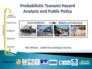
- 1. Rick Wilson, California Geological Survey Probabilistic Tsunami Hazard Analysis and Public Policy Partners =
- 2. Community
- 3. Evacuation/Emergency response planning Maritime planning Land-use planning Recovery planning www.tsunami.ca.gov
- 4. California Seismic Hazard Mapping Act: Project–level assessment and real-estate disclosure Expert Work Group assisting in review of pilot study work in Crescent City and Huntington Beach Initial probabilistic modeling completed by URS Corp. and Univ. of Washington in parts of California Initial findings completed and report being generated Guidance on application will come from California Tsunami Policy Work Group A second phase of work and mapping is being initiated Status of Probabilistic/Land-use Mapping in CA Crescent City Huntington Beach
- 5. Initial Findings of CA-PTHA Work Group PTHA in California scientifically feasible and appropriate for use Tsunami model and map results are most sensitive to source characterization, especially fault slip/uplift amount Alignment with formal Probabilistic Seismic Hazard Analysis vital, especially for national production of consistent products (building code, policymakers, and NTHMP) Application of probabilistic analysis will improve the understanding of the tsunami risk, as long as: input parameters are correct uncertainties are well understood and translatable products are accurate, consistent, and easy to understand P R E L I M I N A R Y URS Consultants, 2012 for Caltrans/PEER/CGS Probabilistic Tsunami Hazard Analysis in Crescent City; blue line is 2009 state inundation map line
- 6. Uses for Probabilistic Tsunami Hazard Analysis Our concept: Produce single set of risk maps/products for multiple uses › Project–level assessment and real- estate disclosure (CGS-Seismic Hazard Mapping Act) › Land-use planning (communities, CA Coastal Commission) › Standardized hazard analysis for evacuation planning (Cal-OES) › Building design and construction , critical facilities (ASCE, Uniform/ International Building Code, Nuclear Regulatory Commission) › Flood protection and insurance (FEMA, Risk MAP, CA-Dept. of Water Resources) › Input for consistent risk analysis and damage estimates (HAZUS) Preliminary risk levels for different applications Preliminary products for different applications
- 7. PILOT STUDIES •Probabilistic Hazard •Community Analysis •Maritime Products Implementation TSUNAMI SCENARIO •Vulnerability Analysis •Social & Economic •Structural Damage Impact POLICY WORKING GROUP •Land Use – Construction •Emergency Management •Recovery Issues POLICY MAKERS Guidance - Regulations • Local • State • Federal Action (Soft) (Hard) Formed in October 2011 to address issues for both the state tsunami program and the USGS tsunami scenario project called “Science Applications for Risk Reduction” (SAFRR) Work Group is a voluntary advisory board comprised of state, federal, and local government representatives, as well as private organizations with interest in coastal planning Charged with identifying, evaluating and making recommendations to resolve issues preventing full and effective implementation of tsunami hazard mitigation and risk reduction at a local level Work Group has evaluated the status of tsunami hazard assessment, preparedness, mitigation, response, and recovery activities in the state and identified the needs to sustain existing programs or implement new programs California Tsunami Policy Work Group Figure from Real and others, 2012
- 8. California Tsunami Policy Work Group Notable Federal and State Legislation and Programs (from Johnson and Real, 2013) FEDERAL LEGISLATION Tsunami Warning and Education Act of 2006 (preparedness and mitigation) Coastal Zone Management Act of 1972 (planning) Disaster Mitigation Act of 2000 (mitigation) Stafford Disaster Relief and Emergency Assistance Act (mitigation and recovery) STATE PROGRAMS California Tsunami Preparedness and Hazard Mitigation Program (hazard assessment, preparedness, mitigation, response) California Tsunami Policy Work Group (policy and planning) Safety Element in Local General Plans (planning) California Coastal Commission (planning) California Building Standards Code (mitigation) FEDERAL PROGRAMS National Tsunami Hazard Mitigation Program (preparedness, mitigation, response) TsunamiReady Program (preparedness) National Response Framework (response) National Disaster Recovery Framework (recovery) FEMA Flood Insurance Rate Maps and RiskMAP (mitigation and recovery) STATE LEGISLATION Seismic Hazard Mapping Act of 1990 (mitigation) California Coastal Act of 1976 (mitigation and planning) California Oil Spill Prevention and Response Act of 1990 (recovery – environmental) NOTE: Tsunami specific in red
- 9. California Tsunami Policy Work Group Possible Courses of Action (from Johnson and Real, 2013) Ensure continued funding and support for the National Tsunami Hazard Mitigation Program, TsunamiReady and affiliated state and local programs. Develop a coordinated and sufficiently robust policy framework for tsunami hazard assessment and mitigation planning for California coastal communities, ports and harbors. Explore opportunities to advance multi-hazard mitigation planning along California’s coast and bays to more holistically address issues of future tsunami risk, sea level rise and future coastal flooding and erosion, and earthquake-induced liquefaction. Encourage responders and government managers at all levels to conduct self- assessments, devise table-top exercises, and more carefully consider how the short-fuse intensity and wide geographic scale of tsunami scenarios could challenge current assumptions. Work to address recovery challenges likely for the most vulnerable coastal communities, ports and harbors, as well portions of the state’s fishing and agriculture sectors.
- 10. Transferability of Ideas/Policies Hazard Assessment Preparedness Mitigation Response Recovery Is commitment to pre- disaster planning for post-event recovery in California and U.S. adequate? DisasterCycle Reconstruction Design Council in Response to the Great East Japan Earthquake, June 2011 Sendai Plain Santa Cruz