
Recomendados
Más contenido relacionado
Similar a EOPS_2019_09_12.pdf
Similar a EOPS_2019_09_12.pdf (20)
Más de EOPS EOPS
Último
Último (20)
EOPS_2019_09_12.pdf
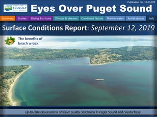
- 1. Up-to-date observations of water quality conditions in Puget Sound and coastal bays Surface Conditions Report: September 12, 2019 Eyes Over Puget Sound Publication No. 19-03-075 Summary Stories Diving & critters Climate & streams Combined factors Marine water Aerial photos Info The benefits of beach wrack
- 2. Guest contribution p.4 The benefits of beach wrack. Personal stories p. 6 Ecology scientists contribute to “global biodiversity library.” Climate & streams p. 10 This year, air temperatures were warmer: a pattern that has lasted several years and is predicted to continue. Precipitation was low, but over the last half-year, conditions improved in some regions. River flows remained low, in step with the warming temperatures. Water temperature and food web p. 13 In August, surface water temperatures were 0.6 °C warmer across all regions; this was beneficial for anchovies in Central Sound, Whidbey Basin, and Hood Canal, and for herring and salmon in the San Juan Islands. Optimum geoduck growth temperatures occurred in the Straits. Aerial photography p. 14 Water is unusually clear, and blooms are restricted to smaller inlets; however, macroalgae are still abundant. Jellyfish are present in Sinclair Inlet, while schools of anchovies are present in Eld Inlet. LONG-TERM MARINE MONITORING UNIT Editorial assistance provided by: Elisa Rauschl, Julianne Ruffner, Ruth Froese, Valerie Partridge. Summary conditions at a glance Summary Stories Diving & critters Climate & streams Combined factors Marine water Aerial photos Info Skip Albertson Dr. Christopher Krembs (Editor) Tyler Burks Jim Shedd Dany Burgess Jason Toft UW SAFS
- 3. Organizations from across Washington state are coming together to stand up for Puget Sound protection and recovery. The stories in this blog are curated from partners and community members who are each invested in keeping this place great. Puget Sound Innovation Stories PUGET SOUND: IT’S WORTH SAVING Have you seen the blog? Start here
- 4. A. Schools of anchovies are still present in some finger inlets. B. Bloom and jellyfish. Location: Eld Inlet (South Sound) 1:29 PM fish jellyfish fish fish fish fish fish Bloom boat A. B. Anchovies still provide opportunities in South Sound Summary Stories Diving & critters Climate & streams Combined factors Marine water Aerial photos Info fish fish jellyfish Bloom Green Cove Sunset Beach
- 5. 2004 2006 2019 Reestablishment of beach wrack, logs, and shoreline vegetation. Logs, wrack, and high-shore invertebrates decline with shoreline armoring. Young scientists exploring the “hoppers” in the wrack... Juhi LaFuente (UW SAFS) measuring percent of beach wrack at the Bowman Bay armor-removal restoration site. Jason Toft (UW SAFS), measuring percent of beach wrack. Beach-hopper amphipods live in the wrack, feeding and taking refuge. They are also prey for fish and birds. …and their dad, Jason. Personal Field Impression Summary Stories Diving & critters Climate & streams Combined factors Marine water Aerial photos Info The benefits of beach wrack Seahurst Park, armor removed in 2005
- 6. It’s all about a health balance. With too much wrack, negative impacts to humans might begin to outweigh ecological benefits. Beach wrack serves as a habitat. At 75% wrack cover, gains in species richness level off. A balance between ecological benefits and human impacts Protocols for monitoring beach wrack and a new database. Shoreline Monitoring Toolbox • At normal levels, beach wrack provides food and shelter for many invertebrates. • Beach wrack can also act as a reservoir for bacteria. With too much wrack, your risk of getting sick increases. See Washington BEACH Program. Summary Stories Diving & critters Climate & streams Combined factors Marine water Aerial photos Info The benefits of beach wrack
- 7. Marine Sediment Monitoring Team Volunteers sorted colorful live organisms into trays that were then passed to taxonomists to identify and photograph. Images courtesy of LAUOE staff. Ecology scientists contribute to “global biodiversity library” Dany Burgess Los Angeles Urban Ocean Expedition (LAUOE) Recently I had the pleasure of participating in a “bioblitz” in sunny Los Angeles, where expert scientists from around the country gathered to collect and document the amazing marine invertebrate biodiversity of Southern California. Bioblitz events like this one are happening worldwide, and many employ genetic techniques like DNA barcoding to identify new and existing species. Learn more about the LAUOE on Ecology’s EcoConnect blog. Summary Stories Diving & critters Climate & streams Combined factors Marine water Aerial photos Info Eyes Under Puget Sound
- 8. Best and worst horizontal visibility at corresponding vertical depth This is a new feature and we are soliciting feedback (skip.albertson@ecy.wa.gov). Good Poor Visibility (only best visibility shown) Find depths with high/low visibility • Best visibility occurred in Elliott Bay near Seacrest Park (location 9), with nearly 80 ft visibility at 98 ft depth. Other locations along East Passage (e.g., Three-Tree & Dash Point) also had good visibility at similar depths. • Poor visibility (no diver icon) occurred near the surface in Commencement Bay (location 14) and also in Oakland Bay near Shelton (location 18). • The poster, “Underwater Visibility Maps — a Tool for Scuba Divers,” is available here. Best visibility in Aug Location Best Visibility Worst Visibility Horizontal Distance (ft.) Vertical Depth (ft.) Horizontal Distance (ft.) Vertical Depth (ft.) 1 32 64 7 2 2 13 2 9 30 3 23 5 17 97 4 31 71 6 31 5 27 71 23 3 6 38 85 15 18 7 36 66 7 8 8 30 67 4 7 9 79 98 23 21 10 11 18 5 52 11 59 90 8 20 12 63 95 13 11 13 23 69 6 5 14 65 97 0 3 15 6 36 4 5 16 31 98 23 7 17 28 98 17 5 18 14 31 3 8 What was the water visibility like for divers? Personal Field Impression Summary Stories Diving & critters Climate & streams Combined factors Marine water Aerial photos Info What can you find underwater?
- 9. In the last 30 days, Puget Sound air temperatures and precipitation were generally above normal (A). In the next 30 days, temperatures are forecasted to be warmer than normal, while precipitation is expected to normalize (B). With a shift to fall-like weather patterns, rivers are beginning to recover. How much water did we get and what can we expect? Summary Stories Diving & critters Climate & streams Combined factors Marine water Aerial photos Info A. Northwest Climate Toolbox (Previous 30 days) B. Northwest Climate Toolbox (Next 30 days) Temperature Anomaly from historical mean ranged from -1 to +4 °F in the Puget Sound region during the past 30 days. Precipitation Anomaly from historical mean ranged from -2 to +5 inches in the Puget Sound region during the past 30 days. Temperature Precipitation Temperature Precipitation Precipitation Anomaly from historical mean is forecasted to be near normal in the Puget Sound region during the next 30 days. Temperature Anomaly from historical mean is forecasted to be +2 °F in the Puget Sound region during the next 30 days.
- 10. Following a dry summer, the return of precipitation has resulted in normal to above-normal freshwater inputs to Puget Sound (trend charts, left). Current flow distribution across the watershed is mixed (map, right), due to the variable delivery of rain over the region. Flows will continue to be variable until the regular pattern of precipitation is established. How much water flows into Puget Sound? Summary Stories Diving & critters Climate & streams Combined factors Marine water Aerial photos Info Daily average discharge, in cubic feet per second Select Puget Sound Streamflow Trends Daily average discharge, in cubic feet per second Current Streamflow Conditions as of 9/16/2019 Current conditions: CLICK HERE! USGS WaterWatch: CLICK HERE! Skagit River near Mt. Vernon (12200500) Snohomish River near Monroe (12150800) Puyallup River at Puyallup (12101500)
- 11. Climateinfluences:HowwellisPugetSoundexchangingits water? The Fraser River is the major driver of estuarine circulation and water exchange between the Salish Sea and the ocean. Fraser River has regained expected levels. Dramatic snow melt in May resulted in well-below-normal flows in early summer. Historically, the peaks of coastal upwelling and the freshet are in sync. In 2019, the freshet is weak. NPGO (x10) PDO/Upwelling Index How do ocean boundary conditions affect the quality of water we exchange with the ocean? Recent years’ warm water is gone (PDO). Upwelling (Upwelling Index anomaly) and NPGO, which reflects the surface productivity along the coast, are at neutral levels. Pacific Decadal Oscillation Index (PDO, temperature, explanation). Upwelling Index (anomalies) (Upwelling, low oxygen, explanation). North Pacific Gyre Oscillation Index (NPGO, productivity, explanation). Three-year running average of PDO, Upwelling, and NPGO Indices Summary Stories Diving & critters Climate & streams Combined factors Marine water Aerial photos Info Fraser River (at midnight) Higher than normal Lower than normal Expected -25 -15 -5 5 15 25 -2 -1 0 1 2 1945 1950 1955 1960 1965 1970 1975 1980 1985 1990 1995 2000 2005 2010 2015
- 12. higher No data lower expected *Upwelling/downwelling Anomalies (PFEL) PDO = Pacific Decadal Oscillation ENSO = El Niño Southern Oscillation All data are from public sources: UW GRAYSKIES; river flows from USGS and Environment Canada; indices from NOAA & UW (PDO). Conditions leading up to September: Air temperatures were generally warm this year, following recent years. Precipitation for the past five months was lower than in 2018, but July and August were wetter. Sunshine (opposite of cloud cover) has been high, except in July and August. River flows have been low since last year, June 2018. Upwelling started early in spring in 2018 and 2019. In summer of 2019, it weakened prematurely. What influences Puget Sound’s water quality? In the anomaly plot, we want to connect different factors influencing water quality in the context of space and time. Conditions leading up to June 2019 were drier, with lower river flows than in Spring 2018. The past winter was consistently warmer than the previous two winters, although February was much colder. Early-onset upwelling was a factor in both 2018 and 2019. For recent river and stream inflow, see page 8. Summary Stories Diving & critters Climate & streams Combined factors Marine water Aerial photos Info
- 13. Like The Blob, the new heat wave emerged over the course of a few months. In the news, a new heat wave might occur Summary Stories Diving & critters Climate & streams Combined factors Marine water Aerial photos Info By Lynda V. Mapes, Seattle Times environment reporter. “A new marine heat wave has formed off the West Coast that is similar to a 2015 event — nicknamed ‘The Blob’ — that devastated sea life and ravaged runs of Pacific salmon. Although the similarities are striking, whether the new system will cause the same havoc is yet to be seen.”
- 14. Summary Stories Diving & critters Climate & streams Combined factors Marine water Aerial photos Info Water temperature affects ecosystem performance Warmer than expected Cooler than expected Expected 18-year average Legend: Can organisms thrive and survive? The life cycles of organisms respond to temperature. To be successful, the timing of early life stages must line up with good growth conditions. Temperature is important for growth, but also dictates if certain organisms can overwinter in Puget Sound (e.g., Northern anchovy). * Help us get these right. We scoured the literature for temperatures important to the success and survival of marine organisms. Lifecycles Temperature Climate In August, average surface water (0 – 30 m) temperatures were 0.6 °C above the baseline (1999 – 2018) across all regions. Central Sound, Whidbey Basin, and Hood Canal reached optimal spawning temperatures for anchovies. Optimum growth temperatures for herring and salmon were reached in the San Juan Islands, and near-optimum geoduck growth temperatures occurred in the Straits. Optimal temperatures for Puget Sound organisms*
- 15. What are the conditions at the surface? Start here Bloom Debris Front Plume Narrow Hammersley Inlet connecting Oakland Bay Mixing and fronts: Tidal eddies near Fox Island, fronts off Maury Island. Debris: Rafts of macroalgae in Central and South Sound still present. Visible blooms: Red-brown bloom in Henderson, Eld and Budd Inlets. Turquoise water in some bays, cause unknown. Dark maroon bloom in Case Inlet. Jellyfish and fish: Many jellyfish patches in Sinclair Inlet; few patches in Eld and Budd Inlets. Schools of fish in Eld Inlet. Suspended sediment: Glacial flour from the Puyallup and Nisqually Rivers extending into Puget Sound. Water is unusually clear, and red-brown fall blooms are restricted to smaller inlets. Case Inlet has a dark maroon color. Macroalgae are still abundant in Carr and Case Inlets and have been sighted near Normandy Park. Jellyfish abundance is high in Sinclair Inlet but much lower than previous years. In South Sound, schools of anchovies still are present. Summary Stories Diving & critters Climate & streams Combined factors Marine water Aerial photos Info Bloom Elisa Rauschl, our new team member, joined the EOPS flight. Turquoise water in East bay, Budd Inlet.
- 16. Flight Strait of Juan de Fuca San Juan Islands Main Basin Hood Canal Whidbey Basin Sunny and hazy Flight Observations Aerial navigation guide South Sound Summary Stories Diving & critters Climate & streams Combined factors Marine water Aerial photos Info Padilla Bay Tide data from 9/12/2019 (Seattle): Time Pred High/Low 04:16 AM 9.44 H 10:41 AM 0.43 L 5:43 PM 10.90 H 11:37 PM 4.43 L 11 12 13 14 6 10 1 3 2 4 7 8 9 5 People sharing images 15
- 17. Red-brown bloom. Location: Budd Inlet (South Sound), 1:29 PM 1 Aerial photography 9-12-2019 Navigate Summary Stories Diving & critters Climate & streams Combined factors Marine water Aerial photos Info Priest Point Park Bloom boat
- 18. A. Macroalgae accumulating along tidal front. B. Macroalgae patch drifting across Long Island. Location: Case Inlet (South Sound), 1:40 PM macroalgae A. B. 2 Navigate Summary Stories Diving & critters Climate & streams Combined factors Marine water Aerial photos Info Aerial photography 9-12-2019 macroalgae Vaughn Bay Bloom near Allyn P. reticulatum and Prorocentrum spp. (Sound Toxins). boat
- 19. Red-brown bloom and aggregations of organic material in Henderson Bay. Location: Carr Inlet (South Sound), 1:46 PM Allen Point 3 Navigate Summary Stories Diving & critters Climate & streams Combined factors Marine water Aerial photos Info Aerial photography 9-12-2019 Bloom Debris boat Bloom Debris Tacoma
- 20. Patches of jellyfish and red-brown bloom mixed with what appears to be turquoise water. Location: Sinclair Inlet (Central Sound), 1:51 PM 4 Navigate Summary Stories Diving & critters Climate & streams Combined factors Marine water Aerial photos Info Aerial photography 9-12-2019 jellyfish jellyfish jellyfish jellyfish jellyfish Bloom barge
- 21. Patches of jellyfish and red-brown bloom mixed with what appears to be turquoise water. Location: Sinclair Inlet (Central Sound), 1:54 PM 5 Navigate Summary Stories Diving & critters Climate & streams Combined factors Marine water Aerial photos Info Aerial photography 9-12-2019 jellyfish jellyfish jellyfish jellyfish Bloom boat
- 22. A. Thin layer of surface water of different color mixing around piling structures. B. Red-brown bloom. Location: Liberty Bay (Central Sound), 2:02 PM boat boat Bloom A. B. 6 Navigate Summary Stories Diving & critters Climate & streams Combined factors Marine water Aerial photos Info Aerial photography 9-12-2019 Bloom Cabin reflection boat mixing mixing
- 23. 7 Navigate Summary Stories Diving & critters Climate & streams Combined factors Marine water Aerial photos Info Aerial photography 9-12-2019 Red-brown bloom and very turbid water. Location: Quartermaster Harbor (Central Sound), 2:20 PM boat Bloom Bloom Maury Island high turbidity
- 24. Maury Island Debris boat Red-brown bloom and very turquoise water. Location: Quartermaster Harbor (Central Sound), 2:21 PM 8 Navigate Summary Stories Diving & critters Climate & streams Combined factors Marine water Aerial photos Info Aerial photography 9-12-2019 barge boat Bloom
- 25. 9 Navigate Summary Stories Diving & critters Climate & streams Combined factors Marine water Aerial photos Info Aerial photography 9-12-2019 Puyallup River plume, rich in sediment, extending into Central Sound. Location: Vashon Island and Commencement Bay (Central Sound), 2:23 PM Plume boat Bloom Maury Island Vashon Island Puyallup River Mount Rainier
- 26. Macroalgae rafts accumulating in large tidal eddy. Location: Carr Inlet (South Sound), 2:23 PM 10 Navigate Summary Stories Diving & critters Climate & streams Combined factors Marine water Aerial photos Info Aerial photography 9-12-2019 Fox Island macroalgae boat macroalgae eddy macroalgae
- 27. 11 Navigate Summary Stories Diving & critters Climate & streams Combined factors Marine water Aerial photos Info Aerial photography 9-12-2019 Multiple macroalgae rafts accumulating along parallel lines. Location: Carr Inlet (South Sound), 2:32 PM macroalgae macroalgae macroalgae macroalgae macroalgae macroalgae macroalgae
- 28. Macroalgae patches at end of Balch Passage. Location: Balch Passage (South Sound), 2:35 PM 12 Navigate Summary Stories Diving & critters Climate & streams Combined factors Marine water Aerial photos Info Aerial photography 9-12-2019 Hogan Point macroalgae macroalgae
- 29. Sediment plume of Nisqually River hugging Anderson Island, flowing West (toward the bottom). Location: Nisqually Reach (South Sound), 2:37 PM Anderson Island boat 13 Navigate Summary Stories Diving & critters Climate & streams Combined factors Marine water Aerial photos Info Aerial photography 9-12-2019 Nisqually River Plume Plume
- 30. Red-brown bloom and turquoise water showing circulation of river water preferentially northward (toward the bottom). Location: Henderson Inlet (South Sound), 2:40 PM 14 Navigate Summary Stories Diving & critters Climate & streams Combined factors Marine water Aerial photos Info Aerial photography 9-12-2019 Woodard Bay boat Bloom
- 31. A. 9/7/2019 15 Navigate Summary Stories Diving & critters Climate & streams Combined factors Marine water Aerial photos Info Citizens contributing with observations macroalgae Vashon Island 9/6/2019 C. B. A. Macroalgae rafts in southern Central Basin. B. Diffuse jellyfish smacks in West Sound, Orcas Island. Location: A. Normandy Park, B. Brace Point & Three Tree Point (Central Sound), C. West Sound (San Juan Islands). macroalgae 9/23/2019
- 32. Find past editions of EOPS on the next pages Summary Stories Diving & critters Climate & streams Combined factors Marine water Aerial photos Info We have published 83 editions! Recommended Citation (example for September 2018 edition): Washington State Department of Ecology. 2018. Eyes Over Puget Sound: Surface Conditions Report, September 17, 2018. Publication No. 18-03-075. Olympia, WA. https://fortress.wa.gov/ecy/publications/documents/1803075.pdf. Find all previous Eyes Over Puget Sound editions at the end of this document. Contact: Dr. Christopher Krembs Christopher.Krembs@ecy.wa.gov Marine Monitoring Unit Environmental Assessment Program Washington State Department of Ecology Subscribe to the Eyes Over Puget Sound email listserv. Many thanks to our business partners: Shannon Point Marine Lab (WWU), Jorgensen Air
- 33. XXXX_X_XXXX, Publication No. 19-03-0XX XXXX_X_XXXX, Publication No. 19-03-0XX September_12_2019, Publication No. 19-03-075 July_29_2019 Publication No. 19-03-074 June_4_2019, Publication No. 19-03-073 March_26_2019, Publication No. 19-03-072 February_21_2019, Publication No. 19-03-071 January_10_2019, Publication No. 19-03-070 November_6_2018, Publication No. 18-03-075 September_17_2018, Publication No. 18-03-074 July_16_2018, Publication No. 18-03-073 June_28_2018, Publication No. 18-03-072 May_22_2018, Publication No. 18-03-025 April_19_2018, Publication No. 18-03-071 Winter_2018, Publication No. 18-03-070 October_31_2017, Publication No. 17-03-073 August_28_2017, Publication No. 17-03-072 July_24_2017, Publication No. 17-03-071 June_6_2017, Publication No. 17-03-070 December_31_2016, Publication No. 16-03-079
- 34. November_22_2016, Publication No. 16-03-078 September_26_2016, Publication No. 16-03-077 August_24_2016, Publication No. 16-03-076 July_20_2016, Publication No. 16-03-075 June_27_2016, Publication No. 16-03-074 May_2_2016, Publication No. 16-03-073 April_6_2016, Publication No. 16-03-072 March_16_2016, Publication No. 16-03-071 February_8_2016, Publication No. 16-03-070 December_30_2015, Publication No. 15-03-080 December_14_2015, Publication No. 15-03-079 October_6_2015, Publication No. 15-03-078 September_21_2015, Publication No. 15-03-077 August_8_2015, Publication No. 15-03-076 July_6_2015, Publication No. 15-03-075 June_8_2015, Publication No. 15-03-074 April_29_2015, Publication No. 15-03-073 March_24_2015, Publication No. 15-03-072 February_17_2015, Publication No. 15-03-071 January_28_2015, Publication No. 15-03-070
- 35. December_30_2014, Publication No. 14-03-080 November_17_2014, Publication No. 14-03-079 October_29_2014, Publication No. 14-03-078 September_16_2014, Publication No. 14-03-077 August_18_2014, Publication No. 14-03-076 July_28_2014, Publication No. 14-03-075 June_23_2014, Publication No. 14-03-074 May_12_2014, Publication No. 14-03-073 April_21_2014, Publication No. 14-03-072 March_24_2014, Publication No. 14-03-071 February_4_2014, Publication No. 14-03-070 December_31_2013, Publication No. 13-03-081 November_21_2013, Publication No. 13-03-080 October_28_2013, Publication No. 13-03-079 September_11_2013, Publication No. 13-03-078 August_21_2013, Publication No. 13-03-077 July_15_2013, Publication No. 13-03-076 June_17_2013, Publication No. 13-03-075 May_20_2013, Publication No. 13-03-074 April_8_2013, Publication No. 13-03-073
- 36. Mar_25_2013, Publication No. 13-03-072 February_26_2013, Publication No. 13-03-071 January_15_2013, Publication No. 13-03-070 December_13_2012, Publication No. 12-03-081 November_8_2012, Publication No. 12-03-080 October_8_2012, Publication No. 12-03-079 September_11_2012, Publication No. 12-03-078 August_27_2012, Publication No. 12-03-077 July_31_2012, Publication No. 12-03-076 June_12_2012, Publication No. 12-03-075 May_14_2012, Publication No. 12-03-074 April_23_2012, Publication No. 12-03-073 March_19_2012, Publication No. 12-03-072 February_27_2012, Publication No. 12-03-071 January_30_2012, Publication No. 12-03-070 December_5_2011, Publication No. 11-03-082 November_15_2011, Publication No. 11-03-081 October_17_2011, Publication No. 11-03-080 September_12_2011, Publication No. 11-03-079 August_8_2011, Publication No. 11-03-078
- 37. July_6_2011, Publication No. 11-03-077 June_20_2011, Publication No. 11-03-076 June_6_2011, Publication No. 11-03-075 May_4_2011, Publication No. 11-03-074 April_27_2011, Publication No. 11-03-073
- 39. Month_date_year, Publication No. 20-03-07X Month_date_year, Publication No. 20-03-07X Month_date_year, Publication No. 20-03-07X Month_date_year, Publication No. 20-03-07X March_16_2020, Publication No. 20-03-071 Jan_10_2020, Publication No. 20-03-070 October_30_2019, Publication No. 19-03-076 September_12_2019, Publication No. 19-03-075 July_29_2019 Publication No. 19-03-074 June_4_2019, Publication No. 19-03-073 March_26_2019, Publication No. 19-03-072 February_21_2019, Publication No. 19-03-071 January_10_2019, Publication No. 19-03-070 November_6_2018, Publication No. 18-03-075 September_17_2018, Publication No. 18-03-074 July_16_2018, Publication No. 18-03-073 June_28_2018, Publication No. 18-03-072 May_22_2018, Publication No. 18-03-025 April_19_2018, Publication No. 18-03-071 Winter_2018, Publication No. 18-03-070
- 40. October_31_2017, Publication No. 17-03-073 August_28_2017, Publication No. 17-03-072 July_24_2017, Publication No. 17-03-071 June_6_2017, Publication No. 17-03-070 December_31_2016, Publication No. 16-03-079 November_22_2016, Publication No. 16-03-078 September_26_2016, Publication No. 16-03-077 August_24_2016, Publication No. 16-03-076 July_20_2016, Publication No. 16-03-075 June_27_2016, Publication No. 16-03-074 May_2_2016, Publication No. 16-03-073 April_6_2016, Publication No. 16-03-072 March_16_2016, Publication No. 16-03-071 February_8_2016, Publication No. 16-03-070 December_30_2015, Publication No. 15-03-080 December_14_2015, Publication No. 15-03-079 October_6_2015, Publication No. 15-03-078 September_21_2015, Publication No. 15-03-077 August_8_2015, Publication No. 15-03-076 July_6_2015, Publication No. 15-03-075
- 41. June_8_2015, Publication No. 15-03-074 April_29_2015, Publication No. 15-03-073 March_24_2015, Publication No. 15-03-072 February_17_2015, Publication No. 15-03-071 January_28_2015, Publication No. 15-03-070 December_30_2014, Publication No. 14-03-080 November_17_2014, Publication No. 14-03-079 October_29_2014, Publication No. 14-03-078 September_16_2014, Publication No. 14-03-077 August_18_2014, Publication No. 14-03-076 July_28_2014, Publication No. 14-03-075 June_23_2014, Publication No. 14-03-074 May_12_2014, Publication No. 14-03-073 April_21_2014, Publication No. 14-03-072 March_24_2014, Publication No. 14-03-071 February_4_2014, Publication No. 14-03-070 December_31_2013, Publication No. 13-03-081 November_21_2013, Publication No. 13-03-080 October_28_2013, Publication No. 13-03-079 September_11_2013, Publication No. 13-03-078
- 42. August_21_2013, Publication No. 13-03-077 July_15_2013, Publication No. 13-03-076 June_17_2013, Publication No. 13-03-075 May_20_2013, Publication No. 13-03-074 April_8_2013, Publication No. 13-03-073 Mar_25_2013, Publication No. 13-03-072 February_26_2013, Publication No. 13-03-071 January_15_2013, Publication No. 13-03-070 December_13_2012, Publication No. 12-03-081 November_8_2012, Publication No. 12-03-080 October_8_2012, Publication No. 12-03-079 September_11_2012, Publication No. 12-03-078 August_27_2012, Publication No. 12-03-077 July_31_2012, Publication No. 12-03-076 June_12_2012, Publication No. 12-03-075 May_14_2012, Publication No. 12-03-074 April_23_2012, Publication No. 12-03-073 March_19_2012, Publication No. 12-03-072 February_27_2012, Publication No. 12-03-071 January_30_2012, Publication No. 12-03-070
- 43. December_5_2011, Publication No. 11-03-082 November_15_2011, Publication No. 11-03-081 October_17_2011, Publication No. 11-03-080 September_12_2011, Publication No. 11-03-079 August_8_2011, Publication No. 11-03-078 July_6_2011, Publication No. 11-03-077 June_20_2011, Publication No. 11-03-076 June_6_2011, Publication No. 11-03-075 May_4_2011, Publication No. 11-03-074 April_27_2011, Publication No. 11-03-073