ArcGIS: A Platform for Intelligent 3D Imagery
•
0 recomendaciones•635 vistas

The ArcGIS platform provides more than just 3D maps by enabling users to share, create, and add 3D content through web browsers and mobile apps. It allows existing 2D data and processes to be used to automate the creation of 3D models from imagery and lidar data. This facilitates large-scale 3D mapping of cities, facilities, and other areas. The platform also supports augmented reality and delivering 3D content anywhere through web scenes.

Recomendados
Más contenido relacionado
La actualidad más candente
La actualidad más candente (20)
Similar a ArcGIS: A Platform for Intelligent 3D Imagery
Similar a ArcGIS: A Platform for Intelligent 3D Imagery (20)
Más de Esri
Más de Esri (20)
Último
Último (20)
ArcGIS: A Platform for Intelligent 3D Imagery
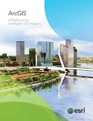
- 1. ArcGIS A Platform for Intelligent 3D Imagery ®
- 2. 2D GIS Lidar 3D Map+ = ArcGIS: A Platform for Intelligent 3D Imagery The ArcGIS® platform provides more than simple, realistic 3D maps. Realize the full potential of 3D data with the ArcGIS platform. Share 3D maps, apps, and content through web browsers; create new 3D solutions via ArcGIS Runtime SDK for Windows Mobile; and add 3D content into ArcGIS Marketplace. Get the most out of your 3D mapping with ArcGIS. Use existing 2D technology and data. No need to change established processes, data, or technology—bring your existing 2D data to life in 3D with ArcGIS. The height of 2D objects can be readily populated using information from many different types of sensors.
- 3. Automate processes and workflows. Automate the ingestion of imagery and lidar. Instead of manually adding heights to 2D building footprints and contour lines or creating models from scratch, set up automation once and use it many times. Readily create 3D data for large geographic areas including national mapping; city mapping; or complex, data-rich mapping inside facilities. Unleash 3D. Thanks to increased processing power of smart devices and the ability to bring processing to the cloud, 3D data can be delivered anytime, anywhere. Use Esri web scenes to easily create apps and share them with anyone. Step 1 Geodatabase/2D Information Step 2 3D Streets, Blocks, and Parcels (import or creation) Step 3 3D Extrusion, Roof Generation, and Street Furniture Step 4 Texturing and Facade Creation (details) Step 5 Finished 3D City Shared on the Web and Updated in the Geodatabase Power maps, apps, and analytics with an intelligent data model. Esri’s 3D city information model allows users to move away from the need to access and process hundreds of thousands of shapefiles to a database-centric production process. Work in every scale, from city to building. Replicate environments and automate updates so more time can be spent performing analytics. The future is now. Extend 3D mapping to fuse all data, including full-motion video, and create and use augmented reality. Provide 3D basemaps for standard visualizations or to embed analytics. Interact with data in any number of ways. It all starts with standard 2D data and the familiar ArcGIS production environment. Don’t wait —learn more at esri.com/3Dmapping.
- 4. Printed in USA Contact Esri 380 New York Street Redlands, California 92373-8100 USA 1 800 447 9778 T 909 793 2853 F 909 793 5953 info@esri.com esri.com Offices worldwide esri.com/locations Esri inspires and enables people to positively impact their future through a deeper, geographic understanding of the changing world around them. Governments, industry leaders, academics, and nongovernmental organizations trust us to connect them with the analytic knowledge they need to make the critical decisions that shape the planet. For more than 40 years, Esri has cultivated collaborative relationships with partners who share our commitment to solving earth’s most pressing challenges with geographic expertise and rational resolve. Today, we believe that geography is at the heart of a more resilient and sustainable future. Creating responsible products and solutions drives our passion for improving quality of life everywhere. Copyright © 2014 Esri. All rights reserved. Esri, the Esri globe logo, ArcGIS, ArcScene, @esri.com, and esri.com are trademarks, service marks, or registered marks of Esri in the United States, the European Community, or certain other jurisdictions. Other companies and products or services mentioned herein may be trademarks, service marks, or registered marks of their respective mark owners. 139397 ESRI6C4/14dl