Forest monitoring and forest change : 1990 - 2010
•Descargar como PPTX, PDF•
3 recomendaciones•1,285 vistas


Recomendados
Recomendados
Más contenido relacionado
Similar a Forest monitoring and forest change : 1990 - 2010
Similar a Forest monitoring and forest change : 1990 - 2010 (20)
Más de FAO
Más de FAO (20)
Último
Último (20)
Forest monitoring and forest change : 1990 - 2010
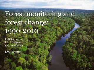
- 1. Forest monitoring and forest change: 1990-2010 R. D’Annunzio E.L. Lindquist K.G. MacDicken FAO Forestry
- 2. In 1923 the world first learned about global forest resources… … in 1948 FAO began monitoring forest resource change
- 3. …. so what difference did this knowledge make?
- 4. Four key global results have made a difference since 1923…
- 5. Widespread forest loss in the tropics was detected1 Resulting in 60+ years of investment
- 6. … resulting in increased planting Gaps in wood supply were identified 2
- 7. Forest conversion was identified as a contributor to global climate change Forest management is now part of global mitigation strategies 3
- 8. Remote sensing was proven as a tool for monitoring forest resources Leading to some 100 earth observing satellites 4
- 9. Since 1948, most of this information has come from one source: the Global Forest Resources Assessment (FRA)
- 10. ...but no single source of reporting data is completely adequate... … the combination of FRA country reports and systematic remote sensing adds value…
- 11. In 2009 FAO and the EC Joint Research Centre began analysis of Landsat data to assess forest land use change
- 12. The FRA Remote Sensing Survey included 13,575 sample sites with land use review inputs from over 200 national experts from 107 countries…
- 13. Forestry Paper 169 provides methods and results from 1990-2005…
- 14. Tropical: 1,730 (45%) Boreal: 1,190 (31%) Temperate: 630 (16%) Subtropical : 330 (8%) World : 3,880 2010 forest area (million hectares)
- 15. Annual global forest change: 15.5 million ha gross loss 10.2 million ha gross gain 5.3 million ha net loss Or a ~110 million ha total net loss from 1990-2010
- 16. ...yet the story is really told at the climatic domain level…
- 17. 0 200 400 600 800 1,000 1,200 1,400 1,600 1,800 2,000 2,200 1990 2000 2010 Forestarea(millionhectares) Year Tropical Boreal Temperate Subtropical How has forest area changed over time?
- 18. Regions of significant change: Tropical South America
- 19. Regions of significant change: Tropical Africa
- 20. Regions of significant change: Asia
- 21. Remote sensing provides clues to what is happening with the world’s forests… Which is complemented by ground- based data on: Natural vs. planted forest Forest stocks (volume, biomass, carbon) Conservation and protection Production and management Social and economic values
- 22. How much forest is there per person?* * 50 countries for which data is available since 1923
- 23. In summary… • Forest monitoring provides tangible returns on investment • Global forest area is decreasing at a steady rate, but gains are occurring in some regions/forest types • Forest conversion continues in the tropics …. primarily due to demand for agriculture
Notas del editor
- Monitoring since 1923 has resulted in:
- Detection of widespread forest loss in the tropicsResulting in 60 years of investment
- A need for more wood…. And An increase in planted forest of ….
- Understanding forests and climate changeInclusion of forests as part of global mitigation strategies
- A need for remote sensing of earth resourcesLeading to some 100 earth observing satellites