The document discusses how unmanned aerial systems (UAS) could be used as a new tool for urban firefighting. It describes how UAS equipped with cameras could provide situational awareness and persistent surveillance at fire scenes. Fire trucks could each deploy a tethered hexacopter UAS to gather video feeds and transmit them to command staff in real time. This would allow commanders to make informed decisions and monitor multiple angles of the fire. The document also outlines the costs and regulatory considerations of adopting UAS for fire departments.
1. INTERNATIONAL FIRE FIGHTER 31
AERIAL DEVICES
F
or the past few years discussions of UAS in
firefighting have centered around forest-fires,
and how to utilise unmanned assets to better
predict movement, document fuel sources in the
path and gather data to support deployment
efforts to combat the fire. Now, startup companies
like Nitrofirex of Spain are developing deployable
UAS gliders that will allow Night Time Fighting of
Forest Fires. According to company president Luis
Bordallo, “Nitrofirex has obtained a global patent
on a new approach in the world of the aerial
vehicles, which aims to develop the capacity of
spraying or spreading a large payload in a hostile,
difficult or impossible to access environments
using ‘Autonomous Gliding Containers’ (AGC)
these carry the payload from C-130 type Launch
Aircraft (LA) from altitude. The payload is delivered
to the programmed release point autonomously
with pinpoint accuracy. Once empty and removed
from the fire zone, the AGC begin their recovery
phase by means of their engine, recovering and
landing in the base of operation of the LA in a
completely autonomous way. The company is still
in the viability and design phase, but has the
attention of university researchers, investors, and
the aeronautical community.”
So if this could be the future of aerial forest fire
fighting, how can UAS impact the urban or metro-
politan firefighter? We have all read articles and
heard statements from politicians about the
‘privacy concerns’ of using unmanned aircraft in
law enforcement applications, so how does the
firefighting community avoid the political issues of
incorporating UAS into the basic tools that are
currently used to protect property and save lives of
citizens and first responders?
One company that is working to solve this
problem is Information Processing Systems Inc.
(IPS). For over 40 years, IPS has specialized in
building interoperable communications systems
for first responders and the military. These quickly
deployable Mobile Command Vehicles (MCV) and
incident command mobile carts integrate these
aerial, ground, and subsurface remotely controlled
robotic platforms with cameras and sensors into a
ground control station. Each UAS or Remotely
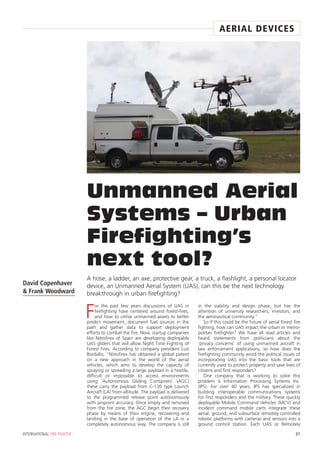
Unmanned Aerial
Systems – Urban
Firefighting’s
next tool?
A hose, a ladder, an axe, protective gear, a truck, a flashlight, a personal locator
device, an Unmanned Aerial System (UAS), can this be the next technology
breakthrough in urban firefighting?
David Copenhaver
& Frank Woodward
2. Operated Vehicle (ROV) is connected with or with-
out a tether to the ground station which provides
the GIS software solution for providing a Common
Operating Picture (COP) to First Responders on
scene – as well as a backhaul via satellite to the
strategic command.
In the last twelve years, there have been
tremendous efforts made to make sure that in
emergency response situations, all first responders
have the ability to communicate seamlessly across
all responding agency radio communication
systems. We could envision a new situation where
first responders could be creating stand alone
islands of both Metadata and Video data. Com-
mand Centers are now accumulating from these
independent robotic sensors (such as UAS, ROV,
throwbots, and other unmanned platforms) large
databases of actionable data that benefits all
responding agencies and not having the means to
share this information to all responding agencies.
There was a possibility that the National Guard
would arrive with their UAS; the County Sheriff’s
department with their ROV for underwater search
and rescue; the local police with their aerial asset,
the Fire Department with their UAS, and Federal
agencies like DHS or Forest Service could all arrive
on scene with manned/unmanned assets and each
one with their own Command and Control
UAS/ROV response vehicle. So we began working
with industry manufacturers like VideoRay,
Hoverfly, RP Flight, Sofcoast, and ISIS Copters to
integrate their UAS and ROV products into the IPS
MCV, with the focus on creating the next genera-
tion of incident response vehicle. But like most
commercial companies, we focused our sales and
marketing efforts on the homeland security market.
However, we quickly learned from our UAS
manufacturing partners that in today’s personal
and political environment, safe free flight of UAS
in the national airspace for security and surveil-
lance in most countries is still being evaluated and
studied, and awaiting regulation by government
agencies responsible for aviation safety and
addressing the public’s privacy concerns.
In an effort to develop alternate marketing
opportunities, we exhibited the IPS Nexgen MCV
with aerial and underwater unmanned systems at
the recent FDIC 2013 (Fire Department Instructors
Conference) held in Indianapolis, we learned from
departments from all over the world that they are
looking for UAS solutions that are quickly
deployable, cost effective, public-friendly tools for
creating immediate situational awareness upon
arriving on site. We heard current methods for
developing an aerial view that provides actionable
information to help commanders make informed
decisions at the response site could range from
camera – mounted mast on trucks; to cameras
mounted on snorkel or ladder trucks; to watching
video from the news helicopter or in some
instances the Police helicopter can provide video to
a responding police car. These all have some value
to emergency responders, but many times what
they really need is not just situational awareness –
they also need persistent (constant) surveillance.
One very powerful tool for situational aware-
ness and persistent surveillance is a tethered UAS,
either a rotary wing quadcopter or hexacopter
capable of maintaining a controlled hover at
150ft above the scene and we are not alone in
that assessment. One of the leading UAS industry
experts, Patrick Egan who is the Editor of the
Americas Desk at sUAS (Small Unmanned Aerial
Systems) News and the host and executive produc-
er of the sUAS News Podcast Series was recently
quoted as saying, “Those in the UAS industry
looking for a lasting opportunity should be beat-
ing a path to the firefighter end-users door with
systems that address safe, controlled, cost effec-
tive platforms that cannot be bundled under the
32 INTERNATIONAL FIRE FIGHTER
UNMANNED AERIAL SYSTEMS – URBAN FIREFIGHTING’S NEXT TOOL?
AERIAL DEVICES
3. misleading term ‘drones’ and will become just
another tool in saving lives and property in large
dwelling, structure fires or Hazmat situations.”
For example, as a Battalion Chief, you are
dispatched to a multiple alarm structure fire in
your operations area, from each of your four
assigned stations you have a truck respond that
has a tethered hexacopter UAS with a high defini-
tion (HD) and infrared (IR) camera attached. The
UAS is deployed from a box mounted on the top
of the truck. The box contains a tether manage-
ment system which provides power and a fibre
optic video link down to the truck and broadcast
capability to other responding equipment,
command centers, tablets, or personal viewing
devices. The UAS features an autopilot system that
maintains altitude and position within 1 metre in
winds gusting to 35 knots. The UAS is effective in
temperature ranges from minus 10 to 150 degrees
Fahrenheit and can maintain flight in rainfall up to
25mm per hour. Operation in thunderstorm condi-
tions has the same risk or guidelines as a ladder or
snorkel truck.
As the trucks arrive on scene, they are deployed
to each side of the fire. The engineer or driver
immediately deploys the UAS to a programmed
altitude determined by the structure height. On
your in-vehicle monitor, you have access to all four
incoming video feeds as you arrive on scene. The
cameras can be controlled for pan, tilt, zoom or
could be programmed in sweep mode to provide a
360 degree view of the surrounding structures,
hazards, and citizens, vehicles, and access roads.
Situational awareness is now being provided by
ground and air in HD or IR in real time video
images to command staff, ground leaders, and
individual firefighters within minutes of arrival.
Upon your arrival, you deploy a portable com-
mand center from the back of your vehicle with
monitors, radio communications, and a Common
Operating Picture (COP) view showing the position
of fire vehicles; personnel; all commercial, public,
private aircraft above the scene; and current
weather conditions in a real time view. You can
click on an asset and the video being broadcast
will be displayed in a window on the display. All
communications, video, and equip-
ment and personnel positioning
can be archived for later review or
for training purposes.
During the FDIC show, we were
approached by a fire boat manu-
facturer who after hearing the
explanation of the UAS capability
has begun offering the tethered
UAS solution as an option on their
fire boats. The only difference in
the scenario is that all maritime
traffic in the operations area would
be displayed on the boat Captains
COP.
There are numerous scenarios
that could be defined where the
UAS could play a key role in reduc-
ing the loss of property and life.
The UAS described in the
example above are currently being
built and tested by both Hoverfly in
Winter Springs, FL and ISIS Copters
in Carlsbad, CA for the urban fire-
fighting market. Suggested
acquisition cost for systems currently being devel-
oped by both companies depending on number of
rotors, camera type and image resolution would
range from $30,000 to $75,000. Quick Deploy-
ment carts and MCV’s with integrated aerial,
underwater, and ground robot capability are
available from IPS NexGen in San Carlos, CA, will
range from $18,000 to $250,000 and the COP
software developed by Simulyze, Inc and is
available as a deployed server configuration for
commercial applications, public agencies, and
Educational Research Institutions has a license
cost of $75,000.
One of the issues common to the adoption of
emerging technology in existing markets, especially
within public agencies at local or state level is
grant availability or funding sources. We believe
that fire vehicle manufacturers will begin to offer
integrated UAS as an option on all new equip-
ment. Until that time, consider maintenance costs,
truck upgrade or equipment improvement funds
as sources of funding for UAS acquisition.
A major concern of most departments, who
have expressed an interest or have pursued acquir-
ing a UAS for their operations, has been the issue
of having to obtain a Certificate of Authorisation
(COA) prior to flight and current government
restrictions pertaining to Free Flight UAS opera-
tions in the national airspace. One of the reasons
for utilising low altitude, small form factor tethered
UAS solutions is the elimination of ‘uncontrolled
fly away events’ which could jeopardise manned
aircraft operations. A tethered UAS can be
compared to a kite or blimp operation requiring
minimal or no government Aviation Authority
regulations.
For information on the companies or organisations
mentioned in this article, visit their websites:
www.nitrofirex.com/en
www.IPSNexGen.com
www.suasnews.com
www.hoverflytech.com
www.isiscopter.com
www.videoray.com
www.rpflightsystems.com
IFF
34 INTERNATIONAL FIRE FIGHTER
UNMANNED AERIAL SYSTEMS – URBAN FIREFIGHTING’S NEXT TOOL?
AERIAL DEVICES
For more information,
contact David at
ecommercewizard@
hotmail.com
or Frank at
Woodward.fw@gmail.com
David Copenhaver and
Frank Woodward have a
combined 50 years
experience in helping
emerging small and large
technology companies
develop sales and marketing
strategies for the public and
private sector marketplace.
Frank has over 25 years of
operational and business
development experience,
working with companies in
the marketing, sales, and
development of leading edge
technologies including Light
Surveillance Aircraft, UAV’s,
HD/IR video, and Software
Development. Frank was
responsible for obtaining the
first GSA schedule and DHS
Safety Act certification given
to a surveillance aerostat
company in the US.
David and Frank have
international business
development experience in
delivering security and
mission improvement
solutions in the European
and Asian markets.