SlideShare una empresa de Scribd logo
1 de 11
Descargar para leer sin conexión
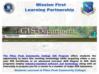
The Pikes Peak Community College GIS Program offers students the
opportunity to learn this exciting technology while acquiring either a oneyear GIS Certificate or an advanced two-year AAS Degree in GIS. Both
programs employ industry-standard software and technology along with an
internship to prepare you for a career in a number of major GIS industries:

Students succeed at Pikes Peak Community College!
One Year Student Licenses of ArcGIS!

GIS 210
Problem Solving with GIS

GIS 280
Internship

GIS 211
Spatial Data Modeling

The student must complete a working internship of at least 90 hours. The
student may find their own internship, or may request to be placed into an
internship with one of the GIS program's internship partners.

Prerequisites: GIS 101, GIS 210, GIS 212

Students succeed at Pikes Peak Community College!
21st Space Wing GeoBase Program/Pikes Peak Community College GIS Interns
Garnered over 1800 hours of support to update Geographically-Separated Units Common
Installation Picture and Infrastructure data elements now represented on the 21
Space Wing geospatial data enterprise, their efforts accounted for a 50% increase
in geospatial data elements that ensured higher compliance ratings.

Cape Code AFS GeoBase Compliance Report
46%!

97%!

Feature Dataset Comparison

Feature Dataset Comparison

Feature Class Comparison

Feature Class Comparison

Required Field Verification

Required Field Verification

Required Field Percent Complete

Required Field Percent Complete

Metadata Verification (Feature Class)

Metadata Verification (Feature Class)

Peterson CIP – 97.4% Cheyenne Mt. CIP – 98.2% Cape Cod AFS CIP – 98.8% Cavalier AFS CIP – 93.2% Clear AFS CIP – 99% Thule AB CIP – 97.4%

Students succeed at Pikes Peak Community College!
• Wing Projects:
• Confined Spaces Accountability/Inventory
• Validated 730 Confined Spaces Assessments against GIS Infrastructure features
• Roofing Management
• Transferred over 200 Roofing Inspection reports into GIS System
• Completed ADA Accessibility Study
• Captured over 800 ADA features; attributed features based on current ADA guidelines
• Completed Crosswalk Inventory
• Calculated total Square Footage; Joined Traffic Study data; Assessed ADA compliance
• Captured Open Drainage features through slope datasets and Segway data collection
• Provided “connective” features for surface water drainage assessments
• Constructed Pavements Linear Segmentation data set from legacy data sources and imagery
• Reconstructed past road networks relative to real property designations
• Completed Thule Air Base Environmental and Infrastructure feature classes
• Input environmental project deliverables for hazards and pollution compliance

Students succeed at Pikes Peak Community College!
Custodial Services

Students succeed at Pikes Peak Community College!
Roof Management

Students succeed at Pikes Peak Community College!
Pedestrian Accessibility = Traffic Volume

Detectable Warnings

Accessibility Location

Students succeed at Pikes Peak Community College!
Future Projects/Planning

Students succeed at Pikes Peak Community College!
Confined Spaces

Students succeed at Pikes Peak Community College!

Más contenido relacionado

Similar a 2013 Mission First Track, Mission First Learning Partnership by Roger Clarke

Wilson_Brad_Master_01072016
Wilson_Brad_Master_01072016Wilson_Brad_Master_01072016
Wilson_Brad_Master_01072016
Brad Wilson
 
GIS & Facilities - NJAPPA Talk - April 26 2012
GIS & Facilities - NJAPPA Talk - April 26 2012GIS & Facilities - NJAPPA Talk - April 26 2012
GIS & Facilities - NJAPPA Talk - April 26 2012
John Reiser
 
GIS Analyst Resume
GIS Analyst ResumeGIS Analyst Resume
GIS Analyst Resume
Daryl Rember
 
Eric_H_Resume_Dec2016
Eric_H_Resume_Dec2016Eric_H_Resume_Dec2016
Eric_H_Resume_Dec2016
Eric Hicks
 
Julie Rediker GIS Professional
Julie Rediker GIS ProfessionalJulie Rediker GIS Professional
Julie Rediker GIS Professional
Julie Rediker
 

Similar a 2013 Mission First Track, Mission First Learning Partnership by Roger Clarke (20)

Resume_GIS
Resume_GISResume_GIS
Resume_GIS
 
Certificate of Competence in GIS
Certificate of Competence in GISCertificate of Competence in GIS
Certificate of Competence in GIS
 
Wilson_Brad_Master_01072016
Wilson_Brad_Master_01072016Wilson_Brad_Master_01072016
Wilson_Brad_Master_01072016
 
August 31 - 0130 - Chuck Brandel
August 31 - 0130 - Chuck BrandelAugust 31 - 0130 - Chuck Brandel
August 31 - 0130 - Chuck Brandel
 
NJAPPA 2012 - Campus Facilities
NJAPPA 2012 - Campus FacilitiesNJAPPA 2012 - Campus Facilities
NJAPPA 2012 - Campus Facilities
 
GIS & Facilities - NJAPPA Talk - April 26 2012
GIS & Facilities - NJAPPA Talk - April 26 2012GIS & Facilities - NJAPPA Talk - April 26 2012
GIS & Facilities - NJAPPA Talk - April 26 2012
 
GIS Analyst Resume
GIS Analyst ResumeGIS Analyst Resume
GIS Analyst Resume
 
Eric_Lu
Eric_LuEric_Lu
Eric_Lu
 
Eric_H_Resume_Dec2016
Eric_H_Resume_Dec2016Eric_H_Resume_Dec2016
Eric_H_Resume_Dec2016
 
CAbbott_Resume_GISP_072416
CAbbott_Resume_GISP_072416CAbbott_Resume_GISP_072416
CAbbott_Resume_GISP_072416
 
RESUME_VIDHYA_MOHANDAS
RESUME_VIDHYA_MOHANDASRESUME_VIDHYA_MOHANDAS
RESUME_VIDHYA_MOHANDAS
 
University of Ballarat Spatial Research
University of Ballarat Spatial ResearchUniversity of Ballarat Spatial Research
University of Ballarat Spatial Research
 
160820 open source_mk_hammond resume
160820 open source_mk_hammond resume160820 open source_mk_hammond resume
160820 open source_mk_hammond resume
 
United Utilities and GIS
United Utilities and GISUnited Utilities and GIS
United Utilities and GIS
 
Julie Rediker GIS Professional
Julie Rediker GIS ProfessionalJulie Rediker GIS Professional
Julie Rediker GIS Professional
 
DeStephen Derek Resume
DeStephen Derek ResumeDeStephen Derek Resume
DeStephen Derek Resume
 
Managing Assets in Your GIS
Managing Assets in Your GISManaging Assets in Your GIS
Managing Assets in Your GIS
 
DeStephen Derek RESUME
DeStephen Derek RESUMEDeStephen Derek RESUME
DeStephen Derek RESUME
 
Successes of the Certificate Competence in GIS in Ecosystem Management Program
Successes of the Certificate Competence in GIS in Ecosystem Management ProgramSuccesses of the Certificate Competence in GIS in Ecosystem Management Program
Successes of the Certificate Competence in GIS in Ecosystem Management Program
 
Big data in Digimap
Big data in DigimapBig data in Digimap
Big data in Digimap
 

Más de GIS in the Rockies

2018 GIS in the Rockies Vendor Showcase (Th): The Data Driven Government
2018 GIS in the Rockies Vendor Showcase (Th): The Data Driven Government2018 GIS in the Rockies Vendor Showcase (Th): The Data Driven Government
2018 GIS in the Rockies Vendor Showcase (Th): The Data Driven Government
GIS in the Rockies
 
2018 GIS in the Rockies Vendor Showcase (Th): Solving Real World Issues With ...
2018 GIS in the Rockies Vendor Showcase (Th): Solving Real World Issues With ...2018 GIS in the Rockies Vendor Showcase (Th): Solving Real World Issues With ...
2018 GIS in the Rockies Vendor Showcase (Th): Solving Real World Issues With ...
GIS in the Rockies
 
2018 GIS in Recreation: A Creek Runs Through It
2018 GIS in Recreation: A Creek Runs Through It2018 GIS in Recreation: A Creek Runs Through It
2018 GIS in Recreation: A Creek Runs Through It
GIS in the Rockies
 

Más de GIS in the Rockies (20)

GISCO Fall 2018: Bike Network Equity: A GIS and Qualitative Analysis of Ameri...
GISCO Fall 2018: Bike Network Equity: A GIS and Qualitative Analysis of Ameri...GISCO Fall 2018: Bike Network Equity: A GIS and Qualitative Analysis of Ameri...
GISCO Fall 2018: Bike Network Equity: A GIS and Qualitative Analysis of Ameri...
 
GISCO Fall 2018: Colorado 811: Changes and Challenges – Brian Collison
GISCO Fall 2018: Colorado 811: Changes and Challenges – Brian CollisonGISCO Fall 2018: Colorado 811: Changes and Challenges – Brian Collison
GISCO Fall 2018: Colorado 811: Changes and Challenges – Brian Collison
 
GISCO Fall 2018: Senate Bill 18-167 and GIS – Dave Murray
GISCO Fall 2018: Senate Bill 18-167 and GIS – Dave MurrayGISCO Fall 2018: Senate Bill 18-167 and GIS – Dave Murray
GISCO Fall 2018: Senate Bill 18-167 and GIS – Dave Murray
 
2018 GIS in the Rockies Workshop: Coordinate Systems and Projections
2018 GIS in the Rockies Workshop: Coordinate Systems and Projections 2018 GIS in the Rockies Workshop: Coordinate Systems and Projections
2018 GIS in the Rockies Workshop: Coordinate Systems and Projections
 
2018 GIS in Emergency Management: Denver Office of Emergency Management Overview
2018 GIS in Emergency Management: Denver Office of Emergency Management Overview2018 GIS in Emergency Management: Denver Office of Emergency Management Overview
2018 GIS in Emergency Management: Denver Office of Emergency Management Overview
 
2018 GIS in the Rockies Vendor Showcase (Th): The Data Driven Government
2018 GIS in the Rockies Vendor Showcase (Th): The Data Driven Government2018 GIS in the Rockies Vendor Showcase (Th): The Data Driven Government
2018 GIS in the Rockies Vendor Showcase (Th): The Data Driven Government
 
2018 GIS in the Rockies Vendor Showcase (Th): Solving Real World Issues With ...
2018 GIS in the Rockies Vendor Showcase (Th): Solving Real World Issues With ...2018 GIS in the Rockies Vendor Showcase (Th): Solving Real World Issues With ...
2018 GIS in the Rockies Vendor Showcase (Th): Solving Real World Issues With ...
 
2018 GIS in the Rockies Vendor Showcase (Th): ERDAS Imagine What's New and Ti...
2018 GIS in the Rockies Vendor Showcase (Th): ERDAS Imagine What's New and Ti...2018 GIS in the Rockies Vendor Showcase (Th): ERDAS Imagine What's New and Ti...
2018 GIS in the Rockies Vendor Showcase (Th): ERDAS Imagine What's New and Ti...
 
2018 GIS in the Rockies Vendor Showcase (Th): Building High Performance Gover...
2018 GIS in the Rockies Vendor Showcase (Th): Building High Performance Gover...2018 GIS in the Rockies Vendor Showcase (Th): Building High Performance Gover...
2018 GIS in the Rockies Vendor Showcase (Th): Building High Performance Gover...
 
2018 GIS in Recreation: The Making of a Trail
2018 GIS in Recreation: The Making of a Trail2018 GIS in Recreation: The Making of a Trail
2018 GIS in Recreation: The Making of a Trail
 
2018 GIS in Recreation: The Latest Trail Technology Crowdsourcing Maps and Apps
2018 GIS in Recreation: The Latest Trail Technology Crowdsourcing Maps and Apps2018 GIS in Recreation: The Latest Trail Technology Crowdsourcing Maps and Apps
2018 GIS in Recreation: The Latest Trail Technology Crowdsourcing Maps and Apps
 
2018 GIS in the Rockies: Riparian Shrub Assessment of the Mancos River Canyon...
2018 GIS in the Rockies: Riparian Shrub Assessment of the Mancos River Canyon...2018 GIS in the Rockies: Riparian Shrub Assessment of the Mancos River Canyon...
2018 GIS in the Rockies: Riparian Shrub Assessment of the Mancos River Canyon...
 
2018 GIS in Development: Partnerships Lead to Additional Recreational Content...
2018 GIS in Development: Partnerships Lead to Additional Recreational Content...2018 GIS in Development: Partnerships Lead to Additional Recreational Content...
2018 GIS in Development: Partnerships Lead to Additional Recreational Content...
 
2018 GIS in Recreation: Adding Value to Colorado the Beautiful Initiative carr
2018 GIS in Recreation: Adding Value to Colorado the Beautiful Initiative carr2018 GIS in Recreation: Adding Value to Colorado the Beautiful Initiative carr
2018 GIS in Recreation: Adding Value to Colorado the Beautiful Initiative carr
 
2018 GIS in Recreation: A Creek Runs Through It
2018 GIS in Recreation: A Creek Runs Through It2018 GIS in Recreation: A Creek Runs Through It
2018 GIS in Recreation: A Creek Runs Through It
 
2018 GIS in Recreation: Virtually Touring the National Trails
2018 GIS in Recreation: Virtually Touring the National Trails2018 GIS in Recreation: Virtually Touring the National Trails
2018 GIS in Recreation: Virtually Touring the National Trails
 
2018 GIS in the Rockies PLSC Track: Turning Towards the Future
2018 GIS in the Rockies PLSC Track: Turning Towards the Future2018 GIS in the Rockies PLSC Track: Turning Towards the Future
2018 GIS in the Rockies PLSC Track: Turning Towards the Future
 
2018 GIS in the Rockies PLSC: Intro to PLSS
2018 GIS in the Rockies PLSC: Intro to PLSS2018 GIS in the Rockies PLSC: Intro to PLSS
2018 GIS in the Rockies PLSC: Intro to PLSS
 
2018 GIS in the Rockies PLSC Track: Grid to Ground NATRF2022
2018 GIS in the Rockies PLSC Track: Grid to Ground NATRF20222018 GIS in the Rockies PLSC Track: Grid to Ground NATRF2022
2018 GIS in the Rockies PLSC Track: Grid to Ground NATRF2022
 
2018 GIS in Development: USGS and Citizen Science Success and Enhancements fo...
2018 GIS in Development: USGS and Citizen Science Success and Enhancements fo...2018 GIS in Development: USGS and Citizen Science Success and Enhancements fo...
2018 GIS in Development: USGS and Citizen Science Success and Enhancements fo...
 

Último

Seal of Good Local Governance (SGLG) 2024Final.pptx
Seal of Good Local Governance (SGLG) 2024Final.pptxSeal of Good Local Governance (SGLG) 2024Final.pptx
Seal of Good Local Governance (SGLG) 2024Final.pptx
negromaestrong
 
1029-Danh muc Sach Giao Khoa khoi 6.pdf
1029-Danh muc Sach Giao Khoa khoi  6.pdf1029-Danh muc Sach Giao Khoa khoi  6.pdf
1029-Danh muc Sach Giao Khoa khoi 6.pdf
QucHHunhnh
 

Último (20)

Understanding Accommodations and Modifications
Understanding  Accommodations and ModificationsUnderstanding  Accommodations and Modifications
Understanding Accommodations and Modifications
 
Mehran University Newsletter Vol-X, Issue-I, 2024
Mehran University Newsletter Vol-X, Issue-I, 2024Mehran University Newsletter Vol-X, Issue-I, 2024
Mehran University Newsletter Vol-X, Issue-I, 2024
 
microwave assisted reaction. General introduction
microwave assisted reaction. General introductionmicrowave assisted reaction. General introduction
microwave assisted reaction. General introduction
 
Accessible Digital Futures project (20/03/2024)
Accessible Digital Futures project (20/03/2024)Accessible Digital Futures project (20/03/2024)
Accessible Digital Futures project (20/03/2024)
 
Seal of Good Local Governance (SGLG) 2024Final.pptx
Seal of Good Local Governance (SGLG) 2024Final.pptxSeal of Good Local Governance (SGLG) 2024Final.pptx
Seal of Good Local Governance (SGLG) 2024Final.pptx
 
SKILL OF INTRODUCING THE LESSON MICRO SKILLS.pptx
SKILL OF INTRODUCING THE LESSON MICRO SKILLS.pptxSKILL OF INTRODUCING THE LESSON MICRO SKILLS.pptx
SKILL OF INTRODUCING THE LESSON MICRO SKILLS.pptx
 
Mixin Classes in Odoo 17 How to Extend Models Using Mixin Classes
Mixin Classes in Odoo 17  How to Extend Models Using Mixin ClassesMixin Classes in Odoo 17  How to Extend Models Using Mixin Classes
Mixin Classes in Odoo 17 How to Extend Models Using Mixin Classes
 
TỔNG ÔN TẬP THI VÀO LỚP 10 MÔN TIẾNG ANH NĂM HỌC 2023 - 2024 CÓ ĐÁP ÁN (NGỮ Â...
TỔNG ÔN TẬP THI VÀO LỚP 10 MÔN TIẾNG ANH NĂM HỌC 2023 - 2024 CÓ ĐÁP ÁN (NGỮ Â...TỔNG ÔN TẬP THI VÀO LỚP 10 MÔN TIẾNG ANH NĂM HỌC 2023 - 2024 CÓ ĐÁP ÁN (NGỮ Â...
TỔNG ÔN TẬP THI VÀO LỚP 10 MÔN TIẾNG ANH NĂM HỌC 2023 - 2024 CÓ ĐÁP ÁN (NGỮ Â...
 
Introduction to Nonprofit Accounting: The Basics
Introduction to Nonprofit Accounting: The BasicsIntroduction to Nonprofit Accounting: The Basics
Introduction to Nonprofit Accounting: The Basics
 
SOC 101 Demonstration of Learning Presentation
SOC 101 Demonstration of Learning PresentationSOC 101 Demonstration of Learning Presentation
SOC 101 Demonstration of Learning Presentation
 
Food safety_Challenges food safety laboratories_.pdf
Food safety_Challenges food safety laboratories_.pdfFood safety_Challenges food safety laboratories_.pdf
Food safety_Challenges food safety laboratories_.pdf
 
ICT role in 21st century education and it's challenges.
ICT role in 21st century education and it's challenges.ICT role in 21st century education and it's challenges.
ICT role in 21st century education and it's challenges.
 
Holdier Curriculum Vitae (April 2024).pdf
Holdier Curriculum Vitae (April 2024).pdfHoldier Curriculum Vitae (April 2024).pdf
Holdier Curriculum Vitae (April 2024).pdf
 
1029-Danh muc Sach Giao Khoa khoi 6.pdf
1029-Danh muc Sach Giao Khoa khoi  6.pdf1029-Danh muc Sach Giao Khoa khoi  6.pdf
1029-Danh muc Sach Giao Khoa khoi 6.pdf
 
Basic Civil Engineering first year Notes- Chapter 4 Building.pptx
Basic Civil Engineering first year Notes- Chapter 4 Building.pptxBasic Civil Engineering first year Notes- Chapter 4 Building.pptx
Basic Civil Engineering first year Notes- Chapter 4 Building.pptx
 
UGC NET Paper 1 Mathematical Reasoning & Aptitude.pdf
UGC NET Paper 1 Mathematical Reasoning & Aptitude.pdfUGC NET Paper 1 Mathematical Reasoning & Aptitude.pdf
UGC NET Paper 1 Mathematical Reasoning & Aptitude.pdf
 
PROCESS RECORDING FORMAT.docx
PROCESS      RECORDING        FORMAT.docxPROCESS      RECORDING        FORMAT.docx
PROCESS RECORDING FORMAT.docx
 
Unit-IV- Pharma. Marketing Channels.pptx
Unit-IV- Pharma. Marketing Channels.pptxUnit-IV- Pharma. Marketing Channels.pptx
Unit-IV- Pharma. Marketing Channels.pptx
 
Kodo Millet PPT made by Ghanshyam bairwa college of Agriculture kumher bhara...
Kodo Millet  PPT made by Ghanshyam bairwa college of Agriculture kumher bhara...Kodo Millet  PPT made by Ghanshyam bairwa college of Agriculture kumher bhara...
Kodo Millet PPT made by Ghanshyam bairwa college of Agriculture kumher bhara...
 
2024-NATIONAL-LEARNING-CAMP-AND-OTHER.pptx
2024-NATIONAL-LEARNING-CAMP-AND-OTHER.pptx2024-NATIONAL-LEARNING-CAMP-AND-OTHER.pptx
2024-NATIONAL-LEARNING-CAMP-AND-OTHER.pptx
 

2013 Mission First Track, Mission First Learning Partnership by Roger Clarke

  • 1. The Pikes Peak Community College GIS Program offers students the opportunity to learn this exciting technology while acquiring either a oneyear GIS Certificate or an advanced two-year AAS Degree in GIS. Both programs employ industry-standard software and technology along with an internship to prepare you for a career in a number of major GIS industries: Students succeed at Pikes Peak Community College!
  • 2. One Year Student Licenses of ArcGIS! GIS 210 Problem Solving with GIS GIS 280 Internship GIS 211 Spatial Data Modeling The student must complete a working internship of at least 90 hours. The student may find their own internship, or may request to be placed into an internship with one of the GIS program's internship partners. Prerequisites: GIS 101, GIS 210, GIS 212 Students succeed at Pikes Peak Community College!
  • 3. Students succeed at Pikes Peak Community College!
  • 4. 21st Space Wing GeoBase Program/Pikes Peak Community College GIS Interns Garnered over 1800 hours of support to update Geographically-Separated Units Common Installation Picture and Infrastructure data elements now represented on the 21 Space Wing geospatial data enterprise, their efforts accounted for a 50% increase in geospatial data elements that ensured higher compliance ratings. Cape Code AFS GeoBase Compliance Report 46%! 97%! Feature Dataset Comparison Feature Dataset Comparison Feature Class Comparison Feature Class Comparison Required Field Verification Required Field Verification Required Field Percent Complete Required Field Percent Complete Metadata Verification (Feature Class) Metadata Verification (Feature Class) Peterson CIP – 97.4% Cheyenne Mt. CIP – 98.2% Cape Cod AFS CIP – 98.8% Cavalier AFS CIP – 93.2% Clear AFS CIP – 99% Thule AB CIP – 97.4% Students succeed at Pikes Peak Community College!
  • 5. • Wing Projects: • Confined Spaces Accountability/Inventory • Validated 730 Confined Spaces Assessments against GIS Infrastructure features • Roofing Management • Transferred over 200 Roofing Inspection reports into GIS System • Completed ADA Accessibility Study • Captured over 800 ADA features; attributed features based on current ADA guidelines • Completed Crosswalk Inventory • Calculated total Square Footage; Joined Traffic Study data; Assessed ADA compliance • Captured Open Drainage features through slope datasets and Segway data collection • Provided “connective” features for surface water drainage assessments • Constructed Pavements Linear Segmentation data set from legacy data sources and imagery • Reconstructed past road networks relative to real property designations • Completed Thule Air Base Environmental and Infrastructure feature classes • Input environmental project deliverables for hazards and pollution compliance Students succeed at Pikes Peak Community College!
  • 6. Custodial Services Students succeed at Pikes Peak Community College!
  • 7. Roof Management Students succeed at Pikes Peak Community College!
  • 8. Students succeed at Pikes Peak Community College!
  • 9. Pedestrian Accessibility = Traffic Volume Detectable Warnings Accessibility Location Students succeed at Pikes Peak Community College!
  • 10. Future Projects/Planning Students succeed at Pikes Peak Community College!
  • 11. Confined Spaces Students succeed at Pikes Peak Community College!