2016 conservation track: geolocation by light: following the migration of lesser kestrels of mongolia by paul milhouser
•Descargar como PPTX, PDF•
1 recomendación•210 vistas

geolocation by light: following the migration of lesser kestrels of mongolia

Recomendados
Recomendados
Más contenido relacionado
Destacado
Destacado (20)
Más de GIS in the Rockies
Más de GIS in the Rockies (20)
Último
Último (20)
2016 conservation track: geolocation by light: following the migration of lesser kestrels of mongolia by paul milhouser
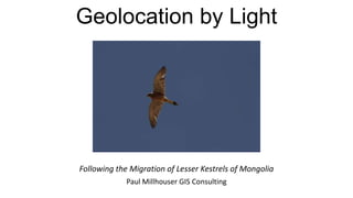
- 1. Geolocation by Light Following the Migration of Lesser Kestrels of Mongolia Paul Millhouser GIS Consulting
- 3. The Challenge • Denver Zoo conservation biologists are studying lesser kestrels in Mongolia and need to understand their migratory patterns • Literature is contradictory • Lesser kestrels are small • Wingspan of about 2 feet • Weight of less than 8 ounces • Satellite tracker costs $3000+
- 4. The Solution • Light-based geolocators developed by the British Antarctic Survey for seabird research • Determine approximate latitude and longitude • Longitude is determined by time of sunrise and sunset • Latitude requires estimating length of day and knowing the zenith angle at which the unit senses sunrise and sunset • Cost per unit of ~$200
- 5. The Technology • Geolocator consists of light sensor, clock, and memory embedded in clear epoxy. • Simply records average light intensity for the preceding two minutes for each minute • Location fixes determined in post-processing
- 6. Kestrel Capture: Bal-Chatri Trap rap
- 7. Viewing the Data • Unit is calibrated by measuring light levels at known location • Light level threshold set to reflect sunrise/sunset times and elevation angles
- 8. Confounding Factors • Dense cloud cover • Tree canopy • Artificial lights/full moons • Equinox +/- 2 weeks • Length of day approximately the same at different latitudes • Assign lower confidence levels to transitions in that period • Poor positioning of geolocator on bird
- 9. Processing the Data • View each sunrise/sunset • Automatically filter transitions resulting in impossibly short “nights” • Manually delete transitions that are clearly erroneous • Assign lower confidence levels to doubtful transitions
- 10. Mapping the Data: All Confidence Levels
- 11. Mapping the Data: High Confidence Only
- 14. Light Geolocator vs Satellite Light Geolocator • Low initial cost • No ongoing expense • Requires recapture • Average error +/- 185 km • Retrospective data Satellite • High initial cost • Monthly subscription • One capture only • Highly accurate and precise • Real time data
- 15. Acknowledgments Thanks to John V. Azua, Jr., Curator of Birds, and Ganchimeg Wingard, Mongolia Program Director, Denver Zoo Photos and data courtesy of Denver Zoo
Notas del editor
- \
- .