Int. Roundtable on Transboundary Waters Management, 15-16.12.2011, Damir Mrden
•
0 recomendaciones•245 vistas

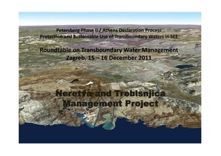
Neretva and Trebisnjica Management Project International Roundtable on Protection and Sustainable Use of Trans-boundary Waters in South East Europe, 15-16 December 2011, Zagreb, Croatia

Recomendados
Recomendados
Más contenido relacionado
Destacado
Destacado (11)
Más de GWP-Mediterranean (GWP-Med)
Más de GWP-Mediterranean (GWP-Med) (19)
Int. Roundtable on Transboundary Waters Management, 15-16.12.2011, Damir Mrden
- 1. Petersberg Phase II / Athens Declaration Process Protection and Sustainable Use of Transboundary Waters in SEE Roundtable on Transboundary Water Management Zagreb, 15 – 16 December 2011 g , Neretva and Trebisnjica Management Project
- 2. Introduction of the Project Introduction of the Project • NTMP is a regional cooperation project ‐ Republic of Croatia and Bosnia and Herzegovina. • Transboundary river basin on the territory of: T b d i b i th t it f • Republic of Croatia • Dubrovnik‐Neretva County and • Split‐Dalmatia County • Bosnia and Herzegovina (B&H) • Federation of BiH (FB&H) • Herzegovina‐Neretva Canton (7)/ Western Herzegovina Canton (8) • Herzeg‐Bosnia Canton (10) • Republika Srpska (RS) p p ( ) • Trebinje Region • The Neretva is: • the longest river of the Adriatic catchment area (215 km long, with only 22 km in Croatia) • the water richest tributary of the Adriatic Sea on the the water –richest tributary of the Adriatic Sea on the territory of these two countries • complex karst hydrography makes it difficult to define the exact boundaries of the catchment area (around 10,500 km2) • the water regime of the Neretva River basin has been significantly modified by the construction of hydropower facilities in the upper and middle sections of the Neretva River and on the Trebišnjica River with 7 reservoirs built from 1954 to 1985.
- 3. Background • Implementation Teams Legal Basis g Cooperation between the Republic of Croatia and Bosnia and Herzegovina BOSNIA AND REPUBLIC OF Agreement between the Governments of Croatia and BiH HERZEGOVINA HERZEGOVINA CROATIA regulating water management relations concluded in July (BiH) 1996 – approved and ratified Grant Agreement concluded in September 2008 with the g p International Bank for Reconstruction and Development (IBRD) acting as an Implementing Agency of GEF Project BiH Project Implementation Team Implementation Team Project Agreement concluded with the International Bank for (PIT) Hrvatske vode (PMT & PIT) May 2009 Reconstruction and Development (IBRD) i d l ( ) 19 December 2008 19 December 2008 Memorandum of Understanding signed between Bosnia and Herzegovina and the Republic of Croatia on implementation of joint activities under the Project joint activities under the Project COORDINATION COORDINATION Agreements become effective COMMITTEE COMMITTEE Croatia – 7 January 2009 BiH – 6 March 2009 8 June 2009 22 October 2009 Official start (meeting in Sarajevo) 12‐13 March 2009
- 4. Project Implementation Project Implementation Structure Interstate Water Commission Component 1 Component 4 Components 2&3 MRDFWM Coordination Committee BiH MOFTER HV PIT (5) PMT TA FM MRDFWM (1) Procurement FBiH MC (2) MAWMF MEPPPC (1) MAFRD (1) RS MAFWM TA Agency for Adriatic Sea Agency for Adriatic Sea Watershed, Mostar Watershed, Trebinje FM Procurement MAWMF MAFWM PIT PIT MET MSPCEE Reporting relation p g Municip. Municip. Working relation
- 5. Water Management Characteristics of the Region h f h oThe water regime of the oThe water regime of the Neretva River basin has been significantly modified by the construction of hydropower facilities in the upper and f iliti i th d middle sections of the Neretva River and on the Trebišnjica River with River with reservoirs: • Jablanica (1954) ( ) • Rama (1969) • Grabovica (1981) • Salakovac (1981) • Mostar (1985) • Gorica (1965) and Bileća (1968) • Equalizing basins of Čapljina E li i b i f Č lji pumping HPP in Popovo polje and Svitava (1978)
- 8. Component 1 – Improved Transboundary Water T b d W Resource Management Institution and capacity building Institution and capacity building Measurement, monitoring, and information management Measurement, monitoring, and information management Development of Water Information System, including GIS Development of Water Information System, including GIS Development of Neretva and Trebišnjica River Basin Management Plan (RBMP) ( )
- 9. Subcomponent: Neretva and Trebišnjica River Basin Management T biš ji Ri B i M t Plan (NTRBMP) • The general goal of the project is to improve water The NTRBMP consists of river basin management plans that address the issues of interest for the entire basin area in a management and thus ensure the fulfillment and improvement of synchronized manner with special emphasis on the functions that the watercourses of this basin have in water valorization of transboundary impacts, i.e. impacts between y p , p management on the national level. g river basin districts. River basin district in Monitoring Croatia Characterization Status NTRBMP n implementation Implementation Plan Status River basin River basin district in district in FBiH RS Reporting to the e Measures Dead‐lines Funds Competent public Risks institution
- 10. Improved Operation of Reservoirs and HPPs • C d i Conducting a study to determine the minimum d d i h i i environmental flow in the Neretva and Trebišnjica Rivers • Preparing a plan, guidelines, and training program for optimal management of multipurpose HPP reservoirs optimal management of multipurpose HPP reservoirs • Developing a dynamic management model for reservoir operation reservoir operation • Developing and implementing mathematical models for hydrological predictions, HPP operations, for hydrological predictions HPP operations forecasting and decision‐making
- 11. Prostorna distribucija godišnjeg suficita/deficita količina kišnih padavina u posljednjoj dekadi (1999-2008.) u poređenju sa referentnim periodom (1961-1990.) u BiH HM postaje.kmz
- 15. Precipation Data Precipation Data • Prema podacima Federalnog hidrometeorološkog zavoda, u periodu od 1.11. do 8.12.2010. godine Prema podacima Federalnog hidrometeorološkog zavoda u periodu od 1 11 do 8 12 2010 godine ukupne padaline sa snijegom na stanici Ivan Sedlo su iznosile 545,00 mm (što je više od 35% od ukupnog srednjeg godišnjeg prosjeka), na stanici Mostar 491,80 mm, na stanici Livno 446,10 mm, na stanici Bjelašnica 398,50 mm, na stanici Stolac 461,20 mm, na stanici Neum 339,40 mm. • Prema podacima sa nekih od mjernih stanica AVP Jadranskog mora i elektroprivrednih poduzeća p j g p p ukupne padaline su iznosile: • Konjic – Hagenuk ‐ od 1.11. do 5.12. ukupno 460,30 mm (u periodu od 17.11.‐5.12. ukupno 270,90 mm) • Glavatičevo most – od 17.11. do 3.12., 354,80 mm (u periodu od 1.11.‐1.12. ukupno 539,20 mm) • Brana HE Jablanica – od 1.11. do 5.12. ukupno 832,10 mm • MP Umoljani – od 1.11. do 8.12. ukupno 711,40 mm • MP Trešnjevica – od 1.11. do 8.12. ukupno 425,20 mm • MP Jasenik od 1.11. do 8.12. ukupno 414,90 mm MP Jasenik – od 1.11. do 8.12. ukupno 414,90 mm • MP Čuhovići – od 1.11. do 8.12. ukupno 433,00 mm (u periodu od 17.11‐8.12 ukupno 327,30 mm) • MP Jasenjani – od 1.11. do 8.12. ukupno 999,40 mm (u periodu od 17.11‐8.12 ukupno 657,70 mm) • MP Blidinje – od 1.11. do 8.12. ukupno 841,00 mm • HP Humac – od 1.11. do 8.12. ukupno 343,80 mm (u periodu od 17.11‐8.12 ukupno 255,60 mm) HP Humac od 1 11 do 8 12 ukupno 343 80 mm (u periodu od 17 11 8 12 ukupno 255 60 mm)
- 21. THANK YOU FOR YOUR ATTENTION