SlideShare una empresa de Scribd logo
1 de 16
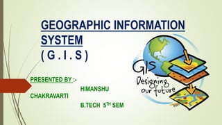
GEOGRAPHIC INFORMATION
SYSTEM
( G . I . S )
PRESENTED BY :-
HIMANSHU
CHAKRAVARTI
B.TECH 5TH SEM
TOPICS
 WHAT IS GIS ?
 HISTORICAL BACKGROUND
 COMPONENTS OF GIS
 GIS PROCESS
 GIS AREAS
 WHY IS GIS UNIQUE ?
 TECHNOLOGIES USED IN GIS
 GIS DATA FORMAT
 DIFFERENCE BETWEEN RASTER AND VECTOR DATA !
 WHY GIS IS IMPORTANT IN URBAN PLANNING?
WHAT IS GIS ?
 A geographic information system (GIS) integrates hardware ,
software and data for capturing , managing , analysing and
displaying all forms of geographically referenced information.
 GIS allows us to view, understand , question , interpret , and
visualize data in many ways that reveal relationships , patterns
, and trends in the form of maps , globes, reports, and charts.
 A GIS helps you answer questions and solve problems by
looking at your data in a way that is quickly understood and
easily shared .
 GIS technology can be integrated into any enterprise
information system framework .
GIS : HISTORICAL
BACKGROUNDThis technology has developed from :
Digital cartography and CAD
DATA BASE MANAGEMENT
SYSTEMS
GIS : HISTORICAL
BACKGROUND
The first known use of the term “GEOGRAPHIC
INFORMATION SYSTEM “ was by ROGER TOMLINSON
in the year 1968 in his paper “A GEOGRAPHIC
IFORMATION SYSTEM FOR REGIONAL PLANNING” .
TOMILSON is also acknowledged as the “ FATHER OF
GIS”
COMPONENTS OF GIS
1. HARDWARE :- It includes
CPU,VDU,PLOTTER,PRINTER,CD/DVD DRIVE etc.
– to store , process , and present spatial data .
2. SOFTWARE :- It includes software like – Arc
GIS , Map info , Geometrica , Autodesk Map – to
perform GIS operation .
3. DATA :- Geographical data in form of - Hard
copy map , digital map , digital map , aerial photos,
satellite images , statistical tables , other
documents – used for GIS operations.
4. PROCEDURE & ANALYSIS :- To complete task –
procedures are performed using – hardware and
software.
5. EXPERT AND SKILLED PERSONNAL :- Expert
with knowledge area required to apply GIS
properly .Different types of users are using GIS at
different level .
GIS PROCESS
CAPTURE
DATA
REGISTER
MAP BASE
INTERPRET
DATA
CONVERT
DATA INTO
DIGITAL
FORM
STORE
DATA IN
COMPUTER
PROCESS
DATA
DISPLAY
RESULT
GIS Application Areas
 Geo sciences
 Civil engineering
 Transportation
 Natural resources
 Geology & geophysics
 Environment
 Planning
 Administration
 Management
 Business
 Remote sensing
 Image processing
 Urban & Rural Development
 Floods , disasters
 Oil Exploration
 Mines
 Surveys
 Watershed Management
 Tourism
 Communications
Why is GIS unique ?
GIS handles SPATIAL information
• Information referenced by its location in
space.
GIS makes connections between activities
based on spatial proximity .
TECHNOLOGIES USED IN ( GIS )
Modern GIS technologies use digital information , for which various digitized data creation
methods are used. The most common method of data creation is digitization, where hard
copy map or survey plan is transferred into digital medium through the use of a CAD
PROGRAM .
With the wide availability of ORTHO-RECTIFIED IMAGERY ( both from satellite & aerial
sources ), HEADS-UP DIGITIZING is becoming the main avenue through which geographic
data is extracted.
HEADS-UP DIGITIZING involves the tracing of geographic data directly on top of the
aerial imagery instead of by the traditional method of tracing the geographic form on a
separate DIGITIZING TABLET (HEADS-DOWN DIGITIZING).
GIS allows multiple layers of information to be
displayed on a single map .
GIS DATA FORMAT
There are two
formats used by GIS
systems to store and
retrieve
geographical data :
RASTER
VECTOR
DIFFRENCE BETWEEN RASTER & VECTOR
DATA
RASTER FORMAT
 Raster data comes in the form
of individual pixels , and each
spatial location has a pixel
associated where the pixel
values indicates the attributes
 Raster data structure produces
huge file size.
 A representation of world as a
surface divided into a regular
grid of cells.
 It has simple data structure .
VECTOR FORMAT
 Vector data comes in the form
of points and lines that are
geometrically and
mathematically associated.
 Vector data structure produces
smaller file size.
 A representation of the world
using points, lines and polygons.
 It has relatively compact data
structure.
For - EXAMPLE
WHY IS GIS IMPORTANT IN URBAN
PLANNING ? A GIS can have impact on your life without you ever knowing it. GIS
technology is often used in urban planning and impacts people living in
the area in many ways . The benefit of using a GIS in urban planning
are numerous , because GIS takes into consideration many different
factors to help build an efficient and organized city .
 MULTILAYERED MAPS :- one of the feature of a GIS is multi-layered mapping .
A municipal planning committee can use a GIS to see a variety of differents
things , including prime agricultural land , surface water , high flood frequency ,
and highly erodible land . This multi-layered capability can make big difference
when developing an area .
For example :- places with high flood frequency could lead to high flood insurance
premium for residents , which may detract from people wanting to live there .
 BUSINESS WILL IMPROVE :- based on customer provided data . GIS can help a
business see where their potential customers might come from .
For example :- if a produce store opens , and it is 10 miles closer than the previous
store , the business owner can conclude that customers will be likely to try his/her
store if the quality and prices are comparable.
THANK YOU 

Más contenido relacionado

La actualidad más candente

Commonly used ground truth equipments
Commonly used ground truth equipmentsCommonly used ground truth equipments
Commonly used ground truth equipmentsHimangshuKalita10
 
Spatial analysis and modeling
Spatial analysis and modelingSpatial analysis and modeling
Spatial analysis and modelingTolasa_F
 
Remote Sensing: Georeferencing
Remote Sensing: GeoreferencingRemote Sensing: Georeferencing
Remote Sensing: GeoreferencingKamlesh Kumar
 
Atmospheric correction albufera_web
Atmospheric correction albufera_webAtmospheric correction albufera_web
Atmospheric correction albufera_webGabriel Parodi
 
Image classification, remote sensing, P K MANI
Image classification, remote sensing, P K MANIImage classification, remote sensing, P K MANI
Image classification, remote sensing, P K MANIP.K. Mani
 
Change detection using remote sensing and GIS
Change detection using remote sensing and GISChange detection using remote sensing and GIS
Change detection using remote sensing and GISTilok Chetri
 
Digital image processing
Digital image processingDigital image processing
Digital image processingMuheeb Awawdeh
 
Principles of GIS unit 1
Principles of GIS unit 1Principles of GIS unit 1
Principles of GIS unit 1SanjanaKhemka1
 
Lec_6_Intro to geo-referencing
Lec_6_Intro to geo-referencingLec_6_Intro to geo-referencing
Lec_6_Intro to geo-referencingAtiqa khan
 
Arc Geographic Information System (GIS) Digital Elevation Models (DEM).
Arc Geographic Information System (GIS) Digital Elevation Models (DEM).Arc Geographic Information System (GIS) Digital Elevation Models (DEM).
Arc Geographic Information System (GIS) Digital Elevation Models (DEM).Uday Kumar Shil
 
Band ratioing presentation
Band ratioing presentationBand ratioing presentation
Band ratioing presentationsk asadul haque
 
Basics of remote sensing, pk mani
Basics of remote sensing, pk maniBasics of remote sensing, pk mani
Basics of remote sensing, pk maniP.K. Mani
 

La actualidad más candente (20)

Commonly used ground truth equipments
Commonly used ground truth equipmentsCommonly used ground truth equipments
Commonly used ground truth equipments
 
Digital terrain model
Digital terrain modelDigital terrain model
Digital terrain model
 
Spatial analysis and modeling
Spatial analysis and modelingSpatial analysis and modeling
Spatial analysis and modeling
 
A short introduction to GIS
A short introduction to GISA short introduction to GIS
A short introduction to GIS
 
Basics of geodesy
Basics of geodesyBasics of geodesy
Basics of geodesy
 
Remote Sensing: Georeferencing
Remote Sensing: GeoreferencingRemote Sensing: Georeferencing
Remote Sensing: Georeferencing
 
Atmospheric correction albufera_web
Atmospheric correction albufera_webAtmospheric correction albufera_web
Atmospheric correction albufera_web
 
Image classification, remote sensing, P K MANI
Image classification, remote sensing, P K MANIImage classification, remote sensing, P K MANI
Image classification, remote sensing, P K MANI
 
Gis functions
Gis functionsGis functions
Gis functions
 
Change detection using remote sensing and GIS
Change detection using remote sensing and GISChange detection using remote sensing and GIS
Change detection using remote sensing and GIS
 
Digital photogrammetry
Digital photogrammetryDigital photogrammetry
Digital photogrammetry
 
Digital image processing
Digital image processingDigital image processing
Digital image processing
 
Principles of GIS unit 1
Principles of GIS unit 1Principles of GIS unit 1
Principles of GIS unit 1
 
Pre processing
Pre processingPre processing
Pre processing
 
DTM DEM Generation
DTM DEM GenerationDTM DEM Generation
DTM DEM Generation
 
Lec_6_Intro to geo-referencing
Lec_6_Intro to geo-referencingLec_6_Intro to geo-referencing
Lec_6_Intro to geo-referencing
 
Stereoscopic Parallax
Stereoscopic ParallaxStereoscopic Parallax
Stereoscopic Parallax
 
Arc Geographic Information System (GIS) Digital Elevation Models (DEM).
Arc Geographic Information System (GIS) Digital Elevation Models (DEM).Arc Geographic Information System (GIS) Digital Elevation Models (DEM).
Arc Geographic Information System (GIS) Digital Elevation Models (DEM).
 
Band ratioing presentation
Band ratioing presentationBand ratioing presentation
Band ratioing presentation
 
Basics of remote sensing, pk mani
Basics of remote sensing, pk maniBasics of remote sensing, pk mani
Basics of remote sensing, pk mani
 

Similar a ( G . i . s )

1_GEOGRAPHIC INFORMATION SYSTEMSTEM.pptx
1_GEOGRAPHIC INFORMATION SYSTEMSTEM.pptx1_GEOGRAPHIC INFORMATION SYSTEMSTEM.pptx
1_GEOGRAPHIC INFORMATION SYSTEMSTEM.pptxLaleanePale
 
MODERN trends of GIS
MODERN trends of GISMODERN trends of GIS
MODERN trends of GISVAISHALI JAIN
 
Geographic information system
Geographic information systemGeographic information system
Geographic information systemDhaval Jalalpara
 
What is GIS (PDF).pdf
What is GIS (PDF).pdfWhat is GIS (PDF).pdf
What is GIS (PDF).pdfKartikBhatt43
 
Geographical information system
Geographical information systemGeographical information system
Geographical information systemBipin Karki
 
Geographical information system
Geographical information systemGeographical information system
Geographical information systemBipin Karki
 
Management information system
Management information systemManagement information system
Management information systemSajid Jadoon
 
geographic information system(gis) (1).pdf
geographic information system(gis) (1).pdfgeographic information system(gis) (1).pdf
geographic information system(gis) (1).pdfShubham30007
 
INTRODUCTION TO GIS.pdf
INTRODUCTION TO GIS.pdfINTRODUCTION TO GIS.pdf
INTRODUCTION TO GIS.pdfKingFrimp
 
TYBSC IT PGIS Unit I Chapter I- Introduction to Geographic Information Systems
TYBSC IT PGIS Unit I  Chapter I- Introduction to Geographic Information SystemsTYBSC IT PGIS Unit I  Chapter I- Introduction to Geographic Information Systems
TYBSC IT PGIS Unit I Chapter I- Introduction to Geographic Information SystemsArti Parab Academics
 
Gis application in civil engineering
Gis application in civil engineeringGis application in civil engineering
Gis application in civil engineeringAmal C Varghese
 
Gisapplicationincivilengineering 140227110022-phpapp02
Gisapplicationincivilengineering 140227110022-phpapp02Gisapplicationincivilengineering 140227110022-phpapp02
Gisapplicationincivilengineering 140227110022-phpapp02Antriksh Vatsyayana
 

Similar a ( G . i . s ) (20)

1_GEOGRAPHIC INFORMATION SYSTEMSTEM.pptx
1_GEOGRAPHIC INFORMATION SYSTEMSTEM.pptx1_GEOGRAPHIC INFORMATION SYSTEMSTEM.pptx
1_GEOGRAPHIC INFORMATION SYSTEMSTEM.pptx
 
MODERN trends of GIS
MODERN trends of GISMODERN trends of GIS
MODERN trends of GIS
 
Geographic information system
Geographic information systemGeographic information system
Geographic information system
 
introduction to GIS
introduction to GIS introduction to GIS
introduction to GIS
 
Mrp Intrim
Mrp IntrimMrp Intrim
Mrp Intrim
 
G I S.pptx
G I S.pptxG I S.pptx
G I S.pptx
 
What is GIS (PDF).pdf
What is GIS (PDF).pdfWhat is GIS (PDF).pdf
What is GIS (PDF).pdf
 
Geographical information system
Geographical information systemGeographical information system
Geographical information system
 
Geographical information system
Geographical information systemGeographical information system
Geographical information system
 
Management information system
Management information systemManagement information system
Management information system
 
FINAL 31,12,10
FINAL 31,12,10FINAL 31,12,10
FINAL 31,12,10
 
Gis
GisGis
Gis
 
Gis
GisGis
Gis
 
geographic information system(gis) (1).pdf
geographic information system(gis) (1).pdfgeographic information system(gis) (1).pdf
geographic information system(gis) (1).pdf
 
GIS in Nutshell
GIS in NutshellGIS in Nutshell
GIS in Nutshell
 
INTRODUCTION TO GIS.pdf
INTRODUCTION TO GIS.pdfINTRODUCTION TO GIS.pdf
INTRODUCTION TO GIS.pdf
 
TYBSC IT PGIS Unit I Chapter I- Introduction to Geographic Information Systems
TYBSC IT PGIS Unit I  Chapter I- Introduction to Geographic Information SystemsTYBSC IT PGIS Unit I  Chapter I- Introduction to Geographic Information Systems
TYBSC IT PGIS Unit I Chapter I- Introduction to Geographic Information Systems
 
Deploma
DeplomaDeploma
Deploma
 
Gis application in civil engineering
Gis application in civil engineeringGis application in civil engineering
Gis application in civil engineering
 
Gisapplicationincivilengineering 140227110022-phpapp02
Gisapplicationincivilengineering 140227110022-phpapp02Gisapplicationincivilengineering 140227110022-phpapp02
Gisapplicationincivilengineering 140227110022-phpapp02
 

Más de Himanshu Chakravarti (6)

Innovations in Civil Engineering
Innovations in Civil EngineeringInnovations in Civil Engineering
Innovations in Civil Engineering
 
BBM Report
BBM ReportBBM Report
BBM Report
 
Construction of PCC Parapet
Construction of PCC Parapet Construction of PCC Parapet
Construction of PCC Parapet
 
BBM PPT By Hchakravarti
BBM PPT By HchakravartiBBM PPT By Hchakravarti
BBM PPT By Hchakravarti
 
Earthquake
EarthquakeEarthquake
Earthquake
 
Cement
CementCement
Cement
 

Último

Generative AI or GenAI technology based PPT
Generative AI or GenAI technology based PPTGenerative AI or GenAI technology based PPT
Generative AI or GenAI technology based PPTbhaskargani46
 
Unit 1 - Soil Classification and Compaction.pdf
Unit 1 - Soil Classification and Compaction.pdfUnit 1 - Soil Classification and Compaction.pdf
Unit 1 - Soil Classification and Compaction.pdfRagavanV2
 
Design For Accessibility: Getting it right from the start
Design For Accessibility: Getting it right from the startDesign For Accessibility: Getting it right from the start
Design For Accessibility: Getting it right from the startQuintin Balsdon
 
2016EF22_0 solar project report rooftop projects
2016EF22_0 solar project report rooftop projects2016EF22_0 solar project report rooftop projects
2016EF22_0 solar project report rooftop projectssmsksolar
 
Block diagram reduction techniques in control systems.ppt
Block diagram reduction techniques in control systems.pptBlock diagram reduction techniques in control systems.ppt
Block diagram reduction techniques in control systems.pptNANDHAKUMARA10
 
Hostel management system project report..pdf
Hostel management system project report..pdfHostel management system project report..pdf
Hostel management system project report..pdfKamal Acharya
 
Double Revolving field theory-how the rotor develops torque
Double Revolving field theory-how the rotor develops torqueDouble Revolving field theory-how the rotor develops torque
Double Revolving field theory-how the rotor develops torqueBhangaleSonal
 
University management System project report..pdf
University management System project report..pdfUniversity management System project report..pdf
University management System project report..pdfKamal Acharya
 
COST-EFFETIVE and Energy Efficient BUILDINGS ptx
COST-EFFETIVE  and Energy Efficient BUILDINGS ptxCOST-EFFETIVE  and Energy Efficient BUILDINGS ptx
COST-EFFETIVE and Energy Efficient BUILDINGS ptxJIT KUMAR GUPTA
 
Introduction to Serverless with AWS Lambda
Introduction to Serverless with AWS LambdaIntroduction to Serverless with AWS Lambda
Introduction to Serverless with AWS LambdaOmar Fathy
 
KubeKraft presentation @CloudNativeHooghly
KubeKraft presentation @CloudNativeHooghlyKubeKraft presentation @CloudNativeHooghly
KubeKraft presentation @CloudNativeHooghlysanyuktamishra911
 
Work-Permit-Receiver-in-Saudi-Aramco.pptx
Work-Permit-Receiver-in-Saudi-Aramco.pptxWork-Permit-Receiver-in-Saudi-Aramco.pptx
Work-Permit-Receiver-in-Saudi-Aramco.pptxJuliansyahHarahap1
 
Top Rated Call Girls In chittoor 📱 {7001035870} VIP Escorts chittoor
Top Rated Call Girls In chittoor 📱 {7001035870} VIP Escorts chittoorTop Rated Call Girls In chittoor 📱 {7001035870} VIP Escorts chittoor
Top Rated Call Girls In chittoor 📱 {7001035870} VIP Escorts chittoordharasingh5698
 
UNIT - IV - Air Compressors and its Performance
UNIT - IV - Air Compressors and its PerformanceUNIT - IV - Air Compressors and its Performance
UNIT - IV - Air Compressors and its Performancesivaprakash250
 
VIP Call Girls Palanpur 7001035870 Whatsapp Number, 24/07 Booking
VIP Call Girls Palanpur 7001035870 Whatsapp Number, 24/07 BookingVIP Call Girls Palanpur 7001035870 Whatsapp Number, 24/07 Booking
VIP Call Girls Palanpur 7001035870 Whatsapp Number, 24/07 Bookingdharasingh5698
 

Último (20)

Generative AI or GenAI technology based PPT
Generative AI or GenAI technology based PPTGenerative AI or GenAI technology based PPT
Generative AI or GenAI technology based PPT
 
Unit 1 - Soil Classification and Compaction.pdf
Unit 1 - Soil Classification and Compaction.pdfUnit 1 - Soil Classification and Compaction.pdf
Unit 1 - Soil Classification and Compaction.pdf
 
(INDIRA) Call Girl Aurangabad Call Now 8617697112 Aurangabad Escorts 24x7
(INDIRA) Call Girl Aurangabad Call Now 8617697112 Aurangabad Escorts 24x7(INDIRA) Call Girl Aurangabad Call Now 8617697112 Aurangabad Escorts 24x7
(INDIRA) Call Girl Aurangabad Call Now 8617697112 Aurangabad Escorts 24x7
 
(INDIRA) Call Girl Meerut Call Now 8617697112 Meerut Escorts 24x7
(INDIRA) Call Girl Meerut Call Now 8617697112 Meerut Escorts 24x7(INDIRA) Call Girl Meerut Call Now 8617697112 Meerut Escorts 24x7
(INDIRA) Call Girl Meerut Call Now 8617697112 Meerut Escorts 24x7
 
Design For Accessibility: Getting it right from the start
Design For Accessibility: Getting it right from the startDesign For Accessibility: Getting it right from the start
Design For Accessibility: Getting it right from the start
 
Cara Menggugurkan Sperma Yang Masuk Rahim Biyar Tidak Hamil
Cara Menggugurkan Sperma Yang Masuk Rahim Biyar Tidak HamilCara Menggugurkan Sperma Yang Masuk Rahim Biyar Tidak Hamil
Cara Menggugurkan Sperma Yang Masuk Rahim Biyar Tidak Hamil
 
2016EF22_0 solar project report rooftop projects
2016EF22_0 solar project report rooftop projects2016EF22_0 solar project report rooftop projects
2016EF22_0 solar project report rooftop projects
 
Block diagram reduction techniques in control systems.ppt
Block diagram reduction techniques in control systems.pptBlock diagram reduction techniques in control systems.ppt
Block diagram reduction techniques in control systems.ppt
 
Hostel management system project report..pdf
Hostel management system project report..pdfHostel management system project report..pdf
Hostel management system project report..pdf
 
Double Revolving field theory-how the rotor develops torque
Double Revolving field theory-how the rotor develops torqueDouble Revolving field theory-how the rotor develops torque
Double Revolving field theory-how the rotor develops torque
 
University management System project report..pdf
University management System project report..pdfUniversity management System project report..pdf
University management System project report..pdf
 
COST-EFFETIVE and Energy Efficient BUILDINGS ptx
COST-EFFETIVE  and Energy Efficient BUILDINGS ptxCOST-EFFETIVE  and Energy Efficient BUILDINGS ptx
COST-EFFETIVE and Energy Efficient BUILDINGS ptx
 
Introduction to Serverless with AWS Lambda
Introduction to Serverless with AWS LambdaIntroduction to Serverless with AWS Lambda
Introduction to Serverless with AWS Lambda
 
(INDIRA) Call Girl Bhosari Call Now 8617697112 Bhosari Escorts 24x7
(INDIRA) Call Girl Bhosari Call Now 8617697112 Bhosari Escorts 24x7(INDIRA) Call Girl Bhosari Call Now 8617697112 Bhosari Escorts 24x7
(INDIRA) Call Girl Bhosari Call Now 8617697112 Bhosari Escorts 24x7
 
KubeKraft presentation @CloudNativeHooghly
KubeKraft presentation @CloudNativeHooghlyKubeKraft presentation @CloudNativeHooghly
KubeKraft presentation @CloudNativeHooghly
 
Work-Permit-Receiver-in-Saudi-Aramco.pptx
Work-Permit-Receiver-in-Saudi-Aramco.pptxWork-Permit-Receiver-in-Saudi-Aramco.pptx
Work-Permit-Receiver-in-Saudi-Aramco.pptx
 
Top Rated Call Girls In chittoor 📱 {7001035870} VIP Escorts chittoor
Top Rated Call Girls In chittoor 📱 {7001035870} VIP Escorts chittoorTop Rated Call Girls In chittoor 📱 {7001035870} VIP Escorts chittoor
Top Rated Call Girls In chittoor 📱 {7001035870} VIP Escorts chittoor
 
UNIT - IV - Air Compressors and its Performance
UNIT - IV - Air Compressors and its PerformanceUNIT - IV - Air Compressors and its Performance
UNIT - IV - Air Compressors and its Performance
 
VIP Call Girls Palanpur 7001035870 Whatsapp Number, 24/07 Booking
VIP Call Girls Palanpur 7001035870 Whatsapp Number, 24/07 BookingVIP Call Girls Palanpur 7001035870 Whatsapp Number, 24/07 Booking
VIP Call Girls Palanpur 7001035870 Whatsapp Number, 24/07 Booking
 
Call Now ≽ 9953056974 ≼🔝 Call Girls In New Ashok Nagar ≼🔝 Delhi door step de...
Call Now ≽ 9953056974 ≼🔝 Call Girls In New Ashok Nagar  ≼🔝 Delhi door step de...Call Now ≽ 9953056974 ≼🔝 Call Girls In New Ashok Nagar  ≼🔝 Delhi door step de...
Call Now ≽ 9953056974 ≼🔝 Call Girls In New Ashok Nagar ≼🔝 Delhi door step de...
 

( G . i . s )

  • 1. GEOGRAPHIC INFORMATION SYSTEM ( G . I . S ) PRESENTED BY :- HIMANSHU CHAKRAVARTI B.TECH 5TH SEM
  • 2. TOPICS  WHAT IS GIS ?  HISTORICAL BACKGROUND  COMPONENTS OF GIS  GIS PROCESS  GIS AREAS  WHY IS GIS UNIQUE ?  TECHNOLOGIES USED IN GIS  GIS DATA FORMAT  DIFFERENCE BETWEEN RASTER AND VECTOR DATA !  WHY GIS IS IMPORTANT IN URBAN PLANNING?
  • 3. WHAT IS GIS ?  A geographic information system (GIS) integrates hardware , software and data for capturing , managing , analysing and displaying all forms of geographically referenced information.  GIS allows us to view, understand , question , interpret , and visualize data in many ways that reveal relationships , patterns , and trends in the form of maps , globes, reports, and charts.  A GIS helps you answer questions and solve problems by looking at your data in a way that is quickly understood and easily shared .  GIS technology can be integrated into any enterprise information system framework .
  • 4. GIS : HISTORICAL BACKGROUNDThis technology has developed from : Digital cartography and CAD DATA BASE MANAGEMENT SYSTEMS
  • 5. GIS : HISTORICAL BACKGROUND The first known use of the term “GEOGRAPHIC INFORMATION SYSTEM “ was by ROGER TOMLINSON in the year 1968 in his paper “A GEOGRAPHIC IFORMATION SYSTEM FOR REGIONAL PLANNING” . TOMILSON is also acknowledged as the “ FATHER OF GIS”
  • 6. COMPONENTS OF GIS 1. HARDWARE :- It includes CPU,VDU,PLOTTER,PRINTER,CD/DVD DRIVE etc. – to store , process , and present spatial data . 2. SOFTWARE :- It includes software like – Arc GIS , Map info , Geometrica , Autodesk Map – to perform GIS operation . 3. DATA :- Geographical data in form of - Hard copy map , digital map , digital map , aerial photos, satellite images , statistical tables , other documents – used for GIS operations. 4. PROCEDURE & ANALYSIS :- To complete task – procedures are performed using – hardware and software. 5. EXPERT AND SKILLED PERSONNAL :- Expert with knowledge area required to apply GIS properly .Different types of users are using GIS at different level .
  • 7. GIS PROCESS CAPTURE DATA REGISTER MAP BASE INTERPRET DATA CONVERT DATA INTO DIGITAL FORM STORE DATA IN COMPUTER PROCESS DATA DISPLAY RESULT
  • 8. GIS Application Areas  Geo sciences  Civil engineering  Transportation  Natural resources  Geology & geophysics  Environment  Planning  Administration  Management  Business  Remote sensing  Image processing  Urban & Rural Development  Floods , disasters  Oil Exploration  Mines  Surveys  Watershed Management  Tourism  Communications
  • 9. Why is GIS unique ? GIS handles SPATIAL information • Information referenced by its location in space. GIS makes connections between activities based on spatial proximity .
  • 10. TECHNOLOGIES USED IN ( GIS ) Modern GIS technologies use digital information , for which various digitized data creation methods are used. The most common method of data creation is digitization, where hard copy map or survey plan is transferred into digital medium through the use of a CAD PROGRAM . With the wide availability of ORTHO-RECTIFIED IMAGERY ( both from satellite & aerial sources ), HEADS-UP DIGITIZING is becoming the main avenue through which geographic data is extracted. HEADS-UP DIGITIZING involves the tracing of geographic data directly on top of the aerial imagery instead of by the traditional method of tracing the geographic form on a separate DIGITIZING TABLET (HEADS-DOWN DIGITIZING). GIS allows multiple layers of information to be displayed on a single map .
  • 11. GIS DATA FORMAT There are two formats used by GIS systems to store and retrieve geographical data : RASTER VECTOR
  • 12. DIFFRENCE BETWEEN RASTER & VECTOR DATA RASTER FORMAT  Raster data comes in the form of individual pixels , and each spatial location has a pixel associated where the pixel values indicates the attributes  Raster data structure produces huge file size.  A representation of world as a surface divided into a regular grid of cells.  It has simple data structure . VECTOR FORMAT  Vector data comes in the form of points and lines that are geometrically and mathematically associated.  Vector data structure produces smaller file size.  A representation of the world using points, lines and polygons.  It has relatively compact data structure.
  • 14. WHY IS GIS IMPORTANT IN URBAN PLANNING ? A GIS can have impact on your life without you ever knowing it. GIS technology is often used in urban planning and impacts people living in the area in many ways . The benefit of using a GIS in urban planning are numerous , because GIS takes into consideration many different factors to help build an efficient and organized city .
  • 15.  MULTILAYERED MAPS :- one of the feature of a GIS is multi-layered mapping . A municipal planning committee can use a GIS to see a variety of differents things , including prime agricultural land , surface water , high flood frequency , and highly erodible land . This multi-layered capability can make big difference when developing an area . For example :- places with high flood frequency could lead to high flood insurance premium for residents , which may detract from people wanting to live there .  BUSINESS WILL IMPROVE :- based on customer provided data . GIS can help a business see where their potential customers might come from . For example :- if a produce store opens , and it is 10 miles closer than the previous store , the business owner can conclude that customers will be likely to try his/her store if the quality and prices are comparable.