
Recomendados
Recomendados
Más contenido relacionado
Último
Último (20)
Destacado
Destacado (20)
Typographic Mapping of Surnames: #geomob MAy 2011
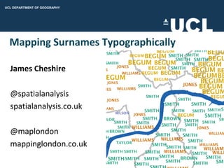
- 1. Mapping Surnames Typographically James Cheshire @spatialanalysis spatialanalysis.co.uk @maplondon mappinglondon.co.uk
- 2. This Talk… Why surnames and where did I get them from? Typographic maps. Combining the two: National Geographic Surnames of N. America. London Surnames. Feedback.
- 3. Surnames Worldnames.publicprofiler.org -Surnames (and forenames) for 28 + countries. -Allows users to map their surnames. -Used as training data to guess surname origins.
- 5. Typographic Maps Credits: National Geographic Axis Maps AV Browne Golden Section Graphics
- 6. National Geographic Surname Map
- 9. Positive Features Simplicity. Clear message. Understates work required to create it.
- 10. Things it misses Interactivity. Detail.
- 11. Making the London Map Unlike NGM no team of designers (+interns)... ArcGIS 10 Maplex labeling. Creation of rules for font size, colour, location. Surnames from Electoral Roll and their origins derived from Onomap. OSM Thames, OS Opendata boundaries. Used Adobe Illustrator for finishing touches. Exported to PNG. Biggest challenge was to find the most appropriate geography.
- 13. Interactive 15 PNGs tiled the displayed using OpenLayers. Users could transition from 1st to 15th most popular surnames. 2379 unique surnames. > 15,000 labels. Pan and Zoom. Not georeferenced. Thanks to Oliver O’Brien
- 14. Demo…names.mappinglondon.co.uk #FAIL? Copyright sKaiHeitz, Flickr
- 16. London Surnames Feedback 40 seconds average time on website. People like controversy: When labeling surname origins have to be careful about: Colour. Wording. Categories. Can’t please everyone but try to respond to suggestions.
- 18. Web: casa.ucl.ac.uk Email: casa@ucl.ac.uk
- 19. Thanks names.mappinglondon.co.uk (james@) spatialanalysis.co.uk