SlideShare una empresa de Scribd logo
1 de 18
Remote sensing analysis of high resolution satellite
  images as a support to targeted monitoring of
   Grapevine Flavescence dorée phytoplasma


                   Matej Knapič, Agricultural Institute of Slovenia
INTRODUCTION
 -   Remote sensing could be used for
     detection and determination of
     specific plant species and diseased
     or stressed plants.
 -   Noninvasive and nondestructive method
 -   Together with GIS tools used for
     determination of spatial occurrence and
     quantification of the weakened plants
 -   Spatial analysis: fields, region, country or
     globally.
An example of Cotton root rot
-   Cotton root rot caused by Phymatotrichopsis omnivora (1927) in APS feature, 2005
-   soil-borne fungus infects numerous crop plants
INTRODUCTION
-   Remote sensing system exploit
    measuring and recording of reflected
    or emitted electromagnetic energy
    from the objects.
     1                       2
-
INTRODUCTION

-   The most common source of
    electromagnetic radiation (ER),
    which is recorded by satellites, is the
    sun
              3
-  ER interacts with atmosphere
   and earth surface (vegetation,
   soils…)
- absorption
- transmission
- reflection
K. Oštir.
Daljinsko
zaznavanje, 2006
INTRODUCTION


Detectors – sensors at the satelite record
 values of individual spectral channel


                                Source: APSnet
                             Feature,K. Steddom et
                                   all, 2005
Remote sensing in grapevine FD
             monitoring
x An ongoing research project 2011-2012
x Remote sensing of vineyards in order to
  develop support to targeted monitoring
  of Grapevine Flavescence dorée
  phytoplasma in Slovenia.
x Use of high resolution and multispectral
  satellite images
x Basis for broader use in plant pathology
Remote sensing of vineyards in foci 1

In addition to the research project input was
  done via official survey program
Satellite recording of FD demarcated area in 2
  regions was ordered in first half of August
  and first half of September 2011
Satellite recording of FD demarcated area


x   on the coastal area (Koper-Izola)
         x part of Dolenjska region (500 km2)
Remote sensing of vineyards in foci 2

x In the time frame of the satellite recording
  ground truthing was made.
x Images were georeferenced and
  orthorectificated to obtain spatial accuracy.
x First analysis were made for the Izola focus
x Central vineyard was mapped for symptoms
  to the level of individual grapevine plants
Remote sensing of vineyards in foci 3
Remote sensing of vineyards in foci 4

Analysis of high resolution and multispectral
   satellite images
If the difference in spectral signature is
   significant, a distinction between the
   objects or even inside the objects from the
   satellite image can be made.
We try to use this fact to implement remote
   sensing to the target monitoring of
   Grapevine FD symptoms in plants.
Remote sensing of vineyards in foci 5


  NDVI=IR-
    R/IR+R
Remote sensing of vineyards in foci 6
 WBI=NIR1/NIR2
Remote sensing of vineyards in foci 7


     Rededge kanal = 725
       nm
Remote sensing of vineyards in foci 8

In the first phase of the image analyzes
  we are searching for the suitable:
x classification and
x algorithm which would enable
  distinction
x between healthy and diseased plants
x and determination of FD infested plants
  location.
Conclusions
x We are not expecting to develop
  100% certainty in remote FD
  determination.
x However, results should help to
  monitor vineyards for FD presence in
  more targeting way and to locate
  some possible foci of FD also in
  isolated and abandoned locations
Acknowledgment
Many thanks for good cooperation to:
The project team:
- National Institute of Biology
- Agricultural Institute
The survey team, especially phytosanitary
  inspectors from Koper and colleagues from
  plant protection service KGZ Novo mesto
Ministry of Agriculture and Environment
Phytosanitary Administration of R Slovenia

Más contenido relacionado

La actualidad más candente

Application of gis and remote sensing in agriculture
Application of gis and remote sensing in agricultureApplication of gis and remote sensing in agriculture
Application of gis and remote sensing in agriculture
Rehana Qureshi
 
Remote sensing ppt
Remote sensing pptRemote sensing ppt
Remote sensing ppt
coolmridul92
 
Ppt on remote sensing system
Ppt on remote sensing systemPpt on remote sensing system
Ppt on remote sensing system
Alisha Korpal
 
Remote sensing and GIS- role in IPM
Remote sensing and GIS- role in IPM Remote sensing and GIS- role in IPM
Remote sensing and GIS- role in IPM
srikala musku
 

La actualidad más candente (20)

Precision agriculture
Precision agriculturePrecision agriculture
Precision agriculture
 
Application of gis and remote sensing in agriculture
Application of gis and remote sensing in agricultureApplication of gis and remote sensing in agriculture
Application of gis and remote sensing in agriculture
 
Application of remote sensing in precision farming
 Application of remote sensing in precision farming  Application of remote sensing in precision farming
Application of remote sensing in precision farming
 
role of Geospatial technology in agriculture
role of Geospatial technology  in agriculturerole of Geospatial technology  in agriculture
role of Geospatial technology in agriculture
 
Optical remote sensing
Optical remote sensingOptical remote sensing
Optical remote sensing
 
Remote sensing application in monitoring and management of soil, water and ai...
Remote sensing application in monitoring and management of soil, water and ai...Remote sensing application in monitoring and management of soil, water and ai...
Remote sensing application in monitoring and management of soil, water and ai...
 
Image processing & interpretation
Image processing & interpretationImage processing & interpretation
Image processing & interpretation
 
Soil mapping approach in gis
Soil mapping approach in gisSoil mapping approach in gis
Soil mapping approach in gis
 
Assessing stress by using remote sensing
Assessing stress by using remote sensingAssessing stress by using remote sensing
Assessing stress by using remote sensing
 
Geoinformatics For Precision Agriculture
Geoinformatics For Precision AgricultureGeoinformatics For Precision Agriculture
Geoinformatics For Precision Agriculture
 
Remote sensing in agriculture
Remote sensing in agricultureRemote sensing in agriculture
Remote sensing in agriculture
 
Global positioning system (gps) and its application in precision farming
Global positioning system (gps) and its application in precision farmingGlobal positioning system (gps) and its application in precision farming
Global positioning system (gps) and its application in precision farming
 
GPS IN PRECISION AGRICULTURE
GPS IN PRECISION AGRICULTUREGPS IN PRECISION AGRICULTURE
GPS IN PRECISION AGRICULTURE
 
APPLICATION OF REMOTE SENSING AND GIS IN AGRICULTURE
APPLICATION OF REMOTE SENSING AND GIS IN AGRICULTUREAPPLICATION OF REMOTE SENSING AND GIS IN AGRICULTURE
APPLICATION OF REMOTE SENSING AND GIS IN AGRICULTURE
 
Remote sensing ppt
Remote sensing pptRemote sensing ppt
Remote sensing ppt
 
Rs in agriculture & soil
Rs in agriculture & soilRs in agriculture & soil
Rs in agriculture & soil
 
Role of geo-informatics in land use/land cover
Role of geo-informatics in land use/land coverRole of geo-informatics in land use/land cover
Role of geo-informatics in land use/land cover
 
Ppt on remote sensing system
Ppt on remote sensing systemPpt on remote sensing system
Ppt on remote sensing system
 
GIS Applications for Smart Agriculture-Case Studies & Research Prospects.
GIS Applications for Smart Agriculture-Case Studies & Research Prospects.GIS Applications for Smart Agriculture-Case Studies & Research Prospects.
GIS Applications for Smart Agriculture-Case Studies & Research Prospects.
 
Remote sensing and GIS- role in IPM
Remote sensing and GIS- role in IPM Remote sensing and GIS- role in IPM
Remote sensing and GIS- role in IPM
 

Destacado

Operational Agriculture Monitoring System Using Remote Sensing
Operational Agriculture Monitoring System Using Remote SensingOperational Agriculture Monitoring System Using Remote Sensing
Operational Agriculture Monitoring System Using Remote Sensing
Mary Adel
 
Active Carbon used for drinking filters - EcoWater UK
Active Carbon used for drinking filters - EcoWater UKActive Carbon used for drinking filters - EcoWater UK
Active Carbon used for drinking filters - EcoWater UK
Janet Lord
 
Aali pt astra agro lestari tbk annual report 2013 (final)
Aali pt astra agro lestari tbk   annual report 2013 (final)Aali pt astra agro lestari tbk   annual report 2013 (final)
Aali pt astra agro lestari tbk annual report 2013 (final)
wanto03
 
GEOMATIC WORLD WITH A SPECIAL LOOK TO GIS
GEOMATIC WORLDWITH A SPECIAL LOOK TO GISGEOMATIC WORLDWITH A SPECIAL LOOK TO GIS
GEOMATIC WORLD WITH A SPECIAL LOOK TO GIS
Mary Adel
 
APPLICATIONS OF ARC SWAT MODEL FOR HYDROLOGICAL MODELLING
APPLICATIONS OF ARC SWAT MODEL FOR HYDROLOGICAL MODELLINGAPPLICATIONS OF ARC SWAT MODEL FOR HYDROLOGICAL MODELLING
APPLICATIONS OF ARC SWAT MODEL FOR HYDROLOGICAL MODELLING
Abhiram Kanigolla
 

Destacado (17)

Operational Agriculture Monitoring System Using Remote Sensing
Operational Agriculture Monitoring System Using Remote SensingOperational Agriculture Monitoring System Using Remote Sensing
Operational Agriculture Monitoring System Using Remote Sensing
 
Remote Sensing PPT
Remote Sensing PPTRemote Sensing PPT
Remote Sensing PPT
 
Remote sensing in agriculture
Remote sensing in agricultureRemote sensing in agriculture
Remote sensing in agriculture
 
Farming the Future: GIS for Agriculture, Vol. 2
Farming the Future: GIS for Agriculture, Vol. 2Farming the Future: GIS for Agriculture, Vol. 2
Farming the Future: GIS for Agriculture, Vol. 2
 
Application of remote sensing
Application of remote sensingApplication of remote sensing
Application of remote sensing
 
Agriculture drought with remote sensing
Agriculture drought with remote sensingAgriculture drought with remote sensing
Agriculture drought with remote sensing
 
Iirs overview -Remote sensing and GIS application in Water Resources Management
Iirs overview -Remote sensing and GIS application in Water Resources ManagementIirs overview -Remote sensing and GIS application in Water Resources Management
Iirs overview -Remote sensing and GIS application in Water Resources Management
 
remote sensing
remote sensingremote sensing
remote sensing
 
REMOTE SENSING
REMOTE SENSINGREMOTE SENSING
REMOTE SENSING
 
Basic of Remote Sensing
Basic of Remote SensingBasic of Remote Sensing
Basic of Remote Sensing
 
Active Carbon used for drinking filters - EcoWater UK
Active Carbon used for drinking filters - EcoWater UKActive Carbon used for drinking filters - EcoWater UK
Active Carbon used for drinking filters - EcoWater UK
 
Remote Sensing Applications in Agriculture at the USDA National Agricultural...
Remote Sensing Applications in Agriculture at the USDA  National Agricultural...Remote Sensing Applications in Agriculture at the USDA  National Agricultural...
Remote Sensing Applications in Agriculture at the USDA National Agricultural...
 
Aali pt astra agro lestari tbk annual report 2013 (final)
Aali pt astra agro lestari tbk   annual report 2013 (final)Aali pt astra agro lestari tbk   annual report 2013 (final)
Aali pt astra agro lestari tbk annual report 2013 (final)
 
GEOMATIC WORLD WITH A SPECIAL LOOK TO GIS
GEOMATIC WORLDWITH A SPECIAL LOOK TO GISGEOMATIC WORLDWITH A SPECIAL LOOK TO GIS
GEOMATIC WORLD WITH A SPECIAL LOOK TO GIS
 
APPLICATIONS OF ARC SWAT MODEL FOR HYDROLOGICAL MODELLING
APPLICATIONS OF ARC SWAT MODEL FOR HYDROLOGICAL MODELLINGAPPLICATIONS OF ARC SWAT MODEL FOR HYDROLOGICAL MODELLING
APPLICATIONS OF ARC SWAT MODEL FOR HYDROLOGICAL MODELLING
 
Bw Plantation Making The Leap From Good To Great
Bw Plantation   Making The Leap From Good To GreatBw Plantation   Making The Leap From Good To Great
Bw Plantation Making The Leap From Good To Great
 
Relevance of Futures for Indian Oil & Oilseed Industry
Relevance of Futures for Indian Oil & Oilseed IndustryRelevance of Futures for Indian Oil & Oilseed Industry
Relevance of Futures for Indian Oil & Oilseed Industry
 

Similar a Remote sensing agriculture

Remote sensing and application by Nikhil Pakwanne
Remote sensing and application by Nikhil PakwanneRemote sensing and application by Nikhil Pakwanne
Remote sensing and application by Nikhil Pakwanne
NIKHIL PAKWANNE
 
Application of spectral remote sensing in agronomic decision by Dr.V.Harihara...
Application of spectral remote sensing in agronomic decision by Dr.V.Harihara...Application of spectral remote sensing in agronomic decision by Dr.V.Harihara...
Application of spectral remote sensing in agronomic decision by Dr.V.Harihara...
Hari Hariharasudhan
 
rsgis-unitii-160731062950.pdf
rsgis-unitii-160731062950.pdfrsgis-unitii-160731062950.pdf
rsgis-unitii-160731062950.pdf
BSuresh26
 
TEMPORAL AND SPATIAL VARIABILITY IN PLANT PATHOENS.pptx
TEMPORAL AND SPATIAL VARIABILITY IN PLANT PATHOENS.pptxTEMPORAL AND SPATIAL VARIABILITY IN PLANT PATHOENS.pptx
TEMPORAL AND SPATIAL VARIABILITY IN PLANT PATHOENS.pptx
sunilsuriya1
 

Similar a Remote sensing agriculture (20)

Remote sensing APPLICATIONS IN PLANT PATHOLOGY.
Remote sensing APPLICATIONS IN PLANT PATHOLOGY.Remote sensing APPLICATIONS IN PLANT PATHOLOGY.
Remote sensing APPLICATIONS IN PLANT PATHOLOGY.
 
Remote Sensing Applications in Agriculture in Pakistan
Remote Sensing Applications in Agriculture in PakistanRemote Sensing Applications in Agriculture in Pakistan
Remote Sensing Applications in Agriculture in Pakistan
 
Remote sensing and application by Nikhil Pakwanne
Remote sensing and application by Nikhil PakwanneRemote sensing and application by Nikhil Pakwanne
Remote sensing and application by Nikhil Pakwanne
 
A Picture Is Worth A Thousand Words
A Picture Is Worth A Thousand WordsA Picture Is Worth A Thousand Words
A Picture Is Worth A Thousand Words
 
Recent advances on application of remote sensing in fruit production of imp...
Recent advances on  application of remote sensing  in fruit production of imp...Recent advances on  application of remote sensing  in fruit production of imp...
Recent advances on application of remote sensing in fruit production of imp...
 
DOCTORAL SEMINAR on remote sensing in Agriculture
DOCTORAL SEMINAR on remote sensing  in AgricultureDOCTORAL SEMINAR on remote sensing  in Agriculture
DOCTORAL SEMINAR on remote sensing in Agriculture
 
Application of spectral remote sensing in agronomic decision by Dr.V.Harihara...
Application of spectral remote sensing in agronomic decision by Dr.V.Harihara...Application of spectral remote sensing in agronomic decision by Dr.V.Harihara...
Application of spectral remote sensing in agronomic decision by Dr.V.Harihara...
 
REMOTE SENSING
REMOTE SENSINGREMOTE SENSING
REMOTE SENSING
 
Report
ReportReport
Report
 
A new technique for infrared remote sensing of solar induced fluorescence and...
A new technique for infrared remote sensing of solar induced fluorescence and...A new technique for infrared remote sensing of solar induced fluorescence and...
A new technique for infrared remote sensing of solar induced fluorescence and...
 
Basic Understanding of Remote Sensing.pdf
Basic Understanding of Remote Sensing.pdfBasic Understanding of Remote Sensing.pdf
Basic Understanding of Remote Sensing.pdf
 
Iirs lecure notes for Remote sensing –An Overview of Decision Maker
Iirs lecure notes for Remote sensing –An Overview of Decision MakerIirs lecure notes for Remote sensing –An Overview of Decision Maker
Iirs lecure notes for Remote sensing –An Overview of Decision Maker
 
remote sensing
remote sensingremote sensing
remote sensing
 
Introduction to Remote Sensing
Introduction to Remote SensingIntroduction to Remote Sensing
Introduction to Remote Sensing
 
remote sensing and GIS -role in pest managment
remote sensing and GIS -role in pest managmentremote sensing and GIS -role in pest managment
remote sensing and GIS -role in pest managment
 
rsgis-unitii-160731062950.pdf
rsgis-unitii-160731062950.pdfrsgis-unitii-160731062950.pdf
rsgis-unitii-160731062950.pdf
 
TEMPORAL AND SPATIAL VARIABILITY IN PLANT PATHOENS.pptx
TEMPORAL AND SPATIAL VARIABILITY IN PLANT PATHOENS.pptxTEMPORAL AND SPATIAL VARIABILITY IN PLANT PATHOENS.pptx
TEMPORAL AND SPATIAL VARIABILITY IN PLANT PATHOENS.pptx
 
449879014-Remote-Sensing-Ppt.pptx
449879014-Remote-Sensing-Ppt.pptx449879014-Remote-Sensing-Ppt.pptx
449879014-Remote-Sensing-Ppt.pptx
 
Remote sensing
 Remote sensing Remote sensing
Remote sensing
 
Soil spectroscopy in the africa soil information service: Getting the best ou...
Soil spectroscopy in the africa soil information service: Getting the best ou...Soil spectroscopy in the africa soil information service: Getting the best ou...
Soil spectroscopy in the africa soil information service: Getting the best ou...
 

Más de Slovenian Plant Protection

Vpliv novih bolezni in škodljivcev rastlin na pridelavo in naravo
Vpliv novih bolezni in škodljivcev rastlin na pridelavo in naravoVpliv novih bolezni in škodljivcev rastlin na pridelavo in naravo
Vpliv novih bolezni in škodljivcev rastlin na pridelavo in naravo
Slovenian Plant Protection
 
Priročnik za usposabljanje odgovornih oseb zdravstvenega varstva rastlin 2008
Priročnik za usposabljanje odgovornih oseb zdravstvenega varstva rastlin 2008Priročnik za usposabljanje odgovornih oseb zdravstvenega varstva rastlin 2008
Priročnik za usposabljanje odgovornih oseb zdravstvenega varstva rastlin 2008
Slovenian Plant Protection
 

Más de Slovenian Plant Protection (20)

Invasive plants lecture sarah brunel
Invasive plants lecture sarah brunelInvasive plants lecture sarah brunel
Invasive plants lecture sarah brunel
 
6 strok izpit_pra_nujniukrepi
6 strok izpit_pra_nujniukrepi6 strok izpit_pra_nujniukrepi
6 strok izpit_pra_nujniukrepi
 
4 strok izpit_stalniodborzvr
4 strok izpit_stalniodborzvr4 strok izpit_stalniodborzvr
4 strok izpit_stalniodborzvr
 
3 strok izpit_splosnidel_posebninadzor
3 strok izpit_splosnidel_posebninadzor3 strok izpit_splosnidel_posebninadzor
3 strok izpit_splosnidel_posebninadzor
 
2 strok izpit_splosnidel
2 strok izpit_splosnidel2 strok izpit_splosnidel
2 strok izpit_splosnidel
 
1 strok izpit_predpisi
1 strok izpit_predpisi1 strok izpit_predpisi
1 strok izpit_predpisi
 
7 strok izpit_fitosanitarni_ukrepi
7 strok izpit_fitosanitarni_ukrepi7 strok izpit_fitosanitarni_ukrepi
7 strok izpit_fitosanitarni_ukrepi
 
5 strok izpit_priloge2000_29
5 strok izpit_priloge2000_295 strok izpit_priloge2000_29
5 strok izpit_priloge2000_29
 
Priročnik - fitosanitarni predpisi 2009
Priročnik - fitosanitarni predpisi 2009Priročnik - fitosanitarni predpisi 2009
Priročnik - fitosanitarni predpisi 2009
 
Gradivo usposabljanje - fitomedicina 2009
Gradivo usposabljanje - fitomedicina 2009Gradivo usposabljanje - fitomedicina 2009
Gradivo usposabljanje - fitomedicina 2009
 
Vpliv novih bolezni in škodljivcev rastlin na pridelavo in naravo
Vpliv novih bolezni in škodljivcev rastlin na pridelavo in naravoVpliv novih bolezni in škodljivcev rastlin na pridelavo in naravo
Vpliv novih bolezni in škodljivcev rastlin na pridelavo in naravo
 
Priročnik za usposabljanje odgovornih oseb zdravstvenega varstva rastlin 2008
Priročnik za usposabljanje odgovornih oseb zdravstvenega varstva rastlin 2008Priročnik za usposabljanje odgovornih oseb zdravstvenega varstva rastlin 2008
Priročnik za usposabljanje odgovornih oseb zdravstvenega varstva rastlin 2008
 
Zmanjšanje drifta Vajs 2007
Zmanjšanje drifta Vajs 2007Zmanjšanje drifta Vajs 2007
Zmanjšanje drifta Vajs 2007
 
Zatiranje koruznega hrošča 2008
Zatiranje koruznega hrošča 2008Zatiranje koruznega hrošča 2008
Zatiranje koruznega hrošča 2008
 
Viroidi v slovenskih kultivarjih hmelja, Knapič V. 1999
Viroidi v slovenskih kultivarjih hmelja, Knapič V. 1999Viroidi v slovenskih kultivarjih hmelja, Knapič V. 1999
Viroidi v slovenskih kultivarjih hmelja, Knapič V. 1999
 
Urad k ciraj_07
Urad k ciraj_07Urad k ciraj_07
Urad k ciraj_07
 
Sterilizirane zuzelke bjelis 07
Sterilizirane zuzelke bjelis 07Sterilizirane zuzelke bjelis 07
Sterilizirane zuzelke bjelis 07
 
Soglasje ffs ciraj_05
Soglasje ffs ciraj_05Soglasje ffs ciraj_05
Soglasje ffs ciraj_05
 
Skrzatki trta seljak_03
Skrzatki trta seljak_03Skrzatki trta seljak_03
Skrzatki trta seljak_03
 
Skrlup 3mesl 05
Skrlup 3mesl 05Skrlup 3mesl 05
Skrlup 3mesl 05
 

Último

Architecting Cloud Native Applications
Architecting Cloud Native ApplicationsArchitecting Cloud Native Applications
Architecting Cloud Native Applications
WSO2
 

Último (20)

Architecting Cloud Native Applications
Architecting Cloud Native ApplicationsArchitecting Cloud Native Applications
Architecting Cloud Native Applications
 
Real Time Object Detection Using Open CV
Real Time Object Detection Using Open CVReal Time Object Detection Using Open CV
Real Time Object Detection Using Open CV
 
Manulife - Insurer Transformation Award 2024
Manulife - Insurer Transformation Award 2024Manulife - Insurer Transformation Award 2024
Manulife - Insurer Transformation Award 2024
 
A Year of the Servo Reboot: Where Are We Now?
A Year of the Servo Reboot: Where Are We Now?A Year of the Servo Reboot: Where Are We Now?
A Year of the Servo Reboot: Where Are We Now?
 
Web Form Automation for Bonterra Impact Management (fka Social Solutions Apri...
Web Form Automation for Bonterra Impact Management (fka Social Solutions Apri...Web Form Automation for Bonterra Impact Management (fka Social Solutions Apri...
Web Form Automation for Bonterra Impact Management (fka Social Solutions Apri...
 
Axa Assurance Maroc - Insurer Innovation Award 2024
Axa Assurance Maroc - Insurer Innovation Award 2024Axa Assurance Maroc - Insurer Innovation Award 2024
Axa Assurance Maroc - Insurer Innovation Award 2024
 
presentation ICT roal in 21st century education
presentation ICT roal in 21st century educationpresentation ICT roal in 21st century education
presentation ICT roal in 21st century education
 
FWD Group - Insurer Innovation Award 2024
FWD Group - Insurer Innovation Award 2024FWD Group - Insurer Innovation Award 2024
FWD Group - Insurer Innovation Award 2024
 
AWS Community Day CPH - Three problems of Terraform
AWS Community Day CPH - Three problems of TerraformAWS Community Day CPH - Three problems of Terraform
AWS Community Day CPH - Three problems of Terraform
 
Apidays New York 2024 - The Good, the Bad and the Governed by David O'Neill, ...
Apidays New York 2024 - The Good, the Bad and the Governed by David O'Neill, ...Apidays New York 2024 - The Good, the Bad and the Governed by David O'Neill, ...
Apidays New York 2024 - The Good, the Bad and the Governed by David O'Neill, ...
 
Corporate and higher education May webinar.pptx
Corporate and higher education May webinar.pptxCorporate and higher education May webinar.pptx
Corporate and higher education May webinar.pptx
 
Apidays New York 2024 - The value of a flexible API Management solution for O...
Apidays New York 2024 - The value of a flexible API Management solution for O...Apidays New York 2024 - The value of a flexible API Management solution for O...
Apidays New York 2024 - The value of a flexible API Management solution for O...
 
How to Troubleshoot Apps for the Modern Connected Worker
How to Troubleshoot Apps for the Modern Connected WorkerHow to Troubleshoot Apps for the Modern Connected Worker
How to Troubleshoot Apps for the Modern Connected Worker
 
TrustArc Webinar - Stay Ahead of US State Data Privacy Law Developments
TrustArc Webinar - Stay Ahead of US State Data Privacy Law DevelopmentsTrustArc Webinar - Stay Ahead of US State Data Privacy Law Developments
TrustArc Webinar - Stay Ahead of US State Data Privacy Law Developments
 
EMPOWERMENT TECHNOLOGY GRADE 11 QUARTER 2 REVIEWER
EMPOWERMENT TECHNOLOGY GRADE 11 QUARTER 2 REVIEWEREMPOWERMENT TECHNOLOGY GRADE 11 QUARTER 2 REVIEWER
EMPOWERMENT TECHNOLOGY GRADE 11 QUARTER 2 REVIEWER
 
Boost Fertility New Invention Ups Success Rates.pdf
Boost Fertility New Invention Ups Success Rates.pdfBoost Fertility New Invention Ups Success Rates.pdf
Boost Fertility New Invention Ups Success Rates.pdf
 
Powerful Google developer tools for immediate impact! (2023-24 C)
Powerful Google developer tools for immediate impact! (2023-24 C)Powerful Google developer tools for immediate impact! (2023-24 C)
Powerful Google developer tools for immediate impact! (2023-24 C)
 
Strategize a Smooth Tenant-to-tenant Migration and Copilot Takeoff
Strategize a Smooth Tenant-to-tenant Migration and Copilot TakeoffStrategize a Smooth Tenant-to-tenant Migration and Copilot Takeoff
Strategize a Smooth Tenant-to-tenant Migration and Copilot Takeoff
 
Apidays Singapore 2024 - Scalable LLM APIs for AI and Generative AI Applicati...
Apidays Singapore 2024 - Scalable LLM APIs for AI and Generative AI Applicati...Apidays Singapore 2024 - Scalable LLM APIs for AI and Generative AI Applicati...
Apidays Singapore 2024 - Scalable LLM APIs for AI and Generative AI Applicati...
 
A Beginners Guide to Building a RAG App Using Open Source Milvus
A Beginners Guide to Building a RAG App Using Open Source MilvusA Beginners Guide to Building a RAG App Using Open Source Milvus
A Beginners Guide to Building a RAG App Using Open Source Milvus
 

Remote sensing agriculture

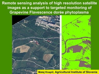
  • 1. Remote sensing analysis of high resolution satellite images as a support to targeted monitoring of Grapevine Flavescence dorée phytoplasma Matej Knapič, Agricultural Institute of Slovenia
  • 2. INTRODUCTION - Remote sensing could be used for detection and determination of specific plant species and diseased or stressed plants. - Noninvasive and nondestructive method - Together with GIS tools used for determination of spatial occurrence and quantification of the weakened plants - Spatial analysis: fields, region, country or globally.
  • 3. An example of Cotton root rot - Cotton root rot caused by Phymatotrichopsis omnivora (1927) in APS feature, 2005 - soil-borne fungus infects numerous crop plants
  • 4. INTRODUCTION - Remote sensing system exploit measuring and recording of reflected or emitted electromagnetic energy from the objects. 1 2 -
  • 5. INTRODUCTION - The most common source of electromagnetic radiation (ER), which is recorded by satellites, is the sun 3 - ER interacts with atmosphere and earth surface (vegetation, soils…) - absorption - transmission - reflection K. Oštir. Daljinsko zaznavanje, 2006
  • 6. INTRODUCTION Detectors – sensors at the satelite record values of individual spectral channel Source: APSnet Feature,K. Steddom et all, 2005
  • 7. Remote sensing in grapevine FD monitoring x An ongoing research project 2011-2012 x Remote sensing of vineyards in order to develop support to targeted monitoring of Grapevine Flavescence dorée phytoplasma in Slovenia. x Use of high resolution and multispectral satellite images x Basis for broader use in plant pathology
  • 8. Remote sensing of vineyards in foci 1 In addition to the research project input was done via official survey program Satellite recording of FD demarcated area in 2 regions was ordered in first half of August and first half of September 2011
  • 9. Satellite recording of FD demarcated area x on the coastal area (Koper-Izola) x part of Dolenjska region (500 km2)
  • 10. Remote sensing of vineyards in foci 2 x In the time frame of the satellite recording ground truthing was made. x Images were georeferenced and orthorectificated to obtain spatial accuracy. x First analysis were made for the Izola focus x Central vineyard was mapped for symptoms to the level of individual grapevine plants
  • 11. Remote sensing of vineyards in foci 3
  • 12. Remote sensing of vineyards in foci 4 Analysis of high resolution and multispectral satellite images If the difference in spectral signature is significant, a distinction between the objects or even inside the objects from the satellite image can be made. We try to use this fact to implement remote sensing to the target monitoring of Grapevine FD symptoms in plants.
  • 13. Remote sensing of vineyards in foci 5 NDVI=IR- R/IR+R
  • 14. Remote sensing of vineyards in foci 6 WBI=NIR1/NIR2
  • 15. Remote sensing of vineyards in foci 7 Rededge kanal = 725 nm
  • 16. Remote sensing of vineyards in foci 8 In the first phase of the image analyzes we are searching for the suitable: x classification and x algorithm which would enable distinction x between healthy and diseased plants x and determination of FD infested plants location.
  • 17. Conclusions x We are not expecting to develop 100% certainty in remote FD determination. x However, results should help to monitor vineyards for FD presence in more targeting way and to locate some possible foci of FD also in isolated and abandoned locations
  • 18. Acknowledgment Many thanks for good cooperation to: The project team: - National Institute of Biology - Agricultural Institute The survey team, especially phytosanitary inspectors from Koper and colleagues from plant protection service KGZ Novo mesto Ministry of Agriculture and Environment Phytosanitary Administration of R Slovenia