Lake2Bay
•
3 recomendaciones•2,499 vistas

LAKE2BAY will be the healthiest urban space in the world to live, work, learn, study, create, visit, and play by: • Maximizing the value of iconic public spaces and cultural experiences by connecting Myrtle Edwards Park and the SAM Sculpture Garden up through the Seattle Center and its surrounding neighborhoods to South Lake Union Park. • Leveraging the opportunities generated by market activity and innovation • Creating a comprehensive, connected and coherent mobility and access system that emphasizes safe, attractive walking and biking • Creating housing in neighborhoods that are affordable and compassionately serve a full spectrum of residents • Emphasizing sustainable design in projects and buildings throughout the area

Recomendados
Más contenido relacionado
La actualidad más candente
La actualidad más candente (12)
Destacado
Destacado (8)
Similar a Lake2Bay
Similar a Lake2Bay (20)
Último
Último (20)
Lake2Bay
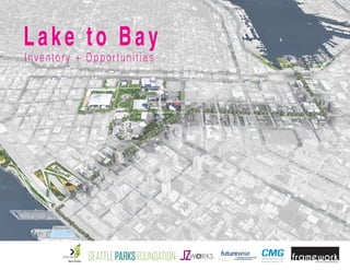
- 1. Inventory + Opportunities Lake to Bay
- 2. LAKE TO BAY EXECUTIVE SUMMARY Lake to Bay Vision The Lake to Inventory and Opportunities work included a deep review of existing conditions; including research on transportation, topography, land uses, environmental conditions, current amenities, policy documents, and gaps along with future opportunities. This analysis resulted in a re-imaged vision of the Lake to Bay as a city-defining connection between the north end of the waterfront and South Lake Union, along with a focus on creating a high quality public realm for the Lake to Bay zone. This work was supported by the Lake2Bay Coalition, Seattle Parks Foundation, Bill and Melinda Gates Foundation, and Vulcan Real Estate. Create the healthiest urban space in the world to live, work, learn, study, create, visit and play! LAKETO BAY2
- 3. TABLE OF CONTENTS GOALS + AMBITION OPPORTUNITIES APPENDIX: INVENTORY APPENDIX: POLICY - PAGE 6 - - PAGE 18 - - PAGE 50 - - PAGE 73 - LAKETO BAY 3
- 4. Denny Way Denny Way Broad Street Mercer Street Mercer Street ElliotAvenue W W estern Avenue Alaska W ay 2ND Avenue 5TH Avenue DexterAvenueN Valley Street WestlakeAvenue TerryAvenueN Thomas Street BELLTOWN UPTOWN South Lake Union PROJECT STUDY AREA LAKETO BAY4
- 5. Major gaps in the physical environment hinder a friendly, exciting, fun, high quality experience Denny Way Denny Way Broad Street Mercer Street Mercer Street ElliotAvenue W W estern Avenue Alaska W ay 2ND Avenue 5TH Avenue DexterAvenueN Valley Street WestlakeAvenue TerryAvenueN Thomas Street Stronger Stronger Stronger Reconnect Ped + Bike Improvements GAPGAP Gap east of Seattle Center will be reconnected with Alaskan Way Viaduct Replacement Project. There are no existing plans to remove the gap along Broad Street. Leadership will be needed to reconnect the Olympic Sculpture Park and Seattle Center. LAKETO BAY 5
- 6. Goals + Ambition Lake to Bay What is Lake to Bay?Lake to Bay aims to be a model for the future, integrating residential and work spaces with cultural activities, natural systems, and delightful ways to move through the neighborhoods. The ambition for Lake to Bay is high and city-defining, connecting iconic buildings and spaces from Lake Union to Elliot Bay. It is a Zone It is a Route It is an Idea LAKETO BAY6
- 7. What does Lake to Bay do? 4 3 2 1 CONNECTS LAKE UNION TO ELLIOT BAY IN A CITY-DEFINING ROUTE FOCUSES ON SEATTLE CENTER AS THE CENTER LEVERAGES CREATIVITY AND INNOVATION WITHIN THE PUBLIC REALM SUPPORTS HIGH QUALITY URBAN NEIGHBORHOODS LAKETO BAY 7
- 8. BAY LAKE CONNECTS LAKE UNION TO ELLIOT BAY IN A CITY-DEFINING ROUTE1 LAKETO BAY8
- 9. City-Defining Ambition Examples from around the world 1 3 4 5 2Highline, NYC Lombard Street, San Francisco, CA Hollywood, CA La Rambla, Barcelona San Antonio Riverwalk, San Antonio, TX LAKETO BAY 9
- 10. Uptown Queen Anne Seattle Center South Lake Union Downtown Belltown FOCUSES ON SEATTLE CENTER AS THE CENTER2 LAKETO BAY10
- 11. Denny Way Denny Way Broad Street Mercer Street Mercer Street ElliotAvenue W W estern Avenue Alaska W ay 2ND Avenue 5TH Avenue DexterAvenueN Valley Street WestlakeAvenue TerryAvenueN Thomas Street SUPPORTS HIGH QUALITY URBAN NEIGHBORHOODS3 LAKETO BAY 11
- 12. Model for High Quality Urban Neighborhood Examples from around the world 1 3 4 5 2Terry Avenue North, Seattle, WA 16th Street, Denver, CO Portland, OR 8th Street, Washington DC Parklet, San Francisco, CA LAKETO BAY12
- 13. Connecting People, Creativity + Innovation in the Public Realm 1 2 3 Creative transportation Creative and accessible ways to move 1. Outdoor Street Escalator Vitoria-Gasteiz, Spain 2. Trampe CycloCable Bike lift Trondheim, Norway 3. Axle Contemporary Art Gallery Bus Santa Fe, New Mexico 4 LAKETO BAY 13
- 14. Connecting People, Creativity + Innovation in the Public Realm 1 2 Curated and idea generating public space Creating Seattle’s LIVING LABS 1. BMW Guggenheim Lab : A mobile laboratory traveling around the world to inspire innovative ideas for urban design and urban life. Traveled to NYC, Berlin and Mumbai from 2011 - 2014 2. Moving Icon by Kalhöfer-Korschildgen : pop-up museum moves around the German region of Westphalia – providing residents a rare insight into local history. 3. Living Innovation Zone, San Francisco Description of LIZ from mayor: The Living Innovation Zone Program (LIZ) seeks to create a flexible framework that harnesses the city’s creativity by using City-owned assets, such as public spaces, and partnerships with leading organizations as catalysts for exploration, innovation and play3 BMW Guggenheim Lab: NYC, Berlin and Mumbai Living Innovation Zone, San Francisco Moving Icon pop-up museum : Germany LAKETO BAY14
- 15. Connecting People, Creativity + Innovation in the Public Realm 1 2 3 Physical + Digital installations Innovative wayfinding and access to information 1. IBM Thinkwall New York City, NY 2. Digital Carpet and Starpath Products that illuminate pathways 3. Way-finding kiosk Pearson Lloyd Westfield London, England New York City Westfield London, England Currently in prototype LAKETO BAY 15
- 16. Connecting People, Creativity + Innovation in the Public Realm 1 2 3 Seattle inspires The Next Generation “World’s Fair” 1. La Biennale, Venice, Italy 2012 Russian Pavilion QR code room 2. Seattle Center Bumbershoot Annual Event 3. 1962 Seattle’s World Fair Venice, Italy Seatle, WA Seatle, WA LAKETO BAY16
- 17. “Seattle’s fair left the city with a permanent cultural nexus and major infrastructure... It gave us a refurbished waterfront, streetside trees and new facilities at the University of Washington. It helped boost major projects, such as the completion of Interstate 5 through downtown and the SR 520 bridge. It bequeathed to us Seattle Center, a permanent complex of theaters, pavilions, the Pacific Science Center, Coliseum (now KeyArena), Center House, Opera House, the Monorail and open urban space. It gave us an international civic symbol, the Space Needle, second only to the Eiffel Tower as a world’s fair souvenir and a tourist attraction known around the world.” Seattle Magazine, Febuary 2012, Back to the Future: Why Seattle’s World’s Fair Mattered. By: Knute Berger What would a world’s fair for our generation look like? LAKETO BAY 17
- 18. Opportunities Lake to Bay Along this city-defining Lake to Bay route, key locations are recognized as opportunities for new development and ideas. The following images portray a vision to identify the opportunity and to set the highest level of ambition. BROAD STREET THOMAS STREET WEST OF AURORA MERCER ENTRYWAY THOMAS STREET AT THE BRIDGE NORTH WATERFRONT CONNECTION BROAD STREET TRIANGLE BROAD / THOMAS INTERSECTION LAKETO BAY18
- 19. Denny Way Broad Street Mercer Street Mercer Street ElliotAvenue W W estern Avenue Alaska W ay 2ND Avenue 5TH Avenue DexterAvenueN Valley Stre WestlakeAvenue TerryAvenueN Thomas Street BAY LA LAKETO BAY 19
- 20. NORTH WATERFRONT CONNECTION Connects to the Central Waterfront Project Acts a giant green sponge for water runoff Pedestrian Connection to the Olympic Sculpture Park Connections and Future Vision Our Ambition Denny Way Denny Way Broad Street Mercer Street Mercer Street ElliotAvenue W W estern Avenue Alaska W ay 2ND Avenue 5TH Avenue DexterAvenueN Valley Street WestlakeAvenue TerryAvenueN Thomas Street BAY LAKE LAKETO BAY20
- 21. NORTH WATERFRONT CONNECTION connection to waterfront green infrastructure connection to Olympic Sculpture Park Connections and Future Vision LAKETO BAY 21
- 23. NORTH WATERFRONT CONNECTION AFTER LAKETO BAY 23
- 24. Broad Street Connections and Future Vision Road Diet, Pedestrian priority Curated Sculpture Park to Sculpture Park connection Everyone can go up the hill, easy access Highlight the Elliot Bay Denny Way Denny Way Broad Street Mercer Street Mercer Street ElliotAvenue W W estern Avenue Alaska W ay 2ND Avenue 5TH Avenue DexterAvenueN Valley Street WestlakeAvenue TerryAvenueN Thomas Street BAY LAKE Our Ambition LAKETO BAY24
- 25. Broad Street Connections and Future Vision Seattle Center Connection to Waterfront Sculpture Park LAKETO BAY 25
- 28. Broad Street Triangle Connections and Future Vision Provide a pleasant resting spot and waiting zone Connect Art and Science through fun and interactive elements Provide a clear way to the Seattle Center and Olympic Sculpture Park Denny Way Denny Way Broad Street Mercer Street Mercer Street ElliotAvenue W W estern Avenue Alaska W ay 2ND Avenue 5TH Avenue DexterAvenueN Valley Street WestlakeAvenue TerryAvenueN Thomas Street BAY LAKE Our Ambition LAKETO BAY28
- 29. Broad Street Triangle Connections and Future Vision Connection Connection SCIENCE CENTER Expanded Right of Way for Pedestrians LAKETO BAY 29
- 30. Broad Street Triangle BEFORE LAKETO BAY30
- 31. Broad Street Triangle AFTER LAKETO BAY 31
- 32. Broad / Thomas Intersection Connections and Future Vision Safe and interesting Pedestrian crossing Extension of Seattle Center boundaries, providing a strong entryway Activation areas with places to enjoy the Seattle Center elements Denny Way Denny Way Broad Street Mercer Street Mercer Street ElliotAvenue W W estern Avenue Alaska W ay 2ND Avenue 5TH Avenue DexterAvenueN Valley Street WestlakeAvenue TerryAvenueN Thomas Street BAY LAKE Our Ambition LAKETO BAY32
- 33. Broad / Thomas Intersection Connections and Future Vision Seattle center Active Crossing New Broad Street Corner LAKETO BAY 33
- 34. Broad / Thomas Intersection BEFORE LAKETO BAY34
- 35. Broad / Thomas Intersection AFTER LAKETO BAY 35
- 36. Thomas Street West of Aurora Connections and Future Vision Lighted Bike Path pavement Curated Space related to Seattle City Light, keeping the funk and highlighting infrastructure Night connection to and from the Seattle Center and South Lake Union Denny Way Denny Way Broad Street Mercer Street Mercer Street ElliotAvenue W W estern Avenue Alaska W ay 2ND Avenue 5TH Avenue DexterAvenueN Valley Street WestlakeAvenue TerryAvenueN Thomas Street BAY LAKE Our Ambition LAKETO BAY36
- 37. Thomas Street West of Aurora Connections and Future Vision bus hub activities at Seattle Center activities in South Lake Union industrial influence LAKETO BAY 37
- 38. Thomas Street West of Aurora BEFORE LAKETO BAY38
- 39. Thomas Street West of Aurora AFTER LAKETO BAY 39
- 40. Thomas Street at Bridge Connections and Future Vision Amplifying Thomas Street Concept Plan Neighborhood open space spot Park to Park connection Denny Way Denny Way Broad Street Mercer Street Mercer Street ElliotAvenue W W estern Avenue Alaska W ay 2ND Avenue 5TH Avenue DexterAvenueN Valley Street WestlakeAvenue TerryAvenueN Thomas Street BAY LAKE Our Ambition LAKETO BAY40
- 41. Thomas Street at Bridge Connections and Future Vision neighborhood anchor Green Sponge LAKETO BAY 41
- 42. Thomas Street at Bridge BEFORE LAKETO BAY42
- 43. Thomas Street at Bridge AFTER LAKETO BAY 43
- 44. Mercer Entryway Connections and Future Vision Strong Gateway to Seattle Center, opening to the neighborhood Arts and Culture Incubator space Opportunity for civic amenities such as a STEAM school, arts & culture incubator space and tech hub Denny Way Denny Way Broad Street Mercer Street Mercer Street ElliotAvenue W W estern Avenue Alaska W ay 2ND Avenue 5TH Avenue DexterAvenueN Valley Street WestlakeAvenue TerryAvenueN Thomas Street BAY LAKE Our Ambition LAKETO BAY44
- 45. Mercer Entryway Connections and Future Vision Entry to Seattle Center neighborhood connection neighborhood connection Gates Foundation LAKETO BAY 45
- 48. LAKETO BAY48
- 49. Project Team ryway Framework CMG Futurewise Framework was launched in 2013 by Lesley Bain, FAIA, and Jenny Kempson with the goal of strengthening communities with thoughtful, artistic, and inspiring places. Framework brings multiple design disciplines to the many aspects of cultural placemaking. Combining architecture, urban design, art and research, we aspire to work with creative clients to set new models for forward-thinking cities. www.weareframework.com CMG is a landscape architecture firm providing award-winning urban design, planning, stormwater management, and ecological and habitat design for a wide range of project types and clients. Principally, CMG specializes in the sustainability and livability of cities. From major redevelopment master plans to artistic installations, CMG has developed cutting-edge sustainable designs that set precedents and realize solutions. The integration of street life and vibrant urban environments with infrastructure concerns, stormwater management, and responsible design is CMG’s passion. http://www.cmgsite.com Futurewise is working to build healthy livable communities, protect our most critical working farmlands, forests, and waterways, and create a better quality of life for present and future generations. We believe smart growth solutions create communities that thrive with strong local businesses and jobs, safe efficient transportation choices, affordable places to live, and healthy natural systems. We work with communities to implement effective planning and policies that prevent waste and stop sprawl. Together, we will create a better quality of life in Washington State for present and future generations. http://futurewise.org LAKETO BAY 49
- 50. Appendix: Inventory Lake to Bay This appendix contains maps and materials for the following adjacent categories. These maps were created throughout the duration of this project to assist in analysis. Due to the initial scope, some maps relate to the geographic area for the original Lake to Bay Loop streets, while other maps include the full Lake to Bay zone. Alleys Arts and Culture Hubs Bike Routes and Counts Bus Activity Heatmap Bus, Streetcar and Monorail Routes Canopy Overhead Experience Developable Properties Edge Condition Experience Existing Planning Documents Existing Elements in the Public Realm Ground Floor Experience Natural Systems Memorial Stadium Size Diagram Parking Planning Documents Boundaries Right of Way Width Sidewalk Width Street Trees Use Zones Walking Tour Mapping Example LAKETO BAY50
- 51. Alleys Denny Way Thomas Street Denny Way Broad Street Mercer Street Mercer Street ElliotAvenue W W estern Avenue Alaska W ay 2ND Avenue 5TH Avenue DexterAvenueN Valley Street WestlakeAvenue TerryAvenueN BAY LAKE LAKETO BAY 51
- 52. Arts + Culture Hubs Play Play Play Create Create PlayCreate Create Innovate Learn Learn Learn Learn Learn Innovate Innovate Innovate LAKETO BAY52
- 53. Bike Routes and Counts Bike Lane Sharrow Bike Counts 2012 974 358 528 141 2172 1559 917 # BAY LAKE Denny Way Denny Way Broad Street Mercer Street Mercer Street ElliotAvenue W W estern Avenue Alaska W ay 2ND Avenue 5TH Avenue DexterAvenueN Valley Street WestlakeAvenue TerryAvenueN Thomas Street data from City of Seattle LAKETO BAY 53
- 54. Bus Activity Heatmap BAY LAKE Average # of people at stop/day > 175 176-449 450-999 1000-1659 1659-2805 KEY Denny Way Denny Way Broad Street Mercer Street Mercer Street ElliotAvenue W W estern Avenue Alaska W ay 2ND Avenue 5TH Avenue DexterAvenueN Valley Street WestlakeAvenue TerryAvenueN Thomas Street data from King County Metro LAKETO BAY54
- 55. Bus, Streetcar and Monorail Routes BAY LAKE Average # of people at stop/day > 175 176-449 450-999 1000-1659 1659-2805 Bus Route Streetcar Monorail KEY Denny Way Denny Way Broad Street Mercer Street Mercer Street ElliotAvenue W W estern Avenue Alaska W ay 2ND Avenue 5TH Avenue DexterAvenueN Valley Street WestlakeAvenue TerryAvenueN Thomas Street data from King County Metro LAKETO BAY 55
- 56. Canopy - Overhead Experience Denny Way Thomas Street Denny Way Broad Street Mercer Street Mercer Street ElliotAvenue W W estern Avenue Alaska W ay 2ND Avenue 5TH Avenue DexterAvenueN Valley Street WestlakeAvenue TerryAvenueN BAY LAKE 1 2 3 4 Building Canopy Open Air Tree Canopy Tree - Building data collected in the field by Framework LAKETO BAY56
- 57. Developable Properties Denny Way Denny Way Broad Street Mercer Street Mercer Street ElliotAvenue W W estern Avenue Alaska W ay 2ND Avenue 5TH Avenue DexterAvenueN Valley Street WestlakeAvenue TerryAvenueN Thomas Street 0 500 1,000 1,500 2,000250 Feet Development Potential Parcels with high development potential* Project extents No data available *Properties with developmnent potential have been identified by the City of Seattle’s analytical model in their Development Capacity Status Map model. This model does not reflect property owner preference or market conditions which may produce different results. BAY LAKE Denny Way Broad Street Mercer Street Mercer Street ElliotAvenue W W estern Avenue Alaska W ay 2ND Avenue 5TH Avenue DexterAvenueN Valley Street WestlakeAvenue TerryAvenueN Thomas Street 0 500 1,0250 Fe Development Potential Parcels with high development potential* Project extents No data available *Properties with developmnent potential have been identified by the City of Seattle’s analytical model in their Development Capacity Status Map model. This model does not reflect property owner preference or market conditions which may produce different results. BAY LA LAKETO BAY 57
- 58. Edge Conditions Experience - key on following page Denny Way Thomas Street Denny Way Broad Street Mercer Street Mercer Street ElliotAvenue W W estern Avenue Alaska W ay 2ND Avenue 5TH Avenue DexterAvenueN Valley Street WestlakeAvenue TerryAvenueN data collected in the field by Framework LAKETO BAY58
- 59. Edge Conditions Experience Types Edge Experience Types Building - closed off Building - opened Active Sidewalk Openspace 1 2 3 4 landscape setback non-active entry/plaza Wall or Fence 5 6 7 Parking LAKETO BAY 59
- 60. Existing Elements in the Public Realm 1. Seating 2. Texture Data collected in the field by Framework LAKETO BAY60
- 61. Existing Elements in the Public Realm 3. Trash Receptacles 4. Bike Related 5. Signage Data collected in the field by Framework LAKETO BAY 61
- 62. Ground Floor Experience Denny Way Thomas Street Denny Way Broad Street Mercer Street Mercer Street ElliotAvenue W W estern Avenue Alaska W ay 2ND Avenue 5TH Avenue DexterAvenueN Valley Street WestlakeAvenue TerryAvenueN Buy Live Work Parking KEY Public Industrial Parks Construction as of April 2014 BAY LAKE Data collected in the field by Framework LAKETO BAY62
- 63. Memorial Stadium Size Comparison Olympic Sculpture Park 9.95 Acres Museum of History and Industry 7.61 Acres Memorial Stadium 9.75 Acres LAKETO BAY 63
- 64. Steep View View View View View View View Salt water Fresh water Water Flow Natural Systems LAKETO BAY64
- 65. Parking BAY LAKE On-Street Parking Parking Lots Parks KEY Denny Way Denny Way Broad Street Mercer Street Mercer Street ElliotAvenue W W estern Avenue Alaska W ay 2ND Avenue 5TH Avenue DexterAvenueN Valley Street WestlakeAvenue TerryAvenueN Thomas Street LAKETO BAY 65
- 66. Planning Documents Boundaries - key on following page 3 5 6 12 8 9 10 11 13 14 15 16 7 4 1 2 Denny Way Thomas Street Denny Way Broad Street Mercer Street Mercer Street ElliotAvenue W W estern Avenue Alaska W ay 2ND Avenue 5TH Avenue DexterAvenueN Valley Street WestlakeAvenue TerryAvenueN BAY LAKE LAKETO BAY66
- 67. Planning Documents Boundaries - Key 5 4 1 2 Uptown Neighborhood Uptown Design Guidelines (2013) South Lake Union Design Guidelines (2012) South Lake Union Framework (2011) South Lake Union Mobility Plan (2011) Uptown Neighborhood Framework (2014) South Lake Union Neighborhood Belltown Neighborhood Plan (1998) Belltown Viaduct Lands Study (2011) North Waterfront Access Project (2002) Terry Avenue North Design Guidelines (2005) Thomas Green Street Concept Plan (2013) Mercer East /Mercer West (2013 - in construction) Thomas Street Bridge Overpass ( 2013 - complete) UW Medicine Lake Union Facilities (in construction) Centry 21 Masterplan (2008) Broad Street Green (2009 - complete) Uptown Triangle Charrette (2010) Alaskan Way Viaduct Replacement Project (2011) South Lake Union Concept Plans (2013) 3 Belltown Neighborhood 6 7 8 10 9 11 12 13 14 Cornish Master Plan - tbd15 August Wilson Way16 LAKETO BAY 67
- 68. Right of Way Width 0-40ft 40-60ft 60ft + ROW Width Denny Way Denny Way Broad Street Mercer Street Mercer Street ElliotAvenue W W estern Avenue Alaska W ay 2ND Avenue 5TH Avenue DexterAvenueN Valley Street WestlakeAvenue TerryAvenueN Thomas Street LAKETO BAY68
- 69. Sidewalk Width 0-10 ft 10-15 ft 15-20 ft 20ft + Sidewalk Width Denny Way Denny Way Broad Street Mercer Street Mercer Street ElliotAvenue W W estern Avenue Alaska W ay 2ND Avenue 5TH Avenue DexterAvenueN Valley Street WestlakeAvenue TerryAvenueN Thomas Street LAKETO BAY 69
- 70. Street Trees Denny Way Thomas Street Denny Way Broad Street Mercer Street Mercer Street ElliotAvenue W W estern Avenue Alaska W ay 2ND Avenue 5TH Avenue DexterAvenueN Valley Street WestlakeAvenue TerryAvenueN BAY LAKE LAKETO BAY70
- 71. Use Zones VISIT WORK 8 million / year ~30,000 employees 183% growth VISIT10 million / year VISIT350,000 / year Seattle Center Amazon LIVEBELLTOWN 1O3% growth LIVEUPTOWN 16% growth LIVEQUEEN ANNE 300% growth LIVESouth Lake Union WORK ~200,000 employees Downtown WORK ~ 1,200 employees Gates Foundation Pike Place Market OSP VISIT150,000 / year Mohai data collected from the Downtown Seattle Association 2011 Demographics Report and company websites LAKETO BAY 71
- 72. Lake to Bay : Walking Tour Map Stakeholder Input LAKETO BAY72
- 73. Appendix: Policy Lake to Bay The following report provides a review the existing planning and policy documents which may impact the design and implementation of Lake to Bay as currently conceived through this Inventory and opportunities project. Pedestrian Lighting Citywide Plan 2012 Seattle City Light 2013 – 2018 Strategic Plan Right of Way Improvements Manual 2012 2013 – 2018 Adopted Capital Improvement Alaska Way Viaduct North Portal Design 2011 Mercer East Corridor Project Plan 2012 Mercer West Corridor Project Plan 2012 South Lake Union Neighborhood Design Guidelines 2005 Terry Avenue North Street Design Guidelines 2005 South Lake Union Neighborhood Design Guidelines 2005 Seattle Pedestrian Master Plan 2009 Uptown Neighborhood Design Guidelines 2013 Uptown Triangle Planning Workshop 2010 Complete Streets Ordinance 2007 South Lake Union Mobility Plan 2011 Thomas Green Street Concept Plan 2013 South Lake Union Urban Design Framework 2010 Uptown Framework Plan* 2014 Seattle Bicycle Master Plan 2014 Downtown Seattle Public Spaces & Public Life 2009 Century 21 Master Plan 2008 Seattle Waterfront 2014 LAKETO BAY 73
- 74. Lake to Bay Inventory and Visioning Project Appendix: Policy Review June 2014
- 75. Lake to Bay Inventory and Visioning Project Page 2 Appendix: Policy Review Contents Contents Executive Summary.................................................................................. 3 Report Purpose..................................................................................... 3 Study Context........................................................................................ 3 Summary of Key Findings..................................................................... 5 Next Steps............................................................................................. 6 Seattle Pedestrian Master Plan................................................................ 7 Seattle Bicycle Master Plan...................................................................... 9 Bands of Green (2007) and Bands of Green Update (2011) ................. 13 South Lake Union Urban Design Framework......................................... 15 South Lake Union / Uptown Triangle Mobility Plan ................................ 18 South Lake Union Neighborhood Design Guidelines (2014 Update)..... 21 Terry Avenue North Street Design Guidelines ....................................... 23 South Lake Union Street Concept Plans................................................ 26 Thomas Green Street Concept Plan ...................................................... 29 Seattle Center Century 21 Master Plan.................................................. 33 Uptown Neighborhood Design Guidelines ............................................. 39 Sustainable Cities Design Academy, Uptown Triangle Planning........... 42 Denny Way Streetscape Concept Plan .................................................. 44 Strategic Plan for Realizing the Waterfront Seattle Vision ..................... 46 Waterfront 2020...................................................................................... 48 Downtown Seattle Public Spaces and Public Life Study........................ 50 Alaskan Way Viaduct North Portal Design ............................................. 52 Mercer Corridor Project .......................................................................... 56 Pedestrian Lighting Citywide Plan.......................................................... 59 Complete Streets Ordinance .................................................................. 61 Right of Way Improvements Manual ...................................................... 62 2013-2018 Adopted Capital Improvement Program............................... 65 The following document was prepared in support of the Lake to Bay Inventory and Visioning Project in conjunction with Framework, JZ Works and CMG Landscape Architecture under the direction of the Lake to Bay Committee with financial support from The Seattle Parks Foundation and Vulcan, Inc.
- 76. Lake to Bay Inventory and Visioning Project Page 3 Appendix: Policy Review Executive Summary Executive Summary Report Purpose The following report provides a review the existing planning and policy documents which may impact the design and implementation of Lake to Bay as currently conceived through the Inventory and Visioning Project completed in June of 2014. It focuses on either City-wide planning documents (like the Seattle Pedestrian Master Plan) or project specific plans located in the Lake to Bay area (like Seattle Waterfront 2020). The purpose of this policy review is to highlight where existing and planned efforts are supportive, neutral or unsupportive of the vision and implementation of Lake to Bay. A potential second phase of this project will include specific policy recommendations and advocacy action items related to these findings. Study Context History The City of Seattle has long been committed to a city-wide system of linear parks incorporating greenspace and recreational opportunities. Beginning in 1892, Edward Otto Schwagerl, Superintendent of Parks, created a plan for four major city parks on Lake Washington and Elliott Bay connected by parkways. In 1900, George Coterrill, an Assistant City Engineer, developed a plan for 25 miles of bicycle paths around the city. These were then incorporated into the Olmstead Brothers’ 1903 parks plan called “A Comprehensive System of Parks and Parkways” which envisioned an ambitious and comprehensive network of parks and open space throughout the city. The Olmstead Brothers worked for the City until 1941 designing elements of the parks system which are still great assets to Seattle today. 1 Lake to Bay continues this legacy of linear parks and boulevards. Supported by a wide variety of stakeholders including The Seattle Center, The Seattle Parks Foundation, the City of Seattle, neighborhood groups and private developers, the Lake to Bay concept has been developed over many years and continues to be refined. In 2001, the Seattle Center spearheaded the creation of the “The Potlatch Trail: Concept Plan”, a linear park connecting Lake Union to Elliott Bay through the Seattle Center. This concept was further developed to be the Lake to Bay Loop whose design and implementation is led by the Lake to Bay Committee. The Committee supports the implementation and improvement of Lake to Bay through planning, visioning and funding. Most recently, they convened 95 city leaders for public visioning and secured funding for way-finding signage along the route. Currently, the trail is called the “Lake to Bay Loop”, and is branded as “Seattle’s Scenic Urban Walking Trail.” It is comprised of a figure eight with two distinct loops – the Lake Loop and the Bay Loop which connect at Seattle Center. 1 Friends of Seattle’s Olmstead Parks
- 77. Lake to Bay Inventory and Visioning Project Page 4 Appendix: Policy Review Executive Summary Geography Lake to Bay connects Lake Union and Elliott Bay through some of Seattle’s most historic neighborhoods and its fastest growing, most dynamic neighborhoods – Belltown, Uptown, Queen Anne, South Lake Union, and Downtown, all connected through Seattle’s most iconic asset, the Seattle Center. This area, particularly Belltown, South Lake Union and Uptown are seeing significant growth in both housing and employment and are the location of several infrastructure projects which are changing the landscape of the built environment, re-establishing connectivity between neighborhoods and expanding pedestrian and bicycle networks. In addition, the area contains some of Seattle’s most important cultural assets which are enjoyed by both local residents and visitors, including: Bill & Melinda Gates Visitor Center Center for Wooden Boats Denny Park Experience Music Project Key Arena Lake Union Park Museum of History and Industry Myrtle Edwards Park Pacific Science Center SAM Sculpture Park Seattle Center South Lake Union Discovery Center The map at right shows the Lake to Bay area as well as the focus areas of the plans reviewed in this report. The Vision Under the leadership of the Lake to Bay Committee, the concept of Lake to Bay has been refined and key projects implemented; however it has not yet reached its full potential. The Lake to Bay Inventory and Visioning Project is intended to expand the Lake to Bay vision and ensure that the ambition of Lake to Bay reflects the strength of the area’s assets and potential. The vision, detailed in the main body of this report is three- fold: A Route – Create a city-defining boulevard which is nationally- recognizable as “Seattle” anchored by Seattle Art Museum Sculpture Park, Seattle Center and Lake Union. A Zone – Create a “web” of great streets which connect neighborhoods, provide multiple routes and connections for pedestrians and cyclists and foster a strong sense of place and vibrancy. An Idea – The Lake to Bay area is a world center for innovation in business, culture, science, philanthropy and education. The vision for Lake to Bay is that this innovation and leadership is visible and present for all who live, work or visit the area through street level interactions, collaborations and learning. Source: FRAMEWORK
- 78. Lake to Bay Inventory and Visioning Project Page 5 Appendix: Policy Review Executive Summary Summary of Key Findings Of the three elements of Lake to Bay, current planning documents are most supportive of the concept of the Lake to Bay area as “web” of great streets connecting the surrounding neighborhoods. Many of the street design guidelines and neighborhood design plans recommend good practice in design which supports increased opportunity for multi-modal transportation, creation of public spaces, street activation through design and land use and strategies to maintain and reflect the unique character and history of the individual neighborhoods which intersect in the Lake to Bay area. Of all of the plans, Seattle Center Century 21 Master Plan and Seattle Waterfront 2020 are most supportive of Lake to Bay as a route which is a world-class destination and closely identifiable with the City of Seattle. The ambitious plans for improvements to both of these assets would support Lake to Bay both as a route and as a destination itself. Many of the plans which prioritize funding for infrastructure improvements include the Lake to Bay area in their highest tier for funding priority. Due to its high volumes of vehicular, pedestrian and bicycle traffic, increasing number of residential units and jobs and regional destinations, the area is typically seen as a prime target of public investment for infrastructure and other improvements. Many of the plans in the following document set forth a street hierarchy, including boulevards, green streets, festival streets, arterials, etc. However, the hierarchies are not consistent with each other nor are they supportive of Lake to Bay as the premiere street through the zone. In particular, Thomas Street - which is classified in many plans as a green street, compared to Boulevards and other street typologies - will need to be featured more prominently to make Lake to Bay stand out through the zone of quality streets. Many of the street design guidelines incorporate elements of green infrastructure, both as an amenity and as an important element of the urban ecological system. None of the plans incorporate a comprehensive, area-wide green infrastructure approach. As mentioned above, Seattle Waterfront 2020 could be a great complement to the Lake to Bay vision, anchoring the southwest side of the route with a world-class amenity and destination. It is imperative that the projects be perceived as synergistic and mutually supportive. Particularly as funding mechanisms are explored (including public, quasi-public and private), these projects should not be put in a position of competing for public support and funding. Very few of the plans have associated funding. The primary means by which the plans are implemented are either through the Capital Improvement Program (CIP) or by voluntary implementation by public or private entities during other improvement projects. This leads to an inability to plan and implement a large-scale vision which will necessarily incorporate many smaller implementation steps. None of the plans reaches the ambition of Lake to Bay as an idea which inspires and reflects the innovation and leadership of the institutions and businesses which are located in the area. Particularly in regard to street activation beyond cafes and other public spaces, there is not a definitive vision for street activation which reaches the “best practice” tier that will differentiate Lake to Bay within Seattle, the nation or the world. As shown by the remainder of the document, there are a significant number of plans which apply to the Lake to Bay area. Ensuring that all of these plans are consistent with each other and with the Lake to Bay vision will be necessary to provide the clarity and prioritization needed to realize the most ambitious portions of the Lake to Bay vision. The City of Seattle is limited in public funding mechanisms and must rely significantly on a limited pool of local funding sources including taxing authority to implement public improvements. The ability of Lake to Bay to secure funding from these sources will be hampered by the large number of public projects and initiatives contending for the same small pool of funds.
- 79. Lake to Bay Inventory and Visioning Project Page 6 Appendix: Policy Review Executive Summary Next Steps As detailed in this plan, a significant number of planning studies have occurred throughout the Lake to Bay area. Where these plans are supportive of the Lake to Bay vision, it will be necessary to advocate for their implementation through private redevelopment efforts, public infrastructure projects or other implementation mechanisms. In particular, advocacy related to the following should be prioritized: Continue funding of Lake to Bay area infrastructure projects through existing public funding mechanisms like the Capital Improvement Program (CIP). Incorporate public space and public improvements consistent with the Lake to Bay vision into both public sector projects and private development as it occurs, even through voluntary programs. Where the Lake to Bay vision is not yet supported by existing planning documents, processes or funding, it will be necessary to provide leadership in the following areas: Communicate the Lake to Bay vision to relevant stakeholder groups for refinement and support. Explore new funding mechanisms which will generate resources for Lake to Bay. Expand expectations of planning, design and construction of the built environment in both the public and private arenas to support a Lake to Bay that goes beyond “best practice.” In order to fully realize the ambition of the Lake to Bay vision, inspiration will be needed which goes beyond the built environment and expands our existing concepts of street activation, design, public life and community planning. “Think big” and encourage ambitious, imaginative ideas which go beyond existing silos of responsibilities, expectations and collaboration. Explore additional implementation avenues, both in the built environment and in public area programming which expand beyond current planning processes. ADVOCATE LEAD INSPIRE
- 80. Lake to Bay Inventory and Visioning Project Page 7 Appendix: Policy Review Seattle Pedestrian Master Plan Seattle Pedestrian Master Plan Produced by: Seattle Department of Transportation (SDOT) Date: September 2009 Geography: Citywide Status: Being implemented on a project-by-project basis Overview The Seattle Pedestrian Master Plan provides the guiding principles for City efforts to improve pedestrian facilities throughout the city. While the plan does not include specific projects, it sets forth the overriding mission and goals related to walkability in Seattle. In addition, it provides an analysis which creates a framework for how to prioritize projects which are then funded in annual project lists, primarily through “Bridging the Gap” levy, and are incorporated into the Capital Improvements Plan. Plan Mission Make Seattle the Most Walkable City in the Nation Plan Goals Safety—Reduce the number and severity of crashes involving pedestrians. Equity—Make Seattle a more walkable city for all through equity in public engagement, service delivery, accessibility, and capital investments. Vibrancy—Develop a pedestrian environment that sustains healthy communities and supports a vibrant economy. Health—Raise awareness of the important role of walking in promoting health and preventing disease. Design Elements The Seattle Pedestrian Master Plan sets forth general components which are supportive of walkable environments, but does not make particular recommendations regarding specific design elements. The “pedestrian toolbox” recognizes the following ways to improve pedestrian accessibility: Frontage Zone—Tools include signage, weather protection, public/private interface, etc. Walkable Zone—Tools include sidewalks, walkways, shared use trails, stairways, and driveways. Landscape/Furniture Zone—Tools include buffers, lighting, natural drainage, public art, signage, street furniture, street trees/vegetation, utilities, wayfinding, etc. Curb Space Zone—Tools include curbs, curb ramps, curb bulbs, parking, etc. Travelway Zone—Tools include pedestrian overpasses and underpasses, crossing islands, medians, intersection geometry, road diets, roundabouts, traffic signals, traffic calming, traffic management, etc. Miscellaneous Development—Tools include physical and visual connections, developer improvements, Street Types, mixed land use, open space, parks, etc.
- 81. Lake to Bay Inventory and Visioning Project Page 8 Appendix: Policy Review Seattle Pedestrian Master Plan Project Prioritization The Seattle Pedestrian Master Plan sets for a general policy of project prioritization which is based on three factors: (1) Potential Pedestrian Demand (2) Socioeconomic and Health Priority (3) Pedestrian Linkage Priority. The Lake to Bay area scores high on all of these factors and all segments of the loop are in areas that are ranked as Tier 1 or Tier 2 for prioritization in project funding. Projects are divided into “Across the Roadway”, which focuses safety and comfort when crossing streets and “Along the Roadway” which focuses on sidewalks, streetscaping and other elements. Funding The Seattle Pedestrian Master Plan projects are funded by the 2006 Bridging the Gap transportation funding levy, which was estimated to provide approximately $60 million from 2009 to 2014. Key Findings The plan is generally supportive of increased walkability throughout the city which is supportive of potential pedestrian elements in Lake to Bay. All areas of the Lake to Bay are included in Tier 1 or Tier 2 priority areas for project funding and implementation. The Seattle Pedestrian Master Plan does not contain specific projects – either new infrastructure or improvements/maintenance of existing infrastructure. Those projects are determined on an annual basis and incorporated into the Capital Funding. The current Bridging the Gap levy is active through 2014. There is currently no funding source for projects beyond 2014, although there is a planned 2015 Bridging the Gap vote. Actual projects are determined on an annual basis and it is difficult to know what the mid-range or long-range funded projects may be.. Source: Seattle Pedestrian Master Plan
- 82. Lake to Bay Inventory and Visioning Project Page 9 Appendix: Policy Review Seattle Bicycle Master Plan Seattle Bicycle Master Plan Produced by: Seattle Department of Transportation (SDOT) Date: April 2014 Geography: Citywide Status: Adopted Plan Vision Riding a bicycle is a comfortable and integral part of daily life in Seattle for people of all ages and abilities. Plan Goals Ridership—Increase the amount and mode share of bicycling in Seattle for all trip purposes. Safety—Improve safety for bicycle riders. Connectivity—Create a bicycle network that connects to places that people want to go, and provides for a time-efficient travel option. Equity—Provide equal bicycling access for all through public engagement, program delivery, and capital investment. Livability—Build vibrant and healthy communities by creating a welcoming environment for bicycle riding. Plan Objectives Objective 1—Complete and maintain a safe, high-quality bicycle network of on-street and trail facilities throughout the city. Objective 2—Integrate planning for bicycle facilities with all travel modes and complete streets principles. Objective 3—Employ best practices and context sensitivity to design of facilities for optimum levels of bicycling comfort. Objective 4—Build leading-edge bicycle facilities, including on-street separated facilities, multi-use trails, and neighborhood greenways. Objective 5—Update and apply a prioritization framework for bicycle investments throughout the city. Objective 6—Identify and implement actions to support and promote bicycle riding. Bicycle Counts As shown on the map at right, bicycle counts in the Lake to Bay area were some of the highest in the city, particularly at the intersections of Elliott Avenue and Broad Street as well as the intersection of Denny Way and 5 th Avenue. Source: Seattle Bicycle Master Plan
- 83. Lake to Bay Inventory and Visioning Project Page 10 Appendix: Policy Review Seattle Bicycle Master Plan Plan Funding The Seattle Bicycle Master Plan sets forth an ambitious list of proposed network improvements detailed below. Funding for these projects will require a variety of sources, including the Seattle Capital Investments Program (CIP), incorporating bicycle facilities into other street improvement projects using the Complete Streets standards, from MAP- 21 federal funding and from additional grant funding secured by Seattle Department of Transportation. Proposed Network Improvements The Bicycle Master Plan’s recommended network has several facilities which are located within the Lake to Bay context area, including protected bike lanes on several segments, including: North/South Queen Anne Avenue N. between Roy Street and Denny Way (cycle track) 1 st Avenue N. between Roy Street and Broad Street (cycle track) Broad Street from 2 nd Avenue to Alaskan Way (cycle track) 2 nd Avenue from Broad Street into downtown (cycle track) 5 th Avenue from Roy Street to Cedar Street (cycle track) Dexter Avenue from Roy Street to Battery Street (cycle track) 9 th Avenue N. from Lake Union to Denny Way (cycle track) East/West Thomas Street from Elliott Avenue to Eastlake Avenue (neighborhood greenway) Republican Street from Dexter Avenue to Eastlake Avenue (in street, minor separation) Catalyst Projects While not in the study area, one important recommendation from the plan is a catalyst project which is a South Lake Union to Capitol Hill Interstate 5 crossing. While not specified in the plan, initial drawings indicate the project could be located around Thomas Street. This project could increase connectivity for both bicycles and pedestrians from Capitol Hill through South Lake Union and into Lake to Bay. Source: Seattle Bicycle Master Plan
- 84. Lake to Bay Inventory and Visioning Project Page 11 Appendix: Policy Review Seattle Bicycle Master Plan Design The Seattle Bicycle Master Plan details suggested treatments for many types of bicycle facilities. One-way Cycle Tracks Two-way Cycle Tracks In-Street, Minor Separation Shared Street Intersection Treatments Source: Seattle Bicycle Master Plan
- 85. Lake to Bay Inventory and Visioning Project Page 12 Appendix: Policy Review Seattle Bicycle Master Plan Key Findings Plan is supportive of increasing bicycle network through the Lake to Bay area. Plan proposes treatment options which align with Complete Streets and other integrated bike/pedestrian/auto street design frameworks. Exact location of planned bicycle network may not be along key Lake to Bay priority areas. No catalyst projects included within the Lake to Bay area, however Thomas Street I-5 overpass would significantly increase East-West connectivity to Capitol Hill. Bike Share While not detailed in this plan, the coming Puget Sound Bike Share program will have a significant impact on the ability of residents and visitors to utilize the existing and improved bicycle network. Partnerships with employers and other organizations will be a key determinant in the location of bike share facilities and incorporation of bike share in the Lake to Bay area will greatly enhance the area as a cycling destination. Source: Pronto! and Puget Sound Bike Share
- 86. Lake to Bay Inventory and Visioning Project Page 13 Appendix: Policy Review Bands of Green Bands of Green (2007) and Bands of Green Update (2011) Produced by: Seattle Parks Foundation and the Seattle Department of Transportation Date: Original report from 1990, with a major update in 2007, updated in 2011 Geography: Citywide Status: Being implemented on a project-by-project basis Overview The focus of the Bands of Green plans is on linear parks and green connections throughout the City of Seattle. Linear parks and greenways were an integral part of the Olmstead Plan for Seattle and interest in linear parks revived during the 1980s with the public’s support for the construction of the Burke-Gilman trail. Plan Goals The 2007 Bands of Green study set forth the following goals: Beautify the city; Diversify and expand the routes available to walkers, runners, and bicyclists; Add greenery and character to city neighborhoods; Improve the safety of public thoroughfares for bicyclists and pedestrians; Encourage the public to venture to parks they have seldom used; and Relieve overcrowding on existing trails and boulevards by expanding the available resources. Characteristics of a Good Linear Park According to the 2007 plan, a good linear park incorporates the following for characteristics: Connection—The proposed boulevard or trail must connect major open space resources such as parks, shorelines, panoramic views or public activity centers. Continuity—The route must flow to its destination(s) with a minimum of man-made obstacles. The way must be clearly marked by landscaping if possible and with monuments or signs otherwise. Recreational Potential—When possible, a proposed boulevard should be designed to encourage recreation as well as a utilitarian use within the corridor. This means that pedestrians and bicyclists should not be overwhelmed by multiple lanes of high-speed traffic. Scenic Values—Proposed boulevards and trails should offer views of significant natural features, historic structures and/or unique human activities as well as opportunities to experience the natural topography and landscape. The Presence of Nature—Boulevards and trails should be landscaped to reflect their important role in the city’s open space system, and as a means of establishing continuity. Character—The identity of a linear park is rarely established solely with landscaping. Human-made elements – light posts, sea walls, bridges, railings, fences, and buildings – play a critical role in establishing the “feel” of a linear park. Safety—The system must be designed to protect the safety of its most vulnerable users. The speeds of motor vehicles should be slowed when required to assure that bicyclists and pedestrians can safely share the right-of-way.
- 87. Lake to Bay Inventory and Visioning Project Page 14 Appendix: Policy Review Bands of Green Project Priorities The 2007 Bands of Green study specifically mentions the “Lake-to-Bay Trail” as an important project, stating in part: Another necessary connection is, of course, a pedestrian and bicycle link between South Lake Union, the Seattle Center and the waterfront. Although they are separated by just a few blocks, that distance is a death valley for bicyclists and pedestrians. The new Olympic Sculpture Park, the upcoming Mercer Street redevelopment, and the possible reconnection of the grid system across Aurora Avenue will provide the opportunity to create a safe and attractive connection among these destinations. We suggest the City plan the development of the Lake-to-Bay Trail in conjunction with the construction of these projects. 2011 Update The 2011 Update to Bands of Green conducted significant fieldwork which included the following findings: While significant improvements had been made in the trail network from the original plan, gaps in the network were a detriment to the functionality of the network as a whole. There were many areas where a linear parks system and the Bicycle Master Plan can complement each other, however, there is an inherent tension between the two as a balance between “connections” and “green” is established. Some parks have easy connections to the trail network; however there had not been a consistent application of trail improvements to and from existing parks. The original plan relied heavily on the boulevard concept and in order to create an extensive network on existing infrastructure, additional concepts for green networks may be required. Lake to Bay Loop is given as an example of community organizations and employers who have taken the initiative to develop plans incorporating green connections in their neighborhood planning. 2011 Recommendations The 2011 Update lists recommendations related to specific greenways and trail projects established in the original plan. The specific recommendation for Lake to Bay states: Description: The proposed Lake to Bay Loop will link Lake Union Park, Seattle Center and the Olympic Sculpture Park. The concept plan is complete, and funding for the Thomas Street overpass has been secured. Potential Solution: More detailed planning and additional funding is needed to complete the concept. Potential Park Foundation role: The Foundation has been and should continue to be the catalyst for this project. Key Findings Both Bands of Green (2007) and the 2011 Update and Recommendations are very supportive of Lake to Bay, both conceptually as part of a citywide network of connections, as well as the Lake to Bay project specifically. Seattle Parks Foundation has provided funding and continues to support Lake to Bay financially as well as through advocacy and leadership. The ability of the Seattle Parks Foundation to fund implementation of the plan is limited and will require the securing of additional funding sources.
- 88. Lake to Bay Inventory and Visioning Project Page 15 Appendix: Policy Review South Lake Union Urban Design Framework South Lake Union Urban Design Framework Produced by: Seattle Department of Planning and Development (DPD) Date: December 2010 Geography: South Lake Union Neighborhood Status: Adopted, incorporated into zoning and incentive zoning ordinances Overview The South Lake Union Urban Design Framework is intended to set forth clear actions from both the private and public sectors which will achieve the vision set forth in the South Lake Union Neighborhood Plan. The plan encompasses the South Lake Union neighborhood bounded by Denny Way on the south, Broad Street and Aurora Avenue on the west, Galer Street and Lake Union on the north and I-5 to the east. Plan Priorities The Plan reflects five priorities set forth in the South Lake Union Neighborhood Plan: Community Character–Encourage pedestrian activities with pedestrian nodes and corridors, preserve landmarks and a diversity of business. Transportation–Reduce car dependency by improving alternate mode infrastructure. Improve Mercer, Valley Street and connections to surrounding neighborhoods. Parks and Open Space–Improve existing open space such as Lake Union Park, Cascade Playground, P-Patch/People’s Center and Denny Park. Housing–Create diverse housing options which include affordable units and make the neighborhood attractive to families. Sustainability–Encourage green building practices and green stormwater infrastructure. Protect natural light and view corridors, and increase vegetation within the neighborhood and along the shoreline. Guiding Principles The guiding principles of the plan’s design concepts and recommendations are intended to achieve the priorities listed above: Set a clear vision for South Lake Union’s future development that reflects the neighborhood’s physical setting and embodies the goals of the Neighborhood Plan. Integrate South Lake Union with adjacent neighborhoods with special attention to the opportunity presented by improvements to Aurora Avenue. Create a network of great streets with safe connections for all modes. Develop a diverse system of open spaces and community services. Revise zoning and design guidelines which activate streets, help preserve neighborhood landmarks, enhance views, encourage sustainable design and support affordable housing. Create opportunities for families to live in the neighborhood, particularly in clusters along 8 th Avenue and around Cascade Park. Guide new affordable housing investments through incentive zoning and surplus property.
- 89. Lake to Bay Inventory and Visioning Project Page 16 Appendix: Policy Review South Lake Union Urban Design Framework Design Typology The plan establishes several typologies for urban design related to nodes, gateways, various street designs and land uses outlined below. Gateways, Hearts and Edges Gateways–transition locations that mark entry and departure points into the neighborhood, including Broad and Thomas and Mercer and Terry. Hearts–centers of activity, with Regional Hearts at Lake Union Park and Neighborhood Hearts at Westlake Commercial District, Denny and Cascade Parks and a proposed future site on 8 th between Valley and Mercer Streets. Edges–physical characteristics that define the neighborhood which can either be an amenity, like Lake Union, or a challenge, like I-5. Street Character Boulevards/Great Streets – streets of grand scale or importance, often commercial corridors with relatively high intensity for all modes of transportation. The plan proposes several boulevards, including Denny and Mercer (east-west) and 5 th Avenue, Aurora, Dexter, Westlake, Fairview and Eastlake (north-south). Mixed Use Streets–typical downtown streets with a mix of commercial, residential and retail uses which are secondary routes through and to the neighborhood. Recommended mixed-use streets include Republican and Harrison (east-west) and 9 th Avenue (north- south). Festival Streets–flexible streets which are able to be closed down for public use during special events. Recommended festival streets include John from Dexter to 9 th Avenue, Valley from Westlake to Fairview and Terry throughout the neighborhood. Neighborhood Streets–standard local access streets which are not designed as significantly as green streets, but should have narrower roadways, generous plantings and other amenities. Suggested streets include Taylor, 6 th Avenue, Boren, Minor and Yale. Green Streets–low intensity streets that prioritize pedestrian and bike mobility over autos and may have ecological functions related to water management, habitat and tree canopy. Thomas and John are recommended as Green Streets. Woonerf Streets–may act as linear open spaces, with active or agricultural uses and may be closed substantially or totally to automobiles. The plan recommends that 8 th from John to Broad be prioritized as a Woonerf type street. Source: South Lake Union Urban Design Framework
- 90. Lake to Bay Inventory and Visioning Project Page 17 Appendix: Policy Review South Lake Union Urban Design Framework Land Use Primary Residential Areas–Focus on clustering residential development to achieve a critical mass of units, discourage commercial uses other than ground floor retail or services. Residential Emphasis Areas–Mixed-use areas which encourage residential development but with more flexibility than primary residential areas. Pedestrian-Oriented Retail & Services–Locally-servicing businesses like restaurants, banks and other establishments. Neighborhood Retail and Services–Would provide incentives for small commercial establishments. Open Space, Public Space, Views and Lakefront Open Space Strategies–Use a variety of block configurations to incorporate open space into new development. Open space can be incorporated into mid-block connectors, green alleys, streets and pocket parks. Public Space Network–The public space network is a combination of existing parks and greenspace as well as open space created by conscientious siting of new development and infrastructure improvements incorporating public space elements. Views–Significant view corridors exist within the study area, particularly Thomas and John (facing west to the Space Needle) and Terry, Boren and Fairview (facing north, to Lake Union). Lakefront–Lake Union is one of the neighborhood’s primary assets and the plan seeks to maximize the amenity through street improvements along Terry to create a “grand entrance” to Lake Union Park. In addition, the plan calls for improved pedestrian connections throughout the neighborhood, through activation of Valley using cafes and retail stores, greater spacing between tower buildings close to the waterfront and an expansion of the Cheshiahud Loop. Neighborhood Connections The South Lake Union Design Framework prioritizes improving connections to surrounding neighborhoods, and recommends the following which are most likely to influence Lake to Bay: More crossings at Aurora, including Thomas. Improved pedestrian connections including the Cheshiahud Loop and Lake to Bay and their connection point at Terry and Valley. Extend the South Lake Union Streetcar north to Fremont and the U District. Key Findings The plan acknowledges and supports both Seattle Center and South Lake Union as regional destinations and prioritizes their enhancement and connectivity to the neighborhood through street and building design. The South Lake Union Urban Design Framework focuses on a “web” of great streets with different characters which is supportive of a Lake to Bay zone with many types of connections. Some of the street character recommendations are not consistent with the Lake to Bay vision as most recently articulated. For example, Thomas Street will need to be reclassified as a Boulevard/Great Street to support the Lake to Bay vision. There is no specific funding for projects set forth in the plan; however there is a well-organized work plan which sets forth specific actions needed in the public and private sector to enact the plan’s priorities. Source: South Lake Union Urban Design Framework
- 91. Lake to Bay Inventory and Visioning Project Page 18 Appendix: Policy Review South Lake Union / Uptown Triangle Mobility Plan South Lake Union / Uptown Triangle Mobility Plan Produced by: Greater Seattle Chamber of Commerce South Lake Union Community Council South Lake Union Chamber of Commerce Uptown Alliance Date: 2011 Geography: South Lake Union Status: Completed, not adopted Overview The South Lake Union Mobility Plan integrates and expands on recommendations from many previous studies to bring together a comprehensive and coherent approach to mobility throughout the South Lake Union and Uptown neighborhoods. The plan addresses several modes of transportation, including biking, walking, transit and freight needs throughout the area. Recommendations The plan’s recommendations fall under seven key themes, described below with key projects and recommendations highlighted. Connect Communities Creating connections between South Lake Union and Uptown across Aurora Avenue is a top priority. Re-establish the east-west grid across Aurora Avenue at John, Thomas and Harrison Streets. Rename Aurora Avenue to 7 th Avenue N. Provide pedestrian and bicycle facilities on Thomas Street consistent with the Green Street designation. Enhance the pedestrian crossings of 5 th Avenue N. at Thomas and Harrison Streets. Increase Transit Service Provide east-west transit service connecting Capitol Hill and Uptown on Harrison Street. Identify bus layover locations in exchange for extending bus routes. Concentrate transit service at a hub located at Aurora between Harrison and Thomas Streets. Increase nighttime and weekend service at Seattle Center and Lake Union Park. Improve pedestrian lighting and amenities at transit stops. Support additional streetcar routes, prioritizing connections to First Hill Streetcar and the Seattle Center. Source: South Lake Union / Uptown Triangle Mobility Plan
- 92. Lake to Bay Inventory and Visioning Project Page 19 Appendix: Policy Review South Lake Union / Uptown Triangle Mobility Plan Serve Regional Access & Mobility Complete the Mercer West project. Convert Roy Street west of 5 th Avenue N. to two-way operations with bike lanes and traffic calming. Improve pedestrian crossings at intersections along Mercer and Roy Streets. Discourage Republican Street as a high-speed through-route with traffic calming strategies. Encourage Walking Signalize pedestrian crossings of Westlake Avenue N., particularly at Thomas Street and John Street. Implement a comprehensive pedestrian wayfinding program. Improve pedestrian facilities along the Mercer Corridor, improving crossings of Mercer Street near the Seattle Center. Improve pedestrian-level lighting throughout the neighborhood. Complete the Lake to Bay trail. Enhance the pedestrian connection from Terry Avenue to Lake Union Park. Prepare a Streetscape Concept Plan for Dexter Avenue N. from Roy Street to Denny Way. Support Biking Enact planned bicycle improvements as part of Mercer Corridor Project. Provide bike infrastructure on Thomas Street. Improve the Dexter Avenue N. bike lanes. Create a bike sharing program for Uptown, South Lake Union and Seattle Center. Locate bike storage facilities near major transit stations. Leverage Private Transportation Investments Support private shuttles with passenger load zones along public streets at appropriate locations. Incentivize frontage improvements that are beyond City code requirements. Coordinate transportation demand management plans among business and institutions. Manage shared neighborhood parking.Source: South Lake Union / Uptown Triangle Mobility Plan
- 93. Lake to Bay Inventory and Visioning Project Page 20 Appendix: Policy Review South Lake Union / Uptown Triangle Mobility Plan Create Hubs for Mode Transfers Create a transportation hub on Aurora Avenue between Harrison and Thomas Streets. Create a transportation hub on Valley Street near Lake Union Streetcar. Transportation hubs could include supportive surrounding land uses, small-scale retail and services, placemaking design amenities, convenient transit customer information, wayfinding, good pedestrian connections, bike storage and bike sharing facilities. Key Findings The Southlake Union / Uptown Triangle Mobility Plan recommendations are very supportive of the Lake to Bay vision. The plan is most supportive of the “web” of well-designed streets with multimodal infrastructure and connecting neighborhoods like Capitol Hill, South Lake Union and Uptown. The plan’s recommended transit hubs at Thomas/Harrison (on Aurora) and Valley/Terry would increase Lake to Bay connection points to regional transit service. Plan reiterates plan for Thomas Street as a green street which is supportive of Lake to Bay as a whole but does not, it itself, meet the ambition of a city-defining, destination boulevard. Source: South Lake Union / Uptown Triangle Mobility Plan
- 94. Lake to Bay Inventory and Visioning Project Page 21 Appendix: Policy Review South Lake Union Nieghborhood Design Guidelines (2014 Update) South Lake Union Neighborhood Design Guidelines (2014 Update) Produced by: Seattle Department of Planning and Development (DPD) Date: 2005, revised in 2013 Geography: South Lake Union Status: Adopted Overview Design guidelines set forth the qualities of architecture, urban design and public space that guide the Design Review Board in their review of proposed projects. In addition to citywide design guidelines, many neighborhoods also have their own guidelines that are specific to the needs and desires of their community. The South Lake Union Design Guidelines set forth the design principles for the South Lake Union Neighborhood, the area bounded by Aurora Avenue, Eastlake Avenue, Denny Way, and the southern shoreline of Lake Union. Character Areas The plan defines four distinct character areas within the South Lake Union neighborhood: Waterfront–Is characterized by the neighborhood’s water dependent activities and should build upon the industrial maritime nature of the area. Aurora Corridor–Is characterized by an eclectic variety of building types and forms that house diverse business uses and serves as a buffer to the SR 99 Corridor. Westlake–Is characterized by its commercial core consisting of mid- sized, full block commercial and light industrial buildings. Cascade–Is characterized by a mixture of commercial, residential and social services with sustainable infrastructure and improvement projects that maintain a creative, collaborative and eclectic nature. Design Guidelines The South Lake Union Design Guidelines supplement the citywide Seattle Guidelines in many ways. Those most relevant to Lake to Bay include the following: Natural Systems and Site Features New development is encouraged to take advantage of site configuration to accomplish sustainability goals. Components can include solar orientation, storm water management, sustainable landscaping, and buildings designed for their entire life cycles. Urban Pattern and Form Encourage “outlooks and overlooks” for the public to view the lake and cityscapes from public plazas or other open spaces and designing form and façades to enhance views. Reinforce community gateways through architectural elements, streetscaping and/or signage. Potential gateway locations include Westlake and Denny, Westlake and 9 th , Dexter and Mercer, Fairview and Valley, Fairview and Denny, and Fairview and Mercer. Development at “heart” locations, which are community anchors and centers of commercial and social activities, should enhance the character through appropriate site planning and architecture and should incorporate special street treatments such as pedestrian lighting, public art, special paving, landscaping and additional public open space. Areas identified as heart locations include South Lake Union Park, Denny Park, Harrison Street, Terry Avenue N., and Westlake Avenue N.. Address both the pedestrian and auto experience through building placement, scale and details.
- 95. Lake to Bay Inventory and Visioning Project Page 22 Appendix: Policy Review South Lake Union Nieghborhood Design Guidelines (2014 Update) Architectural Context and Character Articulate building façades in intervals that relate to the existing structures or existing pattern of development in the vicinity. Support the existing mix of building styles and re-use. Preserve important buildings and landmarks where possible. Expose historic signs and vintage advertising on buildings where possible. Respond to the working class, maritime, commercial and industrial character of the Waterfront and Westlake areas, which could include window detail patterns, open bay doors or sloped roofs. Connectivity Keep neighborhood connections open and discourage closed campuses. Reinforce pedestrian connections both within the neighborhood and to adjacent neighborhoods. Design for a network of safe and well-lit connections to encourage human activity and link existing high activity areas. Support the creation of a hierarchy of passive and active open space within South Lake Union which may include pooling open space requirements on-site to create larger open spaces. New developments should provide features that enhance the public realm through elements such as curb bulbs, pedestrian-oriented street lighting and street furniture. Walkability Sidewalk-related spaces should appear safe, welcoming and open to the general public. Encourage provisions of spaces for street level uses that vary in size, width and depth. Encourage the use of awnings and weather protection along street fronts, streetscape amenities such as tree grates, benches and lighting and configure retail space to that it can spill out onto the sidewalk. Enhance public safety through enhanced pedestrian and street lighting, well-designed public spaces with clear sight lines and eyes on the street as well as locations for police presence and patrols. Street-Level Interaction Create graceful transitions in streetscaping between public and private uses. Design façades to encourage activity to spill out from business onto the sidewalk. Reinforce retail concentrations with compatible space that encourages pedestrian activity. Create business and community activity clusters. Design entrances to residential buildings to enhance the streetscape through the use of small gardens, stoops and other elements which create a transition between the public and private uses. Project Uses and Activities Parking below grade is preferred. Open Space Concept Encourage landscaping that meets LEED criteria. Install indigenous trees and plants to improve aesthetics, capture water and create habitat. Retain existing, non-intrusive mature trees or replace with large caliper trees. Water features which include natural marsh-like installations are encouraged. Integrate artwork into publically accessible areas of a building and landscaping that evokes a sense of place related to the previous uses of the area, including themes such as laundries, auto row, floral businesses, photography, maritime, etc. Landscaping should be designed to take advantage of views to waterfront and downtown Seattle. Key Findings Supports strong design and construction of public space, landscaping and buildings to support a distinct neighborhood character and strong pedestrian network. Supports connectivity with Lake Union and related uses, particularly with views and design elements. Supports uses which activate the street, like outdoor dining, and open retail. Does not include specific projects and relies on the Design Review process for voluntary inclusion of plan recommendations.
- 96. Lake to Bay Inventory and Visioning Project Page 23 Appendix: Policy Review Terry Avenue North Street Design Guidelines Terry Avenue North Street Design Guidelines Produced by: Seattle Department of Transportation (SDOT) Date: March 2005 Geography: Terry Avenue N. Status: Adopted Overview Like neighborhood design guidelines, street design guidelines supplement citywide design standards and are intended to guide development that is consistent with community vision through the design review process during project permitting. They are voluntary and require the project sponsor, whether a private developer or public entity to commit to meeting the standards. The Terry Avenue North Street Design Guidelines set for design principles for Terry Avenue N. from Denny Way to Valley Street. The intent of the plan is to take advantage of Terry Avenue North’s low vehicle use, location, width and history and to create a pedestrian oriented street. Design Intent The intent of the design guidelines is four-fold: The original community intent called for designing a European-style “woonerf,” or curbless street. However, the regulatory and legal environment in the US prohibits streets without definition between pedestrian and vehicle areas. Therefore, the plan strives to create a perception of continuity by utilizing similar paving materials throughout vehicle and pedestrian areas. Ensure that traffic volumes and speeds stay low over time so that Terry Avenue N. can function as a pedestrian oriented street where design and traffic devices are intended to reduce and slow traffic. A third intent was to incorporate sustainability in lighting, draining and landscape. Finally, design was intended to enhance the character and assets of Terry Avenue N., including its historic atmosphere, topography, settings and connections to downtown and Lake Union. Examples of Seattle Streets which Prioritize Pedestrians Source: Terry Avenue North Street Design Guidelines
- 97. Lake to Bay Inventory and Visioning Project Page 24 Appendix: Policy Review Terry Avenue North Street Design Guidelines Plan Goals & Strategies Street Design–Create a functional right of way that: Allows all of the existing and potential land uses (including nonconforming uses) and their associated access, loading and parking. Accommodates all modes of transportation including the streetcar. Promotes low vehicle speeds and discourages through traffic. Is safe for pedestrians, bicycles and vehicles. Is accessible for all people, including those with disabilities. Is durable and maintainable. Incorporates utilities efficiently and in a way that will accommodate future needs. Allows for incremental development. Provides a balance between right-of-way functions with environmental priorities by minimizing stormwater runoff and protecting water and air quality. Placemaking–Create a great place that: Retains a unique character based on its history, industrial uses, topography and views. Emphasizes pedestrians and amenities for pedestrians. Makes natural systems both multifunctional and visible where possible. Uses sustainability in materials and systems. Design Guidelines The design guidelines set forth range from very specific to very flexible, with the goal of using some elements to create continuity and a unified sense of place while allowing variation throughout the corridor. Specific guidelines include: Right of Way Zones–Terry Avenue enjoys wide right of way zones and should accommodate a vehicle zone (ranging from 23 to 31 feet), a pedestrian zone (ranging from 9 to 14 feet) and the streetcar infrastructure. Materials should reflect the historic character of the street, retaining as much existing brick as possible, and provide continuity between vehicle and pedestrian zones. Accessibility–Terry Avenue N should be accessible to all people and meet requirements in an attractive manner. Where necessary, pedestrian separation should occur with landscaping, attractive warning strips, low curbs and bollards.
- 98. Lake to Bay Inventory and Visioning Project Page 25 Appendix: Policy Review Terry Avenue North Street Design Guidelines Intersections–Intersections should receive special treatments which indicate to cross street vehicles that Terry Avenue is a non-traditional street. In addition, intersections should be designed to accommodate large freight vehicle traffic which serves commercial and industrial uses along the street. Parking–Parking should be modest and encourage use by visitors and patrons of local establishments. Long-term employee parking on Terry should be discouraged. Parking should continue to be a combination of parallel and angled parking. Lighting–Lighting is an element which should provide a sense of visual continuity along Terry Avenue. The lighting in front of the Exchange Building III should be used as a model. Landscaping–In keeping with the industrial history of the street, plantings should maintain a different feel than other streets, focusing on large-scale, distinctive trees rather than uniform plantings. In addition, ground cover and hardscaping below trees should support both tree vitality and pedestrian access and comfort. Stormwater–A stormwater system focused on an 18 to 30 inch runnel should be installed along Terry with additional planting strips which will retain and filter stormwater runoff. Utility Poles–Electric power should be supplied through upgraded, uniform poles which are located at least 3 feet back from curbs and bollard lines, and 10 feet from the vehicle right-of-way where there are curbs without bollards, and curbless conditions without bollards. Public Art–Art should be integrated into the design of the right-of-way in selecting the surface treatment, landscape, street elements and furnishings. It should reflect the industrial and historical character of Terry Avenue and the surrounding neighborhood. Artistic elements should be incorporated wherever possible, including grates, bike racks, fencing, paving materials and other street elements. Key Findings Supports strong design and construction of public space, landscaping and buildings to support a distinct neighborhood character and strong pedestrian network. Prioritizing pedestrians on Terry Avenue through design, particularly through minimizing separation and lowering curbs is a different approach to street design than most of the plans reviewed, lending Terry a unique character and differentiation supportive of Lake to Bay. Terry Avenue has right-of-way wider than most streets which provides more opportunity for “street rooms” and other innovative public spaces that are not necessarily linear in character. Like all street design guidelines, the recommendations are voluntary and depend on participation by public entities or private developers for implementation.
- 99. Lake to Bay Inventory and Visioning Project Page 26 Appendix: Policy Review South Lake Union Street Concept Plans South Lake Union Street Concept Plans Produced by: City of Seattle, Seattle Department of Transportation Date: April 2013 Geography: South Lake Union Neighborhood Status: Adopted; implementation of the plan will occur over time through direct capital investment by the City or other public entities. Overview The South Lake Union Street Concept Plans focus on the portion of the neighborhood west of Westlake Avenue, creating a guide for a streetscape that will be a key amenity of the neighborhood. The area covered by the plan is between 9 th Avenue and Dexter Avenue, from Denny Way on the south to Mercer Street on the north. It includes Denny Park and the UW Medicine Campus. While the plan does not include specific projects, it sets forth the major opportunities for creating needed public amenities in this neighborhood. Plan Mission The South Lake Union Street Concept Plans provide a vision and guidance to the improvements to the right-of-way. The goal is that incremental improvements by both private and public actors will result in an excellent and functional public realm that is context sensitive. The Street Concept Plans has been adopted as an appendix to Seattle’s Right of Way Improvement Manual. Streetscape Concepts The plan details street concepts for each of the seven streets in the study area, as detailed below: Source: South Lake Union Street Concept Plans
- 100. Lake to Bay Inventory and Visioning Project Page 27 Appendix: Policy Review South Lake Union Street Concept Plans 8 th Avenue North Considered to be the “heart of the district” and is designed as a “woonerf” or shared use street with an emphasis on pedestrians and bicycles. The street is planned as a linear park connecting Denny Park and the open spaces at the UW Medicine facility. In addition, the street should add elements of “street rooms” which provide residents in surrounding buildings a place to gather and socialize. The street rooms would primarily be on alternating sides of 8 th Avenue except between Thomas and Harrison Streets which would have a central street room. John Street John Street is envisioned as a Festival Street which can be closed to auto traffic for special events and public gatherings. Because it will be reconnected as part of the Alaska Way Viaduct project, it can serve as an important pedestrian connection. Existing parking should be retained and the green feel along Denny Park should be extended. Thomas Street Thomas Street is envisioned as a Green Street with significant traffic calming measures and ecological features which provide substantial tree canopy, habitat and water management. The proposed configuration includes: 1-travel lane each way 5’ bike lanes each way No parking and table intersection at 8th Ave Pedestrian lights, 12-16’ high Autumn Blaze Maples preferred for consistency with other plans Encourage undergrounding utilities Source: South Lake Union Street Concept Plans
- 101. Lake to Bay Inventory and Visioning Project Page 28 Appendix: Policy Review South Lake Union Street Concept Plans Harrison Street Harrison Street is envisioned as a mixed-use concept which will connect directly to SR 99 and therefore will likely have higher traffic volumes than John and Thomas Streets and should accommodate expected traffic and increased transit uses. Proposed configurations include: 1 travel lane each way at 11’ curbside areas are sized as travel lanes, but may be used as parking if not needed for levels of traffic/transit 11’ sidewalk with planting area - keep existing trees where healthy and add new Cimmaron Ash trees where possible Encourage building setbacks near transit stops Encourage undergrounding of utilities Republican Street Republic Street will not be reconnected through Aurora Avenue, but will need to accommodate traffic exiting Aurora to the east. The street is designated as mixed-use with the following components: 11’ travel lanes; one each direction 7’ parallel parking both sides Bicycles allowed in street; consider painted sharrow signage Keep north curb line set by UW Med development. Extend landscape character from UW Medicine on north side of street 9 th Avenue 9 th Avenue serves many purposes; it is identified as a major bicycle route in the Seattle Bicycle Plan and is designated as a Principal Arterial and a Minor Transit Street. In order to accommodate these uses, the following components are recommended: 1-lane each way Bike lanes in both directions Options for parking vs. landscape Dexter Avenue Because of its width, Dexter is envisioned as a broader boulevard street concept. 2-lanes each way Parallel parking both sides Separated cycle track Sidewalk on both sides, some street trees Utility lines and cobra-head lighting Key Findings Supports strong design and construction of public space, landscaping and buildings to support a distinct neighborhood character and strong pedestrian network. Has a well-defined street hierarchy which recommends well- designed streets accommodating a wide variety of users as well as a variety of street character. Like all street design guidelines, the recommendations are voluntary and depend on participation by public entities or private developers for implementation.
- 102. Lake to Bay Inventory and Visioning Project Page 29 Appendix: Policy Review Thomas Green Street Concept Plan Thomas Green Street Concept Plan Produced by: Seattle Department of Planning and Development (DPD) and Seattle Department of Transportation (SDOT) Date: Summer, 2013 Geography: Thomas Street from Western Avenue to I-5 Status: Adopted Overview The Thomas Green Street Concept Plan is one of several street concept plans developed to guide streetscape improvements through public projects and private redevelopment. It is intended to provide conceptual design guidance and is incorporated into the City Right of Way Improvements Manual. Concept Areas The Thomas Green Street Concept Plan divides Thomas Street into four distinct Concept Areas: Cascade, South Lake Union, The Triangle and Uptown. Though Thomas Street travels through Seattle Center, the plan does not provide specific recommends but instead recommends that the street’s design through should be consistent with the Seattle Center Century 21 Master Plan. A detailed overview of the recommendations for the South Lake Union, The Triangle and Uptown concept areas are below. Source: Thomas Green Street Concept Plan
- 103. Lake to Bay Inventory and Visioning Project Page 30 Appendix: Policy Review Thomas Green Street Concept Plan South Lake Union Concept Area The South Lake Union Concept Area includes Thomas Street from Dexter Avenue to Fairview Avenue. The Design Principles include: Green Promenade–Would begin at 5 th Ave. N intersection adjacent to Seattle Center and extend to Fairview Avenue. It is envisioned as a wide sidewalk (30’ wide on the north side of the street) with abundant plantings, large trees, sidewalk cafes and other amenities. Consistency with Terry Ave N.–Streetscape improvements should be consistent with design elements included in the completed Terry Avenue N., particularly pedestrian scale lighting and textured brick or stone pavers in the landscaping zone. Coordinate with Zoning Incentives–Allow new developments to participate in the zoning incentive program by constructing sections of the Thomas Street green promenade. Targeted Green Stormwater Infrastructure–GSI should be included, potentially at the northeast corner at Boren Street, the northwest corner of 8 th Avenue N. and the northwest corner of 9 th Avenue N. Specimen Trees as Distinctive Elements–One distinctive tree each half block should be interspersed within the row of more uniform tree plantings. Denny Park North Residential Enclave–As part of a planned residential enclave extending from Denny Park north along 8 th Avenue N., streetscape improvements should incorporate a shared street concept at the 8 th Avenue N. intersection. Lake to Bay–The green promenade should be the primary route and location for the Lake to Bay Loop for this stretch. Wayfinding and signage as identification for the Lake to Bay Loop should be carefully integrated within the sidewalk zone, particularly at the Dexter Avenue and Terry Avenue N. intersections. 8 th Avenue North Intersection Focus Area Concept Source: Thomas Green Street Concept Plan
- 104. Lake to Bay Inventory and Visioning Project Page 31 Appendix: Policy Review Thomas Green Street Concept Plan The Triangle Concept Area The Triangle Concept Area includes Thomas Street from 5 th Avenue N. to Dexter Avenue. The Design Principles include: Support Services Corridor–This area of Thomas Street should be focused on including setbacks for sidewalk cafes and street-facing retail with businesses that would support the Seattle Center and nearby employers. Blend the Seattle Center Edge – Enhance physical connections with the Seattle Center by blending the edges. This is consistent with the recent improvements at Counterbalance Park and Broad Street Green and should incorporate similar elements such as creative lighting and seat walls. The pedestrian crossing of 5 th Avenue should be dramatically improved for safety and ease of pedestrian access to the center with a wide crosswalk. Capitalize on Broad Street Remnants–As part of the removal of the portion of Broad Street north of 5 th Avenue, remnants of Broad Street could be reclaimed as a green space that has a relationships and management link with potential redevelopment of private properties in the area. Explore Improved Substation Screening–Enhance substation screening to contribute to the green street corridor and enhance the approach to Seattle Center, which could include color and light consistent with the elements used to blend the Seattle Center edge. Green Promenade–The green promenade would begin at the 5 th Avenue North intersection and extend east to Fairview Avenue. In this portion of Thomas Street, the green promenade is envisioned to be 20’ wide with abundant plantings and large distractive trees on the north side of Thomas Street. Dedicated Bicycle Lanes Near the SR99 Portal–Striped dedicated bike lands are recommended in The Triangle Concept Area due to the high traffic volumes through the area. Specimen Trees as Distinctive Elements–As in other concept areas, large, distinctive trees should be included in the promenade with one in each half-block and interspersed within the row of more uniform tree plantings. 5 th Avenue North Intersection Focus Area Concept Source: Thomas Green Street Concept Plan
- 105. Lake to Bay Inventory and Visioning Project Page 32 Appendix: Policy Review Thomas Green Street Concept Plan The Uptown Concept Area The Uptown Concept Area includes Thomas Street from 1 st Avenue North to Elliott Avenue West. The Design Principles include: A Balanced Neighborhood Green Street–In this portion of Thomas Street, there should be evenly allocated sidewalk space, parking and landscaping on both sides of the roadway. Complement ‘Uptown Park’ Neighborhood Character–Improvements should enhance the green, park like feel of the neighborhood and should include a broad planting strip between curb and sidewalk in the range of 8’ wide, a band of landscaping adjacent to buildings and abundantly landscaped planting beds. Pedestrian Overpass Landing–Improve the landing of the pedestrian overpass at Thomas Street and 3 rd Avenue West. Seattle Center Access and Loading–Street access needed for Seattle Center loading and unloading functions should be prioritized. Specimen Trees as Distinctive Elements–As in other concept areas, large, distinctive trees should be included in the promenade with one in each half-block and interspersed within the row of more uniform tree plantings. Key Findings: The plan is supportive of many elements of the Lake to Bay, and specifically mentions incorporating Lake to Bay signage and elements as design principles for several concept areas. In addition, the plan recommends several Lake to Bay elements, including the blending of the Seattle Center edges, incorporating green space into the Broad Street remnants, shielding the Seattle Light property, and general streetscape improvements throughout Thomas Street. The plan does not have specific project funding and relies on private development or specific city-led projects to incorporate improvements. While the plan incorporates many “good practice” elements for street design and landscaping, it does not reach the ambition of Lake to Bay as an innovative, destination street. Thomas Street at Pedestrian Overpass Focus Area Concept Source: Thomas Green Street Concept Plan
- 106. Lake to Bay Inventory and Visioning Project Page 33 Appendix: Policy Review Seattle Center Century 21 Master Plan Seattle Center Century 21 Master Plan Produced by: Century 21 Committee Members Date: 2008 Geography: Seattle Center Status: Adopted August, 2008 Overview The Century 21 Master Plan is an ambitious vision for the Seattle Center which envisions the campus to “one’s first place to think of when planning what to do or where to go…a Seattle Center that is vibrant with activity, flexible to accommodate change, open and welcoming, and sustainable in construction and design.” The plan sets forth the following goals: Enhance Seattle Center’s position as the Nation’s Best Gathering Place Dramatically increase open space Connect Seattle Center’s dynamic facilities into a synergistic whole Provide capacity for existing and future arts, cultural and recreational programs, to be nurtured, grown and developed Create program and design that captivates and attracts private funding partners Building on the history of Seattle Center while creating the flexible framework to provide for the needs of the future Integrate environmental sustainability in design, construction and operations to reduce energy demands and serve as a model for sustainable development Enrich and connect to the fabric of adjacent neighborhoods through welcoming design, programming and operations Increase accessibility to the center for the grounds for all users Encourage greater mass transit use and easier non-motorized connections Improve pedestrian safety Provide the programs and destinations to attract a larger and increasingly diverse number of visitors Source: Seattle Center Century 21 Master Plan
- 107. Lake to Bay Inventory and Visioning Project Page 34 Appendix: Policy Review Seattle Center Century 21 Master Plan Planning and Design Principles The Plan sets forth 38 Planning and Design Principles, those of which are most relevant to Lake to Bay include: Seattle Center Mission We are the nation’s best gathering place. Supported by the people of Seattle, we are home to the finest cultural and educational organizations, sports teams, festivals, community programs and entertainment facilities. We exist to delight and inspire the human spirit in each person and bring us together as a rich and varied community. The Mission is Sound and the Future is Bright The future of Seattle Center should be as sparkling and dynamic as its past. Diversity is the Center’s hallmark strength. Seattle Center should continue to bring together young and old, rich and poor, arts patrons and sports fans, tourists and Northwest residents, festival revelers and conference attendees. Drawn to the Center The campus should be designed to draw people into the center of the grounds to discover attractions, and be exposed to new programs, people and activities. Future development should maximize the green space at the “Center of the Center” as a place of refuge from the surrounding city. Open Spaces Open spaces and gardens contribute to Seattle Center’s unique identity. They should feature diversity both in size and character, providing for the needs of major festivals as well as quiet enjoyment of green space. Open spaces should feature a mix of active and passive programmatic uses and be available to all. The amount of open space should be increased wherever possible. Open spaces should build on existing program uses while providing flexibility for future program needs. Leader in Sustainable Design and Operations All planning and design work should promote environmental sustainability. Seattle Center should be used as a compelling and highly visible model to showcase emerging green technology in its buildings and landscape and should help demonstrate ways to reduce the City’s carbon footprint. Arrivals and Visual Connections Visual access into and through the campus should draw people to the center of the grounds. Pathways and pedestrian connections into and through the campus should convey a sense of discovery and be clearly legible. Sightlines to key attractions, such as the International Fountain, Space Needle and Center House should be respected as they give Seattle Center its unique sense of place and assist in campus navigation. Campus edges should open to the community and entries should be inviting and festive and clearly convey that one has arrived at Seattle Center. A Mix of Activities and Amenities for Diverse Populations Seattle Center should strive to enliven the campus throughout the hours of the day and the days of the year, balancing out the peaks and valleys of programs and activities. Development should invigorate and update the campus to appeal to the next generation of users, yet changes should honor the campus’ historic character. Pedestrians First Pedestrian friendly planning should unify the campus, enhancing the comfort and safety of people on foot. Pedestrian drop-off points should be located strategically around the perimeter of the campus and vehicular access should not segment the site. Lighting, signage, a coordinated system of direction and information graphics, and street furniture should reinforce the primary pedestrian corridors and facilitate pedestrian access. Green technology and materials should be emphasized.