Lisa stormcon presentation number one ieca
•Descargar como PPT, PDF•
0 recomendaciones•418 vistas

![[object Object],[object Object],[object Object],[object Object],What this presentation will cover…](data:image/gif;base64,R0lGODlhAQABAIAAAAAAAP///yH5BAEAAAAALAAAAAABAAEAAAIBRAA7)
Recomendados
Recomendados
Más contenido relacionado
La actualidad más candente
La actualidad más candente (20)
Destacado
Destacado (14)
Similar a Lisa stormcon presentation number one ieca
Similar a Lisa stormcon presentation number one ieca (20)
Más de Lisa Nisenson
Más de Lisa Nisenson (8)
Último
Último (20)
Lisa stormcon presentation number one ieca
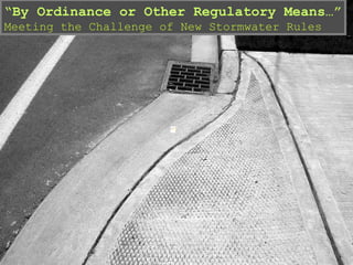
- 1. “ By Ordinance or Other Regulatory Means…” Meeting the Challenge of New Stormwater Rules
- 6. What Does holding each site at 10% get you? Source: www.Sprawlaction.org
- 8. Program Planning at Various Scales Need to expand the scale of current stormwater planning
- 14. Plans and Codes Joint stormwater and land use plans are on the horizon Subwatershed map What to Preserve Map Mitigation Scores Impervious Cover St Joseph River Watershed Assn
- 26. Critique This Picture- Parking EPA
- 30. The Ultimate in Conservation Design – Redevelopment
Notas del editor
- Multiple Processes for Public In put There may be several public outreach efforts occurring simultaneously, for example comprehensive planning, transportation planning sponsored by the state DOT, public outreach for water quality (think of utility bills inserts) as well as Phase II planning. Most planning efforts come with deadlines, so merging the requirements of a land use plan with those of Phase II may be tricky. Data Needs – Certainly science drives a lot of what needs to be included in a Phase II plan. However, the timelines and regulatory language in Phase II pretty much preclude waiting for the science before taking action. Thus, the first phases of a NPDES permit might look to broad measures to reduce volumes or prevent runoff in the first place. As that occurs, however, there are real needs to look at hotspots and the main stressors in the urban and urbanizing environment. Because multiple parties may be involved, they will want proof that the measures chosen are fair, effective and designed to address a problem. Finally, looking at other planning efforts allows you to suggest ways to save resources. Thus, learning the components and details of comprehensive plans could help identify these time and cost saving factors.
- Watershed managers and smart growth practitioners share a common language. It is important to make sure that as comprehensive plans go forward, the common elements are illuminated and stakeholders feel a connection not only to the emerging plans but to each others’ position as well. Why is this important? Because development and growth are often cast as automatically bad for water quality. Often you will face a no-growth audience. At the same time, development projects often look at stormwater control as soemthing to dump into a system, rather than something that can handled, at least in part, at the site level. A joint smart growth and watershed planning effort will recognize the demand for development and manage that demand in a way that is better for water quality.
- How do we get the best of “green” development that delivers for the site, the neighborhood and the region at the same time. This slide is probably one of the most important because it sums up the main issues, which can be complex. The first four bullets are the “How” of balancing development and preservation. They include identification and preservation of ecologically sensitive lands (which is one of the most important first steps), then deciding which lands to develop. Perhaps one of the most under-rated tools for watershed protection is the reuse of already-developed lands. Finally, looking for retrofit opportunities. Keep in mind the ordinances at the base of Phase II only kick in with a development project, even as most water quality problems are from existing development. Programs for improvements to existing properties are as important as the ordinance. The second four bullets go to the how of development at the supra-site level. This is where we have been missing the picture for water quality. These strategies address the pattern, which has more to do with runoff than any combination of site level strategies.
- Multiple Processes for Public In put There may be several public outreach efforts occurring simultaneously, for example comprehensive planning, transportation planning sponsored by the state DOT, public outreach for water quality (think of utility bills inserts) as well as Phase II planning. Most planning efforts come with deadlines, so merging the requirements of a land use plan with those of Phase II may be tricky. Data Needs – Certainly science drives a lot of what needs to be included in a Phase II plan. However, the timelines and regulatory language in Phase II pretty much preclude waiting for the science before taking action. Thus, the first phases of a NPDES permit might look to broad measures to reduce volumes or prevent runoff in the first place. As that occurs, however, there are real needs to look at hotspots and the main stressors in the urban and urbanizing environment. Because multiple parties may be involved, they will want proof that the measures chosen are fair, effective and designed to address a problem. Finally, looking at other planning efforts allows you to suggest ways to save resources. Thus, learning the components and details of comprehensive plans could help identify these time and cost saving factors.
- Multiple Processes for Public In put There may be several public outreach efforts occurring simultaneously, for example comprehensive planning, transportation planning sponsored by the state DOT, public outreach for water quality (think of utility bills inserts) as well as Phase II planning. Most planning efforts come with deadlines, so merging the requirements of a land use plan with those of Phase II may be tricky. Data Needs – Certainly science drives a lot of what needs to be included in a Phase II plan. However, the timelines and regulatory language in Phase II pretty much preclude waiting for the science before taking action. Thus, the first phases of a NPDES permit might look to broad measures to reduce volumes or prevent runoff in the first place. As that occurs, however, there are real needs to look at hotspots and the main stressors in the urban and urbanizing environment. Because multiple parties may be involved, they will want proof that the measures chosen are fair, effective and designed to address a problem. Finally, looking at other planning efforts allows you to suggest ways to save resources. Thus, learning the components and details of comprehensive plans could help identify these time and cost saving factors.
- 217 subwatersheds, 2 states, 15 counties, Combined sewer overflows (CSOs) from 12 cities in Indiana and 2 in Michigan impact the water quality of the St. Joseph River Agriculture, Prioritized concerns Identified one challenge as the existience of multiple jurisdictions each with its owm zoning code Overlay zoning based on current imperviousness can also be used. This targets specific types of development to areas already impacted by past and current land uses. For example, areas currently having 20% or greater imperviousness, such as inner city areas, are targeted for redevelopment and highly dense development. Abandoned industrial lands (brownfields) should be redeveloped to suitable uses. If commercial land is built in new areas, it should be clustered with shared drives, as opposed to spread into strips. Lands with low imperviousness should be targeted to only allow future developments at total low density
- How do these drive cover? Setbacks – minimum setbacks – building has to be at least x number of feet from street. Lot coverage - building cannot cover more than 30% of the site – what fills void? Parking Parkin – minimums – “at least # of spaces” – can fill with more sounds like it conserves space, but serves to limit intensity – spreads to other lots
- How do these drive cover? Setbacks – minimum setbacks – building has to be at least x number of feet from street. Lot coverage - building cannot cover more than 30% of the site – what fills void? Parking Parkin – minimums – “at least # of spaces” – can fill with more sounds like it conserves space, but serves to limit intensity – spreads to other lots
- Districts emerged as urbanization matured. Commercial and residential areas came to expect coordinated infrastructure, amenities and other aspects of city life. District zoning helped to facilitate how private lots met the public realm. In addition, as production builders became a force in the market, they took on (or were handed) responsibility for what public utilities and departments once handled. Standards were needed to ensure minimum safety, environmental and legal obligations were met. Thus subdivision and PUD districts were born. In urban areas, districts helped to coordinate the complexities of built out places and redevelopment. However, district zoning had to arise from established codes, so implementation mechanisms were also needed. Common terms you will hear are overlay zones, floating zones, mixed used zoning and the like.