Geoscan: spatial data country profiles
•
0 recomendaciones•177 vistas

The document summarizes the GeoScan project, an innovation challenge funded by IFAD's Change Delivery and Innovation Unit. The project involved creating spatial data profiles and maps for countries in West and Central Africa to help understand patterns and explore solutions to poverty in rural areas. Key results included the development of country atlases and an interactive web GIS dashboard with hundreds of geospatial layers and web applications accessible online. The goal was to facilitate informed decision making through better access to and analysis of geospatial data.

Recomendados
Recomendados
Más contenido relacionado
La actualidad más candente
La actualidad más candente (20)
Similar a Geoscan: spatial data country profiles
Similar a Geoscan: spatial data country profiles (20)
Último
Último (20)
Geoscan: spatial data country profiles
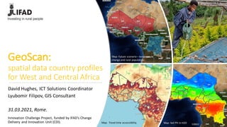
- 1. GeoScan: spatial data country profiles for West and Central Africa Innovation Challenge Project, funded by IFAD’s Change Delivery and Innovation Unit (CDI). Map: Travel time accessibility. Map: Soil PH in H2O Photo: IFAD.org Map: Future scenario– temperature change and rural population. David Hughes, ICT Solutions Coordinator Lyubomir Filipov, GIS Consultant 31.03.2021, Rome.
- 2. ICT GIS activities: enterprise level of integration
- 3. Why GeoScan? • Collaborating • Understanding patterns • Exploring solutions • Embracing innovation Innovation Challenge, funded by IFAD’s Change Delivery and Innovation Unit (CDI) and implemented by Information and Communications Technology Division (ICT). Realizing the vision of informed decision making for solving the complex challenges of poverty in remote, rural areas, fragile environment.... …..requires more than knowledge, organization, technology, data...
- 4. Methodology Innovation Challenge, funded by IFAD’s Change Delivery and Innovation Unit (CDI) and implemented by Information and Communications Technology Division (ICT).
- 5. Innovation Challenge, funded by IFAD’s Change Delivery and Innovation Unit (CDI) and implemented by Information and Communications Technology Division (ICT). Datasources
- 6. Innovation Challenge, funded by IFAD’s Change Delivery and Innovation Unit (CDI) and implemented by Information and Communications Technology Division (ICT). Results: Country atlases
- 7. Results:IFADEnterpriseGIS – Geonodepopulatedwith hundredsof layersand 37 Web Applications. Innovation Challenge, funded by IFAD’s Change Delivery and Innovation Unit (CDI) and implemented by Information and Communications Technology Division (ICT). • Search for layers and map applications by country, topic or area. • Share, comment,make your own web maps.
- 8. Innovation Challenge, funded by IFAD’s Change Delivery and Innovation Unit (CDI) and implemented by Information and Communications Technology Division (ICT). Results: Interactive Web GIS Dashboard Pilot https://geoscan.ifad.org
- 9. Thank you! for contact: geoscan@ifad.org David Hughes Lleïr Borràs Metje Giuseppe Baiamonte AbdelilahAdiba Tom Hughes MarcelloBarnaba Lyubomir Filipov CleliaCarbonari