Data Day 2012_Freeman_Public Data Mapping
•Descargar como PPT, PDF•
0 recomendaciones•509 vistas

1) The document discusses MassGIS, which contains over 1,000 data layers that can be used for various purposes like wind energy planning, fishing locations, and real estate. 2) It introduces OLIVER, a web mapping application that allows users to view and analyze these layers through interfaces like OpenLayers and tools like identifying features, extracting data by polygons, and generating permalinks. 3) OLIVER accesses MassGIS data through open web map services (WMS and WFS) that return maps and feature information in various formats for filtering, styling, and exporting.

Recomendados
Más contenido relacionado
La actualidad más candente
La actualidad más candente (11)
Destacado
Similar a Data Day 2012_Freeman_Public Data Mapping
Similar a Data Day 2012_Freeman_Public Data Mapping (20)
Más de Metropolitan Area Planning Council
Más de Metropolitan Area Planning Council (20)
Último
Último (20)
Data Day 2012_Freeman_Public Data Mapping
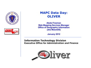
- 1. MAPC Data Day: OLIVER Aleda Freeman Web Mapping Services Manager Office of Geographic Information (aka MassGIS) January 2012
- 2. 02/01/12 MassGIS = digital library with > 1,000 datalayers: Landuse Wind Speed Aerial Impervious Photos Surface
- 3. 02/01/12 Wind engineer Where to put turbine? Wind speed + Elevation + Roads + Zoning + Open Space + Wetlands Vernal Pools Near? Schools + Vernal Pools + Roads + Open Space Teacher Fisherman Real Estate Agent Boat Ramps + Ponds + Roads Where to fish? Where to suggest houses? Geographic Questions Aerial Photos + Parcels + Schools + Hospitals + Libraries + Open Space + Public Transit
- 5. OLIVER 02/01/12 GeoServer OpenLayers GeoExt Bing geocoding Google Yahoo maps User Interface Library (YUI)
- 13. OLIVER initial view 02/01/12
- 15. OLIVER Layer Type Ahead 02/01/12
- 16. OLIVER Change Colors 02/01/12
- 17. OLIVER Extract by Poly 02/01/12
- 18. OLIVER Permalink 02/01/12 http://maps.massgis.state.ma.us/map_ol/oliver.php?lyrs=Massachusetts%20Towns~massgis:GISDATA.TOWNS_POLY~Orange_Polys|Pre-kindergarten%20to%20High%20School%20Buildings~massgis:GISDATA.SCHOOLS_PT~GISDATA.SCHOOLS_PT::Default&bbox=-71.14295332558095,42.39905184521652,-70.96408217081994,42.47215329489033&coordUnit=m&measureUnit=m&base=TopOSM-MA¢er=-7909641.4148005,5226457.2011292&zoom=13&opacity=0.64,1&baseO=null
- 22. OLIVER Linked Dropdowns 02/01/12
- 24. OLIVER External WMS 02/01/12
- 25. Web Map Services Wiki 02/01/12
- 26. THANK YOU. Aleda Freeman [email_address] https://wiki.state.ma.us/confluence/display/massgis 617-626-4530
Notas del editor
- Collaborative effort SeaPlan formerly MA Ocean Partnership Applied Science Associates
- New version – still uses all of these technologies OpenLayers is a Javascript Library
- In particular it uses WMS and WFS
- remembers basemap, layers, styles, opacity of basemap and styles, bounding box, change of color
- No basemap – if you want that use File/Print. But this print offers better legend, plus the ability to save the map and legend as PNG files.
- No basemap – if you want that use File/Print. But this print offers better legend, plus the ability to save the map and legend as PNG files.
- All the tools on the bottom can be hidden, along with the address match, dropdown, identify, external WMS, print and export
- Dropdowns can be set up so that once you pick something such as a town, if there is a database link with another datalayer that datalayer’s dropdown can be narrowed down to only include values from the first dropdown. Here, since Malden was chosen in the first dropdown, only Malden openspace is offered (sorted alphabetically) in the second dropdown.
- OLIVER application can be set up to do editing on points, lines or polys. The editing can be username/password protected. There is also snapping and splitting available. The attribute editing is currently basic (no ability to force users to fill out certain fields or to offer dropdowns, but we’re working on that this spring).
- For more information about the web mapping services behind OLIVER.