

Recomendados
Más contenido relacionado
La actualidad más candente
La actualidad más candente (20)
Similar a History of Cartography: From Ptolemy to TomTom
Similar a History of Cartography: From Ptolemy to TomTom (20)
Más de Mark Baker
Más de Mark Baker (20)
Último
Último (20)
History of Cartography: From Ptolemy to TomTom
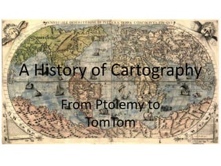
- 1. A History of Cartography From Ptolemy to TomTom
- 2. Pre-Historic Maps Cave paintings at o Trois-Freres, Montesquieu-Avantès, in France – c. 13,000 BC o Lascaux, in France – c. 15,000 BC o El Castillo, in Spain – c 12,000 BC
- 3. Pre-Historic Maps Cave paintings at o Trois-Freres, Montesquieu-Avantès, in France – c. 13,000 BC o Lascaux, in France – c. 15,000 BC o El Castillo, in Spain – c 12,000 BC Rock carvings at ȱ Pavlov, in the Czech Republic – c. 23,000 BC ȱ Çatalhöyük, Anatolia, in Turkey – c. 15,000 BC
- 7. Star Maps Sumerian Star map from Nineveh, c. 3300 BC
- 8. Star Maps Sumerian Star map from Nineveh, c. 3300 BC Su Song Star map from China, c. 1020-1101
- 9. Star Maps Sumerian Star map from Nineveh, c. 3300 BC Su Song Star map from China, c. 1020-1101 Star Map, Albrecht Durer, 1515
- 10. Star Maps Sumerian Star map from Nineveh, c. 3300 BC Su Song Star map from China, c. 1020-1101 Star Map, Albrecht Durer, 1515 Modern Star Map
- 11. Ancient Maps Anaximander (c. 610 - 546 BC) Strabo (c. 64 BC - 24 AD) Hecataeus of Miletus (c. 550 - 476 BC) Pomponius Mela (c. 43 AD) Eratosthenes (276 - 194 BC) Marinus of Tyre (c. 120 AD) Posidonius (c. 150 - 130 BC) Claudius Ptolemy, (90-170 AD)
- 12. Portolan Charts » Used for navigation at sea
- 13. Portolan Charts » Used for navigation at sea » They show Compass Directions and Distances
- 14. Portolan Charts » Used for navigation at sea » They show Compass Directions and Distances » Typically drawn on sheepskin
- 15. Portolan Charts » Used for navigation at sea » They show Compass Directions and Distances » Typically drawn on sheepskin » Marks the 32 directions on a Mariner’s compass
- 16. Portolan Charts » Used for navigation at sea » They show Compass Directions and Distances » Typically drawn on sheepskin » Marks the 32 directions on a Mariner’s compass » Show only coastline, no detail of the interior
- 17. Portolan Charts » Used for navigation at sea » They show Compass Directions and Distances » Typically drawn on sheepskin » Marks the 32 directions on a Mariner’s compass » Show only coastline, no detail of the interior » Medieval Portolani typically show North to the top of the map
- 18. Portolan Charts » Used for navigation at sea » They show Compass Directions and Distances » Typically drawn on sheepskin » Marks the 32 directions on a Mariner’s compass » Show only coastline, no detail of the interior » Medieval Portolani typically show North to the top of the map » Only useful when in sight of land
- 19. Portolan Charts » Used for navigation at sea » They show Compass Directions and Distances » Typically drawn on sheepskin » Marks the 32 directions on a Mariner’s compass » Show only coastline, no detail of the interior » Medieval Portolani typically show North to the top of the map » Only useful when in sight of land » Used with a pilots’ log containing records of reefs, shoals, etc. » Pilots’ log books were know as Rutter or Peripli
- 20. Portolan Charts » Used for navigation at sea » They show Compass Directions and Distances » Typically drawn on sheepskin » Marks the 32 directions on a Mariner’s compass » Show only coastline, no detail of the interior » Medieval Portolani typically show North to the top of the map » Only useful when in sight of land » Used with a pilots’ log containing records of reefs, shoals, etc. » Pilots’ log books were know as Rutter or Peripli » Were considered state secrets in Portugal and Spain
- 21. Portolan Charts Carta Pisana Portolan Chart, c.1275–1300
- 22. Portolan Charts Portolan Chart of Pedro Reinal, 1504
- 23. Mappa Mundi
- 24. Gough Map of Britain - 1360
- 25. Gough Map of Britain - 1360
- 26. Pilgrim Maps Before the Roman came to Rye or out to Severn strode, The rolling English drunkard made the rolling English road. A reeling road, a rolling road, that rambles round the shire, And after him the parson ran, the sexton and the squire; A merry road, a mazy road, and such as we did tread The night we went to Birmingham by way of Beachy Head. • Also called Itinerary, Journey or Strip Maps
- 27. Pilgrim Maps Before the Roman came to Rye or out to Severn strode, The rolling English drunkard made the rolling English road. A reeling road, a rolling road, that rambles round the shire, And after him the parson ran, the sexton and the squire; A merry road, a mazy road, and such as we did tread The night we went to Birmingham by way of Beachy Head. • Also called Itinerary, Journey or Strip Maps • Depict a route from one place to another e.g. from London to Canterbury
- 28. Pilgrim Maps Before the Roman came to Rye or out to Severn strode, The rolling English drunkard made the rolling English road. A reeling road, a rolling road, that rambles round the shire, And after him the parson ran, the sexton and the squire; A merry road, a mazy road, and such as we did tread The night we went to Birmingham by way of Beachy Head. • Also called Itinerary, Journey or Strip Maps • Depict a route from one place to another e.g. from London to Canterbury • Show the Route as a straight line
- 29. Pilgrim Maps Before the Roman came to Rye or out to Severn strode, The rolling English drunkard made the rolling English road. A reeling road, a rolling road, that rambles round the shire, And after him the parson ran, the sexton and the squire; A merry road, a mazy road, and such as we did tread The night we went to Birmingham by way of Beachy Head. • Also called Itinerary, Journey or Strip Maps • Depict a route from one place to another e.g. from London to Canterbury • Show the Route as a straight line • Show Waypoints and Landmarks along the way
- 30. Pilgrim Maps I knew no harm of Bonaparte and plenty of the Squire, And for to fight the Frenchman I did not much desire; But I did bash their baggonets because they came arrayed To straighten out the crooked road an English drunkard made, Where you and I went down the lane with ale-mugs in our hands, The night we went to Glastonbury by way of Goodwin Sands.
- 31. Pilgrim Maps I knew no harm of Bonaparte and plenty of the Squire, And for to fight the Frenchman I did not much desire; But I did bash their baggonets because they came arrayed To straighten out the crooked road an English drunkard made, Where you and I went down the lane with ale-mugs in our hands, The night we went to Glastonbury by way of Goodwin Sands.
- 32. Pilgrim Maps His sins they were forgiven him; or why do flowers run Behind him; and the hedges all strengthening in the sun? The wild thing went from left to right and knew not which was which, But the wild rose was above him when they found him in the ditch. God pardon us, nor harden us; we did not see so clear The night we went to Bannockburn by way of Brighton Pier.
- 33. Pilgrim Maps His sins they were forgiven him; or why do flowers run Behind him; and the hedges all strengthening in the sun? The wild thing went from left to right and knew not which was which, But the wild rose was above him when they found him in the ditch. God pardon us, nor harden us; we did not see so clear The night we went to Bannockburn by way of Brighton Pier.
- 34. Pilgrim Maps My friends, we will not go again or ape an ancient rage, Or stretch the folly of our youth to be the shame of age, But walk with clearer eyes and ears this path that wandereth, And see undrugged in evening light the decent inn of death; For there is good news yet to hear and fine things to be seen, Before we go to Paradise by way of Kensal Green.
- 35. “Age of Discovery” Mercator World Map, 1569
- 36. “Age of Discovery” Abraham Ortelius, 1570
- 37. Map Projections Cylindrical – Transverse Mercator
- 38. Map Projections Projections - Sinusoidal
- 39. Map Projections Projections - Sinusoidal Ecker IV Ecker VI Goode Homolosine
- 40. Map Projections Projections - Sinusoidal Kavrayskiy VII Mollweide Tobler Hyperelliptical
- 41. Map Projections Projections – Albers Conical
- 42. Map Projections Projections – Albers Conical
- 43. Map Projections Projections – Azimuthal Equidistant
- 44. Map Projections Projections – Azimuthal Equidistant
- 45. Map Projections Projections – Azimuthal Equidistant Show the globe as it appears from space
- 46. Map Projections Projections – Gnomic
- 47. Map Projections Projections – Gnomic
- 48. Map Projections Projections – Gnomic Often used by Seismologists, because seismic waves tend to travel along great circles. Used by navies in plotting direction finding bearings, since radio signals travel along great circles
- 49. Panoramic Maps
- 50. Panoramic Maps
- 51. Panoramic Maps
- 52. Panoramic Maps
- 58. Political Maps British Empire 1897
- 59. Social Maps
- 60. Scully: On the old mariner maps, the cartographers would designate unexplored territories by simply writing “Here Be Monsters”. Mulder: I've seen the same thing on maps of New York City. — The X-Files, "Quagmire"
- 61. Scully: On the old mariner maps, the cartographers would designate unexplored territories by simply writing “Here Be Monsters”. Mulder: I've seen the same thing on maps of New York City. — The X-Files, "Quagmire" ~ “Here be Dragons” – “HIC SVNT DRACONES” in Latin.
- 62. Scully: On the old mariner maps, the cartographers would designate unexplored territories by simply writing “Here Be Monsters”. Mulder: I've seen the same thing on maps of New York City. — The X-Files, "Quagmire" ~ “Here be Dragons” – “HIC SVNT DRACONES” in Latin. ~ Phrase first appears on the Hunt-Lenox Globe (ca. 1503-1507). ~ Map Location is Indonesia, so may refer to Komodo Dragons.
- 63. Scully: On the old mariner maps, the cartographers would designate unexplored territories by simply writing “Here Be Monsters”. Mulder: I've seen the same thing on maps of New York City. — The X-Files, "Quagmire" ~ “Here be Dragons” – “HIC SVNT DRACONES” in Latin. ~ Phrase first appears on the Hunt-Lenox Globe (ca. 1503-1507). ~ Map Location is Indonesia, so may refer to Komodo Dragons. ~ “HIC SVNT LEONES” was the traditional phrase.
- 64. Scully: On the old mariner maps, the cartographers would designate unexplored territories by simply writing “Here Be Monsters”. Mulder: I've seen the same thing on maps of New York City. — The X-Files, "Quagmire" ~ “Here be Dragons” – “HIC SVNT DRACONES” in Latin. ~ Phrase first appears on the Hunt-Lenox Globe (ca. 1503-1507). ~ Map Location is Indonesia, so may refer to Komodo Dragons. ~ “HIC SVNT LEONES” was the traditional phrase. ~ Pictures of dragons and serpents did appear on older maps.
- 65. Moon Maps Leonardo da Vinci, c. 1500
- 66. Moon Maps Leonardo da Vinci, c. 1500 Johannes Hevelius, 1647
- 67. Moon Maps Homann and Doppelmayr, 1707
- 68. Wilbur Glenn Voliva Flat Earth Map
- 69. “Inner Earth”Map from c. 1730
- 70. Fictional Maps
Notas del editor
- Cave paintings at Trois-Freres in France, 18,000-15,000 BC
- Cave paintings at Trois-Freres in France, 18,000-15,000 BC
- Cave paintings at Trois-Freres in France, 18,000-15,000 BC
- Sumerian Star map from Nineveh, c. 3300 BCSu Song Star map from China, c. 1020-1101 (Song Dynasty)Star Map, Albrecht Durer, 1515
- Sumerian Star map from Nineveh, c. 3300 BCSu Song Star map from China, c. 1020-1101 (Song Dynasty)Star Map, Albrecht Durer, 1515
- Sumerian Star map from Nineveh, c. 3300 BCSu Song Star map from China, c. 1020-1101 (Song Dynasty)Star Map, Albrecht Durer, 1515
- Sumerian Star map from Nineveh, c. 3300 BCSu Song Star map from China, c. 1020-1101 (Song Dynasty)Star Map, Albrecht Durer, 1515
- CartaPisanaPortolan Chart, c.1275–1300
- Portolan Chart of Pedro Reinal, 1504
- Gough Map, 1360
- Gough Map, 1360 – Detail of East Anglia
- Matthew Paris Itinerary Map
- John Ogilvy Itinerary Map
- John Ogilby Road Map from London to Land’s End
- Senex Guide Map, 1719
- Mercator World Map, 1569
- Panoramic Genoa, 1704
- “Rhinebeck” Panoramic London, 1810
- “Rhinebeck” Panoramic London, 1810
- “Rhinebeck” Panoramic London, 1810
- London Underground Map, 1908
- 1932 London Tube Map
- Beck’s Map of the London Underground, 1933
- Hunt-Lenox Globe (ca. 1503-1507)
- Hunt-Lenox Globe (ca. 1503-1507)
- Hunt-Lenox Globe (ca. 1503-1507)“Carta Marina” of Scandinavia (1539)
- The Flat Earth Society (also known as the International Flat Earth Society or the International Flat Earth Research Society) is an organization that seeks to further the idea that the Earth is flat instead of an oblate spheroid. The modern organization was founded by Englishman Samuel Shenton (a signwriter from Dover) in 1956[1]and was a successor to the Universal Zetetic Society. It was later led by Charles K. Johnson, who based the organization in his home in Lancaster, California. The formal society was inactive after Johnson’s death in 2001 but was resurrected in 2004 by its new president Daniel Shenton (not related to Samuel).Wilbur Glenn Voliva – Flat Earth Map Wilbur Glenn Voliva (March 10, 1870 – October 11, 1942[1]) was an evangelist and a prominent proponent of Flat Earth theories.