Report: Identifying Public Lands Suitable for Urban Agriculture in the City of Federal Way, Washington
•
1 recomendación•605 vistas


Recomendados
Recomendados
Más contenido relacionado
Destacado
Destacado (14)
Similar a Report: Identifying Public Lands Suitable for Urban Agriculture in the City of Federal Way, Washington
Similar a Report: Identifying Public Lands Suitable for Urban Agriculture in the City of Federal Way, Washington (20)
Último
Último (20)
Report: Identifying Public Lands Suitable for Urban Agriculture in the City of Federal Way, Washington
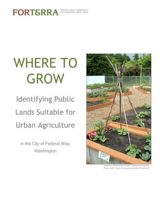
- 1. Nautilus Elementary School Community Garden Photo credit: Federal Community Gardens Foundation WHERE TO GROW Identifying Public Lands Suitable for Urban Agriculture in the City of Federal Way, Washington
- 2. 2 | P a g e Contents EXECUTIVE SUMMARY................................................................................................................................ 3 INTRODUCTION........................................................................................................................................... 4 METHODOLOGY.......................................................................................................................................... 5 RESULTS...................................................................................................................................................... 8 DISCUSSION ................................................................................................................................................ 9 NEXT STEPS............................................................................................................................................... 10 APPENDICES.............................................................................................................................................. 11 Appendix A. Data Dictionary................................................................................................................. 12 Appendix B. Geospatial Analysis Methodology..................................................................................... 17 Appendix C. Results Table..................................................................................................................... 25 Appendix D. Sample Site Profiles .......................................................................................................... 27 This report was prepared for Forterra and the City of Federal Way by Chris Hoffer and Matt Dressler. Spatial analysis was conducted by Matt Dressler and Christopher Walter using ArcGIS 10 software provided by ESRI through the Nonprofit Organization Program. Special thanks to Kara Martin with Urban Foodlink and Kristen McIvor with the Pierce Conservation District, as well as staff from the City of Federal Way, for their thoughtful contributions in developing and conducting the inventory. Please contact Forterra with any questions about this report: 901 5th Ave, Ste. 2200, Seattle, WA 98164; info@forterra.org; (206) 292-5907
- 3. 3 | P a g e EXECUTIVE SUMMARY This report describes the methodology and results of a spatial analysis to develop an inventory of public land with the potential for urban agriculture in the City of Federal Way, Washington. In partnership with City staff, Forterra conducted the analysis over several months in 2012 and 2013. The objective was to assess all public lands relative to a suite of characteristics that address their potential suitability for several forms of urban agriculture. All input and result datasets were delivered to the City in an ArcGIS geodatabase. In addition, City staff was provided KML versions of key datasets so that they would be able to directly access and interact with the results using Google Earth. Using geographic information system (GIS) technology and publicly available data, Forterra evaluated potential sites based on suitability criteria relevant to urban agriculture. These criteria fell into several general categories: land ownership and management; land cover characteristics and growing area; land use characteristics; topography; soil suitability; transportation access; and neighborhood demographics. In all, the assessment identified 362 candidate sites with a combined total of 256 acres of land potentially suitable for urban agriculture. Among the candidate sites, 192 met the criteria for potential cultivation: 26 met the minimum area requirements for small community gardens, another 76 (totaling 20.5 acres) for large community gardens or food forests, and another 90 (totaling 233 acres) for urban farms. In addition, 490 acres were identified as having the potential for agroforestry activities. This analysis represents the first step in identifying new sites on public lands suitable for urban agriculture. With this information, the City of Federal Way now moves to the next phase of reviewing the results, engaging the community, gathering additional information and planning additional urban agriculture projects for the benefit of residents. "Almost any barrier [to urban agriculture] can be overcome by an excited community group." Kristin Mclvor Community Garden Coordinator Pierce County Conservation District
- 4. 4 | P a g e INTRODUCTION Healthy living in Federal Way In 2011, the City of Federal Way was awarded a Healthy Eating Active Living grant from Seattle King County Public Health through the Communities Putting Prevention to Work program funded by the Centers for Disease Control and Prevention. This work involved conducting a food landscape assessment1 to gain a better understanding of the community’s access to food, by mapping and analyzing the retail environment, land use patterns, demographics, and street network. The results of this assessment demonstrated the need for new policies and projects to promote access to food and healthy living in Federal Way. Key findings from the report demonstrate that not only does Federal Way have a high rate of adult obesity, but also that most residents live closer to fast food restaurants and convenience stores than to healthy food sources like supermarkets. Urban agriculture As revealed by Federal Way’s food landscape assessment, many residents have limited access to fresh produce and healthy foods. One strategy identified by the City to ensure that residents have better access to healthy food is to increase access through urban agriculture. Urban agriculture is an umbrella term encompassing a wide range of activities involving the raising, cultivation, processing, marketing and distribution of food in an urban environment. Urban agriculture includes a wide spectrum of activities such as home gardens, community gardens, urban farms, cottage food operations, farm stands, and farmers markets There are many reasons for municipalities to encourage urban agriculture. In addition to improving health and nutrition by increasing access to healthy food, urban agriculture provides environmental benefits, such as improving air and water quality, and helps to preserve cultivatable lands. It also offers social benefits to the community such as capacity building and creating an enhanced sense of place. Community gardens reduce family budgets, facilitate neighborhood and community development and create opportunities for recreation, exercise and education. To help promote urban agriculture, the City of Federal Way received technical assistance in 2012 from Forterra, as part of the Environmental Protection Agency’s Building Blocks for Sustainable Communities program. This technical assistance included engaging the community in conversations about urban agriculture, amending current policies and regulatory codes, and developing a land assessment protocol for identifying public lands that could be used for community gardens and other forms of urban agriculture. 1 Kara E. Martin, Urban Food Link with Branden Born and Eva Ringstrom, Northwest Center for Livable Communities and Amalia Leighton, SvR Design http://www.urbanfoodlink.com/wp/wp-content/uploads/2011/11/FederalWayFoodLandscape.pdf Food landscape assessment key findings Federal Way has the county’s third highest adult obesity rate. Over 87% of the city’s land base is more than one half mile from a super market. There are nearly four times as many fast food restaurants and convenience stores as there are supermarkets, small grocery stores and produce vendors, combined.
- 5. 5 | P a g e Land inventories for urban agriculture Municipalities throughout the country have conducted inventories of publicly owned land that may be suitable for urban agriculture. These inventories have allowed cities and residents to identify the most promising lands for community gardens and other types of urban agriculture, as well as to calculate potential food productivity. Other examples in the Northwest include Seattle and King County, as well as Portland, Oregon and Vancouver, British Columbia. In her review of recent inventories in municipalities across the country2, Megan Horst developed a general framework for conducting an urban agriculture land inventory. Expanding on this framework, Forterra worked with the City to develop a methodology and then to conduct a public land inventory. The purpose of this project was to provide an initial inventory of publicly owned lands and to identify their suitability for urban agriculture. This built on the City’s existing work to assess its food landscape and to adopt policies in support of urban agriculture. The inventory is intended to provide residents, nonprofits, and City staff with information that can support an increase in urban agriculture and food production. Looking ahead, the inventory has the potential to help both residents and City planners identify and consider specific locations for different types of urban agriculture. METHODOLOGY Using the tools and analysis techniques available in geographic information systems (GIS), Forterra conducted an inventory of publicly owned land in Federal Way and evaluated the suitability of that land for urban agriculture based on a set of criteria. This process was informed by reviewing methodologies and best practices of other land inventories conducted across the country, with a focus on local efforts in Seattle, Portland, and Vancouver, BC. After meeting with planning and GIS staff at the City of Federal Way, we created and prioritized a list of suitability criteria. These criteria fit under several general categories of suitability for urban agriculture: land ownership and management; land cover characteristics and growing area; land use characteristics; topography; and soil suitability. Additionally, we included criteria that extended beyond the characteristics of the site itself, such as transportation access and demographics of the surrounding area. This additional information can be used to prioritize potential sites based on how likely they are to benefit residents with the least amount of access to healthy food and other benefits of urban agriculture. Data were acquired from the City of Federal Way as well as a variety of local and federal sources including King County, imagery from the US Department of Agriculture, LIDAR data from the Puget Sound Lidar Consortium and 2010 US Census information. Based on factors 2 “A Review of Suitable Urban Agriculture Land Inventories.” Megan Horst, February 10, 2011. http://www.planning.org/resources/ontheradar/food/pdf/horstpaper.pdf Conducting a land inventory 1) Determine objectives 2) Involve stakeholders 3) Conduct inventory a. Establish an initial set of available lands b. Establish suitability criteria c. Assign scores d. Present results 4) Plan next steps
- 6. 6 | P a g e Minimum criteria for cultivation At least 2,500 square feet Not in a sensitive area or buffer Not forested* Average slope less than 10% Potential cultivation category Small community garden (2,500 – 5,000 ft2 ) Community garden (2,500 ft2 – 0.5 acres) Urban farm ( > 0.5 acres) * Forested sites meeting other minimum criteria were classified as potentially suitable for agroforestry. such as the timeframe for conducting the inventory, the availability of necessary data and initial priorities, not all potentially useful information was collected. The Appendices of this report include both a data dictionary and detailed description of the methodology used for geospatial analysis. For land ownership, we catalogued the name and type of the agency with jurisdiction and management of each property, recognizing that public properties could be owned by city, county, state, federal government or other local entities. We included both the owner of the property, such as the City of Federal Way, as well as the managing agency, such as the Parks Department. Given that the City was in the process of updating its policies and codes as they relate to urban agriculture, we also catalogued land use compatibility such as zoning and current use. To determine the potentially cultivatable area of each site, we calculated the amount of land available after excluding areas that were deemed unsuitable for growing food. Unsuitable areas included: impervious surfaces (such as buildings, pavement, and sidewalks); forested areas covered by tree canopy; sensitive areas and their associated buffers (wetlands, rivers and lakes), and areas with slopes greater than 10%. Based on this information, sites were further categorized by the size of cultivatable area, indicating likely appropriateness for small community gardens, large urban farms, etc. Importantly, no site was excluded from the inventory even if it was determined to be unsuitable for cultivation. Although immediately cultivatable sites were of the most interest to the City, it was agreed that many sites could be used for other forms of urban agriculture. Paved areas could support container gardening or farmers markets, for example, while forested sites could support agroforestry, and sites with extreme slopes might still be developed through terracing. Soil suitability was also important to catalog, both by looking at the USDA farm soil rating as well as potential arsenic contamination. Although arsenic occurs naturally in the environment and is not typically of concern for urban agriculture, a copper smelting plant that operated nearby until 1986 left significantly elevated levels of arsenic in surrounding soils, including much of Federal Way. For each site, the area and concentration of detected arsenic contamination was reported in parts per million based on data from the Washington State Department of Ecology. Those sites with arsenic levels above 20 ppm (the state cleanup level) may still be suitable for cultivation by bringing in new soil, or for other forms of urban agriculture such as container gardening or farmers markets. Given the unique role for urban agriculture to improve equitable food access, the City was also interested in surrounding demographic characteristics of each site. This included identifying areas with higher levels of poverty (with respect to both federal standards and in comparison to the rest of the City). Additionally, the inventory includes the percentage of residents near each
- 7. 7 | P a g e site who are people of color, as these individuals are disproportionately impacted by a lack of access to healthy food. Population density was also measured, recognizing that more dense and urban neighborhoods stand to benefit the most from urban agriculture opportunities, given that less developed areas are likely to have greater access to land for cultivation. Transportation accessibility was also analyzed. This included the proximity of the site to bus service as well as a site’s active transportation potential. This information can be helpful in determining which sites are most accessible for transit-dependent residents. Summary of land suitability categories and criteria SUITABILITY CATEGORY AND RATIONALE SUITABILITY CRITERIA Ownership and Management To identify jurisdiction Ownership Jurisdiction Managing Agency or Department Land Cover Characteristics and Growing Area To determine suitability for cultivation and type of urban agriculture Impervious Area Forested Area Sensitive Area Steep Slope Area Potentially Cultivatable Area Potentially Cultivatable Suitability by Type Potential Agroforestry Area Land Use Characteristics To determine compatibility with current and potential use Current zoning designation Current land use Topography To determine ease of developing site for urban agriculture Slope Transportation Accessibility To determine site access by transit-dependent residents Proximity to bus service Active Transportation Potential Rating Site Soil Suitability To identify soil quality and potential for arsenic contamination Potential Arsenic Pollution USDA Farm Soil Rating Equity To determine proximity to communities with most benefit from, and least access to, urban agriculture Food Equity Residential Density Ethnicity Other Characteristics Property Size Site Name
- 8. 8 | P a g e RESULTS Using Geographic Information Systems and data from the City of Federal Way, King County, and Federal agencies, 362 candidate sites were identified as public land potentially suitable for urban agriculture. Detailed results are included in the appendices, as are sample site profiles that illustrate how the inventory can be used to determine suitability for different types of urban agriculture. Among the candidate sites, 192 sites covering 256 acres met the criteria for potential cultivation, meaning that the site included at least 2,500 square feet that was not forested or impervious, not in a sensitive environmental area, and not steeply sloped. Among these sites, 26 were most appropriately sized for small community gardens, 76 sites (totaling 20.5 acres) for community gardens or food forests, and 90 sites (totaling 233 acres) for larger urban farms. An additional 490 acres among 208 candidate sites were forested, with the potential for agroforestry. In this context, food forests refer to the cultivation of edible trees and shrubs, while agroforestry refers to the cultivation of forest products alone or in combination with agriculture. Among the 192 sites with potentially cultivatable land: 143 are within a ¼ mile of a bus stop More than 180 have a medium or high Active Transportation Potential score 161 have soils with a USDA farm soil rating of “statewide importance” or better 32 sites are within census tracts where 40% or more of the tract is living at 200% of the federal poverty level 43 sites are within census tracts with a median household income at or below $45,207, which is 80% of Federal Way’s median household income 104 are owned by the City of Federal Way, 31 are owned by the Federal Way School District, and 22 are owned by the Lakehaven Utility District 21 are public school properties, 16 are open space and 17 are vacant Summary of key characteristics of potentially cultivatable sites CATEGORY RESULTS Ownership and Management More than half are owned by the City 100 acres are owned by the School District Transportation Accessibility 75% are within a ¼ mile of a bus stop Site Soil Suitability 51% have very low levels of arsenic contamination Equity About 22% are in neighborhoods at or below 80% of Federal Way median household income 3 out of 4 sites are in neighborhoods where 25% - 50% of residents are people of color
- 9. 9 | P a g e DISCUSSION The reality of GIS analysis, like any modeling process, is the unavoidability of a certain amount of error. The goal is to conduct analyses with the highest level of accuracy and precision possible given inherent limitations in data, methods and resources available. The following is a discussion of some known limitations in this analysis. The first source of limitations in this analysis is related to data. For example, the arsenic concentration and farming soil datasets are both subject to sampling error and limitations related to the mathematical interpolation involved with their creation. The U.S. Census data used in the analysis are three years out of date and potential inconsistencies in the record of ownership, management purpose, site name and use will have led to inaccuracies in the aggregation of adjacent parcels as single properties. Also, while the tree canopy dataset was determined to be 92% accurate overall, it will underestimate the canopy in some locations and overestimate it in others, corresponding to an overestimate or underestimate, respectively, of the amount of potentially cultivatable area for different sites. The analysis methodology makes a number of simplifications. The proximity of each candidate site to the nearest bus stop is calculated as Euclidean (straight line) distance rather than the true route taken using the existing transportation network. In addition, all areas with slopes of greater than 10% are predicted to be unsuitable for cultivation, which may not always be the case. Regulatory buffers around sensitive areas such as creeks and wetlands may in some cases be suitable for cultivation and these areas will be missed in this analysis. The actual extent of land suitable for agroforestry will in some cases be smaller than the results suggest as the analysis does not consider the important factor of canopy density. Finally, the three Equity characteristics (Food Equity, Residential Density and Ethnicity) reported for each site are based on a spatial average of Census demographics reported for the surrounding neighborhood. While this is a commonly used analysis technique - in fact, the only feasible method - it produces truly accurate results only where household income levels, racial makeup and household density are evenly distributed throughout the surrounding area: conditions that are rarely, if ever, present in the real world. Nevertheless, despite the existence of some error, this analysis should prove very useful in narrowing the range of potential candidate sites. We recommend that inventory be used more as a tool to identify sites for further consideration than to make exclusionary decisions or take action based on the analysis alone. Reviewing the data using Google Earth will allow city staff to take a first step in this direction by “virtually” ground truthing the results.
- 10. 10 | P a g e NEXT STEPS This land inventory represents the first step in identifying the suitability of public lands for urban agriculture. There are many additional opportunities to share the results of the inventory and engage the community, as well as to gather additional information and explore the suitability of other types of land for related uses. The following are potential next steps for the City to consider: 1. Share results and engage the community. Inventories conducted in other communities have relied on stakeholder input to ensure the inventory is comprehensive. Portland, for example, established a Technical Advisory Committee consisting of city staff and members of a citizen-based Food Policy Council. Focus groups and input from additional stakeholders, such as community garden leaders and nonprofits, were also important in establishing land criteria and reviewing preliminary results. Using this inventory as a starting point, there is significant opportunity to engage the community in refinement and utilization. 2. Gather additional information. Inventories are typically iterative, so there is opportunity to gather additional information and refine the inventory. For example, other inventories have catalogued parking and sidewalk access to sites, as well as proximity to existing community gardens, access to water infrastructure, and the amount of shade or solar access for a given site. There is also opportunity to “ground truth” potential sites; while this can be accomplished through actual site visits, many inventories with large numbers of sites have successfully used satellite imagery and tools such as Google Street View to save time. 3. Rank, classify and prioritize potential sites. Engaging the community and gathering additional information will allow the City and residents to further rank, classify, and prioritize sites. For example, medium to large sites for community gardens or urban farms may be a high priority, as well as those sites in neighborhoods with higher levels of poverty and lower access to healthy food. Sites with water infrastructure and parking access, or those managed by particular agencies or departments, may also be the most feasible to develop for urban agriculture. 4. Create an online interactive site locator to assist public in identifying and accessing potential urban agriculture sites In addition to training City staff on how to share information from the inventory with the public, many communities have also turned the inventory into a publicly available, interactive, online land locator. This empowers residents and nonprofits to identify and conveniently explore potentially suitable lands for urban agriculture. 5. Conduct additional assessment. This inventory is focused on the suitability of publicly owned land for urban agriculture, but there could be other uses to consider, such as suitability for urban livestock, agro-forestry, or community orchards. Additionally, privately-owned land may also worth identifying; churches, for example, are regularly involved in community gardens. Other assessments might focus on parking strips or even the food potential from private home production.
- 11. 11 | P a g e APPENDICES Appendix A. Data Dictionary Appendix B. Analysis Methodology Appendix C. Results Table Appendix D. Site Profiles
- 12. Appendix A. Data Dictionary Feature Class: FederalWay_PublicLands_UrbanAgSuitability Suitability Criteria Reporting Categories Field Name Field Alias Field Description Land Cover Characteristics and Growing Area Impervious Area unsuitable for cultivation < 2500 sq. ft.; 2500-5000 sq. ft.; 5000-21780 sq. ft.; > 21780 sq. ft. IMPR_SF IMPERVIOUS_SURFACE_S QFT Total area (sqft.) of site that is an impervious surface as represented by building footprints, pavement and sidewalks Steep Slope Area likely unsuitable for cultivation Area SLOPE_10 STEEP_SLOPE_SQFT Total area (sqft.) of site with a slope greater than 10% Percent SLOPE_10PCT STEEP_SLOPE_PCT Percent of site with a slope greater than 10% Sensitive Area potentially suitable for cultivation < 2500 sq. ft.; 2500-5000 sq. ft.; 5000-21780 sq. ft.; > 21780 sq. ft. SEN_AREA SENSITVE_AREA Total area (sqft.) of a site that is covered by lakes, wetlands and water courses and their associated buffers Forested Area potentially suitable for cultivation Area FOR_SQFT FORESTED_SQFT Total area (sqft.) of a site that covered by mature tree canopy. Percent FOR_PCT FORESTED_PCT Percent of a site covered by mature tree canopy Potentially Cultivatable Area likely suitable for cultivation Area POTEN_CUL_SF POTENTIAL_CULTIVATIO N_SQFT Total area (sqft.) of a site that is most suitable for cultivation in that it does not include any of the categories above (forest, sensitve, impervious or steep slopes)
- 13. 13 | P a g e Area POTEN_CUL_ACRE S POTENTIAL_CULTIVATIO N_ACRES Total area (acres) of a site that is most suitable for cultivation in that it does not include any of the categories above (forest, sensitve, impervious or steep slopes) unsuitable; small community garden; community garden, food forest; urban farm, food forest POTEN_CUL_SUIT POTENTIAL_CULTIVATIO N_SUITABILITY Suitable category of urban agriculture based on minimum cultivatable area requirements for that category: unsuitable (< 2,500 sqft.); small community gardens (2,500-5,000 sqft.); community gardens and food forests (5,000- 21,780 sqft.); urban farms and food forests (> 21,780 sqft.). Note that sites that qualify for categories with larger size requirements also qualify for those with smaller requirements. Area FOR_FOOD FORESTED_FOOD Total area (sqft.) of a site that is most suitable for cultivation but that is covered by tree canopy (does not include sensitive, impervious or steep slopes). Potentially suitable for agroforestry or food forest cultivation. Ownership and Management Ownership Jurisdiction Name OWN_1 OWNERSHIP Name of government entity that owns site Federal, State, County, City OWN_TYPE OWNERSHIP_TYPE Hierarchical level of government that owns site
- 14. 14 | P a g e Managing Agency or Department Name or abbreviation OWN_DEPT OWNERSHIP_DEPT Name of agency or department that manages site (e.g. DOT, Parks, Public Works) Land Use Characteristics Zoning (site only) Current zoning designation CUR_ZONE CURRENT_ZONE City of Federal Way zoning designation code(s) Use Category (site only) Land use category USE_CAT USE_CITY Existing primary land use according to City of Federal Way Land use category USE_PRESENT USE_COUNTY Existing primary land use according to King County Assessor Topography Slope 0-5%; 5-10%; >10% SLOPE_AVG SLOPE_AVG Average grade across entire site categorized according to suitability for urban agriculture (0-5% good; 5- 10% acceptable; >10% unsuitable) Transportation Accessibility Proximity to Bus Service <0.25 mi; 0.25- 0.5 mi; >0.5 mi PROX_BUS PROXIMITY_BUS Straight line distance (miles) from site to nearest bus stop
- 15. 15 | P a g e Active Transportation Potential Rating Integer ATP_SCORE ATP_SCORE Numerical Score from 4-29 (low- high) representing Active Transportion Potential Rating for site. Rating based on location relative to city transportion network as determined in study conducted for the city of Federal Way. Site Soil Suitability Potential Arsenic Pollution Non-Detect to 20.0 ppm; 20.1 ppm to 40.0 ppm; 40.1 ppm to 100.0 ppm; 100.1 ppm to 200.0 ppm ARSC_CONCEN ARSENIC_CONCENTRATI ON Detected arsenic soil concentration range(s) (ppm) present in soils within site boundary USDA Farm Soil Rating Area SOIL_PRIME SOILS_PRIME_FARMLAND Area (sqft.) of site containing soils designated Prime Farmland (excellent for agriculture) by USDA soil survey Area SOIL_SWI SOILS_STATEWIDE_IMPO RTANCE Area (sqft.) of site containing soils designated Statewide Importance (good or acceptable for agriculture) by USDA soil survey Area SOIL_NOTPRIME SOILS_NOT_PRIME Area (sqft.) of site containing soils designated as poor for agriculture by USDA soil survey
- 16. 16 | P a g e Equity Issues Food Equity Yes, No EQUITY_POV200 EQUITY_POVERTY Whether or not site is located in a Census Tract for which 40% or more of 2010 population is living at or below 200% of Federal Poverty Level. Yes, No EQUITY_MHHIN80 EQUITY_MEDINCOME Whether or not site is located in a Census Tract for which 2010 median household income is at or below 80% of Federal Way's median household income Residential Density <1:1; 1:1-4:1; 4:1-8:1; >8:1 HH_DEN HOUSING_UNITS_ACRE Average density in 2010 of housing units per acre for all Census blocks within a quarter mile of site Ethnicity 0-25% minority; 25-50% minority; 50-75% minority; >75% minority ETH_PCTMN ETHNICITY_PCTMINOR Average percent minority population in 2010 for all Census blocks within a quarter mile of site Other Characteristics Property Size Area AREA_SF AREA_SQFT The area (sqft.) of site as calculated by GIS Area AREA_ACRES AREA_ACRES The area (acres) of site as calcuated by GIS Identification Integer SITE_ID SITE_ID Unique numeric ID for each site Name FACILITY_NAME FACILITY_NAME Site name according to City of Federal Way
- 17. 17 | P a g e Appendix B. Geospatial Analysis Methodology Goal Conduct an inventory of all public lands within the city of Federal Way to assess their suitability for Urban Agriculture--specifically community gardens, urban farms and food forests Scope & Deliverables Identify and assess candidate sites for their suitability based on all criteria identified in project scope. Deliver results dataset in ArcGIS file geodatabase 9.3 format. Include all datasets utilized in analysis, a summary of the suitability criteria and a description of the analysis methodology . Spatial Reference GCS North American 1983 HARN NAD 83 HARN State Plane WA North FIPS 4601 Feet Projection: Lambert Conformal Conic Software ArcGIS 10; XtoolsPro; Microsoft Word/Excel Inputs From City of Federal Way GIS Department: geodatabase dated 20120803: Federal Way Property, Federal Way School District Property, Lakehaven Utility District Property, Washington State Propety, FW_imperv, FW_climits, FW_open_space, FW_parcels, FW_parks, FW_publicparcels, FW_special_district_prop, FW_landuse, FW_lakes, FW_puget, FW_Soils, FW_wetlands, FW_streams, FW_ATPfin_201121, Tacoma_SmelterPlume, 201004, FW_ortho_6inch_2007, FederalWay_ActiveTransportaionStudy_gdb dated 2011. From Other Sources: King_blk2010_pophu, King_blk2010_sf1po3, KingCounty_BusStop_2012, SOILS_King_SSURGO, KingLidar_DGM_6ft_2003, NAIP 2009 with near infrared band, acs_s053b19013 (2010 Tracts joined to ACS table: median household income in past 12 months in 2010 inflation adjusted dollars) and esj_acs_area_poverty200percent (percentage of people living at 200 percent of the Federal Poverty Level in King County by census tract) from American Community Survey/2010 U.S. Census via King County
- 18. 18 | P a g e Action Feature Class Name Data Sources, Dates Spatial Analysis Technique Notes Create analysis file gdb and three feature datasets--Inputs, Intermediates, Results; Include both input and derived raster datasets FederalWay _UrbanAg _LandInventory.gdb See List Below import datasets required for analysis Ensure single geographic coordinate system and projection for all datasets utilized in analysis Create Candidate Sites Feature Class Sites _UrAgCandidates FW Land Public Parcels, 20120803; FW Land Special District Property (including Lakehaven Utility properties) 20120803 Remove overlap in datasets, merge (adjacent) parcels/polygons with same ownership to create a "property" level dataset. Delete extraneous fields and dissolve on essential attributes, run single to multipart, create and populate attribute fields described in suitability criteria matrix for which data already exists via joins to other FW_DBO feature classes dated August, 2012. Create unique site ID for each property. Identify USDA farm soil attributes (type and amount) for each site Soils_SitesSoils SOILS_King_SSURGO, 20080605 (subset of U.S. Dept. of Agriculture, Natural Resources Conservation Service data) Intersect candidate sites with soil data. Dissolve on Site ID, sum areas by site for each soil category and report areas in SQFT. Create field for each soil type in results dataset and populate via join. Redefined Coordinate System (Project Tool) and soil dataset did not line up with city limits along SE boundary. approx 10 sites along SW boundary have portions of site outside soil intersection;
- 19. 19 | P a g e Action Feature Class Name Data Sources, Dates Spatial Analysis Technique Notes calculated soil types and area for these regions assuming continuity of adjacent NRCS soil data and edited intermediate dataset before joining to results. Identify presence and concentration of arsenic in candidate site soils Soils _ArsenicContamination Tacoma_SmelterPlume , 201004; WA Dept. of Ecology Intersect candidate sites with smelter plume data. Dissolve on Site ID, report concentrations in ppm and concatenate categories where multiple exist within a site. Join to results. Redefined Coordinate System (Project Tool) and reported arsenic soil concentration in ppm as all of Federal Way is within the ASARCO smelter plume. Identify sensitive areas, water features and other regulatory buffer areas likely unsuitable for any form of urban agriculture Landcover _SitesSensitiveArea FW_Streams, FW_Wetlands, FW_Lakes, 20120803. Buffer streams 50 feet, buffer wetlands with associated buffers identified in FW_Wetlands. Exclude culverts from stream dataset. Merge all above with lakes, dissolve to remove any overlap, and intersect with candidate sites. Dissolve again on site ID and report areas in four categories, <2500 sq ft, 2500-5000 sq ft, 5000-21780 sq ft, > 21780 sq ft. Definition of sensitive areas for purposes of analysis per conversation with Erik Earle.
- 20. 20 | P a g e Action Feature Class Name Data Sources, Dates Spatial Analysis Technique Notes Identify impervious surface Landcover _SitesImpervious FW_Built_DBO_imperv, 20120803. Intersect candidate sites with impervious data. Dissolve on Site ID, SUM area field and join to results. Impervious data includes building footprints, pavement, sidewalks, pavement edge. Area reported in four categories; <2500 sqft, 2500- 5000 sq ft, 5000- 21780 sq ft, > 21780 sq ft. Calculate distance to nearest bus stop Equity _PovertyMedianIncome KingCounty_BusStop_20 12 Calculate Euclidian distance (straight line) from candidate site polygons to nearest bus stop with Near Tool. Report distance in three categories; <0.25 mi; 0.25-0.5 mi; >0.5 mi. Calculate average active transportation potential value for each site Transportation _SitesATP FW_ATPfin_201121 Convert atp raster pixel type from floating point to integer with Integer tool, convert raster to polygon, intersect with candidate sites, run zonal statistics to derive mean value for each site. Calculate Average Slope Table: FW_SitesSlope _ZonalStats King_DGM6ft_2003 (Lidar) Create slope raster, mask by city limits, run Integer tool on raster (round all values down to integers), then zonal statistics for each site to identify mean value for each site. Create new field and report average slope in categories of 0-5%, 5-10%, > 10%; Identify Steep Slopes likely unsuitable for urban agriculture Landcover_SitesSlope10 King_DGM6ft_2003 (Lidar) Reclassify slope raster (0-10%, 10-20%, etc.), convert to polygon, create new feature class with slopes 10% and greater, intersect with sites, report area in sq. ft and percent of site.
- 21. 21 | P a g e Action Feature Class Name Data Sources, Dates Spatial Analysis Technique Notes Calculate a weighted average of housing units per acre and percent minority population for all Census Blocks within 1/4 mile of each candidate site. Equity_EthnicityDensity; Equity_EthnicityDensity_ Calculations 2010 U.S. Census Block level data Create subset of Census Block data that intersects city limits polygon, add fields and calculate area of census blocks in acres, number of households per acre, total minority population and percent minority population. Buffer candidate sites 1/4 mile, add field and calculate buffer area in acres, then intersect with census block data. Add fields and calculate area of intersect polygons in acres, and percent area of buffered polygons. Add field and multiply percent area of buffered polygon by census block HH density to derive a relative HH density for each intersect polygon. Add field and multiply percent area buffered polygon by percent minority population to derive a relative percent minority population for each intersect polygon. Dissolve on site ID and SUM the two relative percent fields described above. Add two text fields and report weighted/spatial HH density and percent minority populations in categories defined in suitability matrix. Join back to results dataset and use the field calculator to transfer these weighted average values for each site.
- 22. 22 | P a g e Action Feature Class Name Data Sources, Dates Spatial Analysis Technique Notes Identify high-need populations in FW related to Federal Poverty Level and Median Household Income: Food Equity indicators Equity _PovertyMedianIncome 2006-2010 American Community Survey, U.S. Census Bureau; 2010 U.S Census Tract Data augmented by King County Identify census tracts meeting criteria of "high need populations" defined as 40% or higher of census tract is living at 200% Federal Poverty Level. Intersect candidate sites (by centroid) with census tracts and identify candidate sites with centroids in tracts meeting criteria (yes, no). Then identify census tracts meeting criteria of "high need populations" defined as median household income of census tract is at or below 80% of Federal Way's median income (FW median income in 2009, $56,509 ; 80% is $45,207). Median Income from 2006- 2010, same period as Census Data. Intersect candidate sites (by centroid) as above and attribute as meeting second criteria (yes, no). Percent of Population within Census Tract living at 200% Federal Poverty Level and Median Household Income by Census Tract based on estimates from 2006-2010 American Community Survey, U.S. Census Bureau.
- 23. 23 | P a g e Action Feature Class Name Data Sources, Dates Spatial Analysis Technique Notes Determine the area and percent of site covered by tree canopy Landcover_SitesCanopy; Landcover_TreeCanopy National Agricultural Imagery Program (NAIP), 1 meter resolution, 4 Band Imagery, 2009. An image analysis and classification was run on the NAIP imagery using the NDVI tool and then the ISO Unsupervised Classification tool. Steps included extracting by mask a subset of the imagery, running the NDVI analysis, then running the isocluster tool creating 50 classes and assigning values to the pixels (canopy, bare soil, other), then reclassifying the raster and converting to polygon. Features < 100 sq. ft. were deleted and remaining polygons intersected with the candidate sites. To improve the quality of the canopy dataset, the polygons were buffered 10 feet in all directions, converted to lines, buffered another 10 feet, and then erasing these buffered line polygons from the buffered tree canopy. This technique "reclaimed" area of actual tree canopy that was missed in the classification--i.e shadows in areas of contiguous tree canopy--and returned the canopy data to its original outer dimension. The 4-band NAIP Imagery was acquired from United States Department of Agriculture for a small fee, given the appropriate spatial reference and mosaicked together from 4 quads covering Federal Way. Also, an accuracy assessment of the final site/tree canopy dataset was conducted by generating 50 random points and checking for data accuracy at each location. The assessment found the tree canopy classification to be 92% accurate.
- 24. 24 | P a g e Action Feature Class Name Data Sources, Dates Spatial Analysis Technique Notes Determine area potentially suitable for cultivation Landcover_SitesPotential Cultivatable; Landcover_SitesNonCulti vatable Landcover_ SitesCanopy, 2009; Landcover _SitesSlope10, 2003; Landcover _SitesSensitiveArea, 2012; Landcover _SitesImpervious, 2012 The four "unsuitable for cultivation" datasets (SitesCanopy, SitesSlope10, SitesSensitiveArea, SitesImpervious) were merged together and then dissolved to remove overlap. An intersection with the candidate site polygons was run yielding the Landcover_SitesNonCultivatable feature class. This dataset was erased from the candidate site polygons. What remained in the candidate was further refined by removing polygons that overlaid athletic fields, water, beaches and obvious shadows as these areas were considered uncultivatable. The remaining area became the Landcover_SitesPotentialCultivatable feature class. An intersection was run with the candidate sites and the results reported in four categories related to various forms of urban agriculture: < 2500 sq. ft. unsuitable; 2500-5000 sq. ft. marginally suitable for urban gardens and food forests; 5000-21780 sq. ft. suitable for gardens and food forests; > 21780 sq. ft. suitable for urban farms and food forests Determine the area under tree canopy potentially suitable for agroforestry Landcover_Forested _PotentialFoodForest Landcover _SitesCanopy, 2009; Landcover _SitesSlope10, 2003; Landcover _SitesSensitiveArea, 2012; Landcover _SitesImpervious, 2012 The SitesSlope10, SitesSensitiveArea, SitesImpervious were merged together and then dissolved to remove any overlap. The resulting area was considered unsuitable for agroforestry, erased from the Landcover_SitesCanopy feature class, intersected with candidate sites and then reported in sq. ft in the results dataset as Forested_PotentialFoodForest.
- 25. Appendix C. Results Table Suitability Category Reporting Category Number of Sites Cultivatable Area in Acres Notes Potential Cultivatable Area suitable for cultivation 192 256.2 Out of 362 total Candidate Sites small community gardens 26 2.2 meets minimum area requirements for community gardens, food forests 76 20.5 meets minimum area requirements for urban farms, food forests 90 233.5 meets minimum area requirements for unsuitable 170 0 agroforestry 208 492 Forested areas with 10% or less slope, outside of sensitive areas and impervious surfaces and 2500 sq. ft or greater Sites with Cultivatable Area Transportation Accessibility < .25 miles 143 196 straight line to nearest bus stop .25-.5 miles 40 31 straight line to nearest bus stop medium or high atp score 167 228 4-11 low, 12-19 medium, 20-28 high high atp score 23 46 4-11 low, 12-19 medium, 20-28 high Soil Suitability potential arsenic contamination 99 134 "safe", non-detect to 20.0 ppm potential arsenic contamination 4 3.8 "threat to public health", 100ppm or greater USDA Farm Soil Rating 161 121 soils of statewide importance or better Equity - Poverty 40% or more of census tract at 200% FPL 32 39 sites are within census tracts meeting criteria census tract at or below 80% FW MHHI 43 59 sites are within census tracts meeting criteria Equity – Ethnicity 25-50% minority 144 190 A weighted average of the percent minority population for all Census blocks within a quarter mile of each site 50-75% minority 8 11.6 A weighted average of the percent minority population for all Census blocks within a quarter mile of each site
- 26. 26 | P a g e Suitability Category Reporting Category Number of Sites Cultivatable Area in Acres Notes Residential Density 4:1-8:1 38 32.1 A weighted average of household units per acre for all Census blocks within a 1/4 mile of each site Present Use Public School 21 84 Vacant (Multi-family) 7 7.6 Land Use Category Open Space 16 46 Vacant 18 7.7 Park and Ride 5 6.7 Ownership City of Federal Way 104 107 Federal Way School District 31 100 Lakehaven Utility District 22 15.6 King County Housing Authority 8 5.5
- 27. Appendix D. Sample Site Profiles The following site profiles are examples of how the public land inventory can be used to identify sites for potential cultivation. Each profile includes a brief description of urban agriculture potential, Google Earth satellite and street view imagery, and select site characteristics. Site A) Potential Neighborhood Garden or Food Forest: High Point Park Open Space (Site 233) This small neighborhood site has 4,000 square feet of good soil for growing. Even for neighbors with land to grow vegetables at home, the site could provide an excellent space for a food forest containing fruit trees and edible shrubs. Key Site Characteristics City-owned 7,594 square feet total 4,310 cultivatable square feet 5-10% average slope Within ¼ mile of bus stop Low arsenic concentration and good soil for cultivation
- 28. 28 | P a g e Site B) Potential “Commuter Garden” Redondo Heights Parks and Ride (Site 17) This site has more than 70,000 square feet of cultivatable space. As a park and ride, it could provide convenient access for commuters to tend crops and harvest food as part of their daily routine. Key Site Characteristics County-owned 10 acres total 73,109 cultivatable square feet 0-5% average slope Within ¼ mile of bus stop In census tract at or below 80% of Federal Way median household income
- 29. 29 | P a g e Site C) Potential Community Garden on Park Land West Hylebos Wetlands Park (Site 32) This 100+ acre park includes about 7,000 square feet of potentially cultivatable land at the entrance seen below. In Seattle, the Rainier Beach Urban Farm and Wetlands is an example of how urban agriculture can complement nearby ecosystems and open space. Key Site Characteristics City-owned 101 acres total 32,000 cultivatable square feet 5-10% average slope Within ¼ mile of bus stop