The Coatesville Urban Strategic Plan was developed over a period of 5 months to tackle urban challenges in Coatesville, PA. The plan was created by students in the Master of City Planning program at University of Pennsylvania.
From Luxury Escort Service Kamathipura : 9352852248 Make on-demand Arrangemen...
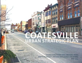
Coatesville Urban Strategic Plan
1. YOONA AHN |YEXIN DING | MICHAEL HONG
BRETT PEANASKY | BROOKE WIECZOREK | CHI ZHANG
MAY 2014
COATESVILLEURBAN STRATEGIC PLAN
2. 2 Introduction
CUSP EXECUTIVE SUMMARY
Forty-five miles west of Philadelphia, in a
picturesque valley once considered the agricultural
and industrial powerhouse of Chester County,
live over 13,000 residents divided into four
neighborhoods who are transforming a declining
city into a growing, vibrant place.
Cusp : noun ˈkəsp: a point of transition (as from
one historical period to the next): turning point;
also: edge, verge (as, on the verge of success)
Coatesville is at a crossroads in its trajectory. The city’s
rich historical past has become obsolete or irrelevant
in the context of current quality of life concerns. Yet
the many projects and partnerships now unfolding in
the city prove that residents are actively working to
create a sense of community and a public realm that
is diverse and dynamic. These initiatives could be
strengthened with the support of the city government.
The municipality continues to struggle with raising
enough revenue to meet the needs of residents, and
is increasingly disconnected from its constituents’
concerns. With many divisions of class, race, income,
educational attainment, and interests, Coatesville is on
the cusp of either becoming another dying Rust Belt
city or reinventing itself as the cultural and economic
center of Chester County.
This plan was born in collaboration, the product
of focused and critical thinking about the interests
and concerns of all stakeholders who want to see a
better Coatesville. By studying the city’s demographic
and socioeconomic conditions, completing scenario
planning, establishing goals, researching precedents
and best practices, and presenting strategic actions, the
Coatesville Urban Strategic Plan—or CUSP—represents
one vision for the city. This plan acknowledges
challenges that the city and its residents face, and
proposes concrete solutions for overcoming them.
This plan is divided into seven chapters: Context &
History, Existing Conditions, SDOC Analysis, Goals &
Objectives, Strategic Actions, Implementation, and
an Appendix containing scenarios and sources. The
plan identities specific actions and names the persons
and organizations that, if they support this vision, can
follow through with the implementation steps. This
is a living document, and the city should revisit and
update if often to regularly ensure that the goals and
priorities listed here continue to match the interests of
Coatesville’s residents.
Coatesville exists on the cusp—a rare moment in its
history. This document is intended to act as a vehicle
and forum to help the city’s residents define what a
successful Coatesville looks like and to pursue it.
3. 3Coatesville Urban Strategic Plan
The planning team produced this plan in fulfillment of the requirements of the CPLN 600 Planmaking Workshop course at
the University of Pennsylvania School of Design in Spring 2014. The team did not consult with Coatesville’s elected leaders,
city staff, or residents to create this plan. The authors would like to thank our instructor, Danae Mobley, for her continued
guidance and encouragement.
Context & History 04
12
32
38
44
86
90
Existing Conditions
SDOC Analysis
Goals & Objectives
Strategic Actions
Implementation
Appendix
CONTENTS
5. CONTEXT & HISTORY
Coatesville has experienced an era of decline and
disinvestment similar to that of many American
industrial towns. Yet this betrays a prosperous history
dating to the 1700s. Beginning as a rural village,
Coatesville grew into a dense industrial city and
reached peak population in the 1930s. Much of the
city’s development is connected to the Lukens Steel
Company, once the largest employer in Chester County.
Formerly the midway stop on the route to Lancaster,
Coatesville has been bypassed by the postwar
spread of metropolitan Philadelphia. The twenty-first
century presents new opportunities for this sturdily-
constructed city with a dense street grid. Investment
in Coatesville’s Amtrak station will provide momentum
for stabilization and revitalization. This is the time for
Coatesville to reinvest, reconnect, and reactivate.
6. 6 Chapter 1 : Context & History
Source: Chester County 2009
Figure 1-1. IN THE LIVABLE LANDSCAPES MAP, CHESTER COUNTY IDENTIFIES COATESVILLE AS ONE OF SEVERAL URBAN AREAS (RED). THE CITY IS
SURROUNDED BY THE SUBURBAN LANDSCAPE (TAN), INTERSPERSED WITH SEVERAL SUBURBAN CENTERS (TEAL).REGIONAL CONTEXT
A Multi-modal Suburban Corridor
Coatesville has the distinction of being Chester County’s
only incorporated city. The city’s location along the Lincoln
Highway (U.S. Route 30) and the Amtrak Keystone Service
makesitrelativelywell-connectedtoPhiladelphia, Lancaster,
and Harrisburg. However, Coatesville’s location has also
made it vulnerable to sprawling development patterns.
Coatesville finds itself increasingly surrounded by edgeless
development spreading westward from metropolitan
Philadelphia. The areas around the city are characterized
by large-lot single family residential subdivisions and cul-
de-sacs. A number of places between Coatesville and
Philadelphia, such as the boroughs of Downingtown and
Malvern, as well as Census-Designated Places (CDP) Exton,
Paoli, and Thorndale, have become suburban centers of
commercial activity. Exton, for example, is a veritable
“edge city,” complete with a highway interchange and
shopping mall.
These development patterns have significantly impacted
Coatesville. Roughly six miles to the west of downtown, a
Walmart-anchored strip mall has developed, and there is
another big-box commercial retail strip four miles to the
east. A new hotel sits at the city’s northern reach, near an
exit on the Coatesville-Downingtown Bypass, and the city
has assembled the surrounding land in hopes of creating an
office park.
Coatesville’s residents do not seem to receive much benefit
from the city’s connections to Philadelphia and Lancaster.
According to the 2012 American Community Survey (ACS)
5-year estimate, 84.6% of Coatesville’s workers commute
to locations within Chester County. While Keystone Service
ridership grew by 3.2% between 2012 and 2013, and a
number of stations posted records in 2013 (e.g. 578,731 in
Lancaster), only 16,626 persons passed through Coatesville’s
station (Amtrak 2013). SEPTA regional rail service does not
extend to Coatesville: the closest station is in Thorndale,
three miles to the east.
The city also has also not captured regional employment
growth. While the city of Coatesville has the highest
population of the six nodes along the corridor between
Lancaster and Philadelphia, it has only the third most jobs.
Recent employment trends show that Coatesville’s residents
are increasingly employed in educational and social services,
or “eds and meds.” However, as the city itself has few such
institutions, this means that these persons are working
elsewhere in Chester County (such as the nearby VA Medical
Center, Immaculata University in Exton, or the Main Line
HealthcampusinPaoli)orperhapsasfarafieldasLancaster’s
General Hospital and Franklin & Marshall College.
Chester County’s Comprehensive Policy Plan expects
continued suburban growth throughout the county.
According to this plan, Coatesville will continued to be
surrounded by the “suburban landscape” abong the Lincoln
Highway,pepperedwithseveral“suburbancenters”(Chester
County 2009, See Figure 1). While the plan hopes that these
areas will “incorporate Smart Growth principles to replace
sprawling development” (Chester County 2009, 30), there
seems little indication that the county’s rural and suburban
development patterns will change dramatically.
Nearly 88% of
Coatesville’s workers
commute to locations
outside the city.
7. 7Coatesville Urban Strategic Plan
COATESVILLE
PHILADELPHIA
44 miles
(50-75 min.)
LANCASTER
30 miles
(25-45 min.)
30
PARKESBURG
DOWNINGTOWN
EXTON
PAOLI
ARDMORE
Coatesville is one of six nodes along the U.S.
Route 30/Amtrak Keystone corridor between
Lancaster and Philadelphia. While Coatesville has
the largest population of these places, it has only
the third most jobs and, by a large margin, the
lowest Amtrak ridership.
Amtrak Ridership (2013)
Source: Amtrak
Coatesville: 16,626
Ardmore: 67,942
Downingtown: 68,918
Paoli: 175,299
Exton: 113,499
Parkesburg: 55,290
Employment (2011)
Source: U.S. Census Bureau
Coatesville: 10,385
Ardmore: 5,082
Downingtown: 12,300
Paoli: 7,155
Exton: 28,033
Parkesburg: 2,100
Population (2010)
Source: U.S. Census Bureau
Coatesville: 13,100
Ardmore: 12,455
Downingtown: 7,891
Paoli: 5,575
Exton: 4,842
Parkesburg: 3,593
8. 8 Chapter 1 : Context & History
HISTORY Figure 1-2. THE BRANDYWINE IRON WORKS AND NAIL FACTORY Figure 1-3. SEAL OF THE CITY OF COATESVILLE
1810
Pennock purchased 110.5 acres of Coates’ farm along
the Brandywine Creek and converted its sawmill into the
Brandywine Iron Works and Nail Factory, which exported
products nationally. At this time, the area was known as
“Coates’ Villa.”
1834
The Philadelphia and Columbia Railroad established a
station on the west side of the Brandywine. Because of its
location at the halfway point between the two terminals,
the station was designated as “Midway.”
1865
The Coatesville train station was built at 3rd Avenue and
Fleetwood Street. In 1867, the villages of Coatesville and
Midway joined to form the Borough of Coatesville.
1911
Zachariah Walker, a black man accused of killing a white
mill policeman, was dragged from a hospital and burned
to death in front of hundreds of Coatesville citizens. The
lynching—the last in Pennsylvania—stained the city’s
reputation and prompted the NAACP to call for an end to
lynching nationwide.
1915
A majority vote of Coatesville’s citizens made it the first and
only incorporated city in Chester County.
1932
By 1900, the population was 6,000. The school system and
religious community also expanded: in 1932 Coatesville was
home to 22 churches and Chester County’s only synagogue.
1945
After World War II, the steel industry began a long decline
and Lukens Steel was sold for the first of many times, forcing
workplace reductions to 5,000 and eventually to 2,000.
1714
The first settlement in this spot along the Brandywine
Creek was an Indian village, which became a market for fur
trapping. Records indicate land holdings as early as 1714 by
William Fleming, a native of Scotland.
1787
Moses Coates, a prosperous farmer and the area’s first
postmaster, purchased land which now comprises the
city’s center. Meanwhile, a few miles south, Isaac Pennock
formulated plans for his Federal Slitting Mill. The mill
was operating by 1793 and furnished much-needed iron
products for the growing region.
1794
Rural life in the valley changed with the construction of the
Philadelphia and Lancaster Turnpike, now U.S. Route 30. It
was America’s first privately-funded, paved road.
A rich past divergent from the present
Source: Greystone Society Source: City of Coatesville
9. 9Coatesville Urban Strategic Plan
Figure 1-4. A RECENTLY-PAINTED COMMUNITY MURAL Figure 1-5. A STRING OF ARSONS DESTROYED DOZENS OF HOMES Figure 1-6. A VISION FOR RAIL IN PENNSYLVANIA
1980s
Coatesville began an ambitious redevelopment project,
which included tearing down abandoned public housing
structures and building new single-family and townhouse
developments, a regional recreation center, and a mixed-use
project that would include retail, office, and condominiums.
1997
SEPTA discontinued regional rail service to Coatesville.
2005
Controversy around the city’s redevelopment plans, which
included eminent domain in a neighboring township, led
to the ousting of four incumbent city councilpersons in
November 2005.
2007-2009
A fire on the 300 block of Fleetwood Street burned 17
rowhomes, causing $2 million in damage and leaving dozens
homeless. By March 2009, police had arrested six suspects,
buthavesolvedonly20ofthenearly70arsonsthatoccurred
in a two-year span.
2009
The city began a HOPE VI funded Revitalization Plan. The
first project involved 47 rental units. Downtown Revival, the
second phase, featured 22 apartments over six downtown
commercial spaces. The final phase consisted of 84 new,
detached, for-sale homes on the former Oak Street public
housing site.
2010
Ten steel columns, forged by Lukens Steel in 1969, were
returned from the World Trade Center in New York City,
having survived the 9/11 terrorist attacks. The columns are
slated to be the centerpieces of a proposed National Iron
and Steel Heritage museum.
2011
Federal and state agencies committed $20 million in funding
to build a new Amtrak station as part of a larger effort by
PennDOT to improve service along the Keystone corridor.
Chester County committed over $700,000 in 2013.
2012
A new Marriott hotel was built along Route 82 on the
outskirts of Coatesville. The project received more than
$10 million in state funding, $5 million in county funds, and
$2.4 million in financing from the city and school district.
The hotel is the first phase in a private developer’s overall
project, which is expected to include an 80,000 square-
foot office building and a restaurant. In total, the campus is
expected to bring 330 jobs to the city.
2013
Residents ousted a school board member after learning
about racist and sexist test message exchanges between the
resigned superintendent and athletic director. The scandal
led to public outcry over personnel management in the
school district.
Source: Coatesville Times, November 15, 2013 Source: Coatesville Times, November 15, 2013 Source: Plan the Keystone, 2012
10. 10 Chapter 1 : Context & History
Recent Uncoordinated Initiatives
PAST & PRESENT PLANS Figure 1-7. TOWER INVESTMENTS’ PLAN FOR THE FLATS Figure 1-8. THE LANDSCAPES 2 PLAN
Coatesville has not updated its comprehensive plan since
1986. However, the city has been affected by a number
of recent public and private planning initiatives. These
include the Chester County Comprehensive Policy Plan, a
proposal for a national velodrome facility, the Department
of Justice’s Weed and Seed Program, a privately-led mixed-
used redevelopment proposal, and the Amtrak-led train
station renovation and transit-oriented development. While
this document does not specifically endorse these efforts
or adopt any of their recommendations, these initiatives
informed the analysis of Coatesville’s present conditions and
the challenges the city faces.
Chester County Comprehensive Policy Plan (2009)
Coatesville is the only incorporated city in the wealthiest
county in the state of Pennsylvania. Under Chester
County’s principle goals of creating livable and sustainable
development patterns, protecting the environment,
maintaining a diverse economy, supporting an efficient
multi-modal transportation system, and enhancing the
quality of life for all residents, the county’s comprehensive
policy plan specifically promotes smart growth, innovative
design practices, and recycling of brownfield sites for urban
areas such as Coatesville.
Both growth management and resource protection are
priorities for the county. A majority of the county remains
rural, yet the planning commission expects continued
suburban growth (Chester County 2009). Chester County
asserts that greenfield development will be balanced
with retrofitted commercial and industrial development,
made possible through public and private partnerships.
The plan points out that regulatory flexibility within
local jurisdictions will promote business attraction and
development, supported by strategic investment of the
Chester County workforce investment board (Chester
County 2009). The county hopes to connect jobs, workforce
housing and education.
As part of a designated growth area, Coatesville’s historic
street grid and mixed-use character make it well-positioned
to benefit from Chester County’s vision.
Tower Investments (2003)
In 2003, Coatesville gave Tower Investments, owned by
Philadelphia-based developer Bart Blatstein, exclusive
rights to develop a 25-acre site along Route 82 and Lincoln
Highway known as the Flats (Lowe 2006). Originally owned
by Lukens Steel, the site is one of the largest cleared and
consolidated parcels in the city. It is ripe for development,
and forms the downtown core of the city’s long-planned
$600 million revitalization efforts (Lowe 2006).
Blatstein partnered with Erdy McHenry Architects to
propose a development with 750 apartments, 550,000
square feet of retail and commercial space, and 40,000
square feet of entertainment facilities, phased over 10 to 15
years. However, Blatstein failed to produce a comprehensive
plan. Residents generally disapproved of the project, voicing
their fear of Coatesville becoming “the next Manayunk,”
far from the family-oriented and working class culture that
defines the city. The Coatesville Redevelopment Authority
and Tower Investments never came to an agreement, and
Blatstein’s exclusive development rights have expired (Lowe
2006). The Flats remains a vacant site.
Source: Erdy McHenry Architecture Source: Chester County Planning Commission
11. 11Coatesville Urban Strategic Plan
Figure 1-9. THE COATESVILLE POLICE DEPARTMENT Figure 1-10. A PERSPECTIVE OF THE NATIONAL VELODROME CENTER Figure 1-11. THE CURRENT COATESVILLE AMTRAK STATION
Weed & Seed Coatesville (2010)
Crime is a particularly acute challenge for Coatesville. In
2010, the Department of Justice (DOJ) provided a grant
to Coatesville to implement a national crime-prevention
program known as “Weed and Seed”. The four strategic
aims of the program are community policing; law
enforcement; neighborhood restoration; and promotion
of crime prevention, intervention and treatment (City of
Coatesville 2010). The Weed and Seed program empowers
urban communities with tough crime problems to lead
revitalization efforts based upon the authority designated
by the community’s council.
In Coatesville, the Police Department has partnered with
social and religious organizations to develop award-winning
interventions, such as the Coatesville Youth Initiative
(CYI) and Coatesville PAL. These programs serve over 700
children and teenagers in the city through leadership in the
CYI Game Changers and enhanced mentoring through PAL
Badges for Baseball (City of Coatesville 2010). Additionally,
evidence-based adult and family mentoring initiatives have
been implemented with Weed and Seed Funding (City of
Coatesville 2010). None of these interventions existed as
recently in 2009, and the city plans to expand them in 2014.
National Velodrome and Events Center (2013)
In late 2013, the Velodrome Management Group released
a feasibility study for a new indoor cycling track on a site
adjacent to the steel mill, between Lincoln Highway and the
High Bridge. Although the velodrome and a comprehensive
cycling program will anchor the facility, the building is
designed for multiple uses, including concerts, other
sporting events, and community activities. If the facility is
constructed, it will be the only indoor velodrome on the East
Coast, and is therefore projected to give Coatesville, Chester
County, and the Philadelphia area a unique and visionary
economic asset (Conventions, Sports and Leisure 2013)
The feasibility study, which included case studies of
comparable velodromes and reviews of cycling participation
and industry trends, showed that the necessary $27.5
million in financing will need to come from sources such
as developer equity, fundraising, grants, and economic
development funds (Conventions, Sports and Leisure 2013).
Developers expect the velodrome to create nearly 100 new
full- and part-time jobs in Coatesville and believe that $25 to
$35 million will be pumped into the local economy by some
50,000 annual out of town visitors each year. However, the
study also demonstrated that even with non-cycling events
and retail space revenue, the facility would not be able to
pay for its debt service and real estate taxes or establish a
capital reserve, and would largely rely on city subsidies.
Amtrak’s Promise (2010-present)
While the Coatesville Amtrak station receives little traffic, it
rests roughly halfway between Philadelphia and Lancaster
on the Keystone Service. The station has therefore received
much attention as a possible catalyst for redevelopment.
In 2003, Coatesville completed a train station parking and
improvements study. This study explored the feasibility of
a three-level parking facility, along with other aesthetic,
structural, and accessibility improvements. None of these
improvements were made, however. Other studies have
been conducted over the years, but none have progressed
past the planning phase.
Currently, Amtrak is leading the effort to implement a station
revitalization plan. The plan’s overall purposes include
streetscapebeautification,connectionstomultimodaltransit,
and privately-driven investment in the neighboring blocks.
After federal and state agencies committed $20 million to
station reconstruction, Chester County committed $700,000
for community development and leveraged additional public
and private funding (Plan the Keystone 2012). The “Plan the
Keystone” team worked with Coatesville and Chester County
to assess existing conditions around the station and led
a series of meetings with community stakeholders in July
2010 and a four-day community design charrette in August
2010 (Plan the Keystone 2012). The train station relocation
project obtained federal environmental clearance in March
2012, and the Coatesville Redevelopment Authority has
cleared the surrounding blocks through eminent domain. In
the intervening years, Amtrak has not published next steps
or a detailed design for the site.
Source: City of Coatesville Source: City of Coatesville Redevelopment Authority
13. 13Coatesville Urban Strategic Plan
EXISTING CONDITIONS
Dramatic growth in Chester County has made it the
wealthiestinthestateofPennsylvania,yetCoatesville—
the county’s only city—has not shared in this
prosperity. Coatesville’s 13,000 residents are sharply
divided along racial and socioeconomic lines, and they
struggle with rising unemployment, income inequality,
and educational disparity. The historical housing stock
does not meet residents’ needs. Recent challenges
with crime have engendered public perceptions that
mask the community’s vibrant culture.
At the same time, Coatesville is blessed with a number
of assets. Its downtown is a National Landmark Historic
District, and many employment sectors have grown
since 2000. Coatesville’s resilient residents remain
the city’s greatest strength, and the city has the
opportunity to channel their power.
14. 14 Chapter 2 : Existing Conditions
Population, Age, and Race
DEMOGRAPHICS
2 %
4 %
6 %
8 %
10 %
12 %
14 %
16 %
18 %
25-345-90-4 35-4410-14 45-5415-17 55-6418-24 65-74 75-84 85+
Coatesville
Chester County
Pennsylvania
Coatesville has higher proportions of
residents younger than 35.
Coatesville has lower proportions of
residents older than 35.
+ 40%
+ 26%
+ 16%+ 26%
+ 16% African American
+ 26% African American
+ 40% White
+ 26% White
47%43% White
African
American
Source: US Census Bureau, ACS 2008-2012
16% of Coatesville’s residents are
between 25 and 34 years old.
Coatesville’s current residents have much different needs
than those of its industrial past. The city’s population has
steadilyincreasedinrecentyears,growingfrom10,838inthe
2000 Census to 13,100 in the 2010 Census. The population is
organized into slightly more than 4,500 households, yielding
an average household size of approximately 2.9 persons.
The city’s residents are rather young compared to those of
Chester County and Pennsylvania (See Figure 2-1). Whereas
the greatest proportion of persons in the county and state
are 45 to 54 years old, the largest age cohort in Coatesville
is 25 to 34 years old. Coatesville has comparatively
higher proportions of residents below the age of 35, and
comparatively lower proportions of residents above the
age of 35. According to the 2012 American Community
Survey 5-year estimate, Coatesville has maintained an equal
proportion of women and men as its population has grown.
Coatesville is rather spatially segregated. About 90 percent
of the total population identifies as either African American
or white (U.S. Census Bureau). Of the four Census tracts
within Coatesville, two have a significantly higher proportion
of white residents and the other two have significantly
more African American residents (U.S. Census Bureau). The
northwestpartofCoatesvillecanbedefinedasmostlywhite,
while the southeast part of the city can be characterized as
mostly African American.
Figure 2-1. POPULATION CHARACTERISTICS
15. 15Coatesville Urban Strategic Plan
Income and Poverty
2009 2010 2011 2012
Coatesville
$48,486
$53,344
$113,161
Philadelphia
Chester County
Less than
$10,000
11.3% 14.3%
9.9%
9.7%
9.7%
$20,000 to
$24,999
$75,000 to
$99,999
2009 2012
Median
$36,434 Median
$34,603
9%
12%
2000
2012
As might be expected for a post-industrial city, Coatesville’s
residents earn comparatively low incomes and a greater
proportion of them experience poverty. According to the
2012 American Community Survey 5-year estimate, the
average household in Coatesville earns approximately two-
fifths of its counterpart in Chester County (See Figure 2-3).
However, the average income of a Coatesville household
earnsonly10%lessthantheaveragePhiladelphiahousehold,
demonstrating the significant economic inequality present
in Chester County and metropolitan Philadelphia.
Focusing on average income, however, obscures the severe
reality of economic inequality within Coatesville. In both
the 2009 and 2012 American Community Survey 5-year
estimates, the largest share of Coatesville’s households
earnedlessthan$10,000,andthisproportionincreasedfrom
11.3%to14.3%(SeeFigure2-4).However,thesecondlargest
proportion of Coatesville’s households in these surveys,
9.7% and 9.9% respectively, earned $75,000 to $99,999. In
addition, the 2009 survey showed that 9.7% of Coatesville’s
residents earned between $20,000 and $24,999; by 2012,
this proportion had decreased significantly. Together, these
figures suggest that the middle class is disappearing from
Coatesville,andthatincomeinequalityamongstitsresidents
continues to worsen.
Similarly, Coatesville’s residents are increasingly living below
the poverty line, and poverty is much more pronounced
in the city than in Chester County. In 2000, only 9% of
Coatesville’s population lived below the poverty line, but
by 2012 this figure had increased to 12% (Social Explorer,
U.S. Census Bureau). Children are particularly affected by
poverty in Coatesville: the amount of the population under
18 years of age living in poverty increased by 80% during this
period. In contrast, the number of children living in poverty
in Chester County increased by only 36% during this period.
On a positive note, the number of Coatesville’s residents 65
or older living in poverty declined by 9% from 2000 to 2012,
lessthanthe28%increaseinChesterCounty(SocialExplorer,
U.S. Census Bureau). These trends, however, suggest that
Coatesville’s most dependent residents—its children—are
bearing the consequences of the city’s economic decline.
Figure 2-2. POPULATION LIVING IN POVERTY, 2000-2012
Source: U.S. Census Bureau, ACS 5-year estimatesSource: U.S. Census Bureau, Social Explorer
Figure 2-3. AVERAGE HOUSEHOLD INCOMES, 2009-2012
Figure 2-4. COATESVILLE HOUSEHOLD INCOMES, 2009-2012
16. 16 Chapter 2 : Existing Conditions
ECONOMIC CONDITIONS
2000 2012
4.8%
8.2%
Source: U.S. Census Bureau, Social Explorer
Agriculture, forestry, fishing, hunting, mining
Construction
Manufacturing
Wholesale trade
Retail trade
Transportation, warehousing, utilities
Finance, insurance, real estate
Professional, scientific, management,
administrative, and waste services
Educational services, health care, social assistance
Arts, entertainment, recreation,
accommodation and food services
Other services, except public administration
Public administration
+64%
-15%
-11%
+53%
+44%
+5%
+27%
+5%
+19%
+23%
+51%
+9%
+51%
Information
Employment and Retail
Figure 2-5. INCREASE IN UNEMPLOYMENT
Figure 2-6. COATESVILLE EMPLOYMENT CHANGE BY SECTOR, 2000 TO 2012
Coatesville faces greater economic challenges in comparison
to Chester County. The Great Recession has had a more
pronounced impact on the civilian workforce in Coatesville
than in Chester County. In 2000, the unemployment rate in
Coatesville was 4.8%, but by 2012 the unemployment rate
had nearly doubled to 8.2% (see Figure 2-5), compared to
6.1%inChesterCounty(SocialExplorer;U.S.CensusBureau).
During this period, there was considerable change in
Coatesville’s employment mix (See Figure 2-6). There were
two notable declines. Employment in the transportation,
warehousing, and utilities sector decreased by 11%, and the
information sector experienced the most significant loss of
15%. However, this latter decrease seems less severe within
context of a 21% decrease in Chester County.
There are several sectors that experienced growth. The
educational services, health care, and social assistance
sector, or “eds and meds,’ experienced the greatest growth
(64%), increasing its share of the workforce from 22% to 27%
(See Figure 3). Employment in eds and meds in Coatesville
grew faster compared to the county, which experienced
a significantly lower growth rate of 33% (Social Explorer;
U.S. Census Bureau). The second highest growth sector in
Coatesville was professional, scientific, management, and
administrative & waste management services, growing by
53% and increasing its share of the workforce from 10% to
11%.Thethirdhighestgrowthsectorwasretailtrade,growing
by 44% and increasing its share of the workforce from 11% to
12%. While other sectors had increases in their employment
base, they generally maintained their respective shares of
the workforce. (Social Explorer; U.S. Census Bureau).
The commercial corridor of Coatesville runs along Lincoln
Highway from approximately 1st Avenue to 4th Avenue,
roughly in the geographic center of the city. The corridor
includes small grocery and convenience stores, hair salons,
furniture stores, and several churches. This is one of the only
pedestrian-friendly areas of Coatesville, with a connection
to the Amtrak station via 3rd Avenue.
A local retail analysis conveys an overall lack of quality in
retail options that do not meet the needs of the community.
Residents largely turn to local convenience stores to meet
their daily shopping needs, which are undersupplied in the
city. While there is an excess supply of grocery, clothing,
and electronics stores; bars; and car service stations, they
are qualitatively insufficient prompting residents to seek
alternatives outside of the city. There is also insufficient
supply of delicatessens, drugstores, and discount stores.
Coatesville’s residents are largely dependent on limited
options of convenience stores and tend to go shop outside
of Coatesville to meet other retail needs.
The educational
services, health care,
and social assistance
sector
grew by
from 2000-2012.
64%
17. 17Coatesville Urban Strategic Plan
No high school diploma
High school graduate
Some college, no degree
Associate’s degree
Bachelor’s degree
Graduate/professional degree
29.5%
Bachelor’s Degree
21.2%
No HS Diploma
18.8%
Grad./Prof. Degree
41.9%High School Graduate
Coatesville
Chester County
United States
1353
Student-Faculty Ratio Expenditure per Student Average SAT Score
13.2
14.4 $20,976
$14,500
1353
1395
1500
Coatesville Chester County
Sources: PA Department of Education 2012, News and Reporter 2012
Providing a high-quality education is a challenge that many
American cities face, and Coatesville is no exception. Relative
to Chester County and Pennsylvania, the Coatesville Area
School District (CASD) performs comparatively poorly, and on
thewhole,Coatesville’sresidentshavecompletedlowerlevels
of education. According to the 2012 American Community
Survey 5-year estimates, slightly less than four-fifths of
Coatesville’s residents have graduated from high school,
almost fifteen percent less than the proportion in Chester
County (See Figure 2-7). The percentage of Coatesville’s
residents who have earned a bachelor’s degree or higher is
even more skewed: 14.7% compared to 48.3% for Chester
County.Holdersofgraduateorprofessionaldegreesarenearly
absent from Coatesville,making uponly3%of thepopulation.
There are two higher educational institutions serving the city:
a satellite campus of Lincoln University near downtown, and
the Chester County Area Vocational Technical School.
It seems that Coatesville’s educational challenges, however,
begin at the elementary level. CASD has the tremendous
task of educating students in a 75-square mile catchment
area, nearly 40 times the size of the city. Within the district,
there are six elementary schools, three middles schools, and
a massive senior high school campus, located just east of
the city boundary. Of these, only one building—Scott Middle
School—is actually located in Coatesville.
Simply put, CASD’s inputs are not translating into positive
results. While CASD has a lower student-faculty ratio than
the Chester County average and spends nearly a third more
per student (See Figure 2-8), students perform lower than
the state average on math and reading proficiency tests (PA
Education
Department of Education 2012). In 2011, CASD students’
average SAT scores (1353) were below those of Chester
County (1395) and the national average of 1500 (News and
Reporter 2012). School funding is also an issue: in its most
recent audit, the CASD General Fund reported a negative
balance of $4.2 million (CASD Audit Report 2012). This
perhaps explains the substantial increases in property taxes
recently levied on residents within the catchment area.
Recent scandals have compounded these struggles. Last
year, two school officials resigned after they were found
exchanging racist and sexist text messages (Saltzman
2013). Some parents have also alleged that teachers and
staff treat low-income minority children and children with
disabilities unfairly, and that the recent closing of the
Graystone Academy Charter School was racially motivated
(Bond 2013). The public has also raised objections over the
millions of dollars in legal fees collected by the CASD district
solicitor (Scala 2013). An overall lack of transparency has
inflamed tensions and created an environment that distracts
attention from students’ needs.
Figure 2-7. EDUCATIONAL ATTAINMENT (POPULATION 25 YEARS AND OVER)
Figure 2-8. COATESVILLE AREA SCHOOL DISTRICT PERFORMANCE INDICATORS
Source: U.S. Census Bureau, 2012 ACS 5-year estimates
18. 18 Chapter 2 : Existing Conditions
Housing
ECONOMIC CONDITIONS Figure 2-10. DUPLEXES NEAR THE HISTORIC DISTRICT
Figure 2-11. CONDEMNED ATTACHED SINGLE-FAMILY HOUSES
Figure 2-12. NEW MULTI-FAMILY HOUSING NORTHWEST OF DOWNTOWN
Figure 2-13. APARTMENTS IN A HISTORIC STABLE ON THIRD AVENUE
Source: Social Explorer
Percent of
Renters > 30%
Burden
Percent of
Owners > 30%
Burden
53%
40%
21%
40%
2000 2012
Downtown Coatesville is relatively dense, yet most of the
city’s dwelling units are detached, single-family homes.
Attached single-family homes were the housing type
that experienced the greatest growth from 2000 to 2012,
increasing by 51%. This housing type’s share of the city’s
housing stock grew from 20% to 23%. All other housing
types either slightly decreased or relatively maintained
their shares. The second largest growth was experienced by
single-family detached homes, with an increase of 29%, but
its share actually decreased from 60% to 59%. The attached
and detached single-family homes comprised of over 80%
of housing growth in the city. The increase of multi-family
Figure 2-9. BURDENED RENTERS AND OWNERS, 2000-2012
units was limited to 24% (Social Explorer; U.S. Census
Bureau). Despite the lower growth rate of multi-family units,
the growth experienced in both housing types indicates a
healthy demand for housing.
Coatesville’s residents are increasingly burdened by their
housing costs as median home values and rents increase.
The percentage of owners with mortgages consuming
30% or more of their household incomes grew by 93%
between 2000 and 2012. The percentage of renters with
gross rents that account for 30% or more of their household
incomes increased by 46% during this period (See Figure
2-9). Chester County had lower growth rates for both of
these metrics—81% and 30%, respectively. Over half of
Coatesville’s renters are burdened, and the average monthly
rent increased by $202, or 25%, from 2000 to 2012.
The number of owners
with mortgages that
required more than 30%
of their incomes grew by
from 2000
to 2012.93%
From 2000 to 2012, there was a 30% increase in occupied
units, largely driven by the growth in owner-occupied,
single-family homes (Social Explorer, U.S. Census Bureau).
The increases in owner- and renter-occupied units were
relatively in line with the increases in occupied units,
30% and 28% respectively (Social Explorer, U.S. Census
Bureau). The majority of Coatesville’s housing units (70%)
are owner-occupied; 23% are renter-occupied. While only
7% of Coatesville’s housing units are vacant, the number
increased by 70% from 2000 to 2012. In comparison, the
vacancy growth in Chester County was noticeably lower,
at 44%. There was also a 20% increase in mobile homes in
Coatesville, which is significantly greater Chester County’s
5% increase. These trends collectively indicate that newer
housing stock may be unattainable for many of Coatesville’s
residents and that older housing stock is not sufficiently
meeting the needs of lower income residents.
19. 19Coatesville Urban Strategic Plan
Municipal Budget and Finances
9.905 12.915
3.699
4.16325.700
32.000
2006 2014
+80%in property taxes
since 2006
Coatesville Area
School District
Chester County
Coatesville
Source: Daily Local News 2014
In recent years, Coatesville has faced challenges in balancing
its budget. The city has largely depended on the Reserve
Trust Fund, increased real estate taxes, and steep cuts to
cover annual budget gaps. Unfortunately, this means that
Coatesville’s residents have been asked to pay more money
for fewer services.
Coatesville created the Reserve Trust Fund in 2000, when
it sold the municipal water authority to Pennsylvania Water
Company for $36 million (Daily Local News 2014). By the
end of 2013, the fund was nearly depleted to $6 million;
the city had used the funds to pay debts, fulfill pension
obligations, and meet other annual budgetary needs. By
law, the city is required to replenish the Reserve Trust Fund.
In order to meet this obligation, Coatesville City Council has
substantially increased the real estate tax rate, up 175%
from 5.368 mills in 2004 to 9.415 mills in 2013. In order to
balance the 2014 budget, the city increased the millage rate
again, to 12.915 mills (Daily Local News 2014).
The burden on Coatesville’s residents is also compounded
by continual property tax increases from Chester County
and the Coatesville Area School District (See Figure 2-14).
A millage rate of 32 is a tax of 3.2% per $100,000 in value.
Thus in 2014, the median homeowner in Coatesville will pay
$4,422 in property taxes.
Despite these increases, the accompanied revenue growth
has been modest. Kirby Hudson, Coatesville’s City Manager,
hasattributedslowrevenuegrowthtothreefactors.Thefirst
is a stagnant construction market. This has been compointed
by broader economic issues and the lack of available land
for new construction. Secondly, there has been an uptick in
property assessment appeals and a decline in deed transfer
tax revenue because of a lack of home sales. Finally, revenue
growth has been by impeded by stagnant incomes, the city’s
largest source of tax revenue (City Council 2012).
As would be expected given these trends, Coatesville has
madedeepcutstoexpenditures.Thecutsintheadopted2012
budget, compared to the 2011 budget, totaled $1.7 million.
Eleven line items were reduced, five were maintained, and
five were modestly increased. The largest reduction was
in Culture and Recreation, with the allocation for Camps
reduced by 66%. Community and Economic Development
was the second largest cut, slashed by 54%. Next was
General Government, with a 35% cut to Council expenses,
followed by Protection to Persons and Property, with a 31%
reduction in the Police allocation (City Council, 2012). In
general, these cuts were achieved through reductions in
personnel, salaries, and benefits. Unfortunately, Coatesville
continues to spend less on services important to residents in
spite of rising taxes.
66% Camps
54% Community Center
35% Council
31% Police
20% Legal
11% Building & Plant
10% Administration
10% Parks
5% Code Enforcement
4% Finance
1% Redevelopment
11% Public Works
7% Fire
4% HR
3% Pools
3% Insurance
Budget Cuts
Budget Increases
Figure 2-14. RESIDENTIAL PROPERTY TAX INCREASES, 2006-2014
20. 20 Chapter 2 : Existing Conditions
Figure 2-15. COATESVILLE’S ROAD NETWORK AND TRAFFIC VOLUME
Source: US 30 Coatesville-Downingtown Bypass Traffic Study
Figure 2-16. COATESVILLE WORKERS’ COMMUTE LOCATIONS
72.5%
12.1%
13.8%
Elsewhere in Chester County
Outside of Chester County
In Coatesville
Outside of Pennsylvania
Source: 2010 ACS 5-year estimate
TRANSPORTATION
The city of Coatesville has ample transportation connections
to surrounding localities, Philadelphia, and Lancaster.
Unfortunately, the roads that run through and near
Coatesvillearegenerallyusedtocarrypassengersawayfrom,
or around, the city. The Coatesville-Downingtown Bypass
(U.S. Route 30, built in the 1960s) and Lincoln Highway (U.S.
Route 30B) are Coatesville’s main vehicle traffic corridors.
During peak travel hours, the bypass brings 400 vehicles per
hour towards the city and takes 800 vehicles per hour away
from the city (US 30 Coatesville-Downingtown Bypass Traffic
Study; See Figure 2-15).
Given this traffic pattern, it is not surprising that most
of Coatesville’s residents have jobs outside of the city.
Only 12.1% work within Coatesville. While 13.8% of
Coatesville’s residents work beyond Chester County, the
greatest proportion (72.5%) work outside of the city but
within Chester County (U.S. Census Bureau, 2010 ACS
5-year estimate; See Figure 2-16). These statistics, coupled
with the travel patterns on major highways, suggest that
Most of Coatesville’s residents travel to employment
centers located in other points along the Highway 30
corridor, such as Exton and Downingtown.
A City of Long-Distance Commuters
Only of
Coatesville’s workers
commute to jobs within
the city limits.
Coatesville’s residents are largely dependent on their cars
when they commute (See Figure 2-18). The substantial
majority of Coatesville’s commuters (86.2%) travel to and
fromworkinprivatevehicles,andonly8.2%usepublictransit
(U.S. Census Bureau, 2010 ACS 5-year estimate). It should be
noted, however, that while 87.5% of Coatesville’s families
have at least one car, this is lower than the proportion of
families in Chester County that own at least one car (95%).
Concomitantly, car commuting is less common in Coatesville
(86.2%)thaninChesterCounty(88.1%).Coatesvilleresidents
are also three times as likely as Chester County residents to
commute by bus or train.
12%
21. 21Coatesville Urban Strategic Plan
Figure 2-17. COATESVILLE’S TRANSIT ROUTES
N
Coatesville
VA Hospital
Brandywine
Hospital
Brandywine
YMCA
Regency Park
Highlands
Corporate
Center
Airport Plaza
Shopping
Parkesburg
West Sadsbury
Commons
Shopping
Cener
Oaklands
Exton Square
Exton
West
CHester
Coatesville Link (TMACC)
Line A (Krapf’s Coaches)
Amtrak Keystone Service
Figure 2-18. CAR OWNERSHIP
87.5%
At Least One Vehicle
12.5%
No Vehicle
5%
At Least One Vehicle
95%
At Least One Vehicle
Figure 2-19. COMMUTING MODE SHARE
Coatesville Chester County
Source: Chester County Planning Commission 2012
Source: U.S. Census Bureau
Source: U.S. Census Bureau
Coatesville
Chester County 88.1% 2.7% 2.5% 0.2% 0.8% 5.7%
86.2% 8.2% 2.5% 1.4% 0.5% 1.3%
Relative to Chester County, a greater proportion of
Coatesville’s residents are dependent upon transit options.
The near-perfect match between the proportion of residents
that do not own a car (12.5%) and those that work within
the city (12.1%) suggests that employment opportunities
are controlled by car ownership and, conversely, transit
accessibility. However, transit options are relatively limited.
The Amtrak Keystone Service is the most prominent
transit route available to Coatesville’s residents. The
Amtrak station is located on North 3rd Avenue, between
Coates Street and Fleetwood Street. However, the station
lacks any Amtrak staff, does not offer ticketing and
baggage services, and is in severe disrepair. As previously
mentioned, Coatesville has by far the lowest train
ridership of the six Keystone stops between Lancaster
and Philadelphia, with only 16,626 passengers in 2013
(See infra, page 7). Simply put, very few of Coatesville’s
commuters are traveling by train.
Bus transit seems a more viable option for Coatesville’s
commuters. Two privately-owned bus lines service the city.
Line A, operated by Krapf’s Coaches, connects Coatesville
to West Chester, via Downingtown and Exton. The service
operates from 5:30am to 11:00pm, with more than 1,200
passengers per day. A second bus service, Coatesville Link,
is provided by the Transportation Management Association
of Chester County. This service seeks to provide access to
nearbyshoppingcenters,medicalfacilities,andemployment
opportunities. A limited evening route also connects
Coatesville residents to service and hospitality jobs in Exton
(Chester County Planning Commission 2012).
Transit Options
22. 22 Chapter 2 : Existing Conditions
Figure 2-20. THE UNUSED AND DILAPIDATED AMTRAK STATION
Figure 2-21. COATESVILLE’S MAIN STREETS ARE PLAGUED BY TRUCKS
Figure 2-22. MANY STREETS ARE NOT PEDESTRIAN-FRIENDLY
Source: Greystone Society
Related Plans and Issues
Amtrak Station
The Amtrak station on 3rd Avenue has been the focus of a
number of studies since the early 2000s. The current plan,
the Coatesville Train Station (CTS) project, is a joint effort
by PennDOT, Amtrak, Chester County, the City of Coatesville,
the Coatesville Redevelopment Authority, and the Chester
County Economic Development Council (Plan the Keystone
2012). The focus of the CTS project is the construction
of new ADA-accessible station approximately 300 feet
to the east of its present location. The new station will
include improved lighting, an overhead canopy, elevators,
a passenger connection for crossing the tracks, and
approximately 100 parking spaces. The CTS vision includes
complementary improvements to the surrounding area,
such as rehabilitation of the existing station for a new use
and streetscape improvements on Third Avenue between
the station and Coatesville’s commercial corridor (DVRPC,
n.d.).Propertieshavealreadybeenacquiredanddemolished
to make way for these improvements.
TRANSPORTATION
Truck Traffic
Coatesville’s main streets are subjected to high volumes
of truck traffic. This problem is especially intrusive at the
intersection of Lincoln Highway and Route 82, at the western
edge of the historic district. Many of the trucks that travel on
Route 82/1st Avenue are transporting large loads of scrap
to the steel mill. Trucks traveling on this road have damaged
the mast arms supporting overhead traffic signals and make
pedestrian access to the historic sites west of 1st Avenue
more difficult. While not all freight companies have access to
the rail lines running to the steel mill, Coatesville’s residents
have expressed a desire to see more scrap transported via
rail rather than truck. (Knight Foundation 2004).
The Pedestrian Environment
Historic downtown Coatesville and the immediately adjacent
residentialneighborhoodsaregenerallybuiltinapedestrian-
friendly manner. The gridded street network, adequate
sidewalks, and attractive architecture of these areas create
a pleasant walking experience. The newer residential
neighborhoods, while rather hilly, also have adequate
sidewalks (although they appear to be infrequently used).
Beyond these neighborhoods, many of Coatesville’s streets
are not conducive to walking. Just under five percent of
Coatesville’s land is vacant. Unoccupied parcels are often
surrounded by chain-link fences and littered with debris.
Moreover,theseareaslacksafesidewalks,forcingpedestrians
to walk in the roadway. This problem is particularly glaring in
the areas surrounding the Amtrak station.
PennDOT expects the
new Amtrak station to
serve as an anchor for
transit-oriented
development in
Coatesville’s center.
23. 23Coatesville Urban Strategic Plan
Coatesville Land Use (2010)
$0 0.25 0.5 0.75 Miles
Walkability and Bikeability
Pedestrian Friendly
Bike Lane
Not Pedestrian Friendly
High Truck Traffic
Problem Intersection
Coatesville’s streets generally cater to the
car over the pedestrian. Lincoln Highway runs
through the center of Coatesville, and many
trucks travel on First Avenue between the steel
mill and the U.S. Route 30 bypass north of the
city. There are a number of intersections with
severe conflicts between truck traffic, car traffic,
and pedestrians. A token effort has been made
to accomodate bicyclists, with a marked bike
lane on Lincoln Highway from 1st Avenue to the
city’s eastern edge.
24. 24 Chapter 2 : Existing Conditions
Figure 2-23. COATESVILLE LAND USE (1,183 ACRES
Source: DVRPC 2010
Transportation/Utility
33%
19.6%
Wooded Area
14.5%
SF Residential
8.8%
Commercial
7.4%
Industrial/Mining
Agriculture
34.6%
26.3%
Wooded Area
18.9%
SF Residential
8.5%
Transportation/
Utility
Agriculture
Transportation/Utility
Wooded
SF Residential
Commercial
Industrial/Mining
Community/Recreation
MF Residential
Vacant
Water
Other
LAND USE
The City of Coatesville encompasses 1,183 acres (DVRPC
2010). Transportation and utility facilities consume the
greatest proportion (390), followed by woodlands (232),
single-family residential (171), commercial (104), industrial
and mining (88), community facilities and recreation (75),
multi-family housing (56), vacant land (54), and water (13)
(DVRPC 2010, See Figure 2-23).
Coatesville has a significantly different land use pattern than
Chester County. Of the county’s 485,463 acres, agriculture
consumes the most (168,174), followed by woodlands
(127,551), single-family residential (91,926), transportation/
utility (41,140), community/recreation (14,610), vacant
land (14,433), commercial (10,350), multi-family residential
(6,426), water (5,000 acres), industrial and mining (3,248),
and other uses, (2,605) (DVRPC 2010, See Figure 2-24).
As would be expected, the city is much more densely
populated than Chester County: Coatesville has 7,081
persons per sq. mi., compared to 658 for the County; and
4.2 dwelling units per acre, compared to 0.40 for the County.
Coatesville does not have a current land use plan. The
Chester County Comprehensive Policy Plan, Landscapes 2,
identifies Coatesville as part of the “urban” landscape, with
a desired density of five or more dwelling units per acre.
The plan states that in these areas of “highest development
intensity,” the focus will be on redevelopment, revitalization,
andthepreservationandreuseofhistoricsitesandstructures
(Chester County 2009). The plan expects municipalities such
as Coatesville to update their comprehensive land use plans,
with a particular focus on developing neighborhood parks
and community facilities.
Figure 2-24. CHESTER COUNTY LAND USE (485,463 ACRES)
Figure 2-25. DUPLEXES AND HOME OFFICES LINING CHESTNUT STREET
Figure 2-26. HIGH BRIDGE, A TRANSPORTATION LANDMARK
Figure 2-27. A DILAPIDATED, BUT STILL USED, STORAGE BUILDING
25. 25Coatesville Urban Strategic Plan
Commercial
Community Facilities
Manufacturing (Heavy Industrial)
Parking
Recreation
Residential: Multi-Family
Residential: Row Home
Residential: Single-Family Detached
Transportation/Utility
Water
Wooded
Vacant
Coatesville Land Use (2010)Coatesville is a small city—roughly 1.85
square miles. The city’s historic core consists
of relatively dense, multi-story commercial
and residential buildings. However, this density
decreases away from Lincoln Highway, the
main street. In total, more than three times
as much land is devoted to single-family
homes as multi-family buildings. Most of the
comparatively new housing units, built into the
wooded hills framing the city, are single-family,
detached dwellings.
26. 26 Chapter 2 : Existing Conditions
Source: DVRPC 2010.
Figure 5. Coatesville Aggregate Land Use
68.4%Developed
31.6%
Undeveloped
(including vacant
land and water)
NATURAL ENVIRONMENT
Resources in Need of Protection
The EPA has identified
Brandywine Creek
an impaired
watercourse
under section 303(d) of
the Clean Water Act.
Unfortunately, Coatesville’s development has encroached
upon its valuable natural areas. Because Coatesville’s
industrial core was powered by the Brandywine Creek, much
of the land near the watercourse is intensely developed and
vulnerable to flooding. The districts within Coatesville’s
borders through which the creek runs are zoned for heavy
industrial and commercial uses. In recent decades, low-
and medium-density residential uses have climbed into the
woodedhillsatthecity’snorthernandsouthernedges.These
neighborhoods are zoned as “residential conservation”
districts, with the purpose to “[r]etain meaningful open
space…protect local resources and to provide for various
recreational or leisure activities” (City of Coatesville, 2014).
This designation provides the city the opportunity to
establish more stringent requirements for site design, lot
coverage and building bulk. Coatesville’s zoning ordinance
also contains Floodplain Conservation, Natural Resource
Protection, and Hilltop Neighborhood Development overlay
districts, with boundaries set according to state and federal
resource mapping (City of Coatesville, 2014).
TheBrandywineCreekispartoftheChristinaRiverwatershed,
which flows into the Delaware River wand empties into the
Delaware Bay. The stretch of the Brandywine Creek that
runs through Coatesville is listed by the EPA as an impaired
watercourse under section 303(d) of the Clean Water
Act. The creek is heavily polluted with organic nutrients,
pesticides, siltation, suspended solids, polychlorinated
biphenyls (coolants, lubricants, and sealants), and other
pollutants (EPA 2006). While much of this pollution comes
from upstream agricultural activities, activities in Coatesville
certainly contribute to this poor water quality.
While Coatesville does not have a natural resources plan,
the city is included in a number of broader environmental
planning initiatives. The Brandywine Creek Greenway, a
project of the Brandywine Conservancy, has developed a
vision of resource protection for an area encompassing
twenty-four municipalities. The concept plan includes multi-
functional destination points and 230 miles of trails along
the Brandywine Creek (Brandywine Creek Greenway, 2013).
ChesterCounty’sLandscapes2planincludessignificantareas
of Coatesville in a natural resource overlay. In these areas,
the plan encourages the protection of natural resources
through multi-municipal resource plans and integrated land
use decisions, with a particular focus on protecting surface
and groundwater sources. The plan notes that, because the
county contains over 1,300 miles of streams, integrated
waterand wastewaterplanning is a“pressing issue” (Chester
County 2009, 60).
Coatesville contains a significant amount of wooded area
and eight distinct community open spaces, including the
Coatesville Community Center and playing fields, Chester
Ash Memorial Park (9.3 acres), Valley View Park (5 acres),
and Fairview Cemetery. However, most of the city’s land is
dedicated to intensive uses, and more than two-thirds is
currently developed (See Figure 2-28). This number serves
as a useful proxy for the amount of pervious surface in
Coatesville. The city’s current zoning provides a useful
foundation for more rigorous development suitability
analyses to protect its resources and improve water quality.
Figure 2-29. COATESVILLE AGGREGATED LAND USE
27. 27Coatesville Urban Strategic Plan
Flood Plain
Rivers and Streams
Hydric Soils
Wetlands
Forests
County Natural Resources Overlay
Natural Resources
Open Space
$0 0.25 0.5 0.75 Miles
Nestled in the Brandywine Valley,
Coatesville boasts abundant natural features
that contributed to the city’s historical
development. The hills, forests, and streams
of Coatesville, particularly to the north and
south, provide a pleasant backdrop for the
city. Environmental resources are often cited
as critical factors to creating a high quality of
life: in recent surveys, Chester County residents
highlighted natural beauty, woodlands, and
historic scenery as the elements that make the
county a “special place” to live.
28. 28 Chapter 2 : Existing Conditions
PUBLIC REALM Figure 2-30. HALF OF COATESVILLE’S 22 PLACES OF WORSHIP ARE IN
THE HISTORIC DISTRICT AND ARE GENERALLY WELL-MAINTAINED
Figure 2-31. THE SIDEWALKS AND STREET FURNITURE ON
COATESVILLE’S MAIN STREET ARE IN NEED OF MAINTENANCE
Figure 2-32. A COLUMN FROM THE WORLD TRADE CENTER, THE START
OF THE NATIONAL IRON & STEEL HERITAGE MUSEUM
Commercial and Cultural Corridor
The heart of Coatesville contains a number of commercially
and culturally important buildings, many of which are within
easy walking distance of the Amtrak station. While parts
of this area have experienced decline and vacancy, vital
institutions remain.
Coatesville’s primary commercial corridor runs along Lincoln
Highway from 1st Avenue to approximately 4th Avenue.
This stretch generally consists of convenience stores, delis,
hair salons, and other locally-oriented retail establishments.
Althoughafewofthesestoresarevacant—includingtheLipkin
furniture store, after 114 years of operation—this corridor
is the city’s most active in terms of pedestrian and vehicle
traffic. The street is lined with bicycle lanes, parking, and
planters, and the heights of the buildings (two to four stories)
make it one of the most welcoming in the city. However, the
planters and sidewalks are in need of maintenance.
A number of important cultural and civic institutions are also
located along Lincoln Highway. These include the historic
National Bank of Chester Valley building, the public library,
the Coatesville Savings Bank, and the Coatesville Cultural
Society. The Coatesville Cultural Society, one of the only
artistic and cultural outlets for Coatesville’s residents, hosts
holiday celebrations and theatrical performances.
Notably,mostofthecommercialandculturalactivitycenters
are located on the east side of Brandywine Creek. The creek
and the formidably sized industrial site serve to separate the
City’s western, primarily residential section from its eastern,
mixed-use section.
Historic District and Industrial Heritage Sites
Coatesville’s National Historic District encompasses the
commercial and cultural corridor and a portion of the
residential area between 5th and 6th Avenues. For a city
of its size, Coatesville has a significant number of places of
worship—twenty-two in all. Approximately half of these
structures are sited within the historic district. Some of
them have attached community service centers or social
assistance providers, suggesting that Coatesville’s religious
institutionsarefillingthevoidcreatedbythecity’sbudgetary
shortfalls and providing much-needed services to residents.
Coatesville’s prominent industrial heritage sites are located
outside of the historic district, to the west of 1st Avenue. The
stately brick building that once served as the administrative
offices for the Lukens Steel Company is now the home of
the Graystone Society, a nonprofit educational organization
dedicated to preserving and exhibiting the region’s
importance to the American steel industry (The Graystone
Society, Inc. 2012). Behind this building, the beginnings
of the National Iron & Steel Heritage Museum have been
constructed around a prominently displayed steel column.
This column, forged at the steel mill in the 1960s, survived
the September 11, 2001 terrorist attacks on the World Trade
Center and was returned to Coatesville in 2010.
Recreational Facilities
Although Coatesville is situated in the picturesque
Brandywine Valley, the city has not taken much advantage
of its position. The industrial site and 1st Avenue separate
the creek from the city’s residents, and there are no formal
access points for recreational purposes. However, there
are approximately 75 acres of community and recreational
spaces in the city. These include the community center in
the northeast part of the town (offering sports lessons for
children and other community events), eight parks and
playgrounds, and two large cemeteries. However, these
facilities are generally cut off from many of Coatesville’s
residents by streets that lack pedestrian infrastructure.
There are
places of worship in
Coatesville.
22
29. 29Coatesville Urban Strategic Plan
$0 0.25 0.5 0.75 Miles
Amtrak Station
Water Area
Open Space
Commercial Corridor
Historic Distrct
Industrial Site
Worship Place
Cultural Center
Grocery
Public RealmFor a city of its size, Coatesville has an
impressive number of cultural and historic
buildings and public open spaces. A significant
portion of the city’s downtown is designated
as a National Historic Landmark District. The
Coatesville Cultural Society and Greystone Society
host several community events throughout the
year. Various groups, such as the Coatesville
Farmers Market, the Boy Scouts, and the
city’s numerous churches, host events in the
Coatesville’s nine parks.
30. 30 Chapter 2 : Existing Conditions
PEOPLE & PERCEPTIONS
Community Culture
Sources: Coatesville Cultural Society, Americantowns, Coatesville Bible Fellowship, Episcopal Church of the Trinity, Coatesville, The Bridge Academy & Community Center
Coatesville Library Events
Coatesville Cultural Society, Theatrical Performances
Coatesville Cultural Society, Live Music Venues
Church Events
Vacation Bible School
Coatesville Cultural Society, Poetry Readings
Pope John Paul II Catholic Elementary School, Spring Outgrown Sale
Bridge Academy Events
January 2013
S M T W R F S
01 02 03 04 05
06 07 08 09 10 11 12
13 14 15 16 17 18 19
20 21 22 23 24 25 26
27 28 29 30 31
01 02
03 04 05 06 07 08 09
10 11 12 13 14 15 16
17 18 19 20 21 22 23
24 25 26 27 28
01 02
03 04 05 06 07 08 09
10 11 12 13 14 15 16
17 18 19 20 21 22 23
24 25 26 27 28 29 30
31
01 02 03 04 05 06
07 08 09 10 11 12 13
14 15 16 17 18 19 20
21 22 23 24 25 26 27
28 29 30
01 02 03 04
05 06 07 08 09 10 11
12 13 14 15 16 17 18
19 20 21 22 23 24 25
26 27 28 29 30 31
01
02 03 04 05 06 07 08
09 10 11 12 13 14 15
16 17 18 19 20 21 22
23 24 25 26 27 28 29
30
01 02 03 04 05 06
07 08 09 10 11 12 13
14 15 16 17 18 19 20
21 22 23 24 25 26 27
28 29 30 31
01 02 03
04 05 06 07 08 09 10
11 12 13 14 15 16 17
18 19 20 21 22 23 24
25 26 27 28 29 30 31
01 02 03 04 05 06 07
08 09 10 11 12 13 14
15 16 17 18 19 20 21
22 23 24 25 26 27 28
29 30
01 02 03 04 05 06
07 08 09 10 11 12 13
14 15 16 17 18 19 20
21 22 23 24 25 26 27
28 29 30 31
01 02 03
04 05 06 07 08 09 10
11 12 13 14 15 16 17
18 19 20 21 22 23 24
25 26 27 28 29 30
01
02 03 04 05 06 07 08
09 10 11 12 13 14 15
16 17 18 19 20 21 22
23 24 25 26 27 28 29
30 31
February March April
May June July August
September October November December
January 2014
S M T W R F S
01 02 03 04 05
06 07 08 09 10 11 12
13 14 15 16 17 18 19
20 21 22 23 24 25 26
27 28 29 30 31
01 02
03 04 05 06 07 08 09
10 11 12 13 14 15 16
17 18 19 20 21 22 23
24 25 26 27 28
01 02
03 04 05 06 07 08 09
10 11 12 13 14 15 16
17 18 19 20 21 22 23
24 25 26 27 28 29 30
31
01 02 03 04 05 06
07 08 09 10 11 12 13
14 15 16 17 18 19 20
21 22 23 24 25 26 27
28 29 30
February March April
Source: Brandywine Health Foundation, 2013
Figure 2-33. COATESVILLE COMMUNITY CALENDAR, 2013-2014
In addition to Coatesville’s twenty-two places of worship and
its library, the city has two major nonprofit organizations—
the Coatesville Cultural Society and the Bridge Academy—
that host community events throughout the year (See
Figure 2-32). The Cultural Society, for example, seeks to
bring the arts to Coatesville’s residents through theatrical
performances, live music, and poetry readings.
Events that bring the entire community together, however,
are rare. Outside of a few charity runs, there is little to
engender connections among the residents of Coatesville’s
spatially separated neighborhoods. Although the main
commercial street runs through the heart of the city,
downtown Coatesville seems to lack a sense of energy.
This is largely due to a dearth of pedestrian activity and a
relatively high amount of storefront vacancy. It also appears
that the few high-quality retailers that remain on this street
struggle to attract customers.
Figure 2-34. THE 4TH ANNUAL COATESVILLE 5K RUN & WALK
31. 31Coatesville Urban Strategic Plan
Figure 2-35. THE COATESVILLE 2007-2009 ARSON WAVE
Source: Shea 2009
522
West Chester
Avondale
Christiana
Honey Brook
Atglen
Parkesburg
Downigtown
South Coatesville
Coatesville
522
294
171
275
134
57
272
24
12
Figure 2-36. CRIME PER 100,000 RESIDENTS (2011)
Source: CItyData 2012
Figure 2-37. TOTAL CRIME BY TYPE (2011)
Coatesville South Coatesville
Violent crimeProperty crime
637
360
80
438
Source: CItyData 2012
There are indications that Coatesville’s important public
institutions are failing. In addition to the previously
discussed controversies surrounding the CASD board, the
Coatesville Police Department has been marred by a recent
embezzlement scandal (Shea 2009). The most visible recent
event, however, is the wave of arsons that ripped through the
city from 2007 to 2009, causing millions of dollars in damage
and displacing hundreds of residents. Some 80 fires during
that span were attributed to arson (See Figure 2-34). Only 20
of these cases have been solved, and one of the identified
perpetrators was a volunteer firefighter (Shea 2009).
Given these conditions, it is not surprising that Coatesville
hasaratherhighcrimerate.In2011,Coatesvilleexperienced
522 crimes per 100,000 residents, far outpacing the rates of
neighboring Chester County municipalities (CityData 2012;
See Figure 2-35). Particularly disheartening is the fact that
Coatesville’s 2011 crime rate was 78% higher than that
of South Coatesville, its immediate neighbor. However, a
greater share of crime in Coatesville is classified as property
crime (See Figure 2-36), suggesting that Coatesville’s
challenges here are linked to the relatively high rate of
vacant and abandoned properties.
Local news outlets have often reported these events to
a broader audience, such that Coatesville is generally
perceivedbynon-residentsasadangerousandunwelcoming
place (Shea 2009). A lack of political transparency has
compounded Coateville’s difficulties. Simply put, the city’s
political and cultural climate have created a situation in
which the city struggles to meet the needs of current
residents and attract new residents and businesses.
Public Perceptions
33. 33Coatesville Urban Strategic Plan
SDOC ANALYSISAfter studying Coatesville’s context and existing
conditions, the planning team sought to look
beneath the data and trends and critically
examine the city’s status. This analysis is organized
according to strengths, internal attributes
upon which Coatesville can build; deficiencies,
characteristics that Coatesville could seek
to correct; opportunities, externally-driven
potential on which Coatesville can capitalize; and
constraints, external limits that Coatesville can
strive to overcome (SDOC).
The outcomes if this analysis established a
foundation for the goals and objectives discussed
in the next chapter. While Coatesville’s challenges
are many, its assets are plentiful.
34. 34 Chapter 3: SDOC Analysis
Coatesville has a unique opportunity to maximize its
strengths and provide a high quality of life for its growing
population. The median age in Coatesville is under 30,
meaning that the city’s growth is driven by young families.
Employment in a number of modern industrial sectors is
growing, supplementing the city’s historic foundation of
manufacturing jobs.
Coatesville’s natural and built environment has certainly
contributed to these positive demographic and economic
trends. The Brandywine Creek and the many historic
structures associated with the Lukens family provide
importantsourcesofcommunitywealth.Thecity’scharacter-
defining architecture serves as a reminder of Coatesville’s
prosperous two-hundred year history. A walkable and
historic downtown makes the city a relatively accessible
and easily navigable place. These qualities, which promoted
Coatesville’s early growth, are the type of amenities that
many city dwellers are seeking in the twenty-first century.
Figure 3-1. THE HISTORIC GREYSTONE MANSION
Figure 3-2. A WORLD TRADE CENTER COLUMN, FORGED IN COATESVILLE
Figure 3-3. THE BRANDYWINE CREEK RUNS UNDER THE HIGH BRIDGE
·· A growing, young, and diverse population
·· A wealth of natural assets, such as the Brandywine
Creek and forested topography, that can serve as green
infrastructure and recreational opportunities
·· A national Historic District and dozens of landmarks
·· Increasingemploymentinconstruction,retail,professional
services, public administration, and “eds and meds”
·· A range of social institutions, including the Coatesville
Cultural Society and twenty-two places of worship
·· A pedestrian-scaled downtown
STRENGTHS
35. 35Coatesville Urban Strategic Plan
Coatesville struggles with a number of issues which
ultimately impact the residents’ quality of life and make the
city relatively unattractive to private investment. Specifically,
these deficiencies fall into four categories: housing, public
resources, education, and crime and safety.
Recentpropertytaxincreaseshavehikedupthecostofliving
in Coatesville, leading to substantial increases in the number
of cost-burdened renters and homeowners. High property
taxes may also be contributing to the high vacancy rate on
the commercial corridor. The concentration of new housing
in remote locations, beyond walking distance to downtown,
has worsened the socioeconomic and racial segregation.
This new residential development has made Coatesville’s
residents even more car-dependent.
A dwindling municipal budget has forced the city to cut back
on important community services. This, coupled with high
property taxes, makes Coatesville an unattractive place for
privately-funded residential and commercial development.
Relative to the residents of Chester County, Coatesville
residents have lower median household incomes and a
significantly higher poverty rate. The absence of a planning
department also inhibits the city’s ability to meet the needs
of its residents.
Rather negative public perceptions of Coatesville,
particularly in regards to education and crime, compound
these difficulties. Recent incidents, such as city council
resignations and an administrative scandal in the Coatesville
Area School District, have generated distrust between the
city’s residents and their elected leaders. Adults in the
Coatesville have comparatively low academic achievement,
and standardized test scores for Coatesville’s students
demonstrate that the prospects for future generations are
not strong. A wave of arson and violent crimes has led to a
conception of an unsafe public realm. Although Coatesville
has received funding to create programs that combat
crime, particularly aimed at teenagers, their results have
not been assessed.
Figure 3-4. NORTH BRANDYWINE MIDDLE SCHOOL, PART OF THE CASD
Figure 3-5. VACANT HOMES DAMAGED BY FIRE Figure 3-6. THE LIPKIN FURNITURE STORE, CLOSED AFTER 114 YEARS
DEFICIENCIES
·· Relatively low educational quality and attainment
·· Comparatively high rates of vacancy and crime
·· Regional and citywide inequality and segregation
·· High property taxes make housing less affordable
·· Poor intermodal transit connections
·· Lack of high-quality, relevant retail establishments
·· Residential neighborhoods lack connections to downtown
·· Residential density too low to support increased transit
36. 36 Chapter 3: SDOC Analysis
Recent investment in Coatesville provides a plethora
of opportunities that the city can harness for equitable
development. Planned improvements to 3rd Avenue, the
focal point of Amtrak’s station redevelopment, can connect
the new station to Coatesville’s walkable commercial
corridor. Coatesville can further leverage this investment by
creating specialized districts and new commuting paths.
In addition, Coatesville’s heritage and ample historic sites
have provided the seeds of a nationally-focused museum. As
a population center along the Brandywine Creek, Coatesville
can both benefit from and contribute to the Brandywine
Creek Greenway, a regional effort to link communities into a
contiguous network of natural and historic resources.
Coatesville has plenty of vacant parcels and unoccupied
structuresinprimelocations.Thesesitescanbebroughtinto
higher uses while providing affordable, senior, and family-
oriented housing. Providing quality retail establishments
and affordable housing can spark a stronger real estate
market and attract private investment. Redevelopment of
thesesitescanhelpthecitybettermeettheneedsofcurrent
and new residents. A renewed planning ethos in Coatesville
will allow the city to make a stronger case for public grants.
Figure 3-7. THIRD AVENUE CONNECTS THE TRAIN STATION TO LINCOLN HIGHWAY
Figure 3-8. A VACANT WAREHOUSE NEAR DOWNTOWN Figure 3-9. THE PARKING AREA NORTH OF THE CURRENT TRAIN STATION
OPPORTUNITIES
·· $20 million in federal and state funding for the Amtrak
station redesign and construction
·· A range of centrally-located sites available for mixed-use
infill development
·· Improvingtransitconnectiontoneighboringmunicipalities
·· Renewed market demand for attractive, walkable
downtown neighborhoods
·· The Brandywine Creek Greenway, a regional network of
twenty-four municipalities
·· Status as the only incorporated city in a wealth county
37. 37Coatesville Urban Strategic Plan
Any plan which moves forward in Coatesville must overcome
the constraints which currently hinder revitalization. These
include barriers to private development, concentrated low-
income communities, and negative perceptions.
While Coatesville has a number of vacant and historic
properties available for development, many regulatory
and financial hurdles must be overcome to make these
sites productive once again. A slow real estate market acts
as a barrier for private investors who are looking to make
a return on investment. With little interest from private
dollars, Coatesville may remain stagnant and plagued by its
existing deficiencies.
The municipalities surrounding Coatesville have benefited
from rapid residential and commercial growth, drawing
private capital away from the city. The lack of middle-
income groups in Coatesville has led to a concentration of
impoverished individuals in the only city in a very wealthy
county. Low-income households have less disposable
income to spend in Coatesville’s retail establishments,
providing further impetus for decline.
From the outside, Coatesville has a particularly negative
image. Recent tumultuous turnovers in the City Council and
school board, as well as the overhaul of Police Department
staff, have left many Coatesville residents skeptical that their
city is in capable hands. Establishing a transparent and open
conversation about the direction of Coatesville—potentially
from a regional perspective—is needed to overcome the
current political distrust and disengagement.
Figure 3-10. THE REMAINS OF PREVIOUS REDVELOPMENT EFFORTS Figure 3-11. A PLEA TO ATTRACT CUSTOMERS DOWNTOWN
CONSTRAINTS
·· Diminished market for private investment
·· Continued competition from neighboring suburban
municipalities for economic development
·· Perceptions about safety and educational quality
·· Concentration of low-income families
·· Regional dominance of single-family housing
·· Historic buildings expensive to restore
·· Recent political tensions and lack of transparency
39. 39Coatesville Urban Strategic Plan
GOALS & OBJECTIVES
This plan—and Coatesville—must now turn its
eyes to the future. The present moment is the
time for Coatesville to overcome its challenges
and transform itself into a stable, vital, connected,
and livable city. The components of revitalization
are present, and this plan offers a vision to unite
and leverage them in two stages: stabilization (1-4
years) and growth (5-8 years).
This plan asserts that Coatesville should set
aggressive goals and strive to become a place
defined by a high quality of life and boundless
opportunities for its residents. These goals are far-
reaching yet pragmatic, ambitious yet grounded
in reality.
40. a. Decrease the violent crime rate to the state level.
b. Decrease the percentage of burdened homeowners
and renters to pre-recession levels.
c. Decrease the foreclosure rate to the county level.
d. Decrease the housing vacancy rate to the county level.
GOAL 1: Provide a sense of stability as a
cornerstone of residents’ quality of life.
To lay a foundation for progress, this plan’s first goal
seeks to ensure that Coatesville residents feel safe
in their communities and supported by their local
government and neighbors. A lack of stability and security
can undermine a sense of community, public trust, and
identity. The purpose of this goal is therefore to create
both a reality and a perception that the city is supporting
its residents. This goal responds directly to the need to
reverse Coatesville’s high crime rate, comparatively low
educational outcomes, and increasing cost of living.
This goal is the most important, as it defines a baseline
expectation for Coatesville’s positive future.
41. b. Decrease the commercial property vacancy rate.
a. Ensure that all city policies and ordinances attract—
rather than discourage—private investment.
c. Increase residents’ earning potential through job
training and support for small businesses.
GOAL 2: Make Coatesville an attractive
place to do business and earn a living.
A significant majority of Coatesville residents leave the
city for employment and shopping opportunities and
shopping amenities. This fact, coupled with dramatic
vacancy on Lincoln Highway, demonstrates a need to
promote economic development within the city. This goal
aims to benefit residents, by expanding their skillsets and
supportingentrepreneurs;localbusinesses,byestablishing
new commercial corridors and incentives; and the city,
by increasing tax revenue. This goal also has implications
for political and administrative changes. Because
economic development is closely tied to affordability and
employment in Coatesville, this goal supports the first.
42. a. Prioritize municipal investments in identified
commercial and cultural corridors.
b. Make Coatesville’s main corridors walkable, bikeable,
and universally accessible.
c. Increase the public transit mode share.
d. Provide residents with access to a high-quality
natural environment.
GOAL 3: Bridge disconnected
neighborhoods and improve residents’
access to the region.
This goal promotes the availability of transportation
options to better connect Coatesville residents to regional
amenities. It is based on the planning team’s findings that
residents rely on the region for employment, shopping,
and recreation. More importantly, accessibility to other
residents within Coatesville is critical to sustaining the
quality of life and economic development improvements
made under the first two goals. Creating a unified and
easily navigable physical environment may generate
stronger human and social capital connections that will
support of the first two goals. Thus this goal speaks to both
physical and social strategies for a more networked city.
43. c. Unify existing resources to create a new identity as an
attractive place to live.
a. Find new, viable uses for vacant buildings in the
historic district.
GOAL 4: Leverage Coatesville’s social,
cultural, and historic resources to meet
residents’ needs.
Coatesville has a rich past, yet current residents may not
identity with it or benefit from it. To create a renewed
sense of place and connect the city’s history with current
and incoming residents’ identities, this goal aims to find
ways to transform these assets into meaningful amenities
and experiences—rather than just relics. This goal will
build on improvements that result from the previous
three goals by fortifying underlining architectural,
natural, and social networks. Coatesville’s history and
people are its greatest source of strength and will provide
an anchor to sustain investments and capacity building
proposed in this plan.
b. Find new, viable uses for vacant buildings in the
historic district.
45. 45Coatesville Urban Strategic Plan
STRATEGIC ACTIONS
Informed by these goals and objectives, Coatesville
can take affirmative steps to overcome its constraints
and deficiencies and maximize its strengths and
opportunities. Specifically, this plan proposes that
Coatesville promote transit-oriented development,
create a public amenities and open space corridor,
renewcitizenengagement,createalternativeeducation
pathways, engender transparency and participation in
municipal decisions, and revitalize the Lincoln Highway
commercial corridor.
This plan directs its proposals to a range of agents.
Ultimately, it seeks to put the power of planning in the
hands of Coatesville’s residents, with the government
as a partner in creating their future.
46. 46 Chapter 5: Strategic Actions
Promote transit-oriented development
around the rebuilt Amtrak station.
The multi-million-dollar investments by Amtrak and
PennDOT into the relocation and reconstruction of the
Coatesville Amtrak station represent a tremendous
opportunity for the city to attract residents and businesses
to a centrally-located area presently marked by vacancy
and deterioration. This investment of public funds also
serves as a signal that external entities see Coatesville as a
city with the potential to become a population center. Real
estate studies continually show that even modest public
investment in transportation infrastructure, particularly
fixed-guideway rail transit, attracts private investment of
much greater value (Leinberger 2009).
The beauty of this strategic action is that it requires little
additional investment of funds by Coatesville. Instead, the
city’s task is to channel the public and private investment
around the Amtrak station. Up to now, Coatesville’s
role in the redevelopment of the area around the new
Amtrak station has largely been limited to condemning
and demolishing structures located in the area. This plan
proposes that Coatesville take targeted and proactive steps
to ensure that the new station and the development it
attracts will be as advantageous to the city and its residents
as possible.
Thethrustofthisstrategicactionisintensifyingdevelopment
aroundthenewAmtrakstation.Alongwithincreaseddensity,
these proposals seek to ensure that the new development is
attractive and accommodates all modes of transportation,
especially pedestrians and bicyclists. While some of these
proposals are similar to those mentioned in later strategic
actions, they are calibrated so that the Lincoln Highway
commercial corridor remains the primary location for
commercial development. Thus these strategies are geared
more towards the creation of a regulatory environment
conducive to development, rather than directly promoting
new development. By designing these strategic actions in
this way, this plan seeks to ensure that the transit-oriented
development complements, rather than competes with, the
revitalization of Coatesville’s main street.
a. Establish a TOD overlay zoning district (short-term)
Coatesville must ensure that the parcels around the new
Amtrak station are appropriately zoned to attract private
development. A TOD zoning overlay district is a necessary
first step. Unfortunately, the present station area plan
dedicates much of the prime parcels around the new train
station to surface parking, an indication that the entities
involved in its creation are more concerned with attracting
commuters from outside of the city limits than making this
area beneficial to Coatesville residents. This plan proposes
a modified site plan that includes more public space,
framed by taller buildings, while still accommodating some
additional parking.
The TOD overlay zoning district should encompass
Fleetwood Street, 3rd Avenue, Diamond Street, and 4th
Avenue (See Figure 5-1). By including 3rd and 4th Avenues,
this overlay seeks to connect the blocks around the Amtrak
station to the Lincoln Highway commercial corridor.
The area north of the tracks should not be included
in the TOD overlay, as the steep terrain makes intense
development both undesirable and impracticable. Within
this mixed-use district, maximum building height should
be increased to four or five stories on streets nearest the
train station (Fleetwood and Lumber) and two to three
stories on streets further from the station (Chestnut
and Diamond). Furthermore, within this district, new
buildings will be designed to promote pedestrian activity
through techniques such as zero lot lines, fenestration, and
compatible signage.
The creation of a TOD overlay presents minimal costs to
the city, requiring little more than time dedicated by the
City Council and city staff. However, to support related
studies and development, Coatesville should apply for a
Transportation and Community Development Initiative
grant from the Delaware Valley Regional Planning
Commission (DVRPC). This program provides planning
grants to local governments so that municipalities may
“create plans that link transportation improvements with
land use strategies, enhance established communities, and
build upon existing public and private assets…to create
more vital and livable neighborhoods in the region’s core
cities and disadvantaged communities” (DVRPC 2014). The
redevelopment of the Coatesville Amtrak station makes
the city a prime candidate for this program, which provides
grants for up to $100,000 to support projects like those
proposed here.
TRANSIT-ORIENTED
DEVELOPMENT
Figure 5-1. TRANSIT-ORIENTED DEVELOPMENT ZONING OVERLAY DISTRICT
47. 47Coatesville Urban Strategic Plan
Figure 5-2. TRANSIT-ORIENTED DEVELOPMENT TARGET AREA Figure 5-3. AFTER COMPLETION OF TRANSIT-ORIENTED DEVELOPMENT
b. Coordinate bus service to the new Amtrak station and
institute annual service evaluations (short-term)
Amtrak anticipates that a new train station in Coatesville will
attract more riders. The challenge for the city is providing the
opportunity for these riders to arrive to, and depart from,
the station without using their cars. This will certainly be
supported by the creation of the complete streets network
discussed later in this plan. The city should also seek to
provide bus service directly to the train station to supplement
existing bus routes. The timing of this route’s arrivals and
departures should be coordinated around the train schedules
to provide train travelers with an incentive to travel by bus to
reach their final destination in or near Coatesville.
A number of entities currently run bus routes through
Coatesville, thus this action requires that the city work
closely with these entities to establish where and when
this new route will run and how it will be financed. Because
these organizations already operate several bus routes, the
increased costs associated with this new route are marginal.
Moreover, once this partnership has been established,
Coatesville should work with the other entities to annually
assess bus ridership and service levels and set coordinated
standards for service. These annual assessments will allow
thecontributingorganizationstoidentifypriorities,eliminate
redundancies, and make accurate demand projections.
The city could defray the costs associated with this effort
by applying for a grant from the U.S. Department of
Transportation, under the Bus Efficiency Enhancements
Research and Demonstrations program, which supports
local efforts to improve the efficiency of bus transit (USDOT
2013). Through this coordinated effort, Coatesville can
ensure that it is providing adequate bus service as efficiently
as possible, thereby reducing operating costs.
c. Conduct a feasibility study for the return of SEPTA
regional rail service (long-term)
SEPTA discontinued regional rail service to Coatesville in
1997, as it deemed demand was insufficient. The most
westward SEPTA station is now at Downingtown, and
it is clear that Coatesville has missed out on residential
and commercial growth that has been directed to other
suburban centers in Chester County, such as Downingtown,
Thorndale, Paoli, and Exton. While the presence of a SEPTA
regional rail stop in these localities is not the only reason for
their growth, the existence of rail transit has certainly been
a contributing factor.
This plan posits that the reconstruction of the Coatesville
train station, coupled with the focused investments in
downtownrevitalization,willbothstabilizethecityandmake
it an attractive place to live and work. In five to eight years,
Coatesville will be a place where commuters both arrive and
depart. The Amtrak Keystone line provides a certain level
of service between the city and regional economic centers
such as Lancaster and Philadelphia. However, commuting
increasingly occurs between suburbs, not necessarily
between outer towns and these major cities. In fact, the
data presented in this plan shows that the overwhelming
majority of Coatesville’s workers work outside of the city but
within Chester County, demonstrating a need for alternative
modes of intercity commuting within the county.
Thus Coatesville will have a strong case to make to SEPTA that
the authority should reestablish regional rail service to the
city. This proposal would require minimal capital outlays, as
SEPTA regional rail service travels on the same tracks as the
Amtrak Keystone service. With a new train station funded by
federal and state sources, SEPTA would only be required to
cover the costs of operating the service. These costs may be
defrayed by the increased ridership at the Coatesville station.
Objectives achieved: 2(b), 3(a), 3(b), 3(c)
48. 48 Chapter 5: Strategic Actions
Lincoln Highway
4th Avenue
3rd Avenue
E Chestnut Street
Fleetwood Street
Lincoln Highway
4th Avenue
3rd Avenue
E Chestnut Street
Fleetwood Street
Lincoln Highway
4th Avenue
3rd Avenue
E Chestnut Street
Fleetwood Street
Current location of the Amtrak station.
A number of underutilized parking lots
exist near the site of the new station.
A presently vacant lot at 3rd Avenue
and Lincoln Highway, a prime location.
The city has cleared the station’s new
location through eminent domain.
49. 49Coatesville Urban Strategic Plan
Lincoln Highway
4th Avenue
3rd Avenue
E Chestnut Street
Fleetwood Street
Fleetwood Street
Lincoln Highway
4th Avenue
3rd Avenue
E Chestnut Street
Fleetwood Street
Location of the new Amtrak station.
The proposed site design for the new
station includes much parking.
Streetscaping on 3rd Avenue attracts
pedestrians to Lincoln Highway.
New shelters along the bus routes.
SEPTA has a reason to restart service.
New mid-rise, mixed-use buildings
frame a new public space.
50. 50 Chapter 5: Strategic Actions
THIRD AVENUE
0 ft 50 ft
7’8’
walking walkingparking parking
13’13’ 8’7’
Section
Figure 5-4. EXISTING CONDITIONS ON 3RD AVENUE 3rd Avenue serves as an important connector between
the existing and new train station and Lincoln Highway,
Coatesville’s commercial corridor. However this street is
currently not equipped with enough pedestrian-friendly
infrastructure to encourage activity. The travel lanes are
wide and the sidewalks are narrow, and many of the
buildings along the avenue are vacant.
Infill development in the TOD district must be coupled with
street renovations to mitigate these issues and provide
a better atmosphere for pedestrians and commuters.
Narrower travel lanes will slow vehicular traffic, vegetative
strips will separate sidewalks from the road, and trees will
provide shade and visual interest for pedestrians.
51. 51Coatesville Urban Strategic Plan
0 ft 50 ft
Parking
8’7’ 2’
Parking
11’ 11’ 7’8’ 2’
New Train Station Lincoln Hwy
Section
0 ft 50 ft
Parking
8’7’ 2’
Parking
11’ 11’ 7’8’ 2’
New Train Station Lincoln Hwy
Section
Figure 5-5. PROPOSED STREET IMPROVEMENTS ON THIRD AVENUE
52. 52 Chapter 5: Strategic Actions
The multi-million-dollar investments into the
relocationandreconstructionoftheCoatesville
Amtrak station represent a tremendous
opportunity for the city to attract residents and
businesses to a centrally-located area presently
marked by vacancy and deterioration. This
plan proposes that Coatesville take targeted
and proactive steps to ensure that the new
station and the development it attracts will be
as advantageous to the city and its residents
as possible.
54. 54 Chapter 5: Strategic Actions
Coatesville is blessed with a unique forested topography
that provides an attractive backdrop for the city. Even
more importantly, the Brandywine Creek runs through
the middle of the city. Unfortunately, the creek serves
more as a divider than a connecter, and Coatesville has
turned its back on it. The ArcelorMittal steel mill and the
historic Lukens administration building are situated within
the 1% floodplain. The other portions of the creek that
run through Coatesville are lined by roads and vacant
land. These conditions have contributed to significant
pollution, and the EPA has listed the Brandywine Creek as
an impaired watercourse.
ThisplanproposesthatCoatesvilleturnitsattentiontowards
theBrandywineCreekandtreatitasanamenity.Thepurpose
of this Strategic Action is not to prevent development in this
central area of Coatesville, but rather to make resource
protection and recreation priorities here. By treating the
creek as a productive asset, Coatesville can use it as the seed
of a citywide network of green infrastructure, which often
proves to be a catalyst for economic development when
carefully planned.
This effort starts with the completion of a trail along the
river, which will eventually extend to connect the city’s
existing and proposed open spaces, all the way to Ash
Park. This network will serve to provide a direct pedestrian
and bicycle link between residents on the East and West
sides of the creek, between residents and important
historical sites, and between Coatesville and other
regional municipalities. The new green spaces will provide
opportunities for community interaction and incentivize
alternative modes of transportation.
Coatesville is beginning to recognize the value of the
Brandywine Creek. The city has constructed a quarter-mile
public trail segment on the creek’s west side, from Lincoln
Highway to Glencrest Road, near the intersection with First
Avenue. Here the city has also installed gazebos donated
by the Rotary Club (City of Coatesville 2014a). There is
therefore some evidence that the construction of this green
infrastructure network could be partially financed by public
funds and private donations.
As discussed in detail below, the construction of a green
infrastructure network through Coatesville could receive
political and financial support from the city’s neighbors.
Coatesville should also apply for a grant, for up to $250,000,
under the Pennsylvania Greenways, Trails and Recreation
Program. This program allocates funds for the “planning,
acquisition, development, rehabilitation and repair of
greenways, recreational trails, open space, parks and
Establish a public amenities and open
space corridor along and across the
Brandywine Creek.
PUBLIC AMENITIES AND
OPEN SPACE
Figure 5-6. EXISTING OPEN SPAGES ARE NOT CONNECTED
beautification projects” (PA 2014a). This Strategic Action will
also be supported by a number of initiatives discussed under
other strategic actions, particularly the establishment of a
community land trust that could accept private donations
of land along the creek. Interestingly, the City of Coatesville
and the Redevelopment Authority already own most of the
land along the Brandywine Creek, thus in many instances
the city would not be required to acquire land, the most
costly element of a green infrastructure network.
a. Establish a conservation overlay zoning district
(short-term)
To support the establishment of the Brandywine Creek
trail, and to enhance and protect the quality of the creek,
Coatesville should establish a conservation overlay district.
Parcels within this district will be required to comply
with a number of “low-impact” restrictions. First, all new
development within 100 feet of the Brandywine Creek
should be prohibited. Secondly, new development should
be prohibited on slopes greater than 30%, and only single-
family homes should be permitted on slopes greater than