Glacial Outburst Flood & Debris Flows From the South Tahoma Glacier: August 12, 2015
•
1 recomendación•801 vistas

Scott Beason, Mount Rainier park geologist, provided information on recent glacial outburst floods and debris flows at the September NRC meeting.

Recomendados
Recomendados
Más contenido relacionado
Similar a Glacial Outburst Flood & Debris Flows From the South Tahoma Glacier: August 12, 2015
Similar a Glacial Outburst Flood & Debris Flows From the South Tahoma Glacier: August 12, 2015 (20)
Más de Nisqually River Council
Más de Nisqually River Council (20)
Último
Último (20)
Glacial Outburst Flood & Debris Flows From the South Tahoma Glacier: August 12, 2015
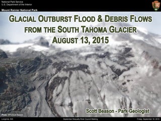
- 1. National Park Service U.S. Department of the Interior Mount Rainier National Park Friday, September 18, 2015Longmire, WA September Nisqually River Council Meeting Photo: NPS/Scott Beason
- 2. National Park Service U.S. Department of the Interior Mount Rainier National Park Friday, September 18, 2015Longmire, WA September Nisqually River Council Meeting TAHOMA GLACIER SOUTH TAHOMA GLACIER Point Success (14,158 ft) Saint Andrews Rock (10,992 ft) Sunset Amphitheater Emerald Ridge (RER) Seismograph Source:GoogleEarth Glacier Island Pyramid Peak (6,937 ft) 1.Setting2.History3.August134.Findings5.Future6.Conclusions
- 3. National Park Service U.S. Department of the Interior Mount Rainier National Park Friday, September 18, 2015Longmire, WA September Nisqually River Council Meeting Attribute Value Type Mid-elevation cirque glacier Aspect Southwest Source 10,500 ft (3,200 m) Terminus 6,800 ft (2,072 m) Length 2 mi (3.2 km) Area 550 ac (2.2 km2) Estimated Volume 79,200 acre-feet Water Storage 23 billion gallons Source:NPS/MORAGIS 1.Setting2.History3.August134.Findings5.Future6.Conclusions
- 4. National Park Service U.S. Department of the Interior Mount Rainier National Park Friday, September 18, 2015Longmire, WA September Nisqually River Council Meeting Referencees:Walder&Driedger,1994;NPS/MORAArchives • 37 debris flows between 1967-2006 • High intensity between 1967-1971 and 1986-1992 • No debris flows between 2007-2014 • Nearly all began as “hydrologic anomalies” • Stagnating ice is a major factor 1.Setting2.History3.August134.Findings5.Future6.Conclusions
- 5. National Park Service U.S. Department of the Interior Mount Rainier National Park Friday, September 18, 2015Longmire, WA September Nisqually River Council Meeting Photos:NPS/MORAArchives;NationalAgriculturalImageryProgram(NAIP) 1.Setting2.History3.August134.Findings5.Future6.Conclusions
- 6. National Park Service U.S. Department of the Interior Mount Rainier National Park Friday, September 18, 2015Longmire, WA September Nisqually River Council Meeting Sources:PacificNorthwestSeismicNetwork(PNSN);USGS/CVO;MountRainierNPDispatchRecords Time Event 09:49 – 10:01 First debris flow on RER seismograph 10:16 – 11:02 Second debris flow on RER seismograph 11:21 – 11:43 Third debris flow on RER seismograph 11:58 Visitor Zach Jones videos debris flow on West Side Road (next slide…) 12:02 VIP Yogev radios dispatch about outburst flood 12:26 – 12:34 Final debris flow on RER seismograph 13:01 Surge #5 seen from Wonderland trail suspension bridge 13:28 Surge #6 14:13 Surge #7 14:52 Surge #8 15:27 Surge #9 15:35 Surge #10 16:58 Surge #11 18:22 Surge #12 1.Setting2.History3.August134.Findings5.Future6.Conclusions
- 7. National Park Service U.S. Department of the Interior Mount Rainier National Park Friday, September 18, 2015Longmire, WA September Nisqually River Council Meeting Video:ZacharyJones,UsedwithPermission 1.Setting2.History3.August134.Findings5.Future6.Conclusions 11:58 AM, DF Surge #3
- 8. National Park Service U.S. Department of the Interior Mount Rainier National Park Friday, September 18, 2015Longmire, WA September Nisqually River Council Meeting Photo:NPS/ScottBeason Significant loss of debris- covered stagnant ice (calving?) at terminus 1.Setting2.History3.August134.Findings5.Future6.Conclusions
- 9. National Park Service U.S. Department of the Interior Mount Rainier National Park Friday, September 18, 2015Longmire, WA September Nisqually River Council Meeting As many as four discrete debris flow signatures on the Emerald Ridge seismograph Source:PacificNorthwestSeismicNetwork(PNSN);SethMoran,USGS/CVO DF #1: 09:49 – 10:01 DF #2: 10:16 – 11:02 DF #3: 11:21 – 11:43 (most energetic) DF #4: 12:26 – 12:34 1.Setting2.History3.August134.Findings5.Future6.Conclusions
- 10. National Park Service U.S. Department of the Interior Mount Rainier National Park Friday, September 18, 2015Longmire, WA September Nisqually River Council Meeting Photo:NPS/ScottBeason Significant discharge (2-3x) observed from South Tahoma Glacier for at least 2 days 1.Setting2.History3.August134.Findings5.Future6.Conclusions
- 11. National Park Service U.S. Department of the Interior Mount Rainier National Park Friday, September 18, 2015Longmire, WA September Nisqually River Council Meeting Source:Worldview2Satellite;NPSMORAGIS Main channel shifted to the east just downstream of the terminus 1.Setting2.History3.August134.Findings5.Future6.Conclusions
- 12. National Park Service U.S. Department of the Interior Mount Rainier National Park Friday, September 18, 2015Longmire, WA September Nisqually River Council Meeting Significant incision into “Little Ice Age” moraine lead to “bulking up” of sediment and instability of upper basin Photo:NPS/ScottBeason 1.Setting2.History3.August134.Findings5.Future6.Conclusions
- 13. National Park Service U.S. Department of the Interior Mount Rainier National Park Friday, September 18, 2015Longmire, WA September Nisqually River Council Meeting Photo:NPS/HeatherSharp As many as 12 discrete high flow or hyper-concentrated flows observed by park staff and visitors 1.Setting2.History3.August134.Findings5.Future6.Conclusions
- 14. National Park Service U.S. Department of the Interior Mount Rainier National Park Friday, September 18, 2015Longmire, WA September Nisqually River Council Meeting Debris flows ended in the vicinity of the Tahoma Creek Trail 1.Setting2.History3.August134.Findings5.Future6.Conclusions Photo:NPS/MitchHaynes
- 15. National Park Service U.S. Department of the Interior Mount Rainier National Park Friday, September 18, 2015Longmire, WA September Nisqually River Council Meeting Area loss: 5.85 acres Average Thickness: 16.7 ft Volume: 4.2 million ft3 Source:Worldview2Satellite;DavidShean,UniversityofWashington 1.Setting2.History3.August134.Findings5.Future6.Conclusions
- 16. National Park Service U.S. Department of the Interior Mount Rainier National Park Friday, September 18, 2015Longmire, WA September Nisqually River Council Meeting Photo:USGS/CarolynDriedger Given its step-like morphology and what appears to be a large area of stagnant ice, we are potentially entering a period of increased glacial outburst floods & debris flows from the South Tahoma Glacier 1.Setting2.History3.August134.Findings5.Future6.Conclusions Glacial Ice Terminus Debris-covered Stagnant Ice 8/13 Source Terminus Pro-glacial Debris
- 17. National Park Service U.S. Department of the Interior Mount Rainier National Park Friday, September 18, 2015Longmire, WA September Nisqually River Council Meeting Photo:NPS/ScottBeason 1.Setting2.History3.August134.Findings5.Future6.Conclusions
- 18. National Park Service U.S. Department of the Interior Mount Rainier National Park Friday, September 18, 2015Longmire, WA September Nisqually River Council Meeting • South Tahoma Glacier and Tahoma Creek have a rich history of outburst floods and debris flows 1.Setting2.History3.August134.Findings5.Future6.Conclusions
- 19. National Park Service U.S. Department of the Interior Mount Rainier National Park Friday, September 18, 2015Longmire, WA September Nisqually River Council Meeting • South Tahoma Glacier and Tahoma Creek have a rich history of outburst floods and debris flows • The 8/13/15 event was likely caused by an outburst flood and calving event that “bulked up” in pro-glacial lateral moraine debris 1.Setting2.History3.August134.Findings5.Future6.Conclusions
- 20. National Park Service U.S. Department of the Interior Mount Rainier National Park Friday, September 18, 2015Longmire, WA September Nisqually River Council Meeting • South Tahoma Glacier and Tahoma Creek have a rich history of outburst floods and debris flows • The 8/13/15 event was likely caused by an outburst flood and calving event that “bulked up” in pro-glacial lateral moraine debris • Four debris flows and 12 high flow surges were seen 1.Setting2.History3.August134.Findings5.Future6.Conclusions
- 21. National Park Service U.S. Department of the Interior Mount Rainier National Park Friday, September 18, 2015Longmire, WA September Nisqually River Council Meeting • South Tahoma Glacier and Tahoma Creek have a rich history of outburst floods and debris flows • The 8/13/15 event was likely caused by an outburst flood and calving event that “bulked up” in pro-glacial lateral moraine debris • Four debris flows and 12 high flow surges were seen • The event was exceedingly well documented 1.Setting2.History3.August134.Findings5.Future6.Conclusions
- 22. National Park Service U.S. Department of the Interior Mount Rainier National Park Friday, September 18, 2015Longmire, WA September Nisqually River Council Meeting • South Tahoma Glacier and Tahoma Creek have a rich history of outburst floods and debris flows • The 8/13/15 event was likely caused by an outburst flood and calving event that “bulked up” in pro-glacial lateral moraine debris • Four debris flows and 12 high flow surges were seen • The event was exceedingly well documented • New technology is allowing us to better understand outburst floods and debris flows 1.Setting2.History3.August134.Findings5.Future6.Conclusions
- 23. National Park Service U.S. Department of the Interior Mount Rainier National Park Friday, September 18, 2015Longmire, WA September Nisqually River Council Meeting 1.Setting2.History3.August134.Findings5.Future6.Conclusions A new debris flow occurred Saturday, September 12, 2015, between 17:24 – 17:50 Accompanied by increased stream flow for 24-48 hours MUCH larger event!
- 24. National Park Service U.S. Department of the Interior Mount Rainier National Park Friday, September 18, 2015Longmire, WA September Nisqually River Council Meeting Scott Beason Park Geologist Mount Rainier National Park Scott_Beason@nps.gov (360) 569-6781 Photo: NPS/Scott Beason