OBIS at IODE-XXII pre-conference workshop
•
1 recomendación•2,037 vistas


Recomendados
Recomendados
Más contenido relacionado
La actualidad más candente
La actualidad más candente (19)
Similar a OBIS at IODE-XXII pre-conference workshop
Similar a OBIS at IODE-XXII pre-conference workshop (20)
Último
Último (20)
OBIS at IODE-XXII pre-conference workshop
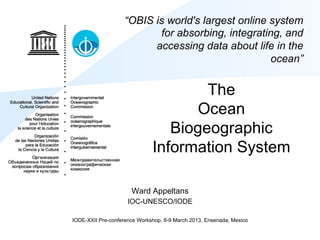
- 1. “OBIS is world's largest online system for absorbing, integrating, and accessing data about life in the ocean” The Ocean Biogeographic Information System Ward Appeltans IOC-UNESCO/IODE IODE-XXII Pre-conference Workshop, 8-9 March 2013, Ensenada, Mexico
- 2. Census of Marine Life (2000-2010)
- 3. Census of Marine Life (2000-2010) • 2,700 scientists • 80+ nations • 540 expeditions • US$ 650 million • 2,600+ scientific publications • 6,000+ potential new species • 30 million distribution records and counting
- 4. Ocean Biogeographic Information System OBIS is the world’s largest open access, online repository of spatially referenced marine life data that: – Nations can use to develop national and regional assessments, to discover trends, gaps and biodiversity hotspots and to meet their obligations to the Convention on Biological Diversity and other international commitments. – Stimulates research about our oceans to generate new hypotheses concerning evolutionary processes, species distributions, and roles of organisms in marine systems on a global scale. – Forms a baseline of marine life’s diversity, distribution, and abundance against which future change can be measured.
- 5. OBIS at IOC-UNESCO In June 2009, the 25th Session of the IOC Assembly decided through Resolution XXV-4 to adopt OBIS as part of IODE, because: 1. Knowledge of the oceans biodiversity is of such importance to national and global environmental issues that the responsibility for its continuing success should be assumed by governments. 2. IOC Member States have repeatedly identified the need to acquire ocean biogeographic data for national ocean and coastal resource management. 3. Without accurate, repeatable and timely biological data it is impossible to address adequately the global ocean environmental issues of pollution, climate impact and mitigation, ocean acidification, ecosystem management, biodiversity loss, and habitat destruction (Resolution of the UN General Assembly A/RES/63/111) 4. OBIS provided the opportunity to adopt an existing global network for biogeographic data and to attract the associated research community that can and should be a continuous part of the Commission’s ocean mandate.
- 6. 10th Conference of the Parties to the Convention on Biological Diversity In Nagoya October 2010, the 10th Conference of the Parties to the Convention on Biological Diversity (Decision COP10/29 para 10 and 35;) requested Member States to further enhance globally networked scientific efforts, such as the Ocean Biogeographic Information System (OBIS), to continue to update a comprehensive and accessible global database of all forms of life in the sea, and further assess and map the distribution and abundance of species in the sea, and; Called upon IOC to facilitate availability and inter-operability of the best available marine and coastal biodiversity data sets and information across global, regional and national scales. As a result OBIS is playing a crucial role in providing scientific guidance, data and information for the identification of Ecologically or Biologically Significant marine Areas, through a series of regional workshops in 2011, 2012 and 2013 convened by the CBD, as part of the UN Strategic Plan for Biodiversity 2011-2020, and in particular to contribute to Aichi Biodiversity Target 11 to conserve and sustainably manage at least 10 per cent of coastal and marine areas by 2020.
- 7. CBD-COP10 listed OBIS as a key source of information for the identification of Ecologically or Biologically Significant Areas (EBSAs) part of CBD" Areas of high biodiversity Areas of special importance for the life history of a species Areas of significant naturalness Areas of uniqueness or rarity
- 8. OBIS contributions to the CBD process:" (1) national reporting and (2) open oceans & deep seas " National EEZ data queries Open-ocean ABNJ data queries Open-access data made International collaborative available to all countries data and research in areas and communities beyond national jurisdiction
- 9. OBIS contributions to the CBD EBSA process " North Pacific regional EBSA workshop, Moscow, 25 Feb – 1 March 2013
- 10. OBIS contributions to the CBD EBSA process " OBIS data are being used to support the identification of sites meeting the EBSA criteria at each regional workshop. OBIS data layers include: • Species observations • Biological Diversity indices • IUCN Red List species Eastern Tropical & Temperate Pacific EBSA workshop, Galapagos Ecuador, August 2012
- 11. OBIS contributions to the CBD EBSA process " examples Marine Mammal Observations IUCN Red-List Species Eastern Tropical & Temperate Pacific Wider Caribbean and Western EBSA workshop, Galapagos Mid-Atlantic workshop, Recife, Ecuador, August 2012 Brazil, February 2012
- 12. OBIS contributions to the CBD EBSA process " Biological Diversity all taxa Wider Caribbean and Western Mid-Atlantic workshop, Recife, Brazil, February 2012 Proposed site meeting EBSA criteria: Abrolhos Bank & Vitoria-Trindade Chain Described in-part due to high regional biodiversity as depicted using OBIS data.
- 13. Species distribution modeling (aquamaps) Flathead mullet (point data)
- 14. Species distribution modeling (aquamaps) Flathead mullet (native range)
- 15. Species distribution modeling (aquamaps) Flathead mullet (Year 2050 range)
- 16. Summary Stats
- 17. Summary Stats
- 18. Summary Stats
- 19. Summary stats (1950-2004) # records increases steadily, until it begins to level off records around 1990 species Decline # species through the 1980s, but then an increase subsequently
- 20. # new species recorded in OBIS 2200 2000 1800 # New Species 1600 1400 1200 1000 1950 1960 1970 1980 1990 2000 year
- 21. Data e-infrastructure Initiative for Fisheries Management and Conservation of Marine Living Resources (i-Marine) • Research Infrastructures CP & CSA funded by the European Commission under the FP7 Capacities Programme - eInfrastructure Unit DG CONNECT (1 Nov 2011 - 30 April 2014) • Launch an initiative aimed at establishing and operating an e-infrastructure supporting the principles of the Ecosystem Approach to Fisheries Management and Conservation of Marine Living Resources.
- 22. Trend Analysis and biodiversity assessments • What are the most common species (10 - 25 or n) reported in OBIS (per taxon, region, period) and is this changing over time? • Are we observing more or fewer species? • Species Status: – Species with IUCN status per MPA – Endemic species per MPA (Nr and occurrences) – Species with IUCN status in < n MPA – Edge effect; MPA near species distribution extension
- 23. The Unknown Ocean: A slice Red = many records, dark blue none Coastal areas > open waters; Surface areas > the deep sea; Vertebrates and other large animals > smaller invertebrates; Northern hemisphere > southern. The vast midwaters, Earth s largest habitat by volume, mostly unexplored (~95%) Source: CoML OBIS Webb, O Dor, Vanden Berghe
- 24. World Ocean Assessment: First Global Integrated Marine Assessment of the Regular Process for Global Reporting and Assessment of the State of the Marine Environment, including Socioeconomic Aspects Part VI Assessment of marine biological diversity and habitats • Section A — Overview of marine biological diversity – Chapter 34 Scale of marine biological diversity – Chapter 35 Extent of assessment of marine biological diversity – Chapter 36 Overall status of major groups of species and habitats • Section B — Marine ecosystems, species and habitats scientifically identified as threatened, declining or otherwise in need of special attention or protection – Chapter 37 Coastal rock and biogenic habitats and related species – Chapter 38 Coastal sediment habitats and related species – Chapter 39 Shelf rock and biogenic reef habitats and related species – Chapter 40 Shelf sediment habitats and related species – Chapter 41 Deep sea habitats and related species – Chapter 42 Water column habitats and related species • Section C — Environmental, economic and/or social aspects of the conservation of marine species and habitats and capacity-building needs – Chapter 43 Significant environmental, economic and/or social aspects in relation to the conservation of marine species and habitats – Chapter 44 Capacity-building needs • Section D — Summary on marine biological diversity – Chapter 45 Summary on marine biological diversity
- 25. Ocean Biogeographic Information System http://www.iobis.org/ Search data based on Taxonomy Datasets Geographical boundaries Time, season, depth Oceanographic variables
- 26. Association of observation points with oceanography Observation data associated with Environmental attributes from World Ocean Atlas ! Bottom depth ! Temperature ! Salinity ! Nitrogen / Oxygen ! Phosphate / Silicate Visualized through interactive graphs ! Time-series graphs ! Histograms WOA09, http://www.nodc.noaa.gov/OC5/WOA09/pr_woa09.html
- 27. OBIS allows extraction of observations based on environmental conditions Example map #1 Cetacean species observations in LME region Celtic-Biscay Shelf (no environmental conditions set) Example map #2 Cetacean species observations in LME region Celtic-Biscay Shelf filtered by a temperature range of 13 to 15 degrees
- 28. User Statistics: 1 March 2011-2013 (Google Analytics) • Visits: 187,906 (av. ± 400 on a regular working day) • Unique visitors: 124,587 • Returning visitors: 35% • Pages/visit: 2,34 • Mobile devices/ipad: 2%
- 29. User Statistics Country(/(Territory( Visits( %(Visits( Country(/(Territory(%(New(Visits( 1" United"States" 47858" 25,5" 1" Hong"Kong" 95,31%" 2" Turkey" 12392" 6,6" 2" Turkey" 86,77%" 3" Canada" 10412" 5,5" 3" China" 76,04%" 4" Germany" 9948" 5,3" 4" Philippines" 74,27%" 5" United"Kingdom" 9301" 4,9" 5" (not"set)" 74,03%" 6" France" 7628" 4,1" 6" India" 73,24%" 7" Brazil" 7614" 4,1" 7" ArgenGna" 71,15%" 8" Spain" 6808" 3,6" 8" Italy" 70,52%" 9" Australia" 5556" 3,0" 9" United"States" 68,14%" 10" Mexico" 5269" 2,8" 10" Spain" 67,32%" 11" Japan" 5226" 2,8" 11" Australia" 64,69%" 12" Belgium" 3890" 2,1" 12" United"Kingdom" 61,28%" 13" Italy" 3731" 2,0" 13" Colombia" 61,00%" 14" India" 3330" 1,8" 14" Brazil" 60,84%" 15" Portugal" 3155" 1,7" 15" Netherlands" 60,70%" 16" Russia" 2637" 1,4" 16" Germany" 59,74%" 17" Chile" 2413" 1,3" 17" Japan" 56,58%" 18" (not"set)" 2118" 1,1" 18" Portugal" 54,96%" 19" Netherlands" 2005" 1,1" 19" Canada" 54,20%" 20" Colombia" 1659" 0,9" 20" France" 53,49%" 21" China" 1653" 0,9" 21" South"Korea" 53,16%" 22" Hong"Kong" 1622" 0,9" 22" Mexico" 51,47%" 23" South"Korea" 1597" 0,8" 23" Chile" 46,66%" 24" Philippines" 1364" 0,7" 24" Belgium" 45,73%" 25" ArgenGna" 1345" 0,7" 25" Russia" 44,22%"
- 30. User Statistics City( Visits( Aydin" 3854" (not"set)" 3113" Sao"Paulo" 2272" Izmir" 2087" Oberlin" 1695" London" 1647" Sydney" 1640" Oostende" 1638" Hong"Kong" 1622" Dartmouth" 1605" Paris" 1521" Yokohama" 1484" Istanbul" 1459" Barcelona" 1458" Mexico"City" 1334" New"York" 1219" Rio"de"Janeiro" 1163" New"Brunswick" 1161" San"Francisco" 1143" Halifax" 1074" Madrid" 1049" Washington" 1026" Singapore" 1014" Lisbon" 1012" Brisbane" 985"
- 31. Social Media • 272 members – 88% senior level, 36% research function • 148 followers – 500–1,000 readers • 74 followers
- 32. Outreach • PPT presentations – 100–200 views each • OBIS Public Library – OBIS papers classified per year, per node – 25 papers in 2012 • Tracks OBIS publications – >800 publications
- 33. Papers citing OBIS (Google Scholar) 800 12 700 10 Cummulative # papers citing OBIS # papers citing OBIS per month 600 08 500 400 06 300 04 200 02 100 0 00 1998 2000 2002 2004 2006 2008 2010 2012 2014
- 34. OBIS data growth: # records 35 million geo-referenced species observations (+ 5 million since Jan 2011) 40 35 30 25 #rrecords in millions 20 15 10 5 0 Apr-01 Sep-02 Jan-04 May-05 Oct-06 Feb-08 Jul-09 Nov-10 Apr-12 Aug-13
- 35. OBIS data growth: # datasets 1,130 datasets (+ 219 since Jan 2011) 1200 1000 800 600 400 200 0 Apr]01" Sep]02" Jan]04" May]05" Oct]06" Feb]08" Jul]09" Nov]10" Apr]12" Aug]13"
- 36. OBIS data growth:# records.k/dataset 180 160 140 120 100 80 60 40 20 0 Apr-01 Sep-02 Jan-04 May-05 Oct-06 Feb-08 Jul-09 Nov-10 Apr-12 Aug-13
- 37. OBIS data growth: # marine species.k 120,000 marine species (+ 5,000 since Jan 2011) 140.00 120.00 100.00 80.00 60.00 40.00 20.00 0.00 Apr-01 Sep-02 Jan-04 May-05 Oct-06 Feb-08 Jul-09 Nov-10 Apr-12 Aug-13
- 38. Very little historical data 1400000 1200000 1000000 #records in OBIS 800000 600000 400000 200000 0 1900 1920 1940 1960 1980 2000 2020
- 39. OBIS Network Stakeholders OBIS is a Partnerships with CBD, GBIF, EOL, GOBI, GOOS, strategic FAO, UNEP-WCMC, ICES, SMEBD/WoRMS, Species2000, GCMD, SCOR, alliance of Users CBOL, … OBIS task hundreds of policy makers, teams scientists and managers, OBIS organisations researchers, OBIS public PO Group of who contribute Experts data, OBIS information Steering Group and expertise OBIS Nodes to OBIS. Data providers
- 40. Six (informal) task teams 1. Technical task team (data system architecture, and data portal) 2. Documentation/Training task team (QC, data validation, standards and best practices) 3. Data task team (data and metadata schemes) 4. Governance task team (sustainability plan, governance model, vision, objectives, partnerships, funding) 5. Taxonomy task team (name reconciliation) 6. Outreach task team (communication strategy)
- 41. OBIS Data System Architecture portal Queries GBIF GEO Mapping production Extraction EOL iMarine LifeWatch GCMD staging classificati on WoRMS MarineRegions ITIS, CoL, IRMNG WOD/ODP assembly indexin g GEBCO QC node node node -Excel, DiGIR, IPT -OBIS (extended DwC) schema
- 42. Data flows in OBIS Current Future
- 43. Draft ToR OBIS nodes • Receiving or harvesting marine biodiversity data (and metadata) from national, regional and international programs, and the scientific community at large. • Perform data validation (using standards, tools and best practices), as described in the OBIS cookbook (OBIS tier II). • Reporting the results of quality control directly to data collectors/ originator. • Making data (and metadata) available to OBIS using agreed upon standards and formats (OBIS cookbook). • Control data access, terms of use and sharing policies. • Provide customer support (data queries, analyses, feedback). • Increase visibility and reach out (Communication and Outreach Strategy). • Build customized portals (e.g., multiple languages). • Comply with the IOC data policy for using and sharing OBIS data.
- 44. OBIS nodes (bold = NODC status, green = Candidate node) 1. Antarctica/ AntOBIS 12. Mediterranean/ 18. Global/ MicrOBIS 2. Arctic/ ArcOD/AOOS MedOBIS 19. Global/ OBIS- 3. Argentina/ArOBIS 13. South-East Pacific/ SEAMAP 4. Australia/ OBIS- ESPOBIS 20. Global/ Hexacorals Australia 14. South-West Atlantic/ 21. Global/ FishBase 5. Black Sea/ BlackSea- WSAOBIS 22. Global/ Seamounts OBIS 15. South-West Pacific/ 23. Gulf of Aden 6. Canada/ OBIS- NZOBIS 24. South-East Asia Canada 16. Sub-Saharan/ 25. Caribbean 7. China/ OBIS-China AfrOBIS 8. Europe/ EurOBIS 17. USA/ OBIS-USA 9. India/ IndOBIS 10. Japan/ OBIS-Japan 11. Korea/ KOBIS
- 45. Establishment of new OBIS nodes (for consideration at IODE-XXII) • If the institute is an existing NODC: – Send a letter of “expression of interest” to the OBIS project office, wishing to join the OBIS network of nodes. • If the institute is not an existing NODC, but wishes to apply for an NODC status: – Follow the procedure for NODCs and include your wish to join the OBIS network of nodes. • If the institute is an existing SODC (if the SODC entity type is adopted by the 22nd session of the IODE Committee): – Send a letter of “expression of interest” to the OBIS project office, wishing to join the OBIS network. • If the institute is not an existing SODC, but wishes to apply for an SODC status: – Follow the procedure for SODCs and include your wish to join the OBIS network of nodes.
- 46. Establishment of new OBIS nodes (for consideration at IODE-XXII) The extra information required for OBIS to include in the application/ expression of interest is the following: – Indicate the level of commitment to function as an OBIS tier II and/ or tier III node; – Indicate the person who will act as the OBIS node manager (and deputy). Applications will be reviewed by the IODE Steering Group for OBIS and a decision will be made within two weeks after confirmation of receipt. The results of the decision from the 22nd session of the IODE Committee will affect the final process developed by the SG-OBIS.
- 47. OBIS Standards and Best Practices • Metadata, no single standard – ISO19115 compliancy (GCMD, FGCD, IMIS, EML..) • Data – Geography: OBIS extension of Darwin Core – Taxonomy: basis = World Register of Marine Species, but also ITIS, CoL and IRMNG (when not in WoRMS). • Data harvesting protocols – GBIFs Integrated Publishing Toolkit (IPT) (txt file + EML) – DiGIR (XML) – CSV • Data publishing services – Maps using Open layers – OGC/Open GIS web map/feature/coverage services (OBIS GeoServer)
- 48. QC/data validation/quality flags • Principle OBIS never change records – data cleaning needs to be done at the expert/data providers level. • OBIS can perform data integrity checks (completeness, correctness), add precision and accuracy information (quality flags)
- 49. QC of metadata • Metadata"should"contain:" – Title"(dataset"name,"comprehensive,"not"just"an"acronym)" – CitaGon"(journal"style,"include"Gtle"of"dataset)" – General"descripGon"(abstract)" – Contact"informaGon"(name"–"insGtute"–"email)" – User"restricGons"(most%cases:% freely%available%if%cited )" – Sampling"design"(collaborate"with"GE]BICH"and"ODSBP)" • Metadata"can"also"contain:" – Keywords,"habitat,"species"funcGonal"groups" – Taxonomic"–"temporal"–"geographic"scope/boundaries" – Links"(online%data,%metadata,%project%page,%DiGIR,%IPT%…)" – Associated"documentaGon"(e.g.,%reports,%publica@ons%…)"
- 50. QC of data • Required"(mandatory)"fields" • Taxonomy" • Life"stage"(need"for"vocab"]>"GE]BICH/ODSBP)" • Gender"(need"for"vocab"]>"GE]BICH/ODSBP)" • Geographic"locaGons"(link"to"gazeheer)" • Depth" • Date"–"Gme" – Start"&"end"fields" • Observed"individuals" • Basis"of"record"(literature,"specimen,"observaGon)"
- 51. Taxonomic QC • Taxon Match tool to check if name is available in WoRMS, ITIS, IRMNG, CoL (if name not available in any of those -> more elaborate search in: PaleoDB, IPNI, Euro+Med Plantbase, Index Fungorum, Fishbase, BOLD, Web of Science • Avoid false matches (homonyms) by indicating higher taxonomic group • Translate common names and cases of cf., sp., complexes etc to higher taxonomic level: Received taxon name Matching name Mytiluus sp. Mytilus Gadus cfr. morhua Gadus Cladocera/Ostracoda Crustacea (= common subphylum) Sponges Porifera Bamboo sharks Galeomorphi (superorder) • Add taxon LSID to record (e.g. TSN, AphiaID)
- 52. Name validation tool: Taxon Match This(tool(uses(the(following(components:( :TAXAMATCH(fuzzy(matching(algorithm(by(Tony(Rees( :PHP/MySql(port(of(TAXAMATCH(by(Michael(Giddens( :ScienHfic(Names(Parser(by(Dmitry(Mozzherin(
- 53. TAXON MATCH
- 54. TAXON MATCH
- 55. TAXON MATCH
- 57. Web Services System( Field( Key( Mechanism( WoRMS" Taxon"name" AphiaID" webservice" WoRMS" Parent"taxon" AphiaID" webservice" WoRMS" Child"taxa" AphiaID" webservice" WoRMS" Synonyms" AphiaID" webservice" WoRMS" Common"name" AphiaID" webservice" WoRMS" References" AphiaID" webservice" WoRMS" Ahributes" AphiaID" Not"yet"
- 58. Taxonomic QC • Current"situaGon" "" "±"198,000"taxon"names"in"OBIS:" – ±"153,500"matched"to"WoRMS"" Overlap"of"±"72"000"taxa" – ±"80,000"matched"to"ITIS" – ±"31,500"not"matched"to"any"standard"(WoRMS,"ITIS,"CoL,"IRMNG)" • Plan OBIS Taxonomic Task Team – April 2013: Status report on numbers of errors (per taxonomic groups and time) – June 2013: Preliminary Cleaning Assessment – Cleaning up residual errors – Ongoing
- 59. Geographic QC • Fields in OBIS 1. LaHtude( 2. Longitude( 3. Start"laGtude" 4. End"laGtude" 5. Start"longitude" 6. End"longitude" 7. Coordinate"precision" 8. Start/end"coordinate"precision" 9. Bounding"box" 10. ConGnent"ocean" 11. Country" 12. State"province" 13. County" 14. Locality"
- 60. Geographic QC • Are"the""laGtude"and"the"longitude"completed"and"are"their"values"different" from"0?" • Are"the"laGtude"or"the"longitude"completed"and"are"their"decimal"values" between"]90"and"+90"(laGtude)"and"between"]180"and"+180"(longitude)" (WGS84)?" • Decimal"check"(X,aabb":"if"aa"<59"and"bb"<59"it"may"mean"the"coordinates"are" not"decimals,"but"degrees,"minutes"and"seconds)""" • Are"the"coordinates"situated"in"sea"or"coast"(buffer"20km)?" • Are"the"coordinates"situated"in"the"right"geographical"area"(fields"9]14,"or"" e.g."AtlanGc"spohed"dolphins"should"not"be"found"in"the"Pacific)?" • Is"the"observaGon"point"not"an"outlier"in"the"dataset?"" – Is"the"observaGon"point"not"more"than"4"X"standard"deviaGon"from"the"centroid"of"the" dataset?" • Is"the"observaGon"point"not"an"outlier"in"the"observaGons"of"the"species?"" – Is"the"observaGon"point"not"more"than"4"X"standard"deviaGon"from"the"centroid"of"the" observaGons"from"that"species?
- 61. Geographic QC Example%dataset%“Marine%Turtles”:% sigh@ngs%and%strandings%of%marine%turtles%around%the%coast%of%UK%and%Ireland”" Outliers%due%to%missing%of%minus%sign.%Correc@ons%made%aKer%consulta@on%data%provider."
- 62. Geographic QC • Related to depth: – Is the minimum depth < maximum depth? – Is the observation depth possible if compared with a depth map (include margin)? – Is the observation depth possible if compared with the given depth range of the species • Related to environmental parameters: – Is the observation possible if compared with the given (min- max) salinity, temperature, oxygen, nutrient range of the species
- 63. QC Presence, abundance, biomass • Is the field 'sample size' completed if the value of the field 'Observed individual count’ or 'observed weight' >0?
- 64. Date QC • Fields in OBIS 1. YearCollected 2. MonthCollected 3. DayCollected 4. StartYearCollected 5. StartMonthCollected 6. StartDayCollected 7. EndYearCollected 8. EndMonthCollected 9. EndDayCollected 10. StartTimeOfDay 11. EndTimeOfDay 12. TimeOfDay 13. Timezone
- 65. Date QC • Is the collection date (year, month, day, end-start) completed and valid (i.e. between 1300 and now)? • Is the ‘collection date’ <= the ‘date identified’ and <= the ‘last modified date’ • If the start date and the end date are completed, is the start date < the end date (taking into consideration the given time)? • Is the time/starttime/endtime >= 0 and <24 and is the timezone completed
- 66. Date QC =>produce time graph for visual check.
- 67. Future plans • Expand on data types (marine extension of Darwin Core) – Tracking data – Acoustics – Images (e.g. fin patterns) • Expand geographical coverage • Capacity building – Biological data management – Regional marine biological observatories • Close collaboration with IODE projects and IOC and UNESCO programmes