NISAR NASA-ISRO Synthetic Aperture Radar (NISAR) Hazards in Texas
•
0 recomendaciones•11 vistas

NISAR Hazards in Texas NASA National Aeronautics and Space Administration NASA-ISRO Synthetic Aperture Radar (NISAR) By Dr. Pankaj Dhussa
![ã2017 California Institute of Technology. Government sponsorship acknowledged.
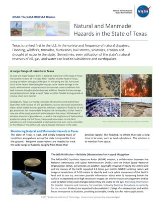
NISAR: The NASA-ISRO SAR Mission
To accurately address the adverse effects on economy and
environment associated with various natural hazards in
Texas, it is critical to use radar observations, such as
NISAR, that can collect data regardless of weather
conditions, during both day and night.
Radar images can delineate areas affected by hurricanes,
tornadoes, or other severe weather events to help
evaluate the magnitude and severity of the damage.
Large-area-coverage and frequent-revisit radar
observations from NISAR can also be used in the
estimation of changes in soil moisture to determine
drought conditions. These are particularly effective in
mapping and monitoring flood extents, even during
inclement weather conditions when optical instruments
cannot see through the clouds. Using radar
interferometry (InSAR), radar images can be used to
monitor land subsidence caused by processes such as the
compaction of underground water-bearing rock, sinkhole
collapse, or hydrocarbon extraction. This allows for the
identification and classification of the causes and
mechanisms responsible for the observed land surface
movement, so that action can be taken to prevent,
reduce, or mitigate the damages incurred from such
hazards. InSAR data is also effective when applied to
seismic hazards, and has proven useful in the
identification and monitoring of active faults. In this way,
seismic risk can be determined.
NISAR will be the first NASA earth observing radar to
image all the U.S. lands and coastal waters on a regular
basis, with every location imaged at least once a week. All
NISAR data products, including the InSAR images, will be
available through an open access web portal. In this way,
the nation’s investment in land surveys remotely acquired
from space can be most widely used to help prevent
natural and accidental hazards from becoming disasters.
National Aeronautics and Space Administration For more information, visit http://nisar.jpl.nasa.gov/applications
Jet Propulsion Laboratory / California Institute of Technology / Pasadena, California / www.jpl.nasa.gov
Land Subsidence in Harris County, Texas
The figure to the right shows a map of the average ground
movement around the Houston area derived from radar images
obtained from 1995-1998. During that time, the peak land surface
drawdown was about 50 mm/year over Harris Country in
northwestern Houston [Qu et al., 2015].
Land subsidence, like that shown in this figure, has caused
extensive damage to buildings and infrastructure, resulting in the
loss of groundwater storage, reactivated faults, generated fissures,
and increased seawater intrusion that caused loss of wetland
habitat. Measuring land subsidence is just one example of how
NISAR will allow us to identify and monitor the various hazards
occurring statewide in Texas, so that we can better protect lives,
property, resources, the environment and the economy.
Ground-based monitoring techniques and GPS observations
provide precise subsidence measurements, but they only measure
what is happening at a single location. Radar can provide high-
accuracy measurements of ground movement over large regions
through time, enabling us to get a better understanding of the
evolution in both space and time of processes responsible for the
observed land surface changes.](data:image/gif;base64,R0lGODlhAQABAIAAAAAAAP///yH5BAEAAAAALAAAAAABAAEAAAIBRAA7)
Recomendados
Recomendados
Más contenido relacionado
Similar a NISAR NASA-ISRO Synthetic Aperture Radar (NISAR) Hazards in Texas
Similar a NISAR NASA-ISRO Synthetic Aperture Radar (NISAR) Hazards in Texas (20)
Más de Dr. Pankaj Dhussa
Más de Dr. Pankaj Dhussa (20)
Último
Último (20)
NISAR NASA-ISRO Synthetic Aperture Radar (NISAR) Hazards in Texas
- 1. ã2017 California Institute of Technology. Government sponsorship acknowledged. NISAR: The NASA-ISRO SAR Mission Monitoring Natural and Manmade Hazards in Texas The state of Texas is vast, and simply keeping track of conditions everywhere across the state is impossible from the ground. Frequent observations are needed to track the wide range of hazards, ranging from those that develop rapidly, like flooding, to others that take a long time to be seen, such as land subsidence. The solution is to monitor from space. Natural and Manmade Hazards in the State of Texas Texas is ranked first in the U.S. in the variety and frequency of natural disasters. Flooding, wildfires, tornados, hurricanes, hail storms, sinkholes, erosion and drought all occur in the state. Sometimes, even utilization of the state’s natural reserves of oil, gas, and water can lead to subsidence and earthquakes. A Large Range of Hazards in Texas At least one major disaster event is declared every year in the state of Texas. The southern extent of “Tornado Alley” reaches into the heart of Texas, causing tornadoes throughout the year. In the spring and fall, hurricanes (such as the recent devastating Harvey) can cause severe damage in the south, while extreme temperatures in the summer create conditions that lead to severe droughts and widespread wildfires. Despite the low average annual precipitation, large areas of Texas are often flooded during periods of intense, short-term rainfall. Geologically, Texas is primarily composed of salt domes and sedimentary layers that hold valuable oil and gas deposits, but are also easily dissolved by water, which makes the area prone to sinkholes. Injection of fluids for oil and gas production has increased the frequency of earthquakes, so that Texas is now one of the most seismically active states in the nation. Withdrawal of extreme amounts of groundwater, as well as the long history of hydrocarbon production along the Gulf Coast, has caused some areas to sink (land subsidence), and these populated areas have become even more vulnerable to the effects of the plethora of natural hazards that occur in the state. The NISAR Mission – Reliable Observations for Hazard Mitigation The NASA–ISRO Synthetic Aperture Radar (NISAR) mission, a collaboration between the National Aeronautics and Space Administration (NASA) and the Indian Space Research Organization (ISRO), will provide all-weather, day/night imaging of nearly the entire land and ice masses of the Earth repeated 4-6 times per month. NISAR’s orbiting radars will image at resolutions of 5-10 meters to identify and track subtle movement of the Earth’s land and its sea ice, and even provide information about what is happening below the surface. Its repeated set of high resolution images can inform resource management and be used to detect small-scale changes before they are visible to the eye. Providing information for disaster response and recovery, for example, following floods or tornadoes, is a priority for the mission. Products are expected to be available 1-2 days after observation, and within hours in response to disasters, providing actionable, timely data for many applications. Photos: UL (NOAA), UR (Texas A&M Forest Service), LL (NOAA), and LR (FEMA)
- 2. ã2017 California Institute of Technology. Government sponsorship acknowledged. NISAR: The NASA-ISRO SAR Mission To accurately address the adverse effects on economy and environment associated with various natural hazards in Texas, it is critical to use radar observations, such as NISAR, that can collect data regardless of weather conditions, during both day and night. Radar images can delineate areas affected by hurricanes, tornadoes, or other severe weather events to help evaluate the magnitude and severity of the damage. Large-area-coverage and frequent-revisit radar observations from NISAR can also be used in the estimation of changes in soil moisture to determine drought conditions. These are particularly effective in mapping and monitoring flood extents, even during inclement weather conditions when optical instruments cannot see through the clouds. Using radar interferometry (InSAR), radar images can be used to monitor land subsidence caused by processes such as the compaction of underground water-bearing rock, sinkhole collapse, or hydrocarbon extraction. This allows for the identification and classification of the causes and mechanisms responsible for the observed land surface movement, so that action can be taken to prevent, reduce, or mitigate the damages incurred from such hazards. InSAR data is also effective when applied to seismic hazards, and has proven useful in the identification and monitoring of active faults. In this way, seismic risk can be determined. NISAR will be the first NASA earth observing radar to image all the U.S. lands and coastal waters on a regular basis, with every location imaged at least once a week. All NISAR data products, including the InSAR images, will be available through an open access web portal. In this way, the nation’s investment in land surveys remotely acquired from space can be most widely used to help prevent natural and accidental hazards from becoming disasters. National Aeronautics and Space Administration For more information, visit http://nisar.jpl.nasa.gov/applications Jet Propulsion Laboratory / California Institute of Technology / Pasadena, California / www.jpl.nasa.gov Land Subsidence in Harris County, Texas The figure to the right shows a map of the average ground movement around the Houston area derived from radar images obtained from 1995-1998. During that time, the peak land surface drawdown was about 50 mm/year over Harris Country in northwestern Houston [Qu et al., 2015]. Land subsidence, like that shown in this figure, has caused extensive damage to buildings and infrastructure, resulting in the loss of groundwater storage, reactivated faults, generated fissures, and increased seawater intrusion that caused loss of wetland habitat. Measuring land subsidence is just one example of how NISAR will allow us to identify and monitor the various hazards occurring statewide in Texas, so that we can better protect lives, property, resources, the environment and the economy. Ground-based monitoring techniques and GPS observations provide precise subsidence measurements, but they only measure what is happening at a single location. Radar can provide high- accuracy measurements of ground movement over large regions through time, enabling us to get a better understanding of the evolution in both space and time of processes responsible for the observed land surface changes.