Recomendados

Recomendados
Más contenido relacionado
La actualidad más candente
La actualidad más candente (20)
Similar a InlailawatashGISBrochure_PosterONLY
Similar a InlailawatashGISBrochure_PosterONLY (20)
InlailawatashGISBrochure_PosterONLY
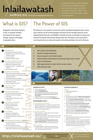
- 1. InlailawatashWhat is GIS? Geographic Information Systems, or GIS, is computer software that allows for the capture, storage, analysis, and display of geospatial data. CARTOGRAPHY a. Bioregional inventory atlas creation b. Biophysical and cultural data composition c. Thematic mapping d. Land use mapping e. Cadastral and legal mapping USE AND OCCUPANCY MAPPING a. Base map production and printing b. Digitization and dataset creation c. Biography, category + hodgepodge map production d. Density/hotspot analysis ARCHAEOLOGY MAPPING a. Mapping to support Archaeological Impact Assessments (AIA) and Archaeological Overview Assessments (AOA) b. Archaeological potential modeling c. Historic transport and energetics modeling d. Place Name mapping e. Referral mapping and analysis DATA COLLECTION a. Direct to digital b. Facilitation of field-based GPS surveys ONLINE MAPPING TOOLS a. Environmental monitoring and analysis b. Preserving traditional knowledge c. Story maps d. Updating Google’s base maps for your community HISTORICAL AIR PHOTOS a. Research and acquisition b. Scanning and digitization c. Georeferencing d. Analysis of change over time GIS SYSTEMS a. Research and assessment b. Hardware and software setup c. Data warehouse setup and maintenance d. Training MAP SCANNING, COPYING + PRINTING a. Up to 42 wide format and 600 DPI scanning into multiple file formats b. Up to 42 wide format copying c. Low-cost printing up to 42 wide on a variety of paper types (including photo, poster, and outdoor) SOURCES OF DATA ++ DataBC www.data.gov.bc.ca ++ GeoGratis www.geogratis.gc.ca ++ UBC Geographic Information Centre Air Photo Collection http://gic.geog.ubc.ca/resources/air-photo-collection- and-services/ ++ Canada’s Open Government Portal http://data.gc.ca/ ++ Integrated Cadastral Information Society www.icisociety.ca RECOMMENDED TOOLS FULL-FEATURED GIS SOFTWARE ++ ESRI ArcGIS (commercial) — the definitive world leader in GIS software. ArcGIS lets you do just about anything, for a price ++ QGIS (free/open source) — a fully functioning desktop GIS that runs on Linux, Windows and MacOS GIS VIEWER SOFTWARE ++ Google Earth (free) — navigate planet earth using satellite imagery and other map layers ++ ArcGIS Online (commercial) — create a map that can be viewed in a browser, desktop or mobile device. Share it on a blog, via email, or embed it in a website ++ iMapBC www.data.gov.bc.ca/dbc/geographic/view_and_ analyze/imapbc/index.page — view thousands of BC map layers in a user friendly interactive mapping application ARCGIS PLUGINS ++ ET GeoWizards (free) — enables users with ArcGIS Basic licenses to perform some data processing tasks possible only in Standard and Advanced licenses MAPPING COMMUNITY FORUMS ++ Aboriginal Mapping Network ++ ESRI Forums TRAINING ++ ESRI Training/Lesson Planner www.esri.com/training/main ++ YouTube GIS Tutorials (search “GIS Tutorials” in YouTube) ++ BCIT GIS www.bcit.ca/study/programs/gis — offers a variety of cutting edge GIS training from Advanced Diploma program in GIS to part-time courses available online ++ UNBC GIS www.unbc.ca/continuing-studies/gis-courses — offers a course for using GIS in a First Nations context ++ First Nations Technology Council www.technologycouncil.ca — provides a broad range of courses and training via mobile computer labs and distance learning technology ++ Google Earth Outreach www.google.ca/earth/outreach/ — Google’s program for providing online tools, training and support to non-profit organizations, view KML files CONFERENCES ++ Integrated Cadastral Information Society User Conferences — various locations throughout BC ++ ESRI User Conferences — various locations throughout BC ++ Summit of Technology, Resource, Opportunities, Networks and Growth (STRONG) — a coming together of cutting-edge technologies and First Nations communities at an annual conference formerly known as the ICT Summit • Essential GIS Mapping Resources A business established by the Tsleil-Waututh Nation 3075 Takaya Drive, North Vancouver, BC V7H 3A8 TEL +1 604.924.4169 / FAX +1 604.929.4158 EMAIL contact@inlailawatash.ca Inlailawatash provides a range of Geographic Information Systems (GIS) and mapping services, technical support, and training to Aboriginal communities / NGOs / crown corporations / government entities / private sector organizations. 8. 7. 6. 5. 4. 3. 2. 1. MAPPING/GIS + Information Management Services Inlailawatash GIS software is very powerful, and can be used to manipulate geospatial data in many ways: features can be moved/reshaped; attributes can be changed; features can be added/deleted. Data sets are DYNAMIC. Hundreds of tools are available to analyse and evaluate the spatial relationships between data sets. We begin to see new patterns and characteristics by viewing the spatial relationships between the earth’s features. 1. Gain support from leadership 2. Conduct a needs assessment 3. Secure long-term committed funding 4. Select software and hardware that matches organization’s needs 5. Train or hire GIS staff 6. Seek opportunities to collect fee-for-service income 7. Make beautiful maps • Inlailawatash GIS Services • How to successfully build and keep a mapping program The Power of GIS http://inlailawatash.ca/