
Recomendados
Recomendados
Más contenido relacionado
La actualidad más candente
La actualidad más candente (20)
Similar a Geospatial intelligence satellite applications catapult pdf - july 23 2019
Similar a Geospatial intelligence satellite applications catapult pdf - july 23 2019 (20)
Más de Peter Bloomfield
Más de Peter Bloomfield (11)
Último
Último (20)
Geospatial intelligence satellite applications catapult pdf - july 23 2019
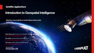
- 1. Catapult Open IntroductiontoGeospatial Intelligence Dan Wicks, Head of Earth Observation daniel.wicks@sa.catapult.org.uk Peter Beaumont, Director of Geospatial Intelligence peter.beaumont@sa.catapult.org.uk Machine Learning/AI on Earth Observation Data 23/07/19 Tom Jones, AI/ML and Earth Observation tom.jones@sa.catapult.org.uk
- 2. Catapult Open Agenda • Introduction to the Satellite Applications Catapult • The Market Opportunity • Introduction to Earth Observation • Example Application Areas
- 3. Catapult Open SATELLITE APPLICATIONS CATAPULT Our Mission // To innovate for a better world, empowered by satellites.
- 4. Catapult Open Who are we? SATELLITE APPLICATIONS CATAPULT An innovation and technology company transforming the way the world uses satellite technology and data. WE HELP ORGANISATIONS GROW THEIR BUSINESS WE ARE INDEPENDENT We help organisations to use satellite applications to grow their business in the UK and internationally. We bring together industry, researchers, end-users and government to explore and develop new ideas. WE ARE GOVERNMENT BACKED We are partly-funded by the Government and work closely with Innovate UK, UK Space Agency, UK Science & Innovation Network, and other public bodies.
- 5. Catapult Open Our focus SATELLITE APPLICATIONS CATAPULT INTEGRATION FOR A CONNECTED AND INFORMATION CENTRIC WORLD APPLICATIONS UBIQUITOUS CONNECTIVITY Super-fast, always on connectivity for the digital age GEOSPATIAL INTELLIGENCE An ever growing demand for information that is accurate, personalised, localised and available globally in real-time
- 6. Catapult Open OUR STRATEGIC VISION ENERGISING THE MARKET Through our market programmes we unlock latent customer demand, open new markets, and drive exports by raising awareness, changing preconceptions and showcasing the power of space derived services. EMPOWERING TECHNOLOGY Through our technology programme we help companies advance their products to be closer to market programme opportunities by identifying the barriers to entry such as regulation, incumbents, or simple accessibility. ENABLING BUSINESS We connect business of all sizes with the resources and facilities they need to launch and grow, opening new routes to market and attracting inward investment. We provide targeted business support, user- centred design expertise and signposting to finance.
- 8. Catapult Open Earth Observation – Growing Opportunity • Satellite-derived EO still relatively immature • Data improving, infrastructure advancing, and applications evolving continuously. • Global satellite-based EO market is buoyant and growing. • Market studies suggest the global industry was worth $43.7 billion in 2017, expected to reach $66.1 billion in 2020 (CAGR of 14.8%) • London Economics’ analysis of the UK space industry suggests that UK EO industry was worth £325 million in 2014/15, double to £625 million by 2020. (CAGR of 11.5%) • Total spend on EO by government is estimated at £1.2bn between 2014 and 2020, equivalent to annual average spend of £175m • Geospatial Commission • Analysis of private sector use cases suggests government could unlock up to £6-11 billion per year of economic value Value of satellite-derived Earth Observation capabilities to the UK Government today and by 2020, London Economics An Initial Analysis of the Potential Geospatial Economic Opportunity, Cabinet Office, 2018
- 9. Catapult Open CEMS Concept Confidentiality Status: Catapult Open Established 2013 Current usage: 48 live environments Projects & SMEs 450+ VMs 1100 Ghz CPU 6.2TB RAM 80% Utilised
- 10. Catapult Open http://sedas.satapps.org/ Confidentiality Status: Catapult Open
- 11. Catapult Open Earth Observation has move on a lot!
- 12. Catapult Open Science of obtaining information about the Earth's physical, chemical and biological systems.
- 13. Catapult Open SPATIAL RESOLUTION Jensen, 2015 Spatial resolution: • smallest separation between two objects that can be resolved; • the size of the cells on the ground
- 15. Catapult Open SPECTRAL RESOLUTION Jensen, 2015 Spectral resolution: • number and dimension of wavelength intervals (‘bands’) in the electromagnetic spectrum Example from Worldview 3
- 16. Catapult Open Data © NASA Image © Satellite Applications Catapult Spectral Resolution
- 17. Catapult Open Data © USGS 2000/2015 Image © Satellite Applications Catapult 2015 Change Detection Temporal Resolution
- 18. 18 Catapult Open Al Zaatari, Jordanien 08.03.2011 Al Zaatari, Jordanien 11.09.2012 Al Zaatari, Jordanien 12.12.2012 Al Zaatari, Jordanien 03.01.2013 Al Zaatari, Jordanien 26.02.2013 Al Zaatari, Jordanien 13.01.2014 Evolution of Al Zaatari refugee camp, Mafraq Governorate, Jordan • WorldView-2 imagery (50cm) @European Space Imaging / DigitalGlobe • Rapid increase of satellite detected shelters and other buildings • Visible areas of expansion through the temporal span, e.g. preparations to accommodate the increasing number of refugees Change Detection
- 19. Catapult Open Copyright © Satellite Applications Catapult Ltd 2015 How many times have we imaged every part of the world? 0 times 15,000 times
- 20. Catapult Open SATELLITE MULTISPECTRAL SENSORS
- 21. Catapult Open EARTH OBSERVATION APPLICATIONS Meteorology Sustainable development Safety and security Global change research Earth system and environmental sciences Mobility Resource management Civil engineering and urban planning
- 22. Catapult Open Harvest logistical planning Growth stage monitoring Grazing management Real-time crop monitoring AGRITECH PROJECTS
- 23. Catapult Open WHO WE ARE Depends on the socio- economic group, the resilient to cope with weather impact varies. On top of that, depends on the built environment, e.g. urban area has mini heat islands, the impact of a weather event is distributed unevenly. Understanding the impact of extreme weather events can support the redesigning built environment and capacity planning to handle ill health. Case Study To understand where the heatwave (2013) hits the hardest Satellite Application • Climate (Weather) • Socio-economic indicators of a population (Heat Vulnerability Index) HEAT VULNERABILITY IN CITIES
- 24. Catapult Open
- 25. Catapult Open www.energeo.co.uk info@energeo.co.uk @energeoltd CLEAN – Solar, Roof Suitability
- 26. Catapult Open UK FloodScore™ AddressRisk: combined risk – Average Annual Loss (defended) Very High Risk High Risk Moderate Risk Low Risk Negligible Risk UK FloodScore™
- 27. Catapult Open 15/08/2019 Urban Planning – supplying information not data @Includes Copyrighted material of DigitalGlobe, Inc., All Rights Reserved
- 28. Catapult Open Interferometric Synthetic Aperture Radar (InSAR) Tunnelling operation in London uplift subsidence • Ground deformation May 2011 – April 2017 • TerraSAR-X satellite (X-band) • Crossrail construction works and their progress clearly visible
- 29. Catapult Open up down Subsidence due to localised compaction Uplift due to rising water table Jubilee Line tunnelling Electricity cable tunnelling Subsidence due to lowering water table Image © TRE
- 30. Catapult Open Image © Remote Sensing Technology Institute DLR
- 31. Catapult Open 31 • Bolivia 7Lithium Prospectivity, Cornwall, UK Carmenellis St. Austell 188km² site with an expansive history of mining activity and more recently reclaimed natural landscapes 111km² site, a landscape that is still subject to intensive mining, providing a current context for environmental monitoring
- 32. Catapult Open Lithium Prospectivity map faults mineral alterations terrain displacement (active faults) vegetation anomalies Legend 1km_prospectivity - 10 class 1km_prospectivity.Prospect 0 - 7 8 - 14 15 - 20 21 - 27 28 - 34 35 - 41 42 - 48 49 - 54 55 - 61 62 - 68 not probable higher probability 1 sqkm probability of Li occurrence lower probability
- 34. Catapult Open Why consider investing in developing Earth Observation applications? • Massively growing opportunity • Contribute to solving todays important challenges • Unprecedented access to data • Essential to optimise information extraction through application of AI/ML • Strong support to develop applications form Catapult network • Look out for funding opportunities Why consider investing in developing Earth Observation applications?
- 35. Catapult Open Thank you Dan Wicks, Head of Earth Observation daniel.wicks@sa.catapult.org.uk Peter Beaumont, Director of Geospatial Intelligence peter.beaumont@sa.catapult.org.uk Tom Jones, AI/ML and Earth Observation tom.jones@sa.catapult.org.uk