

Recomendados
Más contenido relacionado
La actualidad más candente
La actualidad más candente (13)
Destacado
Destacado (17)
Similar a research1
Similar a research1 (20)
research1
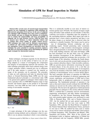
- 1. JOURNAL OF GPRS 1 Simulation of GPR for Road inspection in Matlab B.Rashmi sai* *113EC0220-ECE,burugupallirashmisai@gmail.com, NIT, Rourkela,769008,odisha. Abstract:After several years of research local transportation agencies are now beginning to implement GPR technology for both network and project level surveys. In the area of subgrade soil evaluation GPR techniques have been used to nondestruc- tively identify soil type, to estimate the thickness of overburden and to evaluate the compressibility and frost susceptibility of subgrade soil. In road structure surveys, GPR has been used to measure layer thickness, to detect subsurface defects and to evaluate base course quality. In quality control surveys, GPR techniques have been used for thickness measurements, to estimate air void content of asphalt surfaces and to detect mix segregation. Future developments are described where the technique has great potential in assisting pavement engineers with their new pavement designs and in determining the optimal repair strategies for deteriorated roadways. I. INTRODUCTION Radar techniques, developed originally for the detection of targets in the sky or on the surface of land or sea, are now being adapted as a means of investigating the composition and integrity of nonconducting materials and structures. The radar technique principally detect back-scattered energy from a target; anomalies within a material give rise to reflections and if the radar antenna is scanned over the material an image of the anomalies can be generated. The principles of radar are well understood and radar for detecting buried objects or Ground Penetrating Radar (GPR) uses the same fundamental physical principles as conventional radar. GPR is the general term applied to techniques which employ radio waves, typically in the 1 to 5000 MHz frequency range, to map structure and features buries in the ground or in man-made structures. Last time GPR has been used in non-destructive testing of non-metallic structures. Fig. 1. Gpr A major advantage of the radar technique over the non- destructive testing methods such as ultrasonic is that it is pos- sible to use an antenna (transducer) which is non-conducting. * B.Rashmisai,guided by PROF.Maiti sir, Project started in March 2016. Thus it is technically feasible to scan areas of interest ex- tremely quickly (up to 30 km/h). The majority of targets sought using sub-surface radar methods are non-metallic so that their scattering cross-section is dependent upon the properties of the surrounding dielectric medium. Most targets and voids in particular have a lower relative permittivity and there is not the phase change at an interface that is observed when the scattering is a metallic boundary. This feature may be used as way of distinguishing between conducting and non- conducting targets. Ground penetrating radar (commonly called GPR) is a high resolution electromagnetic technique that is designed primarily to investigate the shallow subsurface of the earth, building materials, and roads and bridges. GPR has been developed over the past thirty years for shallow, high resolution investigations of the subsurface. GPR is a time-dependent geophysical technique that can provide a 3-D pseudo image of the subsurface, including the fourth dimen- sion of color, and can also provide accurate depth estimates for many common subsurface objects. Under favorable conditions, GPR can provide precise information concerning the nature of buried objects. It has also proven to be a tool that can be operated in boreholes to extend the range of investigations away from the boundary of the hole. GPR uses the principle of scattering of electromagnetic waves to locate buried objects. The basic principles and theory of operation for GPR have evolved through the disciplines of electrical engineering and seismic exploration, and practitioners of GPR tend to have backgrounds either in geophysical exploration or electrical engineering. The fundamental principle of operation is the same as that used to detect aircraft overhead, but with GPR that antennas are moved over the surface rather than rotating about a fixed point. This has led to the application of field operational principles that are analogous to the seismic reflection method. GPR is a method that is commonly used for environmental, engineering, archeological, and other shallow investigations. In Scandinavia, the first Ground Penetrating Radar GPR. tests with ground-coupled antennae were performed in early 1980s in Denmark Berg, 1984. and in Sweden Johansson, 1987., but the method did not gain general acceptance at that time. In Finland the first tests were made in 1986 Saarenketo, 1992. and after the Road District of Lapland of the Finnish National Road Administration Finnra. purchased its own unit in 1988, the method has been used as routine survey tool in various road design and rehabili- tation projects in Finland Saarenketo, 1992; Saarenketo and Maijala, 1994; Saarenketo and Scullion, 1994.. Most of the research and development works in highway applications in Finland has been performed with low frequency 100500 MHz. ground-
- 2. JOURNAL OF GPRS 2 coupled antenna in order to evaluate subgrade soils and their interlayers, probe the depth of overburden and survey road structural layers. GPR technique was also applied in aggregate prospecting Saarenketo and Maijala, 1994.. In early- and mid- 1990s tests with high frequency 1.01.5 GHz air-coupled and ground-coupled antennae were started in bridge deck surveys Saarenketo and Sode- rqvist, 1993; Maijala et al., 1994., and in pave- ment design and quality control Saarenketo and Roimela, 1998; Scullion and Saarenketo, 1998; Saarenketo, 1999.. The history of GPR tests on road surveys in the USA relates to the mid-1970s, when accord- ing to Morey 1998., Federal Highway Administration tested the feasibility of radar in tunnel applications and later on bridge decks. The first vehicle mounted GPR system for highways was developed under a FHWA contract in 1985 Morey, 1998.. Since then, most applications have been focused on pavement thickness mea- surements Maser, 1994., detecting voids under concrete slabs Scullion et al., 1994. and detect- ing deteriorated areas in bridge decks Alongi et al., 1992.. These surveys have mainly been performed with high frequency 1.0 GHz. air- launched antennas see Scullion et al., 1992.. A good description of the current practices of GPR applications in highway agencies in North America is given by Morey 1998.. The result of the questionnaire sent to 50 states, Puerto Rico, the District of Columbia and 11 Canadian transportation agencies showed that 33 agencies of the 51 responses had experience with GPR. The most common GPR applications reported were pavement layer thickness 24 agencies., void detection 22 agencies. and bridge delami- nation 16 agencies.; followed by delamination detection 11 agencies., depth to steel dowels 8 agencies., buried objects 8 agencies., depth to bedrock 8 agencies., asphalt stripping 7 agen- cies., and scour around bridge support 6 agen- cies.. Of the various applications GPR seemed to be the most successful for pavement layer thickness measurements, while agencies report less satisfactory results with void detection and questionable results locating areas of asphalt stripping Morey, 1998. II. LITERATURE SURVEY There are many applications of GPR.Mainly Concrete Inspection: Cutting and coring experts and construction professionals require a reliable, non-destructive means to locate targets within concrete structures prior to drilling, cutting or coring. The industrys widest range of concrete inspection antennas ensures that StructureScan is optimized for one’s particular application. StructureScan is the tool of choice of concrete professionals based on ease of use, field-proven durability, and accuracy for locating rebar, post-tension cables and conduits. Utility Locating: Utility locators, construction professionals, environmental firms and land surveyors need a reliable, non-destructive method to locate subsurface targets prior to: digging trenching conducting site assessments mapping The UtilityScan and Profiler EMP-400 are the pre- ferred tools by professionals based on accuracy and ease of use. These attributes make it a necessary tool for damage prevention on construction sites. Road Inspection: Highway professionals, engineers and transportation depart- ments require a safe, reliable and non-destructive method to evaluate roads for pavement preservation, planning and rehabilitation. Ground penetrating radar offers users a quick and effective way to determine pavement layer thickness. GPR can evaluate base and sub-base layers with data collection densities not obtainable by traditional labor-intensive methods, such as coring. Geology: Ground penetrating radar offers an accurate, non-destructive solution to mapping the subsurface of the earth. With GSSI GPR antennas, it is simple to locate features of interest and subsurface layers in real time, up to 100 feet or more. In addition to GPR solutions, GSSI provides the industrys most reliable, state-of-the-art EM profiling system for geolo- gists, engineers and scientists worldwide. Archaeology: Archaeologists and remote sensing specialists around the world rely on GSSI ground penetrating radar and EM con- ductivity instruments as key tools for non-invasive site in- vestigation. Whether the goal is site mapping for excavation or locating sensitive cultural resources for preservation or avoidance, GSSI’s remote sensing technologies have been the tools of choice for nearly 40 years. Bridge Inspection: Bridge and Highway professionals and structural engineers require effective methods for determining the condition of aging bridge decks, parking structures, balconies and other re- inforced concrete structures. Acoustical and visual techniques are subject to operator interpretation. Bridge professionals worldwide use GPR because it is the only nondestructive means of obtaining quantifiable data on bridge decks. Environmental Assessment: The key to a comprehensive environmental assessment is the subsurface investigation. GPR and EM play an integral part by providing a non-intrusive means of examining the subsur- face for environmental hazards such as soil contamination, underground storage tanks and drums. GPR can delineate landfills and pathways for contaminant flow, as well as conduct hydrogeologic investigations such as water table mapping. GSSI offers innovative technology to support site assessment needs. Ice and Snow: Geophysicists, climatologists and civil engineers require a rugged and reliable tool to measure thickness and determine the structural aspects of ice and snow. GSSI ground penetrating radar has long been the industry standard in ice and snow profiling, and is used for locating targets in ice, determining ice and snow thickness, ice road profiling, glaciology studies and crevasse detection. Agriculture and Forestry: Geophysical professionals require a reliable and accurate means to examine soil conditions and the natural structures found beneath the surface of the earth. GSSI ground penetrat- ing radar has long been the choice for geophysical investiga-
- 3. JOURNAL OF GPRS 3 tions with a wide range of high precision, field-proven tools. Mining: Mining professionals rely on GSSI ground penetrating radar to aid in determining mining safety, establishing bedrock depth, mapping sand and gravel deposits, ascertain rock quality, in addition to mineral exploration. Railway Evaluation: Railroad maintenance and service providers have traditionally relied on visual inspection and excavation to assess ballast condition and measure sub-ballast and sub-grade. Ground pen- etrating radar is used to indicate ballast fouling and accurately measure the structural layers to a higher precision and in far less time than with traditional methods. Forensics: Ground penetrating radar is a key tool used by law enforce- ment and crime scene investigators for locating clandestine burials and buried objects. GPR has been instrumental in locating victims, hidden caches of weapons or evidence, and helping to locate the remains of soldiers and civilians killed in war zones. Military and Security: Military, security personnel and border patrols use ground pen- etrating radar in various configurations to detect unexploded ordnance, to locate the presence of tunnels or detect movement near exterior walls or in buildings. This technology is key to helping protect borders and aid military operations in helping secure areas. These all are applications of Ground penetrating radar and road inspection is considered,taking into account the problems that are caused due to bad roads. III. PROPOSED WORK The work proposed is inspection of roads through GPR(electromagnetic sensor)and simulation of it in Matlab. Ground penetrating radar offers users a quick and effective way to determine pavement layer thickness. GPR can evaluate base and sub-base layers with data collection densities not obtainable by traditional labor-intensive methods, such as cor- ing. Highway professionals, engineers and transportation de- partments require a safe, reliable and non-destructive method to evaluate roads for pavement preservation, planning and rehabilitation. Ground-penetrating radar uses a variety of tech- nologies to generate the radar signal: these are impulse,stepped frequency, frequency-modulated continuous-wave (FMCW), and noise. Systems on the market in 2009 also use Digital signal processing (DSP) to process the data during survey work rather than off-line. A special kind of GPR uses unmodulated continuous-wave signals. This holographic subsurface radar differs from other GPR types in that it records plan-view subsurface holograms. Depth penetration of this kind of radar is rather small (2030 cm), but lateral resolution is enough to discriminate different types of landmines in the soil, or cavities, defects, bugging devices, or other hidden objects in walls, floors, and structural elements. GPR is used on vehicles for close-in high-speed road survey and landmine detection as well as in stand-off mode. Pipe-Penetrating Radar (PPR) is an application of GPR technologies applied in-pipe where the signals are directed through pipe and conduit walls to detect pipe wall thickness and voids behind the pipe walls. Wall-penetrating radar can read through walls and even act as a motion sensor for police. The ”Mineseeker Project” seeks to design a system to determine whether landmines are present in areas using ultra wideband synthetic aperture radar units mounted on blimps IV. CONCLUSION The literature survey of project is done till now.Basics of gprs and surveys of road in different regions of world are being researched. By the above analysis GPR technology can be used in road inspection. I learnt a lot about the functioning of GPRS and their applications in real life. Thanks to Prof.Subrata Maiti sir for guiding the project. REFERENCES [1] [1]http://www.equipmentworld.com/gssi-launches-ground-penetrating- radar-for-road-inspection-analysis [2]http://www.crp.pt/docs/A28S64-351.pdf [3]Road evaluation with Ground penetrating radar journal Elseiver. [4]http://www.slideshare.net/project-report-on- GPRS. [5]Report by A.Girish kumar on Low cost implementation of GPR for landmine detection. [6]jM Bourgeouis 1998 IEEE paper , a complete electromagnetic pro- pogation