SlideShare una empresa de Scribd logo
1 de 57
Descargar para leer sin conexión
T   H E    F   O R K
A Plantation Feasibility Study
 1999 Field Sport Concepts, Ltd. All rights reserved.
No part of this document may be reproduced or transmitted in any form or by any means without the express written consent of both Field Sport Concepts, Ltd. and the Client.
CONTENTS

3      CONTENTS                                                         19      PROGRAM DESCRIPTIONS
                                                                        Activities and their relationship to the land

4      THE INTRODUCTION


                        5         THE VISION
                        Reestablishing a “gentleman’s farm”


                                                                        43      LAND USE CONCEPTS
                                                                        Exploring opportunities suitable for creating
                                                                        successful program interrelationships


                        6         THE PROPERTY
                        The lay of the land


                                                                        49      SUMMARY
                                                                        A distillation of findings and recommendations


                                                                        51      TABLES
                        7
THE REGION
Natural resources create attractive
destinations for sportmen and
a variety of other recreational
activities


8      THE HISTORY
Rediscovering lost treasures of
the past


                                      11      SITE ANALYSIS
                                      Natural features determine land
                                      use suitability


                                                                           The Fork, A Plantation Feasibility Study     3
INTRODUCTION
                                               F      ield Sport Concepts, Ltd. is proud to provide you the following analysis of, and feasibility
                                                      study for, The Fork. It is a unique and wonderful property with an interesting history upon
                                                      which one could build a premier equestrian and hunting plantation. With very few
                                               exceptions, the land, as a resource, lends itself well to a functional and pleasing incorporation of all
                                               the program elements you envision.

                                               As a team we have collectively and independently evaluated the subject property in light of the
                                               program vision. This report is intended as a record of our initial observations, inventories, analyses
                                               and recommendations. While it is not a design document, it is our intent that the initial land use
                                               concepts contained herein, along with our research and recommendations, serve to assist you in
                                               your decision regarding purchase of the property.

                                               Should you decide to purchase The Fork, and we are fortunate enough to be involved in
                                               subsequent efforts, we would recommend securing more detailed base information on the property
                                               and refining and expanding on the overall project program at that time. Armed with improved
                                               and more comprehensive data, we would propose to undertake a more aggressive analysis and
                                               design effort. In these subsequent phases the design process would be highly integrated, involving
                                               partnering sessions across platforms to achieve a consolidated and well orchestrated plan for the
                                               property.

                                               We hope you find that this report meets your needs and expectations. Looking to the future, we
                                               expect that any effort to develop your vision at The Fork will evolve into a very rewarding and
                                               exciting endeavor for everyone involved. For Field Sport Concepts, Ltd., we thank you for allowing
                                               us the opportunity to be a part of the team.


4   The Fork, A Plantation Feasibility Study
THE VISION
                                       T       he idea is to re-establish the historical context of a “gentleman’s farm” upon which
                                               agricultural and a variety of rural recreational pursuits can be realized. In the end, the
                                               property should serve as an example of how land can be used in an environmentally
                                       sensitive and culturally sympathetic way. Although portions of the site will be maintained as
                                       a commercial farming operation, the entire property will be managed in a manner founded on
                                       stewardship for the land as well as its cultural and natural resources. True to the character of
                                       a plantation, the property will be developed and operated as a working farm. The goal is to
                                       create a largely sustainable, environmentally sensitive farm by combining the best of current
                                       technology with good old-fashioned common sense.

                                       Maintaining the agricultural heritage of the property is paramount to the success of the vision
                                       as well as the individual programs elemental to it. Some land will have to be removed from crop
                                       production to make room for the diversity of activities envisioned. Also, certain agricultural
                                       practices will be modified to be more sensitive and beneficial to the land and wildlife. The
                                       objective is to take conscientious steps away from the singular focus
                                       of clean, mono-culture farming by absentee managers back toward
                                       a highly diverse agricultural state where, historically, the landowner
                                       resides on the property and oversees the myriad day to day activities
                                       of the farm.

                                       From an environmental perspective, by taking an historic rather
                                       than conventional approach to agriculture, it is hoped that well
                                       orchestrated use-diversity will create critical habitat-diversity,
                                       thereby making the land capable of sustaining a wide variety of
                                       healthy wildlife populations.

                                       The central charge of this study was to determine if the subject site
                                       lends itself to the well orchestrated establishment of the envisioned
                                       programs, and to identify any site conditions which positively or
                                       negatively affect each individual program and their relationship to
                                       one another. Beyond agricultural production, those elements and
                                       activities which are envisioned for the property include: a main
                                       residence and guest quarters, a lodge or replica of a historic tavern
                                       to serve as a retreat, stables, barns, paddocks and trails associated
                                       with horse breeding and equestrian sports such as cross-country
                                       racing, show jumping and dressage, wildlife husbandry efforts for
                                       deer, dove, duck, quail and turkey, pheasant and mallard release programs, and sporting clays
                                       venues.

                                       Most, if not all, of the property will be placed in a conservation easement. This move is
                                       consistent with the vision for the property and the stewardship philosophy of the prospective
                                       owner. Encumbering the property in this manner, while dramatically affecting its value, will
                                       ensure that the integrity of the land will remain intact long into the future.


  “In the end, the property should serve as an example of how land can be used in an environmentally sensitive and culturally sympathetic
  way.”
                                                                                         The Fork, A Plantation Feasibility Study           5
THE PROPERTY
T       he Fork property is located just south of the town of Norwood, in Stanly County, North Carolina. Its roughly 1,100 acres resemble a diamond
        shape; the bottom two sides delineated by the confluence of the Rocky and Pee Dee Rivers, hence the name of the property, as well as the general
        area of the county surrounding the property. Both rivers are robust, scenic and support a variety of wildlife. Access to the property is via paved
State Route 1766 otherwise known as Fork Road which enters the tract from the northern point in a southerly direction. State maintenance of the road
ends just inside the property limits, and not far beyond that the pavement ends and the road changes to a farm lane. A gate, just inside the property, limits
access. In a woodlot adjacent to the gate, a modest brick ranch home oversees the comings and goings on-site. The house and its immediate grounds are
leased on an oral month-to-month arrangement. Beyond the gate, the alignment of the privately-owned main road in its continues through the property in
a southeasterly direction, terminating at the flood plain of the Rocky River three-fourth’s (¾) of a mile upstream of the confluence. Once inside the site,
numerous other farm lanes spur off of the main road providing access to crop fields and long-abandoned home and barn sites. Given clement weather
conditions, all precincts of the property can be reasonably accessed by vehicle.

Physically, the property displays a wide variety of topographic conditions and elevation change. The high ground consists of a central north-south ridge
occupied by the main road. On either side, broad open ridges used as agricultural fields extend east, south and west. Each field is punctuated by wooded
ravines that eventually lead to and through vast open floodplain which lies alongside both rivers.

Over half of the property is wooded. A variety of stands exist, from predominantly young cut-over volunteers to small samplings of mature oak/hickory
lots. Evergreen and deciduous species are typically intermixed, and no economically significant pine stands are present. Hedgerows, most of which follow
property lines and natural physical features, serve to create, in some instances, smaller, sheltered agricultural plots and visually reinforce topographic, road
and riparian edges. Roughly 400 acres of the tract is actively farmed in seasonal crops. Of the 400 acres, nearly
200 acres are classified as floodplain. A local family of farmers has been leasing the agricultural fields for some
time. The fields are currently planted in corn, with a winter cover crop of predominantly wheat using a no-till
program.

Upstream from the site, the Pee Dee river has been dammed creating Lake Tillery. The dam has afforded a
certain level of flood control for the area as well as a variety of recreational opportunities and real estate value
enhancement. Flows vary, and for the most part releases from the impoundment are
regular except during periods of drought. At times of high water, the rivers have been
known to inundate the floodplain for short periods of time. Rather than breaching their
banks and scouring the fields, most of the flooding occurs as water backs onto the site
through low points in the site’s topography near the convergence of the two rivers. During
these times fishing boats have been seen patrolling the flooded fields.

Given its size, location, history and physical attributes, the property
is locally recognized as a valuable natural resource. It is currently
owned by Uwharrie Heritage, LLC, a group interested in preserving
its integrity. The owners are working with a third party who shares
this philosophy to develop a scenario in which a conservation-based
use of the property could financially support a private ownership
arrangement.


     6       The Fork, A Plantation Feasibility Study
THE REGION
S     tanly County is located in south central North Carolina where the winters are
      mild, the summers typically hot and dry, and the time between very pleasant.
      The town of Albemarle serves as the county seat. Most of the major civic
buildings and government functions are located there. It is the commercial hub in
the region and is supported by New London and Richfield to the north, Norwood
                                                                                         TO NORWOOD
                                                                                                                                 LAKE
                                                                                                                                 TILLERY


to the south, and Locust to the southwest. US Route 52 is the main north-south
corridor through the county. State Routes 24, 27 and 73 are key roads that traverse
the county in an east-west direction. All primary roadways pass through Albemarle.
Charlotte is the nearest metropolitan area and is located roughly 40 miles due west.
To the east about the same distance are the renowned golf communities of Pinehurst
and Southern Pines.

The subject site is located in the southeastern-most extreme of Stanley County. In
this area the Rocky River separates Stanley County from Anson County, while both
Montgomery and Richmond Counties lie across the Pee Dee River. Old County
Line Road, the remnants of which leads from the property’s high ground down to
and across the mid-section of the floodplain along the Pee Dee River, serves as the
dividing line between Montgomery and Richmond Counties in its historic course
east of the river. 4.5 miles upstream from the confluence, the Pee Dee River is
traversed by Norwood Dam creating Lake Tillery. The result is a pleasant freshwater                                     SITE
impoundment that provides water-based recreation and hydroelectric power. The


                                                                                                                                                       ER
county also enjoys similar


                                                                                                                                                     RIV
benefits provided by                                                                                                                               EE
                                                                                                        RO                                       D
Badin Lake which                                                                                          CK                               PEE
                                                                                                             Y
straddles
                                                                                                                 RI
the                                                                                                              VE
                                                                                                                  R

boundary
between Stanly and Montgomery
County northeast of Albemarle. Badin Lake
and Lake Tillery are both impoundments of the same
river, however, from a point just below Badin Dam,
near Morrow Mountain State Park, and to the north, it is known as the Yadkin River.
From that point south the river is known as the Pee Dee. Just below Lake Tillery a
third impoundment, Blewett Falls Lake, marks the last time the Pee Dee is delayed as
it winds its way through South Carolina to the Atlantic Ocean near Georgetown.

The region is rich in natural resources which makes it an attractive destination for
sportsmen and those seeking a variety of recreational pursuits. It is also an area of
historic significance. This area of North Carolina has been the site of noteworthy
Civil War, Revolutionary War and prehistoric events. Uwharrie National Forest is
an immense natural reservation covering the majority of Montgomery County and
parts of Randolph and Davidson Counties. Just south of the national forest is Town
Creek Indian Mound. Just downstream from the subject property, on the south bank
of the Pee Dee River, lies the Pee Dee National Wildlife Refuge. The Fork property
itself was the site of a noteworthy Revolutionary War skirmish. Details of this event,
and other site-specific cultural matters are discussed later.

Agriculture is the main industry in the area. Both seasonal crops such as corn and
soybeans, as well as timber, have long been mainstays of the local economy. In
recent years cotton has made a resurgence and now constitutes a significant portion
of the seasonal agribusiness in the area. Other industry such as textiles have, for
generations, employed those not working the land. In general, the population
represents a highly entrepreneurial citizenship, typical of rural areas.


                                                                                                      The Fork, A Plantation Feasibility Study              7
THE HISTORY
                                                                  T        he juncture of two navigable rivers has always been an attractive location for human
                                                                           activity. Whether for settlement, commerce or military purposes, these strategic positions,
                                                                           on what historically were the worlds’ primary thoroughfares, have always been considered
                                                                           prime real estate. Not surprisingly, these same areas typically play a large role in history.

                                                                  As many Native American nations made the transition from nomadic ways to an agrarian culture
                                                                  they looked for places to settle where game-rich lands and tillable soils adjoined rivers which
                                                                  provided both fish and a means of transportation. The confluence of two navigable rivers was a
                                                                  natural place for various tribes to gather for trade, ceremony and battle preparation. Pre-historic
                                                                  artifacts, such as arrowheads, that witness habitation of the area by Native Americans have been
                                                                  found on The Fork property.

                                                                  Archeologists note that North Carolina was first settled by three main Indian nations, the
                                                                  Algonquian, the Siouan and the Cherokee. The Siouan-speaking tribes resided in the Piedmont
                                                                  region while the Cherokee where centered in the mountains to the west, and the Algonquians
                                                                  occupied the coastal zone. Within the Siouan Nation it is thought that members of the Cheraw
                                                                  tribe were the first humans to occupy the area around The Fork.

                                                                  Although inhabited for several thousand years, the major Indian occupation in the area of The
                                                                  Fork was during the 15th and 16th centuries A.D. It was during that time that Town Creek Indian
                                                                  Mound complex was developed. Located just east of The Fork on Little River in Montgomery
                                                                  County, this facility is now a National Historic Site. The location served as a major ceremonial
                                                                  center of the Pee Dee culture. It is thought that these peoples were Muskogean-speakers who
                                                                  moved north into the Pee Dee River valley from South Carolina, replacing the previous Siouan
                                                                  culture. The ceremonial center occupation was relatively short-lived, however, lasting only about
                                                                  100 years.

The features at Town Creek included an earthen mound and temple, a priest’s house and a mortuary house. Several smaller sites have been recorded in the
general vicinity of Town Creek and may have been associated farmsteads and communities. It is believed that the inhabitants of these outlying settlements
came to Town Creek for important religious, political and social occasions. More detailed information is available by contacting Dr. Linda Carnes-
McNaughton at lcarnes-mcnaughton@ncsl.dcr.state.nc.us.

Later, as European settlers pushed west they also recognized the value of these riverine locations as well. Pittsburgh, Vicksburg, and Chattanooga are but a
few of the places easily recognized as thriving cities which played an important role in American history. Such is the case of The Fork property, albeit on a
much smaller scale.

It wasn’t until 1748 that the section now referred to as The Fork was settled by Europeans. According to records in Raleigh, the Colson family became
the first landowners in the area around The Fork. The Colson’s lived in what is now Anson and Stanly Counties; both of which were, at the time, part of
Bladen County. John Colson came to own considerable land in the area of The Fork and was quick to take advantage of its prime location. Two roads
intersected on the ridge between the confluence of the two rivers; the Old Stage Road connecting Cheraw with Salisbury which crossed the Rocky River,
and County Line road which traversed the Pee Dee. Old court records in Salisbury state, “There is a certain King’s Highway, leading from the town of Salisbury, in
the Parish of St. Luke within the County of Rowan, from the County of Anson, used for all the Liege Subjects of our said lord, the king, with their horses, carts and carriages, etc.”
– Stanly County Library Archives. This presumably refers to the Old Stage Road, currently known as Fork Road.

In 1771 the court of Anson County issued a permit to John Colson to operate an “ordinary.” In addition, the court set the rates he could charge for the
ensuing year; “Lodging in a good feather bed and clean sheets – 6 pence. Every dinner not less than 2 dishes, good meat – 1 shilling and 4 pence. Madeira or port wine per qt. – 6
shillings and 8 pence. Toddy with West India Rum and loaf sugar per qt. – 6 shillings and 8 pence. Other drinks with prices that varied were grogg, beer crab cyder, seedling cyder,
brandy and whiskey. Pasturing for every horse, stabling with hay and fodder for 24 hours, Indian corn, rough barley, barley and rye, per quart were all priced by the court.” – Stanly
County Library Archives. The ordinary was primarily for the convenience of the stage coach passengers. As a stage came within bugle range of the ordinary,
it would sound one blast for every passenger present. This allowed the proprietor an opportunity to prepare, in advance, the dining room for the proper
number of guests.

In 1791, while preparing for a journey through the southland, George Washington wrote in his diary that he would not “incommode private families by taking
up quarters with them during the journey.” Later he wrote, “Free hospitality is a universal custom in the Carolinas and Virginia.” – Stanly County Library Archives. He
also recorded lodging and dining at plantation homes between Charlotte, Salisbury and Salem on the regular stage coach roads. One might speculate that
Washington availed himself of the ordinaries of this area during his travels; whether for sustenance or accommodation, and there exists a possibility that
Washington himself paid a visit to Colson’s Ordinary.


     8        The Fork, A Plantation Feasibility Study
The Colson Ordinary has been described as a two-story log structure in two parts, between
                                                               which an aisle existed through which a driveway could have passed. It could be surmised that
                                                               the stage coach would pull between the kitchen and dining “rooms” to be under roof, providing
                                                               cover for disembarking passengers. It is said that Colson maintained a fresh team of horses
                                                               at the ordinary for use by the stage line. The stabling for the horses may have been under the
                                                               ordinary. History has it that the ordinary hosted other activities as well. Those that have been
                                                               mentioned in records include horse racing, chicken fighting, wrestling matches and militia drills.
                                                               At some point in time the ordinary also served as a community meeting place.

                                                         Although the location of the ordinary has yet to be exactly determined, it may have been
                                                         situated at or near the intersection of the two roadways on The Fork property. From this
                                                         vantage point, not only would the business benefit from traffic on both roads, but one could
also look down the largely straight sections of the two roads toward the two ferries that were eventually constructed to see if there were travelers
awaiting passage.

Land records show that William Colson, son of John, owned half interest in a 200 acre property on the south side of the Rocky River upon which a
mill was operated. It is possible that this was what has been referred to as Colson’s Mill. James Parker of Richmond County has offered the following
regarding Colson’s Mill. “-feel sure that the mill referred to was first built just above the mill owned by my father, John Parker, and was washed away by a great freshet. The
next mill was known as the Swaringen Mill, bought by my father, and known today as Parker’s Mill.” – Stanly County Library Archives. It is said that as late as 1980 the
original mill rocks could be seen in the bed of the river where they sank after the mill house floated down stream. James Parker’s son says he has seen
them numerous times while swimming in the river. Given the above, it appears the mill and the ordinary were two distinct properties on separate sides
of the Rocky River, although no documented reports currently in hand discuss them as such. Further research and archeological investigation could
shed important light on this matter.

Mills were important installations to the growing agricultural communities of colonial times. Their importance grew further during times of war, when
exceedingly large numbers of troops would garrison in a rather small rural community, requiring quantities of milled grain well beyond the normal
production standard. Colson’s Mill may have provided such a service as many a detachment of both the British and American Armies traveled through,
and even bivouacked on, The Fork property.

Directly across the Pee Dee River is the site of Fort Hill, a once pallisaded supply and ordnance depot maintained by the Americans. Many such caches
were established up and down the Pee Dee and Yadkin Rivers by the revolutionaries to support their numerous military sorties. It was on one such
foray that The Fork property made history.

In July of 1780, Colonel Bryan and Major McArthur, both British officers, were leading large
parties of men, mostly Tories who were loyalists, on foraging and recruiting expeditions in the
vicinity. Bryan’s men had set up camp adjacent to Colson’s Mill on their way to join with McArthur,
then at nearby Cheraw Hill in northern South Carolina. The Americans got wind of these
detachments and General Rutherford divided his army, then located in Salisbury, into two groups.
Both divisions marched south along the Yadkin/Pee Dee River; Rutherford on the east bank and
Colonel Davidson on the west. After two days marching Davidson came across a group of Tories
on the Colson farm on one of their foraging missions. In the process of dividing and forming up
to attack, Davidson’s men were discovered and the Tories commenced firing upon them. Although
they were outnumbered by more than two to one, Davidson’s squad carried the day, killing and
injuring a handful of the enemy before they retreated post-haste across the rivers to the adjacent
countryside. John Colson, having been a loyalist, fled with them. In the melee Davidson was struck by a bullet in the abdomen. He required two
months to recover, at which time he returned to service under the rank of Brigadier General, a promotion awarded for his valor. A marker has been
placed along Highway 52 near the bridge over the Rocky River to commemorate this significant historic event in Stanly County history.

Another item of historic significance is still evident on the property; that being the Wall-Almond family cemetery. Although documented well in local
records, the cemetery is not designated on any available mapping for the area. In the course of on-site activities the cemetery was discovered. Part of
that investigation uncovered an on-site archive recently prepared by Pierre Watkins. This led to more thorough research of local documentation.

The site of the cemetery is located southeast of the brick ranch home adjacent to the farm gate. Traveling south, behind the house, along the treeline
on an earthen levee, an abandoned farm lane leads east, through the woods, toward an old clearing. Just prior to the clearing on the north side of
the lane is a nearly overgrown grave yard which appears to have been established around 1830 at the death of Jane Wall. She was the wife of Senator
William Wall who, as the elder statesman of the clan, was born April 22, 1776 and died October 15, 1854. He rests beside his beloved wife.

The cemetery is filled with nearly 40 identifiable graves from numerous families. Among them are the final resting places of Thomas Kirby Colson
and Ann Eliza Robinson Colson, as well as James Swaringen, likely related to the family who built and operated a mill after Colson’s Mill was taken out
by a flood. Aside from the formal graves, there are as many as thirty unidentifiable graves marked only with fieldstone. It is uncertain who occupies
these locations, or whether they may pre-date 1830. However, because they are concentrated in a sector of the cemetery, it is possible that these are the
graves of earlier inhabitants, poorer families or slaves. Regardless, the cemeterys’ presence only adds to the flavor and history of the property and it
should be viewed as a significant historic landmark.


                                                                                                                       The Fork, A Plantation Feasibility Study             9
10   The Fork, A Plantation Feasibility Study
SITE ANALYSIS
           Slope

           Elevation

           Soils

           Vegetation

           Hydrology

           Environment


                        The Fork, A Plantation Feasibility Study   11
SLOPE
                                                         F       or analysis purposes, site slopes fall into one of four distinct
                                                                 gradient ranges; 0 – 5% slope, 5 – 15% slope, 15 – 25% slope
                                                                 and greater than 25% slope. The vast majority of the open land
                                                         is in 0 – 5% and 5 – 15% slopes. There are a few wooded areas where
                                                         these modest slopes are found, but they consist of small pockets of a
                                                         couple acres here and there on upland knobs and low boggy areas in the
                                                         center of one or more ravines. While some areas within the wooded
                                                         ravines have rather gentle slopes, typically they display grades in the 15
                                                         – 25% range. For a property of this size a very low percentage of the
                                                         terrain is in critical slopes of 25% or greater. These steep slopes occur
                                                         mainly at the toe of hillsides adjacent to floodplain and creek bottoms.

                                                         Roughly 45% of the site’s 1,100 acres is in slopes of 0 – 5%. Another
                                                         27%, plus or minus, supports slopes of 5 – 15%. 21% of the property
                                                         has slopes in the 15 – 25% range and only 7% is in 25% or greater
                                                         slopes. A small portion of the critical slopes are man-made; created as a
                                                         by-product of roadway construction performed centuries ago. With the
                                                         exception of the farm lanes the site remains in its natural topographic
                                                         state.

                                                         Slope plays a considerable role in determining land use. In terms of the
                                                         envisioned programming for the plantation, agricultural fields, equestrian
                                                         areas and reconstructed wetlands require gently sloped areas while
                                                         housing, shooting venues and wildlife set asides may best be situated on
                                                         steeper zones.


                                                0-5%

                                                5-15%


                                                15-25%


                                                25% <


12   The Fork, A Plantation Feasibility Study
ELEVATION
                      T        he property divides itself into three distinct landforms; riverine
                               floodplain, steep transitional slopes and gently rolling upland.
                               Of the 1,100 acres comprising The Fork, roughly 200 acres lie
                      within the floodplain of the two rivers. This land is not exceedingly flat,
                      but rather low-lying open land with gentle modulations in grade within
                      a 20’ elevation range. The two rivers have mean surface elevations of
                      around 200’ AMSL. From there, the riverbanks extend vertically from
                      10’ near the confluence, to more than 20’ in other areas upstream in both
                      directions. In those areas of higher riverbank conditions the adjacent
                      fields give the appearance of lying lower than the top of the bank.
                      In these cases, the main riverbank constitutes a levee of sorts. The
                      floodplain extends inland to the base of the steeply sloped transitional
                      areas which begin around elevation 230’. At this point the smooth,
                      undulating relief of the floodplain gives way to a configuration of steeply
                      rising headlands penetrated by deeply incised ravines. A few areas of
                      somewhat level ground are scattered about within this zone, but largely
                      this steep condition prevails up to elevation 300’. From here the land
                      levels out once again with contours typical of an upland meadow. This is
                      the area where the vast majority of man-made improvements have been
                      introduced. The high point of the property, with an elevation of just
                      over 350’, is located within a large field near the center of the property,
                      from which views of nearly 360 degrees can be appreciated.


            300 <

            300-350


            250-300


            200-250


                                                The Fork, A Plantation Feasibility Study      13
SOIL
                                                T       he Fork is composed of six soil classifications. They include the
                                                        Badin, Chewacla, Congaree, Georgeville, Goldston and Tatum
                                                        series. The following is a brief description of each soil type.

                                                             Badin Series (BaF)
                                                             The Badin Series consists of moderately deep, well drained,
                                                             moderately permeable, clay-based soils on undulating to steep
                                                             Piedmont uplands. These soils formed in residuum weathered from
                                                             fine-grained rocks, such as argillite and graywacke sandstone, that are
                                                             classified as Carolina slates. Slope is 2 to 45 percent.

                                                             Chewacla Series (Ch)
                                                             The Chewacla Series consists of very deep, somewhat poorly
                                                             drained, moderately permeable, fine loamy-based soils that formed
                                                             in recent alluvium. These soils are on nearly level flood plains. Slope
                                                             is 0 to 2 percent.

                                                             Congaree Series (Co)
                                                             The Congaree Series consists of well drained, moderately
                                                             permeable, fine loamy-based, bottomland soils in floodplain. These
                                                             soils formed in loamy alluvium along the Pee Dee and Rocky
                                                             Rivers. This alluvium was derived primarily from the crystalline rock
                                                             formations outside of Stanly County in the Yadkin and Rocky River
                                                             basins.
                                                             Slope is 0 to 4 percent.

                                                             Georgeville Series (GfB2)
                                                             The Georgeville Series consists of very deep, well drained,
                                                             moderately permeable, clay-based soils on broad, gently sloping
                                                             Piedmont uplands. These soils formed in residuum weathered from
                                                             fine textured rocks, such as tuff, argillite, and graywacke sandstone,
                                                             that are classed as Carolina slates. Slope is 2 to 8 percent.

                                                             Goldston Series (GoF)
                                                             The Goldston Series consists of shallow, well drained to excessively
                                                             drained, moderately permeable, loamy-based soils on undulating to
                                                             steep Piedmont upland side slopes and knolls. These soils formed
                                                             in residuum weathered from fine textured rocks, such as argillite and
                                                             graywacke sandstone, that are classed as Carolina slates.
                                                             Slope is 4 to 45 percent.

                                                             Tatum Series (TcD2)
                                                             The Tatum Series consists of deep, well drained, moderately
                                                             permeable, clay-based soils on gently sloping to steep Piedmont
                                                             uplands. These soils formed in residuum weathered from fine
                                                             textured rocks, such as argillite and graywacke sandstone, that are
                                                             classified as Carolina slates.
                                                             Slope is 2 to 35 percent.


                                                The soils map identifies the general location where each soil series occurs on the
                                                property. In summary, Congaree soils are found along the banks of both rivers
                                                and in the low areas within the bottom land crop fields. Chewacla series consti-
                                                tute the higher ground within the fields located within the floodplain. Several
                                                pockets of Goldston soils are located in the lower sections of the slopes near the
                                                floodplain interface. The slopes between the bottom land and the upper terrace
                                                areas are in Badin series, with the exception of an area on the eastern boundary
                                                which is classified as Tatum soils. The gently sloping areas on the high ground
                                                are home to the Georgeville class. Insofar as the proposed use of the property
                                                is largely agricultural, a table has been included which lists each soil type and the
                                                varying agricultural yields which could be expected of each. In addition, another
                                                series of tables lists the degree to which each soil displays limitations for devel-
                                                opment of a variety of man-made improvements germane to this undertaking.
                                                (See Tables 1-5)


14   The Fork, A Plantation Feasibility Study
VEGETATION
                     T       he Fork property was likely once a heavily wooded tract
                             consisting of birch, maple, sycamore, poplar and tupelo in the
                             lowlands, and oak, hickory, beech, maple and pine in the uplands.
                     At one time the vast majority of land in this part of the United States
                     was clear-cut for timber. Many of the trees which were spared the
                     commercial axe were felled for military purposes. So pervasive was
                     the timbering of this region that, during the Civil War, armies had to
                     resort to burning fencing for fuel in the absence of trees. Consequently,
                     there exist very few pockets of old-growth forest in the eastern United
                     States. As time passed timber became less important than seasonal crop
                     farming and farmers began to focus their attention on the more tillable
                     topography. This allowed certain areas to revert back to forest. The
                     wooded mountains and piedmont areas of the Mid-Atlantic States are
                     testament to the regenerative powers of nature.

                     Unfortunately, The Fork property has experienced significant timbering
                     activity on a regular basis. While there are examples of mature hardwood
                     trees on the property, there is no significant stand of oak/hickory climax
                     forest to be found. Mature specimen trees occur largely at the edge of
                     crop fields and as sentinels at long abandoned building sites. Oddly,
                     there are also no managed pine stands on the property. Apparently, the
                     periodic harvesting of timber as a cash crop has been an after-thought,
                     rather than a profitably managed endeavor. In any case, the result is just
                     over 400 acres of agricultural fields in the upland and lowland zones
                     separated by 600 plus acres of mixed hardwood and softwood forest of
                     a very young age on the transitional slopes between. The bank of both
                     rivers is nicely reinforced by mature riverine species which makes for a
                     rather pleasing setting.

                     On the high ground there are several small isolated islands of emergent
                     tree species suggestive of a place where tilling of the soil was very
                     recently forsaken. This same type of new growth occurs in several areas
                     where abandoned homes and barns are still evident. All told, this type of
                     vegetative cover represents less than one percent of the total acreage.

                     The fields have been leased for some time to the Sikes family who have
                     farmed the land in a variety of crops. A no-till program has been in
                     place on the farm for several years. Corn is the only cash crop currently
                     planted on the property. Evidence in the field confirms that the crop
        Tree Cover   is being harvested for grain rather than silage. A cover crop of winter
                     wheat is drilled in; usually in the month of November. Soybeans have
                     been planted in recent years on the upland fields where flooding was
                     not an issue, but the deer population culled the crop so aggressively that
                     beans were replaced by corn this past year. Cotton has re-established
                     itself as a viable cash crop in the region and the Sikes family has
                     expressed an interest in planting some of the upland fields as such. The
                     “clean farming” practice employed to date has resulted in a distinct lack
                     of any transitional vegetative edge between field and forest in almost all
                     instances.


                                               The Fork, A Plantation Feasibility Study       15
HYDROLOGY
                                                             O         ne of the most outstanding qualities of The Fork property is that it
                                                                       is located at the confluence of two primary river systems in central
                                                                       North Carolina. As mentioned previously, both rivers are quite
                                                             robust and each remains navigable in the area adjacent to the subject site
                                                             during periods of low flow. The Pee Dee River is impounded upstream
                                                             of the confluence of the two rivers to create Baden Lake and Lake Tillery.
                                                             The dams at both reservoirs serve to generate electricity and control flow
                                                             regimes downstream. Consequently, the Pee Dee River adjacent to The Fork
                                                             experiences vast fluctuations in both water surface elevation and volume
                                                             of flow. During the three days of the on-site field investigation, the Pee
                                                             Dee was observed to change dramatically, even though weather conditions
                                                             were consistently dry. At times the water was a completely seamless flow,
                                                             uninterrupted by obstructions. Later the same day the river had dropped at
                                                             least three feet, displaying numerous rock shoals, and the water giving the
                                                             appearance of flowing upstream. Upon traversing the Pee Dee via the Route
                                                             731 bridge just below Lake Tillery, the river, at that time, seemed a nearly
                                                             dry gulch. It was after such an event that the river on site displayed this odd
                                                             appearance. Investigation is underway to determine if the elevation of Blewett
                                                             Falls Lake immediately downstream, along with consistent contributions by the
                                                             Rocky River, actually causes water to back up into the Pee Dee River channel
                                                             during low flow events. The need for additional information on this matter
                                                             is amplified insofar as a proposal to raise the dam at Blewett Falls Lake 12’ to
                                                             create additional storage is currently being reviewed.

                                                             Between the two rivers, nearly 200 acres of land at The Fork experience
                                                             periodic flooding resulting from rain events or prescribed drawdown of Lake
                                                             Tillery in the Spring. Within the floodplain zone a small number of wetlands
                                                             occur; generally attendant to man-made drainages installed to facilitate
                                                             agriculture. More likely than not, natural wetlands existed in these low-lying
                                                             areas prior to man’s intervention.

                                                             The ravines which drain the upland areas of the property all lead to and
                                                             through the floodplain before emptying into the rivers. In a few instances,
                                                             springs contribute water to these draws, some of which sustain little more
                                                             than damp soil, while others support legitimate creeks. One run drains the
                                                             southwest quadrant of the tract, running in a southerly direction toward the
                                                Creeks/      Rocky River, passing under the Old Stage Road near the bottom land. A
                                                Ponds        second branch, actually two separate branches in the same straight alignment,
                                                             runs parallel to the Pee Dee River along the toe of slope at the floodplain’s
                                                Floodplain
                                                             upper limits. Judging from field observations, this system drains in both
                                                             a southwestern and northeastern direction. The southern course empties
                                                River        directly into the Rocky River, while the northern course combines with a
                                                             sizable, highly eroded ravine which subsequently contributes to the Pee Dee
                                                Drainage     River along the eastern property line.
                                                Area
                                                Limits       Only two small ponds currently exist on The Fork property and each is less
                                                             than an acre in size. The first is located immediately adjacent to and east of
                                                             Fork Road in the far northern section of the tract. It has a thin perimeter of
                                                             trees, but is by and large in a crop field setting. The second pond is located in
                                                             a wooded setting in a very minor ravine near the southernmost promontory.
                                                             In contrast to the first pond, this location is quite private and, in fact idyllic in
                                                             many ways. The surrounding woods are by no means mature hardwood forest,
                                                             but the setting is special nonetheless and deserving of honorable mention.


16   The Fork, A Plantation Feasibility Study
ENVIRONMENT
               Prevailing winter
               winds from north
               and northwest
                                                                                                   F      or the purposes of this study, issues have been segregated into one of
                                                                                                          three environmental categories. The first classification includes
                                                                                                          physical and weather conditions that serve as design parameters including
                                                                                                   wind direction, solar orientation, storm events, views, noise and glare. Second
                                                                                                   are the features that make up the man-made environment such as structures,
                                                                          Less frequent but
                                                                          possibly severe winter   roads, fencing, utilities, wells, cemeteries and adjacent development. Finally
                                   1            2                         winds from northeast     there are the human practices that can generate environmental concerns like
                                                                                                   dumping of waste, fuel storage and pesticide use.
                                                         3
                                                                                                   The Fork property is comprised of a series of prominent, open, upland ridges
                                                                      4                            separated by pronounced wooded ravines. Two rivers and their associated
                                        5                                                          floodplain surround the property on the southeast and southwest. The site
                                                              6                                    displays a largely southern slope and exposure. Although winter winds out
                                                                                                   of the northwest and southerly summer breezes prevail on the high, open
                                            9                                                      precincts, within the ravines and along the river, topography, vegetation and
                Secondary                                                 7     8                  river alignments combine to create unique microclimates. While the upland
                Airflow                              10
                                                                                                   fields provide opportunities for expansive views, they are also areas that are very
                                                                                                   exposed to the elements during storm events. Driving wind, rain and lightening
                                       11
                                                              Major                                are significant considerations in land planning. Because of its remote location,
                                                              Views                                noise and glare are not concerns.
             Minor
             Views
                              12                                                                   The tract has been occupied, and presumably farmed, since the mid-1700’s.
                                                                                                   Homes, barns, workshops, mills and other structures were, at one time or
                                       13                          Potential                       another, active on the property. Observable on the site today are an abandoned
                                                                   Views                           bungalow, a small, old, unused barn, a silo, and the remains of a Victorian farm
     Wind patterns
                                                                                                   house that appears to have been constructed over a protracted time frame.
                                                             14                                    Only one structure remains in use on the property and that is a modest brick
     influenced by       16
     river channel                                                                                 ranch residence near the entrance to the site. Judging by the exterior of the
                                                                                                   structure and grounds, it has little value.
                                                              15
                                                                                                   Some of the roads accessing the site and the various uses within it are still in
                                                                                                   place, while others have been long abandoned. Several of these old sites show
                                                                                                   evidence of old wells still in place. Above-ground utilities had been brought
                                                                                                   to the property in support of the housing of more recent vintage and fencing
                                                                                                   can still be found as witness to historical property boundaries. A cemetery was
                             17
                                                                                                   discovered on the property which contains as many as seventy graves and dates
                                                                                                   back to 1830. Adjacent development has very little impact on the subject site.
                                                                                                   The vast majority of the surrounding countryside is in agricultural use. One
                                                                  Less frequent summer             adjacent property (the Martin tract), which is home to a hunting club, uses The
          Prevailing summer winds from                            winds possibly severe from       Fork property roadways for access.
          south and southwest                                     southeast in late summer
                                                                  and fall when associated
                                                                  with hurricanes                  Because the site has been occupied for more than two centuries, one
                                                                                                   could expect that a certain amount of insensitive activity may have taken
                                                                                                   place. Humans generate waste and don’t always dispose of the waste in an
1.  Abandoned residence                                                                            environmentally sensitive manner. A small amount of dumping, old tires
2.  Abandoned barn/sheds                                                                           for the most part, was witnessed adjacent to the silo. Wholesale dumping of
3.  Occupied brick ranch residence                                                                 domestic waste, appliances and such is not immediately evident to the casual
4.  Wall-Almond cemetery                                                                           observer. Outhouses were prevalent during the previous period of occupation
5.  Abandoned barn and evidence of residence
                                                                                                   on site. Any areas where housing has been known to exist should eventually
6.  USGS map location of non-existent structure
    (possibly the former site of William Wall’s machine shop)                                      undergo investigation and identification of waste pits. The drainfield associated
7. Abandoned residence                                                                             with the currently occupied residence should also be located.
8. Abandoned barn
9. USGS map location of non-existent structure                                                     No underground storage tanks (UST’s) show up on government databases.
    (origin unknown)
                                                                                                   Above-ground units were more typical of installations pre-dating 1960 and
10. Old Cheraw/ Salisbury Road (Allenton Road)
11. USGS map location of non-existent structure                                                    nothing was observed to suggest that either equipment or heating fuel storage
    (origin unknown)                                                                               existed, but one could assume it had.
12. USGS map location of non-existent structure
    (possibly the former site of Colson’s Ordinary)                                                Pesticides have long been employed to foster commercial crops. Generally,
13 Abandoned silo and location of non-existent barn
                                                                                                   that use continues today on an accelerated pace. Myriad chemicals have been
14. Old County Line Road
15. Former site of Colson’s Ferry                                                                  developed to assist the farmer in battling the elements that seek to damage his
16. Former site of ferry                                                                           crops. The benefits of this technology comes with a price. Wildlife is poisoned
17. Possible site of Colson’s Mill                                                                 and their habitat destroyed. Certain chemical substances remain in the soil for
                                                                                                   protracted periods of time. Subsequent efforts on the property should include
                                                                                                   an analysis of the historic use of agricultural chemicals on the land to determine
                                                                                                   what, if any remedial action needs to be taken.


                                                                                                                                  The Fork, A Plantation Feasibility Study       17
18   The Fork, A Plantation Feasibility Study
PROGRAM DESCRIPTIONS

           Agricultural


           Equestrian


           Shooting Sports


           Wildlife/Hunting


           Residential


                    The Fork, A Plantation Feasibility Study   19
Agricultural Program Areas


                                                The map shows those areas that are
                                                currently being used as commercial
                                                crop fields.

20   The Fork, A Plantation Feasibility Study
AGRICULTURAL
                                         O         ne of the key components of the vision for The Fork is the preservation of the
                                                   agricultural heritage of the property. To date, none of the wooded areas have been
                                                   conscientiously managed for timber. This shows, and is one of the few liabilities of
                                                   the site. The paucity of large, hard-mast producing trees is a natural governor for
                                         wildlife species such as deer, turkey and duck that benefit from these winter food sources. A
                                         comprehensive timber management plan should be put in place to encourage the maturation
                                         of hardwood species on the property to the benefit of wildlife, particularly big game.

                                         Over 400 acres of the land has been historically used to grow seasonal crops. The property
                                         is planted exclusively in corn. Mono-culture farming of this type is typical of strictly
                                         commercial ventures. Clean farming practices remain the site standard, however a no-till
                                         program was instituted recently which is very beneficial to the environment. Still, there is
                                         room for improvement in the commercial farming methods. For instance, crops are being
                                         planted up to and under the limbs of the trees which define the field limits. Historically,
                                         cultivating this land was done to prevent the forest from reclaiming the hard-won fields over
                                         time. However, the crops along the wooded edges display signs of low yield from immaturity
                                         as well as heavy forage by wildlife. Immediately outside the treeline crops appear to have been
                                         very productive. In a few areas, springs have surfaced in crop fields making the soil damp and
                                         slippery even on the sides of well graded slopes.

                                         Agriculture is critical to the overall plantation program in many ways. First, it will provide
                                         pasture and processed food for the equestrian program. Second, by leaving standing crops
                                         in key areas and using the equipment to plant food plots and buffer strips, it benefits the
                                         wildlife program. Finally, the presence of an active agricultural program brings a broad base
                                         of focused knowledge to the table and provides a level of stewardship and security for the
                                         property. Whether through outside sources or on-site means, an active agricultural program
                                         will be required to ensure that the property is managed in a manner that is productive and in
                                         concert with the other envisioned land uses. Among those items that need to be reconsidered
                                         are types of crops to be planted and where, the use of herbicides and pesticides, the timing
                                         and frequency of machinery in the fields, harvesting schedules and methods, and use of
                                         fields for dual-programming. If agriculture is pursued through outside sources, education
                                         and indoctrination of the farmer will be critical. Also, an arrangement should be crafted that
                                         provides adequate incentive for the farmer to remain active on the property and willing to
                                         execute the special measures necessary to the overall vision.

                                         In the recent past, soybeans and corn have been cultivated on the property. Cotton has
                                         made a resurgence as a cash crop in this area of North Carolina and the family currently
                                         farming the property has expressed an interest in planting cotton on the high ground. Cotton
                                         provides little or no value to a wildlife-based venture and requires placing machinery in the
                                         field at critical times during ground-nesting bird lifecycles.

                                        Warm-season crops of corn and soybeans remain commercially viable and are far more
                                        beneficial to the plantation program. Financial hardships to the farmer stemming from crop
                                        losses due to foraging, reduced pesticide applications and other programming considerations
                                        can be offset through the landowner/farmer lease agreement. Other compensation should
                                        be afforded the farmer for assistance provided in support of ancillary agricultural efforts.
                                        These include planting areas of commercial crops that will not be harvested, establishment
                                        of wildlife-specific crop stands of buckwheat, sorghum, millet, sunflowers, chufa, rice and
                                        other grain crops, use of a foam-brush to remove hardwood volunteers from field edges, hay
                                        production, manure spreading, and overall land management practices. The ultimate goal is
                                        to develop a plantation plan that includes, in its program, commercial agriculture that, from a
                                        scale and contextual perspective, is attractive and profitable for the farmer.

                                        Numerous government programs can exist that assist landowners who wish to promote
                                        wildlife habitat on their property. The Conservation Reserve Program, the Stewardship
                                        Incentive Program and the Wetland Reserve Program are but a few vehicles through which
                                        landowners can receive technical and financial support to achieve wildlife goals. Financial
                                        incentives include both cost-sharing for installation of measures and annual rent payments for
                                        acreage enrolled in the program. Benefits from participation can further assist in offsetting
                                        losses in commercial agriculture on site. These programs, and the people behind them, should
                                        be considered a necessary toolbox for anyone considering wildlife stewardship programming
                                        on their property.


  “Whether through outside sources or on-site means, an active agricultural program will be required to ensure that the property is
  managed in a manner that is productive and in concert with the other envisioned land uses.”
                                                                                        The Fork, A Plantation Feasibility Study      21
Equestrian Program Areas


                                                The map indicates those areas that are
                                                deemed suitable for various equestrian
                                                program components. Trails would
                                                be acceptable in nearly all areas of the
                                                site except on steep slopes and areas
                                                containing highly erodible soils.

22   The Fork, A Plantation Feasibility Study
EQUESTRIAN
        T       wo components make up the equestrian program. The first is a husbandry project
                designed to purify the blood line of Irish draught horses. The second is
                development of a USCTA certifiable eventing facility. Both activities are to take place
        on land that has not supported livestock in any way in the recent past. This program will have
        to be built from the ground up.

        From a maintenance and security perspective, the equestrian facilities require constant
        monitoring and attention to detail in their upkeep. For the sake of efficiency the key
        components should be developed as a central equestrian complex. A full-service, state-of-the-
        art stable, storage and equipment barns, arenas, show rings, exercise pens and paddocks will
        need to be included in the primary horse compound and configured in a way that facilitates
        safe and fluid interaction between activity areas. To guarantee proper security and oversight
        it is recommended that residential quarters be included in the complex. Fenced pastures
        with run-in sheds, cross-country courses and a trail system can be located outboard of the
        equestrian nexus yet connected either physically or visibly to afford appropriate integration.

        Insofar as the caliber of horses to be maintained on the property is high and their security
        paramount, all primary equestrian facilities should be located toward the center of the
        property in a highly observable area. Since numerous structures and relatively level activity
        areas are necessary, it makes sense to place the equestrian complex away from the threat of
        flood and in an areas of gentle slope. Positive drainage and good air circulation are critical,
        however, locating a structure on an open promontory will invite the threat of a lightening
        strike. The best location for the equestrian complex is in an open, well-drained area on the
        side of a gentle slope that does not orient north, and one that offers a visual connection to
        other facilities on the property.

        Pastures, cross-country courses and the trail system should be partially visible and readily
        accessible from the main complex. Certain areas will need to be removed from cash crop
        production and placed in warm-season grasses and legumes to provide required pasturage
        and hay production opportunities. Cross-country courses can be designed to lay largely
        upon the natural grade along the perimeter of hay fields. The course surface itself should
        be maintained in cool-season grasses. This will serve as a visual counterpoint to the warm-
        season grasses in the hay fields and also act as an emergency firebreak. Hay fields can also
        provide desirable cover, forage and brooding conditions for ground-nesting fowl. The course
        should be developed around an area of high ground so as to provide adequate observation of
        distance events. The trail system could be laid out to offer access to remote and special places
        throughout the property. It is expected that, from time to time, horses may be the desired
        mode of transportation to and from non-equestrian venues. Proper accommodation for their
        staging should be provided in key locations.

        Respites, or guest cottages, are envisioned for the property. Visitors will be provided
        accommodations for both themselves and any horses they may be traveling with.
        Consequently, the program should include small paddocks with run-in sheds adjacent to
        some, if not all, of the respite cabins.


                                                       The Fork, A Plantation Feasibility Study          23
Shooting Sports Program Areas


                                                The map illustrates those areas best
                                                suited to the establishment of sporting
                                                clays venues.

24   The Fork, A Plantation Feasibility Study
SHOOTING SPORTS
        O         f all of the programs constituting the overall vision for the property, shooting
                  sports is the most independent. The provision of trap, skeet and sporting clays
                  opportunities requires very little land and can be accommodated in a wide variety of
        configurations to suit almost any property. The main external consideration is the impact the
        shooting activity will have on other programs. Safety and awareness are the primary concerns.
        Shooting venues need to be located in areas and in such a manner as to all but preclude the
        possibility of harm to property, livestock and people. Locating these activities away from
        all other uses is one way to accomplish this. When shooting facilities have to be located in
        areas where other activities occur, shooting can be scheduled and monitored in a fashion that
        ensures conflicts are avoided. Whenever possible, shooting facilities should be placed in an
        area that can be monitored to prevent theft and vandalism.

        Currently, only sporting clays are being considered. The event could occur in an abbreviated
        format within an expanded trap/skeet range, or placed within the landscape. In the latter
        configuration, five to ten stations are developed along a course. Each station affords the
        shooter a series of different target presentations. The sport is most challenging when each
        station is situated in a natural setting, and the trap trajectories designed to mimic real-life field
        and flight conditions of a particular game species. This level of refinement requires a variety
        of topographic, vegetative and hydrologic conditions to be present or created artificially.
        Manual or automated trap machines can be employed, however, manual courses are labor
        intensive and tend to be used less frequently. The table entitled, Sporting Clays Course Design
        Considerations (Table 6) describes certain parameters that could be used to design a field-based
        sporting clays course.

         Ideally, the shooting venue would be located as far inside the property as possible for
         security reasons and a good distance from any equestrian complex. With the exception of
         the extreme northern section of the property, those areas regularly flooded, and a few steep,
         remote wooded areas, a very fine course could be installed at any number of locations. A
         five-stand venue could be accommodated on a standard trap and skeet range and would need
         to be on rather level terrain and preferably have a north-south
         orientation. A more sophisticated sporting clays course is less       “The sport is most
         dependent on orientation and takes advantage of varied terrain,       challenging when each
         clearings, ponds, wooded areas, ravines, bluffs and bottomland.       station is situated in a
                                                                               natural setting, and the
         The shooting sports program can, and should, benefit, wherever         trap trajectories designed
         possible, from the presence of other program elements. The            to mimic real-life field
         creation of wildlife habitat throughout the property will             and flight conditions of a
         provide excellent conditions for real-life hunting simulations.       particular game species.”
         Unfortunately, regardless of location, the noise associated
         with shooting in any form is going to influence the habits of
         turkey and deer. The facilities should be placed a reasonable
         distance from any rearing pond associated with the mallard release program. Given creative
         placement, areas in the lowlands set aside for live duck hunting could also be employed as
        simulation areas for goose, duck and teal. During the waterfowl season clay shooting will need
        to be kept to a minimum, but this will likely prove to a minor inconvenience given the live
        shooting opportunities available at that time. Any tower constructed for a pheasant release
        program could also support a trap machine for simulated shooting of the same type.

        Trails and stations associated with sporting clays courses could be constructed and situated
        such that they could be used for horse trails and areas of repose. Proper planning would
        capitalize on opportunities to have the trail system connect various use areas to one another.
        If shooting is conscientiously scheduled, respite cabins could be placed in close proximity to
        shooting platforms where they also may serve as observation decks. A lodge could be placed
        in close proximity to the range or course to serve as headquarters for shooting activities.


                                                         The Fork, A Plantation Feasibility Study         25
The map illustrates those areas best
                                                suited to the various types of wildlife
                                                and hunting activities envisioned on
                                                the property .

26   The Fork, A Plantation Feasibility Study
WILDLIFE/HUNTING
                                              T        he “build it and they will come” approach carries a lot of weight when promoting
                                                       wildlife. One of the main reasons certain areas hold little value as hunting venues is
                                                       that the conditions required by many game species are absent. The loss of habitat
                                              to development and clean farming practices has historically lead to a great reduction in
                                              many game species populations. Bag limits and hunting seasons have gone a long way to
                                              curtailing the decline, but to fully reverse that trend and jump-start the recovery of these
                                              species, man must proactively engage in alteration of the land through re-introduction of
                                              plant communities and re-establishment of environments that favor wildlife. Research and
                                              scientifically tested field trials, followed up by years of professional observation have proven
                                              that human intervention on behalf of the environment can significantly benefit wildlife.
                                              The numerous government programs mentioned earlier are designed to promote these
                                              methodologies.

                                               In a successful field sport venture, the agricultural program works hand in hand with the
                                              wildlife/hunting program by fostering the necessary habitat to support native, as well as
                                              introduced, wildlife species. Crop and timber management practices, modified to be more
                                              sensitive and beneficial to wildlife, result in healthy, productive populations of game and non-
                                              game animals. The challenge is to strike a balance in the cost/yield equation. In the case of
                                              The Fork property it is also paramount that a symbiosis be developed between the wildlife/
                                              hunting program and the other envisioned activities.

                                               Game species for which the plantation will be tailored include deer, turkey, dove, duck and
                                                        quail. Pheasant and chukar may be released as well and will undoubtedly benefit
                                                        from the amendments made for the other species. Currently the property supports
                       “In a successful field sport      a sizeable population of deer and some turkey and quail. Waterfowl have been
                       venture, the agricultural        observed utilizing the rivers as flyways. The presence of corn in the agricultural
                       program works hand in            fields has been a boon to the above species as well as dove. One goal of the
                       hand with the wildlife/          wildlife/hunting program is to increase the biomass of desired game species to
                       hunting program by fostering     near the maximum carrying capacity of the land while maintaining the health of
                                                        the stock. In some species this goal may expand to include gender-balancing and
                       the necessary habitat to         trophy management.
                       support native, as well
                       as introduced, wildlife           Overall, the plan should involve the alteration of the site’s topography, hydrology
                       species. Crop and timber          and vegetation to create suitable environments for each species. In some cases this
                       management practices,             may merely require monitoring of current conditions as they evolve. In others, a
                       modified to be more sensitive      complete retooling of existing site features may be in order. In between the two
                                                         extremes are processes and applications such as setting aside field edges for native
                       and beneficial to wildlife,        plant communities, introduction of warm-season grass species and soft mass
                       result in healthy, productive     plants, developing impoundments, and instituting integrated pest management and
                       populations of game and           a controlled burn program. In fact all of these, and many other prescriptions, will
                       non-game animals. The             likely comprise a successful wildlife husbandry effort.
                       challenge is to strike a
                       balance in the cost/yield           All of this comes at a cost. For the wildlife/hunting program to be successful
                                                           many standard agricultural practices will have to be altered. Planting and harvesting
                       equation.”                          times will need to be scheduled to preclude nest disturbance. Harvesting heights
                                                           for hay and other crops will need to be sensitive to the needs of the animals
                                                           utilizing the fields for cover. Pesticide applications will have to be abandoned or
                                              adjusted, and carefully monitored, to avoid poisoning of wildlife. And activities that generate
                                              significant noise will have to be regulated and directed to areas where the least impact on
                                              wildlife is experienced. To bring The Fork property up to the high standards desired, a
                                              portion of the cash crop fields will need to be removed from production. Typically the impact
                                              is minimal in that those areas best set aside for wildlife habitat tend to be those areas least
                                              productive from an agricultural perspective.

                                              Each effort to increase the wildlife population will bring with it a commensurate increase
                                              in predator populations. Those species having the greatest impact on game species include
                                              hawks, skunks, opossum, raccoons, foxes, and snakes. Management of predator species is
                                              permitted within strict guidelines. However, studies have yet to prove that reducing predator
                                              populations has a significant impact on the success of many gamebird species. The operative
                                              word in the wildlife program is “encouragement.” The following is a brief description of each
                                              species, their habitat requirements and the envisioned program particular to them.


 “The loss of habitat to development and clean farming practices has historically lead to a great reduction in many game species population.”

                                                                                              The Fork, A Plantation Feasibility Study       27
Deer Program Areas


                                                The map indicates those areas where
                                                food plots and evergreen stands could be
                                                installed. In addition, it is recommended
                                                that all old fencing be dismantled and
                                                removed unless absolutely necessary.
                                                Deer will roam the entire property and
                                                benefit tremendously from activities
                                                attendant to all of the other programs.
                                                Arrangements should be made with
                                                the farmer to leave a small percentage
                                                of the cash crops standing in the field
                                                and to discourage disturbance of newly
                                                established transitional edges. As the
                                                hardwood ravines mature many more
                                                trees will reach mast-bearing age thereby
                                                increasing the deer carrying capacity of
                                                the property.

28   The Fork, A Plantation Feasibility Study
DEER
   W          hite-tailed Deer are considered the most popular big game species in North America. They are hardy, prolific
              creatures that range over a wide area. In the warm months they seek out cool shady glens in which to rest.
              When cold weather approaches they look for evergreen thickets for shelter from the elements. At certain times
   of the year, and when the intrusions are infrequent, they will bed down in fields of tall grass.

   When they are not resting, like most ruminants, they forage almost continuously on tender grasses, forbs, berries, vines,
   lichens, mushrooms, leaves, twigs, buds and bark of trees, and acorns. In the spring and summer lactating females require
   water daily, otherwise deer can go for several days without water, gaining needed moisture from foodstuffs. In this same
   period deer can experience stress due to the lack of natural high-quality forage. In the fall and early winter seeds, berries
   and nuts mature providing deer with ample food. This cornucopia is necessary as deer expend a great deal of energy during
   the fall mating season, or rut. Once the rut is over deer begin the arduous task of surviving the winter. It is during this
   period that deer have the most difficulty finding food. Hard-mast trees, and to a lesser degree soft-mast trees and shrubs,
   are the mainstay of deer populations through the winter.

   Deer are opportunistic and will supplement, or even supplant, their native diets with agricultural crops when palatable
   options are present. Food plots have proven successful in encouraging healthy deer populations. Given the hardiness of
   the species, the best course of action is to recognize the shortcomings of a property with regard to deer habitat and take
   steps to manage native vegetation in a way which allows it to gradually improve over time. If native conditions require
   significant improvement, food plots will prove invaluable to sustaining herd health.

   As the deer population increases, management will become more sophisticated. Gender-balancing through calculated
   harvesting of does and bucks, and establishing antler-slot restrictions on buck harvests are just two of the tools through
   which wildlife managers cultivate healthy, trophy herds of white-tailed deer.

   The deer program is not expected to have a significant impact on other on-site activities. Given the overall vision for
   the plantation, one should expect to see deer roaming freely over the entire tract. While they will tend to cull a certain
   percentage of cash crops, the provision of designated food plots will serve to minimize damage.

   As previously stated, The Fork property already supports a substantial deer herd. In fact, Stanley, Anson and Montgomery
   Counties already have relatively high populations of deer, generally exceeding 40 deer per square mile. Until last year, the
   state record buck, a non-typical scoring 208 Boone & Crockett points, was taken in Anson County.


                                    In an effort to increase the local herd, maximize health and antler production, and
                                    encourage deer to remain on the property the following steps will likely prove beneficial:

                                       Encourage crop plantings of corn and soybeans as warm-season crops in commercial
                                       fields
                                       Leave small portions of warm-season cropland edges unharvested.
                                       Continue installation of cool-season cover crops of clover, wheat and other small grains
                                       in commercial fields
                                       Set aside remote areas throughout the property for food plots of corn, soybeans, alfalfa,
                                       clover and small grains
                                       Manage existing woodlands for mast-producing hardwood trees
                                       Plant small evergreen stands in key areas of the site
                                       Establish transitional edges between fields and woodlots
                                       Abstain from removing all noxious vines such as honeysuckle and poison ivy
                                       Convert some fields to warm-season grasses and legumes
                                       Avoid disturbance within wooded ravines and hedgerows
                                       Regulate on-site hunting activity
                                       Selective harvest deer for herd gender balance and age
                                       Consistently collect harvest data


                                                                                 The Fork, A Plantation Feasibility Study       29
The Fork
The Fork
The Fork
The Fork
The Fork
The Fork
The Fork
The Fork
The Fork
The Fork
The Fork
The Fork
The Fork
The Fork
The Fork
The Fork
The Fork
The Fork
The Fork
The Fork
The Fork
The Fork
The Fork
The Fork
The Fork
The Fork
The Fork
The Fork

Más contenido relacionado

Destacado

2024 State of Marketing Report – by Hubspot
2024 State of Marketing Report – by Hubspot2024 State of Marketing Report – by Hubspot
2024 State of Marketing Report – by HubspotMarius Sescu
 
Everything You Need To Know About ChatGPT
Everything You Need To Know About ChatGPTEverything You Need To Know About ChatGPT
Everything You Need To Know About ChatGPTExpeed Software
 
Product Design Trends in 2024 | Teenage Engineerings
Product Design Trends in 2024 | Teenage EngineeringsProduct Design Trends in 2024 | Teenage Engineerings
Product Design Trends in 2024 | Teenage EngineeringsPixeldarts
 
How Race, Age and Gender Shape Attitudes Towards Mental Health
How Race, Age and Gender Shape Attitudes Towards Mental HealthHow Race, Age and Gender Shape Attitudes Towards Mental Health
How Race, Age and Gender Shape Attitudes Towards Mental HealthThinkNow
 
AI Trends in Creative Operations 2024 by Artwork Flow.pdf
AI Trends in Creative Operations 2024 by Artwork Flow.pdfAI Trends in Creative Operations 2024 by Artwork Flow.pdf
AI Trends in Creative Operations 2024 by Artwork Flow.pdfmarketingartwork
 
PEPSICO Presentation to CAGNY Conference Feb 2024
PEPSICO Presentation to CAGNY Conference Feb 2024PEPSICO Presentation to CAGNY Conference Feb 2024
PEPSICO Presentation to CAGNY Conference Feb 2024Neil Kimberley
 
Content Methodology: A Best Practices Report (Webinar)
Content Methodology: A Best Practices Report (Webinar)Content Methodology: A Best Practices Report (Webinar)
Content Methodology: A Best Practices Report (Webinar)contently
 
How to Prepare For a Successful Job Search for 2024
How to Prepare For a Successful Job Search for 2024How to Prepare For a Successful Job Search for 2024
How to Prepare For a Successful Job Search for 2024Albert Qian
 
Social Media Marketing Trends 2024 // The Global Indie Insights
Social Media Marketing Trends 2024 // The Global Indie InsightsSocial Media Marketing Trends 2024 // The Global Indie Insights
Social Media Marketing Trends 2024 // The Global Indie InsightsKurio // The Social Media Age(ncy)
 
Trends In Paid Search: Navigating The Digital Landscape In 2024
Trends In Paid Search: Navigating The Digital Landscape In 2024Trends In Paid Search: Navigating The Digital Landscape In 2024
Trends In Paid Search: Navigating The Digital Landscape In 2024Search Engine Journal
 
5 Public speaking tips from TED - Visualized summary
5 Public speaking tips from TED - Visualized summary5 Public speaking tips from TED - Visualized summary
5 Public speaking tips from TED - Visualized summarySpeakerHub
 
ChatGPT and the Future of Work - Clark Boyd
ChatGPT and the Future of Work - Clark Boyd ChatGPT and the Future of Work - Clark Boyd
ChatGPT and the Future of Work - Clark Boyd Clark Boyd
 
Getting into the tech field. what next
Getting into the tech field. what next Getting into the tech field. what next
Getting into the tech field. what next Tessa Mero
 
Google's Just Not That Into You: Understanding Core Updates & Search Intent
Google's Just Not That Into You: Understanding Core Updates & Search IntentGoogle's Just Not That Into You: Understanding Core Updates & Search Intent
Google's Just Not That Into You: Understanding Core Updates & Search IntentLily Ray
 
Time Management & Productivity - Best Practices
Time Management & Productivity -  Best PracticesTime Management & Productivity -  Best Practices
Time Management & Productivity - Best PracticesVit Horky
 
The six step guide to practical project management
The six step guide to practical project managementThe six step guide to practical project management
The six step guide to practical project managementMindGenius
 
Beginners Guide to TikTok for Search - Rachel Pearson - We are Tilt __ Bright...
Beginners Guide to TikTok for Search - Rachel Pearson - We are Tilt __ Bright...Beginners Guide to TikTok for Search - Rachel Pearson - We are Tilt __ Bright...
Beginners Guide to TikTok for Search - Rachel Pearson - We are Tilt __ Bright...RachelPearson36
 

Destacado (20)

2024 State of Marketing Report – by Hubspot
2024 State of Marketing Report – by Hubspot2024 State of Marketing Report – by Hubspot
2024 State of Marketing Report – by Hubspot
 
Everything You Need To Know About ChatGPT
Everything You Need To Know About ChatGPTEverything You Need To Know About ChatGPT
Everything You Need To Know About ChatGPT
 
Product Design Trends in 2024 | Teenage Engineerings
Product Design Trends in 2024 | Teenage EngineeringsProduct Design Trends in 2024 | Teenage Engineerings
Product Design Trends in 2024 | Teenage Engineerings
 
How Race, Age and Gender Shape Attitudes Towards Mental Health
How Race, Age and Gender Shape Attitudes Towards Mental HealthHow Race, Age and Gender Shape Attitudes Towards Mental Health
How Race, Age and Gender Shape Attitudes Towards Mental Health
 
AI Trends in Creative Operations 2024 by Artwork Flow.pdf
AI Trends in Creative Operations 2024 by Artwork Flow.pdfAI Trends in Creative Operations 2024 by Artwork Flow.pdf
AI Trends in Creative Operations 2024 by Artwork Flow.pdf
 
Skeleton Culture Code
Skeleton Culture CodeSkeleton Culture Code
Skeleton Culture Code
 
PEPSICO Presentation to CAGNY Conference Feb 2024
PEPSICO Presentation to CAGNY Conference Feb 2024PEPSICO Presentation to CAGNY Conference Feb 2024
PEPSICO Presentation to CAGNY Conference Feb 2024
 
Content Methodology: A Best Practices Report (Webinar)
Content Methodology: A Best Practices Report (Webinar)Content Methodology: A Best Practices Report (Webinar)
Content Methodology: A Best Practices Report (Webinar)
 
How to Prepare For a Successful Job Search for 2024
How to Prepare For a Successful Job Search for 2024How to Prepare For a Successful Job Search for 2024
How to Prepare For a Successful Job Search for 2024
 
Social Media Marketing Trends 2024 // The Global Indie Insights
Social Media Marketing Trends 2024 // The Global Indie InsightsSocial Media Marketing Trends 2024 // The Global Indie Insights
Social Media Marketing Trends 2024 // The Global Indie Insights
 
Trends In Paid Search: Navigating The Digital Landscape In 2024
Trends In Paid Search: Navigating The Digital Landscape In 2024Trends In Paid Search: Navigating The Digital Landscape In 2024
Trends In Paid Search: Navigating The Digital Landscape In 2024
 
5 Public speaking tips from TED - Visualized summary
5 Public speaking tips from TED - Visualized summary5 Public speaking tips from TED - Visualized summary
5 Public speaking tips from TED - Visualized summary
 
ChatGPT and the Future of Work - Clark Boyd
ChatGPT and the Future of Work - Clark Boyd ChatGPT and the Future of Work - Clark Boyd
ChatGPT and the Future of Work - Clark Boyd
 
Getting into the tech field. what next
Getting into the tech field. what next Getting into the tech field. what next
Getting into the tech field. what next
 
Google's Just Not That Into You: Understanding Core Updates & Search Intent
Google's Just Not That Into You: Understanding Core Updates & Search IntentGoogle's Just Not That Into You: Understanding Core Updates & Search Intent
Google's Just Not That Into You: Understanding Core Updates & Search Intent
 
How to have difficult conversations
How to have difficult conversations How to have difficult conversations
How to have difficult conversations
 
Introduction to Data Science
Introduction to Data ScienceIntroduction to Data Science
Introduction to Data Science
 
Time Management & Productivity - Best Practices
Time Management & Productivity -  Best PracticesTime Management & Productivity -  Best Practices
Time Management & Productivity - Best Practices
 
The six step guide to practical project management
The six step guide to practical project managementThe six step guide to practical project management
The six step guide to practical project management
 
Beginners Guide to TikTok for Search - Rachel Pearson - We are Tilt __ Bright...
Beginners Guide to TikTok for Search - Rachel Pearson - We are Tilt __ Bright...Beginners Guide to TikTok for Search - Rachel Pearson - We are Tilt __ Bright...
Beginners Guide to TikTok for Search - Rachel Pearson - We are Tilt __ Bright...
 

The Fork

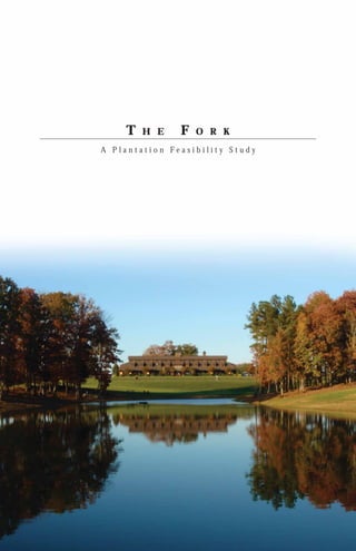
  • 1. T H E F O R K A Plantation Feasibility Study
  • 2.  1999 Field Sport Concepts, Ltd. All rights reserved. No part of this document may be reproduced or transmitted in any form or by any means without the express written consent of both Field Sport Concepts, Ltd. and the Client.
  • 3. CONTENTS 3 CONTENTS 19 PROGRAM DESCRIPTIONS Activities and their relationship to the land 4 THE INTRODUCTION 5 THE VISION Reestablishing a “gentleman’s farm” 43 LAND USE CONCEPTS Exploring opportunities suitable for creating successful program interrelationships 6 THE PROPERTY The lay of the land 49 SUMMARY A distillation of findings and recommendations 51 TABLES 7 THE REGION Natural resources create attractive destinations for sportmen and a variety of other recreational activities 8 THE HISTORY Rediscovering lost treasures of the past 11 SITE ANALYSIS Natural features determine land use suitability The Fork, A Plantation Feasibility Study 3
  • 4. INTRODUCTION F ield Sport Concepts, Ltd. is proud to provide you the following analysis of, and feasibility study for, The Fork. It is a unique and wonderful property with an interesting history upon which one could build a premier equestrian and hunting plantation. With very few exceptions, the land, as a resource, lends itself well to a functional and pleasing incorporation of all the program elements you envision. As a team we have collectively and independently evaluated the subject property in light of the program vision. This report is intended as a record of our initial observations, inventories, analyses and recommendations. While it is not a design document, it is our intent that the initial land use concepts contained herein, along with our research and recommendations, serve to assist you in your decision regarding purchase of the property. Should you decide to purchase The Fork, and we are fortunate enough to be involved in subsequent efforts, we would recommend securing more detailed base information on the property and refining and expanding on the overall project program at that time. Armed with improved and more comprehensive data, we would propose to undertake a more aggressive analysis and design effort. In these subsequent phases the design process would be highly integrated, involving partnering sessions across platforms to achieve a consolidated and well orchestrated plan for the property. We hope you find that this report meets your needs and expectations. Looking to the future, we expect that any effort to develop your vision at The Fork will evolve into a very rewarding and exciting endeavor for everyone involved. For Field Sport Concepts, Ltd., we thank you for allowing us the opportunity to be a part of the team. 4 The Fork, A Plantation Feasibility Study
  • 5. THE VISION T he idea is to re-establish the historical context of a “gentleman’s farm” upon which agricultural and a variety of rural recreational pursuits can be realized. In the end, the property should serve as an example of how land can be used in an environmentally sensitive and culturally sympathetic way. Although portions of the site will be maintained as a commercial farming operation, the entire property will be managed in a manner founded on stewardship for the land as well as its cultural and natural resources. True to the character of a plantation, the property will be developed and operated as a working farm. The goal is to create a largely sustainable, environmentally sensitive farm by combining the best of current technology with good old-fashioned common sense. Maintaining the agricultural heritage of the property is paramount to the success of the vision as well as the individual programs elemental to it. Some land will have to be removed from crop production to make room for the diversity of activities envisioned. Also, certain agricultural practices will be modified to be more sensitive and beneficial to the land and wildlife. The objective is to take conscientious steps away from the singular focus of clean, mono-culture farming by absentee managers back toward a highly diverse agricultural state where, historically, the landowner resides on the property and oversees the myriad day to day activities of the farm. From an environmental perspective, by taking an historic rather than conventional approach to agriculture, it is hoped that well orchestrated use-diversity will create critical habitat-diversity, thereby making the land capable of sustaining a wide variety of healthy wildlife populations. The central charge of this study was to determine if the subject site lends itself to the well orchestrated establishment of the envisioned programs, and to identify any site conditions which positively or negatively affect each individual program and their relationship to one another. Beyond agricultural production, those elements and activities which are envisioned for the property include: a main residence and guest quarters, a lodge or replica of a historic tavern to serve as a retreat, stables, barns, paddocks and trails associated with horse breeding and equestrian sports such as cross-country racing, show jumping and dressage, wildlife husbandry efforts for deer, dove, duck, quail and turkey, pheasant and mallard release programs, and sporting clays venues. Most, if not all, of the property will be placed in a conservation easement. This move is consistent with the vision for the property and the stewardship philosophy of the prospective owner. Encumbering the property in this manner, while dramatically affecting its value, will ensure that the integrity of the land will remain intact long into the future. “In the end, the property should serve as an example of how land can be used in an environmentally sensitive and culturally sympathetic way.” The Fork, A Plantation Feasibility Study 5
  • 6. THE PROPERTY T he Fork property is located just south of the town of Norwood, in Stanly County, North Carolina. Its roughly 1,100 acres resemble a diamond shape; the bottom two sides delineated by the confluence of the Rocky and Pee Dee Rivers, hence the name of the property, as well as the general area of the county surrounding the property. Both rivers are robust, scenic and support a variety of wildlife. Access to the property is via paved State Route 1766 otherwise known as Fork Road which enters the tract from the northern point in a southerly direction. State maintenance of the road ends just inside the property limits, and not far beyond that the pavement ends and the road changes to a farm lane. A gate, just inside the property, limits access. In a woodlot adjacent to the gate, a modest brick ranch home oversees the comings and goings on-site. The house and its immediate grounds are leased on an oral month-to-month arrangement. Beyond the gate, the alignment of the privately-owned main road in its continues through the property in a southeasterly direction, terminating at the flood plain of the Rocky River three-fourth’s (¾) of a mile upstream of the confluence. Once inside the site, numerous other farm lanes spur off of the main road providing access to crop fields and long-abandoned home and barn sites. Given clement weather conditions, all precincts of the property can be reasonably accessed by vehicle. Physically, the property displays a wide variety of topographic conditions and elevation change. The high ground consists of a central north-south ridge occupied by the main road. On either side, broad open ridges used as agricultural fields extend east, south and west. Each field is punctuated by wooded ravines that eventually lead to and through vast open floodplain which lies alongside both rivers. Over half of the property is wooded. A variety of stands exist, from predominantly young cut-over volunteers to small samplings of mature oak/hickory lots. Evergreen and deciduous species are typically intermixed, and no economically significant pine stands are present. Hedgerows, most of which follow property lines and natural physical features, serve to create, in some instances, smaller, sheltered agricultural plots and visually reinforce topographic, road and riparian edges. Roughly 400 acres of the tract is actively farmed in seasonal crops. Of the 400 acres, nearly 200 acres are classified as floodplain. A local family of farmers has been leasing the agricultural fields for some time. The fields are currently planted in corn, with a winter cover crop of predominantly wheat using a no-till program. Upstream from the site, the Pee Dee river has been dammed creating Lake Tillery. The dam has afforded a certain level of flood control for the area as well as a variety of recreational opportunities and real estate value enhancement. Flows vary, and for the most part releases from the impoundment are regular except during periods of drought. At times of high water, the rivers have been known to inundate the floodplain for short periods of time. Rather than breaching their banks and scouring the fields, most of the flooding occurs as water backs onto the site through low points in the site’s topography near the convergence of the two rivers. During these times fishing boats have been seen patrolling the flooded fields. Given its size, location, history and physical attributes, the property is locally recognized as a valuable natural resource. It is currently owned by Uwharrie Heritage, LLC, a group interested in preserving its integrity. The owners are working with a third party who shares this philosophy to develop a scenario in which a conservation-based use of the property could financially support a private ownership arrangement. 6 The Fork, A Plantation Feasibility Study
  • 7. THE REGION S tanly County is located in south central North Carolina where the winters are mild, the summers typically hot and dry, and the time between very pleasant. The town of Albemarle serves as the county seat. Most of the major civic buildings and government functions are located there. It is the commercial hub in the region and is supported by New London and Richfield to the north, Norwood TO NORWOOD LAKE TILLERY to the south, and Locust to the southwest. US Route 52 is the main north-south corridor through the county. State Routes 24, 27 and 73 are key roads that traverse the county in an east-west direction. All primary roadways pass through Albemarle. Charlotte is the nearest metropolitan area and is located roughly 40 miles due west. To the east about the same distance are the renowned golf communities of Pinehurst and Southern Pines. The subject site is located in the southeastern-most extreme of Stanley County. In this area the Rocky River separates Stanley County from Anson County, while both Montgomery and Richmond Counties lie across the Pee Dee River. Old County Line Road, the remnants of which leads from the property’s high ground down to and across the mid-section of the floodplain along the Pee Dee River, serves as the dividing line between Montgomery and Richmond Counties in its historic course east of the river. 4.5 miles upstream from the confluence, the Pee Dee River is traversed by Norwood Dam creating Lake Tillery. The result is a pleasant freshwater SITE impoundment that provides water-based recreation and hydroelectric power. The ER county also enjoys similar RIV benefits provided by EE RO D Badin Lake which CK PEE Y straddles RI the VE R boundary between Stanly and Montgomery County northeast of Albemarle. Badin Lake and Lake Tillery are both impoundments of the same river, however, from a point just below Badin Dam, near Morrow Mountain State Park, and to the north, it is known as the Yadkin River. From that point south the river is known as the Pee Dee. Just below Lake Tillery a third impoundment, Blewett Falls Lake, marks the last time the Pee Dee is delayed as it winds its way through South Carolina to the Atlantic Ocean near Georgetown. The region is rich in natural resources which makes it an attractive destination for sportsmen and those seeking a variety of recreational pursuits. It is also an area of historic significance. This area of North Carolina has been the site of noteworthy Civil War, Revolutionary War and prehistoric events. Uwharrie National Forest is an immense natural reservation covering the majority of Montgomery County and parts of Randolph and Davidson Counties. Just south of the national forest is Town Creek Indian Mound. Just downstream from the subject property, on the south bank of the Pee Dee River, lies the Pee Dee National Wildlife Refuge. The Fork property itself was the site of a noteworthy Revolutionary War skirmish. Details of this event, and other site-specific cultural matters are discussed later. Agriculture is the main industry in the area. Both seasonal crops such as corn and soybeans, as well as timber, have long been mainstays of the local economy. In recent years cotton has made a resurgence and now constitutes a significant portion of the seasonal agribusiness in the area. Other industry such as textiles have, for generations, employed those not working the land. In general, the population represents a highly entrepreneurial citizenship, typical of rural areas. The Fork, A Plantation Feasibility Study 7
  • 8. THE HISTORY T he juncture of two navigable rivers has always been an attractive location for human activity. Whether for settlement, commerce or military purposes, these strategic positions, on what historically were the worlds’ primary thoroughfares, have always been considered prime real estate. Not surprisingly, these same areas typically play a large role in history. As many Native American nations made the transition from nomadic ways to an agrarian culture they looked for places to settle where game-rich lands and tillable soils adjoined rivers which provided both fish and a means of transportation. The confluence of two navigable rivers was a natural place for various tribes to gather for trade, ceremony and battle preparation. Pre-historic artifacts, such as arrowheads, that witness habitation of the area by Native Americans have been found on The Fork property. Archeologists note that North Carolina was first settled by three main Indian nations, the Algonquian, the Siouan and the Cherokee. The Siouan-speaking tribes resided in the Piedmont region while the Cherokee where centered in the mountains to the west, and the Algonquians occupied the coastal zone. Within the Siouan Nation it is thought that members of the Cheraw tribe were the first humans to occupy the area around The Fork. Although inhabited for several thousand years, the major Indian occupation in the area of The Fork was during the 15th and 16th centuries A.D. It was during that time that Town Creek Indian Mound complex was developed. Located just east of The Fork on Little River in Montgomery County, this facility is now a National Historic Site. The location served as a major ceremonial center of the Pee Dee culture. It is thought that these peoples were Muskogean-speakers who moved north into the Pee Dee River valley from South Carolina, replacing the previous Siouan culture. The ceremonial center occupation was relatively short-lived, however, lasting only about 100 years. The features at Town Creek included an earthen mound and temple, a priest’s house and a mortuary house. Several smaller sites have been recorded in the general vicinity of Town Creek and may have been associated farmsteads and communities. It is believed that the inhabitants of these outlying settlements came to Town Creek for important religious, political and social occasions. More detailed information is available by contacting Dr. Linda Carnes- McNaughton at lcarnes-mcnaughton@ncsl.dcr.state.nc.us. Later, as European settlers pushed west they also recognized the value of these riverine locations as well. Pittsburgh, Vicksburg, and Chattanooga are but a few of the places easily recognized as thriving cities which played an important role in American history. Such is the case of The Fork property, albeit on a much smaller scale. It wasn’t until 1748 that the section now referred to as The Fork was settled by Europeans. According to records in Raleigh, the Colson family became the first landowners in the area around The Fork. The Colson’s lived in what is now Anson and Stanly Counties; both of which were, at the time, part of Bladen County. John Colson came to own considerable land in the area of The Fork and was quick to take advantage of its prime location. Two roads intersected on the ridge between the confluence of the two rivers; the Old Stage Road connecting Cheraw with Salisbury which crossed the Rocky River, and County Line road which traversed the Pee Dee. Old court records in Salisbury state, “There is a certain King’s Highway, leading from the town of Salisbury, in the Parish of St. Luke within the County of Rowan, from the County of Anson, used for all the Liege Subjects of our said lord, the king, with their horses, carts and carriages, etc.” – Stanly County Library Archives. This presumably refers to the Old Stage Road, currently known as Fork Road. In 1771 the court of Anson County issued a permit to John Colson to operate an “ordinary.” In addition, the court set the rates he could charge for the ensuing year; “Lodging in a good feather bed and clean sheets – 6 pence. Every dinner not less than 2 dishes, good meat – 1 shilling and 4 pence. Madeira or port wine per qt. – 6 shillings and 8 pence. Toddy with West India Rum and loaf sugar per qt. – 6 shillings and 8 pence. Other drinks with prices that varied were grogg, beer crab cyder, seedling cyder, brandy and whiskey. Pasturing for every horse, stabling with hay and fodder for 24 hours, Indian corn, rough barley, barley and rye, per quart were all priced by the court.” – Stanly County Library Archives. The ordinary was primarily for the convenience of the stage coach passengers. As a stage came within bugle range of the ordinary, it would sound one blast for every passenger present. This allowed the proprietor an opportunity to prepare, in advance, the dining room for the proper number of guests. In 1791, while preparing for a journey through the southland, George Washington wrote in his diary that he would not “incommode private families by taking up quarters with them during the journey.” Later he wrote, “Free hospitality is a universal custom in the Carolinas and Virginia.” – Stanly County Library Archives. He also recorded lodging and dining at plantation homes between Charlotte, Salisbury and Salem on the regular stage coach roads. One might speculate that Washington availed himself of the ordinaries of this area during his travels; whether for sustenance or accommodation, and there exists a possibility that Washington himself paid a visit to Colson’s Ordinary. 8 The Fork, A Plantation Feasibility Study
  • 9. The Colson Ordinary has been described as a two-story log structure in two parts, between which an aisle existed through which a driveway could have passed. It could be surmised that the stage coach would pull between the kitchen and dining “rooms” to be under roof, providing cover for disembarking passengers. It is said that Colson maintained a fresh team of horses at the ordinary for use by the stage line. The stabling for the horses may have been under the ordinary. History has it that the ordinary hosted other activities as well. Those that have been mentioned in records include horse racing, chicken fighting, wrestling matches and militia drills. At some point in time the ordinary also served as a community meeting place. Although the location of the ordinary has yet to be exactly determined, it may have been situated at or near the intersection of the two roadways on The Fork property. From this vantage point, not only would the business benefit from traffic on both roads, but one could also look down the largely straight sections of the two roads toward the two ferries that were eventually constructed to see if there were travelers awaiting passage. Land records show that William Colson, son of John, owned half interest in a 200 acre property on the south side of the Rocky River upon which a mill was operated. It is possible that this was what has been referred to as Colson’s Mill. James Parker of Richmond County has offered the following regarding Colson’s Mill. “-feel sure that the mill referred to was first built just above the mill owned by my father, John Parker, and was washed away by a great freshet. The next mill was known as the Swaringen Mill, bought by my father, and known today as Parker’s Mill.” – Stanly County Library Archives. It is said that as late as 1980 the original mill rocks could be seen in the bed of the river where they sank after the mill house floated down stream. James Parker’s son says he has seen them numerous times while swimming in the river. Given the above, it appears the mill and the ordinary were two distinct properties on separate sides of the Rocky River, although no documented reports currently in hand discuss them as such. Further research and archeological investigation could shed important light on this matter. Mills were important installations to the growing agricultural communities of colonial times. Their importance grew further during times of war, when exceedingly large numbers of troops would garrison in a rather small rural community, requiring quantities of milled grain well beyond the normal production standard. Colson’s Mill may have provided such a service as many a detachment of both the British and American Armies traveled through, and even bivouacked on, The Fork property. Directly across the Pee Dee River is the site of Fort Hill, a once pallisaded supply and ordnance depot maintained by the Americans. Many such caches were established up and down the Pee Dee and Yadkin Rivers by the revolutionaries to support their numerous military sorties. It was on one such foray that The Fork property made history. In July of 1780, Colonel Bryan and Major McArthur, both British officers, were leading large parties of men, mostly Tories who were loyalists, on foraging and recruiting expeditions in the vicinity. Bryan’s men had set up camp adjacent to Colson’s Mill on their way to join with McArthur, then at nearby Cheraw Hill in northern South Carolina. The Americans got wind of these detachments and General Rutherford divided his army, then located in Salisbury, into two groups. Both divisions marched south along the Yadkin/Pee Dee River; Rutherford on the east bank and Colonel Davidson on the west. After two days marching Davidson came across a group of Tories on the Colson farm on one of their foraging missions. In the process of dividing and forming up to attack, Davidson’s men were discovered and the Tories commenced firing upon them. Although they were outnumbered by more than two to one, Davidson’s squad carried the day, killing and injuring a handful of the enemy before they retreated post-haste across the rivers to the adjacent countryside. John Colson, having been a loyalist, fled with them. In the melee Davidson was struck by a bullet in the abdomen. He required two months to recover, at which time he returned to service under the rank of Brigadier General, a promotion awarded for his valor. A marker has been placed along Highway 52 near the bridge over the Rocky River to commemorate this significant historic event in Stanly County history. Another item of historic significance is still evident on the property; that being the Wall-Almond family cemetery. Although documented well in local records, the cemetery is not designated on any available mapping for the area. In the course of on-site activities the cemetery was discovered. Part of that investigation uncovered an on-site archive recently prepared by Pierre Watkins. This led to more thorough research of local documentation. The site of the cemetery is located southeast of the brick ranch home adjacent to the farm gate. Traveling south, behind the house, along the treeline on an earthen levee, an abandoned farm lane leads east, through the woods, toward an old clearing. Just prior to the clearing on the north side of the lane is a nearly overgrown grave yard which appears to have been established around 1830 at the death of Jane Wall. She was the wife of Senator William Wall who, as the elder statesman of the clan, was born April 22, 1776 and died October 15, 1854. He rests beside his beloved wife. The cemetery is filled with nearly 40 identifiable graves from numerous families. Among them are the final resting places of Thomas Kirby Colson and Ann Eliza Robinson Colson, as well as James Swaringen, likely related to the family who built and operated a mill after Colson’s Mill was taken out by a flood. Aside from the formal graves, there are as many as thirty unidentifiable graves marked only with fieldstone. It is uncertain who occupies these locations, or whether they may pre-date 1830. However, because they are concentrated in a sector of the cemetery, it is possible that these are the graves of earlier inhabitants, poorer families or slaves. Regardless, the cemeterys’ presence only adds to the flavor and history of the property and it should be viewed as a significant historic landmark. The Fork, A Plantation Feasibility Study 9
  • 10. 10 The Fork, A Plantation Feasibility Study
  • 11. SITE ANALYSIS Slope Elevation Soils Vegetation Hydrology Environment The Fork, A Plantation Feasibility Study 11
  • 12. SLOPE F or analysis purposes, site slopes fall into one of four distinct gradient ranges; 0 – 5% slope, 5 – 15% slope, 15 – 25% slope and greater than 25% slope. The vast majority of the open land is in 0 – 5% and 5 – 15% slopes. There are a few wooded areas where these modest slopes are found, but they consist of small pockets of a couple acres here and there on upland knobs and low boggy areas in the center of one or more ravines. While some areas within the wooded ravines have rather gentle slopes, typically they display grades in the 15 – 25% range. For a property of this size a very low percentage of the terrain is in critical slopes of 25% or greater. These steep slopes occur mainly at the toe of hillsides adjacent to floodplain and creek bottoms. Roughly 45% of the site’s 1,100 acres is in slopes of 0 – 5%. Another 27%, plus or minus, supports slopes of 5 – 15%. 21% of the property has slopes in the 15 – 25% range and only 7% is in 25% or greater slopes. A small portion of the critical slopes are man-made; created as a by-product of roadway construction performed centuries ago. With the exception of the farm lanes the site remains in its natural topographic state. Slope plays a considerable role in determining land use. In terms of the envisioned programming for the plantation, agricultural fields, equestrian areas and reconstructed wetlands require gently sloped areas while housing, shooting venues and wildlife set asides may best be situated on steeper zones. 0-5% 5-15% 15-25% 25% < 12 The Fork, A Plantation Feasibility Study
  • 13. ELEVATION T he property divides itself into three distinct landforms; riverine floodplain, steep transitional slopes and gently rolling upland. Of the 1,100 acres comprising The Fork, roughly 200 acres lie within the floodplain of the two rivers. This land is not exceedingly flat, but rather low-lying open land with gentle modulations in grade within a 20’ elevation range. The two rivers have mean surface elevations of around 200’ AMSL. From there, the riverbanks extend vertically from 10’ near the confluence, to more than 20’ in other areas upstream in both directions. In those areas of higher riverbank conditions the adjacent fields give the appearance of lying lower than the top of the bank. In these cases, the main riverbank constitutes a levee of sorts. The floodplain extends inland to the base of the steeply sloped transitional areas which begin around elevation 230’. At this point the smooth, undulating relief of the floodplain gives way to a configuration of steeply rising headlands penetrated by deeply incised ravines. A few areas of somewhat level ground are scattered about within this zone, but largely this steep condition prevails up to elevation 300’. From here the land levels out once again with contours typical of an upland meadow. This is the area where the vast majority of man-made improvements have been introduced. The high point of the property, with an elevation of just over 350’, is located within a large field near the center of the property, from which views of nearly 360 degrees can be appreciated. 300 < 300-350 250-300 200-250 The Fork, A Plantation Feasibility Study 13
  • 14. SOIL T he Fork is composed of six soil classifications. They include the Badin, Chewacla, Congaree, Georgeville, Goldston and Tatum series. The following is a brief description of each soil type. Badin Series (BaF) The Badin Series consists of moderately deep, well drained, moderately permeable, clay-based soils on undulating to steep Piedmont uplands. These soils formed in residuum weathered from fine-grained rocks, such as argillite and graywacke sandstone, that are classified as Carolina slates. Slope is 2 to 45 percent. Chewacla Series (Ch) The Chewacla Series consists of very deep, somewhat poorly drained, moderately permeable, fine loamy-based soils that formed in recent alluvium. These soils are on nearly level flood plains. Slope is 0 to 2 percent. Congaree Series (Co) The Congaree Series consists of well drained, moderately permeable, fine loamy-based, bottomland soils in floodplain. These soils formed in loamy alluvium along the Pee Dee and Rocky Rivers. This alluvium was derived primarily from the crystalline rock formations outside of Stanly County in the Yadkin and Rocky River basins. Slope is 0 to 4 percent. Georgeville Series (GfB2) The Georgeville Series consists of very deep, well drained, moderately permeable, clay-based soils on broad, gently sloping Piedmont uplands. These soils formed in residuum weathered from fine textured rocks, such as tuff, argillite, and graywacke sandstone, that are classed as Carolina slates. Slope is 2 to 8 percent. Goldston Series (GoF) The Goldston Series consists of shallow, well drained to excessively drained, moderately permeable, loamy-based soils on undulating to steep Piedmont upland side slopes and knolls. These soils formed in residuum weathered from fine textured rocks, such as argillite and graywacke sandstone, that are classed as Carolina slates. Slope is 4 to 45 percent. Tatum Series (TcD2) The Tatum Series consists of deep, well drained, moderately permeable, clay-based soils on gently sloping to steep Piedmont uplands. These soils formed in residuum weathered from fine textured rocks, such as argillite and graywacke sandstone, that are classified as Carolina slates. Slope is 2 to 35 percent. The soils map identifies the general location where each soil series occurs on the property. In summary, Congaree soils are found along the banks of both rivers and in the low areas within the bottom land crop fields. Chewacla series consti- tute the higher ground within the fields located within the floodplain. Several pockets of Goldston soils are located in the lower sections of the slopes near the floodplain interface. The slopes between the bottom land and the upper terrace areas are in Badin series, with the exception of an area on the eastern boundary which is classified as Tatum soils. The gently sloping areas on the high ground are home to the Georgeville class. Insofar as the proposed use of the property is largely agricultural, a table has been included which lists each soil type and the varying agricultural yields which could be expected of each. In addition, another series of tables lists the degree to which each soil displays limitations for devel- opment of a variety of man-made improvements germane to this undertaking. (See Tables 1-5) 14 The Fork, A Plantation Feasibility Study
  • 15. VEGETATION T he Fork property was likely once a heavily wooded tract consisting of birch, maple, sycamore, poplar and tupelo in the lowlands, and oak, hickory, beech, maple and pine in the uplands. At one time the vast majority of land in this part of the United States was clear-cut for timber. Many of the trees which were spared the commercial axe were felled for military purposes. So pervasive was the timbering of this region that, during the Civil War, armies had to resort to burning fencing for fuel in the absence of trees. Consequently, there exist very few pockets of old-growth forest in the eastern United States. As time passed timber became less important than seasonal crop farming and farmers began to focus their attention on the more tillable topography. This allowed certain areas to revert back to forest. The wooded mountains and piedmont areas of the Mid-Atlantic States are testament to the regenerative powers of nature. Unfortunately, The Fork property has experienced significant timbering activity on a regular basis. While there are examples of mature hardwood trees on the property, there is no significant stand of oak/hickory climax forest to be found. Mature specimen trees occur largely at the edge of crop fields and as sentinels at long abandoned building sites. Oddly, there are also no managed pine stands on the property. Apparently, the periodic harvesting of timber as a cash crop has been an after-thought, rather than a profitably managed endeavor. In any case, the result is just over 400 acres of agricultural fields in the upland and lowland zones separated by 600 plus acres of mixed hardwood and softwood forest of a very young age on the transitional slopes between. The bank of both rivers is nicely reinforced by mature riverine species which makes for a rather pleasing setting. On the high ground there are several small isolated islands of emergent tree species suggestive of a place where tilling of the soil was very recently forsaken. This same type of new growth occurs in several areas where abandoned homes and barns are still evident. All told, this type of vegetative cover represents less than one percent of the total acreage. The fields have been leased for some time to the Sikes family who have farmed the land in a variety of crops. A no-till program has been in place on the farm for several years. Corn is the only cash crop currently planted on the property. Evidence in the field confirms that the crop Tree Cover is being harvested for grain rather than silage. A cover crop of winter wheat is drilled in; usually in the month of November. Soybeans have been planted in recent years on the upland fields where flooding was not an issue, but the deer population culled the crop so aggressively that beans were replaced by corn this past year. Cotton has re-established itself as a viable cash crop in the region and the Sikes family has expressed an interest in planting some of the upland fields as such. The “clean farming” practice employed to date has resulted in a distinct lack of any transitional vegetative edge between field and forest in almost all instances. The Fork, A Plantation Feasibility Study 15
  • 16. HYDROLOGY O ne of the most outstanding qualities of The Fork property is that it is located at the confluence of two primary river systems in central North Carolina. As mentioned previously, both rivers are quite robust and each remains navigable in the area adjacent to the subject site during periods of low flow. The Pee Dee River is impounded upstream of the confluence of the two rivers to create Baden Lake and Lake Tillery. The dams at both reservoirs serve to generate electricity and control flow regimes downstream. Consequently, the Pee Dee River adjacent to The Fork experiences vast fluctuations in both water surface elevation and volume of flow. During the three days of the on-site field investigation, the Pee Dee was observed to change dramatically, even though weather conditions were consistently dry. At times the water was a completely seamless flow, uninterrupted by obstructions. Later the same day the river had dropped at least three feet, displaying numerous rock shoals, and the water giving the appearance of flowing upstream. Upon traversing the Pee Dee via the Route 731 bridge just below Lake Tillery, the river, at that time, seemed a nearly dry gulch. It was after such an event that the river on site displayed this odd appearance. Investigation is underway to determine if the elevation of Blewett Falls Lake immediately downstream, along with consistent contributions by the Rocky River, actually causes water to back up into the Pee Dee River channel during low flow events. The need for additional information on this matter is amplified insofar as a proposal to raise the dam at Blewett Falls Lake 12’ to create additional storage is currently being reviewed. Between the two rivers, nearly 200 acres of land at The Fork experience periodic flooding resulting from rain events or prescribed drawdown of Lake Tillery in the Spring. Within the floodplain zone a small number of wetlands occur; generally attendant to man-made drainages installed to facilitate agriculture. More likely than not, natural wetlands existed in these low-lying areas prior to man’s intervention. The ravines which drain the upland areas of the property all lead to and through the floodplain before emptying into the rivers. In a few instances, springs contribute water to these draws, some of which sustain little more than damp soil, while others support legitimate creeks. One run drains the southwest quadrant of the tract, running in a southerly direction toward the Creeks/ Rocky River, passing under the Old Stage Road near the bottom land. A Ponds second branch, actually two separate branches in the same straight alignment, runs parallel to the Pee Dee River along the toe of slope at the floodplain’s Floodplain upper limits. Judging from field observations, this system drains in both a southwestern and northeastern direction. The southern course empties River directly into the Rocky River, while the northern course combines with a sizable, highly eroded ravine which subsequently contributes to the Pee Dee Drainage River along the eastern property line. Area Limits Only two small ponds currently exist on The Fork property and each is less than an acre in size. The first is located immediately adjacent to and east of Fork Road in the far northern section of the tract. It has a thin perimeter of trees, but is by and large in a crop field setting. The second pond is located in a wooded setting in a very minor ravine near the southernmost promontory. In contrast to the first pond, this location is quite private and, in fact idyllic in many ways. The surrounding woods are by no means mature hardwood forest, but the setting is special nonetheless and deserving of honorable mention. 16 The Fork, A Plantation Feasibility Study
  • 17. ENVIRONMENT Prevailing winter winds from north and northwest F or the purposes of this study, issues have been segregated into one of three environmental categories. The first classification includes physical and weather conditions that serve as design parameters including wind direction, solar orientation, storm events, views, noise and glare. Second are the features that make up the man-made environment such as structures, Less frequent but possibly severe winter roads, fencing, utilities, wells, cemeteries and adjacent development. Finally 1 2 winds from northeast there are the human practices that can generate environmental concerns like dumping of waste, fuel storage and pesticide use. 3 The Fork property is comprised of a series of prominent, open, upland ridges 4 separated by pronounced wooded ravines. Two rivers and their associated 5 floodplain surround the property on the southeast and southwest. The site 6 displays a largely southern slope and exposure. Although winter winds out of the northwest and southerly summer breezes prevail on the high, open 9 precincts, within the ravines and along the river, topography, vegetation and Secondary 7 8 river alignments combine to create unique microclimates. While the upland Airflow 10 fields provide opportunities for expansive views, they are also areas that are very exposed to the elements during storm events. Driving wind, rain and lightening 11 Major are significant considerations in land planning. Because of its remote location, Views noise and glare are not concerns. Minor Views 12 The tract has been occupied, and presumably farmed, since the mid-1700’s. Homes, barns, workshops, mills and other structures were, at one time or 13 Potential another, active on the property. Observable on the site today are an abandoned Views bungalow, a small, old, unused barn, a silo, and the remains of a Victorian farm Wind patterns house that appears to have been constructed over a protracted time frame. 14 Only one structure remains in use on the property and that is a modest brick influenced by 16 river channel ranch residence near the entrance to the site. Judging by the exterior of the structure and grounds, it has little value. 15 Some of the roads accessing the site and the various uses within it are still in place, while others have been long abandoned. Several of these old sites show evidence of old wells still in place. Above-ground utilities had been brought to the property in support of the housing of more recent vintage and fencing can still be found as witness to historical property boundaries. A cemetery was 17 discovered on the property which contains as many as seventy graves and dates back to 1830. Adjacent development has very little impact on the subject site. The vast majority of the surrounding countryside is in agricultural use. One Less frequent summer adjacent property (the Martin tract), which is home to a hunting club, uses The Prevailing summer winds from winds possibly severe from Fork property roadways for access. south and southwest southeast in late summer and fall when associated with hurricanes Because the site has been occupied for more than two centuries, one could expect that a certain amount of insensitive activity may have taken place. Humans generate waste and don’t always dispose of the waste in an 1. Abandoned residence environmentally sensitive manner. A small amount of dumping, old tires 2. Abandoned barn/sheds for the most part, was witnessed adjacent to the silo. Wholesale dumping of 3. Occupied brick ranch residence domestic waste, appliances and such is not immediately evident to the casual 4. Wall-Almond cemetery observer. Outhouses were prevalent during the previous period of occupation 5. Abandoned barn and evidence of residence on site. Any areas where housing has been known to exist should eventually 6. USGS map location of non-existent structure (possibly the former site of William Wall’s machine shop) undergo investigation and identification of waste pits. The drainfield associated 7. Abandoned residence with the currently occupied residence should also be located. 8. Abandoned barn 9. USGS map location of non-existent structure No underground storage tanks (UST’s) show up on government databases. (origin unknown) Above-ground units were more typical of installations pre-dating 1960 and 10. Old Cheraw/ Salisbury Road (Allenton Road) 11. USGS map location of non-existent structure nothing was observed to suggest that either equipment or heating fuel storage (origin unknown) existed, but one could assume it had. 12. USGS map location of non-existent structure (possibly the former site of Colson’s Ordinary) Pesticides have long been employed to foster commercial crops. Generally, 13 Abandoned silo and location of non-existent barn that use continues today on an accelerated pace. Myriad chemicals have been 14. Old County Line Road 15. Former site of Colson’s Ferry developed to assist the farmer in battling the elements that seek to damage his 16. Former site of ferry crops. The benefits of this technology comes with a price. Wildlife is poisoned 17. Possible site of Colson’s Mill and their habitat destroyed. Certain chemical substances remain in the soil for protracted periods of time. Subsequent efforts on the property should include an analysis of the historic use of agricultural chemicals on the land to determine what, if any remedial action needs to be taken. The Fork, A Plantation Feasibility Study 17
  • 18. 18 The Fork, A Plantation Feasibility Study
  • 19. PROGRAM DESCRIPTIONS Agricultural Equestrian Shooting Sports Wildlife/Hunting Residential The Fork, A Plantation Feasibility Study 19
  • 20. Agricultural Program Areas The map shows those areas that are currently being used as commercial crop fields. 20 The Fork, A Plantation Feasibility Study
  • 21. AGRICULTURAL O ne of the key components of the vision for The Fork is the preservation of the agricultural heritage of the property. To date, none of the wooded areas have been conscientiously managed for timber. This shows, and is one of the few liabilities of the site. The paucity of large, hard-mast producing trees is a natural governor for wildlife species such as deer, turkey and duck that benefit from these winter food sources. A comprehensive timber management plan should be put in place to encourage the maturation of hardwood species on the property to the benefit of wildlife, particularly big game. Over 400 acres of the land has been historically used to grow seasonal crops. The property is planted exclusively in corn. Mono-culture farming of this type is typical of strictly commercial ventures. Clean farming practices remain the site standard, however a no-till program was instituted recently which is very beneficial to the environment. Still, there is room for improvement in the commercial farming methods. For instance, crops are being planted up to and under the limbs of the trees which define the field limits. Historically, cultivating this land was done to prevent the forest from reclaiming the hard-won fields over time. However, the crops along the wooded edges display signs of low yield from immaturity as well as heavy forage by wildlife. Immediately outside the treeline crops appear to have been very productive. In a few areas, springs have surfaced in crop fields making the soil damp and slippery even on the sides of well graded slopes. Agriculture is critical to the overall plantation program in many ways. First, it will provide pasture and processed food for the equestrian program. Second, by leaving standing crops in key areas and using the equipment to plant food plots and buffer strips, it benefits the wildlife program. Finally, the presence of an active agricultural program brings a broad base of focused knowledge to the table and provides a level of stewardship and security for the property. Whether through outside sources or on-site means, an active agricultural program will be required to ensure that the property is managed in a manner that is productive and in concert with the other envisioned land uses. Among those items that need to be reconsidered are types of crops to be planted and where, the use of herbicides and pesticides, the timing and frequency of machinery in the fields, harvesting schedules and methods, and use of fields for dual-programming. If agriculture is pursued through outside sources, education and indoctrination of the farmer will be critical. Also, an arrangement should be crafted that provides adequate incentive for the farmer to remain active on the property and willing to execute the special measures necessary to the overall vision. In the recent past, soybeans and corn have been cultivated on the property. Cotton has made a resurgence as a cash crop in this area of North Carolina and the family currently farming the property has expressed an interest in planting cotton on the high ground. Cotton provides little or no value to a wildlife-based venture and requires placing machinery in the field at critical times during ground-nesting bird lifecycles. Warm-season crops of corn and soybeans remain commercially viable and are far more beneficial to the plantation program. Financial hardships to the farmer stemming from crop losses due to foraging, reduced pesticide applications and other programming considerations can be offset through the landowner/farmer lease agreement. Other compensation should be afforded the farmer for assistance provided in support of ancillary agricultural efforts. These include planting areas of commercial crops that will not be harvested, establishment of wildlife-specific crop stands of buckwheat, sorghum, millet, sunflowers, chufa, rice and other grain crops, use of a foam-brush to remove hardwood volunteers from field edges, hay production, manure spreading, and overall land management practices. The ultimate goal is to develop a plantation plan that includes, in its program, commercial agriculture that, from a scale and contextual perspective, is attractive and profitable for the farmer. Numerous government programs can exist that assist landowners who wish to promote wildlife habitat on their property. The Conservation Reserve Program, the Stewardship Incentive Program and the Wetland Reserve Program are but a few vehicles through which landowners can receive technical and financial support to achieve wildlife goals. Financial incentives include both cost-sharing for installation of measures and annual rent payments for acreage enrolled in the program. Benefits from participation can further assist in offsetting losses in commercial agriculture on site. These programs, and the people behind them, should be considered a necessary toolbox for anyone considering wildlife stewardship programming on their property. “Whether through outside sources or on-site means, an active agricultural program will be required to ensure that the property is managed in a manner that is productive and in concert with the other envisioned land uses.” The Fork, A Plantation Feasibility Study 21
  • 22. Equestrian Program Areas The map indicates those areas that are deemed suitable for various equestrian program components. Trails would be acceptable in nearly all areas of the site except on steep slopes and areas containing highly erodible soils. 22 The Fork, A Plantation Feasibility Study
  • 23. EQUESTRIAN T wo components make up the equestrian program. The first is a husbandry project designed to purify the blood line of Irish draught horses. The second is development of a USCTA certifiable eventing facility. Both activities are to take place on land that has not supported livestock in any way in the recent past. This program will have to be built from the ground up. From a maintenance and security perspective, the equestrian facilities require constant monitoring and attention to detail in their upkeep. For the sake of efficiency the key components should be developed as a central equestrian complex. A full-service, state-of-the- art stable, storage and equipment barns, arenas, show rings, exercise pens and paddocks will need to be included in the primary horse compound and configured in a way that facilitates safe and fluid interaction between activity areas. To guarantee proper security and oversight it is recommended that residential quarters be included in the complex. Fenced pastures with run-in sheds, cross-country courses and a trail system can be located outboard of the equestrian nexus yet connected either physically or visibly to afford appropriate integration. Insofar as the caliber of horses to be maintained on the property is high and their security paramount, all primary equestrian facilities should be located toward the center of the property in a highly observable area. Since numerous structures and relatively level activity areas are necessary, it makes sense to place the equestrian complex away from the threat of flood and in an areas of gentle slope. Positive drainage and good air circulation are critical, however, locating a structure on an open promontory will invite the threat of a lightening strike. The best location for the equestrian complex is in an open, well-drained area on the side of a gentle slope that does not orient north, and one that offers a visual connection to other facilities on the property. Pastures, cross-country courses and the trail system should be partially visible and readily accessible from the main complex. Certain areas will need to be removed from cash crop production and placed in warm-season grasses and legumes to provide required pasturage and hay production opportunities. Cross-country courses can be designed to lay largely upon the natural grade along the perimeter of hay fields. The course surface itself should be maintained in cool-season grasses. This will serve as a visual counterpoint to the warm- season grasses in the hay fields and also act as an emergency firebreak. Hay fields can also provide desirable cover, forage and brooding conditions for ground-nesting fowl. The course should be developed around an area of high ground so as to provide adequate observation of distance events. The trail system could be laid out to offer access to remote and special places throughout the property. It is expected that, from time to time, horses may be the desired mode of transportation to and from non-equestrian venues. Proper accommodation for their staging should be provided in key locations. Respites, or guest cottages, are envisioned for the property. Visitors will be provided accommodations for both themselves and any horses they may be traveling with. Consequently, the program should include small paddocks with run-in sheds adjacent to some, if not all, of the respite cabins. The Fork, A Plantation Feasibility Study 23
  • 24. Shooting Sports Program Areas The map illustrates those areas best suited to the establishment of sporting clays venues. 24 The Fork, A Plantation Feasibility Study
  • 25. SHOOTING SPORTS O f all of the programs constituting the overall vision for the property, shooting sports is the most independent. The provision of trap, skeet and sporting clays opportunities requires very little land and can be accommodated in a wide variety of configurations to suit almost any property. The main external consideration is the impact the shooting activity will have on other programs. Safety and awareness are the primary concerns. Shooting venues need to be located in areas and in such a manner as to all but preclude the possibility of harm to property, livestock and people. Locating these activities away from all other uses is one way to accomplish this. When shooting facilities have to be located in areas where other activities occur, shooting can be scheduled and monitored in a fashion that ensures conflicts are avoided. Whenever possible, shooting facilities should be placed in an area that can be monitored to prevent theft and vandalism. Currently, only sporting clays are being considered. The event could occur in an abbreviated format within an expanded trap/skeet range, or placed within the landscape. In the latter configuration, five to ten stations are developed along a course. Each station affords the shooter a series of different target presentations. The sport is most challenging when each station is situated in a natural setting, and the trap trajectories designed to mimic real-life field and flight conditions of a particular game species. This level of refinement requires a variety of topographic, vegetative and hydrologic conditions to be present or created artificially. Manual or automated trap machines can be employed, however, manual courses are labor intensive and tend to be used less frequently. The table entitled, Sporting Clays Course Design Considerations (Table 6) describes certain parameters that could be used to design a field-based sporting clays course. Ideally, the shooting venue would be located as far inside the property as possible for security reasons and a good distance from any equestrian complex. With the exception of the extreme northern section of the property, those areas regularly flooded, and a few steep, remote wooded areas, a very fine course could be installed at any number of locations. A five-stand venue could be accommodated on a standard trap and skeet range and would need to be on rather level terrain and preferably have a north-south orientation. A more sophisticated sporting clays course is less “The sport is most dependent on orientation and takes advantage of varied terrain, challenging when each clearings, ponds, wooded areas, ravines, bluffs and bottomland. station is situated in a natural setting, and the The shooting sports program can, and should, benefit, wherever trap trajectories designed possible, from the presence of other program elements. The to mimic real-life field creation of wildlife habitat throughout the property will and flight conditions of a provide excellent conditions for real-life hunting simulations. particular game species.” Unfortunately, regardless of location, the noise associated with shooting in any form is going to influence the habits of turkey and deer. The facilities should be placed a reasonable distance from any rearing pond associated with the mallard release program. Given creative placement, areas in the lowlands set aside for live duck hunting could also be employed as simulation areas for goose, duck and teal. During the waterfowl season clay shooting will need to be kept to a minimum, but this will likely prove to a minor inconvenience given the live shooting opportunities available at that time. Any tower constructed for a pheasant release program could also support a trap machine for simulated shooting of the same type. Trails and stations associated with sporting clays courses could be constructed and situated such that they could be used for horse trails and areas of repose. Proper planning would capitalize on opportunities to have the trail system connect various use areas to one another. If shooting is conscientiously scheduled, respite cabins could be placed in close proximity to shooting platforms where they also may serve as observation decks. A lodge could be placed in close proximity to the range or course to serve as headquarters for shooting activities. The Fork, A Plantation Feasibility Study 25
  • 26. The map illustrates those areas best suited to the various types of wildlife and hunting activities envisioned on the property . 26 The Fork, A Plantation Feasibility Study
  • 27. WILDLIFE/HUNTING T he “build it and they will come” approach carries a lot of weight when promoting wildlife. One of the main reasons certain areas hold little value as hunting venues is that the conditions required by many game species are absent. The loss of habitat to development and clean farming practices has historically lead to a great reduction in many game species populations. Bag limits and hunting seasons have gone a long way to curtailing the decline, but to fully reverse that trend and jump-start the recovery of these species, man must proactively engage in alteration of the land through re-introduction of plant communities and re-establishment of environments that favor wildlife. Research and scientifically tested field trials, followed up by years of professional observation have proven that human intervention on behalf of the environment can significantly benefit wildlife. The numerous government programs mentioned earlier are designed to promote these methodologies. In a successful field sport venture, the agricultural program works hand in hand with the wildlife/hunting program by fostering the necessary habitat to support native, as well as introduced, wildlife species. Crop and timber management practices, modified to be more sensitive and beneficial to wildlife, result in healthy, productive populations of game and non- game animals. The challenge is to strike a balance in the cost/yield equation. In the case of The Fork property it is also paramount that a symbiosis be developed between the wildlife/ hunting program and the other envisioned activities. Game species for which the plantation will be tailored include deer, turkey, dove, duck and quail. Pheasant and chukar may be released as well and will undoubtedly benefit from the amendments made for the other species. Currently the property supports “In a successful field sport a sizeable population of deer and some turkey and quail. Waterfowl have been venture, the agricultural observed utilizing the rivers as flyways. The presence of corn in the agricultural program works hand in fields has been a boon to the above species as well as dove. One goal of the hand with the wildlife/ wildlife/hunting program is to increase the biomass of desired game species to hunting program by fostering near the maximum carrying capacity of the land while maintaining the health of the stock. In some species this goal may expand to include gender-balancing and the necessary habitat to trophy management. support native, as well as introduced, wildlife Overall, the plan should involve the alteration of the site’s topography, hydrology species. Crop and timber and vegetation to create suitable environments for each species. In some cases this management practices, may merely require monitoring of current conditions as they evolve. In others, a modified to be more sensitive complete retooling of existing site features may be in order. In between the two extremes are processes and applications such as setting aside field edges for native and beneficial to wildlife, plant communities, introduction of warm-season grass species and soft mass result in healthy, productive plants, developing impoundments, and instituting integrated pest management and populations of game and a controlled burn program. In fact all of these, and many other prescriptions, will non-game animals. The likely comprise a successful wildlife husbandry effort. challenge is to strike a balance in the cost/yield All of this comes at a cost. For the wildlife/hunting program to be successful many standard agricultural practices will have to be altered. Planting and harvesting equation.” times will need to be scheduled to preclude nest disturbance. Harvesting heights for hay and other crops will need to be sensitive to the needs of the animals utilizing the fields for cover. Pesticide applications will have to be abandoned or adjusted, and carefully monitored, to avoid poisoning of wildlife. And activities that generate significant noise will have to be regulated and directed to areas where the least impact on wildlife is experienced. To bring The Fork property up to the high standards desired, a portion of the cash crop fields will need to be removed from production. Typically the impact is minimal in that those areas best set aside for wildlife habitat tend to be those areas least productive from an agricultural perspective. Each effort to increase the wildlife population will bring with it a commensurate increase in predator populations. Those species having the greatest impact on game species include hawks, skunks, opossum, raccoons, foxes, and snakes. Management of predator species is permitted within strict guidelines. However, studies have yet to prove that reducing predator populations has a significant impact on the success of many gamebird species. The operative word in the wildlife program is “encouragement.” The following is a brief description of each species, their habitat requirements and the envisioned program particular to them. “The loss of habitat to development and clean farming practices has historically lead to a great reduction in many game species population.” The Fork, A Plantation Feasibility Study 27
  • 28. Deer Program Areas The map indicates those areas where food plots and evergreen stands could be installed. In addition, it is recommended that all old fencing be dismantled and removed unless absolutely necessary. Deer will roam the entire property and benefit tremendously from activities attendant to all of the other programs. Arrangements should be made with the farmer to leave a small percentage of the cash crops standing in the field and to discourage disturbance of newly established transitional edges. As the hardwood ravines mature many more trees will reach mast-bearing age thereby increasing the deer carrying capacity of the property. 28 The Fork, A Plantation Feasibility Study
  • 29. DEER W hite-tailed Deer are considered the most popular big game species in North America. They are hardy, prolific creatures that range over a wide area. In the warm months they seek out cool shady glens in which to rest. When cold weather approaches they look for evergreen thickets for shelter from the elements. At certain times of the year, and when the intrusions are infrequent, they will bed down in fields of tall grass. When they are not resting, like most ruminants, they forage almost continuously on tender grasses, forbs, berries, vines, lichens, mushrooms, leaves, twigs, buds and bark of trees, and acorns. In the spring and summer lactating females require water daily, otherwise deer can go for several days without water, gaining needed moisture from foodstuffs. In this same period deer can experience stress due to the lack of natural high-quality forage. In the fall and early winter seeds, berries and nuts mature providing deer with ample food. This cornucopia is necessary as deer expend a great deal of energy during the fall mating season, or rut. Once the rut is over deer begin the arduous task of surviving the winter. It is during this period that deer have the most difficulty finding food. Hard-mast trees, and to a lesser degree soft-mast trees and shrubs, are the mainstay of deer populations through the winter. Deer are opportunistic and will supplement, or even supplant, their native diets with agricultural crops when palatable options are present. Food plots have proven successful in encouraging healthy deer populations. Given the hardiness of the species, the best course of action is to recognize the shortcomings of a property with regard to deer habitat and take steps to manage native vegetation in a way which allows it to gradually improve over time. If native conditions require significant improvement, food plots will prove invaluable to sustaining herd health. As the deer population increases, management will become more sophisticated. Gender-balancing through calculated harvesting of does and bucks, and establishing antler-slot restrictions on buck harvests are just two of the tools through which wildlife managers cultivate healthy, trophy herds of white-tailed deer. The deer program is not expected to have a significant impact on other on-site activities. Given the overall vision for the plantation, one should expect to see deer roaming freely over the entire tract. While they will tend to cull a certain percentage of cash crops, the provision of designated food plots will serve to minimize damage. As previously stated, The Fork property already supports a substantial deer herd. In fact, Stanley, Anson and Montgomery Counties already have relatively high populations of deer, generally exceeding 40 deer per square mile. Until last year, the state record buck, a non-typical scoring 208 Boone & Crockett points, was taken in Anson County. In an effort to increase the local herd, maximize health and antler production, and encourage deer to remain on the property the following steps will likely prove beneficial: Encourage crop plantings of corn and soybeans as warm-season crops in commercial fields Leave small portions of warm-season cropland edges unharvested. Continue installation of cool-season cover crops of clover, wheat and other small grains in commercial fields Set aside remote areas throughout the property for food plots of corn, soybeans, alfalfa, clover and small grains Manage existing woodlands for mast-producing hardwood trees Plant small evergreen stands in key areas of the site Establish transitional edges between fields and woodlots Abstain from removing all noxious vines such as honeysuckle and poison ivy Convert some fields to warm-season grasses and legumes Avoid disturbance within wooded ravines and hedgerows Regulate on-site hunting activity Selective harvest deer for herd gender balance and age Consistently collect harvest data The Fork, A Plantation Feasibility Study 29