Montecito Debris Flows - Professor Ed Keller, UCSB
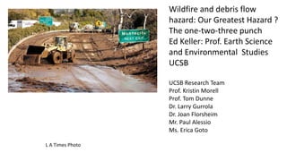
1. L A Times Photo
Wildfire and debris flow
hazard: Our Greatest Hazard ?
The one-two-three punch
Ed Keller: Prof. Earth Science
and Environmental Studies
UCSB
UCSB Research Team
Prof. Kristin Morell
Prof. Tom Dunne
Dr. Larry Gurrola
Dr. Joan Florsheim
Mr. Paul Alessio
Ms. Erica Goto
2. Wildfire is natural process that
helps balance the carbon
budget
As a result of climate change
Wildfire intensity and size are
increasing
Fire season is getting longer—
now almost all year
5. Debris flow sources are on steep slopes above foot of mountains (piedmont)
Debris flow deposits on debris flow fans, a type of alluvial fan
Debris flows may be high speed and of large volume
Debris flows need a source of boulders and a source of fine sediment (mud)
Debris flows have a viscosity about 200 times that of water
Debris flow unit weight of the mud is about 120 lb. per cubic foot
Debris flow boulders have a unit weight of about 150 lb. per cubic foot
As a result of boulders are carried near the surface at front or sides of the flow ---boulders bob along like corks
When the flow slows down the mud moves out from the boulders leaving a boulder field
If debris flow is blocked by a bridge or other structure or goes around a tight bend it may leave channel and spread out
or form a new channel
Stage 1: accumulation of debris in canyon floor (may take
hundreds of years)
Stage 2: Wildfire (occur every 30 -50 years) that forms water
repellant soil
Stage 3: Intense precipitation (example 1/2 inch in a 5
minutes) that occurs ever few hundred years. Debris flow may
occur minutes after.
As a result a large debris flows that comes out of any one
canyon is a rare event
6.
7. Cold Spring Cr. Before 2018 debris flow
Trail Quest
Cols Spring after
2018 Debris flow
looking upstream
Channel is
scoured
T Dunne
8. 34˚26´00´´
119˚44´0
119˚41´00´´
Rocky Nook Park
Skofield Park
Skofield landslide
N
2 km
Figure 15: The major morphologic divisions of the Mission debris flow deposit. The piedmont deposits include the
three morphologic lobes and a region of runout.
There is a long history of
debris flows in S CA.
10. Montecito 2018
Looks a bit like Rocky
Nook, but much smaller
flow
(Mike Eliason / Santa Barbara County Fire
Department photo)
11. New Years Day Flood and debris flow killed more than 40 people, destroyed about 400 houses, and damaged streets,
bridges, and highways. A deadly debris flow killed 12 people who had gone to seek shelter in the Montrose Legion Hall.
The debris simply crashed through the middle of the building, leaving holes in the uphill and downhill walls.
Why was the debris flow so damaging? 1) November 1933 fire and lack of heavy rainstorms in the years before the
flood. First, fire increases the likelihood of landslides after a heavy storm. 2) The 1934 storms produced the heaviest
rainfall in years. Sediments of all sizes - including boulders weighing tons - had been building up in the canyons for a long
time. The heavy rains and the burned hills caused the debris to flow, and destroy all in its path. Source : slight edit of
USGS report. Looks similar to 2018 in Montecito, but fires were much smaller.
Photos: Historical Society of the Crescenta Valley
17. Rainfall Intensity, RIs
Max 5-minute, 10-minute, 15-minute, 30-minute, and 1-hour max rain intensities.
5-minute 0.54" 1/9/2018 03:38:10 AM Montecito Greater than a 200-year frequency rainfall
10-minute 0.73" 1/9/2018 03:34:44 AM KTYD 50-year frequency rainfall
15-minute 0.86" 1/9/2018 03:51:56 AM Carpinteria FS 50-year frequency rainfall
30-minute 1.11" 1/9/2018 03:49:29 AM Carpinteria FS 50-year frequency rainfall
1-hour 1.54" 1/9/2018 03:42:39 AM Matilija Canyon 5-year frequency rainfall
From: Jayme Laber - NOAA Federal [mailto:jayme.laber@noaa.gov]
Sent: Wednesday, January 10, 2018 9:55 AM
31. Larry Gurrola Map UCSB; Alluvial
fans of Montecito
Almost all of Montecito is built
on these fans.
Ages of fans from about
1,000yrs. to 125,000 yrs.
People like the boulders in
gardens –perhaps little clue as to
where and how they got there.
Problem : alluvial fan flooding
32.
33. Lessons Learned
Need to improve science of debris flow and fire recurrence.
Are high magnitude debris flows after fire rare events, but
climate change is increasing the intensity of wildfires as well as
precipitation events.
Need an education program for community
We are attempting to obtain funding
34. More debris flows in other areas over next 2+ years are possible: Carpinteria, Ojai Valley, Ventura Coast, and back country
35. Prior to Storms: Source :USGS
* Watch the patterns of storm-water drainage near your home, and note the places where runoff water
converges, increasing flow in channels. These are areas to avoid during a storm.
* Contact your local authorities to learn about the emergency-response and evacuation plans for your area.
Develop your own emergency plan for your family or business.
During a Storm: Source :USGS
* Stay alert! Many debris-flow and flood fatalities occur when people are sleeping. Listen to the radio for
warnings of intense rainfall. NOAA Weather Radio All Hazards tone alert will let you know of hazards in your
area. Be aware that intense bursts of rain may be particularly dangerous, especially after longer periods of
heavy rainfall.
* If you are in an area susceptible to flooding or debris flow (or has experienced flooding or debris flow in the
past), consider leaving if it is safe to do so. Remember that driving during heavy rainstorms can be hazardous.
* If you are near a stream or a channel, listen for any unusual sounds that might indicate moving debris, such as
trees cracking or boulders knocking together. If you can hear a debris flow (may sound like a freight train) do not
move toward the sound. If time permits, move quickly away and upslope if possible. Don't delay! Save yourself,
not your belongings. You cannot outrun a debris flow.
* Keep in mind that rises in water levels during flash floods and debris flows may occur much more rapidly, and
may be significantly larger, than those produced when the watershed is not burned.
* Be particularly alert when driving. Bridges may be washed out, and culverts overtopped. Do not cross flooding
streams.
36. Research Objectives
1) Map sources and paths of Montecito debris flows
2) Estimate volume of debris flows
3) Understand links between debris flows and wildfire
4) Improve the science of fire related debris flows
5) Improve education: Many in Montecito did not know what a
debris flow or alluvial fan was.
37. Likelihood Model USGS
The likelihood of a debris-flow in response to a given peak 15-minute rainfall intensity are based upon a logistic regression
approach, which combines the following equations:
(1) P = ex / (1 + ex)
Where
P is the probability of debris-flow occurrence in fractional form, and
ex is the exponential function where e represents the mathematical constant 2.718.
For recently burned areas in southern California, equation 2 is used to calculate x:
x = -3.63 + (0.41 × X1R) + (0.67 × X2R) + (0.7 × X3R) burned area factor X precipitation factor X soil factor
Where
X1R is the proportion of upslope area in burned area reflectance class (BARC) Class 3 or 4 with gradients ≥ 23°, multiplied
by the peak 15-minute rainfall accumulation of the design storm (in millimeters [mm]),
X2R is the average differenced normalized burn ratio (dNBR) of the upslope area, multiplied by the peak 15-minute rainfall
accumulation of the design storm (in millimeters [mm]),
X3R is the soil KF-Factor (Schwartz and Alexander, 1995) of the upslope area, multiplied by the peak 15-minute rainfall
accumulation of the design storm (in millimeters [mm]).
Likelihood values predicted by the equation potentially range from 0 (least likely) to 1 (most likely). The predicted
likelihood values are assigned to 1 of 5 equal interval classes for cartographic display, and are represented as a percentage
likelihood (rather than a ratio).
38. Volume Model USGS
Debris-flow volumes both at the basin outlet and along the drainage network are predicted using a
multiple linear regression model (Gartner and others, 2014). The multiple linear regression models
are used to estimate the volume (V, in m3) of material that could issue from a point along the
drainage network in response to a storm of a given rainfall intensity.
Potential debris-flow volume is calculated with the equation :
ln(V) = 4.22 + (0.13 × sqrt(ElevRange)) + (0.36 × ln(HMkm)) + (0.39 × sqrt(i15))
Where
Elev Range is the range (maximum elevation–minimum elevation) of elevation values within the
upstream watershed (in meters),
HMkm is the area upstream of the calculation point that was burned at high or moderate severity (in
km2), and
i15 is the spatially-averaged peak 15-min rainfall intensity for the design storm in the upstream
watershed (in mm/h).
Volume estimates were classified in order of magnitude scale ranges 0–1,000 m3; 1,000–10,000 m3;
10,000–100,000 m3; and greater than 100,000 m3 for cartographic display.