SlideShare una empresa de Scribd logo
1 de 32
Descargar para leer sin conexión
Advanced Data Interoperability:
LiDAR 3D BIM
#FMEwebinar@SafeSoftware
Hi.
Dale Lutz Tiana Warner
Connect
Transform
Automate
FME: by Safe Software Inc.
ArcGIS Data Interoperability Extension
● Convert and transform data in 130+ formats
● Graphical workflow authoring
FME ArcGIS Data Interop Edition
● Adds 150+ more formats
● Adds 100+ more transformers
● safe.com/datainterop
LiDAR
Overview of point cloud scenarios
Converting point cloud formats
Import point clouds and
automatically generate .lasd for
quick LAS use in ArcGIS.
• ASPRS Lidar Data Exchange Format (LAS) • ASTM E57
• Point Cloud XYZ • Oracle Spatial Point Cloud
• RIEGL Laser Scan Database (RDB) • Terrasolid TerraScan
• Mojang Minecraft • Z+F LaserControl ZFS
Demo
Convert TerraScan directory to LAS
Transforming Point Clouds
● Thinning
● Drape to create a surface model
● Slicing/profiling to divide along a line
● Update extents
● Combine
● Set components manually
● Point-by-point calculations
● Point-by-point filtering
● …
Reprojection
● Change a point cloud’s coordinate system
● Support for geocentric coordinates and orthometric
heights
Tiling
● Chop points into a series of tiles
● Speed up processing time using parallel processing on
tiles
● Easier delivery for large point clouds
--------------------------------- Splitting
● Extract points based on the value of any component
● E.g. color, classification, intensity
● Can split based on exact value or range
Demo
Split a point cloud
Colorization
● Automatically set color components
● Overlay point cloud on raster
Demo
Colorize point cloud with orthophoto
3D GIS
Working with 3D data
● Converting 2D building outlines to 3D
○ FeatureMerger joins outlines with
tabular data containing building
heights
○ Extruder adds 3rd dimension to create
3D solids
○ 3DForcer to set base heights for 3D
● TINGenerator creates TIN from a point
cloud
● AppearanceSetter defines details of 3D
surface
Demo
- Convert Shapefile to Sketchup
- Create surface model TIN using height information
from a point cloud
BIM and GIS
Working with BIM data
● File size and complexity make
BIM data hard to repurpose
● BIM exports IFC (too complex)
or DWG (too simple)
● Key: keep what you need,
discard what you don’t
BIM to GIS: Mount Vernon
● George Washington’s home laser scanned to
create high quality BIM in Revit
● Data Interoperability extension used to
convert BIM to GIS
○ Export Revit data (plus added
georeferencing) with FME Revit Exporter
○ Import to ArcGIS with Data
Interoperability extension
○ Reconnect attribution
● Browser delivery – easy sharing
● Rich detail of BIM with spatial context of GIS
fme.ly/MountVernonBlogPost
BIM to GIS Scenarios
● Translate Revit floorplan to
Geodatabase
● Extract/use BIM georeferencing
● Complete control over IFC
hierarchies
● Reduce BIM data volumes
● Update BIM from Excel tables
● Webinar: GIS and BIM
Interoperability - fme.ly/gisbim
Demo
Revit to Geodatabase
Minecraft
Exporting to
Working with Minecraft
● A Minecraft world is a point cloud
● blockID and blockData components
● Convert any data to Minecraft
○ Vector, Raster, LiDAR, BIM, etc.
Example
Bowen Island: GIS + DEM to Minecraft
Workspace Summary
1. Read road lines (Shapefile), forest polygons (MapInfo),
and raster DEM
2. Buffer and clip vectors to avoid overlap
3. Rasterize vector layers
■ Make numeric rasters for Z, blockID, blockData
4. Convert raster pixels to points
■ Set Z value and point cloud components
Minecraft & the Real
World
● Hypothetical scenarios
○ Lava flow
○ Forest fires
○ Rising sea levels
● Geodesign
○ Sweden used Minecraft for
public urban planning
● Fun: fme.ly/MazeGenerator
Free Training
Hands-on and instructor led.
FME Desktop for Esri
August 20
FME Desktop for Smallworld
September 29
www.safe.com/training
Resources / Q&A
● Download a trial at esri.com/datainteroperability
● Esri Virtual Campus – search “Spatial ETL” on training.esri.com
○ Transforming Data Using Extract, Transform, and Load
Processes
○ Controlling Data Translations Using Extract, Transform, and
Load Processes
● Webinar: GIS and BIM Interoperability - fme.ly/gisbim
● Webinar: LiDAR and ArcGIS - fme.ly/interoplidar
● Tutorial: How to make Minecraft worlds in FME - fme.ly/minecraft
Thank you!
Get a free trial of FME
Visit safe.com or contact info@safe.com

Más contenido relacionado

La actualidad más candente

WEB GIS AND WEB MAP.pptx
WEB GIS AND WEB MAP.pptxWEB GIS AND WEB MAP.pptx
WEB GIS AND WEB MAP.pptx
Asim Pt
 
Spatial Data Infrastructure Best Practices with GeoNode
Spatial Data Infrastructure Best Practices with GeoNodeSpatial Data Infrastructure Best Practices with GeoNode
Spatial Data Infrastructure Best Practices with GeoNode
Sebastian Benthall
 
Introduction to GIS
Introduction to GISIntroduction to GIS
Introduction to GIS
Uday kumar Devalla
 

La actualidad más candente (20)

Conversion of Existing Data
Conversion of Existing DataConversion of Existing Data
Conversion of Existing Data
 
Accuracy of UAV Photogrammetry
Accuracy of UAV PhotogrammetryAccuracy of UAV Photogrammetry
Accuracy of UAV Photogrammetry
 
Integration of BIM and GIS: From Ideal to Reality
Integration of BIM and GIS: From Ideal to RealityIntegration of BIM and GIS: From Ideal to Reality
Integration of BIM and GIS: From Ideal to Reality
 
WEB GIS AND WEB MAP.pptx
WEB GIS AND WEB MAP.pptxWEB GIS AND WEB MAP.pptx
WEB GIS AND WEB MAP.pptx
 
Types of Ellipsoid
Types of EllipsoidTypes of Ellipsoid
Types of Ellipsoid
 
What is Geography Information Systems (GIS)
What is Geography Information Systems (GIS)What is Geography Information Systems (GIS)
What is Geography Information Systems (GIS)
 
spatial data infrastructure : issues and concepts
spatial data infrastructure : issues and conceptsspatial data infrastructure : issues and concepts
spatial data infrastructure : issues and concepts
 
Open BIM: bridging the gap between BIM and GIS
Open BIM: bridging the gap between BIM and GISOpen BIM: bridging the gap between BIM and GIS
Open BIM: bridging the gap between BIM and GIS
 
Web GIS
Web GISWeb GIS
Web GIS
 
Mobile gis
Mobile gisMobile gis
Mobile gis
 
Spatial Data Infrastructure Best Practices with GeoNode
Spatial Data Infrastructure Best Practices with GeoNodeSpatial Data Infrastructure Best Practices with GeoNode
Spatial Data Infrastructure Best Practices with GeoNode
 
GIS - lecture-1.ppt
GIS - lecture-1.pptGIS - lecture-1.ppt
GIS - lecture-1.ppt
 
Drone flight data processing
Drone flight data processingDrone flight data processing
Drone flight data processing
 
Introduction To Geographical Information System (GIS)
Introduction To Geographical Information System (GIS) Introduction To Geographical Information System (GIS)
Introduction To Geographical Information System (GIS)
 
Map design in GIS
Map design in GISMap design in GIS
Map design in GIS
 
Slope Modeling & Terrain Analysis (EPAN09)
Slope Modeling & Terrain Analysis (EPAN09)Slope Modeling & Terrain Analysis (EPAN09)
Slope Modeling & Terrain Analysis (EPAN09)
 
UAV: sensors and Remote sensing techniques for the small platform
UAV: sensors and Remote sensing techniques for the small platformUAV: sensors and Remote sensing techniques for the small platform
UAV: sensors and Remote sensing techniques for the small platform
 
Introduction to GIS
Introduction to GISIntroduction to GIS
Introduction to GIS
 
Digital Cartography
Digital CartographyDigital Cartography
Digital Cartography
 
Geoprocessing
GeoprocessingGeoprocessing
Geoprocessing
 

Destacado

Austrade Presentation - Big Data the New Oil (Microsoft draft)
Austrade Presentation - Big Data the New Oil   (Microsoft draft)Austrade Presentation - Big Data the New Oil   (Microsoft draft)
Austrade Presentation - Big Data the New Oil (Microsoft draft)
Dr Andrew Seit
 
Belajar arc gis 10.2 10.3
Belajar arc gis 10.2 10.3Belajar arc gis 10.2 10.3
Belajar arc gis 10.2 10.3
Beni Raharjo
 

Destacado (20)

How to Create GIS and BIM Interoperability
How to Create GIS and BIM InteroperabilityHow to Create GIS and BIM Interoperability
How to Create GIS and BIM Interoperability
 
Prepare LiDAR Data To Meet Your Requirements
Prepare LiDAR Data To Meet Your RequirementsPrepare LiDAR Data To Meet Your Requirements
Prepare LiDAR Data To Meet Your Requirements
 
How to Get the Most Out of LiDAR Data
How to Get the Most Out of LiDAR DataHow to Get the Most Out of LiDAR Data
How to Get the Most Out of LiDAR Data
 
Gain Total Control of Your LiDAR and Point Cloud Data
Gain Total Control of Your LiDAR and Point Cloud DataGain Total Control of Your LiDAR and Point Cloud Data
Gain Total Control of Your LiDAR and Point Cloud Data
 
The XYZ's of LiDAR: Lessons from 6 Point Cloud Wins
The XYZ's of LiDAR: Lessons from 6 Point Cloud WinsThe XYZ's of LiDAR: Lessons from 6 Point Cloud Wins
The XYZ's of LiDAR: Lessons from 6 Point Cloud Wins
 
Application of Morphological Representation to Enhance the Visualization of D...
Application of Morphological Representation to Enhance the Visualization of D...Application of Morphological Representation to Enhance the Visualization of D...
Application of Morphological Representation to Enhance the Visualization of D...
 
Austrade Presentation - Big Data the New Oil (Microsoft draft)
Austrade Presentation - Big Data the New Oil   (Microsoft draft)Austrade Presentation - Big Data the New Oil   (Microsoft draft)
Austrade Presentation - Big Data the New Oil (Microsoft draft)
 
How to Easily Read and Write CityGML Data Using FME
How to Easily Read and Write CityGML Data Using FME How to Easily Read and Write CityGML Data Using FME
How to Easily Read and Write CityGML Data Using FME
 
Chevron Case
Chevron Case Chevron Case
Chevron Case
 
3D Visibility with Vector GIS Data
3D Visibility with Vector GIS Data3D Visibility with Vector GIS Data
3D Visibility with Vector GIS Data
 
Three dimensional (3D) GIS
Three dimensional (3D) GISThree dimensional (3D) GIS
Three dimensional (3D) GIS
 
How to Exchange Data between CAD and GIS
How to Exchange Data between CAD and GISHow to Exchange Data between CAD and GIS
How to Exchange Data between CAD and GIS
 
3-D TECHNOLOGY
3-D TECHNOLOGY 3-D TECHNOLOGY
3-D TECHNOLOGY
 
Tiga Cara Memotong file Raster Sesuai Batas Polygon Menggunakan ArcGIS
Tiga Cara Memotong file Raster Sesuai Batas Polygon Menggunakan ArcGISTiga Cara Memotong file Raster Sesuai Batas Polygon Menggunakan ArcGIS
Tiga Cara Memotong file Raster Sesuai Batas Polygon Menggunakan ArcGIS
 
ATTRIBUT TABLE pada ARCGIS 10.0
ATTRIBUT TABLE pada ARCGIS 10.0ATTRIBUT TABLE pada ARCGIS 10.0
ATTRIBUT TABLE pada ARCGIS 10.0
 
BIM Workflows: How to Build from CAD & GIS for Infrastructure
BIM Workflows: How to Build from CAD & GIS for InfrastructureBIM Workflows: How to Build from CAD & GIS for Infrastructure
BIM Workflows: How to Build from CAD & GIS for Infrastructure
 
Pemetaan digital
Pemetaan digital Pemetaan digital
Pemetaan digital
 
Tutorial penyusunan layer peta & pembuatan layout di arcgis
Tutorial penyusunan layer peta & pembuatan layout di arcgisTutorial penyusunan layer peta & pembuatan layout di arcgis
Tutorial penyusunan layer peta & pembuatan layout di arcgis
 
Belajar arc gis 10.2 10.3
Belajar arc gis 10.2 10.3Belajar arc gis 10.2 10.3
Belajar arc gis 10.2 10.3
 
Modul GIS (QGIS) Diklat GPS dan GIS BPSDM Kementerian PUPR, April 2016
Modul GIS (QGIS) Diklat GPS dan GIS BPSDM Kementerian PUPR, April 2016Modul GIS (QGIS) Diklat GPS dan GIS BPSDM Kementerian PUPR, April 2016
Modul GIS (QGIS) Diklat GPS dan GIS BPSDM Kementerian PUPR, April 2016
 

Similar a ArcGIS Data Interoperability: Tips for LiDAR, 3D, and BIM

Similar a ArcGIS Data Interoperability: Tips for LiDAR, 3D, and BIM (20)

Advanced Data Interoperability: LiDAR, 3D, and BIM - Esri UC 2015
Advanced Data Interoperability:LiDAR, 3D, and BIM - Esri UC 2015Advanced Data Interoperability:LiDAR, 3D, and BIM - Esri UC 2015
Advanced Data Interoperability: LiDAR, 3D, and BIM - Esri UC 2015
 
Your Data in Unreal: How to bring your data into real-time environments
Your Data in Unreal: How to bring your data into real-time environmentsYour Data in Unreal: How to bring your data into real-time environments
Your Data in Unreal: How to bring your data into real-time environments
 
Bridging Between CAD & GIS: 8 Ways to Automate Data Integration
Bridging Between CAD & GIS: 8 Ways to Automate Data IntegrationBridging Between CAD & GIS: 8 Ways to Automate Data Integration
Bridging Between CAD & GIS: 8 Ways to Automate Data Integration
 
Bridging Between CAD & GIS: 8 Ways to Automate Your Data Integration
Bridging Between CAD & GIS: 8 Ways to Automate Your Data IntegrationBridging Between CAD & GIS: 8 Ways to Automate Your Data Integration
Bridging Between CAD & GIS: 8 Ways to Automate Your Data Integration
 
Bridging Between CAD & GIS: 8 Ways to Automate Data Integration
Bridging Between CAD & GIS: 8 Ways to Automate Data IntegrationBridging Between CAD & GIS: 8 Ways to Automate Data Integration
Bridging Between CAD & GIS: 8 Ways to Automate Data Integration
 
5 Ways to Improve Your LiDAR Workflows
5 Ways to Improve Your LiDAR Workflows5 Ways to Improve Your LiDAR Workflows
5 Ways to Improve Your LiDAR Workflows
 
5 Ways to Optimize Your LiDAR Data
5 Ways to Optimize Your LiDAR Data5 Ways to Optimize Your LiDAR Data
5 Ways to Optimize Your LiDAR Data
 
How to Automate CAD & GIS Integration
How to Automate CAD & GIS IntegrationHow to Automate CAD & GIS Integration
How to Automate CAD & GIS Integration
 
Extend the Value of Your BIM Data with FME: Part 1
Extend the Value of Your BIM Data with FME: Part 1Extend the Value of Your BIM Data with FME: Part 1
Extend the Value of Your BIM Data with FME: Part 1
 
Current State of mago3D, an Open Source Based Digital Twin Platform
Current State of mago3D, an Open Source Based Digital Twin PlatformCurrent State of mago3D, an Open Source Based Digital Twin Platform
Current State of mago3D, an Open Source Based Digital Twin Platform
 
Leveraging Autodesk Products with FME: AutoCAD to GIS is Only the Beginning
Leveraging Autodesk Products with FME: AutoCAD to GIS is Only the BeginningLeveraging Autodesk Products with FME: AutoCAD to GIS is Only the Beginning
Leveraging Autodesk Products with FME: AutoCAD to GIS is Only the Beginning
 
State of mago3D, An Open Source Based Digital Twin Platform
State of mago3D, An Open Source Based Digital Twin PlatformState of mago3D, An Open Source Based Digital Twin Platform
State of mago3D, An Open Source Based Digital Twin Platform
 
A sneak peek into the Viasys VDC product roadmaps
A sneak peek into the Viasys VDC product roadmapsA sneak peek into the Viasys VDC product roadmaps
A sneak peek into the Viasys VDC product roadmaps
 
Introduction of super map gis 10i bitcc technology jayson
Introduction of super map gis 10i bitcc technology jaysonIntroduction of super map gis 10i bitcc technology jayson
Introduction of super map gis 10i bitcc technology jayson
 
Bridging Between CAD & GIS: 6 Ways to Automate Your Data Integration
Bridging Between  CAD & GIS: 6 Ways to Automate Your  Data IntegrationBridging Between  CAD & GIS: 6 Ways to Automate Your  Data Integration
Bridging Between CAD & GIS: 6 Ways to Automate Your Data Integration
 
Bridging Between CAD & GIS: 6 Ways to Automate Your Data Integration
Bridging Between CAD & GIS: 6 Ways to Automate Your Data IntegrationBridging Between CAD & GIS: 6 Ways to Automate Your Data Integration
Bridging Between CAD & GIS: 6 Ways to Automate Your Data Integration
 
Bridging Between CAD & GIS: 6 Ways to Automate Your Data Integration
Bridging Between CAD & GIS:  6 Ways to Automate Your Data IntegrationBridging Between CAD & GIS:  6 Ways to Automate Your Data Integration
Bridging Between CAD & GIS: 6 Ways to Automate Your Data Integration
 
FME 2020 Unleashed: Authoring
FME 2020 Unleashed: AuthoringFME 2020 Unleashed: Authoring
FME 2020 Unleashed: Authoring
 
Introduction to mago3D, an Open Source Based Digital Twin Platform
Introduction to mago3D, an Open Source Based Digital Twin PlatformIntroduction to mago3D, an Open Source Based Digital Twin Platform
Introduction to mago3D, an Open Source Based Digital Twin Platform
 
Extending 3D Model Visualization with FME 2017
Extending 3D Model Visualization with FME 2017Extending 3D Model Visualization with FME 2017
Extending 3D Model Visualization with FME 2017
 

Más de Safe Software

Cloud Frontiers: A Deep Dive into Serverless Spatial Data and FME
Cloud Frontiers:  A Deep Dive into Serverless Spatial Data and FMECloud Frontiers:  A Deep Dive into Serverless Spatial Data and FME
Cloud Frontiers: A Deep Dive into Serverless Spatial Data and FME
Safe Software
 
Cloud Revolution: Exploring the New Wave of Serverless Spatial Data
Cloud Revolution: Exploring the New Wave of Serverless Spatial DataCloud Revolution: Exploring the New Wave of Serverless Spatial Data
Cloud Revolution: Exploring the New Wave of Serverless Spatial Data
Safe Software
 
Igniting Next Level Productivity with AI-Infused Data Integration Workflows
Igniting Next Level Productivity with AI-Infused Data Integration WorkflowsIgniting Next Level Productivity with AI-Infused Data Integration Workflows
Igniting Next Level Productivity with AI-Infused Data Integration Workflows
Safe Software
 
Introducing the New FME Community Webinar - Feb 21, 2024 (2).pdf
Introducing the New FME Community Webinar - Feb 21, 2024 (2).pdfIntroducing the New FME Community Webinar - Feb 21, 2024 (2).pdf
Introducing the New FME Community Webinar - Feb 21, 2024 (2).pdf
Safe Software
 
Cloud Revolution: Exploring the New Wave of Serverless Spatial Data
Cloud Revolution: Exploring the New Wave of Serverless Spatial DataCloud Revolution: Exploring the New Wave of Serverless Spatial Data
Cloud Revolution: Exploring the New Wave of Serverless Spatial Data
Safe Software
 
Taking Off with FME: Elevating Airport Operations to New Heights
Taking Off with FME: Elevating Airport Operations to New HeightsTaking Off with FME: Elevating Airport Operations to New Heights
Taking Off with FME: Elevating Airport Operations to New Heights
Safe Software
 
Initiating and Advancing Your Strategic GIS Governance Strategy
Initiating and Advancing Your Strategic GIS Governance StrategyInitiating and Advancing Your Strategic GIS Governance Strategy
Initiating and Advancing Your Strategic GIS Governance Strategy
Safe Software
 
Igniting Next Level Productivity with AI-Infused Data Integration Workflows
Igniting Next Level Productivity with AI-Infused Data Integration Workflows Igniting Next Level Productivity with AI-Infused Data Integration Workflows
Igniting Next Level Productivity with AI-Infused Data Integration Workflows
Safe Software
 
Geospatial Synergy: Amplifying Efficiency with FME & Esri ft. Peak Guest Spea...
Geospatial Synergy: Amplifying Efficiency with FME & Esri ft. Peak Guest Spea...Geospatial Synergy: Amplifying Efficiency with FME & Esri ft. Peak Guest Spea...
Geospatial Synergy: Amplifying Efficiency with FME & Esri ft. Peak Guest Spea...
Safe Software
 

Más de Safe Software (20)

Cloud Frontiers: A Deep Dive into Serverless Spatial Data and FME
Cloud Frontiers:  A Deep Dive into Serverless Spatial Data and FMECloud Frontiers:  A Deep Dive into Serverless Spatial Data and FME
Cloud Frontiers: A Deep Dive into Serverless Spatial Data and FME
 
From Event to Action: Accelerate Your Decision Making with Real-Time Automation
From Event to Action: Accelerate Your Decision Making with Real-Time AutomationFrom Event to Action: Accelerate Your Decision Making with Real-Time Automation
From Event to Action: Accelerate Your Decision Making with Real-Time Automation
 
From Event to Action: Accelerate Your Decision Making with Real-Time Automation
From Event to Action:  Accelerate Your Decision Making with Real-Time AutomationFrom Event to Action:  Accelerate Your Decision Making with Real-Time Automation
From Event to Action: Accelerate Your Decision Making with Real-Time Automation
 
Beyond Boundaries: Leveraging No-Code Solutions for Industry Innovation
Beyond Boundaries: Leveraging No-Code Solutions for Industry InnovationBeyond Boundaries: Leveraging No-Code Solutions for Industry Innovation
Beyond Boundaries: Leveraging No-Code Solutions for Industry Innovation
 
Powering Real-Time Decisions with Continuous Data Streams
Powering Real-Time Decisions with Continuous Data StreamsPowering Real-Time Decisions with Continuous Data Streams
Powering Real-Time Decisions with Continuous Data Streams
 
The Critical Role of Spatial Data in Today's Data Ecosystem
The Critical Role of Spatial Data in Today's Data EcosystemThe Critical Role of Spatial Data in Today's Data Ecosystem
The Critical Role of Spatial Data in Today's Data Ecosystem
 
Cloud Revolution: Exploring the New Wave of Serverless Spatial Data
Cloud Revolution: Exploring the New Wave of Serverless Spatial DataCloud Revolution: Exploring the New Wave of Serverless Spatial Data
Cloud Revolution: Exploring the New Wave of Serverless Spatial Data
 
Igniting Next Level Productivity with AI-Infused Data Integration Workflows
Igniting Next Level Productivity with AI-Infused Data Integration WorkflowsIgniting Next Level Productivity with AI-Infused Data Integration Workflows
Igniting Next Level Productivity with AI-Infused Data Integration Workflows
 
The Zero-ETL Approach: Enhancing Data Agility and Insight
The Zero-ETL Approach: Enhancing Data Agility and InsightThe Zero-ETL Approach: Enhancing Data Agility and Insight
The Zero-ETL Approach: Enhancing Data Agility and Insight
 
Mastering MicroStation DGN: How to Integrate CAD and GIS
Mastering MicroStation DGN: How to Integrate CAD and GISMastering MicroStation DGN: How to Integrate CAD and GIS
Mastering MicroStation DGN: How to Integrate CAD and GIS
 
Geospatial Synergy: Amplifying Efficiency with FME & Esri
Geospatial Synergy: Amplifying Efficiency with FME & EsriGeospatial Synergy: Amplifying Efficiency with FME & Esri
Geospatial Synergy: Amplifying Efficiency with FME & Esri
 
Introducing the New FME Community Webinar - Feb 21, 2024 (2).pdf
Introducing the New FME Community Webinar - Feb 21, 2024 (2).pdfIntroducing the New FME Community Webinar - Feb 21, 2024 (2).pdf
Introducing the New FME Community Webinar - Feb 21, 2024 (2).pdf
 
Breaking Barriers & Leveraging the Latest Developments in AI Technology
Breaking Barriers & Leveraging the Latest Developments in AI TechnologyBreaking Barriers & Leveraging the Latest Developments in AI Technology
Breaking Barriers & Leveraging the Latest Developments in AI Technology
 
Best Practices to Navigating Data and Application Integration for the Enterpr...
Best Practices to Navigating Data and Application Integration for the Enterpr...Best Practices to Navigating Data and Application Integration for the Enterpr...
Best Practices to Navigating Data and Application Integration for the Enterpr...
 
Cloud Revolution: Exploring the New Wave of Serverless Spatial Data
Cloud Revolution: Exploring the New Wave of Serverless Spatial DataCloud Revolution: Exploring the New Wave of Serverless Spatial Data
Cloud Revolution: Exploring the New Wave of Serverless Spatial Data
 
New Year's Fireside Chat with Safe Software’s Founders
New Year's Fireside Chat with Safe Software’s FoundersNew Year's Fireside Chat with Safe Software’s Founders
New Year's Fireside Chat with Safe Software’s Founders
 
Taking Off with FME: Elevating Airport Operations to New Heights
Taking Off with FME: Elevating Airport Operations to New HeightsTaking Off with FME: Elevating Airport Operations to New Heights
Taking Off with FME: Elevating Airport Operations to New Heights
 
Initiating and Advancing Your Strategic GIS Governance Strategy
Initiating and Advancing Your Strategic GIS Governance StrategyInitiating and Advancing Your Strategic GIS Governance Strategy
Initiating and Advancing Your Strategic GIS Governance Strategy
 
Igniting Next Level Productivity with AI-Infused Data Integration Workflows
Igniting Next Level Productivity with AI-Infused Data Integration Workflows Igniting Next Level Productivity with AI-Infused Data Integration Workflows
Igniting Next Level Productivity with AI-Infused Data Integration Workflows
 
Geospatial Synergy: Amplifying Efficiency with FME & Esri ft. Peak Guest Spea...
Geospatial Synergy: Amplifying Efficiency with FME & Esri ft. Peak Guest Spea...Geospatial Synergy: Amplifying Efficiency with FME & Esri ft. Peak Guest Spea...
Geospatial Synergy: Amplifying Efficiency with FME & Esri ft. Peak Guest Spea...
 

Último

+971565801893>>SAFE AND ORIGINAL ABORTION PILLS FOR SALE IN DUBAI AND ABUDHAB...
+971565801893>>SAFE AND ORIGINAL ABORTION PILLS FOR SALE IN DUBAI AND ABUDHAB...+971565801893>>SAFE AND ORIGINAL ABORTION PILLS FOR SALE IN DUBAI AND ABUDHAB...
+971565801893>>SAFE AND ORIGINAL ABORTION PILLS FOR SALE IN DUBAI AND ABUDHAB...
Health
 

Último (20)

call girls in Vaishali (Ghaziabad) 🔝 >༒8448380779 🔝 genuine Escort Service 🔝✔️✔️
call girls in Vaishali (Ghaziabad) 🔝 >༒8448380779 🔝 genuine Escort Service 🔝✔️✔️call girls in Vaishali (Ghaziabad) 🔝 >༒8448380779 🔝 genuine Escort Service 🔝✔️✔️
call girls in Vaishali (Ghaziabad) 🔝 >༒8448380779 🔝 genuine Escort Service 🔝✔️✔️
 
Vip Call Girls Noida ➡️ Delhi ➡️ 9999965857 No Advance 24HRS Live
Vip Call Girls Noida ➡️ Delhi ➡️ 9999965857 No Advance 24HRS LiveVip Call Girls Noida ➡️ Delhi ➡️ 9999965857 No Advance 24HRS Live
Vip Call Girls Noida ➡️ Delhi ➡️ 9999965857 No Advance 24HRS Live
 
+971565801893>>SAFE AND ORIGINAL ABORTION PILLS FOR SALE IN DUBAI AND ABUDHAB...
+971565801893>>SAFE AND ORIGINAL ABORTION PILLS FOR SALE IN DUBAI AND ABUDHAB...+971565801893>>SAFE AND ORIGINAL ABORTION PILLS FOR SALE IN DUBAI AND ABUDHAB...
+971565801893>>SAFE AND ORIGINAL ABORTION PILLS FOR SALE IN DUBAI AND ABUDHAB...
 
How To Use Server-Side Rendering with Nuxt.js
How To Use Server-Side Rendering with Nuxt.jsHow To Use Server-Side Rendering with Nuxt.js
How To Use Server-Side Rendering with Nuxt.js
 
The Real-World Challenges of Medical Device Cybersecurity- Mitigating Vulnera...
The Real-World Challenges of Medical Device Cybersecurity- Mitigating Vulnera...The Real-World Challenges of Medical Device Cybersecurity- Mitigating Vulnera...
The Real-World Challenges of Medical Device Cybersecurity- Mitigating Vulnera...
 
The Ultimate Test Automation Guide_ Best Practices and Tips.pdf
The Ultimate Test Automation Guide_ Best Practices and Tips.pdfThe Ultimate Test Automation Guide_ Best Practices and Tips.pdf
The Ultimate Test Automation Guide_ Best Practices and Tips.pdf
 
HR Software Buyers Guide in 2024 - HRSoftware.com
HR Software Buyers Guide in 2024 - HRSoftware.comHR Software Buyers Guide in 2024 - HRSoftware.com
HR Software Buyers Guide in 2024 - HRSoftware.com
 
Unlocking the Future of AI Agents with Large Language Models
Unlocking the Future of AI Agents with Large Language ModelsUnlocking the Future of AI Agents with Large Language Models
Unlocking the Future of AI Agents with Large Language Models
 
Microsoft AI Transformation Partner Playbook.pdf
Microsoft AI Transformation Partner Playbook.pdfMicrosoft AI Transformation Partner Playbook.pdf
Microsoft AI Transformation Partner Playbook.pdf
 
Tech Tuesday-Harness the Power of Effective Resource Planning with OnePlan’s ...
Tech Tuesday-Harness the Power of Effective Resource Planning with OnePlan’s ...Tech Tuesday-Harness the Power of Effective Resource Planning with OnePlan’s ...
Tech Tuesday-Harness the Power of Effective Resource Planning with OnePlan’s ...
 
How to Choose the Right Laravel Development Partner in New York City_compress...
How to Choose the Right Laravel Development Partner in New York City_compress...How to Choose the Right Laravel Development Partner in New York City_compress...
How to Choose the Right Laravel Development Partner in New York City_compress...
 
Introducing Microsoft’s new Enterprise Work Management (EWM) Solution
Introducing Microsoft’s new Enterprise Work Management (EWM) SolutionIntroducing Microsoft’s new Enterprise Work Management (EWM) Solution
Introducing Microsoft’s new Enterprise Work Management (EWM) Solution
 
Software Quality Assurance Interview Questions
Software Quality Assurance Interview QuestionsSoftware Quality Assurance Interview Questions
Software Quality Assurance Interview Questions
 
A Secure and Reliable Document Management System is Essential.docx
A Secure and Reliable Document Management System is Essential.docxA Secure and Reliable Document Management System is Essential.docx
A Secure and Reliable Document Management System is Essential.docx
 
Exploring the Best Video Editing App.pdf
Exploring the Best Video Editing App.pdfExploring the Best Video Editing App.pdf
Exploring the Best Video Editing App.pdf
 
VTU technical seminar 8Th Sem on Scikit-learn
VTU technical seminar 8Th Sem on Scikit-learnVTU technical seminar 8Th Sem on Scikit-learn
VTU technical seminar 8Th Sem on Scikit-learn
 
Optimizing AI for immediate response in Smart CCTV
Optimizing AI for immediate response in Smart CCTVOptimizing AI for immediate response in Smart CCTV
Optimizing AI for immediate response in Smart CCTV
 
Diamond Application Development Crafting Solutions with Precision
Diamond Application Development Crafting Solutions with PrecisionDiamond Application Development Crafting Solutions with Precision
Diamond Application Development Crafting Solutions with Precision
 
How To Troubleshoot Collaboration Apps for the Modern Connected Worker
How To Troubleshoot Collaboration Apps for the Modern Connected WorkerHow To Troubleshoot Collaboration Apps for the Modern Connected Worker
How To Troubleshoot Collaboration Apps for the Modern Connected Worker
 
Shapes for Sharing between Graph Data Spaces - and Epistemic Querying of RDF-...
Shapes for Sharing between Graph Data Spaces - and Epistemic Querying of RDF-...Shapes for Sharing between Graph Data Spaces - and Epistemic Querying of RDF-...
Shapes for Sharing between Graph Data Spaces - and Epistemic Querying of RDF-...
 

ArcGIS Data Interoperability: Tips for LiDAR, 3D, and BIM

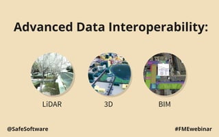
  • 1. Advanced Data Interoperability: LiDAR 3D BIM #FMEwebinar@SafeSoftware
  • 4. ArcGIS Data Interoperability Extension ● Convert and transform data in 130+ formats ● Graphical workflow authoring
  • 5. FME ArcGIS Data Interop Edition ● Adds 150+ more formats ● Adds 100+ more transformers ● safe.com/datainterop
  • 6. LiDAR Overview of point cloud scenarios
  • 7. Converting point cloud formats Import point clouds and automatically generate .lasd for quick LAS use in ArcGIS. • ASPRS Lidar Data Exchange Format (LAS) • ASTM E57 • Point Cloud XYZ • Oracle Spatial Point Cloud • RIEGL Laser Scan Database (RDB) • Terrasolid TerraScan • Mojang Minecraft • Z+F LaserControl ZFS
  • 9. Transforming Point Clouds ● Thinning ● Drape to create a surface model ● Slicing/profiling to divide along a line ● Update extents ● Combine ● Set components manually ● Point-by-point calculations ● Point-by-point filtering ● …
  • 10. Reprojection ● Change a point cloud’s coordinate system ● Support for geocentric coordinates and orthometric heights
  • 11. Tiling ● Chop points into a series of tiles ● Speed up processing time using parallel processing on tiles ● Easier delivery for large point clouds
  • 12. --------------------------------- Splitting ● Extract points based on the value of any component ● E.g. color, classification, intensity ● Can split based on exact value or range
  • 14. Colorization ● Automatically set color components ● Overlay point cloud on raster
  • 15. Demo Colorize point cloud with orthophoto
  • 17. Working with 3D data ● Converting 2D building outlines to 3D ○ FeatureMerger joins outlines with tabular data containing building heights ○ Extruder adds 3rd dimension to create 3D solids ○ 3DForcer to set base heights for 3D ● TINGenerator creates TIN from a point cloud ● AppearanceSetter defines details of 3D surface
  • 18. Demo - Convert Shapefile to Sketchup - Create surface model TIN using height information from a point cloud
  • 19. BIM and GIS Working with BIM data
  • 20. Working with BIM data ● File size and complexity make BIM data hard to repurpose ● BIM exports IFC (too complex) or DWG (too simple) ● Key: keep what you need, discard what you don’t
  • 21. BIM to GIS: Mount Vernon ● George Washington’s home laser scanned to create high quality BIM in Revit ● Data Interoperability extension used to convert BIM to GIS ○ Export Revit data (plus added georeferencing) with FME Revit Exporter ○ Import to ArcGIS with Data Interoperability extension ○ Reconnect attribution ● Browser delivery – easy sharing ● Rich detail of BIM with spatial context of GIS fme.ly/MountVernonBlogPost
  • 22. BIM to GIS Scenarios ● Translate Revit floorplan to Geodatabase ● Extract/use BIM georeferencing ● Complete control over IFC hierarchies ● Reduce BIM data volumes ● Update BIM from Excel tables ● Webinar: GIS and BIM Interoperability - fme.ly/gisbim
  • 25. Working with Minecraft ● A Minecraft world is a point cloud ● blockID and blockData components ● Convert any data to Minecraft ○ Vector, Raster, LiDAR, BIM, etc.
  • 26. Example Bowen Island: GIS + DEM to Minecraft
  • 27. Workspace Summary 1. Read road lines (Shapefile), forest polygons (MapInfo), and raster DEM 2. Buffer and clip vectors to avoid overlap 3. Rasterize vector layers ■ Make numeric rasters for Z, blockID, blockData 4. Convert raster pixels to points ■ Set Z value and point cloud components
  • 28.
  • 29. Minecraft & the Real World ● Hypothetical scenarios ○ Lava flow ○ Forest fires ○ Rising sea levels ● Geodesign ○ Sweden used Minecraft for public urban planning ● Fun: fme.ly/MazeGenerator
  • 30. Free Training Hands-on and instructor led. FME Desktop for Esri August 20 FME Desktop for Smallworld September 29 www.safe.com/training
  • 31. Resources / Q&A ● Download a trial at esri.com/datainteroperability ● Esri Virtual Campus – search “Spatial ETL” on training.esri.com ○ Transforming Data Using Extract, Transform, and Load Processes ○ Controlling Data Translations Using Extract, Transform, and Load Processes ● Webinar: GIS and BIM Interoperability - fme.ly/gisbim ● Webinar: LiDAR and ArcGIS - fme.ly/interoplidar ● Tutorial: How to make Minecraft worlds in FME - fme.ly/minecraft
  • 32. Thank you! Get a free trial of FME Visit safe.com or contact info@safe.com