
Recomendados
Más contenido relacionado
La actualidad más candente
La actualidad más candente (20)
Similar a Enbe
Similar a Enbe (20)
Más de Sarah Esa
Más de Sarah Esa (20)
Último
Último (20)
Enbe
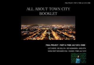
- 1. FINAL PROJECT / PART A / FNBE JULY 2015 / ENBE ALL ABOUT TOWN CITY BOOKLET “PUCHONG” FINAL PROJECT / PART A / FNBE JULY 2015 / ENBE LECTURERS : MS DELLIYA – MS HASMANIRA – MISS IFFA SARAH BINTI MOHAMED ESA / 0324805 / FNBE JULY 2015
- 2. CONTENT TITLE PAGE WHAT IS A “TOWN” 1 PAST, PRESENT AND FUTURE CITY 3 TOWN PLANNING PRINCIPLE : SATTELITE TOWNS 16 WHAT MAKES A BETTER FUTURE CITY ? 23 THE TOWN THAT I LIVE IN 25 BETTER FUTURE CITY 38 APPENDIX 40
- 3. WHAT IS A“TOWN”?? URBAN AREA HAS A NAME DEFINED BY BOUNDARIES & LOCAL GOVERNMENTS TOWN PROVIDES SECURITY RULES AND LAWS CITY SERVICES 1
- 4. CITY VS. TOWN SIZE COMPARISONS : CITY TOWN POPULATION : RULER: CORPORATE BODIES MUNICIPAL BODIES HEAD : MAYOR CHAIRMAN 2
- 5. M E D I E V A L C I T Y MEDIEVAL, THE DARK AGES EARLY ( 5th -10th ) MIDIEVAL PERIOD( CENTURY ) HIGH ( 11th – 13th ) LATE ( 13th – 15th ) ARCHITECTURE ROMANESQUE ARCHITECTURE LEANING TOWER OF PISA, ITALY GOTHIC ARCHITECTURE CATHEDRAL OF EXETER, ENGLAND Have round arches and vaults any by the substitution of columns Have stained-glass windows, gargoyles, flying buttresses, tall spires, turrets and pointed arches. PERPENDICULAR GOTHIC ARCHITECTURE KING’S COLLEGE CHAPEL, ENGLAND Have vertical lines of stone window tracery, enlargement of windows with great proportions and conversion of the interior stories into a single unified vertical expanse. 3
- 6. M E D I E V A L C I T Y THE COUNTRIES OF MEDIEVAL ENGLAND FRANCE ITALY SCOTLAND DENMARK IRELAND RUSSIA HUNGARY 4
- 7. EXAMPLE: MONT-SAINT MICHEL, FRANCE LOCATION : Mouth of the Couesnon River near Avranches SIZE : 100 hectares POPULATION: <1000 The Mont-Saint Michel is named after the arch-angel, Saint Michel. It is known as the Merveille de l'Occident or Wonder of the Western World. The construction of the abbey took more than 500 years, from 1017 to 1521. It is inspired actually from the appearance of angel Michael in a series of dreams dreamt by Aubert, Bishop of Avranches, telling him to build a church on what was then a barren rock called Mont Tombe. 5
- 8. EXAMPLE: MONT-SAINT MICHEL, FRANCE The structural composition of the city exemplifies the feudal society that constructed it. For example, the top rock is capped by a large cathedral which represents the God, the abbey and monastery. The position of the homes and shops below hugs the sides of the city’s formation. At the bottom, outside the walls is where the fishermen and farmers live. Most of the buildings here are made out of granite and limestone. Many underground crypts and chapels had to be build to compensate the weight of the Abbey that formed the basis for the supportive upward structure which can be seen today. In conclusion, the tiny Mount-Saint Michel is the most unspoiled Medieval city in Europe as it has remained virtually the same over the centuries. 6
- 9. C U R R E N T C I T Y WHAT IS “CURRENT CITY” ? A CITY THAT IS HAPPENING OR BEING USED THAT HAS THE POTENTIAL OF BECOMING A FUTURISTIC CITY. BELONGING TO PRESENT 7
- 10. EXAMPLE : KUALA LUMPUR, MALAYSIA LOCATION : Central west coast of Peninsula Malaysia SIZE : 243km² POPULATION : Approximately 7.1million (1.6 million in the core city of Kuala Lumpur and 5.5 million in the suburbs). YEAR 1875 It all started in the year 1875 when a member of Selangor’s royal family, Raja Abdullah, decided to open up an area In the Klang Valley for tin prospectors. Miners from China soon arrived and despite pestilence that killed a large number of them, the Chinese miners thrived, attracting merchants and businesses. The commercial area of tin trading was located in the confluence of the Klang and Gombak rivers and it was here that Kuala Lumpur was established. 8
- 11. EXAMPLE : KUALA LUMPUR, MALAYSIA The Kuala Lumpur region of Malaysia is generally defined by the state of Sealngor and two geographical enclaves, the federal territories of Kuala Lumpur (white) and Putrajaya . Kuala Lumpur houses the national Parliament and Putrajaya the executive and judicial branches. Kuala Lumpur urban area is located in a densely forested tropical region, where the residential areas take place. The largest building are mostly located at the central business district which are much less densely packed compared to most large cities around the world. 9
- 12. EXAMPLE : KUALA LUMPUR, MALAYSIA Besides that, Kuala Lumpur had opened three metro lines, a monorail and three commuter rail lines in 2010. Kuala Lumpur region also serves and extensive network of expressways. One of the common expressways is the SMART tunnel which serves both vehicles and storm water. This tunnel is very useful to overcome the traffic madness especially when there is serious flooding. 10
- 13. F U T U R I S T I C C I T Y STEPPING INTO THE FUTURE FUTURISTIC modern technology or design. the characteristics of futurism Something that has to do with future or is ahead of the current city CURRENT CITY FUTURISTIC CITY enhance quality and performance of urban services reduce the resource consumption engage effectively and actively with its citizens 11
- 14. F U T U R I S T I C C I T Y FUTURISTICS CITIES ACROSS THE GLOBE JAPAN TOKYO CITY CHINA HONG KONG FUTURISTIC ARCHITECTURE FUTURISTIC ARCHITECTURE & TECHNOLOGY 12
- 15. F U T U R I S T I C C I T Y FUTURISTICS CITIES ACROSS THE GLOBE SYSTEMATIC PLANS FOR GROWTH SINGAPORE FINLAND HELSINKI DATA TRANSPARENCY 13
- 16. EXAMPLE: DUBAI, UNITED ARAB EMIRATES LOCATION : Persian Gulf, northeast of United Arab Emirates SIZE : 3885km² (urban area) 35km² (city) POPULATION : 2106 million (2013) The formation of Dubai started at the mouth of the creek. The creek was a natural harbor and Dubai soon became a centre for fishing , pearling and sea trade. In the 1950’s the creek began to slit and turned into a waterway dredged. As a result, Dubai had became a major trading and re-export hub. Oil which was discovered in 1966 had increased the infrastructure development of Dubai until today. 14
- 17. EXAMPLE: DUBAI, UNITED ARAB EMIRATES The reason why Dubai known as one of the futuristic city in the world is because of its buildings and structures. Dubai offers some of the world’s tallest and biggest structures. Biggest mall, tallest hotel, second largest man-made marina and the world’s largest aquarium are all located in Dubai. Dubai Creek which is located in the city of Dubai provides porting facilities for traders from the area and the subcontinent. It is also used as boating activities. Dubai Palm Island is one of Dubai’s man- made islands. It consists of hotels and resorts, beachfront houses and shopping malls. However, the traffic in Dubai is so bad and it become congested because of the developments. So in order to overcome this problem , double- decker roads for transportation were being introduced here. 15
- 18. TOWN PLANNING PRINCIPLE: SATELLITE TOWN Town, self-contained and limited in size, built in a particular place of a large town or city. A planned city in a natural growth path of a nearby larger city designed to stop urban sprawl ( expansion of human population) to the suburbs and to supplement and aid the larger city’s expansion. 16
- 19. CHARACTERISTICS OF A SATELLITE TOWN Partially independent from that metropolis economically and socially. Physically separated from the metropolis by rural territory or by a major geographic barrier. Satellite cities should have their own independent urbanized area. Have their own bedroom communities (residential area; a suburb of a major urban center) May have a traditional downtown surrounded by traditional “inner city” neighborhoods. 17
- 20. EXAMPLE: BRASILIA , BRAZIL LOCATION : BRAZIL FOUNDED : 22nd APRIL 1960 POPULATION : 2.5 MILLION (2011) URBAN PLANNER : LUCIO COSTA ARCHITECT : OSCAR NIEMEYER LANDSCAPE ARCHITECT : BURLE MARX Brasilia is the capital city of Brazil and it was officially opened on 22nd April 1960. It is a planned city distinguished by its white, modern architecture designed by Oscar Niemeyer. Brasilia existed because of the migrants from all across the country saw Brasilia an opportunity for a better life. Because of this, small villages were built. As the number of migrants increases, these villages had grew and eventually turned into satellite city. 1946 1956 now 18
- 21. EXAMPLE: BRASILIA , BRAZIL BRASILIA’S TOWN PLANNING STAGES Urban planner, Lucio Costa had decided a concept pointed to the shape of a cross, to symbolize possession. Brasilia has two axis crossing at right angle; the monumental axis intersecting in the centre of the city with a residential axis. Residential axis Monumental axis To adapt this design to the local topography, the natural drainage of the area was included. One of the axis was curved in order to fit into the equilateral triangle. Curved axis (residential axis) 19
- 22. EXAMPLE: BRASILIA , BRAZIL BRASILIA’S TOWN PLANNING Residential - civic and administrative centres - recreation centres - municipal administration facilities - storage and supply zones - railway station - banking - commercial districts - high-way residential Entertainment 20
- 23. EXAMPLE: BRASILIA , BRAZIL BRASILIA’S TRANSPORTATION SYSTEM Eixo Rodoviaro runs North to South with a slight curve. Eixo Monumental runs straight from East to West and divides the city into North Wing and South Wing. Loop roads without traffic lights had helped to reduce traffic jams during the peak hours. It is also used to gain access to local streets. BRASILIA INTERNATIONAL AIRPORT Serves domestic flights from major cities. CENTAL BUS STATIONS Located at the intersection of the Eixo Rodoviaro and Eixo Monumental. 21
- 24. EXAMPLE: BRASILIA , BRAZIL BRASILIA’S TRANSPORTATION SYSTEM VEHICULAR CIRCULATION Secondary Roads : Controls heavy vehicular traffics. Traffic : Controlled by roads that would either go on a platform, underground, or under the platform. Clover Shaped Turn – Offs: Circulate in different districts without creating an intersection. PEDESTRIAN PATH Independent Paths : Local pathway systems were created for each district. Separated from vehicular circulation. LANDSCAPING Buildings are surrounded by bands of greenery planted with trees. Park cities are filled with open areas ; squares, gardens, orchards. 22
- 25. WHAT MAKES A BETTER FUTURE CITY? Increase public transportation especially monorails to provide more space for other developments as ell as reduce bad traffics Transform unused roofs spaces into a garden for leisure activities. Instead of using big trucks, cities can use smaller and greener vans to make deliveries. This will lower the street’s congestion and provide space for people to walk around. Use power plants in cities. They can be connected to smart grids which can reduce energy consumption. 23
- 26. WHAT MAKES A BETTER FUTURE CITY? Turn underground basement parking into a reservoir to divert flood water in a control way and can help to reduce flash floods during the rainy days. Introduce more Footfall Harvesting. Footfall Harvesting is the capture of kinetic energy from pedestrians’ footsteps and convert it into electricity. To encourage people to keep a city clean, the government should introduce Smart Rubbish Bins. It is a rubbish bin which is equipped with motor that pushes down the rubbish when it reach near the top. Develop affordable mixed-use neighborhoods. It means that a way of a development of a building that blends the combination of residential, commercial, cultural, institutional or industrial uses that provides pedestrian connections. 24
- 27. THE TOWN THAT I LIVE IN 25
- 28. INTRODUCING PUCHONG LOCATION : MIDWAY BETWEEN KUALA LUMPUR AND PETALING JAYA SIZE : 19.97mi² = 335419 (2008) ESTABLISHMENT : Early 1900 KUALA LUMPUR PUCHONGDISTANCE : 23.7km 26
- 29. ZONING OF PUCHONG Puchong serves as a residential town for three major cities, Kuala Lumpur, Subang Jaya and Petaling Jaya. About 28% of Puchong is the residential areas. FOCUS AREA; BANDAR PUTERI Bandar Puteri is considered as the new township developed by the IOI Group. It is located in a strategic location near Putrajaya, Cyberjaya, the Kuala Lumpur International Airport, Subang Jaya and Sunway. 27
- 30. RESIDENTIAL AREAS IN BANDAR PUTERI, PUCHONG Location : Puteri 8, Bandar Puteri This is where the medium-cost terraces are located Location : Puteri 12, Bandar Puteri This is the only high-cost residential area located in Bandar Puteri. The houses here are mostly 3-storey terrace houses and also bungalows with front yard and backyard. There are also bungalows located on the hill side (right). SRI DAHLIA APARTMENT Location : Puteri 3, Bandar Puteri One of the low-cost apartment in Bandar Puteri is Sri Dahlia Apartment. It is a five- storey walk up apartment with a total of five blocks and 600 units. 28
- 31. PUBLIC BUILDINGS IN BANDAR PUTERI, PUCHONG MICHAEL’S BADMINTON COURT Location : Puteri 1, Bandar Puteri On some days, school students will come here to play badminton for their curricular activities. Some badminton competitions were also held here. HIPERMEDIA LIBRARY Location : Puteri 1, Bandar Puteri It is a new library opened by MPSJ which located just opposite the Michael’s Badminton Court. 29
- 32. PARKS IN BANDAR PUTERI, PUCHONG TOWN PARK Location : Jalan Puteri 5, Bandar Puteri This is the only biggest park here in Bandar Puteri. Bandar Puteri residence often come here for leisure or recreational activities. The location is strategic as it is located near to Puteri Mart and the residential area so the residence have easy access to the park. 30
- 33. MARKET PLACE IN BANDAR PUTERI, PUCHONG Location : Lengkuk Puteri Utama, Bandar Puteri Puteri Mart is a wet market and food court in one building. The back side of the building is allocated for the morning market vendors whereas the food court is located at the front portion of the building. Puteri Mart is always packed especially during the weekends PUTERI MART GIANT SUPERMARKET Location : Jalan Puteri 1, Bandar Puteri This is the only superstore in Bandar Puteri where the residents go for groceries shopping. THE CUBE Location : Jalan Puteri 7, Bandar Puteri The Cube is a commercial development of IOI Properties. It is a 926 acres of three storey shop office. 31
- 34. GOVERNMENT BUILDINGS IN BANDAR PUTERI, PUCHONG COLUMBIA ASIA HOSPITAL Location : Lebuh Puteri, Bandar Puteri Opened in 2007, this community hospital serves the suburban areas southwest of Kuala Lumpur. It is accessible easily from the neighborhoods of Sunway, Subang Jaya and Shah Alam. KPMC HOSPITAL Location : Jalan Puteri 2, Bandar Puteri KPMC Hospital is actually a specialist centre located in front of Giant Superstore. Most of the residents will come here for labor and delivery. BANDAR PUTERI POLICE STATION Location : Jalan Puteri 7, Bandar Puteri The location is strategic as it is situated near the residential area. 32
- 35. EDUCATIONAL AREA IN PUCHONG A lot of educational areas are actually located outside of Bandar Puteri. SMK PUSAT BANDAR PUCHONG (1) My former high school SMK PUCHONG UTAMA (1) SMK PUCHONG BATU 14 SK PUCHONG PERDANA 33
- 36. TRANSPORTATION SYSTEMS IN BANDAR PUTERI, PUCHONG LDP road (highway) The population in Bandar Puteri increases drastically because of the LDP road. This road provides easy access to the residence to go to and from a destination. Main road The main roads connect the LDP highway and the secondary road. Secondary roads Small roads are connected to the residential areas as well as the commercial areas. 34
- 37. RELIGIOUS AREA IN BANDAR PUTERI, PUCHONG RIVER OF LIFE SANCTUARY CHURCH TAMIL LIFE METHODIST CHURCH SRI MAHA MARIAMMAN TEMPLEMost of the churches in Bandar Puteri are located at the commercial area. There isn’t a lot of mosques located here however there is a few temples located in Bandar Puteri. This proves that most of the residence here are either Chinese or Indians. 35
- 38. FACILITIES IN BANDAR PUTERI, PUCHONG Water supply The water supply in Bandar Puteri is under SYABAS. It runs underground throughout Bandar Puteri. Sewerage area The sewerage area in Bandar Puteri are located at the end of the town. Electrical supply 36
- 39. CONCLUSION One of the main problems that the residents often face is flash floods during the heavy rains. The authorities should improve the drainage system more efficiently to overcome this problem. However, the as the overall, Puchong had improved a lot compared to a few years before in terms of developments. One of the main reasons that contributes this is that its strategic location which is located in the midway between Kuala Lumpur and Petaling Jaya. Puchong also provides easy access through the LDP highway. 37
- 40. BETTER FUTURE CITY Build more double Decker roads to prevent street congestions during heavy traffic flow. To provide more space for development in a city, monorail should be build to replace public transportations such as bus or taxi. This will also reduce street congestions. Draw nature close to people by blending nature in the city. Plant more greeneries in the city to improve air quality. 38
- 41. BETTER FUTURE CITY Have a systematically town planning structure. For example like Brasilia in Brazil. Make public space work harder. This is by using any open spaces an transform it into a functional space. Example, rooftop gardens. Promote green buildings that uses power plants to generate electricity. This can reduce the amount of energy consumption. Cities should improve visual access to public spaces to help keep the neighborhood safe. 39
- 42. APPENDIX 40
- 43. REFERENCES Le Mont-Saint-Michel. (n.d.). Retrieved November 1, 2015, from http://en.normandie-tourisme.fr/articles/mont-saint-michel-298-2.html Sacred Destinations. (n.d.). Retrieved November 1, 2015, from http://www.sacred-destinations.com/france/mont-st-miche Mont Saint Michel. (n.d.). Retrieved November 1, 2015, from http://castles.org/dokuwiki/castlesoftheworld/france/mont-st-michae (n.d.). Retrieved November 1, 2015, from http://dictionary.reference.com/browse/town Rosenberg, M. (n.d.). What is the difference between a city and a town? Retrieved November 1, 2015, from http://geography.about.com/library/faq/blqzcitytown.htm Satellite towns are best to decongest bigger cities. (n.d.). Retrieved November 1, 2015, from http://articles.economictimes.indiatimes.com/2009-08-22/news/27635421_1_satellite-town- property-prices Brasilia. (n.d.). Retrieved November 1, 2015, from http://whc.unesco.org/en/list/445
- 44. REFERENCES Homepage. (n.d.). Retrieved November 1, 2015, from http://www.aboutbrasilia.com/facts BrasÃlia, Brazil - Lonely Planet. (n.d.). Retrieved November 1, 2015, from http://www.lonelyplanet.com/brazil/the-central-west/brasilia