SlideShare una empresa de Scribd logo
1 de 9
LiDER
SYED SAMIUL HAQUE
KAZI NAZRUL UNIVERSITY
DEPERMENT OF GEO-INFORMATICS
LiDER
Light detection and Ranging is Active Remote Sensing Methods that uses laser to measure
variable distances to the Earth.
LiDER uses Ultraviolet,visible,infrared sense the objects and can penetrate low density of the
objects including trees.
Light energy emitted by the LiDER system is know the Pulse light, and reflect from the object
is know the Return.
 LiDER system sends a pulse and it wait pulse to return.
This travel time the light of pulses can be used to create
3d representation of the surface.
COMPONENTS of LiDER
Laser Scanner
• Scan the ground from side to side as the plane flying. The sensor is commonly green or NIR band.
• Frequency 50000 to 20000 pulses per second(HZ).
• Scanning angle 75 degree (Receives reflected pulse from surface return).
High Precision Clock
• Records the time to laser pulse leaves and return to scanner.
GPS
• Tracks the Altitude and Location of Airplane( x, y, z location of scanner) and accurate terrain elevation value.
IMU(inertial measurement unit)
• Measure of the angular orientation of the scanner relative to the ground and gives the precise orientation of the
scanner.
Computers
• Data storage and management
system.
PRINCIPLES OF LiDER REMOTE SENSING
The working principal of light Detection and ranging is quite simple.
A LiDER sensor mounted on the aircraft or helicopter.
It generally laser pulse which sent to surface /target measure the time and it takes to return to his source.
The different time ,with the angle the pulse of light was fired, and the location of the system itself and will able to
give the 3D coordinate target of the object.
The actual calculating for measuring how far a retiring a light photon has travel to and from and object is
calculated
 using following equation: Distance=(Travel Time)*(speed of light )/2
LIDER SYSTEM (PLATFORMS)
AERIAL/AVIATION(Airborne based LIDER): For highly detailed local elevation data. Small area where highly
density is needed.
SATELLITE(Space borne based LIDER): Cover Large areas with less details.
TERRESTRIAL(Ground based LIDER): Where the system will be fixed to the ground.
ADVANTAGES
All data geo-referenced from inception.
High level of accuracy.
Ability of cover large area quickly.
Quicker turn around less labour intensive and lower.
Cost than photogrammetric methods.
Can collect data steep terrain and shadows.
Can produce DTM and DSM.
DISADVANTAGE
Inability of penetrate very dense canopy leads to elevation model error.
Very large data set that are difficult interpreted and process.
No international protocols.
Highly cost.
LiDER DATA FORMAT
LiDER data generate from point cloud.
Point values are usually delivered by vendors as either ASCII point files or LAS format.
LIDER PROCESSING SOFTWARE
Micro station
Terra scan.
Arc GIS(work station,lider analyst,3d analyst ,lP360).
Lica photogrammetric suite..
APPLICATION
Mapping for corridors (roads,railway tracks,pipelines,waterway,landscape).
Mapping for electrical transmission lines.
DSM and DTM generation,espically in forest areas.
Study of drainage pattern.
Measurement of costal areas ,including dunes ,determination of costal change and erosion.
High accuracy and very dense measurement application-flood maping,DTM generation,volume calculation,
waste deposit.
3D mapping and model for important infrastructure and architectural design.
3D city model.
Rapid mapping and drainage assessment after natural disaster after landslides earthquake cyclone.
Measurement of snow and ice cover areas including glacier monitoring or wetlands.
Derivation of vegetation parameters -Tree height tree density biomass estimation determination of forest borders.
Orthoimage and true orthoimage generation.
Hydrographic survey in depths up to 50-70m.
Plant growth monitoring in precision farming.
THANK YOU

Más contenido relacionado

La actualidad más candente (20)

Remote sensing
Remote sensingRemote sensing
Remote sensing
 
REMOTE SENSING
REMOTE SENSINGREMOTE SENSING
REMOTE SENSING
 
LIDAR
LIDARLIDAR
LIDAR
 
GIS - lecture-1.ppt
GIS - lecture-1.pptGIS - lecture-1.ppt
GIS - lecture-1.ppt
 
Remote Sensing - Fundamentals
Remote Sensing - FundamentalsRemote Sensing - Fundamentals
Remote Sensing - Fundamentals
 
Microwave remote sensing
Microwave remote sensingMicrowave remote sensing
Microwave remote sensing
 
LiDAR
LiDARLiDAR
LiDAR
 
Lidar- light detection and ranging
Lidar- light detection and rangingLidar- light detection and ranging
Lidar- light detection and ranging
 
DTM
DTMDTM
DTM
 
LiDAR 101
LiDAR 101LiDAR 101
LiDAR 101
 
Geodetic systems
Geodetic systemsGeodetic systems
Geodetic systems
 
photogrammetry
photogrammetryphotogrammetry
photogrammetry
 
Introduction to GPS
Introduction to GPSIntroduction to GPS
Introduction to GPS
 
Lidar technology and it’s applications
Lidar technology and it’s applicationsLidar technology and it’s applications
Lidar technology and it’s applications
 
Introduction to LiDAR presentation.
Introduction to LiDAR presentation.Introduction to LiDAR presentation.
Introduction to LiDAR presentation.
 
Remote sensing
Remote sensing Remote sensing
Remote sensing
 
Gps
GpsGps
Gps
 
light-detection-and-ranging(lidar)
 light-detection-and-ranging(lidar) light-detection-and-ranging(lidar)
light-detection-and-ranging(lidar)
 
Introduction of photogrammetry
Introduction of photogrammetryIntroduction of photogrammetry
Introduction of photogrammetry
 
Rankin LiDAR presentation
Rankin LiDAR presentationRankin LiDAR presentation
Rankin LiDAR presentation
 

Similar a LiDER ACTIVE MICROWACE REMOTE SENSING

Lidar final ppt
Lidar final pptLidar final ppt
Lidar final pptrsarnagat
 
LiDAR Technology and Geospatial Services
LiDAR Technology and Geospatial Services LiDAR Technology and Geospatial Services
LiDAR Technology and Geospatial Services MattBethel1
 
Remote Sensing Data Acquisition,Scanning/Imaging systems
Remote Sensing Data Acquisition,Scanning/Imaging systemsRemote Sensing Data Acquisition,Scanning/Imaging systems
Remote Sensing Data Acquisition,Scanning/Imaging systemsdaniyal rustam
 
Airborne Laser Scanning Remote Sensing with LiDAR.ppt
Airborne Laser Scanning Remote Sensing with LiDAR.pptAirborne Laser Scanning Remote Sensing with LiDAR.ppt
Airborne Laser Scanning Remote Sensing with LiDAR.pptssuser6358fd
 
Laser ScanningLaser scanning is an emerging data acquisition techn.pdf
Laser ScanningLaser scanning is an emerging data acquisition techn.pdfLaser ScanningLaser scanning is an emerging data acquisition techn.pdf
Laser ScanningLaser scanning is an emerging data acquisition techn.pdfanjaniar7gallery
 
Lidarpptbysharath copy-140316044543-phpapp01
Lidarpptbysharath copy-140316044543-phpapp01Lidarpptbysharath copy-140316044543-phpapp01
Lidarpptbysharath copy-140316044543-phpapp01bhanu kushangala
 
LiDAR technology
LiDAR technology LiDAR technology
LiDAR technology shlokdoshi
 
Introduction to li dar technology advanced remote sensing
Introduction to li dar technology   advanced remote sensingIntroduction to li dar technology   advanced remote sensing
Introduction to li dar technology advanced remote sensingBrightTimeStudio
 
Planning techniques geo informatics
Planning techniques  geo informaticsPlanning techniques  geo informatics
Planning techniques geo informaticsManish Jain Luhadia
 
Lidar : light detection and rangeing
Lidar : light detection and rangeingLidar : light detection and rangeing
Lidar : light detection and rangeingRahul Bhagore
 
Laser-beams, spacecraft and archaeology; recent approaches to the recording, ...
Laser-beams, spacecraft and archaeology; recent approaches to the recording, ...Laser-beams, spacecraft and archaeology; recent approaches to the recording, ...
Laser-beams, spacecraft and archaeology; recent approaches to the recording, ...Paul Cripps
 
Producing Geographic Data with LIDAR
Producing Geographic Data with LIDARProducing Geographic Data with LIDAR
Producing Geographic Data with LIDARKodi Volkmann
 
bc_fp_lidar_pres_moskal.ppt
bc_fp_lidar_pres_moskal.pptbc_fp_lidar_pres_moskal.ppt
bc_fp_lidar_pres_moskal.pptFatima891926
 
Unit 1 introduction to remote sensing
Unit  1 introduction to remote sensing Unit  1 introduction to remote sensing
Unit 1 introduction to remote sensing Dhanalakshmi Dasari
 

Similar a LiDER ACTIVE MICROWACE REMOTE SENSING (20)

Lidar final ppt
Lidar final pptLidar final ppt
Lidar final ppt
 
LiDAR Technology and Geospatial Services
LiDAR Technology and Geospatial Services LiDAR Technology and Geospatial Services
LiDAR Technology and Geospatial Services
 
Remote Sensing Data Acquisition,Scanning/Imaging systems
Remote Sensing Data Acquisition,Scanning/Imaging systemsRemote Sensing Data Acquisition,Scanning/Imaging systems
Remote Sensing Data Acquisition,Scanning/Imaging systems
 
Airborne Laser Scanning Remote Sensing with LiDAR.ppt
Airborne Laser Scanning Remote Sensing with LiDAR.pptAirborne Laser Scanning Remote Sensing with LiDAR.ppt
Airborne Laser Scanning Remote Sensing with LiDAR.ppt
 
Lidar and sensing
Lidar and sensingLidar and sensing
Lidar and sensing
 
Laser ScanningLaser scanning is an emerging data acquisition techn.pdf
Laser ScanningLaser scanning is an emerging data acquisition techn.pdfLaser ScanningLaser scanning is an emerging data acquisition techn.pdf
Laser ScanningLaser scanning is an emerging data acquisition techn.pdf
 
Lidarpptbysharath copy-140316044543-phpapp01
Lidarpptbysharath copy-140316044543-phpapp01Lidarpptbysharath copy-140316044543-phpapp01
Lidarpptbysharath copy-140316044543-phpapp01
 
LIDAR
LIDARLIDAR
LIDAR
 
Altm (1)
Altm (1)Altm (1)
Altm (1)
 
LIDAR
LIDARLIDAR
LIDAR
 
LiDAR technology
LiDAR technology LiDAR technology
LiDAR technology
 
Introduction to li dar technology advanced remote sensing
Introduction to li dar technology   advanced remote sensingIntroduction to li dar technology   advanced remote sensing
Introduction to li dar technology advanced remote sensing
 
Lidar
LidarLidar
Lidar
 
Planning techniques geo informatics
Planning techniques  geo informaticsPlanning techniques  geo informatics
Planning techniques geo informatics
 
Lidar : light detection and rangeing
Lidar : light detection and rangeingLidar : light detection and rangeing
Lidar : light detection and rangeing
 
Laser-beams, spacecraft and archaeology; recent approaches to the recording, ...
Laser-beams, spacecraft and archaeology; recent approaches to the recording, ...Laser-beams, spacecraft and archaeology; recent approaches to the recording, ...
Laser-beams, spacecraft and archaeology; recent approaches to the recording, ...
 
Als seminar
Als seminarAls seminar
Als seminar
 
Producing Geographic Data with LIDAR
Producing Geographic Data with LIDARProducing Geographic Data with LIDAR
Producing Geographic Data with LIDAR
 
bc_fp_lidar_pres_moskal.ppt
bc_fp_lidar_pres_moskal.pptbc_fp_lidar_pres_moskal.ppt
bc_fp_lidar_pres_moskal.ppt
 
Unit 1 introduction to remote sensing
Unit  1 introduction to remote sensing Unit  1 introduction to remote sensing
Unit 1 introduction to remote sensing
 

Último

NO1 Top Black Magic Specialist In Lahore Black magic In Pakistan Kala Ilam Ex...
NO1 Top Black Magic Specialist In Lahore Black magic In Pakistan Kala Ilam Ex...NO1 Top Black Magic Specialist In Lahore Black magic In Pakistan Kala Ilam Ex...
NO1 Top Black Magic Specialist In Lahore Black magic In Pakistan Kala Ilam Ex...Amil baba
 
REMIFENTANIL: An Ultra short acting opioid.pptx
REMIFENTANIL: An Ultra short acting opioid.pptxREMIFENTANIL: An Ultra short acting opioid.pptx
REMIFENTANIL: An Ultra short acting opioid.pptxDr. Ravikiran H M Gowda
 
2024-NATIONAL-LEARNING-CAMP-AND-OTHER.pptx
2024-NATIONAL-LEARNING-CAMP-AND-OTHER.pptx2024-NATIONAL-LEARNING-CAMP-AND-OTHER.pptx
2024-NATIONAL-LEARNING-CAMP-AND-OTHER.pptxMaritesTamaniVerdade
 
Accessible Digital Futures project (20/03/2024)
Accessible Digital Futures project (20/03/2024)Accessible Digital Futures project (20/03/2024)
Accessible Digital Futures project (20/03/2024)Jisc
 
Kodo Millet PPT made by Ghanshyam bairwa college of Agriculture kumher bhara...
Kodo Millet  PPT made by Ghanshyam bairwa college of Agriculture kumher bhara...Kodo Millet  PPT made by Ghanshyam bairwa college of Agriculture kumher bhara...
Kodo Millet PPT made by Ghanshyam bairwa college of Agriculture kumher bhara...pradhanghanshyam7136
 
How to Add New Custom Addons Path in Odoo 17
How to Add New Custom Addons Path in Odoo 17How to Add New Custom Addons Path in Odoo 17
How to Add New Custom Addons Path in Odoo 17Celine George
 
Towards a code of practice for AI in AT.pptx
Towards a code of practice for AI in AT.pptxTowards a code of practice for AI in AT.pptx
Towards a code of practice for AI in AT.pptxJisc
 
FSB Advising Checklist - Orientation 2024
FSB Advising Checklist - Orientation 2024FSB Advising Checklist - Orientation 2024
FSB Advising Checklist - Orientation 2024Elizabeth Walsh
 
Exploring_the_Narrative_Style_of_Amitav_Ghoshs_Gun_Island.pptx
Exploring_the_Narrative_Style_of_Amitav_Ghoshs_Gun_Island.pptxExploring_the_Narrative_Style_of_Amitav_Ghoshs_Gun_Island.pptx
Exploring_the_Narrative_Style_of_Amitav_Ghoshs_Gun_Island.pptxPooja Bhuva
 
Food safety_Challenges food safety laboratories_.pdf
Food safety_Challenges food safety laboratories_.pdfFood safety_Challenges food safety laboratories_.pdf
Food safety_Challenges food safety laboratories_.pdfSherif Taha
 
How to Manage Global Discount in Odoo 17 POS
How to Manage Global Discount in Odoo 17 POSHow to Manage Global Discount in Odoo 17 POS
How to Manage Global Discount in Odoo 17 POSCeline George
 
Google Gemini An AI Revolution in Education.pptx
Google Gemini An AI Revolution in Education.pptxGoogle Gemini An AI Revolution in Education.pptx
Google Gemini An AI Revolution in Education.pptxDr. Sarita Anand
 
Sociology 101 Demonstration of Learning Exhibit
Sociology 101 Demonstration of Learning ExhibitSociology 101 Demonstration of Learning Exhibit
Sociology 101 Demonstration of Learning Exhibitjbellavia9
 
HMCS Max Bernays Pre-Deployment Brief (May 2024).pptx
HMCS Max Bernays Pre-Deployment Brief (May 2024).pptxHMCS Max Bernays Pre-Deployment Brief (May 2024).pptx
HMCS Max Bernays Pre-Deployment Brief (May 2024).pptxEsquimalt MFRC
 
Basic Civil Engineering first year Notes- Chapter 4 Building.pptx
Basic Civil Engineering first year Notes- Chapter 4 Building.pptxBasic Civil Engineering first year Notes- Chapter 4 Building.pptx
Basic Civil Engineering first year Notes- Chapter 4 Building.pptxDenish Jangid
 
How to Create and Manage Wizard in Odoo 17
How to Create and Manage Wizard in Odoo 17How to Create and Manage Wizard in Odoo 17
How to Create and Manage Wizard in Odoo 17Celine George
 
Unit 3 Emotional Intelligence and Spiritual Intelligence.pdf
Unit 3 Emotional Intelligence and Spiritual Intelligence.pdfUnit 3 Emotional Intelligence and Spiritual Intelligence.pdf
Unit 3 Emotional Intelligence and Spiritual Intelligence.pdfDr Vijay Vishwakarma
 
Wellbeing inclusion and digital dystopias.pptx
Wellbeing inclusion and digital dystopias.pptxWellbeing inclusion and digital dystopias.pptx
Wellbeing inclusion and digital dystopias.pptxJisc
 
Understanding Accommodations and Modifications
Understanding  Accommodations and ModificationsUnderstanding  Accommodations and Modifications
Understanding Accommodations and ModificationsMJDuyan
 

Último (20)

NO1 Top Black Magic Specialist In Lahore Black magic In Pakistan Kala Ilam Ex...
NO1 Top Black Magic Specialist In Lahore Black magic In Pakistan Kala Ilam Ex...NO1 Top Black Magic Specialist In Lahore Black magic In Pakistan Kala Ilam Ex...
NO1 Top Black Magic Specialist In Lahore Black magic In Pakistan Kala Ilam Ex...
 
REMIFENTANIL: An Ultra short acting opioid.pptx
REMIFENTANIL: An Ultra short acting opioid.pptxREMIFENTANIL: An Ultra short acting opioid.pptx
REMIFENTANIL: An Ultra short acting opioid.pptx
 
2024-NATIONAL-LEARNING-CAMP-AND-OTHER.pptx
2024-NATIONAL-LEARNING-CAMP-AND-OTHER.pptx2024-NATIONAL-LEARNING-CAMP-AND-OTHER.pptx
2024-NATIONAL-LEARNING-CAMP-AND-OTHER.pptx
 
Accessible Digital Futures project (20/03/2024)
Accessible Digital Futures project (20/03/2024)Accessible Digital Futures project (20/03/2024)
Accessible Digital Futures project (20/03/2024)
 
Kodo Millet PPT made by Ghanshyam bairwa college of Agriculture kumher bhara...
Kodo Millet  PPT made by Ghanshyam bairwa college of Agriculture kumher bhara...Kodo Millet  PPT made by Ghanshyam bairwa college of Agriculture kumher bhara...
Kodo Millet PPT made by Ghanshyam bairwa college of Agriculture kumher bhara...
 
How to Add New Custom Addons Path in Odoo 17
How to Add New Custom Addons Path in Odoo 17How to Add New Custom Addons Path in Odoo 17
How to Add New Custom Addons Path in Odoo 17
 
Towards a code of practice for AI in AT.pptx
Towards a code of practice for AI in AT.pptxTowards a code of practice for AI in AT.pptx
Towards a code of practice for AI in AT.pptx
 
FSB Advising Checklist - Orientation 2024
FSB Advising Checklist - Orientation 2024FSB Advising Checklist - Orientation 2024
FSB Advising Checklist - Orientation 2024
 
Exploring_the_Narrative_Style_of_Amitav_Ghoshs_Gun_Island.pptx
Exploring_the_Narrative_Style_of_Amitav_Ghoshs_Gun_Island.pptxExploring_the_Narrative_Style_of_Amitav_Ghoshs_Gun_Island.pptx
Exploring_the_Narrative_Style_of_Amitav_Ghoshs_Gun_Island.pptx
 
Food safety_Challenges food safety laboratories_.pdf
Food safety_Challenges food safety laboratories_.pdfFood safety_Challenges food safety laboratories_.pdf
Food safety_Challenges food safety laboratories_.pdf
 
How to Manage Global Discount in Odoo 17 POS
How to Manage Global Discount in Odoo 17 POSHow to Manage Global Discount in Odoo 17 POS
How to Manage Global Discount in Odoo 17 POS
 
Google Gemini An AI Revolution in Education.pptx
Google Gemini An AI Revolution in Education.pptxGoogle Gemini An AI Revolution in Education.pptx
Google Gemini An AI Revolution in Education.pptx
 
Sociology 101 Demonstration of Learning Exhibit
Sociology 101 Demonstration of Learning ExhibitSociology 101 Demonstration of Learning Exhibit
Sociology 101 Demonstration of Learning Exhibit
 
HMCS Max Bernays Pre-Deployment Brief (May 2024).pptx
HMCS Max Bernays Pre-Deployment Brief (May 2024).pptxHMCS Max Bernays Pre-Deployment Brief (May 2024).pptx
HMCS Max Bernays Pre-Deployment Brief (May 2024).pptx
 
Basic Civil Engineering first year Notes- Chapter 4 Building.pptx
Basic Civil Engineering first year Notes- Chapter 4 Building.pptxBasic Civil Engineering first year Notes- Chapter 4 Building.pptx
Basic Civil Engineering first year Notes- Chapter 4 Building.pptx
 
How to Create and Manage Wizard in Odoo 17
How to Create and Manage Wizard in Odoo 17How to Create and Manage Wizard in Odoo 17
How to Create and Manage Wizard in Odoo 17
 
Unit 3 Emotional Intelligence and Spiritual Intelligence.pdf
Unit 3 Emotional Intelligence and Spiritual Intelligence.pdfUnit 3 Emotional Intelligence and Spiritual Intelligence.pdf
Unit 3 Emotional Intelligence and Spiritual Intelligence.pdf
 
Wellbeing inclusion and digital dystopias.pptx
Wellbeing inclusion and digital dystopias.pptxWellbeing inclusion and digital dystopias.pptx
Wellbeing inclusion and digital dystopias.pptx
 
Understanding Accommodations and Modifications
Understanding  Accommodations and ModificationsUnderstanding  Accommodations and Modifications
Understanding Accommodations and Modifications
 
Mehran University Newsletter Vol-X, Issue-I, 2024
Mehran University Newsletter Vol-X, Issue-I, 2024Mehran University Newsletter Vol-X, Issue-I, 2024
Mehran University Newsletter Vol-X, Issue-I, 2024
 

LiDER ACTIVE MICROWACE REMOTE SENSING

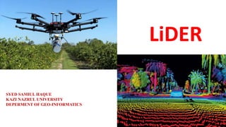
  • 1. LiDER SYED SAMIUL HAQUE KAZI NAZRUL UNIVERSITY DEPERMENT OF GEO-INFORMATICS
  • 2. LiDER Light detection and Ranging is Active Remote Sensing Methods that uses laser to measure variable distances to the Earth. LiDER uses Ultraviolet,visible,infrared sense the objects and can penetrate low density of the objects including trees. Light energy emitted by the LiDER system is know the Pulse light, and reflect from the object is know the Return.  LiDER system sends a pulse and it wait pulse to return. This travel time the light of pulses can be used to create 3d representation of the surface.
  • 3. COMPONENTS of LiDER Laser Scanner • Scan the ground from side to side as the plane flying. The sensor is commonly green or NIR band. • Frequency 50000 to 20000 pulses per second(HZ). • Scanning angle 75 degree (Receives reflected pulse from surface return). High Precision Clock • Records the time to laser pulse leaves and return to scanner. GPS • Tracks the Altitude and Location of Airplane( x, y, z location of scanner) and accurate terrain elevation value. IMU(inertial measurement unit) • Measure of the angular orientation of the scanner relative to the ground and gives the precise orientation of the scanner. Computers • Data storage and management system.
  • 4. PRINCIPLES OF LiDER REMOTE SENSING The working principal of light Detection and ranging is quite simple. A LiDER sensor mounted on the aircraft or helicopter. It generally laser pulse which sent to surface /target measure the time and it takes to return to his source. The different time ,with the angle the pulse of light was fired, and the location of the system itself and will able to give the 3D coordinate target of the object. The actual calculating for measuring how far a retiring a light photon has travel to and from and object is calculated  using following equation: Distance=(Travel Time)*(speed of light )/2
  • 5. LIDER SYSTEM (PLATFORMS) AERIAL/AVIATION(Airborne based LIDER): For highly detailed local elevation data. Small area where highly density is needed. SATELLITE(Space borne based LIDER): Cover Large areas with less details. TERRESTRIAL(Ground based LIDER): Where the system will be fixed to the ground.
  • 6. ADVANTAGES All data geo-referenced from inception. High level of accuracy. Ability of cover large area quickly. Quicker turn around less labour intensive and lower. Cost than photogrammetric methods. Can collect data steep terrain and shadows. Can produce DTM and DSM. DISADVANTAGE Inability of penetrate very dense canopy leads to elevation model error. Very large data set that are difficult interpreted and process. No international protocols. Highly cost.
  • 7. LiDER DATA FORMAT LiDER data generate from point cloud. Point values are usually delivered by vendors as either ASCII point files or LAS format. LIDER PROCESSING SOFTWARE Micro station Terra scan. Arc GIS(work station,lider analyst,3d analyst ,lP360). Lica photogrammetric suite..
  • 8. APPLICATION Mapping for corridors (roads,railway tracks,pipelines,waterway,landscape). Mapping for electrical transmission lines. DSM and DTM generation,espically in forest areas. Study of drainage pattern. Measurement of costal areas ,including dunes ,determination of costal change and erosion. High accuracy and very dense measurement application-flood maping,DTM generation,volume calculation, waste deposit. 3D mapping and model for important infrastructure and architectural design. 3D city model. Rapid mapping and drainage assessment after natural disaster after landslides earthquake cyclone. Measurement of snow and ice cover areas including glacier monitoring or wetlands. Derivation of vegetation parameters -Tree height tree density biomass estimation determination of forest borders. Orthoimage and true orthoimage generation. Hydrographic survey in depths up to 50-70m. Plant growth monitoring in precision farming.