SlideShare una empresa de Scribd logo
1 de 35
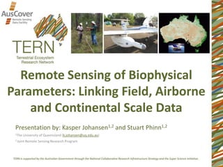
Remote Sensing of Biophysical
Parameters: Linking Field, Airborne
and Continental Scale Data
Presentation by: Kasper Johansen1,2 and Stuart Phinn1,2
1The University of Queensland (k.johansen@uq.edu.au)
2 Joint Remote Sensing Research Program
Outline
1. Introduction: Australian Supersites Network and
AusCover
2. AusCover Activities and Products
3. AusCover Data Collection
4. Linking Field, Airborne and Satellite Image Data
Plot locations of the ASN
Australian Supersites Network (ASN)
and AusCover
Plot locations of AusCover
Australian Supersites Network and
AusCover
AusCover Activities and Products
A nationally consistent approach to deliver, calibrate and validate satellite
image based data sets designed for Australian conditions.
Field-based Measurements Satellite Based MeasurementsAirborne Measurements
AusCover Activities and Products:
AusCover Field and Airborne Campaigns
Time-Series Measurements
Field and Airborne Data Collection Design
• Each site represents dominant
biome or environment with
high conservation value
• Homogenous 5 x 5 km sites
• Capture variability within site
• Rapid sites (TLS, hemispherical
photos, GPS)
• Field data collection
influenced by accessibility and
type of environment
• Homogenous plots
• Ground, mid-storey and
over-storey
• Basal area
• Vegetation structure
• LAI (LAI-2200)
• Hemispherical photos
• Terrestrial Laser Scanning
• Leaf samples and species
ID
• Phenology photos
Field and Airborne Data Collection Design
Field Data Collection Processes:
Ground, mid-storey and over-storey
Field Data Collection Processes:
Basal area
Field Data Collection Processes:
Hemispherical photos
Field Data Collection Processes:
Leaf area index
Digital Plant Canopy Imager (CI-110)
Licor Plant Canopy Analyser LAI-2200
Field Data Collection Processes:
Terrestrial laser scanning
Field Data Collection Processes:
Terrestrial laser scanning
Field Data Collection Processes:
Terrestrial laser scanning
Field Data Collection Processes:
Leaf samples and chemistry
Field Data Collection Processes:
Phenology
Field Data Collection Processes:
Spectrometer measurements
Field Data Collection Processes:
Atmospheric measurements
Field Data Collection Processes:
Accessing the field data
Airborne Data Collection Processes:
LiDAR and hyper-spectral data
Airborne Data Collection Processes:
LiDAR and hyper-spectral data
Airborne Data Collection Processes:
LiDAR and hyper-spectral data
Site
rapid1
PAI
3.673067
rapid2 3.363939
rapid3 2.279929
rapid4 2.62392
rapid5 4.901737
rapid6 3.14998
rapid7 3.335957
rapid8 3.652275
rapid9 3.190056
rapid10 6.049383
rapid11 2.897515
rapid12 3.360222
Airborne Data Collection Processes:
LiDAR and hyper-spectral data
200 m
100 m
50 m
2 km
Airborne Data Collection Processes:
LiDAR and hyper-spectral data
AusCover Products
• The vertically-projected fraction of long-term, persistent green
vegetation (nominally woody vegetation) cover
Landsat Time-Series of Persistent Green-
Vegetation Fraction for Australia
SOURCE DESCRIPTION
QLD DSITIA Fractional-cover field sites
ABARES Fractional-cover field sites
NSW OEH SPOT-5 Image-interpretation
NT Bushfires DBH field sites
NT NRETAS Fractional-cover field sites
ACRIS Locations of low-foliage scrub
WA Woody-vegetation sampling sites
QLD Herbarium Biomass field sites
• Field data from 800 sites collected using nationally consistent protocol, RMSE of 11%
• Decision tree classifier based on robust regression statistics used to classify each pixel
as persistent or non-persistent green vegetation
Landsat Time-Series of Persistent Green-
Vegetation Fraction for Australia
0
0.1
0.2
0.3
0.4
0.5
0.6
0.7
0.8
0.9
1
0 1000 2000 3000 4000
day
greenfraction
min
max
mask
Non-PGV
Persistent Green Vegetation Fraction –
Airborne LiDAR Validation
• Collation of Riegl LMS-Q560 and Riegl LMS-Q680i waveform LiDAR datasets
captured within the temporal extent of the product (2000-2010)
• Woody Foliage Projective Cover estimates from field calibration of LiDAR Pgap
• Comparison with Landsat persistent green extent and cover fractions
Persistent Green Vegetation Fraction –
Airborne LiDAR Validation
• The mean RMSE and Pearson correlation coefficient across all flight
paths were 0.13±0.076 and 0.71±0.15, respectively.
• Herbaceous and woody understorey not included in LiDAR FPC (<0.5m)
Accessing the Persistent Green
Vegetation Fraction Product
Future Work & Conclusions
Future Work
• Research linking both ASN and AusCover field, airborne and satellite
image data and flux measurements (e.g. for productivity, biomass,
time-series change, vegetation structure and phenology assessment)
• Expand data collection over time
Conclusions
• Unique data sets available for selected supersites across Australia
• Will support research and ecosystem science in Australia in selected
biomes
• Working with state and federal government agencies and researchers
associated with AusCover and TERN enabled this work
Acknowledgements
AGENCY PEOPLE
ABARES Jasmine Rickards
NT Bushfires Andrew Edwards
NT NRETAS Nick Cuff
ACRIS / CSIRO Gary Bastin, Matt Bradform
WA DEC Graeme Behn
Airborne Research Australia Jorg Hacker
Monash Jason Beringer
CDU Stefan Maier
QLD Herbarium
NSW Office of Environment and Heritage Tim Danaher
JCU Mike Liddell
Individual AusCover nodes
TERN in general
Remote Sensing of Biophysical
Parameters: Linking Field, Airborne
and Continental Scale Data
Presentation by: Kasper Johansen1,2 and Stuart Phinn1,2
1The University of Queensland (k.johansen@uq.edu.au)
2 Joint Remote Sensing Research Program

Más contenido relacionado

La actualidad más candente

Leaf Area Index (LAI) in the quantification of vegetation disturbance in Iris...
Leaf Area Index (LAI) in the quantification of vegetation disturbance in Iris...Leaf Area Index (LAI) in the quantification of vegetation disturbance in Iris...
Leaf Area Index (LAI) in the quantification of vegetation disturbance in Iris...Environmental Protection Agency, Ireland
 
WE1.L09 - GLOBAL BIOMASS ESTIMATES FROM DESDYNI
WE1.L09 - GLOBAL BIOMASS ESTIMATES FROM DESDYNIWE1.L09 - GLOBAL BIOMASS ESTIMATES FROM DESDYNI
WE1.L09 - GLOBAL BIOMASS ESTIMATES FROM DESDYNIgrssieee
 
Common Chemometric Indicators for Prediction of Soil Organic Matter Content a...
Common Chemometric Indicators for Prediction of Soil Organic Matter Content a...Common Chemometric Indicators for Prediction of Soil Organic Matter Content a...
Common Chemometric Indicators for Prediction of Soil Organic Matter Content a...FAO
 
2013-04-30 EE DSS Approach and Demo
2013-04-30 EE DSS Approach and Demo2013-04-30 EE DSS Approach and Demo
2013-04-30 EE DSS Approach and DemoRudolf Husar
 
EcoTas13 BradEvans e-MAST
EcoTas13 BradEvans e-MASTEcoTas13 BradEvans e-MAST
EcoTas13 BradEvans e-MASTTERN Australia
 
DRI UAV Expertise and Related Interests
DRI UAV Expertise and Related InterestsDRI UAV Expertise and Related Interests
DRI UAV Expertise and Related InterestsDRIscience
 
Measuring Solar Spectral Energy
Measuring Solar Spectral EnergyMeasuring Solar Spectral Energy
Measuring Solar Spectral EnergyBetsy Kenaston
 
ACEF: Australian Coastal Ecosystems Facility
ACEF: Australian Coastal Ecosystems FacilityACEF: Australian Coastal Ecosystems Facility
ACEF: Australian Coastal Ecosystems FacilityTERN Australia
 
DRI Cloud Seeding Forum - Science and Program History
DRI Cloud Seeding Forum - Science and Program HistoryDRI Cloud Seeding Forum - Science and Program History
DRI Cloud Seeding Forum - Science and Program HistoryDRIscience
 
Drones and A.I in Earth Science
Drones and A.I in Earth ScienceDrones and A.I in Earth Science
Drones and A.I in Earth ScienceARDC
 
How to use NCI's national repository of big spatial data collections
How to use NCI's national repository of big spatial data collectionsHow to use NCI's national repository of big spatial data collections
How to use NCI's national repository of big spatial data collectionsARDC
 
How TERN Data Infrastructure works
How TERN Data Infrastructure worksHow TERN Data Infrastructure works
How TERN Data Infrastructure worksTERN Australia
 
FR4.L09 - QUANTITATIVE ASSESSMENT ON THE REQUIREMENTS OF DESDYNI MISSION FOR ...
FR4.L09 - QUANTITATIVE ASSESSMENT ON THE REQUIREMENTS OF DESDYNI MISSION FOR ...FR4.L09 - QUANTITATIVE ASSESSMENT ON THE REQUIREMENTS OF DESDYNI MISSION FOR ...
FR4.L09 - QUANTITATIVE ASSESSMENT ON THE REQUIREMENTS OF DESDYNI MISSION FOR ...grssieee
 
Satellite Link Measurements
Satellite Link MeasurementsSatellite Link Measurements
Satellite Link Measurementsbjp4642
 
4_bindlish_igarss2011.pptx
4_bindlish_igarss2011.pptx4_bindlish_igarss2011.pptx
4_bindlish_igarss2011.pptxgrssieee
 
130205 epa ee_presentation_subm
130205 epa ee_presentation_subm130205 epa ee_presentation_subm
130205 epa ee_presentation_submRudolf Husar
 

La actualidad más candente (19)

Air Quality Mapping Using GIS
Air Quality Mapping Using GISAir Quality Mapping Using GIS
Air Quality Mapping Using GIS
 
Leaf Area Index (LAI) in the quantification of vegetation disturbance in Iris...
Leaf Area Index (LAI) in the quantification of vegetation disturbance in Iris...Leaf Area Index (LAI) in the quantification of vegetation disturbance in Iris...
Leaf Area Index (LAI) in the quantification of vegetation disturbance in Iris...
 
WE1.L09 - GLOBAL BIOMASS ESTIMATES FROM DESDYNI
WE1.L09 - GLOBAL BIOMASS ESTIMATES FROM DESDYNIWE1.L09 - GLOBAL BIOMASS ESTIMATES FROM DESDYNI
WE1.L09 - GLOBAL BIOMASS ESTIMATES FROM DESDYNI
 
Common Chemometric Indicators for Prediction of Soil Organic Matter Content a...
Common Chemometric Indicators for Prediction of Soil Organic Matter Content a...Common Chemometric Indicators for Prediction of Soil Organic Matter Content a...
Common Chemometric Indicators for Prediction of Soil Organic Matter Content a...
 
2013-04-30 EE DSS Approach and Demo
2013-04-30 EE DSS Approach and Demo2013-04-30 EE DSS Approach and Demo
2013-04-30 EE DSS Approach and Demo
 
Poster Nov19 V1
Poster Nov19 V1Poster Nov19 V1
Poster Nov19 V1
 
Poster Nov19 V2
Poster Nov19 V2Poster Nov19 V2
Poster Nov19 V2
 
EcoTas13 BradEvans e-MAST
EcoTas13 BradEvans e-MASTEcoTas13 BradEvans e-MAST
EcoTas13 BradEvans e-MAST
 
DRI UAV Expertise and Related Interests
DRI UAV Expertise and Related InterestsDRI UAV Expertise and Related Interests
DRI UAV Expertise and Related Interests
 
Measuring Solar Spectral Energy
Measuring Solar Spectral EnergyMeasuring Solar Spectral Energy
Measuring Solar Spectral Energy
 
ACEF: Australian Coastal Ecosystems Facility
ACEF: Australian Coastal Ecosystems FacilityACEF: Australian Coastal Ecosystems Facility
ACEF: Australian Coastal Ecosystems Facility
 
DRI Cloud Seeding Forum - Science and Program History
DRI Cloud Seeding Forum - Science and Program HistoryDRI Cloud Seeding Forum - Science and Program History
DRI Cloud Seeding Forum - Science and Program History
 
Drones and A.I in Earth Science
Drones and A.I in Earth ScienceDrones and A.I in Earth Science
Drones and A.I in Earth Science
 
How to use NCI's national repository of big spatial data collections
How to use NCI's national repository of big spatial data collectionsHow to use NCI's national repository of big spatial data collections
How to use NCI's national repository of big spatial data collections
 
How TERN Data Infrastructure works
How TERN Data Infrastructure worksHow TERN Data Infrastructure works
How TERN Data Infrastructure works
 
FR4.L09 - QUANTITATIVE ASSESSMENT ON THE REQUIREMENTS OF DESDYNI MISSION FOR ...
FR4.L09 - QUANTITATIVE ASSESSMENT ON THE REQUIREMENTS OF DESDYNI MISSION FOR ...FR4.L09 - QUANTITATIVE ASSESSMENT ON THE REQUIREMENTS OF DESDYNI MISSION FOR ...
FR4.L09 - QUANTITATIVE ASSESSMENT ON THE REQUIREMENTS OF DESDYNI MISSION FOR ...
 
Satellite Link Measurements
Satellite Link MeasurementsSatellite Link Measurements
Satellite Link Measurements
 
4_bindlish_igarss2011.pptx
4_bindlish_igarss2011.pptx4_bindlish_igarss2011.pptx
4_bindlish_igarss2011.pptx
 
130205 epa ee_presentation_subm
130205 epa ee_presentation_subm130205 epa ee_presentation_subm
130205 epa ee_presentation_subm
 

Destacado

Spatial variation of soil constraints and its implications for site-specific ...
Spatial variation of soil constraints and its implications for site-specific ...Spatial variation of soil constraints and its implications for site-specific ...
Spatial variation of soil constraints and its implications for site-specific ...Joanna Hicks
 
groundtruth collection for remotesensing support
groundtruth collection for remotesensing supportgroundtruth collection for remotesensing support
groundtruth collection for remotesensing supportThiruvengadam .
 
Polly use of remote sensing products for local water
Polly use of remote sensing products for local waterPolly use of remote sensing products for local water
Polly use of remote sensing products for local waterGeCo in the Rockies
 
Archaeological applications of multi/hyper-spectral data: challenges and pote...
Archaeological applications of multi/hyper-spectral data: challenges and pote...Archaeological applications of multi/hyper-spectral data: challenges and pote...
Archaeological applications of multi/hyper-spectral data: challenges and pote...DART Project
 
TERN eMAST : Observations and terrestrial ecosystem models : Terrestrial Ecos...
TERN eMAST : Observations and terrestrial ecosystem models : Terrestrial Ecos...TERN eMAST : Observations and terrestrial ecosystem models : Terrestrial Ecos...
TERN eMAST : Observations and terrestrial ecosystem models : Terrestrial Ecos...Brad Evans
 
Remote sensing and its applications in environment
Remote sensing and its applications in environmentRemote sensing and its applications in environment
Remote sensing and its applications in environmentMuhammad Sajjad
 
Mathematical Modelling in Industry
Mathematical Modelling in IndustryMathematical Modelling in Industry
Mathematical Modelling in IndustryInnovation Centre WA
 
Applications of Remote Sensing
Applications of Remote SensingApplications of Remote Sensing
Applications of Remote SensingAbhiram Kanigolla
 
Multispectral remote sensing
Multispectral remote sensingMultispectral remote sensing
Multispectral remote sensingDharmendera Meena
 
HYPERSPECTRAL RS IN MINERAL MAPPING
HYPERSPECTRAL RS IN MINERAL MAPPINGHYPERSPECTRAL RS IN MINERAL MAPPING
HYPERSPECTRAL RS IN MINERAL MAPPINGAbhiram Kanigolla
 
hyperspectral remote sensing and its geological applications
hyperspectral remote sensing and its geological applicationshyperspectral remote sensing and its geological applications
hyperspectral remote sensing and its geological applicationsabhijeet_banerjee
 
Remote sensing in agriculture
Remote sensing in agricultureRemote sensing in agriculture
Remote sensing in agricultureChitra Nair
 
MINERAL EXPLORATION USING ASTER IMAGE
MINERAL EXPLORATION USING ASTER IMAGE MINERAL EXPLORATION USING ASTER IMAGE
MINERAL EXPLORATION USING ASTER IMAGE Abhiram Kanigolla
 
Raleigh and Mie scattering in remote sensing,
Raleigh and Mie scattering in remote sensing,Raleigh and Mie scattering in remote sensing,
Raleigh and Mie scattering in remote sensing,P.K. Mani
 
Hyperspectral remote sensing for oil exploration
Hyperspectral remote sensing for oil explorationHyperspectral remote sensing for oil exploration
Hyperspectral remote sensing for oil explorationJayanth Joshua
 
Precision Agriculture; Past, present and future
Precision Agriculture; Past, present and futurePrecision Agriculture; Past, present and future
Precision Agriculture; Past, present and futureNetNexusBrasil
 
Application of remote sensing in agriculture
Application of remote sensing in agricultureApplication of remote sensing in agriculture
Application of remote sensing in agriculturevajinder kalra
 
Remote Sensing And GIS Application In Wetland Mapping
Remote Sensing And GIS Application In Wetland MappingRemote Sensing And GIS Application In Wetland Mapping
Remote Sensing And GIS Application In Wetland MappingSwetha A
 
Remote sensing application in agriculture & forestry_Dr Menon A R R (The Kera...
Remote sensing application in agriculture & forestry_Dr Menon A R R (The Kera...Remote sensing application in agriculture & forestry_Dr Menon A R R (The Kera...
Remote sensing application in agriculture & forestry_Dr Menon A R R (The Kera...India Water Portal
 
Remote Sensing And GIS Application In Mineral , Oil , Ground Water MappingMin...
Remote Sensing And GIS Application In Mineral , Oil , Ground Water MappingMin...Remote Sensing And GIS Application In Mineral , Oil , Ground Water MappingMin...
Remote Sensing And GIS Application In Mineral , Oil , Ground Water MappingMin...Swetha A
 

Destacado (20)

Spatial variation of soil constraints and its implications for site-specific ...
Spatial variation of soil constraints and its implications for site-specific ...Spatial variation of soil constraints and its implications for site-specific ...
Spatial variation of soil constraints and its implications for site-specific ...
 
groundtruth collection for remotesensing support
groundtruth collection for remotesensing supportgroundtruth collection for remotesensing support
groundtruth collection for remotesensing support
 
Polly use of remote sensing products for local water
Polly use of remote sensing products for local waterPolly use of remote sensing products for local water
Polly use of remote sensing products for local water
 
Archaeological applications of multi/hyper-spectral data: challenges and pote...
Archaeological applications of multi/hyper-spectral data: challenges and pote...Archaeological applications of multi/hyper-spectral data: challenges and pote...
Archaeological applications of multi/hyper-spectral data: challenges and pote...
 
TERN eMAST : Observations and terrestrial ecosystem models : Terrestrial Ecos...
TERN eMAST : Observations and terrestrial ecosystem models : Terrestrial Ecos...TERN eMAST : Observations and terrestrial ecosystem models : Terrestrial Ecos...
TERN eMAST : Observations and terrestrial ecosystem models : Terrestrial Ecos...
 
Remote sensing and its applications in environment
Remote sensing and its applications in environmentRemote sensing and its applications in environment
Remote sensing and its applications in environment
 
Mathematical Modelling in Industry
Mathematical Modelling in IndustryMathematical Modelling in Industry
Mathematical Modelling in Industry
 
Applications of Remote Sensing
Applications of Remote SensingApplications of Remote Sensing
Applications of Remote Sensing
 
Multispectral remote sensing
Multispectral remote sensingMultispectral remote sensing
Multispectral remote sensing
 
HYPERSPECTRAL RS IN MINERAL MAPPING
HYPERSPECTRAL RS IN MINERAL MAPPINGHYPERSPECTRAL RS IN MINERAL MAPPING
HYPERSPECTRAL RS IN MINERAL MAPPING
 
hyperspectral remote sensing and its geological applications
hyperspectral remote sensing and its geological applicationshyperspectral remote sensing and its geological applications
hyperspectral remote sensing and its geological applications
 
Remote sensing in agriculture
Remote sensing in agricultureRemote sensing in agriculture
Remote sensing in agriculture
 
MINERAL EXPLORATION USING ASTER IMAGE
MINERAL EXPLORATION USING ASTER IMAGE MINERAL EXPLORATION USING ASTER IMAGE
MINERAL EXPLORATION USING ASTER IMAGE
 
Raleigh and Mie scattering in remote sensing,
Raleigh and Mie scattering in remote sensing,Raleigh and Mie scattering in remote sensing,
Raleigh and Mie scattering in remote sensing,
 
Hyperspectral remote sensing for oil exploration
Hyperspectral remote sensing for oil explorationHyperspectral remote sensing for oil exploration
Hyperspectral remote sensing for oil exploration
 
Precision Agriculture; Past, present and future
Precision Agriculture; Past, present and futurePrecision Agriculture; Past, present and future
Precision Agriculture; Past, present and future
 
Application of remote sensing in agriculture
Application of remote sensing in agricultureApplication of remote sensing in agriculture
Application of remote sensing in agriculture
 
Remote Sensing And GIS Application In Wetland Mapping
Remote Sensing And GIS Application In Wetland MappingRemote Sensing And GIS Application In Wetland Mapping
Remote Sensing And GIS Application In Wetland Mapping
 
Remote sensing application in agriculture & forestry_Dr Menon A R R (The Kera...
Remote sensing application in agriculture & forestry_Dr Menon A R R (The Kera...Remote sensing application in agriculture & forestry_Dr Menon A R R (The Kera...
Remote sensing application in agriculture & forestry_Dr Menon A R R (The Kera...
 
Remote Sensing And GIS Application In Mineral , Oil , Ground Water MappingMin...
Remote Sensing And GIS Application In Mineral , Oil , Ground Water MappingMin...Remote Sensing And GIS Application In Mineral , Oil , Ground Water MappingMin...
Remote Sensing And GIS Application In Mineral , Oil , Ground Water MappingMin...
 

Similar a Remote sensing of biophysical parameters: linking field, airborne and continental scale data_Johansen

Alex Held_Achievements of AusCover - TERN's remote sensing data facility
Alex Held_Achievements of AusCover - TERN's remote sensing data facilityAlex Held_Achievements of AusCover - TERN's remote sensing data facility
Alex Held_Achievements of AusCover - TERN's remote sensing data facilityTERN Australia
 
Recent developments in the availability and delivery of biogeochemical datase...
Recent developments in the availability and delivery of biogeochemical datase...Recent developments in the availability and delivery of biogeochemical datase...
Recent developments in the availability and delivery of biogeochemical datase...TERN Australia
 
Advances in Agricultural remote sensings
Advances in Agricultural remote sensingsAdvances in Agricultural remote sensings
Advances in Agricultural remote sensingsAyanDas644783
 
Zebra - TRIAD-ES Joint Presentation
Zebra - TRIAD-ES Joint PresentationZebra - TRIAD-ES Joint Presentation
Zebra - TRIAD-ES Joint PresentationZEBRA Environmental
 
Andrew Baker_Supporting Science and Education With Flexible Cloud-Based Solut...
Andrew Baker_Supporting Science and Education With Flexible Cloud-Based Solut...Andrew Baker_Supporting Science and Education With Flexible Cloud-Based Solut...
Andrew Baker_Supporting Science and Education With Flexible Cloud-Based Solut...Andrew Baker
 
Global Soil Spectral Library, A global reference, spectral library and conver...
Global Soil Spectral Library, A global reference, spectral library and conver...Global Soil Spectral Library, A global reference, spectral library and conver...
Global Soil Spectral Library, A global reference, spectral library and conver...FAO
 
EcoTas13 Caddy-Retalic TERN Infrastructure
EcoTas13 Caddy-Retalic TERN InfrastructureEcoTas13 Caddy-Retalic TERN Infrastructure
EcoTas13 Caddy-Retalic TERN InfrastructureTERN Australia
 
Land Health Surveillance Information for decision making
Land Health Surveillance Information for decision makingLand Health Surveillance Information for decision making
Land Health Surveillance Information for decision makingCIMMYT
 
Hyperspectral Remote Sensing Of Vegetation Using Red Edge Position Techniques
Hyperspectral Remote Sensing Of Vegetation Using Red Edge Position TechniquesHyperspectral Remote Sensing Of Vegetation Using Red Edge Position Techniques
Hyperspectral Remote Sensing Of Vegetation Using Red Edge Position TechniquesErin Torres
 
NEON Airborne Operations
NEON Airborne OperationsNEON Airborne Operations
NEON Airborne Operationsjjparnell
 
Seeing the unseen: Improving aerial prospection outside the visible spectrum
Seeing the unseen: Improving aerial prospection outside the visible spectrumSeeing the unseen: Improving aerial prospection outside the visible spectrum
Seeing the unseen: Improving aerial prospection outside the visible spectrumDART Project
 
Seeing the Unseen- Improving aerial archaeological prospection
Seeing the Unseen- Improving aerial archaeological prospectionSeeing the Unseen- Improving aerial archaeological prospection
Seeing the Unseen- Improving aerial archaeological prospectiondavstott
 
Hyperspectral_Part3_Final.pdf
Hyperspectral_Part3_Final.pdfHyperspectral_Part3_Final.pdf
Hyperspectral_Part3_Final.pdfTKDMGVHSS
 
DRI and UAS Applications Research
DRI and UAS Applications ResearchDRI and UAS Applications Research
DRI and UAS Applications ResearchDRIscience
 
REMOTE SENSING PLATFORMS.ppt
REMOTE SENSING PLATFORMS.pptREMOTE SENSING PLATFORMS.ppt
REMOTE SENSING PLATFORMS.pptDivyaPriya700213
 
4_REMOTE SENSING PLATFORMS.ppt
4_REMOTE SENSING PLATFORMS.ppt4_REMOTE SENSING PLATFORMS.ppt
4_REMOTE SENSING PLATFORMS.pptDivyaPriya700213
 
remote sensing platforms materials for student
remote sensing platforms materials for studentremote sensing platforms materials for student
remote sensing platforms materials for studentWidyastutiSAA
 

Similar a Remote sensing of biophysical parameters: linking field, airborne and continental scale data_Johansen (20)

Alex Held_Achievements of AusCover - TERN's remote sensing data facility
Alex Held_Achievements of AusCover - TERN's remote sensing data facilityAlex Held_Achievements of AusCover - TERN's remote sensing data facility
Alex Held_Achievements of AusCover - TERN's remote sensing data facility
 
Recent developments in the availability and delivery of biogeochemical datase...
Recent developments in the availability and delivery of biogeochemical datase...Recent developments in the availability and delivery of biogeochemical datase...
Recent developments in the availability and delivery of biogeochemical datase...
 
Advances in Agricultural remote sensings
Advances in Agricultural remote sensingsAdvances in Agricultural remote sensings
Advances in Agricultural remote sensings
 
Zebra - TRIAD-ES Joint Presentation
Zebra - TRIAD-ES Joint PresentationZebra - TRIAD-ES Joint Presentation
Zebra - TRIAD-ES Joint Presentation
 
Andrew Baker_Supporting Science and Education With Flexible Cloud-Based Solut...
Andrew Baker_Supporting Science and Education With Flexible Cloud-Based Solut...Andrew Baker_Supporting Science and Education With Flexible Cloud-Based Solut...
Andrew Baker_Supporting Science and Education With Flexible Cloud-Based Solut...
 
Global Soil Spectral Library, A global reference, spectral library and conver...
Global Soil Spectral Library, A global reference, spectral library and conver...Global Soil Spectral Library, A global reference, spectral library and conver...
Global Soil Spectral Library, A global reference, spectral library and conver...
 
Fundamentals aquatic-web
Fundamentals aquatic-webFundamentals aquatic-web
Fundamentals aquatic-web
 
Goal andga oct01
Goal andga oct01Goal andga oct01
Goal andga oct01
 
AusCover
AusCoverAusCover
AusCover
 
EcoTas13 Caddy-Retalic TERN Infrastructure
EcoTas13 Caddy-Retalic TERN InfrastructureEcoTas13 Caddy-Retalic TERN Infrastructure
EcoTas13 Caddy-Retalic TERN Infrastructure
 
Land Health Surveillance Information for decision making
Land Health Surveillance Information for decision makingLand Health Surveillance Information for decision making
Land Health Surveillance Information for decision making
 
Hyperspectral Remote Sensing Of Vegetation Using Red Edge Position Techniques
Hyperspectral Remote Sensing Of Vegetation Using Red Edge Position TechniquesHyperspectral Remote Sensing Of Vegetation Using Red Edge Position Techniques
Hyperspectral Remote Sensing Of Vegetation Using Red Edge Position Techniques
 
NEON Airborne Operations
NEON Airborne OperationsNEON Airborne Operations
NEON Airborne Operations
 
Seeing the unseen: Improving aerial prospection outside the visible spectrum
Seeing the unseen: Improving aerial prospection outside the visible spectrumSeeing the unseen: Improving aerial prospection outside the visible spectrum
Seeing the unseen: Improving aerial prospection outside the visible spectrum
 
Seeing the Unseen- Improving aerial archaeological prospection
Seeing the Unseen- Improving aerial archaeological prospectionSeeing the Unseen- Improving aerial archaeological prospection
Seeing the Unseen- Improving aerial archaeological prospection
 
Hyperspectral_Part3_Final.pdf
Hyperspectral_Part3_Final.pdfHyperspectral_Part3_Final.pdf
Hyperspectral_Part3_Final.pdf
 
DRI and UAS Applications Research
DRI and UAS Applications ResearchDRI and UAS Applications Research
DRI and UAS Applications Research
 
REMOTE SENSING PLATFORMS.ppt
REMOTE SENSING PLATFORMS.pptREMOTE SENSING PLATFORMS.ppt
REMOTE SENSING PLATFORMS.ppt
 
4_REMOTE SENSING PLATFORMS.ppt
4_REMOTE SENSING PLATFORMS.ppt4_REMOTE SENSING PLATFORMS.ppt
4_REMOTE SENSING PLATFORMS.ppt
 
remote sensing platforms materials for student
remote sensing platforms materials for studentremote sensing platforms materials for student
remote sensing platforms materials for student
 

Más de TERN Australia

Careers Grounded in Soils
Careers Grounded in SoilsCareers Grounded in Soils
Careers Grounded in SoilsTERN Australia
 
TERN Australia Soil & Herbarium Collection Brochure
TERN Australia Soil & Herbarium Collection BrochureTERN Australia Soil & Herbarium Collection Brochure
TERN Australia Soil & Herbarium Collection BrochureTERN Australia
 
Summary of TERN monitoring plots in the Pilbara WA, Apr2015 - Jun2021
Summary of TERN monitoring plots in the Pilbara WA, Apr2015 - Jun2021Summary of TERN monitoring plots in the Pilbara WA, Apr2015 - Jun2021
Summary of TERN monitoring plots in the Pilbara WA, Apr2015 - Jun2021TERN Australia
 
Summary of TERN plots on Kangaroo Island, SA, Oct 2018 - Oct 2021
Summary of TERN plots on Kangaroo Island, SA, Oct 2018 - Oct 2021Summary of TERN plots on Kangaroo Island, SA, Oct 2018 - Oct 2021
Summary of TERN plots on Kangaroo Island, SA, Oct 2018 - Oct 2021TERN Australia
 
MER Pilot Network flyer 2020
MER Pilot Network flyer 2020MER Pilot Network flyer 2020
MER Pilot Network flyer 2020TERN Australia
 
Australia's Environmental Predictive Capability
Australia's Environmental Predictive CapabilityAustralia's Environmental Predictive Capability
Australia's Environmental Predictive CapabilityTERN Australia
 
Biodiversity Management in Tasmania's Temperate Native Forests
Biodiversity Management in Tasmania's Temperate Native ForestsBiodiversity Management in Tasmania's Temperate Native Forests
Biodiversity Management in Tasmania's Temperate Native ForestsTERN Australia
 
Observing Environmental Change in Australia: Conversations for Sustainability
Observing Environmental Change in Australia: Conversations for SustainabilityObserving Environmental Change in Australia: Conversations for Sustainability
Observing Environmental Change in Australia: Conversations for SustainabilityTERN Australia
 
Dr Michael Mirtl (ILTER Chair) presenting at the AusLTER Forum 2018
Dr Michael Mirtl  (ILTER Chair) presenting at the AusLTER Forum 2018Dr Michael Mirtl  (ILTER Chair) presenting at the AusLTER Forum 2018
Dr Michael Mirtl (ILTER Chair) presenting at the AusLTER Forum 2018TERN Australia
 
Prof Bob Scholes (Wits University, South Africa) presenting at the AusLTER Fo...
Prof Bob Scholes (Wits University, South Africa) presenting at the AusLTER Fo...Prof Bob Scholes (Wits University, South Africa) presenting at the AusLTER Fo...
Prof Bob Scholes (Wits University, South Africa) presenting at the AusLTER Fo...TERN Australia
 
Prof Phil Robertson (Michigan State University, USA) presenting at the AusLTE...
Prof Phil Robertson (Michigan State University, USA) presenting at the AusLTE...Prof Phil Robertson (Michigan State University, USA) presenting at the AusLTE...
Prof Phil Robertson (Michigan State University, USA) presenting at the AusLTE...TERN Australia
 
Dr Manuel Maass (National Autonomous University of Mexico) presenting at the ...
Dr Manuel Maass (National Autonomous University of Mexico) presenting at the ...Dr Manuel Maass (National Autonomous University of Mexico) presenting at the ...
Dr Manuel Maass (National Autonomous University of Mexico) presenting at the ...TERN Australia
 
Yuxia Liu Phenology 2018 poster on tracking grass phenology
Yuxia Liu Phenology 2018 poster on tracking grass phenologyYuxia Liu Phenology 2018 poster on tracking grass phenology
Yuxia Liu Phenology 2018 poster on tracking grass phenologyTERN Australia
 
Qiaoyun Xie Phenology 2018 presentation on agricultural phenology
Qiaoyun Xie Phenology 2018 presentation on agricultural phenologyQiaoyun Xie Phenology 2018 presentation on agricultural phenology
Qiaoyun Xie Phenology 2018 presentation on agricultural phenologyTERN Australia
 
Ha Nguyen Phenology 2018 presentation on Melbourne pollen trends
Ha Nguyen Phenology 2018 presentation on Melbourne pollen trendsHa Nguyen Phenology 2018 presentation on Melbourne pollen trends
Ha Nguyen Phenology 2018 presentation on Melbourne pollen trendsTERN Australia
 
Paul Beggs Phenology 2018 presentation on AusPollen
Paul Beggs Phenology 2018 presentation on AusPollenPaul Beggs Phenology 2018 presentation on AusPollen
Paul Beggs Phenology 2018 presentation on AusPollenTERN Australia
 
GEOSS Ecosystem Mapping for Australia
GEOSS Ecosystem Mapping for AustraliaGEOSS Ecosystem Mapping for Australia
GEOSS Ecosystem Mapping for AustraliaTERN Australia
 
TERN Ecosystem Surveillance Plots Roy Hill Station
TERN Ecosystem Surveillance Plots Roy Hill StationTERN Ecosystem Surveillance Plots Roy Hill Station
TERN Ecosystem Surveillance Plots Roy Hill StationTERN Australia
 
TERN Ecosystem Surveillance Plots Kakadu National Park
TERN Ecosystem Surveillance Plots Kakadu National ParkTERN Ecosystem Surveillance Plots Kakadu National Park
TERN Ecosystem Surveillance Plots Kakadu National ParkTERN Australia
 

Más de TERN Australia (20)

Careers Grounded in Soils
Careers Grounded in SoilsCareers Grounded in Soils
Careers Grounded in Soils
 
TERN Australia Soil & Herbarium Collection Brochure
TERN Australia Soil & Herbarium Collection BrochureTERN Australia Soil & Herbarium Collection Brochure
TERN Australia Soil & Herbarium Collection Brochure
 
Summary of TERN monitoring plots in the Pilbara WA, Apr2015 - Jun2021
Summary of TERN monitoring plots in the Pilbara WA, Apr2015 - Jun2021Summary of TERN monitoring plots in the Pilbara WA, Apr2015 - Jun2021
Summary of TERN monitoring plots in the Pilbara WA, Apr2015 - Jun2021
 
Summary of TERN plots on Kangaroo Island, SA, Oct 2018 - Oct 2021
Summary of TERN plots on Kangaroo Island, SA, Oct 2018 - Oct 2021Summary of TERN plots on Kangaroo Island, SA, Oct 2018 - Oct 2021
Summary of TERN plots on Kangaroo Island, SA, Oct 2018 - Oct 2021
 
MER Pilot Network flyer 2020
MER Pilot Network flyer 2020MER Pilot Network flyer 2020
MER Pilot Network flyer 2020
 
Australia's Environmental Predictive Capability
Australia's Environmental Predictive CapabilityAustralia's Environmental Predictive Capability
Australia's Environmental Predictive Capability
 
Biodiversity Management in Tasmania's Temperate Native Forests
Biodiversity Management in Tasmania's Temperate Native ForestsBiodiversity Management in Tasmania's Temperate Native Forests
Biodiversity Management in Tasmania's Temperate Native Forests
 
Observing Environmental Change in Australia: Conversations for Sustainability
Observing Environmental Change in Australia: Conversations for SustainabilityObserving Environmental Change in Australia: Conversations for Sustainability
Observing Environmental Change in Australia: Conversations for Sustainability
 
Observing Environmental Change in Australia: Conversations for Sustainability
Observing Environmental Change in Australia: Conversations for SustainabilityObserving Environmental Change in Australia: Conversations for Sustainability
Observing Environmental Change in Australia: Conversations for Sustainability
 
Dr Michael Mirtl (ILTER Chair) presenting at the AusLTER Forum 2018
Dr Michael Mirtl  (ILTER Chair) presenting at the AusLTER Forum 2018Dr Michael Mirtl  (ILTER Chair) presenting at the AusLTER Forum 2018
Dr Michael Mirtl (ILTER Chair) presenting at the AusLTER Forum 2018
 
Prof Bob Scholes (Wits University, South Africa) presenting at the AusLTER Fo...
Prof Bob Scholes (Wits University, South Africa) presenting at the AusLTER Fo...Prof Bob Scholes (Wits University, South Africa) presenting at the AusLTER Fo...
Prof Bob Scholes (Wits University, South Africa) presenting at the AusLTER Fo...
 
Prof Phil Robertson (Michigan State University, USA) presenting at the AusLTE...
Prof Phil Robertson (Michigan State University, USA) presenting at the AusLTE...Prof Phil Robertson (Michigan State University, USA) presenting at the AusLTE...
Prof Phil Robertson (Michigan State University, USA) presenting at the AusLTE...
 
Dr Manuel Maass (National Autonomous University of Mexico) presenting at the ...
Dr Manuel Maass (National Autonomous University of Mexico) presenting at the ...Dr Manuel Maass (National Autonomous University of Mexico) presenting at the ...
Dr Manuel Maass (National Autonomous University of Mexico) presenting at the ...
 
Yuxia Liu Phenology 2018 poster on tracking grass phenology
Yuxia Liu Phenology 2018 poster on tracking grass phenologyYuxia Liu Phenology 2018 poster on tracking grass phenology
Yuxia Liu Phenology 2018 poster on tracking grass phenology
 
Qiaoyun Xie Phenology 2018 presentation on agricultural phenology
Qiaoyun Xie Phenology 2018 presentation on agricultural phenologyQiaoyun Xie Phenology 2018 presentation on agricultural phenology
Qiaoyun Xie Phenology 2018 presentation on agricultural phenology
 
Ha Nguyen Phenology 2018 presentation on Melbourne pollen trends
Ha Nguyen Phenology 2018 presentation on Melbourne pollen trendsHa Nguyen Phenology 2018 presentation on Melbourne pollen trends
Ha Nguyen Phenology 2018 presentation on Melbourne pollen trends
 
Paul Beggs Phenology 2018 presentation on AusPollen
Paul Beggs Phenology 2018 presentation on AusPollenPaul Beggs Phenology 2018 presentation on AusPollen
Paul Beggs Phenology 2018 presentation on AusPollen
 
GEOSS Ecosystem Mapping for Australia
GEOSS Ecosystem Mapping for AustraliaGEOSS Ecosystem Mapping for Australia
GEOSS Ecosystem Mapping for Australia
 
TERN Ecosystem Surveillance Plots Roy Hill Station
TERN Ecosystem Surveillance Plots Roy Hill StationTERN Ecosystem Surveillance Plots Roy Hill Station
TERN Ecosystem Surveillance Plots Roy Hill Station
 
TERN Ecosystem Surveillance Plots Kakadu National Park
TERN Ecosystem Surveillance Plots Kakadu National ParkTERN Ecosystem Surveillance Plots Kakadu National Park
TERN Ecosystem Surveillance Plots Kakadu National Park
 

Último

Workshop - Best of Both Worlds_ Combine KG and Vector search for enhanced R...
Workshop - Best of Both Worlds_ Combine  KG and Vector search for  enhanced R...Workshop - Best of Both Worlds_ Combine  KG and Vector search for  enhanced R...
Workshop - Best of Both Worlds_ Combine KG and Vector search for enhanced R...Neo4j
 
Breaking the Kubernetes Kill Chain: Host Path Mount
Breaking the Kubernetes Kill Chain: Host Path MountBreaking the Kubernetes Kill Chain: Host Path Mount
Breaking the Kubernetes Kill Chain: Host Path MountPuma Security, LLC
 
EIS-Webinar-Prompt-Knowledge-Eng-2024-04-08.pptx
EIS-Webinar-Prompt-Knowledge-Eng-2024-04-08.pptxEIS-Webinar-Prompt-Knowledge-Eng-2024-04-08.pptx
EIS-Webinar-Prompt-Knowledge-Eng-2024-04-08.pptxEarley Information Science
 
Slack Application Development 101 Slides
Slack Application Development 101 SlidesSlack Application Development 101 Slides
Slack Application Development 101 Slidespraypatel2
 
Finology Group – Insurtech Innovation Award 2024
Finology Group – Insurtech Innovation Award 2024Finology Group – Insurtech Innovation Award 2024
Finology Group – Insurtech Innovation Award 2024The Digital Insurer
 
Strategies for Unlocking Knowledge Management in Microsoft 365 in the Copilot...
Strategies for Unlocking Knowledge Management in Microsoft 365 in the Copilot...Strategies for Unlocking Knowledge Management in Microsoft 365 in the Copilot...
Strategies for Unlocking Knowledge Management in Microsoft 365 in the Copilot...Drew Madelung
 
08448380779 Call Girls In Civil Lines Women Seeking Men
08448380779 Call Girls In Civil Lines Women Seeking Men08448380779 Call Girls In Civil Lines Women Seeking Men
08448380779 Call Girls In Civil Lines Women Seeking MenDelhi Call girls
 
Apidays Singapore 2024 - Building Digital Trust in a Digital Economy by Veron...
Apidays Singapore 2024 - Building Digital Trust in a Digital Economy by Veron...Apidays Singapore 2024 - Building Digital Trust in a Digital Economy by Veron...
Apidays Singapore 2024 - Building Digital Trust in a Digital Economy by Veron...apidays
 
GenCyber Cyber Security Day Presentation
GenCyber Cyber Security Day PresentationGenCyber Cyber Security Day Presentation
GenCyber Cyber Security Day PresentationMichael W. Hawkins
 
What Are The Drone Anti-jamming Systems Technology?
What Are The Drone Anti-jamming Systems Technology?What Are The Drone Anti-jamming Systems Technology?
What Are The Drone Anti-jamming Systems Technology?Antenna Manufacturer Coco
 
TrustArc Webinar - Stay Ahead of US State Data Privacy Law Developments
TrustArc Webinar - Stay Ahead of US State Data Privacy Law DevelopmentsTrustArc Webinar - Stay Ahead of US State Data Privacy Law Developments
TrustArc Webinar - Stay Ahead of US State Data Privacy Law DevelopmentsTrustArc
 
04-2024-HHUG-Sales-and-Marketing-Alignment.pptx
04-2024-HHUG-Sales-and-Marketing-Alignment.pptx04-2024-HHUG-Sales-and-Marketing-Alignment.pptx
04-2024-HHUG-Sales-and-Marketing-Alignment.pptxHampshireHUG
 
Driving Behavioral Change for Information Management through Data-Driven Gree...
Driving Behavioral Change for Information Management through Data-Driven Gree...Driving Behavioral Change for Information Management through Data-Driven Gree...
Driving Behavioral Change for Information Management through Data-Driven Gree...Enterprise Knowledge
 
CNv6 Instructor Chapter 6 Quality of Service
CNv6 Instructor Chapter 6 Quality of ServiceCNv6 Instructor Chapter 6 Quality of Service
CNv6 Instructor Chapter 6 Quality of Servicegiselly40
 
A Domino Admins Adventures (Engage 2024)
A Domino Admins Adventures (Engage 2024)A Domino Admins Adventures (Engage 2024)
A Domino Admins Adventures (Engage 2024)Gabriella Davis
 
Bajaj Allianz Life Insurance Company - Insurer Innovation Award 2024
Bajaj Allianz Life Insurance Company - Insurer Innovation Award 2024Bajaj Allianz Life Insurance Company - Insurer Innovation Award 2024
Bajaj Allianz Life Insurance Company - Insurer Innovation Award 2024The Digital Insurer
 
The Role of Taxonomy and Ontology in Semantic Layers - Heather Hedden.pdf
The Role of Taxonomy and Ontology in Semantic Layers - Heather Hedden.pdfThe Role of Taxonomy and Ontology in Semantic Layers - Heather Hedden.pdf
The Role of Taxonomy and Ontology in Semantic Layers - Heather Hedden.pdfEnterprise Knowledge
 
Handwritten Text Recognition for manuscripts and early printed texts
Handwritten Text Recognition for manuscripts and early printed textsHandwritten Text Recognition for manuscripts and early printed texts
Handwritten Text Recognition for manuscripts and early printed textsMaria Levchenko
 
Artificial Intelligence: Facts and Myths
Artificial Intelligence: Facts and MythsArtificial Intelligence: Facts and Myths
Artificial Intelligence: Facts and MythsJoaquim Jorge
 
Histor y of HAM Radio presentation slide
Histor y of HAM Radio presentation slideHistor y of HAM Radio presentation slide
Histor y of HAM Radio presentation slidevu2urc
 

Último (20)

Workshop - Best of Both Worlds_ Combine KG and Vector search for enhanced R...
Workshop - Best of Both Worlds_ Combine  KG and Vector search for  enhanced R...Workshop - Best of Both Worlds_ Combine  KG and Vector search for  enhanced R...
Workshop - Best of Both Worlds_ Combine KG and Vector search for enhanced R...
 
Breaking the Kubernetes Kill Chain: Host Path Mount
Breaking the Kubernetes Kill Chain: Host Path MountBreaking the Kubernetes Kill Chain: Host Path Mount
Breaking the Kubernetes Kill Chain: Host Path Mount
 
EIS-Webinar-Prompt-Knowledge-Eng-2024-04-08.pptx
EIS-Webinar-Prompt-Knowledge-Eng-2024-04-08.pptxEIS-Webinar-Prompt-Knowledge-Eng-2024-04-08.pptx
EIS-Webinar-Prompt-Knowledge-Eng-2024-04-08.pptx
 
Slack Application Development 101 Slides
Slack Application Development 101 SlidesSlack Application Development 101 Slides
Slack Application Development 101 Slides
 
Finology Group – Insurtech Innovation Award 2024
Finology Group – Insurtech Innovation Award 2024Finology Group – Insurtech Innovation Award 2024
Finology Group – Insurtech Innovation Award 2024
 
Strategies for Unlocking Knowledge Management in Microsoft 365 in the Copilot...
Strategies for Unlocking Knowledge Management in Microsoft 365 in the Copilot...Strategies for Unlocking Knowledge Management in Microsoft 365 in the Copilot...
Strategies for Unlocking Knowledge Management in Microsoft 365 in the Copilot...
 
08448380779 Call Girls In Civil Lines Women Seeking Men
08448380779 Call Girls In Civil Lines Women Seeking Men08448380779 Call Girls In Civil Lines Women Seeking Men
08448380779 Call Girls In Civil Lines Women Seeking Men
 
Apidays Singapore 2024 - Building Digital Trust in a Digital Economy by Veron...
Apidays Singapore 2024 - Building Digital Trust in a Digital Economy by Veron...Apidays Singapore 2024 - Building Digital Trust in a Digital Economy by Veron...
Apidays Singapore 2024 - Building Digital Trust in a Digital Economy by Veron...
 
GenCyber Cyber Security Day Presentation
GenCyber Cyber Security Day PresentationGenCyber Cyber Security Day Presentation
GenCyber Cyber Security Day Presentation
 
What Are The Drone Anti-jamming Systems Technology?
What Are The Drone Anti-jamming Systems Technology?What Are The Drone Anti-jamming Systems Technology?
What Are The Drone Anti-jamming Systems Technology?
 
TrustArc Webinar - Stay Ahead of US State Data Privacy Law Developments
TrustArc Webinar - Stay Ahead of US State Data Privacy Law DevelopmentsTrustArc Webinar - Stay Ahead of US State Data Privacy Law Developments
TrustArc Webinar - Stay Ahead of US State Data Privacy Law Developments
 
04-2024-HHUG-Sales-and-Marketing-Alignment.pptx
04-2024-HHUG-Sales-and-Marketing-Alignment.pptx04-2024-HHUG-Sales-and-Marketing-Alignment.pptx
04-2024-HHUG-Sales-and-Marketing-Alignment.pptx
 
Driving Behavioral Change for Information Management through Data-Driven Gree...
Driving Behavioral Change for Information Management through Data-Driven Gree...Driving Behavioral Change for Information Management through Data-Driven Gree...
Driving Behavioral Change for Information Management through Data-Driven Gree...
 
CNv6 Instructor Chapter 6 Quality of Service
CNv6 Instructor Chapter 6 Quality of ServiceCNv6 Instructor Chapter 6 Quality of Service
CNv6 Instructor Chapter 6 Quality of Service
 
A Domino Admins Adventures (Engage 2024)
A Domino Admins Adventures (Engage 2024)A Domino Admins Adventures (Engage 2024)
A Domino Admins Adventures (Engage 2024)
 
Bajaj Allianz Life Insurance Company - Insurer Innovation Award 2024
Bajaj Allianz Life Insurance Company - Insurer Innovation Award 2024Bajaj Allianz Life Insurance Company - Insurer Innovation Award 2024
Bajaj Allianz Life Insurance Company - Insurer Innovation Award 2024
 
The Role of Taxonomy and Ontology in Semantic Layers - Heather Hedden.pdf
The Role of Taxonomy and Ontology in Semantic Layers - Heather Hedden.pdfThe Role of Taxonomy and Ontology in Semantic Layers - Heather Hedden.pdf
The Role of Taxonomy and Ontology in Semantic Layers - Heather Hedden.pdf
 
Handwritten Text Recognition for manuscripts and early printed texts
Handwritten Text Recognition for manuscripts and early printed textsHandwritten Text Recognition for manuscripts and early printed texts
Handwritten Text Recognition for manuscripts and early printed texts
 
Artificial Intelligence: Facts and Myths
Artificial Intelligence: Facts and MythsArtificial Intelligence: Facts and Myths
Artificial Intelligence: Facts and Myths
 
Histor y of HAM Radio presentation slide
Histor y of HAM Radio presentation slideHistor y of HAM Radio presentation slide
Histor y of HAM Radio presentation slide
 

Remote sensing of biophysical parameters: linking field, airborne and continental scale data_Johansen

  • 1. Remote Sensing of Biophysical Parameters: Linking Field, Airborne and Continental Scale Data Presentation by: Kasper Johansen1,2 and Stuart Phinn1,2 1The University of Queensland (k.johansen@uq.edu.au) 2 Joint Remote Sensing Research Program
  • 2. Outline 1. Introduction: Australian Supersites Network and AusCover 2. AusCover Activities and Products 3. AusCover Data Collection 4. Linking Field, Airborne and Satellite Image Data
  • 3. Plot locations of the ASN Australian Supersites Network (ASN) and AusCover Plot locations of AusCover
  • 5. AusCover Activities and Products A nationally consistent approach to deliver, calibrate and validate satellite image based data sets designed for Australian conditions.
  • 6. Field-based Measurements Satellite Based MeasurementsAirborne Measurements AusCover Activities and Products: AusCover Field and Airborne Campaigns Time-Series Measurements
  • 7. Field and Airborne Data Collection Design • Each site represents dominant biome or environment with high conservation value • Homogenous 5 x 5 km sites • Capture variability within site • Rapid sites (TLS, hemispherical photos, GPS) • Field data collection influenced by accessibility and type of environment
  • 8. • Homogenous plots • Ground, mid-storey and over-storey • Basal area • Vegetation structure • LAI (LAI-2200) • Hemispherical photos • Terrestrial Laser Scanning • Leaf samples and species ID • Phenology photos Field and Airborne Data Collection Design
  • 9. Field and Airborne Data Collection Design
  • 10. Field Data Collection Processes: Ground, mid-storey and over-storey
  • 11. Field Data Collection Processes: Basal area
  • 12. Field Data Collection Processes: Hemispherical photos
  • 13. Field Data Collection Processes: Leaf area index Digital Plant Canopy Imager (CI-110) Licor Plant Canopy Analyser LAI-2200
  • 14. Field Data Collection Processes: Terrestrial laser scanning
  • 15. Field Data Collection Processes: Terrestrial laser scanning
  • 16. Field Data Collection Processes: Terrestrial laser scanning
  • 17. Field Data Collection Processes: Leaf samples and chemistry
  • 18. Field Data Collection Processes: Phenology
  • 19. Field Data Collection Processes: Spectrometer measurements
  • 20. Field Data Collection Processes: Atmospheric measurements
  • 21. Field Data Collection Processes: Accessing the field data
  • 22. Airborne Data Collection Processes: LiDAR and hyper-spectral data
  • 23. Airborne Data Collection Processes: LiDAR and hyper-spectral data
  • 24. Airborne Data Collection Processes: LiDAR and hyper-spectral data Site rapid1 PAI 3.673067 rapid2 3.363939 rapid3 2.279929 rapid4 2.62392 rapid5 4.901737 rapid6 3.14998 rapid7 3.335957 rapid8 3.652275 rapid9 3.190056 rapid10 6.049383 rapid11 2.897515 rapid12 3.360222
  • 25. Airborne Data Collection Processes: LiDAR and hyper-spectral data 200 m 100 m 50 m 2 km
  • 26. Airborne Data Collection Processes: LiDAR and hyper-spectral data
  • 27. AusCover Products • The vertically-projected fraction of long-term, persistent green vegetation (nominally woody vegetation) cover
  • 28. Landsat Time-Series of Persistent Green- Vegetation Fraction for Australia SOURCE DESCRIPTION QLD DSITIA Fractional-cover field sites ABARES Fractional-cover field sites NSW OEH SPOT-5 Image-interpretation NT Bushfires DBH field sites NT NRETAS Fractional-cover field sites ACRIS Locations of low-foliage scrub WA Woody-vegetation sampling sites QLD Herbarium Biomass field sites • Field data from 800 sites collected using nationally consistent protocol, RMSE of 11% • Decision tree classifier based on robust regression statistics used to classify each pixel as persistent or non-persistent green vegetation
  • 29. Landsat Time-Series of Persistent Green- Vegetation Fraction for Australia 0 0.1 0.2 0.3 0.4 0.5 0.6 0.7 0.8 0.9 1 0 1000 2000 3000 4000 day greenfraction min max mask Non-PGV
  • 30. Persistent Green Vegetation Fraction – Airborne LiDAR Validation • Collation of Riegl LMS-Q560 and Riegl LMS-Q680i waveform LiDAR datasets captured within the temporal extent of the product (2000-2010) • Woody Foliage Projective Cover estimates from field calibration of LiDAR Pgap • Comparison with Landsat persistent green extent and cover fractions
  • 31. Persistent Green Vegetation Fraction – Airborne LiDAR Validation • The mean RMSE and Pearson correlation coefficient across all flight paths were 0.13±0.076 and 0.71±0.15, respectively. • Herbaceous and woody understorey not included in LiDAR FPC (<0.5m)
  • 32. Accessing the Persistent Green Vegetation Fraction Product
  • 33. Future Work & Conclusions Future Work • Research linking both ASN and AusCover field, airborne and satellite image data and flux measurements (e.g. for productivity, biomass, time-series change, vegetation structure and phenology assessment) • Expand data collection over time Conclusions • Unique data sets available for selected supersites across Australia • Will support research and ecosystem science in Australia in selected biomes • Working with state and federal government agencies and researchers associated with AusCover and TERN enabled this work
  • 34. Acknowledgements AGENCY PEOPLE ABARES Jasmine Rickards NT Bushfires Andrew Edwards NT NRETAS Nick Cuff ACRIS / CSIRO Gary Bastin, Matt Bradform WA DEC Graeme Behn Airborne Research Australia Jorg Hacker Monash Jason Beringer CDU Stefan Maier QLD Herbarium NSW Office of Environment and Heritage Tim Danaher JCU Mike Liddell Individual AusCover nodes TERN in general
  • 35. Remote Sensing of Biophysical Parameters: Linking Field, Airborne and Continental Scale Data Presentation by: Kasper Johansen1,2 and Stuart Phinn1,2 1The University of Queensland (k.johansen@uq.edu.au) 2 Joint Remote Sensing Research Program