
Recomendados
Más contenido relacionado
La actualidad más candente
La actualidad más candente (20)
Similar a Gdal introduction
Similar a Gdal introduction (20)
Último
Último (20)
Gdal introduction
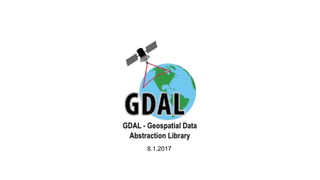
- 1. 8.1.2017
- 2. Agenda 1. What is GDAL? 2. Software using GDAL 3. Geospatial Data 4. Abstraction 5. Library or maybe framework? 6. Getting started with GDAL and C# 7. More Information
- 3. What is GDAL? ● Translator library for raster and vector geospatial data formats ● Started in 1998 by Frank Warmerdam as independent professional ● Now the project is under OSGeo’s umberlla ● Free and Open Source Software ● Written in C++
- 4. Software using GDAL QGIS IDRISI ArcGIS 9.2+ gstat Micromine GRASS GIS libral SpaceEyes3D PostGIS Geoweb3d pktools MapGuide Thuban OpenEV OSSIM ERDAS CartoDB TerrainView GeoServer GMT Bluemapia Google Earth Fiona GenGIS MapServer Procura SAGA GIS vGeo
- 5. GDAL - Geospatial Data Abstraction Library Data which has a geographical or spatial aspect Raster - A spatial data model that defines space as an array of equally sized cells arranged in rows and columns, and composed of single or multiple bands. Vector - A coordinate-based data model that represents geographic features as points, lines, and polygons.
- 6. GDAL - Geospatial Data Abstraction Library 3 major classes within the GDAL library: ● GDAL - Raster ● OGR - Vector ● OSR - Spatial Reference What can they do? Coordinate system conversion, statistics, format conversion, geo operations on geometries and layers, image merge, build pyramids, create a tileindex, Convert rgb to indexed color, etc...
- 7. GDAL - Geospatial Data Abstraction Library Presents a single raster abstract data model and a single vector abstract data model to the calling application for all supported formats. ● Supported raster formats (142 drivers) : GeoTIFF, Erdas Imagine, ECW, JPEG2000, DTED… ● Supported vector formats (84 drivers): ESRI Shapefile, ESRI ArcSDE, ESRI FileGDB, KML, PostGIS, Oracle Spatial, AutoCAD DWG, Elasticsearch...
- 8. GDAL - Geospatial Data Abstraction Library Example for GDAL abstraction:
- 9. GDAL - Geospatial Data Abstraction Library Or maybe framework? ● Cross platform - Windows (32, 64 bit), MAC OS X, Linux ● Variety of programming language bindings - Offical: C#, Java. Perl, Python Unofficial: Go, Lua, Node.js, PHP, Tcl. ● Comes with many useful command line utilities for data translation and processing ● Extensibility for more geo formats (with plugins) ● Wide community
- 10. GDAL - Geospatial Data Abstraction Library Examples for using command line utiltiles: ● ogr2ogr - converts simple features data between file formats ● gdalinfo - lists information about a raster dataset % ogr2ogr -f "ESRI Shapefile" c:output.shp "PG: host=localhost user=postgres dbname=gisdb password=postgres" -sql "SELECT name, geom FROM tableName" % gdalinfo c:input.tiff
- 11. GDAL - Geospatial Data Abstraction Library A personal experience about how the community helped me: Few months ago, I submitted a new bug in the GDB driver. Two weeks later the bug was fixed and published as part of the next GDAL version.
- 12. Getting started with GDAL in C# 1. Download the latest version of the precompiled GDAL binaries (32 or 64 bit) 2. Extract the contents from the zip file to a location on your hard disk e.g. C:Program FilesGDAL 3. Include the path to C:Program FilesGDAL in your PATH system variable and add path to C:Program FilesGDALgdal-data in a new system variable named GDAL_DATA 4. Add references to dll-files that can be found at C:Program FilesGDALcsharp 5. Write your code 6. To view the full turorial click here
- 13. More Information Links: ● http://www.gdal.org - official GDAL website ● http://www.gisinternals.com - website to download sources ● Getting started with GDAL and C# ● http://svn.osgeo.org/gdal/trunk/gdal/swig/csharp/apps/ - gdal examples in C# ● GDAL dev forum ● https://trac.osgeo.org/gdal - website to submit bugs Create by: Tomer .L. and Ori .A.
- 14. Questions?